| Pages:
1
..
9
10
11
12 |
PaulW
Ultra Nomad

Posts: 3009
Registered: 5-21-2013
Member Is Offline
|
|
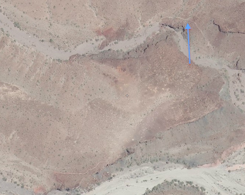
Both of the tracks in the image are no longer reachable from the wash. Just up Jaquegel from the Zuk we encountered a large rock pile where the canyon
gets narrow. Those rocks were in the 3' size and piled in the usual random manner. I wanted to drive there to show the other members of the party the
two cliffs which I now have identified as Jaquegel and Enmedio
Paul
==========
|
|
|
4x4abc
Ultra Nomad
Posts: 4165
Registered: 4-24-2009
Location: La Paz, BCS
Member Is Offline
Mood: happy - always
|
|
to bypass the waterfall you don't need to go up that far in the nameless canyon
Harald Pietschmann
|
|
|
PaulW
Ultra Nomad
Posts: 3009
Registered: 5-21-2013
Member Is Offline
|
|
======
My GPS WP for the rock stoppage is 31 35.5098, -115 24.11999
However I think I marked it after turning around? Most likely my real stoppage was at 31 35.498, -115 24.234 which is at the narrows. Is your nameless
before (east) of these two places?
Paul
|
|
|
4x4abc
Ultra Nomad
Posts: 4165
Registered: 4-24-2009
Location: La Paz, BCS
Member Is Offline
Mood: happy - always
|
|
so, you were still in Jaquegel - 0.5+ miles away from the nameless canyon
Harald Pietschmann
|
|
|
David K
Honored Nomad
Posts: 64490
Registered: 8-30-2002
Location: San Diego County
Member Is Offline
Mood: Have Baja Fever
|
|
From Harald, 4x4abc...
Received today, some more materials left in the desert by our boys in World War II, in Baja California (along with an insulator with wire still
attached Harald gave me on the trip):
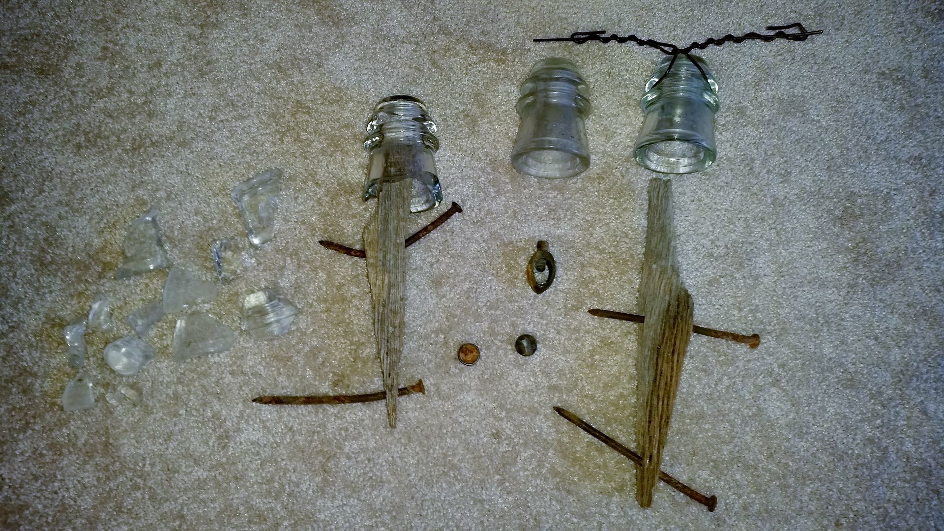
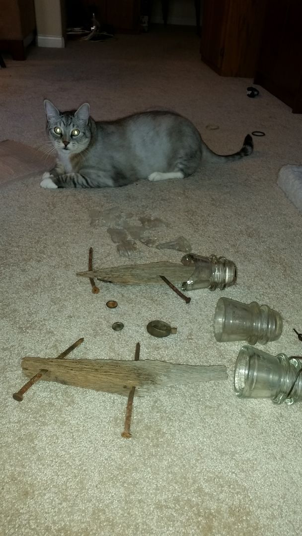
Maverick had to get in the photo.
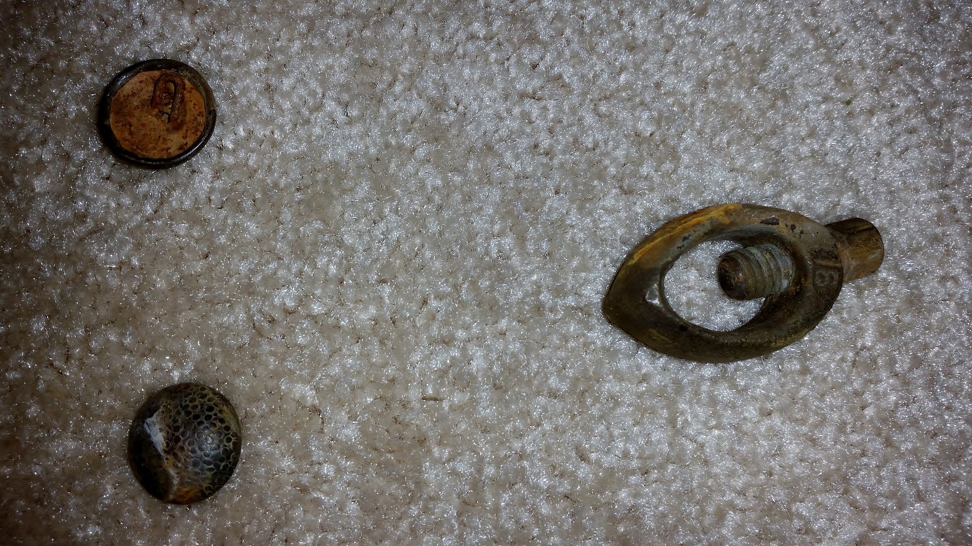
Close up of buttons and a wire clamp.
Thank you Harald!
[Edited on 5-1-2015 by David K]
|
|
|
David K
Honored Nomad
Posts: 64490
Registered: 8-30-2002
Location: San Diego County
Member Is Offline
Mood: Have Baja Fever
|
|
Researching continues...
From: http://the-wanderling.com/hoover_dam.html
As far as the southern reaches of the radar network was concerned, and unknown by most people still, there were at least three radar sites built and
commanded by the U.S. Army in Mexico along the coast of Baja California to protect the southern approaches to San Diego. According to Mexican Forts
known sites included Station B-92 at Punta Salispuedes, located 22 miles northwest of Ensenada (later moved to Alasitos, 36 miles south of Tiajuana);
Station B-94 at Punta San Jacinto, 60 miles south of Ensenada; and Station B-97 at Punta Estrella, south of San Felipe on the Gulf of California (aka
Sea of Cortez).
It is not clear when all three of the radar sites were in full operation, but it is known through outside observers that the Punta Estrella site was
operational and fully staffed by April of 1942.
-------------------------------------------------------------------------------------------------------
From April, 1953 Desert Magazine:
We continued along an unimproved
and winding desert trail through ironwood,
palo verde and smoke trees for
24 miles, bearing always to the south
and coming finally to a telephone pole
line which crosses the arroyo at right
angles. This telephone, now abandoned,
was built by the U. S. armed
forces during World War II, to connect
San Felipe with Ensenada on the
Pacific coast. It was feared that Japanese
submarines might establish contact
with secret agents by way of the
Gulf of California, and this communication
line was deemed necessary for
the national security.
Where this military phone line
crosses the Arroyo Grande another
great dry watercourse comes in from
the west as a tributary. This is the
Arroyo Jaque'el.
|
|
|
David K
Honored Nomad
Posts: 64490
Registered: 8-30-2002
Location: San Diego County
Member Is Offline
Mood: Have Baja Fever
|
|
From: http://californiamilitaryhistory.org/SDWW2.html
Arrangements were made between the U.S. Government and the Government of Mexico to allow joint teams of U.S. Army officers and Mexicans Army officers
and soldiers to patrol the Mexican peninsula of Baja California. The teams were platoon-size units and patrolled all the way to the southern tip of
the peninsula. There were persistent rumors early in the war that the Japanese might have secret air bases in Baja California, but no evidence of this
was ever found. The American officers were required to wear civilian clothing and all U.S. markings had to be removed from U.S. Army vehicles and
other equipment to accommodate Mexico's neutrality laws.
|
|
|
BAJACAT
Ultra Nomad
Posts: 2902
Registered: 11-21-2005
Location: NATIONAL CITY, CA
Member Is Offline
|
|
Nice report guys, Im still 0 for this trip, maybe next year when I lift my JEEP...thanks guys for sharing
BAJA IS WHAT YOU WANTED TO BE, FUN,DANGEROUS,INCREDIBLE, REMOTE, EXOTIC..JUST GO AND HAVE FUN.....
|
|
|
David K
Honored Nomad
Posts: 64490
Registered: 8-30-2002
Location: San Diego County
Member Is Offline
Mood: Have Baja Fever
|
|
Quote: Originally posted by BAJACAT  | Nice report guys, Im still 0 for this trip, maybe next year when I lift my JEEP...thanks guys for sharing
|
JEEP? No more Dodge/Ram truck?
|
|
|
BAJACAT
Ultra Nomad
Posts: 2902
Registered: 11-21-2005
Location: NATIONAL CITY, CA
Member Is Offline
|
|
nope Big Red is goone DK.. Im riding in a SAHARA UNLIMITED JEEP
BAJA IS WHAT YOU WANTED TO BE, FUN,DANGEROUS,INCREDIBLE, REMOTE, EXOTIC..JUST GO AND HAVE FUN.....
|
|
|
David K
Honored Nomad
Posts: 64490
Registered: 8-30-2002
Location: San Diego County
Member Is Offline
Mood: Have Baja Fever
|
|
Photos please!
Ken got to you before Neal Johns did, I see! 
|
|
|
Ken Cooke
Elite Nomad
Posts: 8921
Registered: 2-9-2004
Location: Riverside, CA
Member Is Offline
Mood: Black Trans Lives Matter
|
|
This was a stellar day on the trail. Just revisiting the fun. 
| Quote: Originally posted by David K |
How we heard about this road...
The Pole Line Road Run was made popular about 15 years ago by Desert Explorer Neal Johns (one who is responsible for my getting a Tacoma) after
reading about it in an old guidebook to Baja California...
From 1962 Lower California Guidebook:
I wish to thank Ken Cooke for organizing this run and inviting me along (with a request I provide a mission lecture for the group). I was thrilled
Baja Angel was agreeable to me having fun without her (she would have loved to go, being a former Jeep owner and veteran of the Rubicon run at Lake
Tahoe).
Disclaimer: In no way does my poking fun at any of the events intend to diminish my respect for Ken, Jeep Corporation, or especially the Ford Motor
Company! My odometer is just a tad slow as I am running 1 taller than stock tires, off 1 mile for every 40 traveled (0.1 for every 4).
9:35 am Mexicali Pemex: Filled 3 jerry cans (19-20 liters if topped cans) and the pump read 59.875 liters (15.8 gallons) which is so close to
reality, I would say this was a pretty honest station. 732.85 pesos (at 14.50:1 exchange), gave the guy $52 with tip. That puts 87 octane Magna Sin at
about $3.23/ gal.
10:50 am After a wonderful tour of the back streets and residential areas of Mexicali, including the majority of 4 way stop signs in that city, a few
dead end streets for fun, and closed construction zones, all before reaching Hwy. 2, we learn the highly prized best taco asadero in El Progreso was
no longer in business! We learned this from those waiting at the next best asadero shop, who got us on the radio as we breezed past them. Hey, this
is Mexico and one must be open to changes!
The now bigger group is heading west on Hwy. 2 as it is decided to use the 24.3 miles of smooth, dry lakebed instead of the usually washboard surface
graded road (signed for Cañon de Guadalupe Hot Springs). Now the road to the dry lake bed is signed as an open public road Laguna Salada off Highway
2, however, on some weekends there is a toll booth set up by some so-called land owners collecting 100 pesos (US$6.90 at a 14.50:1 rate of
exchange). Because of the size of Kens caravan, the jefe agreed to a discount of $6.00 per vehicle.
Mile 0.0, Laguna Salada lakebed, 11:20 am (27 miles driven from border at Mexicali, not using the shortest route). The lakebed is about the best I
have driven in quality.
Mile 21.0, Fork on lakebed to right, 11:48 am
Mile 24.3, Off of lakebed, 11:54 am. A military Humvee and truck with well-armed soldiers is on road pointed towards us. They wave and give thumbs
up us as we pass. Viva Mexico!
Mile 25.5, we meet the graded road from Hwy. 2 to Guadalupe Canyon and turn south, 12:16 pm
There is several houses in a scattered new ejido. New since my last time here, anyway and there is no clear direction to get beyond the ejido. John M
takes the lead from Ken as he has GPS with race course data and this is some of the CODE race route south. We get back on track and head south from
the Guadalupe Canyon fork area.
Mile 29.1, a kilometer sign post KM. 50, the only one I saw, 12:25 pm
Mile 31.8, Fork to right
Mile 45.9, Fork to right, 1:03 pm
Mile 47.6, COHABUZO JUNCTION, 1:08 pm to 2:06 pm
Here we meet more Nomads and Off Roaders from Rio Hardy (including MICK). This is where the road from Hwy. 5 at the sand dunes ends up as a
short-cut to this region from San Felipe. It is not all easy, and the last 20 miles are very tough and full of silt (at least when I drove in in
2002). MICK destroyed a tire before reaching Cohabuzo, I heard.
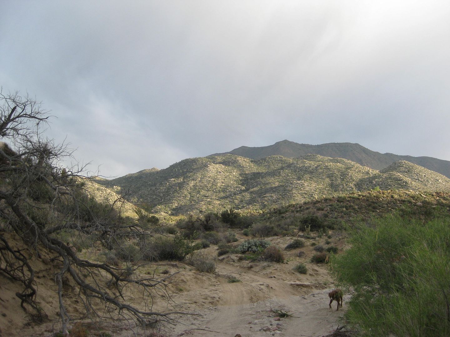
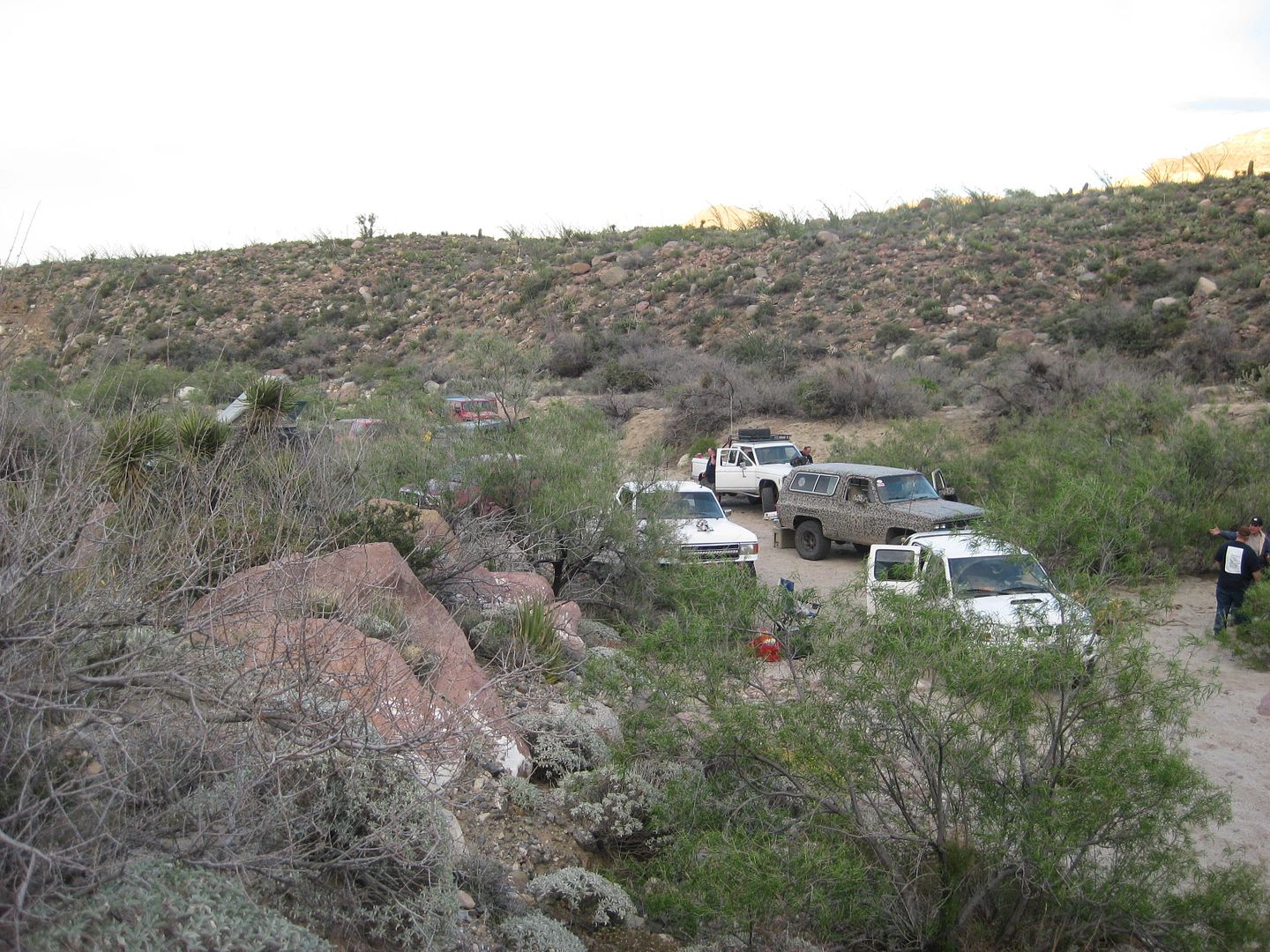
Mile 72.7, POLE LINE ROAD, 5:06 pm, at bottom of the SUMMIT a steep drop off the Sierra Juarez built for the WWII Pole Line construction and has
been used by SCORE for many off road races since the late 1970s. The pole line continued east but not in any regular direction for very long, so as
to not stand and be subject to aerial spotting or destruction by the enemy. This was mid-1942, and the U.S. was not certain of how much the enemy had
infiltrated into remote Baja California peninsula, if at all.
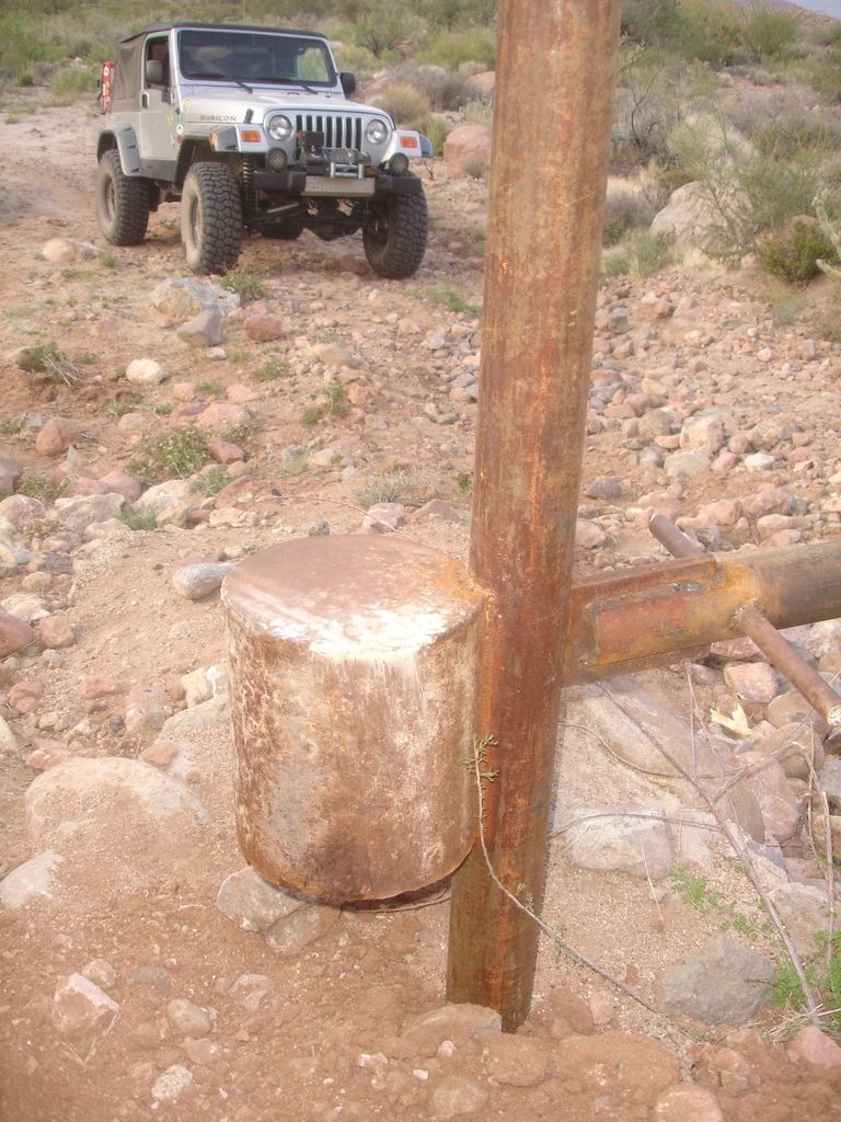
There is a locked, steel gate blocking access to the Pole Line Road, eastbound, near the bottom of the summit. Ken checks it out and then we begin to
use the newly made detour around the west side that goes around the gate. This is a barely traveled route described to us by PaulW, and I make my
first under-body damage on a rock hidden by a shrub. It is very slow going for 1.3 miles before word on the radio says MICKs Ford Ranger has lost its
transmission fluid and is not looking good. It is getting dark soon and even though the wind is howling through the canyon we are in, there is simply
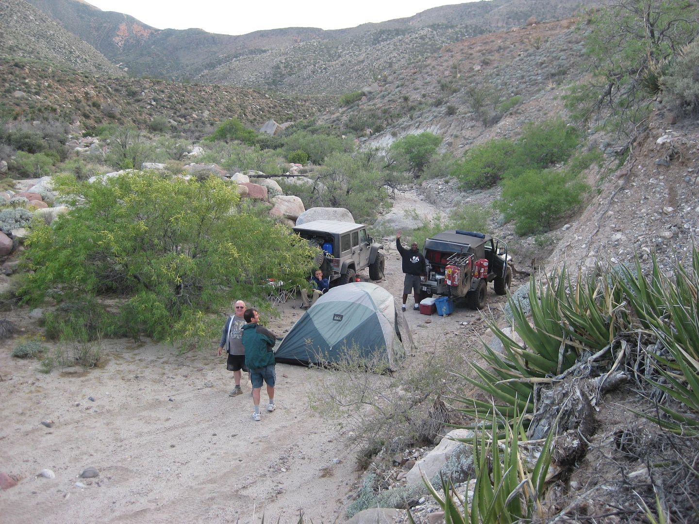
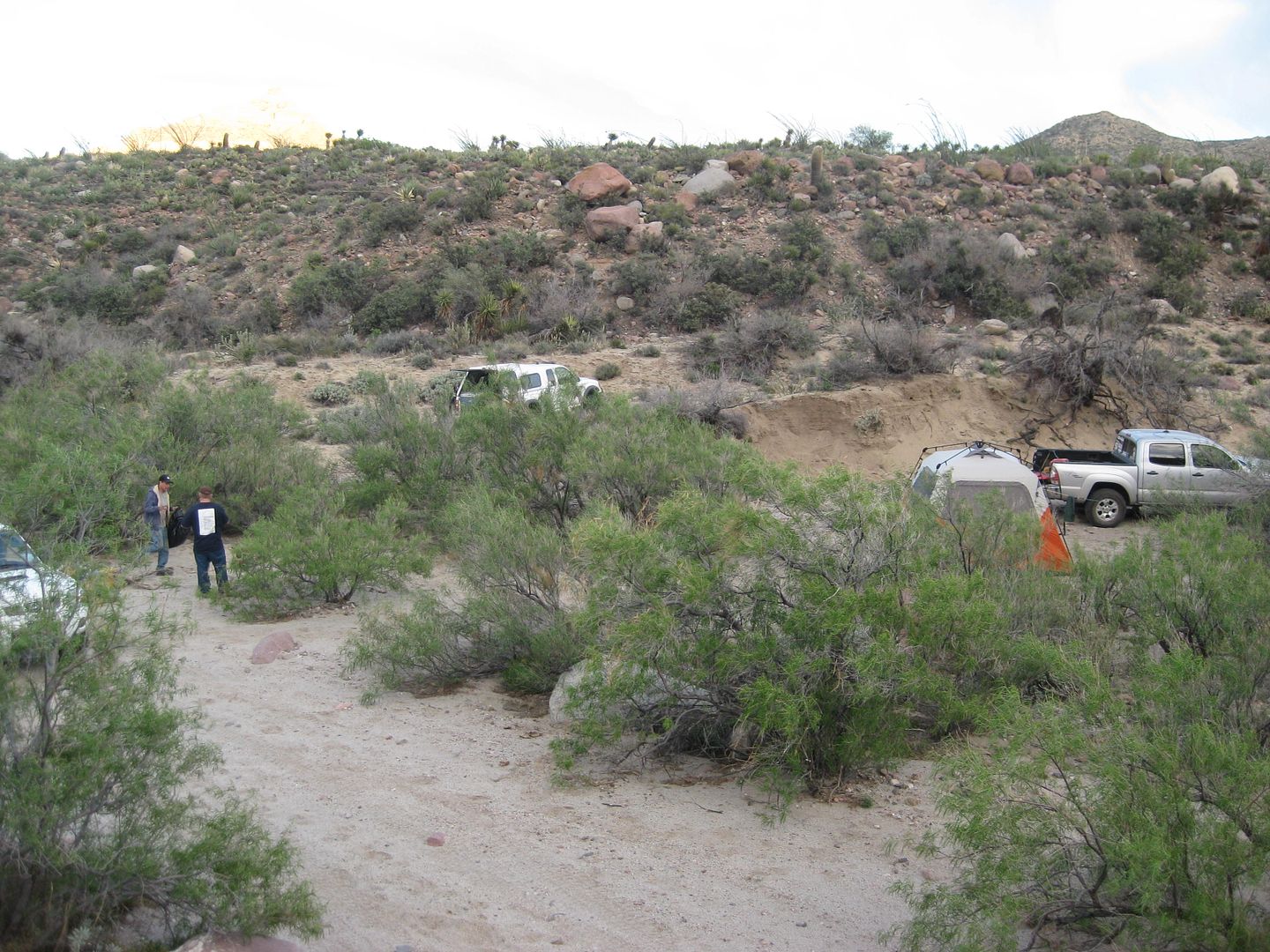
no better place to camp and also evaluate how to help MICK. We make a U-turn and come back down just 0.2 mile to our camp for the first night
(Saturday April 6, 2015). Mile 73.8 (not counting the distance from where we camped to the U-Turn and coming back to camp), 5:35 pm.
The wind is just too strong for a camp fire, and the history lecture is postponed
it is Baja, and being flexible is part of the deal. I put up my
Coleman Insta-Tent and even with the strong wind, I manage to do so easily alone, in just a few minutes. Inside, there is lots of room for my cot,
table, chair and I cook my dinner and make hot cocoa. TW (TMW now on Nomad) is camping across the road from me. TW and Ken Cooke both have a look at
the inside the miracle tent (rated for sleeping 8 and tall enough to stand in).
Sleeping, with the wind flapping the walls of the tent was impossible however
but I was warm and comfy!
END DAY 1
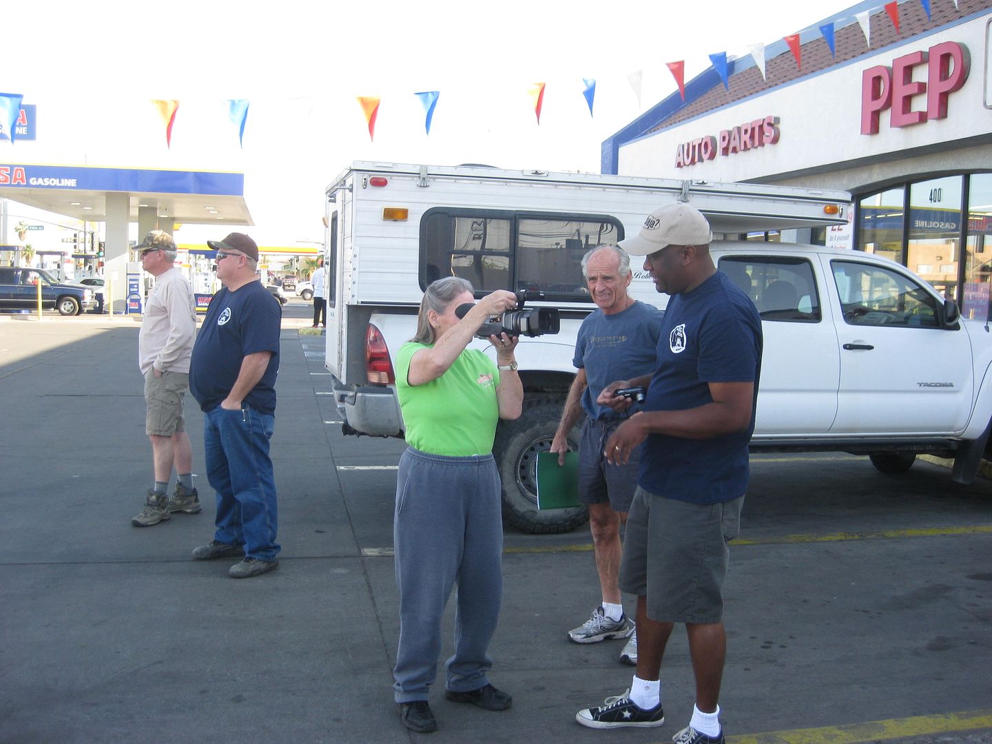
Ken is interviewed at the Calexico meeting location, 8:15 am SAT.
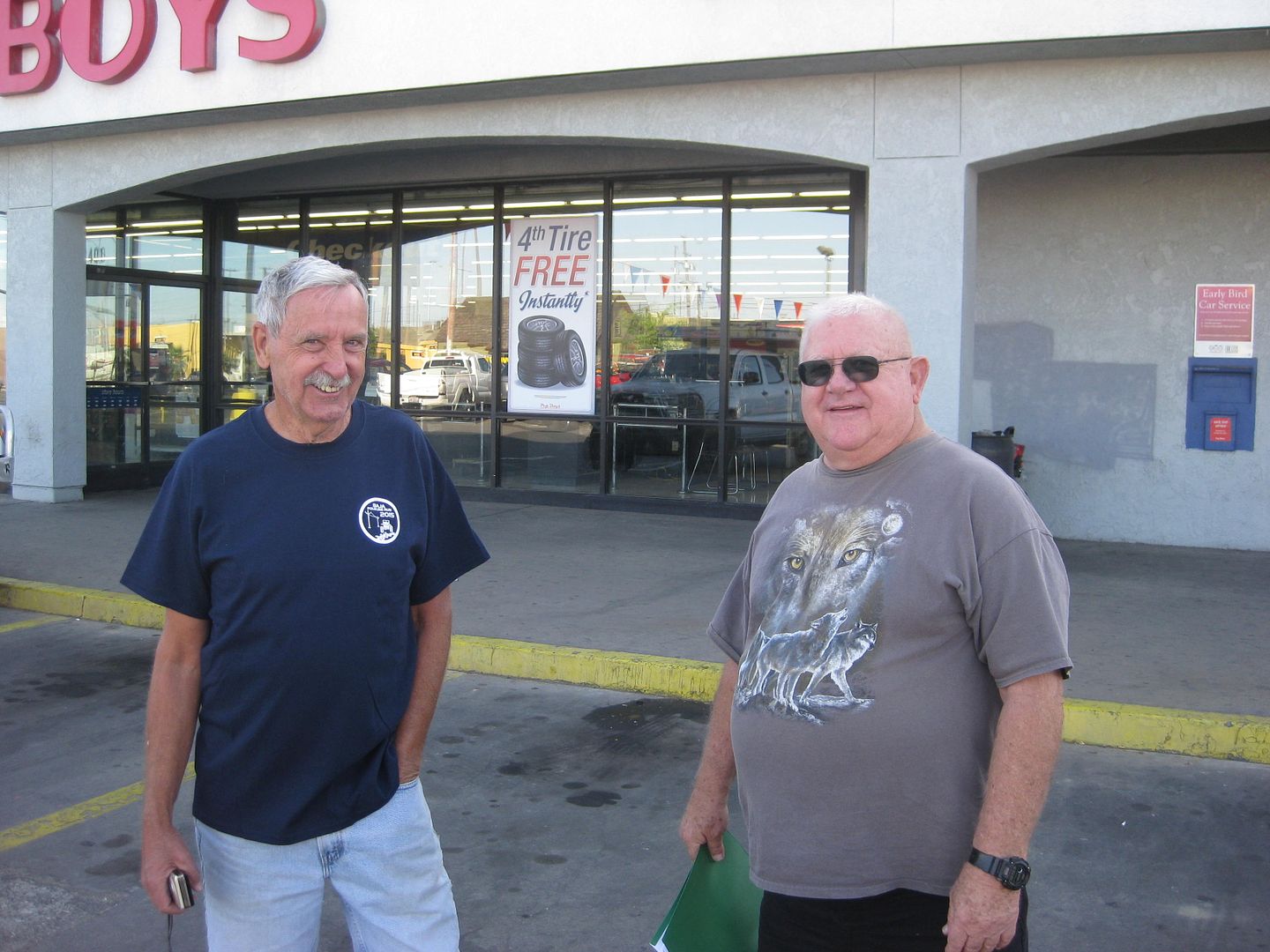
Jonn M and TW (TMW) are ready!
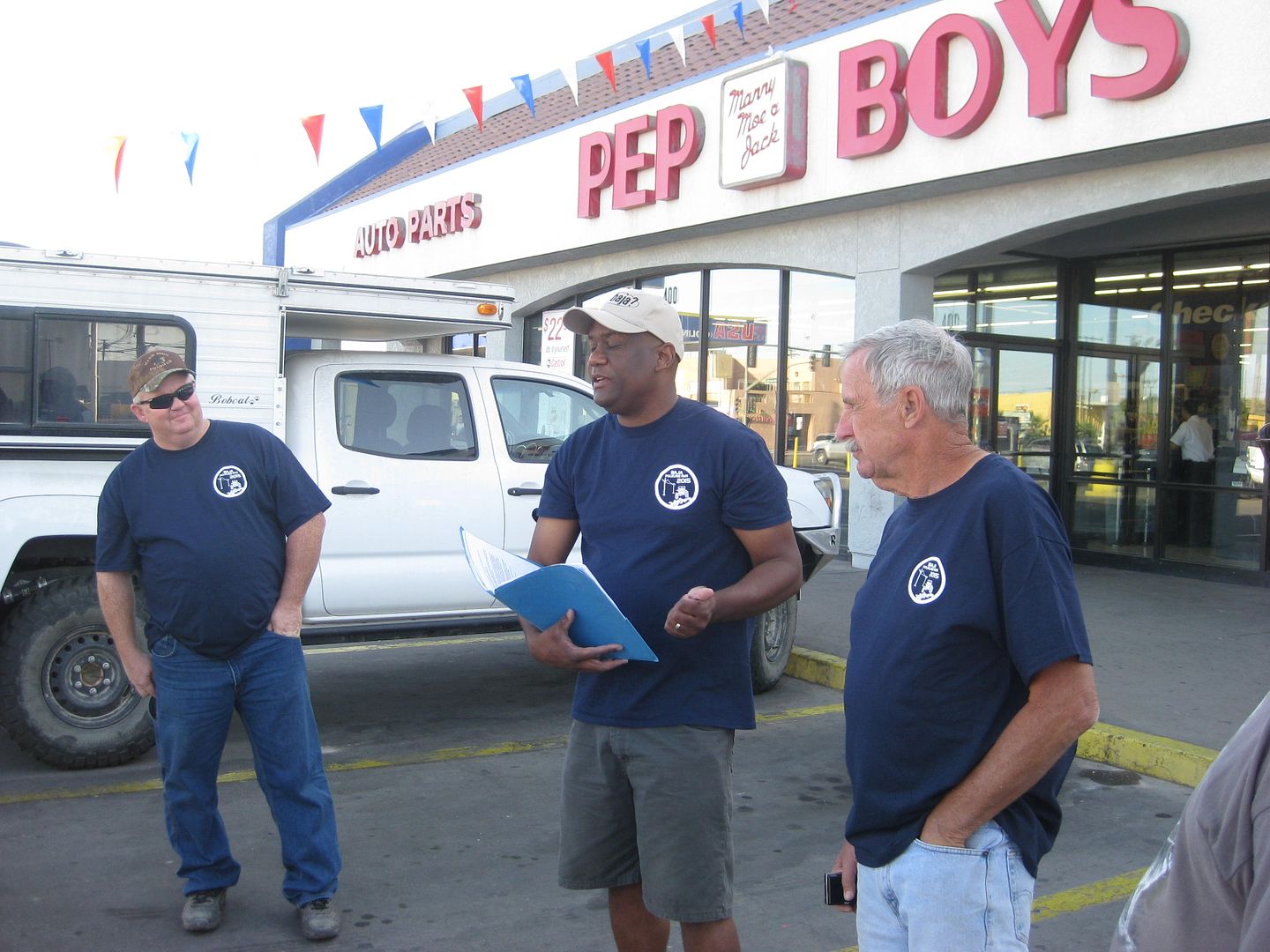
ehall and the rest listen to Ken's driver's meeting notes.
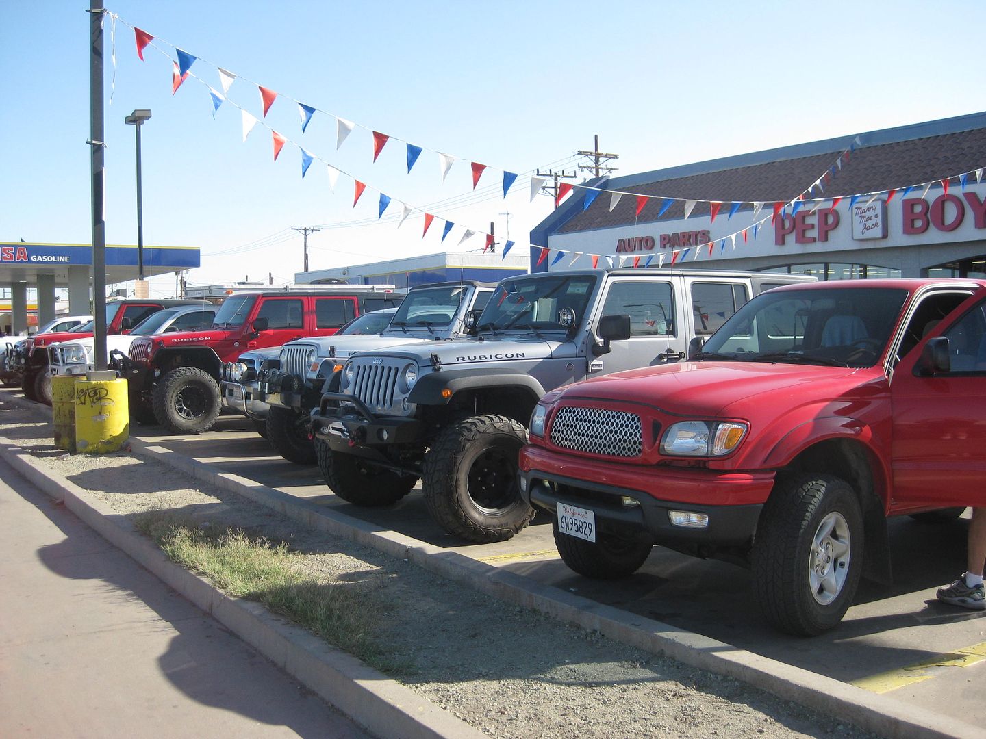
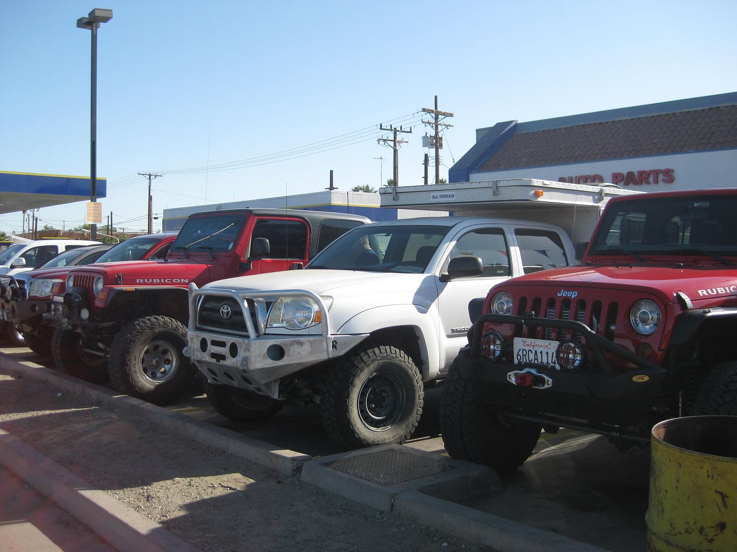
These vehicles will not be so clean in a few hours!

LAGUNA SALADA
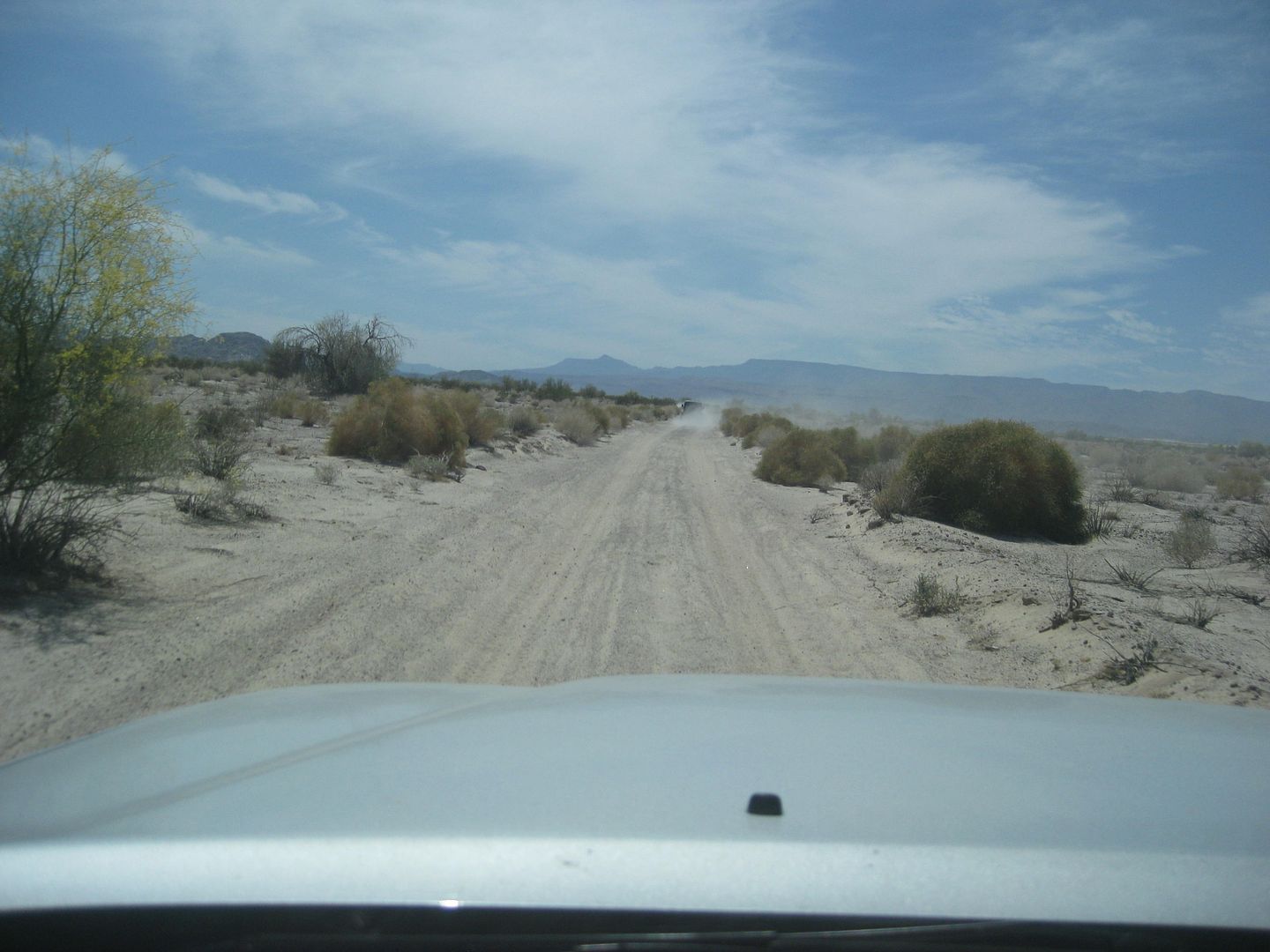
Heading south to Cohabuzo Junction
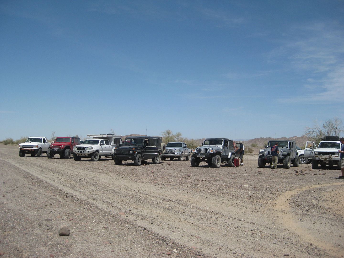
All together now at Cohabuzo Junction.
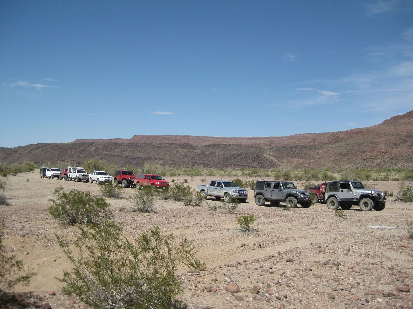
Looks like we have a convoy!
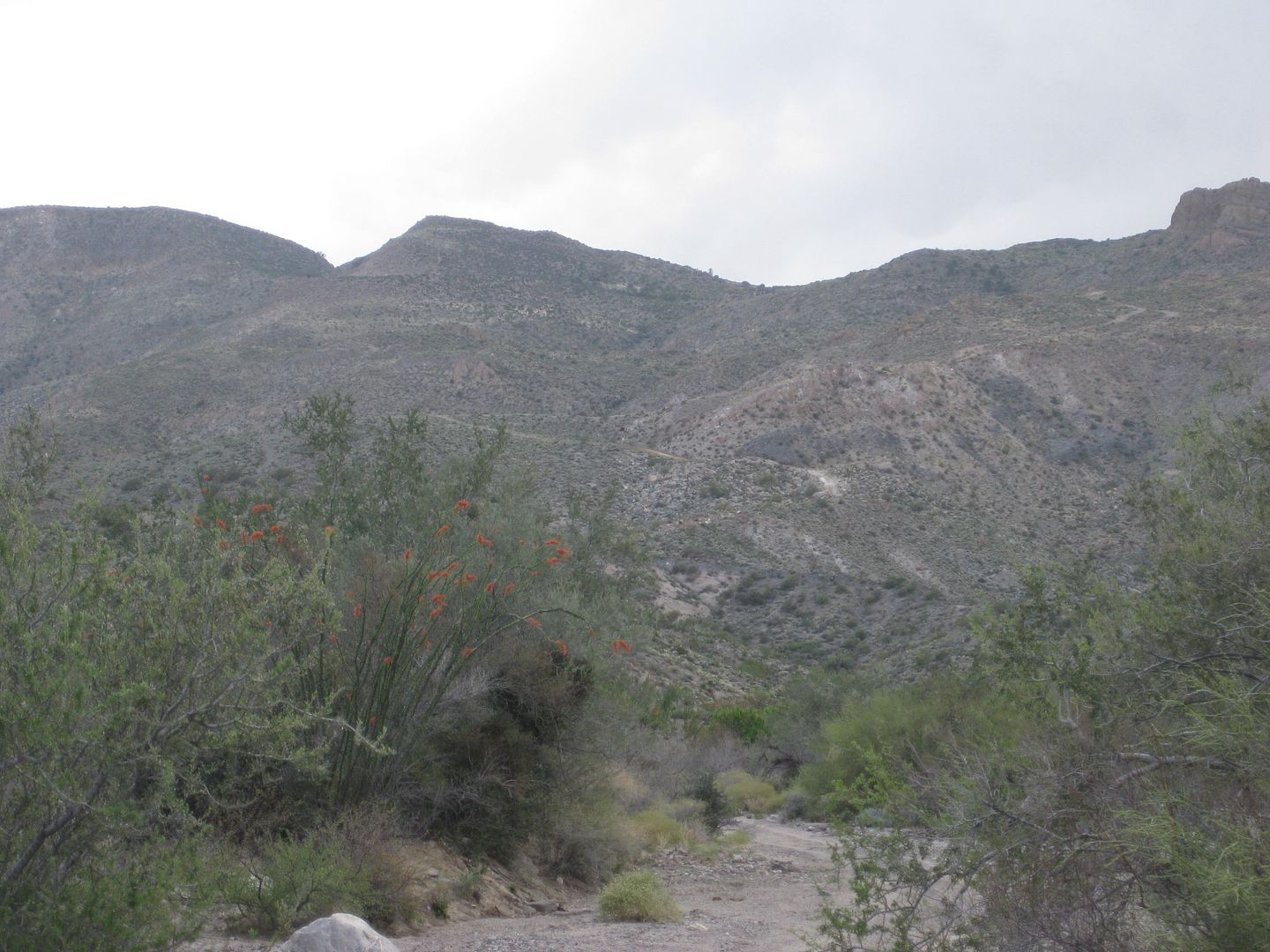
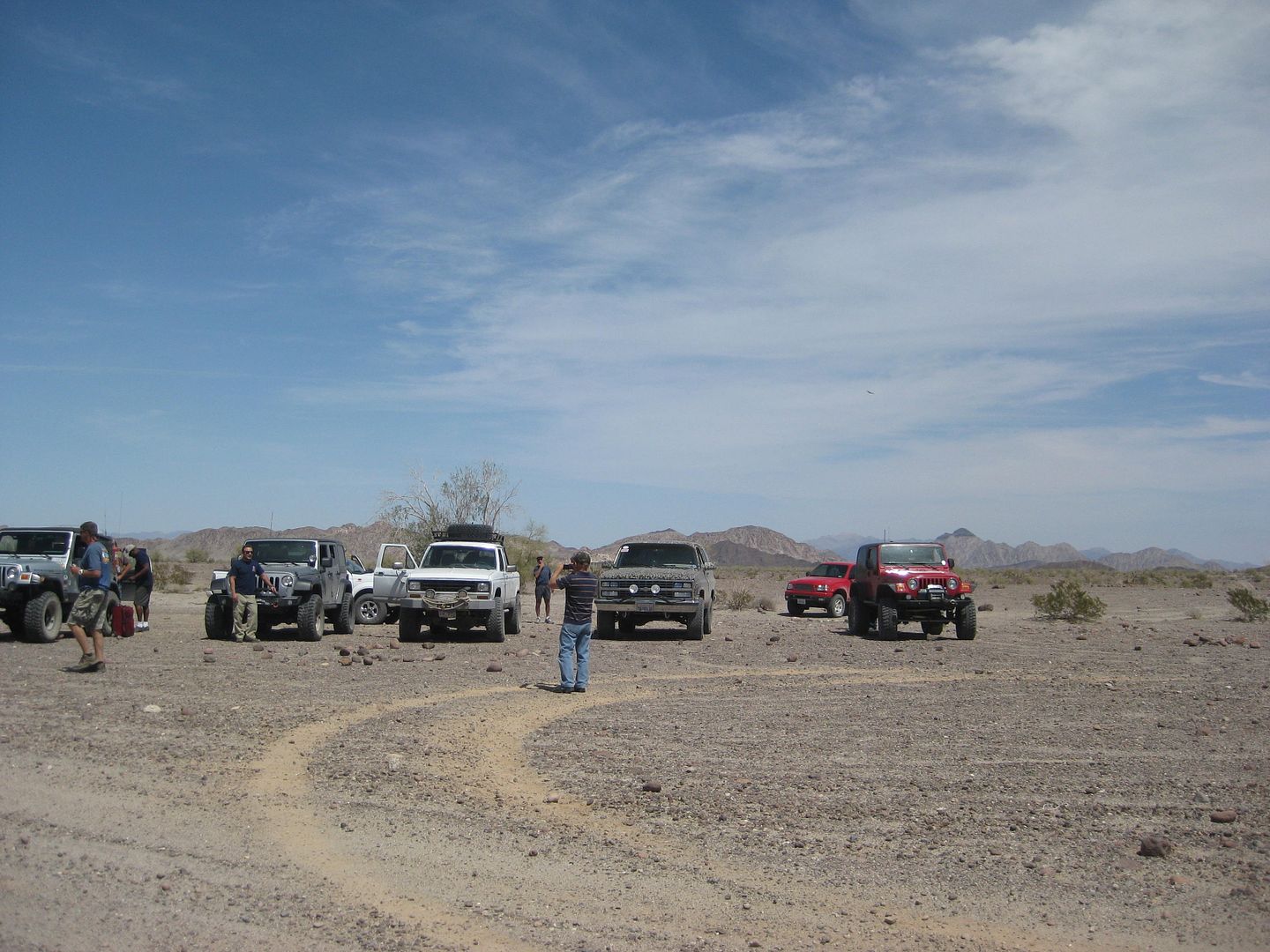
The SUMMIT part of the Pole Line Road as seen from the bottom.
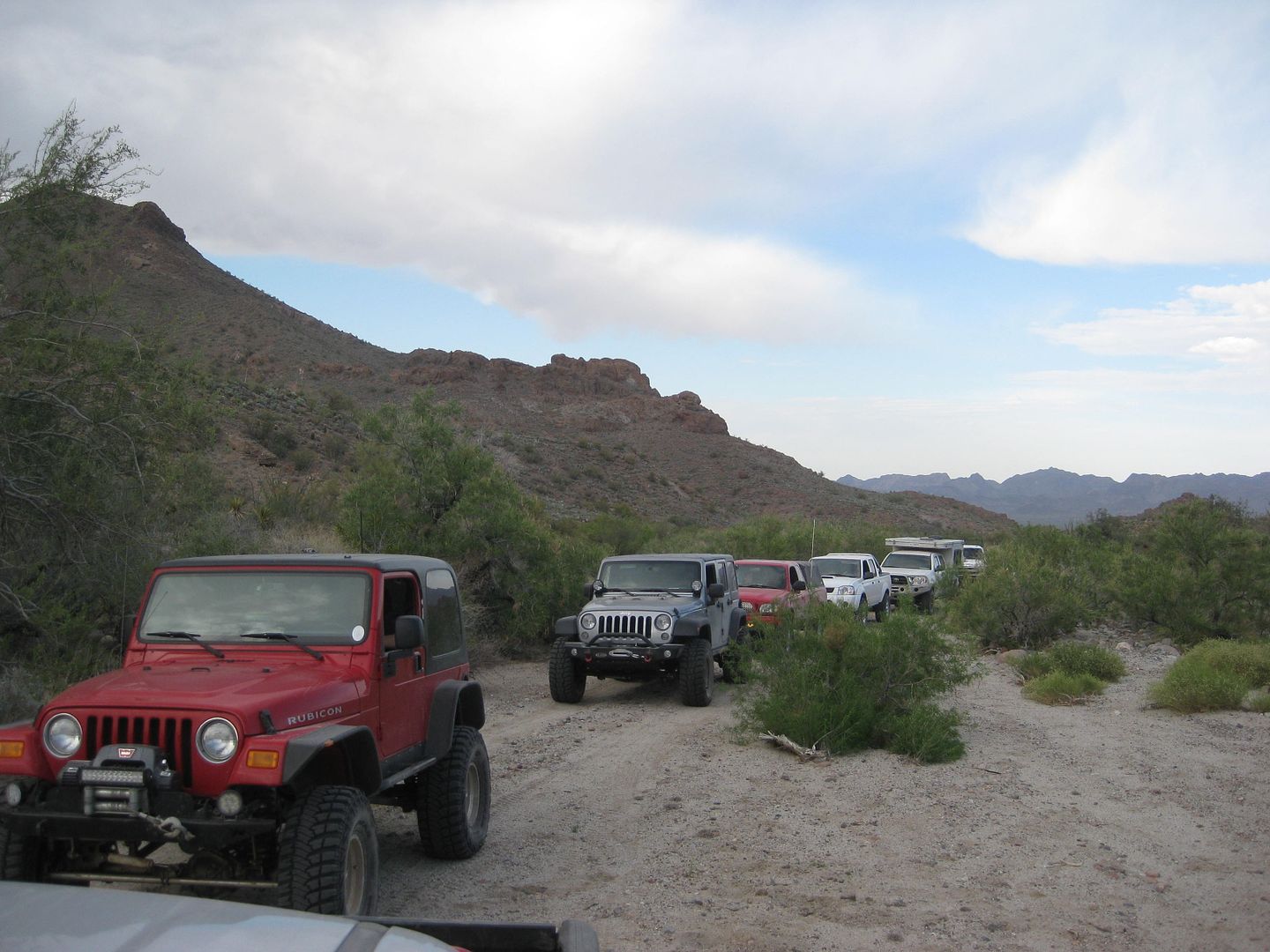
This first gate is easily opened (and closed after us), but soon after was the locked gate.
This is the detour road looking south from where we camped.
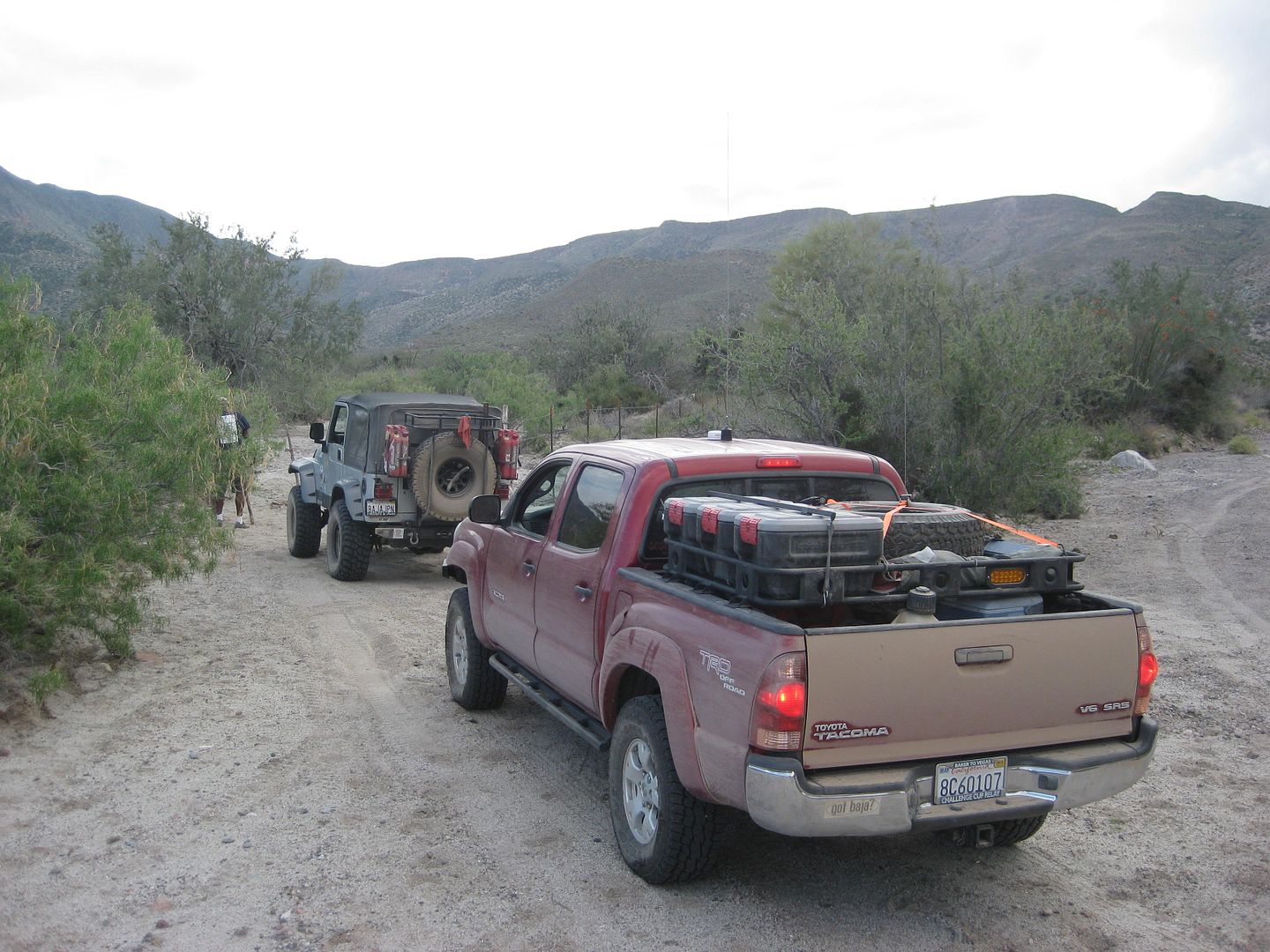
TW, FrigateBird, Ken Cooke
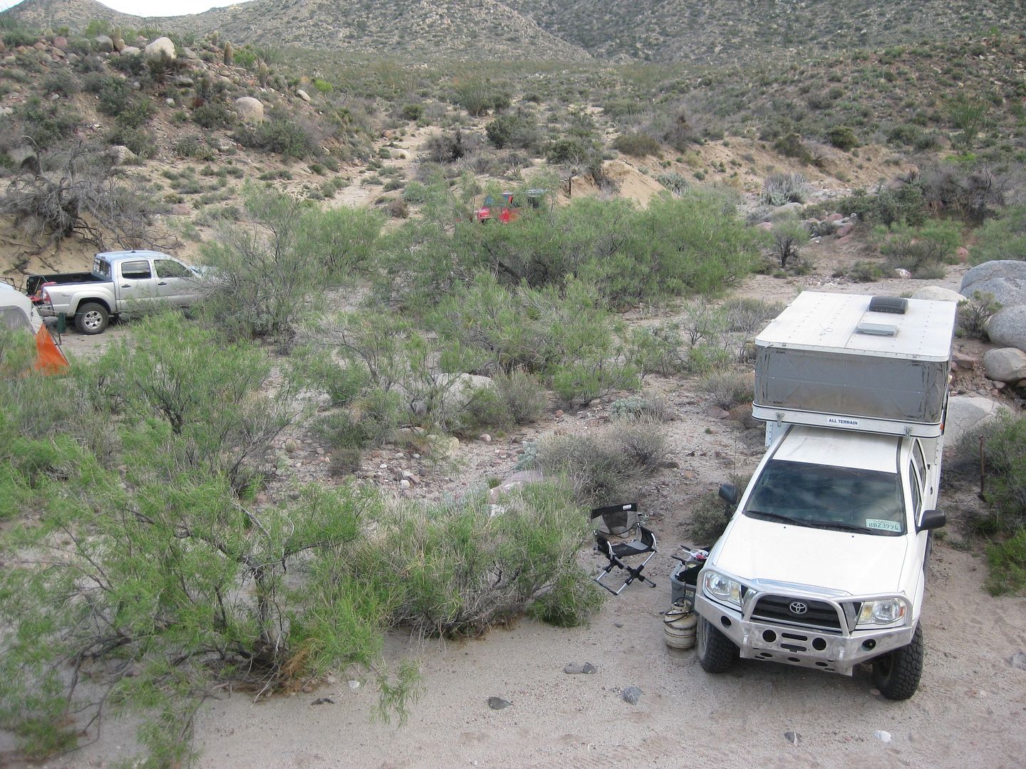
FrigateBird's white Tacoma with pop up camper, and mine nearby.
My Insta-tent, and then TW's white Tacoma.
|
|
|
|
Ken Cooke
Elite Nomad
Posts: 8921
Registered: 2-9-2004
Location: Riverside, CA
Member Is Offline
Mood: Black Trans Lives Matter
|
|
Reminiscing
This was really a great run. Incredible time on the Pole Line Road.
|
|
|
PaulW
Ultra Nomad
Posts: 3009
Registered: 5-21-2013
Member Is Offline
|
|
As much as I hate to mention
Readers should be forewarned that once the rancher discovers the detour around the pipe gate the new detour will probably have an obstacle added. I
base this comment after seeing all the effort the rancher went to with a bulldozer to enhance the pipe gate.
So if coming from the north via Cohabuzo it wont me a big deal to either return or head over the summit to Hwy 3 as an alternative. However when
coming from the east most will not have enough fuel to return to Hwy 5.
As far as I know Kens 4x4 run April 2015 was the last one reported. Please report if anyone has a 4x4 newer passage of the problem area. I did read
the report form bike guys that were easily able to pass the pipe gate since April 2015
Thanks
|
|
|
David K
Honored Nomad
Posts: 64490
Registered: 8-30-2002
Location: San Diego County
Member Is Offline
Mood: Have Baja Fever
|
|
This was a drive back in time to World War II !
I wish that someone would find any unclassified information on the construction of the road and the telephone line to the U.S. radar station in San
Felipe (or Punta Diggs/ Punta Estrella south of town).
|
|
|
Chupacabra
Nomad
Posts: 476
Registered: 7-11-2013
Location: La Jolla, CA
Member Is Offline
|
|
That wolf shirt is amazing.
************************************
WTF
|
|
|
David K
Honored Nomad
Posts: 64490
Registered: 8-30-2002
Location: San Diego County
Member Is Offline
Mood: Have Baja Fever
|
|
That Tom, 'TW' (TMW now) is too! Here he is with 'John M'... and right now, they are on an expedition in northern Baja with Roy, 'The squarecircle'.
Spot signals coming in every few hours.
|
|
|
Ken Cooke
Elite Nomad
Posts: 8921
Registered: 2-9-2004
Location: Riverside, CA
Member Is Offline
Mood: Black Trans Lives Matter
|
|
| Quote: Originally posted by PaulW | As much as I hate to mention
Readers should be forewarned that once the rancher discovers the detour around the pipe gate the new detour will probably have an obstacle added. I
base this comment after seeing all the effort the rancher went to with a bulldozer to enhance the pipe gate.
So if coming from the north via Cohabuzo it wont me a big deal to either return or head over the summit to Hwy 3 as an alternative. However when
coming from the east most will not have enough fuel to return to Hwy 5.
As far as I know Kens 4x4 run April 2015 was the last one reported. Please report if anyone has a 4x4 newer passage of the problem area. I did read
the report form bike guys that were easily able to pass the pipe gate since April 2015
Thanks
|
I will bring additional t-shirts for the Rancher to help open those gates in the future! 
|
|
|
ehall
Super Nomad
Posts: 1906
Registered: 3-29-2014
Location: Buckeye, Az
Member Is Offline
Mood: It's 5 o'clock somewhere
|
|
| Quote: Originally posted by Ken Cooke | | Quote: Originally posted by PaulW | As much as I hate to mention
Readers should be forewarned that once the rancher discovers the detour around the pipe gate the new detour will probably have an obstacle added. I
base this comment after seeing all the effort the rancher went to with a bulldozer to enhance the pipe gate.
So if coming from the north via Cohabuzo it wont me a big deal to either return or head over the summit to Hwy 3 as an alternative. However when
coming from the east most will not have enough fuel to return to Hwy 5.
As far as I know Kens 4x4 run April 2015 was the last one reported. Please report if anyone has a 4x4 newer passage of the problem area. I did read
the report form bike guys that were easily able to pass the pipe gate since April 2015
Thanks
|
I will bring additional t-shirts for the Rancher to help open those gates in the future!
|
Tequila always works well.
|
|
|
David K
Honored Nomad
Posts: 64490
Registered: 8-30-2002
Location: San Diego County
Member Is Offline
Mood: Have Baja Fever
|
|
ONE YEAR AGO... BAJA NOMADS enjoying a drive and camping on a historic Baja road. Trail Boss Ken Cooke.

|
|
|
| Pages:
1
..
9
10
11
12 |