| Pages:
1
..
6
7
8
9
10
..
12 |
PaulW
Ultra Nomad

Posts: 3015
Registered: 5-21-2013
Member Is Offline
|
|
David there is a guy that has taken up residence near the summit. He has the usual collection of animals and a beat up truck. I forget which side of
the summit , but my guess its on the east side.
The guy that redid the lock gate grading and placement of the new boulder came from and returned via the road between the LG and the road we used for
the go around for the lock gate. We could plainly see the fresh tracks of his bulldozer. That road heads northerly and my GPS & GE both show it as
a dead end. Anyway, I suspect that is where his ranch base is located?
Paul
|
|
|
PaulW
Ultra Nomad
Posts: 3015
Registered: 5-21-2013
Member Is Offline
|
|
So -- does anybody think the wash just below the Lock Gate Is Saiz or is it Jamau? That would be the wash Ken and crew drove from the north and
arrived at /near the lock gate.
I do not have a trace on the Enigi map to allow me to make a judgement.
Paul
|
|
|
David K
Honored Nomad
Posts: 64526
Registered: 8-30-2002
Location: San Diego County
Member Is Offline
Mood: Have Baja Fever
|
|
Hi Paul, Google Earth is real handy to get waypoints of points along the road. The area of Basketball Hill is under cloud cover on GE, but clear as a
bell on Bing... pick Bing here: http://www.flashearth.com/
Just move the screen so that the target spot is in the small cross-hair in the center and read the GPS. You have to choose between decimal degrees or
degrees, minutes and seconds. The decimal minutes we typically use will need to be converted from either of the others. You can enter them in the GE
go box and it will convert it, or use one of the map datum converters on the Internet: http://www.fcc.gov/encyclopedia/degrees-minutes-seconds-tofr... or http://www.onlineconversion.com/map_decimaldegrees.htm or http://www.directionsmag.com/site/latlong-converter/
|
|
|
David K
Honored Nomad
Posts: 64526
Registered: 8-30-2002
Location: San Diego County
Member Is Offline
Mood: Have Baja Fever
|
|
Quote: Originally posted by PaulW  | So -- does anybody think the wash just below the Lock Gate Is Saiz or is it Jamau? That would be the wash Ken and crew drove from the north and
arrived at /near the lock gate.
I do not have a trace on the Enigi map to allow me to make a judgement.
Paul |
El Sáiz, per Gulick and per Baja Almanac.
|
|
|
David K
Honored Nomad
Posts: 64526
Registered: 8-30-2002
Location: San Diego County
Member Is Offline
Mood: Have Baja Fever
|
|
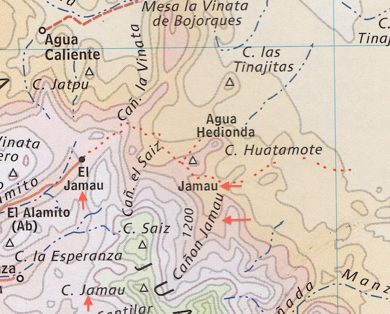
Here is from the Inegi digital site... and El Sáiz is listed along the arroyo, up in the canyon... with the added large block names and arrow from me
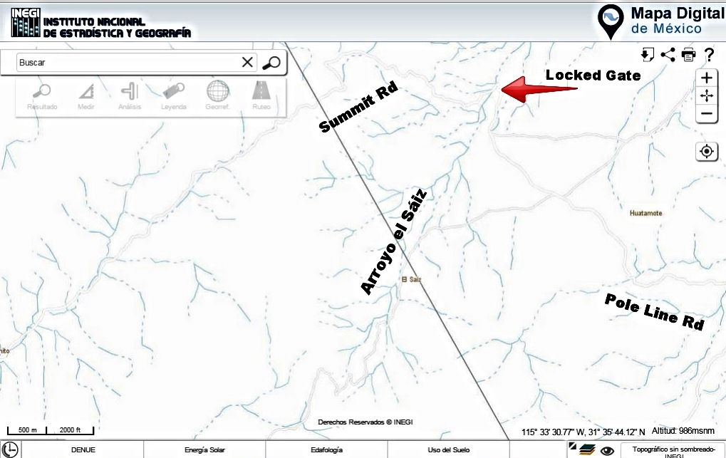
|
|
|
PaulW
Ultra Nomad
Posts: 3015
Registered: 5-21-2013
Member Is Offline
|
|
Improved instructions for INIGI download
Now I am in the states and I get a mix of spanish and english.
Here are the key strokes
www.inegi.org.mx
Geografica or Geography
Choose first =Themes
Choose Topography
Top of the list - click on first one = Cartas topography
In the first box highlight and type H11B25 then Search=Buscar
Click on the title of the first entry
Click on Discharge
Click on PDF and save
Works good
|
|
|
PaulW
Ultra Nomad
Posts: 3015
Registered: 5-21-2013
Member Is Offline
|
|
| Quote: Originally posted by David K | Here is from the Inegi digital site... and El Sáiz is listed along the arroyo, up in the canyon... with the added large block names and arrow from me
And A/C Jamau is missing. Can u tell where it is? |
|
|
|
4x4abc
Ultra Nomad
Posts: 4199
Registered: 4-24-2009
Location: La Paz, BCS
Member Is Offline
Mood: happy - always
|
|
here are Saiz and Jamau on the INEGI map
dotted line: PLR
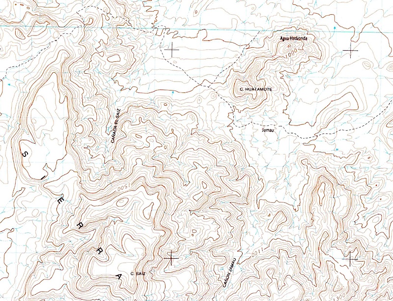
Harald Pietschmann
|
|
|
4x4abc
Ultra Nomad
Posts: 4199
Registered: 4-24-2009
Location: La Paz, BCS
Member Is Offline
Mood: happy - always
|
|
and here is the same in Google Earth:
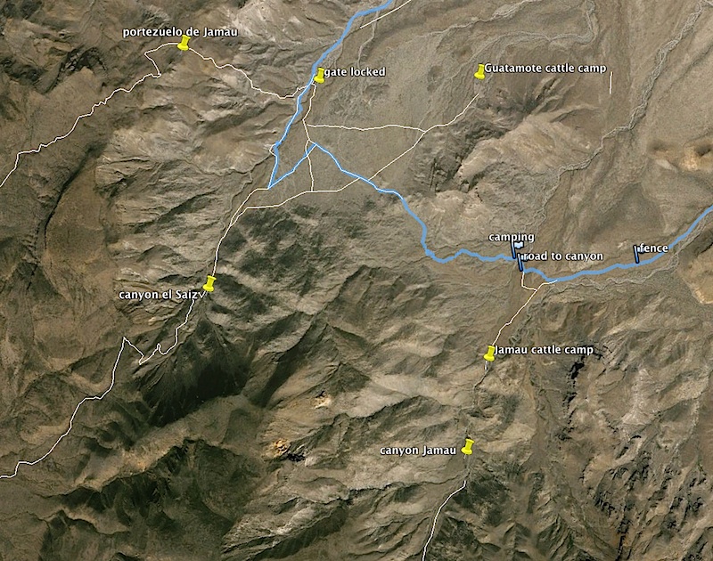
Harald Pietschmann
|
|
|
4x4abc
Ultra Nomad
Posts: 4199
Registered: 4-24-2009
Location: La Paz, BCS
Member Is Offline
Mood: happy - always
|
|
so, how about the secret airstrip east of Guatamote cattle camp?
US WWII? Mex?
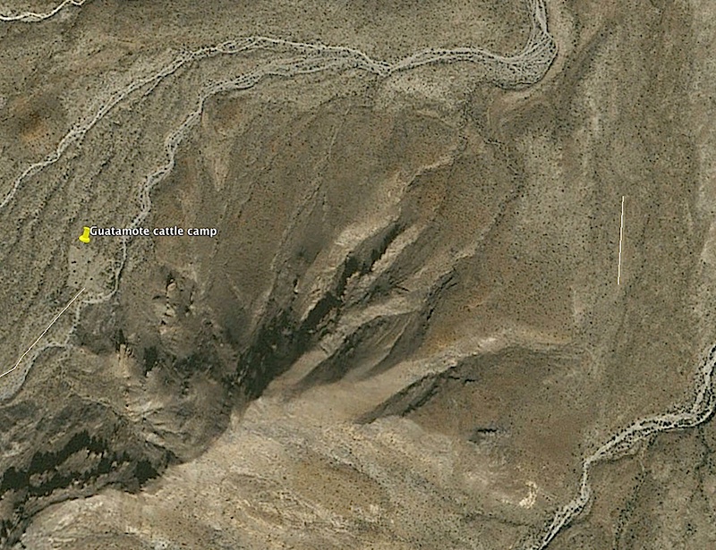
Harald Pietschmann
|
|
|
PaulW
Ultra Nomad
Posts: 3015
Registered: 5-21-2013
Member Is Offline
|
|
Harald, Can you send me a KML file for the siaz & Jamau pic ?
Thanks, Paul<pwpc@sisna.com>
[Edited on 4-17-2015 by PaulW]
|
|
|
4x4abc
Ultra Nomad
Posts: 4199
Registered: 4-24-2009
Location: La Paz, BCS
Member Is Offline
Mood: happy - always
|
|
| Quote: Originally posted by PaulW | Harald, Can you send me a KML file for the siaz & Jamau pic ?
Thanks, Paul<pwpc@sisna.com>
[Edited on 4-17-2015 by PaulW] |
done
Harald Pietschmann
|
|
|
David K
Honored Nomad
Posts: 64526
Registered: 8-30-2002
Location: San Diego County
Member Is Offline
Mood: Have Baja Fever
|
|
There are many secret runways in Baja... and not all have been ditched by the military!
|
|
|
David K
Honored Nomad
Posts: 64526
Registered: 8-30-2002
Location: San Diego County
Member Is Offline
Mood: Have Baja Fever
|
|
| Quote: |
As Harald showed on the bigger area map, it is southeast from El Sáiz.
I think a lot of confusion comes from the double use of the name 'Jamau'.?
The original Pole Line Road route comes off the summit and is called Portezuelo de Jamau. Several miles south is a different canyon, and arroyo named
Jamau (above the old ranch site of Jamau).
[Edited on 4-17-2015 by David K] |
|
|
|
4x4abc
Ultra Nomad
Posts: 4199
Registered: 4-24-2009
Location: La Paz, BCS
Member Is Offline
Mood: happy - always
|
|
Rancho Jamau, Cerro Jamau, Cañon Jamau, Jamau (location)
Harald Pietschmann
|
|
|
PaulW
Ultra Nomad
Posts: 3015
Registered: 5-21-2013
Member Is Offline
|
|
My hand is not enough steady for the Flash earth drill. Do you have a trick?
The image sure is better
I will keep trying
Paul
On my way to the print place to get hard copy of the INEGI downloads
======
[Edited on 4-17-2015 by PaulW]
|
|
|
David K
Honored Nomad
Posts: 64526
Registered: 8-30-2002
Location: San Diego County
Member Is Offline
Mood: Have Baja Fever
|
|
| Quote: Originally posted by PaulW | My hand is not enough steady for the Flash earth drill. Do you have a trick?
The image sure is better
I will keep trying
Paul
On my way to the print place to get hard copy of the INEGI downloads
======
|
1) Go to http://flashearth.com
2) On the left menu box click Bing Maps
3) Zoom in to where in the world you want to see, or enter a GPS waypoint in the Search box.
OR, just go to Bing Maps: http://bing.com/maps and zoom in. You can pick Bird's Eye or Aerial for two different images of the same place.
[Edited on 4-19-2015 by David K]
|
|
|
David K
Honored Nomad
Posts: 64526
Registered: 8-30-2002
Location: San Diego County
Member Is Offline
Mood: Have Baja Fever
|
|
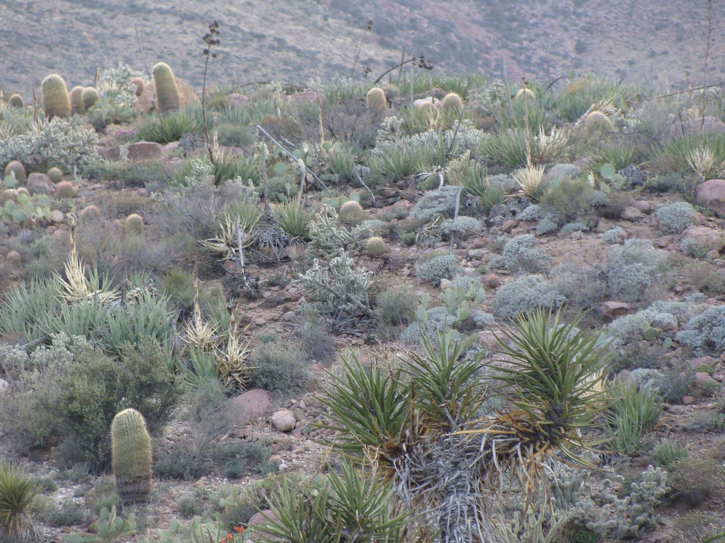
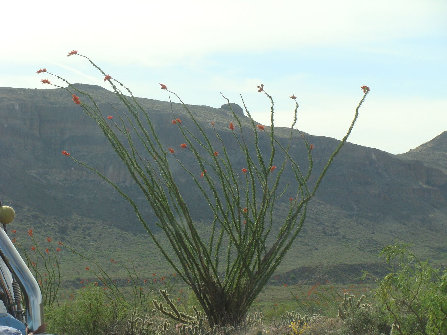
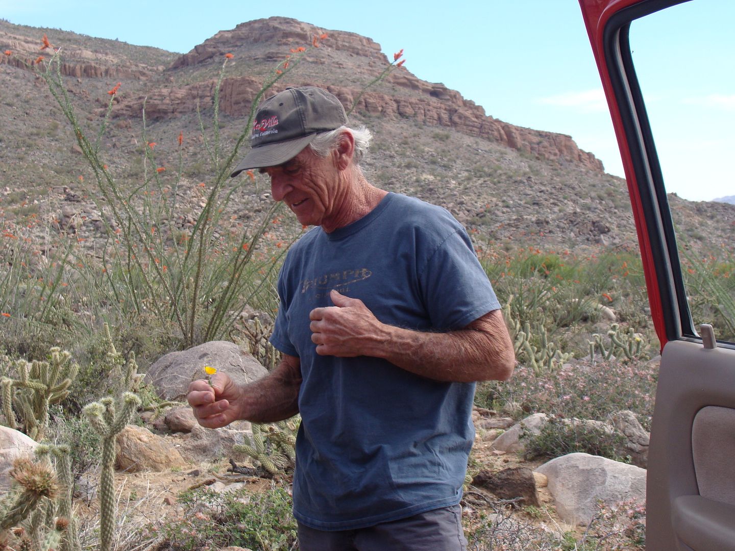
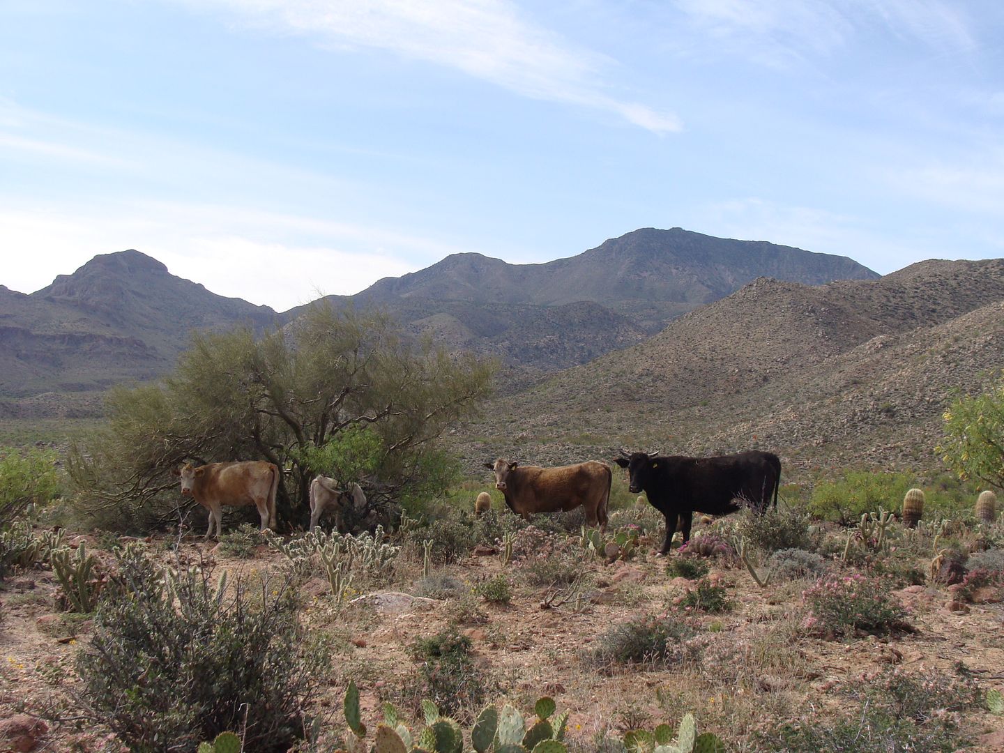
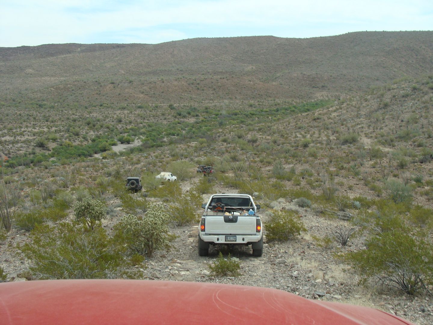
Photos from Sheri...
Sheri sent me a disc with the photos she took during the Pole Line Run.
Here are 25 of them:
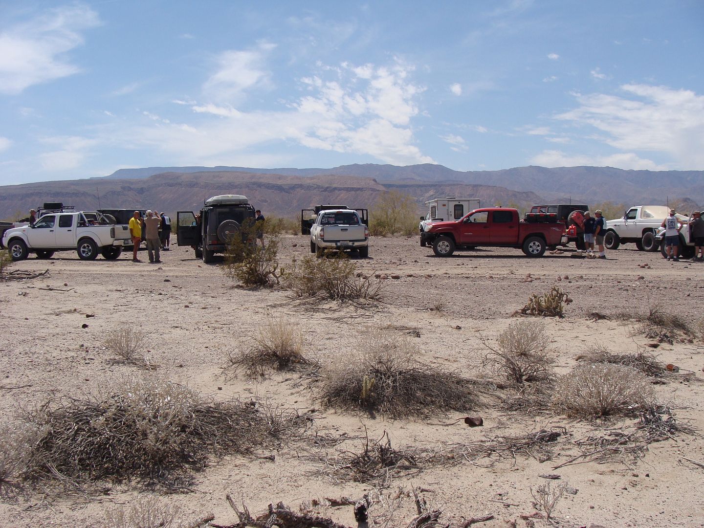
Cohabuzo Junction
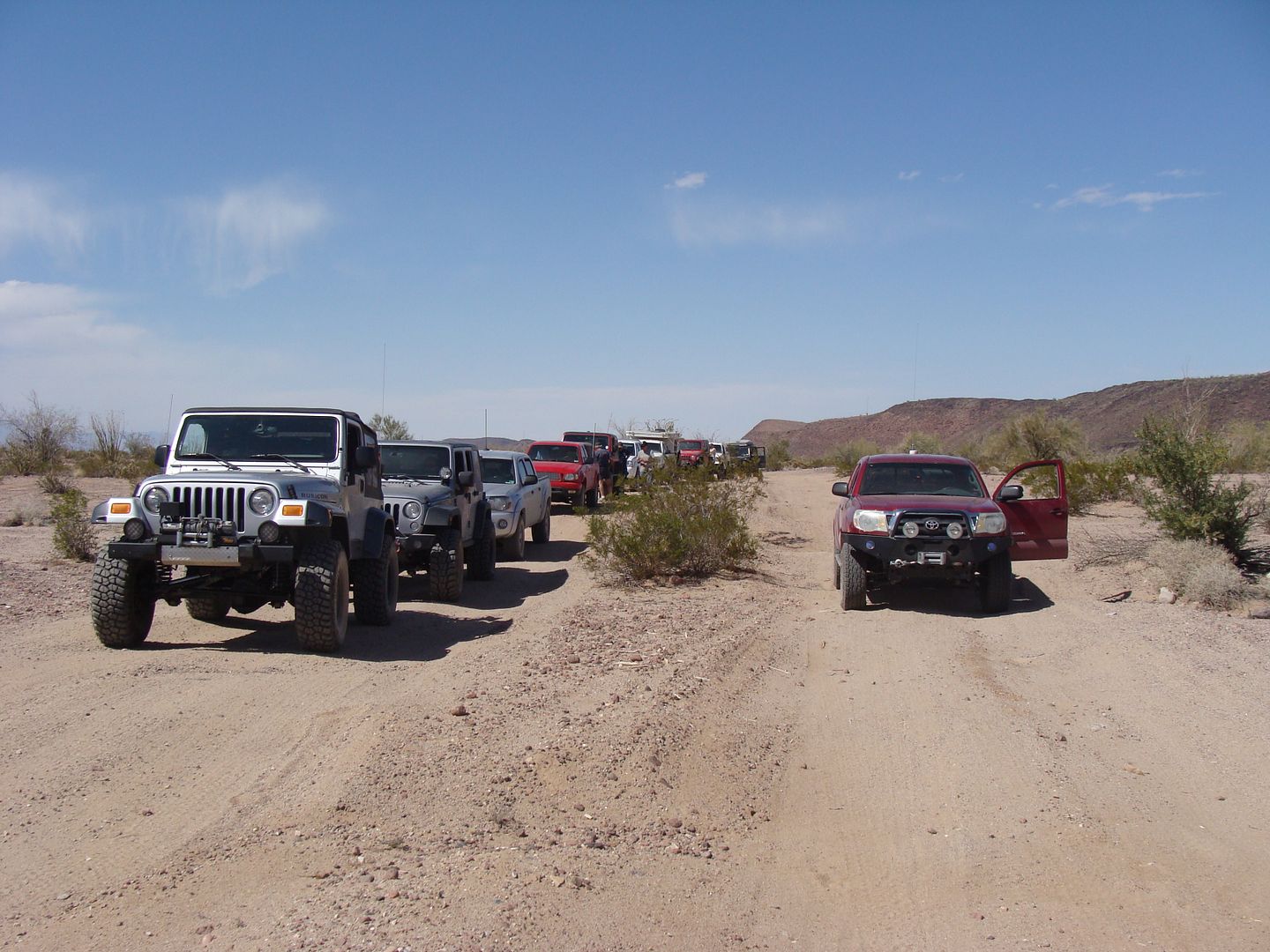
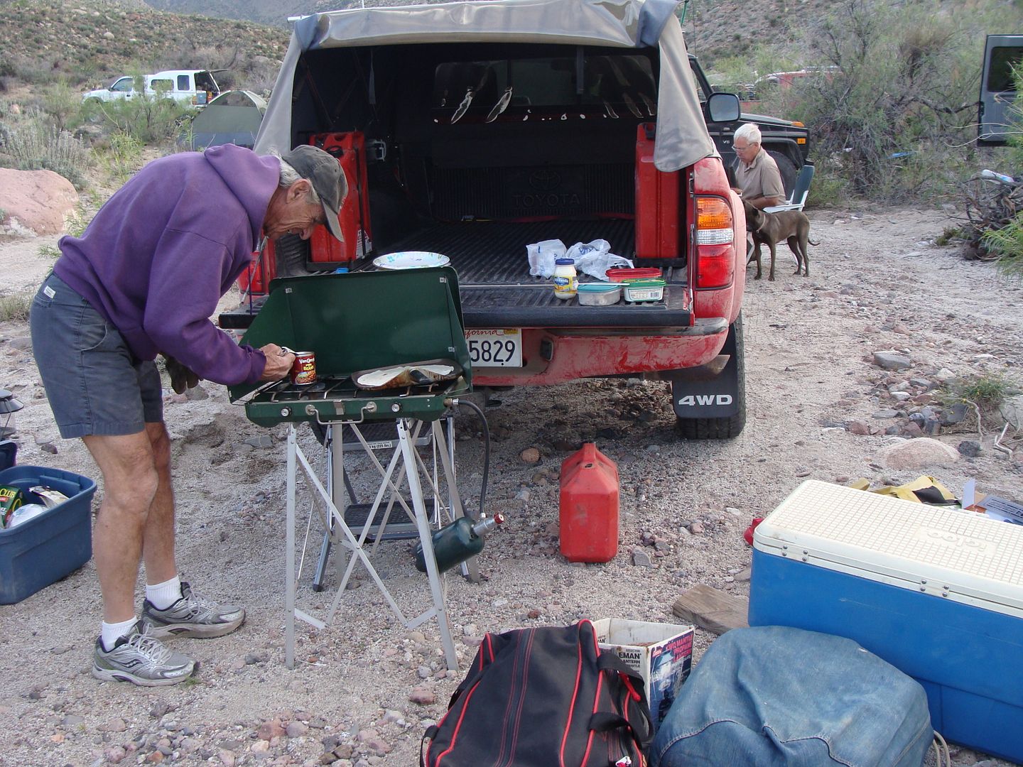
Saturday Night Camp, Arroyo el Sáiz
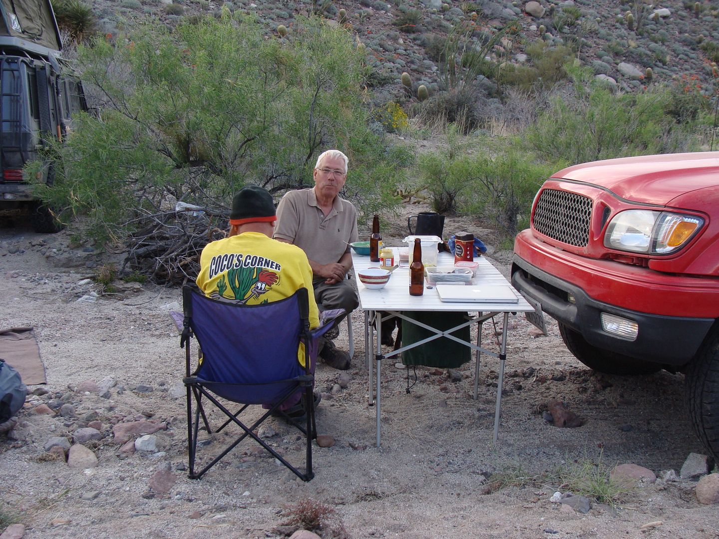
Karl and Harald
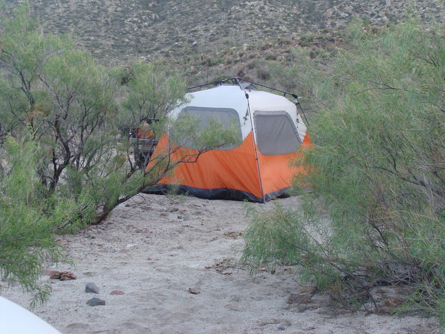
Coleman Insta-Tent, easy even in wind!
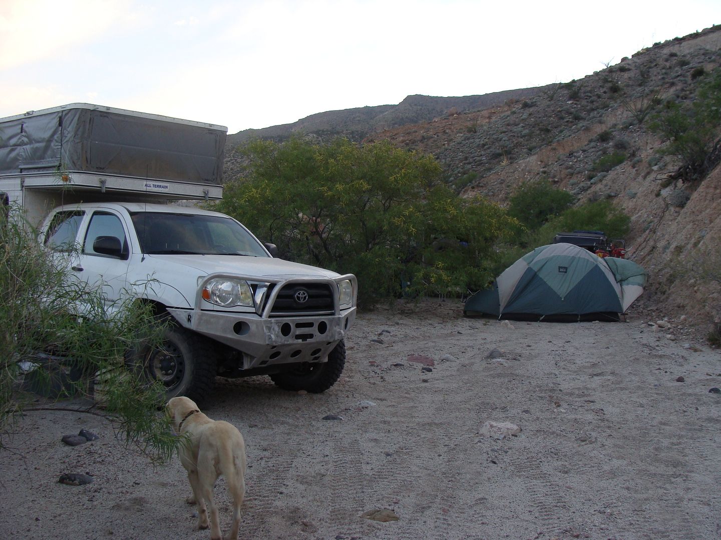
Pop up camper, even easier!
Sunday morning on the 1942 Pole Line Road, eastbound.
Continued...
|
|
|
David K
Honored Nomad
Posts: 64526
Registered: 8-30-2002
Location: San Diego County
Member Is Offline
Mood: Have Baja Fever
|
|
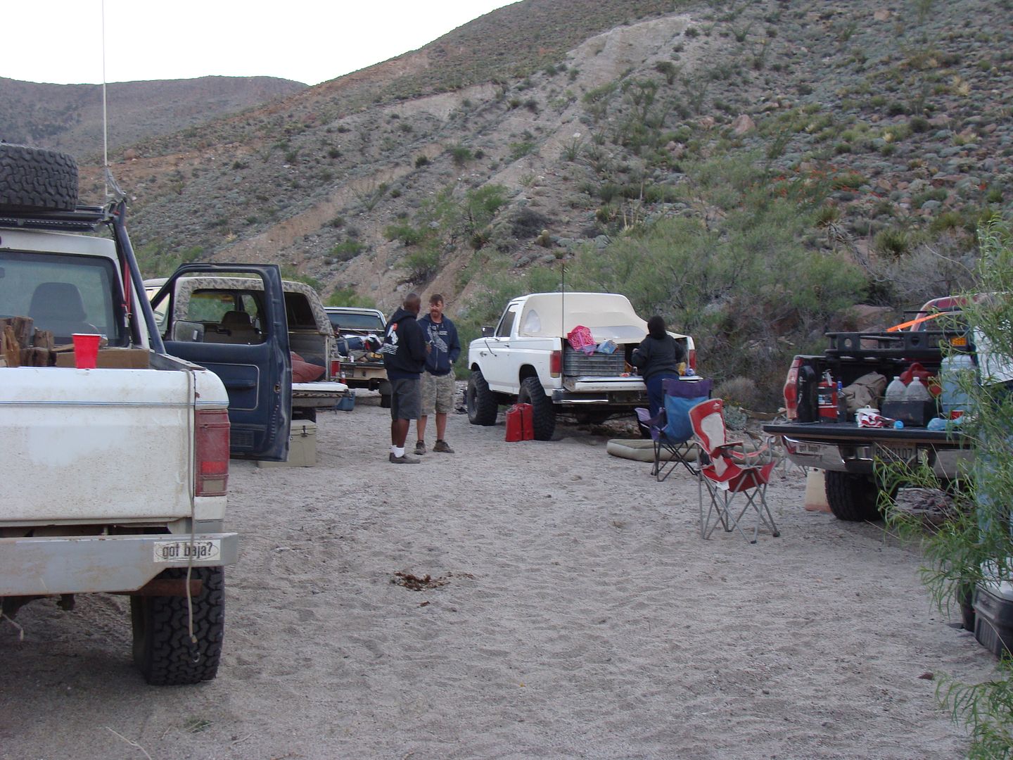
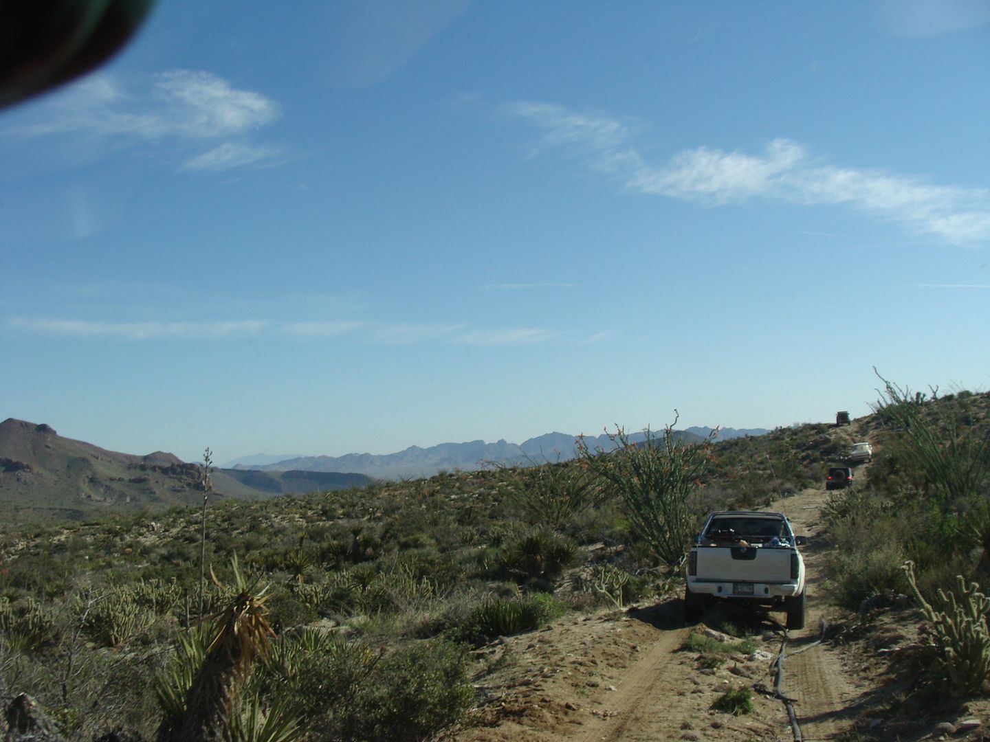
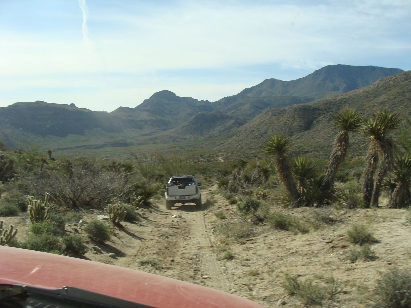
...
Mike
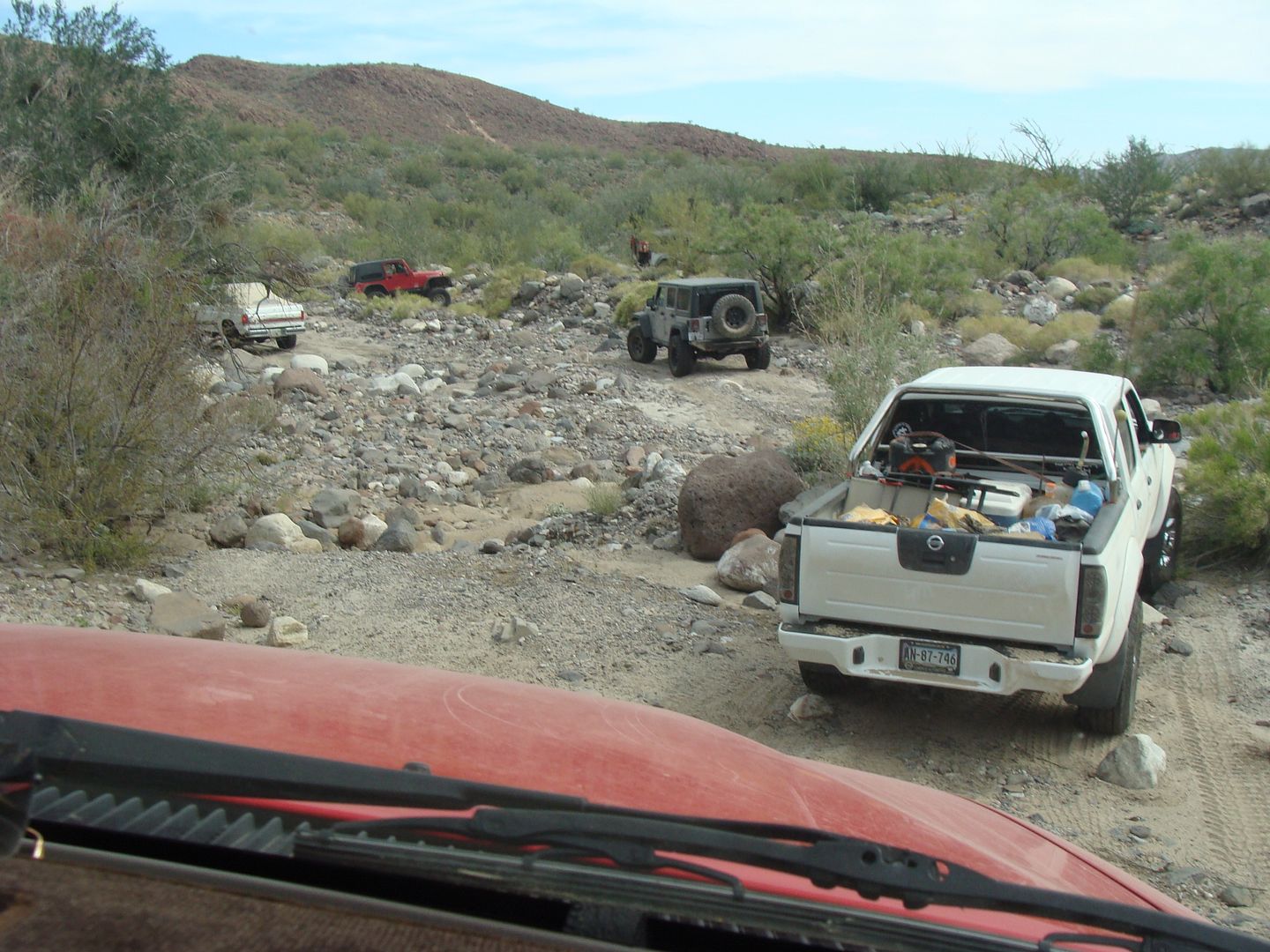
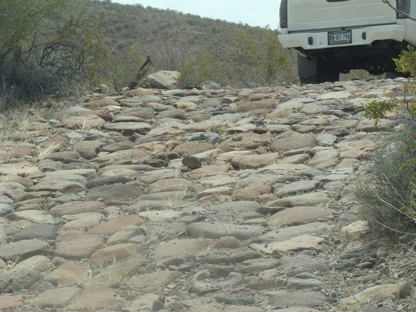
Cobblestone Road
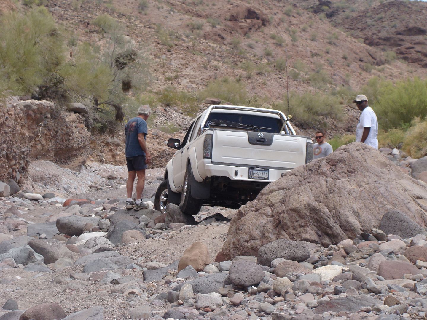
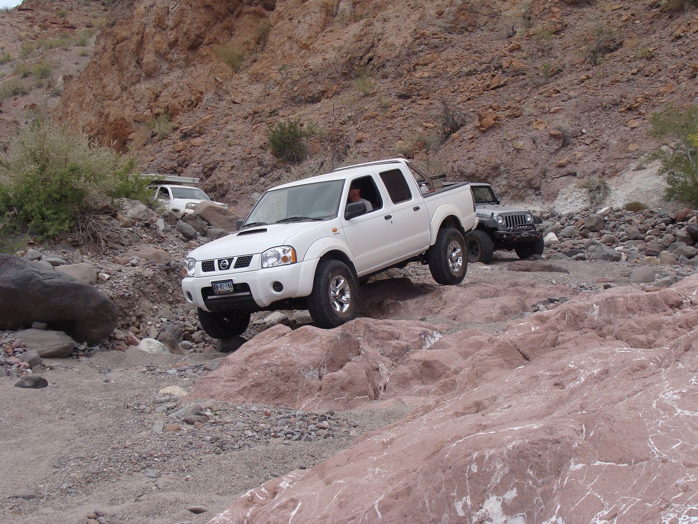
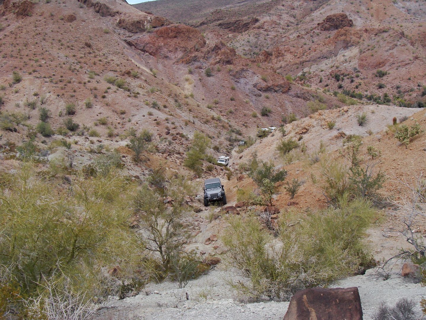
Great shot of Basketball Hill climb.
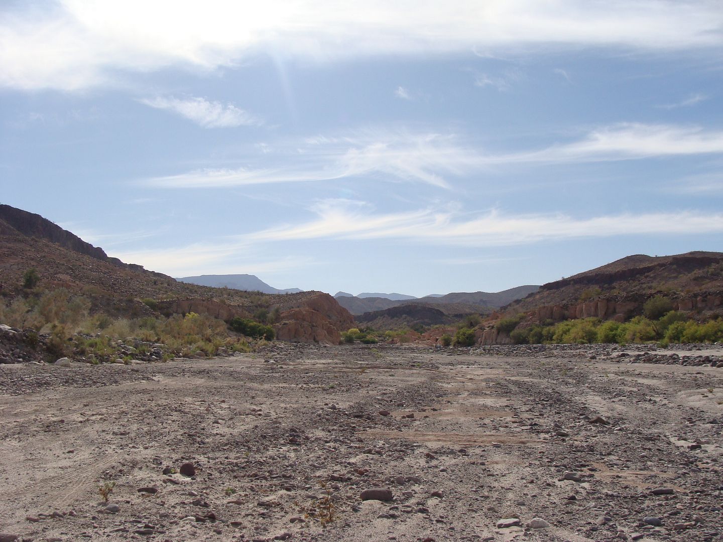
Arroyo Jaquegel looking west from the Suzuki wreck area.
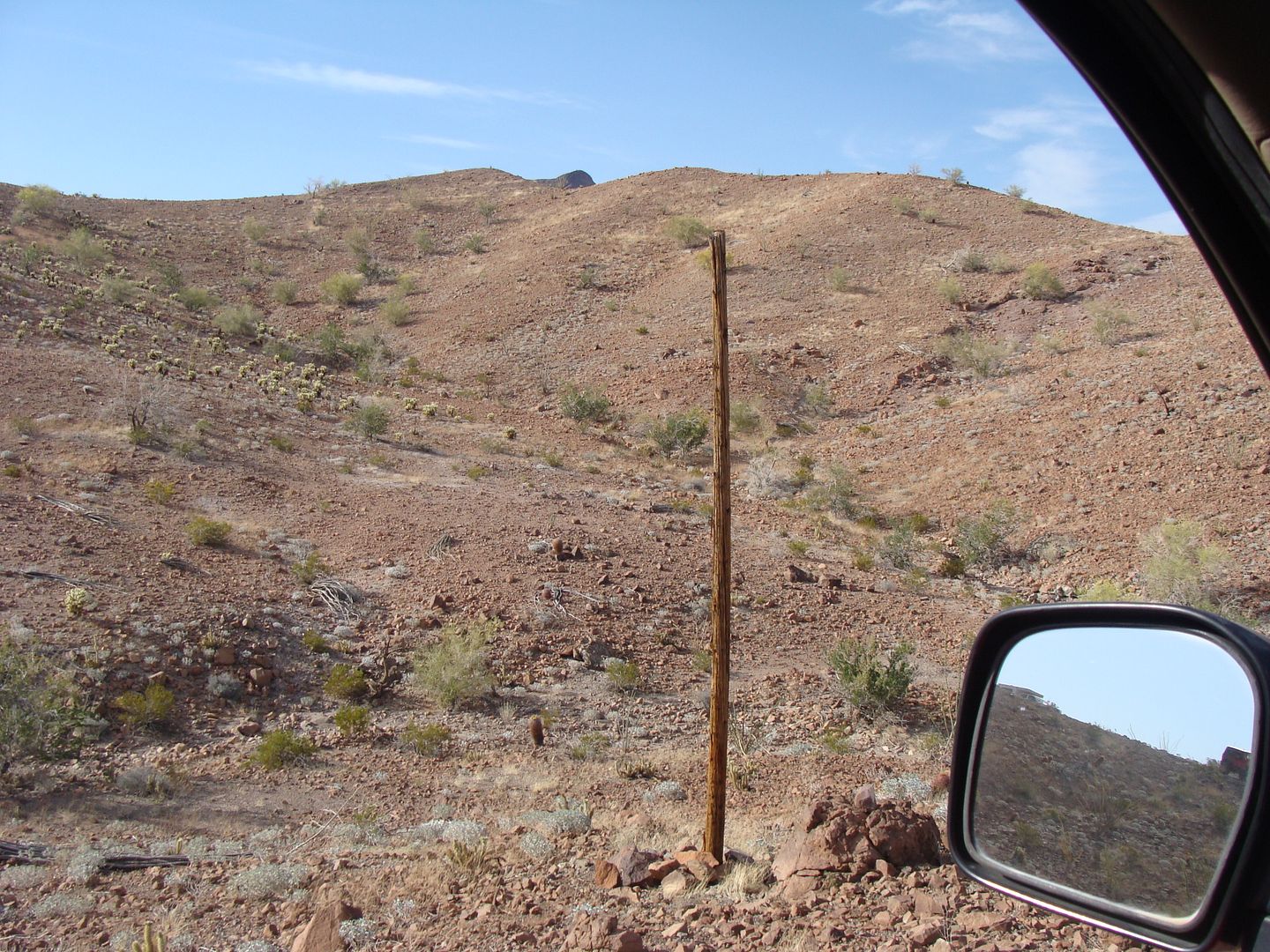
Why the road has its name.
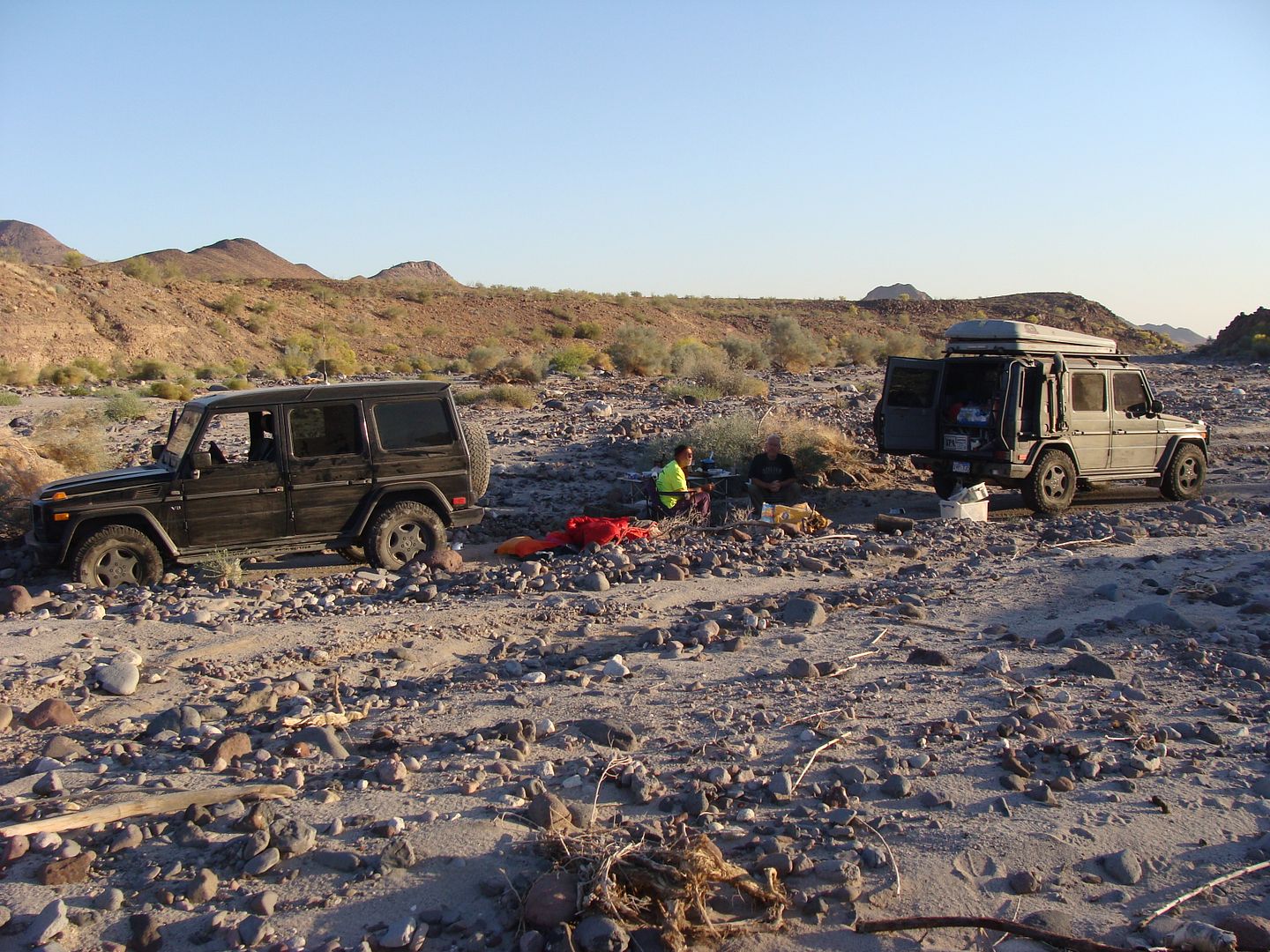
German 4X4 Camp in Arroyo Jaquegel, Sunday night.
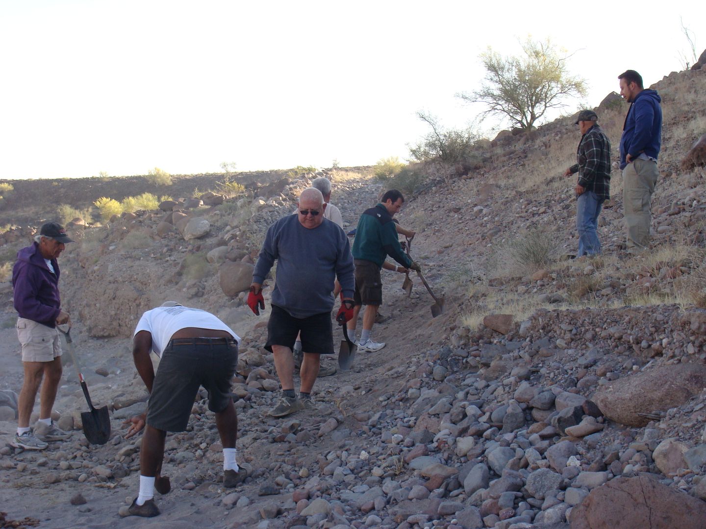
Road building!
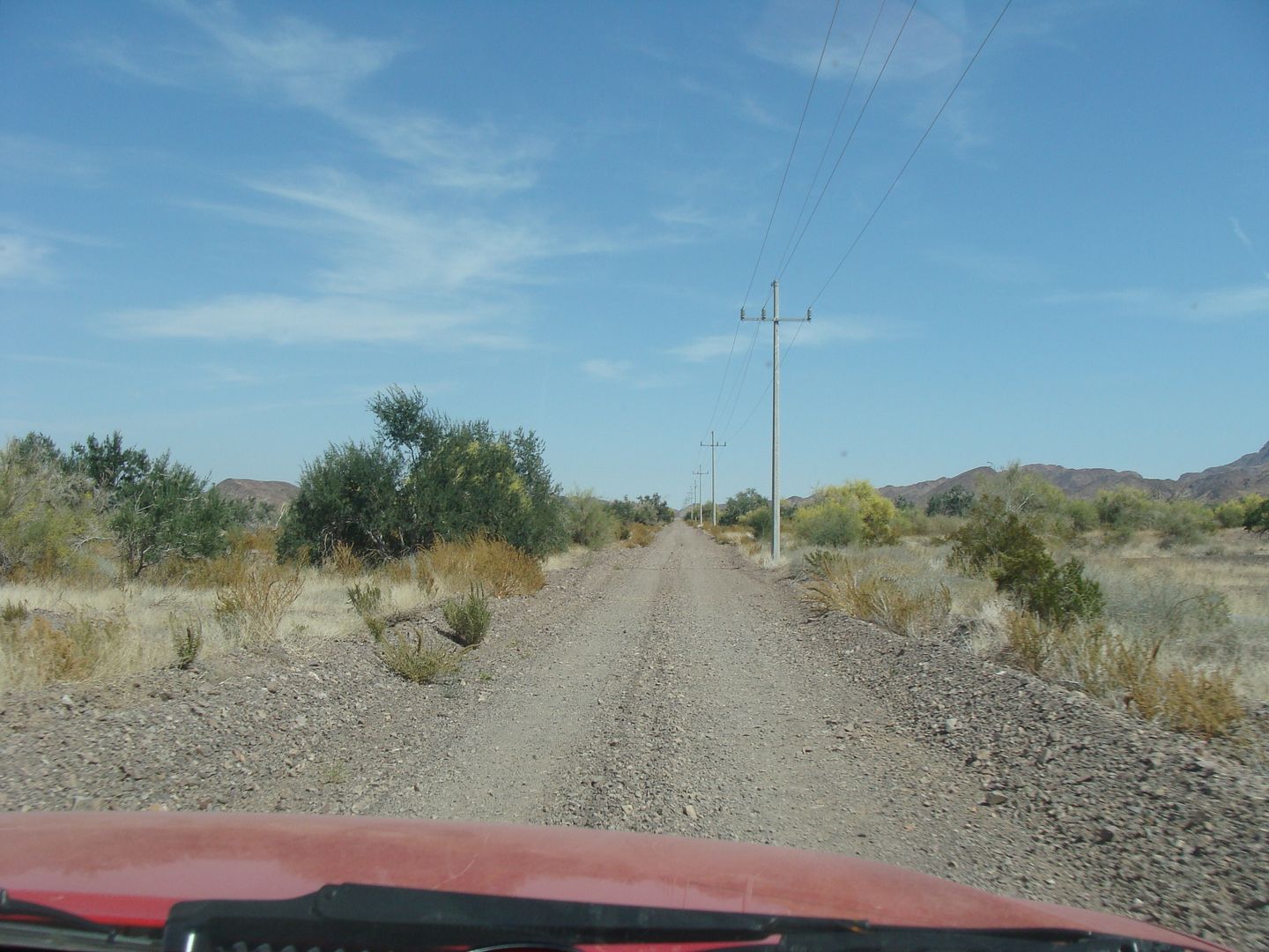
The good road from the wells out to Hwy. 5 at La Ventana.
Thank you for sharing Sheri!!!
|
|
|
| Pages:
1
..
6
7
8
9
10
..
12 |


