| Pages:
1
2 |
TMW
Select Nomad

Posts: 10659
Registered: 9-1-2003
Location: Bakersfield, CA
Member Is Offline
|
|
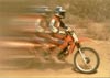
Corky and TW Ride El Volcan, trip report
On Friday our goal was to ride down the El Volcan wash until we could ride out onto a mesa that would take us over to another wash to the north.
However El Volcan would not cooperate. We hit a rock pile right off but not too bad, then after 100 yards of sand more rocks. It seemed the farther we
went the bigger the rocks. After about 2.5 miles we start walking to scout the wash. Another mile or so and the wash narrows to about 50 feet with
large smooth black rock. The elevation drop appeared very noticable. We could probably have taken the bikes down but getting back up would be another
story.
At this point we decide to turn around and head back to Ranch Santa Inez. Our ride lasted about 7 hours. Much of it man handling the bikes over rough
terrain. With the waterfall Corky came up against on the east end last year and the rocky drops on the west end, it appears that the El Volcan wash
will not provide any method of travel between hwy 1 and the Sea of Cortez.
Sat. evening over dinner Bajabucko ( I think that's her forum name, I'm going from memory here so Corky or someone can correct me) anyway she was
there with two other ladies and a man. One lady had broken a couple of fingers when her horse miss-stepped coming down a steep hill on the Camino Real
(Kings Highway) in the mountains. It was a very exciting and interesting conversation of their trip.
Corky wasn't feeling too good Sat. morning and wasn't able to ride so I decided to start early for San Felipe. I stopped several times for GPS
readings. I also stopped at Cocos and visited for about an hour. He's still having problems with his leg, but was in good spirits. He was helping
another man work on his truck, fuel filter was plugged up.
A few miles up the road I came across 3 puppies. Looked to be a couple of month old. Two looked like beagle hounds and the other was yellow. It was at
the Punta Final turn off. I didn't see anyone. The pups wouldn't come close to me. I left some food and water but my guess is they were dropped off
and some coyote will have them for a meal.
I was going to take a GPS reading at the Bill Nickols turn off for Bajalou, but forgot until I was at the Matomi wash, so I turn around and drive all
the way back. Some 15 miles or more each way. When I get to San Felipe Bajalou wasn't home so I left a card in his door. Having another brain fade I
forgot to write the GPS reading on the card, sorry Lou. I'll send them to you.
Crossed the border at 11pm, had about a 35min wait. I guess because I had two MCs in my truck and was alone the border agent asked me several
questions, some I've never been asked before including my occupation.
I had a great time and can't wait to go again.
|
|
|
Mexitron
Ultra Nomad
Posts: 3397
Registered: 9-21-2003
Location: Fort Worth, Texas
Member Is Offline
Mood: Happy!
|
|
Interesting TW--never tried to head down Vulcan like that. Was Baja still green from the rains?
|
|
|
TMW
Select Nomad
Posts: 10659
Registered: 9-1-2003
Location: Bakersfield, CA
Member Is Offline
|
|
Yes it was. Lots of flowers still.
|
|
|
bufeo
Senior Nomad
Posts: 793
Registered: 11-16-2003
Location: Santa Fe New Mexico
Member Is Offline
|
|
TW,
My in-law, Neil, left Santa Ynez (CA) last week in hopes of hooking up with you guys. Did he connect?
I guess since you're back, Corky is too, so I can give him a land-line call to see how things went too.
Thanks for the report.
|
|
|
bajalou
Ultra Nomad
Posts: 4459
Registered: 3-11-2004
Location: South of the broder
Member Is Offline
|
|
Sorry to miss you TW - had to take my wife to the old country to go to her sisters and I waited for machine work to be done in Mexicali so was gone
Fri till about 3 this afternoon. Found your card (El Camote had alredy told me it was here). Thanks for all the effort getting the GPS data and just
Email me when you get a chance. Coming down for the CODE 200? if so I'll see you there.

No Bad Days
\"Never argue with an idiot. People watching may not be able to tell the difference\"
\"The trouble with doing nothing is - how do I know when I\'m done?\"
Nomad Baja Interactive map
And in the San Felipe area - check out Valle Chico area |
|
|
TMW
Select Nomad
Posts: 10659
Registered: 9-1-2003
Location: Bakersfield, CA
Member Is Offline
|
|
Bufeo, they met with Corky Friday evening and Corky said they were coming back at 9am and we were going to ride into mission Santa Maria. With Corky
ill Sat. morning I decided to come back a little early. I don't know when Corky came back, with the way he was running for the john I doubt he got out
of his motorhome before Sun.
Bajalou I'll send you the GPS data as soon as I put it together from my notes.
|
|
|
Corky1
Nomad
Posts: 416
Registered: 11-22-2003
Member Is Offline
|
|
Hello all!!
Thank you TW for posting all the info on our ride.
You are right, I didn't see the outside of my Mtr
Hm till late sunday
"Montezuma" got me good!!
1st time in 35 yrs in Baja??
All's well now.
Corky
 
\"Keep The Rubberside Down\" |
|
|
bufeo
Senior Nomad
Posts: 793
Registered: 11-16-2003
Location: Santa Fe New Mexico
Member Is Offline
|
|
Well that's okay, Corky, we're glad your plumbing is working all right again....but, did you meet up with Neil??
Did you get down to PB?
|
|
|
Corky1
Nomad
Posts: 416
Registered: 11-22-2003
Member Is Offline
|
|
This is an old posting but I am going to up date it with a few pictures.
Pictures from Howard E. Glick collection.
TW and I rode past this location enroute to Volcan.
First picture taken in 1956, second 2005.
[Edited on 6-23-2005 by Corky1]
\"Keep The Rubberside Down\"
|
|
|
David K
Honored Nomad
Posts: 65549
Registered: 8-30-2002
Location: San Diego County
Member Is Offline
Mood: Have Baja Fever
|
|
Until you post your 2005 photo, here's my 2000 photo...

|
|
|
Corky1
Nomad
Posts: 416
Registered: 11-22-2003
Member Is Offline
|
|
Having trouble posting picture. Try again.
April 2005
Ruined picture getting it smaller than 50kb
[Edited on 6-23-2005 by Corky1]
[Edited on 6-23-2005 by Corky1]
[Edited on 6-23-2005 by Corky1]
\"Keep The Rubberside Down\"
|
|
|
David K
Honored Nomad
Posts: 65549
Registered: 8-30-2002
Location: San Diego County
Member Is Offline
Mood: Have Baja Fever
|
|
The overall area, plus the google satellite image is so good you can make out the school house... http://forums.bajanomad.com/viewthread.php?tid=10620
|
|
|
Corky1
Nomad
Posts: 416
Registered: 11-22-2003
Member Is Offline
|
|
To continue on with this post.
TW and I came back to Catavina from Marmol via the old, old road.
Passing the original Virgin shrine
First picture Shrine 1959
[Edited on 6-23-2005 by Corky1]
\"Keep The Rubberside Down\"
|
|
|
Corky1
Nomad
Posts: 416
Registered: 11-22-2003
Member Is Offline
|
|
Virgin Shrine 2005
\"Keep The Rubberside Down\"
|
|
|
TMW
Select Nomad
Posts: 10659
Registered: 9-1-2003
Location: Bakersfield, CA
Member Is Offline
|
|
Corky, great pictures. Next time maybe we'll try going over to the El Olividada mine. The last time I tried going out there about 10-15 years ago the
road was washed out a mile or so past the El Volcan wash. I thought at the time a couple of guys could push, pull and walk the MCs past the wash out.
|
|
|
Corky1
Nomad
Posts: 416
Registered: 11-22-2003
Member Is Offline
|
|
Someday I would like to look at the area east of the mine down to Los Vacos/Mirimar arroyos??
Try to get to Mex 5??
Corky
\"Keep The Rubberside Down\"
|
|
|
David K
Honored Nomad
Posts: 65549
Registered: 8-30-2002
Location: San Diego County
Member Is Offline
Mood: Have Baja Fever
|
|
That's the kicker! If there was a doable route it would have been done, it seems. The La Olividada road gets close, you see the gulf, but there must
be some kind of cliff between the mine and Mex. 5 ???
The Bill Nichols trail seems to be the only one to cross, north of Gonzaga... It goes west from near La Costilla (5+ mi. so. of Puertecitos) and heads
for San Juan de Dios/El Metate and I heard can be riden all the way to San Quintin (off any roads).
From Rancho Santa Ynez, there are two routes to the gulf (at Gonzaga), but they are best for foot or mule... The El Camino Real and Junipero Serra's
cargo trail. Although I know of one motorcycle off road racer who did ride the Camino Real up from Gonzaga to the mission and back, with some damage.
Don Jorge has an excellent page with GPS and map of the El Camino Real between Gonzaga and Santa Maria mission... http://southcoastfarms.com/gonzaga_to_mission_santa_maria.ht...
[Edited on 6-24-2005 by David K]
|
|
|
Bob H
Elite Nomad
Posts: 5867
Registered: 8-19-2003
Location: San Diego
Member Is Offline
|
|
These before and after photos are fantastic. I love this kind of stuff! The old photo of the schoolhouse in El Marmol in 1956 facinates me.
The SAME boiling water that softens the potato hardens the egg. It's about what you are made of NOT the circumstance.
|
|
|
TMW
Select Nomad
Posts: 10659
Registered: 9-1-2003
Location: Bakersfield, CA
Member Is Offline
|
|
Bob, I picked up a copy of Ralph Hanc-ck's book Baja California on ebay and it has several pictures of El Marmol and the many buildings that were
there years ago. Too bad they are all gone except a broken shell of the school house. It would have made a great ghost town. But then someone would
have to guard it and I don't think that could happen.
|
|
|
Corky1
Nomad
Posts: 416
Registered: 11-22-2003
Member Is Offline
|
|
Quote from David K
"That's the kicker!
If there was a doable route it would have been done, it seems.
The La Olividada road gets close, you see the gulf, but there must be some kind of cliff between the mine and Mex. 5 ???
The Bill Nichols trail seems to be the only one to cross, north of Gonzaga."
This is what everyone told Bill Nichols and I when we were looking for the above described trail.
The route is doable once you do it.
The only reason it has not been done is that no slghtly retarted motorcycle riders have tried to do it.
Corky  
\"Keep The Rubberside Down\"
|
|
|
| Pages:
1
2 |