BajaNomad

Choral Pepper's 'LOST' MISSION SITE: FOUND! (What do you think it is?)

 Pages:  1  2

Mexitron - 1-18-2009 at 10:23 AM

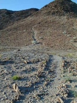
The "chute" looks like a path to get on top of the mesa to me but it also doesn't look like the best place to have a path--David, you were saying the Mesa is very steep--unless there was something at the bottom or top of the mesa in that spot that made a direct path better...did the rocks put aside for the path have the desert varnish as the rock walls?

Taco de Baja - 1-18-2009 at 10:38 AM

Quote:
Originally posted by David K
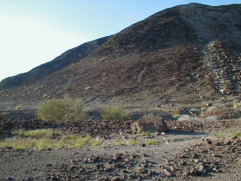
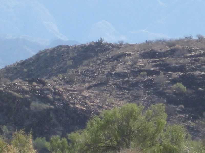
Here is a zoom in on that cleared 'chute' or slide that I thought may have been where supplies for the Spanish fort on top (or whatever was on top) were dragged or pulled up by rope...

This is very steep... we climbed up/ and back down just to the left of it, because using rocks to hold or step on seemed easier, it was that steep.
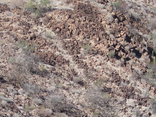


What do you think???


The geologist in me says that the chute is natural. The action of flowing water is removing the desert varnish creating the white strip we see in the photo.

Also, if it as steep as you claim, no one in their right mind would try to clear a trail of 200-300+ pound rocks by placing them on the sides of the trail. If they had, I think you would have seen their crushed bones at the bottom. Also, if they had tried, say in the delirium of being out in the 120 degree heat of an August day, it still would have been easier to roll the boulders down the slope, and I don’t see a pile at the bottom.

Furthermore, people (Native American, and modern) generally put trails at an angle across the face of slopes, not perpendicular. You may have to take more steps, but it is a lot easier to go up (and down) a gradual slope.

Just my $0.02….

David K - 1-18-2009 at 11:09 AM

The chute was sand... not white rock... It was just too steep to use... would have requiread 'all fours'... We did the typical switchback type climb, just to the left of the chute and didn't need to use hands much.

All the rocks were darkened... most all. We did see some quartz at the top... probably brought there?

As for natural... It's top end was not at the low point in the saddle above... It was to the right of the natural water course if it rained. Almost done so on purpose, to prevent the sand from eroding away to the basalt base.

That's why it seemed to me man made... and for a purpose other than climbing up for people. :?:

David K - 1-18-2009 at 11:14 AM

Quote:
Originally posted by jdtrotter
Interesting picture of San Borja on the front of that book----good for comparison to today.

I am always a little ambivalent about missions. I love visiting old historical sites, and I have always enjoyed the missions in both Californias. The ambivalence comes from understanding the brutality of the system in regards to the indigenous populations.

I do cringe when I see the California 4th grade mission project done year after year, the one that the students used to do until the parents started competing. They teach such a fantasized version of that part of California history.

Good luck on finding more information about the wall, etc.


Both my kids built the missions for their 4th grade projects. Drove me crazy to hear such things as San Diego was the FIRST California mission and the missions were all placed a days ride apart...

Loreto was the first misson, and San Diego was founded long after some 17 Jesuit missions and one Franciscan mission was founded on the peninsula. San Diego was the SECOND misson founded by Junipero Serra, after San Fernando Velicata, in Baja!

See, you got me started! LOL!!:lol:

Dr. Eric Ritter answers Corky's question

David K - 1-19-2009 at 10:40 AM

Quote:
Originally posted by Sharksbaja
Looking at the area it appears that at one time water was available for quite a period. That would mean food for animals as well.

The problem with that scenario is, where do you draw the line between habitation by those that built the rings and those that built the wall if in fact the wall was built only hundreds of years ago not thousands.

Domesticated sheep were brought to the New World as early as 1494. Cortes had sheep in Mexico during the 1500s and it's possible I suppose that the introduction of sheep could have occured then.

We'll have to research that. Sheep either domestic or Bighorn we're not mentioned in the diets at the Animas sites. I wonder if the isotope samples that indicate mammals could have overlooked sheep as a possible contributing isotope factor . Mainly because wild sheep were around 1000 years ago.

Evidence points to an arid climate 1000-6000 years ago. It seems not to much has changed in Baja over the millennia. Cactus fruit like pitaya and agave and seeds were main staples in the ancients diet.

So were shellfish and mammals. Dr. Ritters pdf files are copy protected unfortunately so I can't cut and paste from it but one would conclude that the area of BOLA and Animas have similar and connected historical value.

You can conclude a lot from his papers. I would like to ask him if they have identified Bighorn or domestic sheep (or cattle) remains at any site that was preoccupied 1000-6000 years ago.

That might add weight to the notion that the walls were indeed built to contain or direct sheep (or cattle).

======================================================


As to mountain sheep bones in Animas/BLA sites I don't recall any in the assemblages--but the samples are very small and certainly marine-oriented. Mountain folks could be the visitors to the coast and those involved in the wall construction and mountain sheep hunting. However, marine foods were more easily available to them and mountain sheep also availalble in the mountains. I did find a mountian sheep bone awl in a late prehistoric Concepcion Bay assemblage and mountain sheep are found in the rock art. Many similar questions about mountain sheep hunting and faunal assemblages can be found in the Calif./Great Basin desert works, especially with all of the mountain sheep rock art images. Aschmann found no reports of deliberate mountain sheep hunting--among contact groups anyhow (pg. 70). The Seri hunted them. So it is just one possibility. Cattle would be Spanish introductions and I don't know of any cattle bone in sites off hand--other than mission digs.

Main foods at contact: sea mammals and sea turtles; agave and cactus fruits, legumes and annual plant seeds. Deer were very important off course, at least in terms of ceremony and prestige. I have seen mountain sheep on the road between BLA and Animas so they are around. Springs and water holes would be good ambush locations.--people tended to sometimes live a bit away from these water sources so as to not scare the animals. Mountain sheep were probably a prestige animal, occasionally hunted. Some archaeologists would say that the big game hunting and success was related to wife acquisition--successful hunters got the gal or two. They (sheep) do taste good.

As to the wall--I doubt domestic sheep were around here in any numbers to use a "directional" wall. A drive fence for bighorn sheep (or deer?) is only one explanation. We can always fall back on that "ritual" explanation. How does the rock weathering/coatings compare between the rock enclosures and the wall boulders? Could suggest a similar age if all factors of rock coating development could be considered (age, particulate matter in the air, exposure, rock type, etc.). Hope this helps. Eric

Sharksbaja - 1-19-2009 at 12:37 PM

Very informative, thank you Eric. So that pretty much rules out livestock. I don't see the wall as a tool for such. There are other walls in the area as well. Perhaps they are all tied together for a common purpose.

If the water source attracted game maybe the walls(the ones on the fan) were built for the purpose of directing them one way or another without actually containing them. More like a directional funnel for hunters.

The walls on the hill...?????

David K - 1-19-2009 at 06:56 PM

Pretty weird... but it sure is fun to try and guess who, what, when and why!:o

wilderone - 1-20-2009 at 11:06 AM

"... the next site in Baja he is going to study, as I have been there, and am assisting him on it as much as I can/ he needs. (no, I won't tell you where, lol)"

C'mon David, where? I bet a bunch of us have been there and we can give Ritter some advance clues.

Taco de Baja - 1-20-2009 at 11:42 AM

Quote:
Originally posted by wilderone
"... the next site in Baja he is going to study, as I have been there, and am assisting him on it as much as I can/ he needs. (no, I won't tell you where, lol)"

C'mon David, where? I bet a bunch of us have been there and we can give Ritter some advance clues.


Read some of David's trip reports. You can probably figure it out....there's only *** to chose from.....;)

wilderone - 1-20-2009 at 04:45 PM

This was interesting:
CLEARED CIRCLES AND ROCK RINGS
So-called "sleeping circles" are features, often circular in shape and typically 1.5-3.0 meters in diameter, that were formed by clearing away the rocks from an area of desert pavement or by enclosing an area within a low rock border. Thousands of such features are known from the California deserts. In one 9 mi.2 area in eastern San Diego County, Malcolm J. Rogers (1939:7) counted more that 500 circles. Interpretations of the origins of the features have included prehistoric camping areas, geoglyphs, and locations of ritual activity. Some features may have been produced by modern activities or by natural processes.

Rogers (1939, 1966) argued that the features could be assigned, at least primarily, to the earliest phase of the San Dieguito complex, which he also termed the Malpais Industry. This age assignment was based, in part, on the absence of any Late Prehistoric artifacts in association with the circles and their frequent occurrence in locations remote from any modern water source. The features were interpreted as "sleeping circles," within which the early hunters had slept "like sardines in a can" (Rogers 1966:14). The absence of artifacts within or near most of the features was taken to indicate that they were temporary sleeping areas rather than more permanent abodes (Rogers 1939:8).

Robert S. Begole (1973, 1974, 1976, 1981, 1984) conducted investigations for several years in the Anza-Borrego Desert State Park. He argued that sleeping circles in that region dated both well back into the Pleistocene and from the later phases of the San Dieguito complex as well. Many of the features were interpreted as living areas, extensively reused and with added "rooms." In other cases, Begole noted the association with apparent ritual functions, such as trail shrines, geoglyphs, and presumed vision quest areas.

It is plausible to suppose that some of the region's sleeping circles may have been geoglyphs rather than habitation areas. Geoglyphs, or ground art features of various sorts, have been reported in considerable numbers in the Colorado Desert (e.g., Rogers 1939; Solari and Johnson 1982; Von Werlhof 2004). Many were formed by clearing away areas of desert pavement or by placing rocks into linear patterns, in manners comparable to the ways the sleeping circles were formed. Many of the geoglyphs are recognizable as such because they are representational in form or take geometrical shapes that seem to be clearly nonfunctional, beyond serving a ritual or artistic impulse; other geoglyph shapes are more ambiguous. Circles are a common design element for the region, frequently employed in rock art (Hedges 1970) and in pottery decoration (Rogers 1936).

Some apparent sleeping circles may be residues of recent activity. "Macahui," a concentra­tion of such clearings in northern Baja California, was popularly identified, variously, as a major prehistoric town, a ceremonial center, or a vast cemetery (cf. Möller and Aguilar 1982). Closer studies showed that the features consisted, at least in considerable part, of modern gravel collection areas (Bendímez et al. 1986). A controversy has also long surrounded the "Topoc Maze" on the Colorado River, which may be an elaborate geoglyph or another modern gravel collection location (Haenszel 1978; Rogers 1939).

The possibility that some of the cleared circles are natural rather than cultural phenomena has also been raised (e.g., Pat Welch 1985:personal communication). Animal burrowing, the growth of bushes, sweeping of areas by wind-blown bush branches, and soil action are possible sources of some misleading patterns.

To evaluate the disputed origins of the Macahui circles, Julia Bendímez, Don Laylander, and Héctor León (1986) suggested several archaeological tests for distinguishing the functions of desert pavement clearings. The location of features in settings that lack water and other resources and that are off of any natural travel route would argue against habitation use but would not be inconsistent with geoglyph construction. Large, dense concentrations of the features would also seem to argue against habitation use, unless a taboo against the reuse of habitation circles is assumed. An absence of associated artifacts would argue against habitation use, or at least, as Rogers suggested, against any but a very transitory habitation use. Clearings that were made as geoglyphs or by gravel collectors would presumably favor specific sites with particularly dense desert pavement, whereas clearings made for temporary habitation would presumably be situated to minimize the amount of effort needed to clear them. If the cleared rocks are not accounted for within the surrounding pavement, the hypothesis of an origin in modern gravel collection or perhaps some noncultural phenom­enon would be favored. The presence or absence of patination or desert varnish on moved rocks near the features might clarify the matter of their antiquity.

PROSPECTS

Future archaeological investigations may be able to clarify the purposes for which cleared circles and rock rings were constructed, as well as their chronology. Relevant evidence will include detailed documentation of the features, their settings, and their contexts with respect to other features, artifacts, and alterations in the natural pavements.

David K - 1-20-2009 at 05:43 PM

Geoglyphs are another interesting pre-historic sample of Baja native artwork!


Near Mex. 5, north of Mex. 3 jcn. GPS: N 31°40.53', W 115°04.64' (NAD 27)

[Edited on 1-21-2009 by David K]

Sharksbaja - 1-20-2009 at 08:54 PM

Pretty inconclusive. I guess we already covered their potential use(s). A water source seems to be the key to any habitational reason for their existence. I wonder if they built them to escape winds at night. Of course it would be silly to try to escape winds on a promitory.....??

You must wonder how many people were running around the desert building these. Must have been Nomads.

avid - 1-20-2009 at 09:27 PM

Quote:
Originally posted by Sharksbaja
Pretty inconclusive. I guess we already covered their potential use(s). A water source seems to be the key to any habitational reason for their existence. I wonder if they built them to escape winds at night. Of course it would be silly to try to escape winds on a promitory.....??

You must wonder how many people were running around the desert building these. Must have been Nomads.


The Plains Indians moved to the top of buttes looking for wind to help escape mosquitos. If you have ever seen the size and daytime habits of Eastern Montana mosquitos you could certainly understand doing anything possible to escape them.

David K - 1-20-2009 at 10:41 PM

The mosquitos were so bad at the first Santo Tomas mission site, they had to move the entire mission!

Taco de Baja - 1-21-2009 at 08:06 AM

Quote:
Originally posted by Sharksbaja
Pretty inconclusive. I guess we already covered their potential use(s). A water source seems to be the key to any habitational reason for their existence. I wonder if they built them to escape winds at night. Of course it would be silly to try to escape winds on a promitory.....??

You must wonder how many people were running around the desert building these. Must have been Nomads.


Maybe some really bored surfers built the wall while waiting for surf....Been known to happen. ;)

wilderone - 1-21-2009 at 10:52 AM

Here's a thought - after seeing David's photo of the "chute" in the zoomed-out format, it looks like the top is a bowl, with rock sides, and the chute "flows" out of the bowl. Is that a depression in the middle which could hold water in rainy months? Don't forget how much rain can occur with a hurricane and tropical storms. Maybe they tried to keep as much water up there as possible and the chute is a diversion flow to collect at the bottom where some were living (?) (and because it was too inconvenient to climb up and down for the water along the steep sides).
It doesn't look like there is any evidence to demonstrate that there were a lot of people for a long time at this site. Maybe there was a rainy period where it was thought prudent to try to save water for a season or two, and then it ran dry and there was no further reason to stay on. A collection point, such as the flat top of the hill with a depression would be unique - no?
The walls? I got nothin. Except maybe the same water hole attracted animals and the walls kept some of them from running away too quickly and they could drive them into this natural trap and move in for the kill. The indigenous of thousands of years ago did this with mammoths and bison. (walls too low for this?)

David K - 1-21-2009 at 05:55 PM

Great to keep posting ideas!

a) the top of the chute is no bowl, just were the steepness leveled out a bit... near the right end of the second (shorter) wall. Any rainfall excess would flow down to the left of the chute... from what we observed.

b) The walls are both very low (1.5-2 ft.) and would only detract animals that can't jump, I would think. (cows, sheep, turtles lol)

[Edited on 1-22-2009 by David K]

David K - 1-21-2009 at 06:24 PM

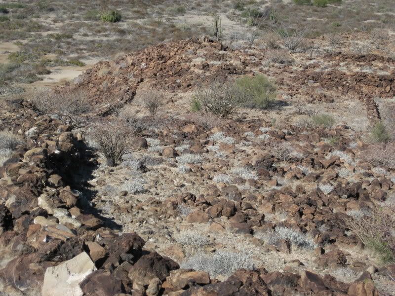
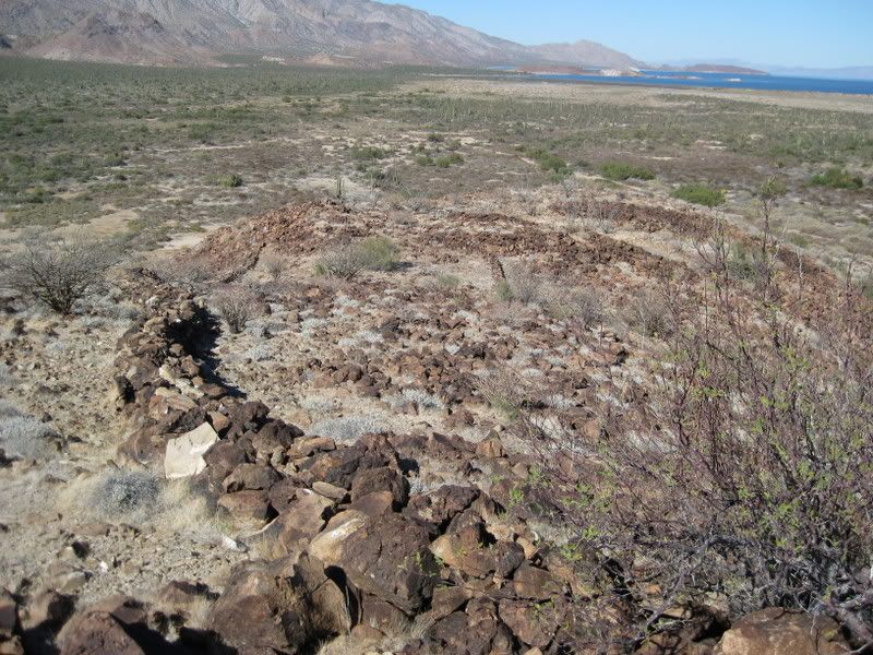
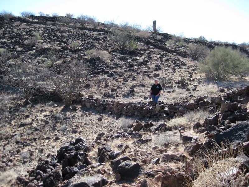
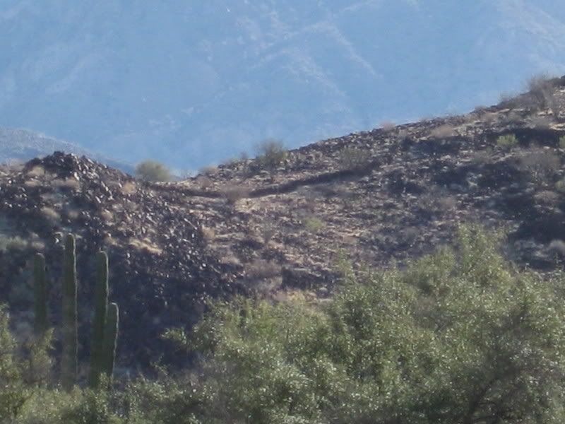
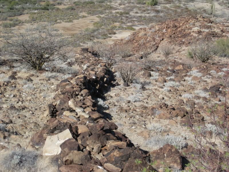
Here is looking down from the higher end of the long wall... see the sorter wall to the right? The chute goes down the steep side, to the right of the far end of that wall... I recall that to be slightly uphill from the midpoint in the shorter wall...


[Edited on 1-22-2009 by David K]

avid - 1-21-2009 at 06:31 PM

The problem with referring to the circled rocks as "sleeping circles" is this. I have spent many nights sleeping under the stars while a wild land firefighter both with a sleeping bag and without. I was awakened one night with a snake on my chest. It's not a great feeling when you are in rattlesnake country. Now, why on earth would anyone want to surround themselves with rocks that snakes love to hide in. How would you know if you were bedding down with a snake inches from your head and neck. Again, this isn't a great sounding idea at least to my way of thinking. Can you imagine a group supposedly packed in like sardines being awakened by the sound of rattling.

HONEY, where's &%$#*@^ the flashlight.

:lol:

David K - 1-21-2009 at 06:34 PM

If it where Graham Mackintosh (or the ancient natives), it would mean dinner time!:light::bounce:

Snake, it not just for brakfast anymore!

avid - 1-21-2009 at 07:05 PM

Quote:
Originally posted by David K
If it where Graham Mackintosh (or the ancient natives), it would mean dinner time!:light::bounce:

Snake, it not just for brakfast anymore!


No doubt, but in the dark prey and preyed upon can go topsy turvy.

mtgoat666 - 1-21-2009 at 07:09 PM

Twas a tribe's winter place on the SOC. They probably decorated it with rock walls and berms same as y'all spend your free time building crazy landscapes in your yard. The walls make the site a bit more interesting than your usual collection of "sleeping circles." We'll never know the deeper meaning as our euro-trash ancestors slaughtered the indians before we got interested in anthropology and archeaology. We'll never know. Oh well, we learn from our mistakes, one hopes.

Hope!

Yes we can!

wilderone - 1-22-2009 at 10:23 AM

I think the site was a lookout post, and the walls were something to hide behind. I've read where offshore tribes were particularly hostile, and coastal tribes needed to defend their food sources from pillage. The circles lined with rocks could have had religous significance - but as the above article relates, these circles are found by the hundreds all over the SW. The slick is evidence that perhaps women-folk would come and process some food for the look-out soldiers.

David K - 1-22-2009 at 02:48 PM

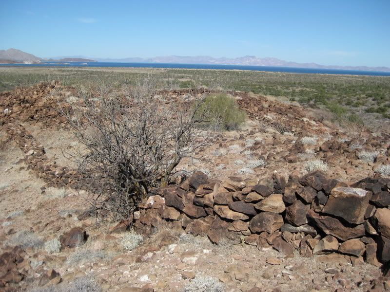
The upper end of the mesa is all covered by lava rocks, and if that is where they wanted to sit, sleep, whatever... clearing away the rocks for some flat ground would have been necessary... A lookout/ fort/ etc. is what that site seemed to me, as well...

The two walls were both very low and one was way long to be much use for humans...? The long wall climbs way up to the higher part of the hill/ mesa. Shorter, taller walls would have made good fighting/ defensive barriers... perhaps... but who knows for sure? Where's that time machine??!!

Thanks for the ideas, Cindi!

avid - 1-22-2009 at 02:49 PM

I am starting to feel like I have loaned my brain to the SETI project. :spingrin:

Could these stone circles be informational kiosks. Perhaps ways of denoting that someone(s) has been here before or is here. That this is a good location for habitation and perhaps even with remnants of the food available nearby left behind to inform or remind those that come afterwards. Circles where chosen because they weren't found in nature, were quick to build and obviously stable. Maybe it was a standard practice common among aboriginals to survey an area from a high spot before making one's presence known. Therefore it was obvious the high point was the place to leave a mark. It would help avoid unnecessary conflicts and to assist others if there was no one around.

I guess I am trying to say it was the earliest know form of BajaNomads.

BAJACAT - 1-22-2009 at 02:50 PM

Maybe was used as a landmark sort of thing, to mark a trail or area of interest.

David K - 1-22-2009 at 02:54 PM

The rock circles are on top of the tall hill, mesa... Only those flying over can see them... Perhaps avid has a point about aliens or ancient astronauts?

[Edited on 1-23-2009 by David K]

Barry A. - 1-22-2009 at 03:17 PM

All the "sleeping circles" I have seen (mostly in the So. Cal deserts, and Baja Norte) have been associated with points of exceptional strategic advantage in that the visibility in several directions was good to exceptional.

Then I tried to "put myself" in their shoes, and speculate:

To me that indicated that "visibility" was the chief advantage, and therefore I associated them with sleeping and sitting points for "watchers". (for enemies, animals, or ???)

Yes, a "time machine" would be most helpful.

Barry

avid - 1-22-2009 at 05:20 PM

Quote:
Originally posted by David K
I like the cat better than the ram...

The rock circles are on top of the tall hill, mesa... Only those flying over can see them... Perhaps avid has a point about aliens or ancient astronauts?


I wasn't referring to extraterrestrials but how my brain feels. Like I have my gray matter logged into a project that is using my bandwidth went I am not. ;D

I am sticking with the idea of a message left for self or others. I think that it was just the MO to head for the highest point before entering a new area. When you arrived there if there were circles of recent origin then you might assume there were already people living there. If they were older then you could make an assumption that someone before you found the area habitable. Inside the circles there could have been bones, seeds, etc. that provided information about what was good to eat in this area. They also could be ways to remember a tribes previous occupation. If you were nomadic there is a chance you might think a place looked familiar but you couldn't remember exactly the facts about it. For instance, children could have been there with their parents and now they have returned with their children. By looking at the circles there could be clues to previous experiences.

Mexitron - 1-23-2009 at 12:00 PM

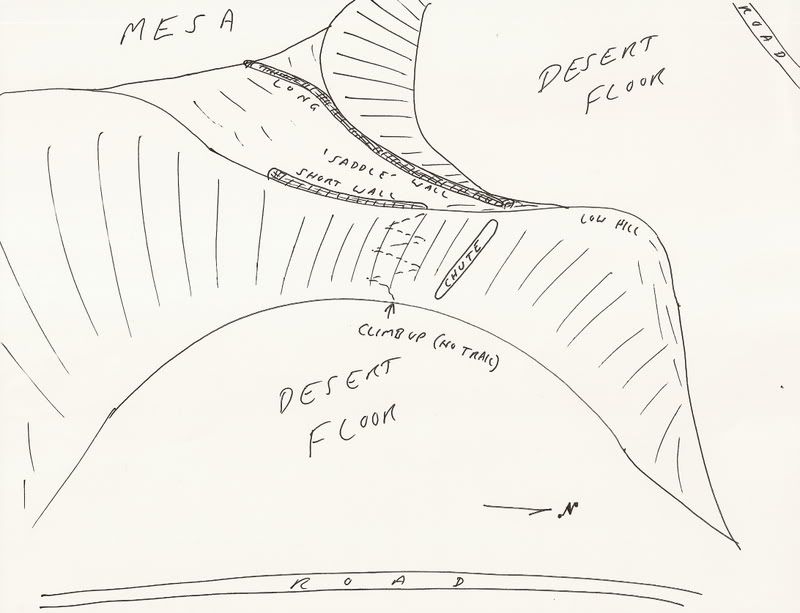
David--in your description of the walls' positioning with the chute it sounds like the walls form an area that is contiguous with the chute--as in they are an extension of the chute onto the mesa...?

avid - 1-23-2009 at 03:00 PM

I was just looking the area over on Google Earth. Actually I travelled all the way down to Santa Rosalia looking for similar habitat. I found nothing like this huge wash with a large area of sub-irrigated, it would appear, vegetation. It looks like a place any grazing mammal would head for if their legs would carry them. I can see no reason a sheepherder would have built a drift fence in this location. The way the sides of the mesa are shaped makes them a natural trap. The walls are built in the low spot between the two insets in the mesa. Looks like a perfect place to ambush antelope, bighorn or maybe jackrabbits and drive them up the hill. The walls could have broken up a herd and caused them to head in different directions or there could have been individuals waiting behind the walls. If my diet was clams day after day I might put a lot of effort into getting a large mammal.

North of San Francisquito I noticed what appears to be prospecting going on. What are they hoping to find, gold or copper?

David K - 1-23-2009 at 03:11 PM

Quote:
Originally posted by Mexitron
David--in your description of the walls' positioning with the chute it sounds like the walls form an area that is contiguous with the chute--as in they are an extension of the chute onto the mesa...?


The top of the chute is near the north end of the shorter wall... not connected to it, however. I will try and draw a simple sketch...


Looking down to the 'saddle' area between the walls:


Looking towards the walls from 'near' the top of the chute:


[Edited on 1-23-2009 by David K]

Sharksbaja - 1-24-2009 at 01:29 AM

I think the circles were built by arriving seasonal nomads. They were built as needed ignoring the existing ones that may have been home to dangerous nocturnal critters.

The chute was for rolling stones down to further progress on the "other" walls that helped funnel wild animals to the spring and associated vegetation.

The walls on the ridge were built to befuddle people, and it still works today!;D

The fact that two walls run parallel on that slope is really wierd imo.

Taco de Baja - 1-24-2009 at 11:43 AM

It is my belief that the rock circles went around the bases of their brush houses. They were not "open air" sleeping circles, as they appear now. They are essentially prehistoric footings.

In several thousand years people may speculate as to the purpose of all the concrete rectangles; all that is left our houses after the walls have rotted away.....

David K - 1-24-2009 at 03:57 PM

Exactly Brooks! In the future we will all be in geo-domes... Why would someone live in a rectangle!:lol:

avid - 1-25-2009 at 09:11 PM

David,

Does the Mesa build from valley floor level on the South as it appears in Google Earth? In other words, does it ramp up slowly till you have a nearly vertically sided mesa? If this is the case, it would appear similar to a Buffalo Jump. Except in this case there was no jump just walls that concentrated the game into a kill zone.

Mexitron - 1-26-2009 at 05:18 AM

Thanks for the drawing David...it does look though like the chute and the walls are kinda part of the same operation...(?) Wow, what a great mystery...

David K - 1-26-2009 at 10:35 AM

Quote:
Originally posted by avid
David,

Does the Mesa build from valley floor level on the South as it appears in Google Earth? In other words, does it ramp up slowly till you have a nearly vertically sided mesa? If this is the case, it would appear similar to a Buffalo Jump. Except in this case there was no jump just walls that concentrated the game into a kill zone.


Yes... good idea! Chase the game (deer, rams, ?) up the mesa... and at the north end they come down into the saddle area where the hunters wait behind the walls to hit them with arrows/ spears... Not sure how men on foot could force the animals on the desert to head up the mesa... but ???

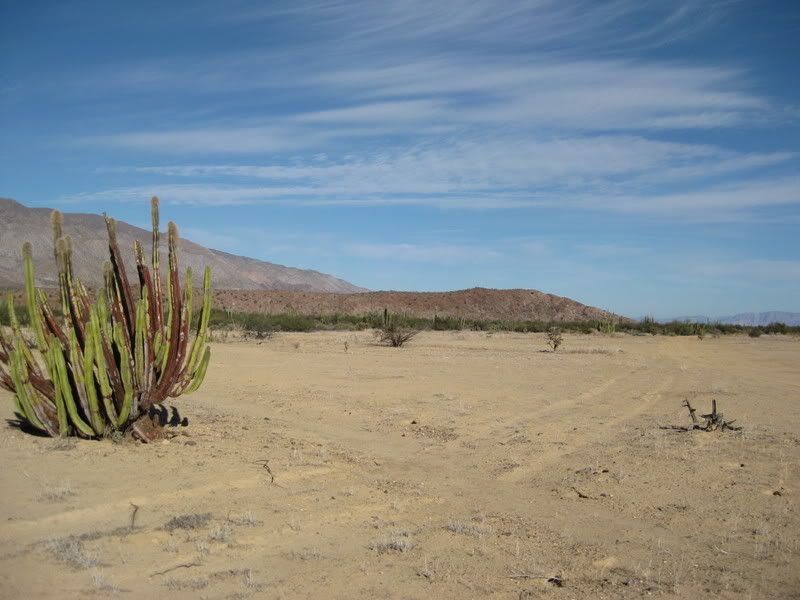
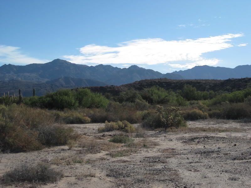
Here is the mesa from the south, shortly after taking the right branch, 7 miles from the San Francisquito road.


David K - 1-26-2009 at 10:41 AM

Quote:
Originally posted by Mexitron
Thanks for the drawing David...it does look though like the chute and the walls are kinda part of the same operation...(?) Wow, what a great mystery...


From the road to Animas, circleing around the mesa and heading back south on the west side of the mesa... Here looking southeast you can see the long wall and saddle area...


A bit further south and a look east towards the wall and saddle area.


Here without zoom...


[Edited on 1-26-2009 by David K]

mtgoat666 - 1-26-2009 at 11:06 AM

Quote:
Originally posted by David K
Quote:
Originally posted by avid
David,

Does the Mesa build from valley floor level on the South as it appears in Google Earth? In other words, does it ramp up slowly till you have a nearly vertically sided mesa? If this is the case, it would appear similar to a Buffalo Jump. Except in this case there was no jump just walls that concentrated the game into a kill zone.


Yes... good idea! Chase the game (deer, rams, ?) up the mesa... and at the north end they come down into the saddle area where the hunters wait behind the walls to hit them with arrows/ spears... Not sure how men on foot could force the animals on the desert to head up the mesa... but ???


I am really curious -- what makes you think the desert once had abundant game to drive into traps? I am not aware of any significant evidence for such existing in last thousand years. Given seismic activity and erosion potential, doubt the walls and circles and soil berms are more than 500 years old.

The walls were probably decorative, maybe were just someone's rock wall that they enjoyed building to decorate their winter camp on the ocean. Why do y'all think the walls had any practical or religious function?

David K - 1-26-2009 at 11:31 AM

It was a lot of work, by several men... just don't think they had that much time for 'fun' when survival was so important... Specially if there weren't herds of deer or borregos, as you imply. The walls are uncommon in ancient Indian sites... very common in Spanish mission sites, however.


mtgoat666 - 1-26-2009 at 12:18 PM

Quote:
Originally posted by David K
It was a lot of work, by several men... just don't think they had that much time for 'fun' when survival was so important...


you're crazy. the natives of baja had time and resources for "fun" and culture. maybe it was different than what you are acustomed to, but it was a highly developed culture in desert areas of CA and Baja.

avid - 1-26-2009 at 02:30 PM

Traps don't mean big herds necessarily. Traps in my mind would indicate weapons with limited range. There were Pronghorn in Baja. They can exist in large numbers in seemingly sparse habitat. They don't refer to them as goats for no reason. ;D
Having had the privilege of hunting Pronghorn you learn some interesting things about them. First of all they have razor sharp eyesight. Supposedly like a human wearing 8X binoculars. They are also very curious because of the great eyesight. They will actually move toward things that don't scare them and that they can't figure out. Once spooked they have a tendency to run pell mell as a herd. I have seen whole herds hit fence corners with some jumping and clearing the fence and others running into the fence. IIRC it was a damn tall fence and I was shocked to actually see some clearing it. When you run at 60 mph, just as driving that fast, things happen quickly.

The other way this could have been used was as a training tool. Perhaps they trained game to walk up or down the chute and occasionally there would be a group hiding behind the walls in ambush. They could have observed animals moving for months or even years and developed strategies for tricking them.

I highly suggest that anyone that is interested take a look at Google Earth and see what you think.

David K - 1-26-2009 at 03:02 PM

Quote:
Originally posted by mtgoat666
Quote:
Originally posted by David K
It was a lot of work, by several men... just don't think they had that much time for 'fun' when survival was so important...


you're crazy. the natives of baja had time and resources for "fun" and culture. maybe it was different than what you are acustomed to, but it was a highly developed culture in desert areas of CA and Baja.


You were there? How old are you?? No, I'm not crazy but I am entertaining everyone's ideas... crazy or not.

There were two native cutures in Baja it would seem... Those from the1400's A.D. or earlier, who painted the cave murals made famous in the books by Erle Stanley Gardner and Harry Crosby and those more primitive the Jesuits found who ate bugs, lizards, and pitaya seeds from the 'second harvest' (1700's).

I found no petroglyphs an any of the rocks up there... and that is why I am more leaning towards the Spanish being resonsible for those walls. Almost everywhere else there were Indians, water, and some down time, there are petroglyphs.

ALL are just guesses... unless someone who saw them being made can come foreward.:light:

Taco de Baja - 1-26-2009 at 03:51 PM

Deer and mountain sheep would laugh at those "walls". Deer can leap 6 feet, more if they are running. Mountain sheep have "suction cups" on their hooves, hence their name.

Short walls like that are for stupid cows.

The walls were not built by the Natives, they are either from the Mission times or vaqueros; more likely the latter.

Sharksbaja - 1-26-2009 at 04:03 PM

You think the circles were already there before the walls were built? Can't they date that varnish?

Taco de Baja - 1-26-2009 at 04:16 PM

The circles were there before the walls and could be several 1,000 years old.
Dating varnish is very inexact, except for use as a relative dating tool (Not as in Appalachia-Singles.com, but as in this is older than that) :)

Sharksbaja - 1-26-2009 at 04:19 PM

CASE CLOSED!:bounce:

Sharksbaja - 1-26-2009 at 04:26 PM

Taco, love that sig!!

David K - 1-26-2009 at 05:34 PM

Thanks Taco de Baja... if it's good enough for Sharksbaja, then it's good enough for me!:light::biggrin::lol:

(but will Mtgoat666 be satisfied?):rolleyes:

avid - 1-26-2009 at 06:03 PM

Quote:
Originally posted by Taco de Baja
Short walls like that are for stupid cows.


Given the steepness and rockiness of the sides of the mesa I don't think cows would have ever gotten up there in numbers to need a drift fence anyhow. If they were going up the chute, which David said is so steep he chose not to climb it, throw a block in the chute. Even if they would have gotten up there who cares if they went down the other side. It was right around the end of the mesa. In my experience, drift fences are built to prevent cows from crossing into other drainages. Like in a saddle at the top of a divide between two watersheds. If someone has cows that climb like that they would mark them and make a point of keeping her calves. Cows are not know for their climbing tendencies. Most cows would be camping out down near the reservoir and spring. This is the reason they are hard on rangeland. FWIW

Sharksbaja - 1-26-2009 at 06:52 PM

No no no...... you got it all wrong. The chute is where the animals were forced over and down into the arms of spear and rock wielding indiginous people.

Now, were those cattle, pronghorn or chupas?:lol::lol::lol:

Mexitron - 1-27-2009 at 07:46 AM

Quote:
Originally posted by Taco de Baja
Deer and mountain sheep would laugh at those "walls". Deer can leap 6 feet, more if they are running. Mountain sheep have "suction cups" on their hooves, hence their name.

Short walls like that are for stupid cows.

The walls were not built by the Natives, they are either from the Mission times or vaqueros; more likely the latter.


Agreed on the wild game theory--not plausible...

...but if the walls were built by vaqueros why aren't they finished? And why on a slope--not a very comfortable spot for the cattle/horses to hang out, and no forage...

Taco de Baja - 1-27-2009 at 08:10 AM

Ok, it's not the Natives, it's not the missionaries, it's not the vaqueros, it's not nomads, it's not surfers.....How about putting this idea on the table:

Feng shui ? Hmmmm? :cool:

Mexitron - 1-27-2009 at 11:04 AM

Feng Shui...hmmmm, some wayward chinese shaman steering the energy around...sure, why not!

David K - 1-27-2009 at 11:17 AM

What do you two guys smoke? Or, after Mision San Pedro Martir... was it the mushrooms?:lol::bounce::cool:

Mexitron - 1-28-2009 at 06:59 PM

Quote:
Originally posted by David K
What do you two guys smoke? Or, after Mision San Pedro Martir... was it the mushrooms?:lol::bounce::cool:


Now how do YOU know about the mushrooms in the SPM?! The ones on Matomi are even better...:lol:

David K - 3-7-2009 at 08:49 AM

Quote:
Originally posted by Mexitron
Quote:
Originally posted by David K
What do you two guys smoke? Or, after Mision San Pedro Martir... was it the mushrooms?:lol::bounce::cool:


Now how do YOU know about the mushrooms in the SPM?! The ones on Matomi are even better...:lol:


Appearance is EVERYTHING!:lol::lol::lol:


David K - 12-7-2010 at 09:58 AM

It has been almost two years since the site was 'discovered' (again)... I know at least one other Nomad has visted and photographed the site... It is one of Baja's great mystery spots, indeed! :wow:

wilderone - 12-7-2010 at 10:06 AM

From 1/17/09: "Dr. Ritter and I have just had some email exchanges about the next site in Baja he is going to study, as I have been there, and am assisting him on it as much as I can/ he needs. (no, I won't tell you where, lol)" So, did you and he do this? Where was it?

David K - 12-7-2010 at 10:42 AM

No, and I have not heard from him... It was in the Gonzaga Bay region.
 Pages:  1  2