Originally posted by mtgoat666
| Quote: | Originally posted by Curt63
Hmmm ..... Whats up?
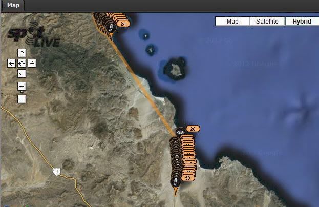
They walked until 9:40am on Fri and made camp.
I could be mistaken, but it looks like they took a ride to Gonzaga.
Medical? Supplies? (hope everyone is OK)
Then, they hit the trail at 3am today.
|
according to spot, they took a long car ride between yesterdays camp spot and this mornings beginning of walk. i guess the walk is over, they drove
their first section -- and it wasn't a spot mistake, that was a large gap, larger than their average daily walk.
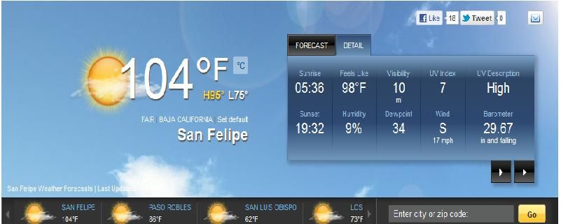
sad to see them give up so soon, but probably sane decision given the heat. |


 Text
Text