Originally posted by Mark_BC
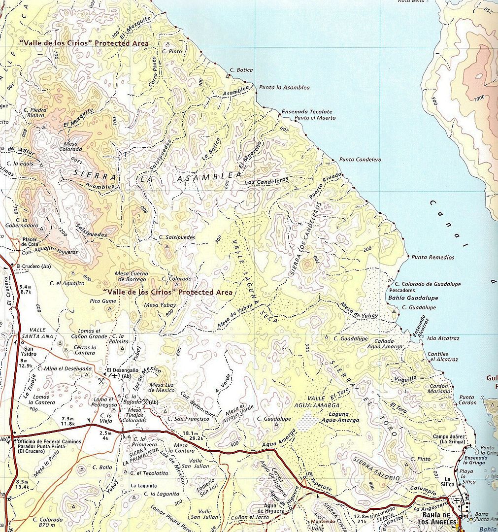
Actually I'm not sure that's drawn right on the Baja Almanac map. I started in the main Salsipuedes drainage, but the road follows it further, all the
way up to near its headwaters on that map. You will see a ranch at 29,16'33'' 114,2'53''. That is in the drainage. I turned off the road way before
that, at 29,15'37'' 114,1'17''. From there the wash leaves the route of the road and heads east-northeast. I rode that to the beginnings of the actual
canyon, at 29,15'43'' 114,1'6'' where I camped the first night in the canyon. From there I followed the main Salsipuedes drainage down, but it's in
the canyon from then on.
It was that evening that Jimmy the local rancher followed my tracks into the canyon and said hi. I was a bit startled and we spoke for a few minutes.
He said there are paintings on the other side (north west side?) of the big granite monument directly to the northwest of that spot. I didn't think it
was safe to go up alone. He said he was from a few kilometers up the road, and I asked if it was Asamblea and he said yes. He was friendly. In
hindsight I wish I had asked him if there was water there year round but I wasn't really prepared to just see him like that. I don't think he knows
much about the canyon downstream of his cattle because he said it should take two days to ride to the ocean! So I guess he's never been down to the
pools as far as I went. Interestingly down in that last section of wash before the pools, at the side of the channel, there is a bunch of black ABS
pipe that they use for moving water around. So someone has been there and tried to set up some kind of a water system.
Before the road goes to his ranch there is a Y which goes right off into Asamblea, down the wash a ways. I don't have the bandwidth right now to look
into the details of that but I remember looking before I came down and it looked pretty rocky most of the way. My concern would be, and was, if you go
a long ways down the canyon, like more than halfway in terms of time, and you've committed yourself to get to the ocean to find water, but you come
across some impassable obstacle, then what do you do. That is what Asamblea kind of looks like to me, it looks rough almost all the way down to the
junction with Salsipuedes. On the other hand Salsipuedes looks pretty easy once you get through the upper canyon. From the confluence at 29,16'46''
113,58'21'' it looks clear sailing all the way to the ocean except for that jumble of rocks 400 m to the north which looks passable. That's why I
would like to look into entering using that confluence at the coordinates in the previous sentence, and instead try from the wash that enters from the
south-east. That terrain is not the blocky granite boulders, it is your typical desert terrain. It doesn't look too bad. I'd enter from Laguna Seca
through the pass at 29,14'52'' 113,56'27'' which is actually lower in elevation than where I entered Salsipuedes canyon! But it should be scouted out
on foot first, a nice little overnight trip, if you can get a vehicle and drive up there.
Those granite boulder areas are really deceptive in Google Earth. Some sections that were totally indecipherable from GE were a breeze and others that
didn't look too bad were difficult or impassable. Because the rocks are vertical!
Yeah it's amazing what they did, considering all the technology and Google Earth we have now.
I got all the pics and video onto my computer. The pics are OK but there's some really great video. |