BajaNomad

Tropical Storm Warning for BCS for Hurricane Norbert

 Pages:  1  2  

micah202 - 9-4-2014 at 10:16 PM

.
...I kinda like the grey line that veers off to the left :yes:


[Edited on 9-5-2014 by micah202]

bajajudy - 9-4-2014 at 11:38 PM

Hey, you guys and gals take care
75
Light rain
10 mph wind
Headed to bed
Mañana

Cappy - 9-5-2014 at 02:41 AM

Gave up trying to sleep. Blowing 50+ in Cerritos. Not much rain

Katiejay99 - 9-5-2014 at 02:42 AM

3:30 am
The power keeps going on and off
Moderate winds - I can't see much outside but I hear it. I have no way to judge the speed.
Not much rain
I'll post pics when/if I can once the sun comes up

Mulegena - 9-5-2014 at 03:25 AM

Mulege 4:20 a.m. update

Awoke 3 a.m. to moderate wind and warm temps. Got up and while making second cup of coffee just now stepped outside... it's raining, light steady drops falling in warm air, no wind.

We shall see. Now, that coffee is ready. Stay snug, everybody.

6 a.m. dry, windless, only partly cloudy

[Edited on 9-5-2014 by Mulegena]

Norbert Los Cabos-6am

pacsur - 9-5-2014 at 05:08 AM

About 6am, pretty windy, Norbert is about 120mi west of Cabo.
Heavy rain last night along with strong winds, rain has stopped for now but still blowing in San Jose-25-50mph at least.
Power on all night.
Internet on and off, keep resetting your router.
Cel phone still working, data also.
Dish network on and off, but pretty good when no rain.
If power goes out you can still use dial up through your phone jack, just like the old days.
Best of luck to all, please send some live updates.

micah202 - 9-5-2014 at 05:37 AM

Quote:
Originally posted by Mulegena
Mulege 4:20 a.m. update

Awoke 3 a.m. to moderate wind and warm temps. Got up and while making second cup of coffee just now stepped outside... it's raining, light steady drops falling in warm air, no wind.

We shall see. Now, that coffee is ready. Stay snug, everybody.

6 a.m. dry, windless, only partly cloudy


.
...well,,a certain amount of rain is good,,,I hope that's all that y'all see as Norbert advances and follows forecast of easing-off in strength over the next 2-3 days.I haven't been able to find much specific information about rain forecasts--I guess these things are too variable to predict who gets what--I suspect the rains are particularly sensitive to hope/prayer influences,,,,and definitely --don't-- tempt fate by hanging any laundry today--too easy for the wind/moisture of wet laundry to draw the flow eastward ;)
... rain warnings have been given as 'locally heavy at times' right through the SW states.'

...Ascunsion---I'm concerned about a couple of things---the forecast has become 'steady' in saying there's a reasonable likelihood of 40-50mph winds,,but be careful to note that the full-moon tides are with us--so there could be some extra intensity if wind ,waves,and high tide combine.....and also...''only a slight deviation to the right of the track would
bring hurricane-force winds to the coast'' in your area as the NHC warns....so it's probably good to keep all household fans pointed to the west still:biggrin:

.


[Edited on 9-5-2014 by micah202]

Katiejay99 - 9-5-2014 at 06:02 AM

7am
Definitely tropical storm force winds. No elect. Can't post pics from phone b/c can't resize. I haven't heard any trees fall yet but the wind is strong enough. No rain.

elskel - 9-5-2014 at 06:04 AM

Monoloco, How was the night in Pescadero, power must be out. Your weather station is down. How about a wind and rain report when you get a chance.
Thanks Brian

chuckie - 9-5-2014 at 06:10 AM

Be safe all!

Mula - 9-5-2014 at 06:17 AM

7:15 here in Lopez. Just getting around to day light.
Been calm and dry all night.

Wind is just now starting to pick up and very overcast.

Woke up this morning to the Red Line on the weather map, so should be an interesting time around Lopez.

Russ - 9-5-2014 at 06:22 AM

wind just picked up again 26mph gust and some rain just starting. Need to closes some windows:wow:

bajajudy - 9-5-2014 at 06:32 AM

Wind and rain all nights...nothing too serious.
Boy Norbert sure looks like a big storm this morning.
Stay safe Pacific coast people!

bajalinda - 9-5-2014 at 06:38 AM

7:30 am at La Aguja - strong wind (sorry, no reading) appears to be just beginning to shift from east to south now - no rain yet!

shari - 9-5-2014 at 06:39 AM

buen dia a todos...here is the morning discussion. The wall of gray is approaching us now and big tuna boats are heading north.

It will be a long hard day in Baja Sur today and we are prepping for lots of flooding if we get the rain they predict. The 17' swell, high tides, wind and rain will make for a very big mess over the next couple days. Debating whether to put the plywood over the windows...big VHF antenna and tent coming down...will get beer stock in when the store opens. Good luck and be smart amigos....thanks so much for all the live reports....they are invaluable.

DISCUSSION AND 48-HOUR OUTLOOK
------------------------------
AT 500 AM PDT...1200 UTC...THE CENTER OF HURRICANE NORBERT WAS
LOCATED NEAR LATITUDE 23.0 NORTH...LONGITUDE 111.9 WEST. NORBERT
IS MOVING TOWARD THE NORTH-NORTHWEST NEAR 8 MPH...13 KM/H. A TURN
TOWARD THE NORTHWEST IS EXPECTED LATER TODAY...AND THIS GENERAL
MOTION SHOULD CONTINUE THROUGH SATURDAY. ON THE FORECAST TRACK...THE
CENTER OF THE HURRICANE WILL CONTINUE TO MOVE NEARLY PARALLEL TO AND
JUST OFFSHORE OF THE PACIFIC COAST OF THE SOUTHERN BAJA CALIFORNIA
PENINSULA THROUGH SATURDAY.

MAXIMUM SUSTAINED WINDS ARE NEAR 90 MPH...150 KM/H...WITH HIGHER
GUSTS. A SLOW WEAKENING IS EXPECTED DURING THE NEXT 48 HOURS.

HURRICANE FORCE WINDS EXTEND OUTWARD UP TO 35 MILES...55 KM...FROM
THE CENTER...AND TROPICAL STORM FORCE WINDS EXTEND OUTWARD UP TO 140
MILES...220 KM.

THE ESTIMATED MINIMUM CENTRAL PRESSURE IS 970 MB...28.65 INCHES.


HAZARDS AFFECTING LAND
----------------------
WIND...ANY DEVIATION OF THE CENTER OF NORBERT TO THE RIGHT OF THE
FORECAST TRACK WILL BRING HURRICANE FORCE WINDS TO A PORTION
OF THE HURRICANE WARNING AREA BY THIS AFTERNOON. TROPICAL STORM
CONDITIONS ARE EXPECTED TO SPREAD NORTHWARD WITHIN THE TROPICAL
STORM WARNING AREA THROUGH TONIGHT. TROPICAL STORM CONDITIONS
ARE POSSIBLE WITHIN THE WATCH AREA TONIGHT AND SATURDAY.

RAINFALL...NORBERT IS EXPECTED TO PRODUCE RAINFALL AMOUNTS OF 3 TO
6 INCHES OVER THE SOUTHERN PART OF THE BAJA CALIFORNIA PENINSULA
WITH ISOLATED AMOUNTS NEAR 10 INCHES THROUGH SATURDAY.

SURF...LARGE SWELLS WILL CONTINUE TO AFFECT PORTIONS OF THE
SOUTHWESTERN COAST OF MEXICO AND THE SOUTHERN PORTION OF THE GULF OF
CALIFORNIA THROUGH TODAY. LARGE SWELLS AFFECTING THE COAST OF THE
SOUTHERN BAJA CALIFORNIA PENINSULA WILL SPREAD NORTHWARD ALONG THE
WEST COAST OF THE PENINSULA THROUGH THE WEEKEND. THESE SWELLS WILL
PRODUCE DANGEROUS SURF CONDITIONS AND RIP CURRENTS.

DENNIS - 9-5-2014 at 06:42 AM

Stay safe down there, Southies. We'll be watching closely and praying quietly.

shari - 9-5-2014 at 06:49 AM

the internet is starting to get funky so we may lose it...sure hope not.

micah202 - 9-5-2014 at 08:25 AM

.
...here's an amazing graphic...
.....worth a copy/paste if my attempt to linky doesn't work:)

http://earth.nullschool.net/#current/wind/surface/level/orth...


[img]http://earth.nullschool.net/#current/wind/surface/level/orthographic=-111.45,26.17,2035[/img]

[/url]http://earth.nullschool.net/#current/wind/surface/level/orthographic=-111.45,26.17,2035[/url]


[Edited on 9-5-2014 by micah202]

EnsenadaDr - 9-5-2014 at 08:29 AM

wow a blow by blow description of the hurricane advancing on us in Baja Norte, can't get much better weather reporting than this!! Keep it coming!!

Katiejay99 - 9-5-2014 at 08:52 AM

Tail end passing. Lots of wind no rain. Wind est
Speed is 50 ish. All is good.

[Edited on 9-5-2014 by Katiejay99]

vandenberg - 9-5-2014 at 08:57 AM

Intermittent rain here in Loreto, heavy at times.
Not much wind to speak of.
Sure hope the power station in San Carlos stays on line. They should be in the brunt of the storm right now.

shari - 9-5-2014 at 09:00 AM

thank you Katie...I was worried when we hadnt heard anything in the last couple hours..this really helps make a decision about whether to cover the windows or not.

bajalinda - 9-5-2014 at 09:11 AM

raining here now - la aguja - 10:10am

Mula - 9-5-2014 at 09:42 AM

Still windy and no rain in Lopez.

Shrimpers are headed out.

Katiejay99 - 9-5-2014 at 09:47 AM

Shari looks like the eye is coming
To you. We got the edge. The wind is still
Howling. The waves are huge - like 20'.
Good luck. No rain.

bajajudy - 9-5-2014 at 10:02 AM

Check out this video on YouTube:

http://youtu.be/PTCcWEd_c7o


[Edited on 9-5-2014 by bajajudy]

Kgryfon - 9-5-2014 at 10:02 AM

I'm in Puerto Vallarta area (Sayulita) right now and we got really big waves and pretty good winds yesterday. Surfers loved it and stayed in the water until after dark! Big rain clouds off shore but a little rain; nothing out of the ordinary. Today looks to be peaceful.

micah202 - 9-5-2014 at 10:14 AM

Quote:
Originally posted by Katiejay99
Shari looks like the eye is coming
To you. We got the edge. The wind is still
Howling. The waves are huge - like 20'.
Good luck. No rain.


....shouldn't be any stronger for Ascunsion than you got in Todos,,unless something changes opposite of recent trends....that said,,I see a consistent forecast for 40-50mph,,,and am concerned how those conditions could combine with full moon tides,,,,and of course a reducing -possibility- that Norbert reverses it's trend of weakening

[Edited on 9-5-2014 by micah202]

bajalinda - 9-5-2014 at 10:15 AM

Mula - the rain has already stopped here (11:15) We are kind of surprised that we haven't had more rain, but you guys up there by Mag Bay stick out farther west than we do here, so perhaps you will get more rain than we have. Ocean is churning like a washing machine - still very strong winds.

micah202 - 9-5-2014 at 10:30 AM

.
....it seems rain amounts is very unpredictable in these.

......the most the forecasts say is 'locally heavy' at times,,,some mention of a 'possibility' of up to 10'' for some areas

...bajaLinda--glad things are passing.....any chance for pictures of that angry ocean sometime?

[Edited on 9-5-2014 by micah202]

shari - 9-5-2014 at 10:30 AM

thanks Judy..looks like you guys fared pretty well...whew...lets hope the same for everyone today and tomorrow!

bajabuddha - 9-5-2014 at 10:32 AM

Shari, as far as your windows are concerned, it's easier to take down plywood than to put in new glass. Ounce of prevention.... Buena suerte.

Katiejay99 - 9-5-2014 at 10:35 AM

We just got electricity back. This storm wasn't all that bad. I posted earlier about trees falling but that was based on looking outside. I then walked out into it and the wind wasn't all that bad - like I later posted, around 50mph.

It is still howling here, but the winds are way down - maybe 35 with gusts. We got about 5 minutes of rain in the last 30 minutes.

shari - 9-5-2014 at 10:38 AM

Quote:
Originally posted by bajabuddha
Shari, as far as your windows are concerned, it's easier to take down plywood than to put in new glass. Ounce of prevention.... Buena suerte.


you havent seen how many friggin windows we have!!!:lol:
As usual, the locals and me...are watching things carefully but mostly in denial because hurricanes sooooo rarely get here. ...so we are pretty complacent. I took the tent down, gathered up things that will fly away...no board up though...might put some masking tape on them.

We usually get around 35-40 knots of wind, big swell and some rain so the flooding will be an issue at high tide as damage was done in last week's storm.

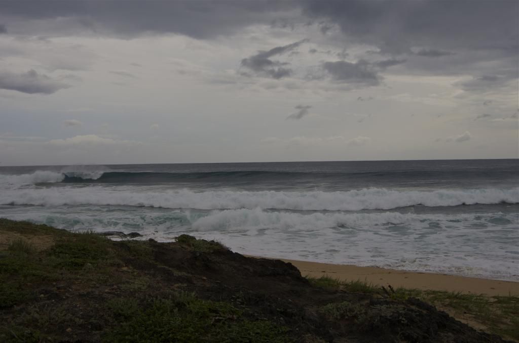
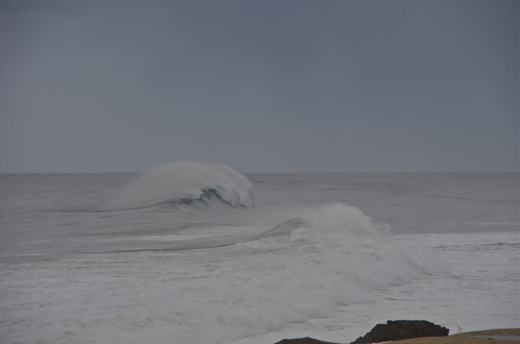
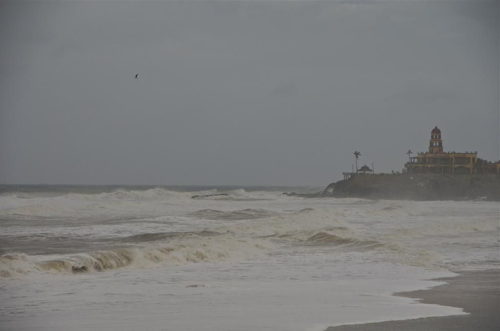
A Few Norbert Photos

monoloco - 9-5-2014 at 10:50 AM


These were the waves generated by Norbert before the wind hit.


This was taken this morning at the peak intensity. We never saw winds higher than 30-35 mph and we've only received .07 inches of rain today. We currently have gusts to about 20 with 83º and the barometer has risen to 29.70.


[Edited on 9-6-2014 by BajaNomad]

shari - 9-5-2014 at 10:56 AM

great pics...I LOVE that blue black we rarely get to see! I heard it has started raining in San Ignacio now...movin on up

bajalinda - 9-5-2014 at 11:06 AM

Micah 202 - well I'm not the main photographer in this household, but I'll see what I can rustle up in the photo dept.

Katiejay99 - 9-5-2014 at 11:09 AM

Wow Monoloco - I guess I need a wind gauge because there aren't that many miles between you and me. The waves here have been huge and it's hard to judge wind speed. It took all of my strength to try to open a south facing door and finally gave up.
Not that that is a good gauge of wind speed, I'm just saying.

Anyhow, it hasn't been that bad.

BajaRat - 9-5-2014 at 11:59 AM

You folks all be safe, best of luck.

shari - 9-5-2014 at 12:05 PM

wind is picking up...internet intermittent...waves are getting really big already and its low tide still...ruh roh.

Mulegena - 9-5-2014 at 12:10 PM

1 pm - Rain, real rain, has finally arrived in Mulege with only moderate wind.

Mula - 9-5-2014 at 12:21 PM

Still no rain in Lopez. Just strong, steady dusty wind and dark skies.
90 degrees and barometer at 29.7.

DawnPatrol - 9-5-2014 at 12:24 PM

Quote:
Originally posted by shari
wind is picking up...internet intermittent...waves are getting really big already and its low tide still...ruh roh.


****my bad**** comments were regarding La Bocana


Shari... how are the beach Cabanas and restaraunt going to fare when its high tide with the winds/waves???

We stayed there last year and even in calm weather the high tide came really close to them

Alan From San Diego

[Edited on 9-5-2014 by DawnPatrol]

[Edited on 9-5-2014 by DawnPatrol]

[Edited on 9-5-2014 by DawnPatrol]

BajaRat - 9-5-2014 at 12:28 PM

Quote:
Originally posted by shari
wind is picking up...internet intermittent...waves are getting really big already and its low tide still...ruh roh.


Pics again Shari.......... Por Favor :biggrin: Merenge :?:

Bob H - 9-5-2014 at 12:36 PM

Quote:
Originally posted by bajajudy
Check out this video on YouTube:

http://youtu.be/PTCcWEd_c7o


[Edited on 9-5-2014 by bajajudy]


GREAT VIDEO!

Mulegena - 9-5-2014 at 12:59 PM

Mulege correction: that rain of an hour ago has stopped...

micah202 - 9-5-2014 at 01:01 PM

Quote:
Originally posted by Mulegena
Mulege correction: that rain of an hour ago has stopped...


...let's keep it that way!;D

Mulegena - 9-5-2014 at 01:25 PM

Quote:
Originally posted by micah202
Quote:
Originally posted by Mulegena
Mulege correction: that rain of an hour ago has stopped...


...let's keep it that way!;D
Nope. It's still raining - enough to make the river road a pig's muddy delight but not enough to make the roads hazardous with falling rock or mudslides yet, except perhaps to pigs.

micah202 - 9-5-2014 at 01:29 PM

Quote:
Originally posted by Mulegena
Quote:
Originally posted by micah202
Quote:
Originally posted by Mulegena
Mulege correction: that rain of an hour ago has stopped...


...let's keep it that way!;D
Nope. It's still raining - enough to make the river road a pig's muddy delight but not enough to make the roads hazardous with falling rock or mudslides yet, except perhaps to pigs.


.
....I'm happy if the piggies** remain happy!


......**....and the sheoats ;D

bajajudy - 9-5-2014 at 01:36 PM

It is still overcast and windy here
Just had a shower come through.
I guess what I am trying to say is that this has been a long storm for us.

Katiejay99 - 9-5-2014 at 01:39 PM

Bajajudy:
I was thinking the same thing here in Todos Santos. We are getting winds (I would hate to guess how high/low) but they are bending the tree tops. Rain comes here and there. The ocean looks angry. It looks like it is about 6pm outside.

[Edited on 9-5-2014 by Katiejay99]

bajalinda - 9-5-2014 at 01:54 PM

just when we thought things were winding down, heaviest rain yet at 2:30 pm here at La Aguja - wind still very strong - we're ready for this to be over!

Have to use two posts for photos - here is a pre-Norbert shot at Rancho la Aguja . .

before-norbert.jpg - 30kB

bajalinda - 9-5-2014 at 02:56 PM

3:50pm torrential rain for last hour and internet was in and out.

Here is Norbert taken earlier - change from tranquil scene above.

after-norbert.jpg - 32kB

shari - 9-5-2014 at 03:01 PM

whew...internet has been possessed the last couple hours...things are deteriorating here rather quickly...I just came from town and the south side of the bay is already nearly as big as the last storm at it's height...and that was with no wind or rain. So I do believe we are in for a doozy here in the wee hours and tomorrow at high tide with strong winds. Seems like it wont weaken much in the next day or so which sucks for us. HEre is the 2:00 discussion

HURRICANE NORBERT DISCUSSION NUMBER 14
NWS NATIONAL HURRICANE CENTER MIAMI FL EP142014
200 PM PDT FRI SEP 05 2014

Even though Norbert's cloud pattern remains fairly well organized in satellite imagery, cloud top temperatures in the central dense overcast have been slowly warming since this morning. Nevertheless, an Air Force Reserve Unit Hurricane Hunter aircraft reported maximum flight-level winds of 92 kt and peak SFMR winds of 76 kt in the northeastern quadrant, with a minimum pressure of 966 mb. These data support an initial intensity estimate of 80 kt for this advisory.

While Norbert will be moving over above-normal SSTs of 27-29 deg C west of the southern Baja California peninsula during the next day or so, some northeasterly shear and an influx of drier and more stable air over the western part of circulation should contribute to a slow weakening. After that time, Norbert should reach substantially cooler waters and other thermodynamic variables should become much less favorable. These negative factors should result in a near-rapid weakening of the cyclone in 2-3 days, and remnant low status is forecast in 3 days. Encountering even cooler waters on day 4-5 and an increase in shear, Norbert should spin down further and dissipate just beyond the end of the forecast period. The NHC intensity forecast has not changed from the previous one and is near the multi-model consensus IVCN.

Satellite and aircraft fixes indicate an initial motion toward the northwest or 325/7 kt. Some re-building of the mid-level ridge to the north of Norbert should cause a slight bend of the track toward the left during the next day or two. After that time, Norbert is expected to reach the western edge of the ridge and encounter a weakness caused by a mid-latitude trough advancing eastward from offshore of the California coast. This synoptic pattern should result in a gradual northward turn during with some decrease in forward speed. The mid-level center of the cyclone is likely to move rapidly northeastward into the southwestern United States on days 3-4, leaving the low-level center meandering offshore the west- central Baja California peninsula until dissipation. The NHC forecast track is little changed from the previous one, and lies on the far eastern side of the guidance envelope and east of the multi- model consensus TVCE.

The hurricane-force wind radii have expanded in the northeastern quadrant based on SFMR data from the aircraft and now extend out 40 n mi from the center. Any deviation to the right of the forecast track would bring hurricane conditions onshore in the hurricane warning area.

Moisture from the remnants of Dolly and the Pacific ITCZ is being advected northward by the outer circulation of Norbert across northern Mexico and into the southwestern United States. This could result in heavy rains and life-threatening flash flooding in these areas during the next few days. Please see information from your local weather office for more details.

I am not at all liking what I see on the satellites.

oladulce - 9-5-2014 at 03:08 PM

Norbert- Friday Sept 5,14 2:30pm Punta Pequeña/ San Juanico BCS

It's still about 80-100 miles South of here but wind is starting to increase. The waves are from South swell that's unrelated to Norbert. Our wind gauge croaked so won't know the velocity when it gets here but as long as the wind sock is still flying, I'm not too worried. So far 0.2" of rain.

[Edited on 9-7-2014 by oladulce]

bajajudy - 9-5-2014 at 03:24 PM

Oladulce
You can always go to Juan y Juan's rock to check out the velocity...is it still there?
Stay safe, amigos

micah202 - 9-5-2014 at 03:35 PM

Quote:
Originally posted by shari
...I just came from town and the south side of the bay is already nearly as big as the last storm at it's height...and that was with no wind or rain. So I do believe we are in for a doozy here in the wee hours and tomorrow at high tide with strong winds. Seems like it wont weaken much in the next day or so which sucks for us.


....a 'bit' of good news!.....is that your highest tides are ~dinnertime--6pm tonight ,,and about an hour later each day,,,with a big LOW tide in the middle of the night .
..although the beastie will be closest ~tomorrow eve,,it should hopefully also have dissipated to be no worse than this eve --here's hoping

http://www.surf-forecast.com/breaks/Asuncion-Bay/tides/lates...

...oladulce--that's a great 'avatar' you've got...can you possibly send a u2u on how to catch a freeze-shot of that page..I'm not having luck

[Edited on 9-5-2014 by micah202]

elgatoloco - 9-5-2014 at 03:36 PM

Stay safe everyone. Awesome photos all!:dudette:

shari - 9-5-2014 at 04:01 PM

yes, it is tomorrow's tide I am most worried about as the storm is still aways away from us. My first storm casualty just now....I went out to secure the Norfolk pine tree and didnt realize the ground was covered with fire ants...little bastards bit me a dozen times or so...I hate it when they bite you between your toes!!!

bajalinda - 9-5-2014 at 04:14 PM

5:00pm at La Aguja - still howling and raining buckets here.

Thanks for the photo Oladulce - stay safe up there you all who are farther north - this is one long, drawn out storm.

BajaGeoff - 9-5-2014 at 04:32 PM

Wow.....the before and after shots are crazy!

bajajudy - 9-5-2014 at 04:34 PM

It is STILL blowing 10-15mph with gusts to 20 here.
Very dark right now. We have not had much rain today but it has been threatening all day.
Yes, a long one!

vandenberg - 9-5-2014 at 04:35 PM

Quote:
Originally posted by shari
yes, it is tomorrow's tide I am most worried about as the storm is still aways away from us. My first storm casualty just now....I went out to secure the Norfolk pine tree and didnt realize the ground was covered with fire ants...little bastards bit me a dozen times or so...I hate it when they bite you between your toes!!!


Some advice" Keep them out of your skivvies." :biggrin::biggrin:

shari - 9-5-2014 at 04:40 PM

I dont know how they did it but I got bit near my armpit and thigh as well as feet and ankles...sheesh. Here is a before photo for ya...we just got some sand back at the beach outside our kitchen door...nice lookin clouds and a few big sets coming in now...could rain at any time with the cells all around.

thanks so much for the reporting...what San Juanico gets we will prolly get!!!


I am sooooooo not liking this satellite image!


[Edited on 9-5-2014 by shari]

vandenberg - 9-5-2014 at 06:00 PM

Strength just upgraded to category 2

EnsenadaDr - 9-5-2014 at 06:07 PM

wow really?? This is getting interesting...wonder what it will be when it hits the Ensenada area....
Quote:
Originally posted by vandenberg
Strength just upgraded to category 2
:o

BajaLuna - 9-5-2014 at 06:12 PM

stay safe everyone, thanks for the reports!

bajajudy - 9-5-2014 at 06:29 PM

Quote:
Originally posted by vandenberg
Strength just upgraded to category 2

Shari
Get those storm boards up!

The San Jose arroyo is running bank to bank now. If it weren't for the bridge, we would be an island.

BajaNomad - 9-5-2014 at 06:34 PM

SUMMARY OF 500 PM PDT...0000 UTC...INFORMATION
----------------------------------------------
LOCATION...24.0N 112.6W
ABOUT 60 MI...95 KM SSW OF CABO SAN LAZARO MEXICO
ABOUT 185 MI...300 KM WNW OF CABO SAN LUCAS MEXICO
MAXIMUM SUSTAINED WINDS...100 MPH...155 KM/H
PRESENT MOVEMENT...NW OR 325 DEGREES AT 8 MPH...13 KM/H
MINIMUM CENTRAL PRESSURE...963 MB...28.44 INCHES


DISCUSSION AND 48-HOUR OUTLOOK
------------------------------
AT 500 PM PDT...0000 UTC...THE EYE OF HURRICANE NORBERT WAS LOCATED
NEAR LATITUDE 24.0 NORTH...LONGITUDE 112.6 WEST. NORBERT IS MOVING
TOWARD THE NORTHWEST NEAR 8 MPH...13 KM/H...AND THIS GENERAL MOTION
SHOULD CONTINUE THROUGH SUNDAY. ON THE FORECAST TRACK...THE CENTER
OF THE HURRICANE WILL CONTINUE TO MOVE NEARLY PARALLEL TO AND JUST
OFFSHORE OF THE PACIFIC COAST OF THE SOUTHERN BAJA CALIFORNIA
PENINSULA THROUGH THE WEEKEND.

MAXIMUM SUSTAINED WINDS HAVE INCREASED TO NEAR 100 MPH...155 KM/H...
WITH HIGHER GUSTS. SLOW WEAKENING IS EXPECTED TO BEGIN BY
SATURDAY...WITH FASTER WEAKENING EXPECTED AFTER THAT TIME.

HURRICANE FORCE WINDS EXTEND OUTWARD UP TO 45 MILES...75 KM...FROM
THE CENTER...AND TROPICAL STORM FORCE WINDS EXTEND OUTWARD UP TO 140
MILES...220 KM. A WEATHER STATION OPERATED BY THE MEXICAN NAVY
LOCATED AT PUERTO CORTES RECENTLY REPORTED A SUSTAINED WIND OF 53
MPH...86 KM/H...AND A WIND GUST OF 67 MPH...108 KM/H.

N2Baja - 9-5-2014 at 06:39 PM

That is an awesome animation Micah, Thank you for posting it!! Best of luck to all.

Quote:
Originally posted by micah202
.
...here's an amazing graphic...
.....worth a copy/paste if my attempt to linky doesn't work:)

http://earth.nullschool.net/#current/wind/surface/level/orth...


[img]http://earth.nullschool.net/#current/wind/surface/level/orthographic=-111.45,26.17,2035[/img]

[/url]http://earth.nullschool.net/#current/wind/surface/level/orthographic=-111.45,26.17,2035[/url]


[Edited on 9-5-2014 by micah202]

Sweetwater - 9-5-2014 at 06:40 PM

It just occurred to me that I should thank all you who have kept us informed about this storm.....and.....what a dilemma it presents to us all.....so much beauty.....so much hazard.....batten down your personal hatches and keep a good photo log of this beautiful hazard......stay safe, one an all.

:wow:

BajaNomad - 9-5-2014 at 06:46 PM

.

norbert-fri-645p.jpg - 50kB

Ateo - 9-5-2014 at 06:59 PM

Great photo oladulce.

This is an interesting system. I hope we get some rain in SD out of it. Probably not though...........

Always better to over prepare then to under prepare. Stay classy and safe Nomads.

Puerto San Carlos, Magdalena Bay

Mulegena - 9-5-2014 at 07:22 PM

Radio Kashana from Sta. Rosalia reports that 40% of Puerto San Carlos is flooded as the high tide breached the 10 breakwaters.

Be well, everyone.

Mulege has a refugee center established in Nuevo Mulege, south of town. Storm advisories given, evacuations are not mandatory at this time. Rain has picked up just a bit.

Stay warm and safe tonight.

micah202 - 9-5-2014 at 08:22 PM

.
.....I'm hoping to hear that high tide was allright(?)

shari - 9-5-2014 at 08:30 PM

Hola amigos...just back from a wee hurricane party and wave watching from the balcony of the Beach House...spectacular...tons of traffic and the bank is lined with people and cars. We moved some folks from the campground over to the Inn on higher ground.

The waves breached the beach again to fill up the new lagoon to the highway and is near the horses house again too and the swell is supposed to double tomorrow which will spell certain flooding. Buoyweather is predicting 19' waves for tomorrow afternoon. The new Pemex and stores are very very busy.

I'm not real happy that Norbert is now a Cat2 but hope the fans are working for him to go west a bit. Here is the not so encouraging latest discussion.

HURRICANE NORBERT DISCUSSION NUMBER 15
NWS NATIONAL HURRICANE CENTER MIAMI FL EP142014
800 PM PDT FRI SEP 05 2014

The satellite presentation of Norbert has improved dramatically since the last advisory. A ragged eye is apparent in infrared imagery surrounded by a ring of cloud tops colder than -70C. Dvorak estimates from TAFB and SAB at 00Z were T5.5/102 kt, and the initial intensity is set a bit below that value at 95 kt for this advisory given the very rapid change in the satellite appearance and the earlier recon data. This recent intensification occurred as Norbert moved over waters warmer than 29C, and some additional strengthening is still possible in the next few hours. However, SSTs steadily decrease along the track going forward, which should result in gradual weakening beginning by 12 hours. Steadier weakening is expected beyond 24 hours as SSTs fall below 26C and the cyclone moves into a drier and more stable airmass. By 72 hours Norbert is expected to become post-tropical and then weaken to a remnant low around day 4. The new NHC intensity forecast has been adjusted upward by 10-15 kt through 24 hours to account for the current intensity trend, and is about 5 kt higher than the previous advisory after that time. This forecast is a little above the intensity consensus through 36 hours and close to the consensus afterward.

Smoothing through some short-term wobbles, the initial motion estimate is 320/08. The track forecast reasoning remains unchanged, as Norbert will be steered around the western periphery of a mid- level ridge centered over the southern United States through 48 hours. After that time, the ridge weakens as a mid-latitude trough moves into the U.S. West Coast. This should result in a weakening of the steering currents, leaving the low-level center of Norbert to drift slowly northward or move erratically at the end of the forecast period. The new NHC track forecast is similar to the previous one, but has been adjusted a little to the east to account for the initial position and motion. This track is close to the TVCE multi-model consensus through 72 hours, and shows little net motion after that time.

Moisture from the remnants of Dolly and the Pacific ITCZ is being advected northward by the outer circulation of Norbert across northern Mexico and into the southwestern United States. This could result in heavy rains and life-threatening flash flooding in these areas during the next few days. Please see information from your local weather office for more details.

FORECAST POSITIONS AND MAX WINDS

INIT 06/0300Z 24.2N 112.8W 95 KT 110 MPH 12H 06/1200Z 24.9N 113.8W 90 KT 105 MPH 24H 07/0000Z 25.6N 114.9W 80 KT 90 MPH 36H 07/1200Z 26.5N 116.1W 65 KT 75 MPH 48H 08/0000Z 27.3N 117.0W 50 KT 60 MPH 72H 09/0000Z 29.0N 117.5W 35 KT 40 MPH...POST-TROPICAL 96H 10/0000Z 29.5N 117.5W 25 KT 30 MPH...POST-TROP/REMNT LOW 120H 11/0000Z 29.5N 117.5W 20 KT 25 MPH...POST-TROP/REMNT LOW

BajaNomad - 9-5-2014 at 08:54 PM

.

norbert-wunder-fri852p.png - 50kB

EnsenadaDr - 9-5-2014 at 08:55 PM

It's a comin'!!!

BajaNomad - 9-5-2014 at 09:05 PM

.

norbert-wunder-fri859p.jpg - 50kB

EnsenadaDr - 9-5-2014 at 09:10 PM

OMG that trajectory looks like it's heading right towards Ensenada!!
Quote:
Originally posted by BajaNomad
.

Mulegena - 9-5-2014 at 09:10 PM

Ok, you posted it twice and I was impressed each time, so I gotta say

DAMM! That's a TRIPPY graphic, Doug. Colors are FAROUT, Dude!

EnsenadaDr - 9-5-2014 at 09:18 PM

I think he did it Mulegena, because initially we didn't get what he was trying to convey, but then it hit me, he was trying to let us Ensenadenses know without telling us (a picture paints a thousand words) that we are in for it!!

EnsenadaDr - 9-5-2014 at 09:22 PM

I'm just waiting for Greengoes to post pictures of the cats with life preserver vests on!!

micah202 - 9-5-2014 at 09:23 PM

Quote:
Originally posted by shari
Hola amigos...just back from a wee hurricane party and wave watching from the balcony of the Beach House...spectacular...tons of traffic and the bank is lined with people and cars. We moved some folks from the campground over to the Inn on higher ground.

The waves breached the beach again to fill up the new lagoon to the highway and is near the horses house again too and the swell is supposed to double tomorrow which will spell certain flooding. Buoyweather is predicting 19' waves for tomorrow afternoon. The new Pemex and stores are very very busy.

I'm not real happy that Norbert is now a Cat2 but hope the fans are working for him to go west a bit. Here is the not so encouraging latest discussion.


....hmm,,not much wind in Ascunsion this evening?...at least according to... http://passageweather.com/#,,showing both wave and wind animations
...Tommorrow evening's high tide is looking like it'll have significantly more wave action,,but a hopeful saving grace will be the breeze should be rotating -offshore- around then hopefully pushing back the effect of the waves. The lesser high tide ~8am sunday might have more 'push' from the wind though.

...wishful thinking is good,,but -any- wobble to the east and/or any delay in dissipation and you'll be wishing you had installed the window panels!
...methinks an appropriate saying might be ...''trust in god,,,but tie-up your horse''!


sorry for reposting-don't want shari to miss this note!

micah202 - 9-5-2014 at 09:28 PM

Quote:
Originally posted by EnsenadaDr
I think he did it Mulegena, because initially we didn't get what he was trying to convey, but then it hit me, he was trying to let us Ensenadenses know without telling us (a picture paints a thousand words) that we are in for it!!


...most of the Norbert's power will have dissipated by the time the storm gets north...you might want ''boot's and umbrella'' though,, and be warned of a potential of lots of rain and associated hazards.

EnsenadaDr - 9-5-2014 at 09:32 PM

Yes I better stock up on the Pepto-Bismol, too!:lol::lol:

shari - 9-5-2014 at 09:33 PM

thank you for your concern but we are OK for tonight unless Norbert cranks up tonight. Here is what it was like a couple hours ago at the beach...lots of lookey loos, then the wind came up to about 20 knots and we are out at the point now going to get some sleep to prepare for tomorrow.


I hope everyone is Ok on the gulf side and hope Mula is on high ground..huricane pyjama party time...night all...hasta manana!

shari - 9-6-2014 at 06:37 AM

good morning all...I am surprised there are no reports this morning yet...perhaps the internet is down further south? or everyone is still asleep...NOT! Here at the Inn refuge, we passed a relatively peaceful albeit windy night but did sleep. Here is the 2:am discussion that tells me Norbert cranked up a bit more...silly hurricane. I look forward to the 8:00 report. the military are doing rounds and we are off to check out the village before things get crazy here...hoping everyone is OK but am a bit worried about our southern amigos.


HURRICANE NORBERT DISCUSSION NUMBER 16
NWS NATIONAL HURRICANE CENTER MIAMI FL EP142014
200 AM PDT SAT SEP 06 2014

Norbert continued to rapidly intensify through about 06Z. Since then, the hurricane appears to have peaked in intensity, with the eye becoming less distinct and the cold cloud tops in the eyewall becoming asymmetric. Satellite intensity estimates at 06Z were 115 kt from TAFB and 102 kt from SAB, while the CIMMS ADT estimates peaked at 110 kt. Based on these data, the initial intensity is increased to 105 kt as a compromise between these estimates and the decay of the cloud pattern since 06Z.

The initial motion is now 315/7. The track forecast reasoning remains unchanged, as Norbert will be steered around the western periphery of a mid-level ridge centered over the southern United States through 48 hours. After that time, the ridge weakens as a mid-latitude trough moves into the U.S. West Coast, which should result in a weakening of the steering currents. The track guidance has come into better agreement that Norbert should move northeastward or eastward after 72 hours, with several of the models showing the remnants making landfall over the northern portion of the Baja California peninsula. The new forecast track reflects this change in the guidance by showing an northeastward and eastward drift after 72 hours. The new forecast track is a little to the right of the center of the guidance envelope through 48 hours, and after that it is slower than the consensus model TVCE.

The forecast track takes Norbert over steadily decreasing sea surface temperatures. The cyclone should thus weaken through the forecast period. Despite the higher initial intensity compared to 6 hours ago, the guidance is in good agreement that Norbert should decay into a remnant low in about 3 days. The new intensity forecast is increased from that of the previous forecast through 36 hours, and then is similar to the previous forecast. The new forecast is in best agreement with the LGEM model.

Moisture from the remnants of Dolly and the Pacific ITCZ is being advected northward by the outer circulation of Norbert across northern Mexico and into the southwestern United States. This could result in heavy rains and life-threatening flash flooding in these areas during the next few days. Please see information from your local weather office for more details.

bajajudy - 9-6-2014 at 06:47 AM

Shari
So glad you checked in. I was surprised there were no new posts this morning.
Norbert sure got a nice eye during the night. Hope all those folks in his path are OK!
He does look much more relaxed this morning.

KaceyJ - 9-6-2014 at 06:52 AM

Instead of shrinking as some models indicated, Norbert increased to a cat 3 overnight and appears to have slowed down which could allow it to gather more rain/ energy.

Still projected to go N -NE

Russ - 9-6-2014 at 07:02 AM

Good luck all you West Coasters. I think we dodged another one here. Wish all a happy ending to this confused Norbert.

PlanB - 9-6-2014 at 07:08 AM

Any news on Mulege'?

bajabuddha - 9-6-2014 at 07:13 AM

Good news is it has taken a more easterly drift, but the ensemble models just in show a sharp 'hook' westward, and it looks to be farther south than Ensenada; San Quintin northward, better start preparing and stocking up; gonna be a big soaker. We'll see how all those new bridges on Hwy 1 hold up in the next week.

monoloco - 9-6-2014 at 07:18 AM

I hope mulla's ok in Lopez Mateos. I suspect that the internet is down there.

Mula - 9-6-2014 at 07:19 AM

Lopez just had it's first burst of torrential downpour. Wind has calmed down, but not died all together.

Steady dusty wind all night and first rain drops started about 4:30.

Haven't been down to the waterfront.

Electricity and internet stayed on all the time here.

Bajaboy - 9-6-2014 at 07:20 AM

Looks like winds to 30 mph and light rain (.2 inch) forecasted for BA today. Hopefully that is what pans out.

Pescador - 9-6-2014 at 07:20 AM

Have not seen anything from Mulege, but north in San Bruno we had a lot of rain, not a significant amount of wind, but things look pretty peaceful this morning. I have not seen a lot of water coming down the arroyos but we will try the Chivato road later today.

Bob and Susan - 9-6-2014 at 07:21 AM

on the bay in mulege...lots of water...sunny now...lots of clouds...

not too much wind...but some wind

no news from town

[Edited on 9-6-2014 by Bob and Susan]

chuckie - 9-6-2014 at 07:30 AM

I didn't hear the fat lady sing yet..Looks like lotsa rain still on the path...

Mula - 9-6-2014 at 07:47 AM

The bay water at the public dock in Lopez is up to within 18" of the top walkway.
Lot's of rain now but not much wind.
In the drive around town just now didn't much down or torn up.
Water is the problem now.

Hoping for the best for Asuncion today.

 Pages:  1  2