BajaNomad

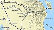
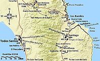
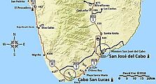
My (31) 2018-2021 Series BAJA CALIFORNIA MAPS

 Pages:  1  2

David K - 11-23-2020 at 08:53 AM

Thanks for your help, Paul!

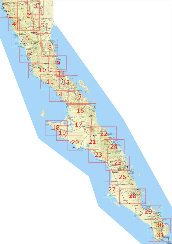
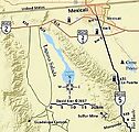
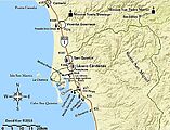
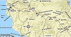
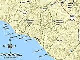
Key Map for the 31 area maps:

David K - 11-25-2020 at 04:15 PM


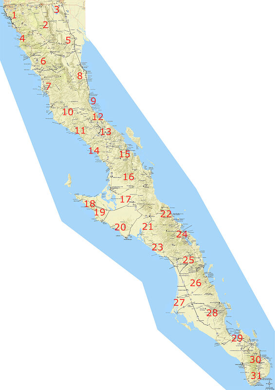
Just numbers:


[Edited on 11-25-2020 by David K]

New Punta Abreojos/ La Bocana map

David K - 11-25-2020 at 05:34 PM

Shows the road now paved into La Bocana:

map-20.jpg - 127kB

[Edited on 11-29-2020 by David K]

David K - 11-26-2020 at 01:19 PM

Have a Happy Thanksgiving!


[Edited on 11-28-2020 by David K]

PDF formats

David K - 11-28-2020 at 03:35 PM

geoffff has made pdf versions of the maps which should be easier to print a copy from (for your personal enjoyment or travel needs).

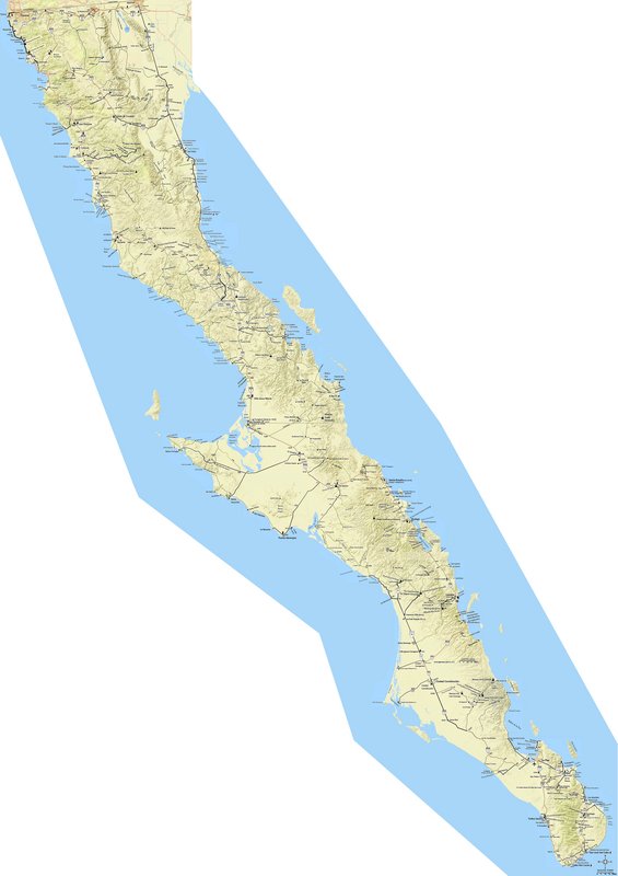
The peninsula map (a stitching together of the 31 area maps and filling in of the off the maps zones):

Baja Peninsula Map

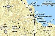
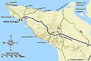
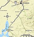
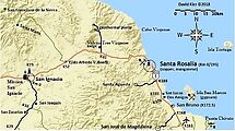
The 31 area maps


Thank you geoffff!


[Edited on 11-29-2020 by David K]

Mr. Bills - 11-28-2020 at 11:05 PM

Thanks so much for these.


David K - 11-30-2020 at 05:07 PM

Glad you like them... They are getting lots of kudos on my Facebook pages, too!

Map 13-A for 2020

David K - 12-1-2020 at 06:38 AM

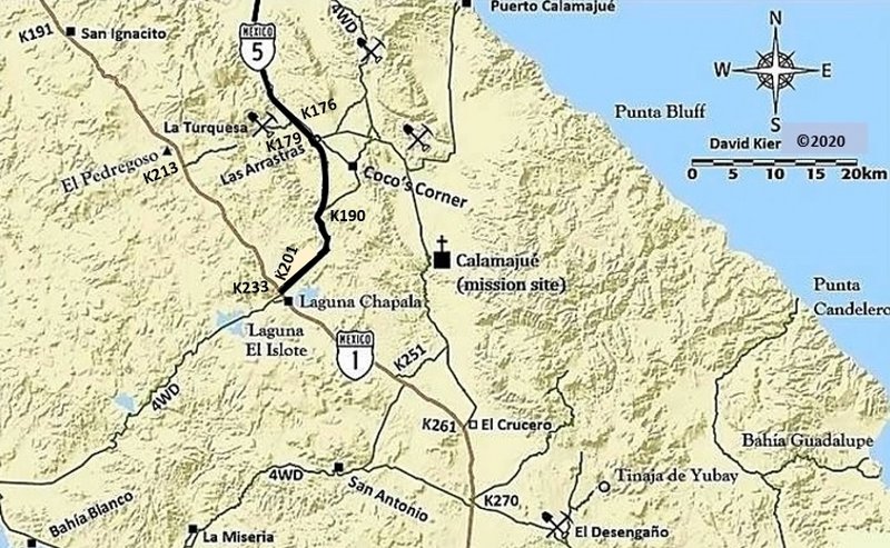
I edited map 13, the Laguna Chapala area.

What I did was add kilometer markers for the newest section of Hwy. 5 and added one for the top end of the La Turquesa Grade road (by El Pedregoso).
I also moved the K233 to the other side of Hwy. 1 at the Hwy. 5 junction.

When geoffff can, he will improve it and match the terrain color to the others. Stuff I don't know how to do!
Thanks geoffff!


HeyMulegeScott - 12-1-2020 at 09:56 AM

Nice work! These are great.

David K - 12-1-2020 at 12:55 PM

Thanks Scott!
I sure enjoy your excellent travel photos online!

PaulW - 12-1-2020 at 06:03 PM

Sorry, I seem to have lost track of the mastee map you have built that shows you various additions. Example it the latest one above. Does it show up in a master collection of your maps?

David K - 12-1-2020 at 06:19 PM

No, I just made it (Map 13-A), if that is what you are asking about?
Geoffff is busy on other projects (work, perhaps) so it will become refined and made into a PDF and swapped into the Map 13 spot, when he can.

The key map (with numbered boxes) is posted above, just scroll up. The PDF for it is also posted...

Here are all the PDF maps:

Peninsula Map:
http://octopup.org/img/misc/davidk/davidk-baja-index-map.pdf

Index-Key Peninsula Map:
http://octopup.org/img/misc/davidk/index-numbers-boxes.pdf

My 31 area maps:
http://octopup.org/img/misc/davidk/davidk-baja-maps.pdf

geoffff - 12-1-2020 at 06:56 PM

Here are links to all DavidK's maps again:

ZIP file with all the maps & index: davidk-baja-maps.zip
PDF file with all the maps & index: davidk-baja-maps.pdf

Extra large version of combo map (JPG) davidk-baja-combo-map--full.jpg
Extra large version of combo map (PDF) davidk-baja-combo-map--full.pdf
Extra large version of index map (JPG) davidk-baja-index-map--full.jpg
Extra large version of index map (PDF) davidk-baja-index-map--full.pdf

Individual map pages: 1 2 3 4 5 6 7 8 9 10 11 12 13 14 15 16 17 18 19 20 21 22 23 24 25 26 27 28 29 30 31 index combo


PaulW - 12-2-2020 at 06:54 AM

Thanks

mtgoat666 - 12-2-2020 at 07:05 AM

Can you format the full-peninsula map to orient the peninsula axis along centerline of rectangular page view, fill the white space, format at 1:450,000 scale, and increase font so legible at 1:450,000 scale?


geoffff - 12-2-2020 at 11:39 AM

Unfortunately changing the font size is difficult because of the way the maps were initially created.

But rotating and filling in the background is easy. Something like this?

combo-rotated-flattened.pdf


Are you wanting to print it? You can use the "Poster" option in Adobe Acrobat's Print dialog for printing the PDF as multiple letter-sized pages.


David K - 12-2-2020 at 11:49 AM

Wow...
Geoffff, I know you have other things to do, but someday maybe we can edit the text so the font is the same for a wall map version? As it is now, the Gonzaga Bay area map font is sized tiny to fit the rest because I drew that map using a larger scale. The Ensenada area is also in the same boat... and of course update the Map 13 changes.
It is very rewarding for me to see such enjoyment these maps have created! That's nice, because they were a lot of work to appear the way I wanted them to and only show places and roads mentioned in the guide so they were free of clutter for the guide user.
A million thanks for your edits and wonderful links!


[Edited on 12-2-2020 by David K]

David K - 12-2-2020 at 12:20 PM

So, rather than monkeying more trying to make my 31 maps blend (for a wall map option or just a single sheet paper folding map), geoffff has said remaking it would be better and we will look at new map drawing programs. I am not sure I have the energy! Maybe if there was a financial incentive? LOL Buy books for Christmas, amigos! www.oldmissions.com

Mr. Bills - 12-2-2020 at 12:56 PM

But I purchased Baja California Land of Missions last year for our trip during the Christmas holidays.

;)


What other financial incentive might you have in mind?

David K - 12-2-2020 at 01:13 PM

That helps!
Thank you... and would you say the book delivered as advertised?
Would you recommend it?

Have you joined the group for the owners of the book? https://www.facebook.com/groups/bajamissions

:light::biggrin:

Mr. Bills - 12-2-2020 at 01:47 PM

Yes, your book was exactly as advertised; signed and dated by the author as promised.

The designated tour guide among us would read some of the relevant portions over the radio as we travelled.

:)

I was not aware of the book club. I tend to avoid Faceplant.


David K - 12-2-2020 at 03:44 PM

Thanks... Not a 'club' but a 'group'... a page I manage that has Baja history and travel to historic sites as the subject. I created the page as a way to keep my book customers up-to-date and show them the color photos that are black & white in the book. There is now over 1,840 members and many are Spanish speakers who are hungry for the details lacking in so many other books. Baja books, maps, fun photos are included. A lot for free (or the price of a book, perhaps)!

mtgoat666 - 12-2-2020 at 06:51 PM

Quote: Originally posted by geoffff  
Unfortunately changing the font size is difficult because of the way the maps were initially created.

But rotating and filling in the background is easy. Something like this?

combo-rotated-flattened.pdf


Are you wanting to print it? You can use the "Poster" option in Adobe Acrobat's Print dialog for printing the PDF as multiple letter-sized pages.


That’s cool :cool:

Printed at wall size would be good


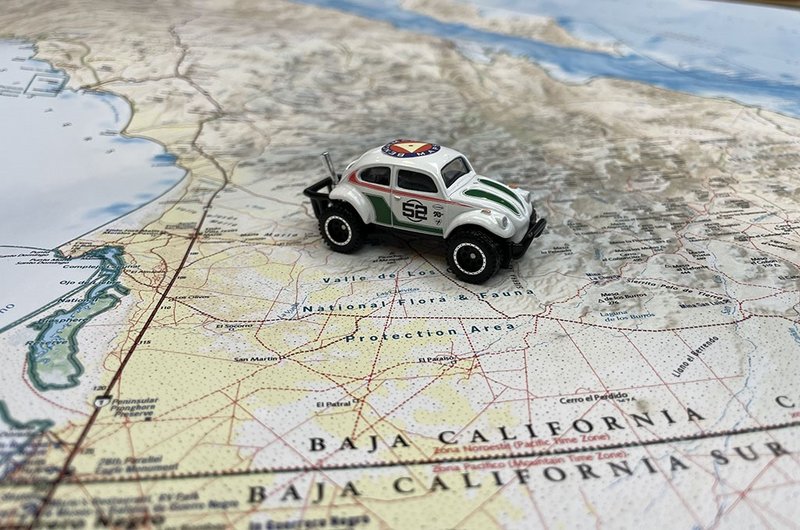
This image also make a nice print for your wall:


LaPazGringo - 12-17-2020 at 04:32 PM

David and Geoff, can't thank you enough.

I had three of the 2009 Almanac, one of which had hundreds of notes and updates and refinements in it so I got the entire thing laminated and now, after a divorce, I have no idea where any of the Alamanacs are, well except for one which fell of my motorcycle in about 2011 somewhere on the dirt road leaving Coco's place. :biggrin:

Question: can what you've already done be imported into some new software? Any chance I can get the data and/or help in some way? I've just done two round-trips from Los Cabos to San Diego and back in the last two months and probably could have verified and added quite a bit.

David K - 12-17-2020 at 08:15 PM

Wow, so sad that the marked up Almanac is gone. I understand how that would feel.

Geoffff is the computer wiz so maybe he can assist?

A new Baja map book is coming in 2021. You will just need to retrace all you past travels and make new notes! It will be fun!

LaPazGringo - 12-17-2020 at 08:18 PM

Quote: Originally posted by David K  
Wow, so sad that the marked up Almanac is gone. I understand how that would feel.

Geoffff is the computer wiz so maybe he can assist?

A new Baja map book is coming in 2021. You will just need to retrace all you past travels and make new notes! It will be fun!


Very much looking forward to that, David! I'll also be happy to see an end to the $750 Baja Almanac sellers on eBay. :mad:

David K - 1-28-2021 at 08:27 AM

Well, guess what?

Yesterday, I found an error on the newest (Sierra Juárez) map! Surprised nobody caught it before me... Just goes to show you how easy it can be to make small mistakes and not see them in plain sight!

Here is the corrected map... can you see the fix made by geoffff for me last night?


The map on page 1 of this thread has been fixed but not the maps where this newest map was first shown.

LaPazGringo - 1-28-2021 at 08:31 AM

Can't thank you enough for the ongoing work, David. My wife and I have been driving some fairly obscure roads down here in Los Cabos and might be able to do some legwork for the project. Man, even the East Cape Rd is steadily evolving!

David K - 1-28-2021 at 08:38 AM

Quote: Originally posted by LaPazGringo  
Can't thank you enough for the ongoing work, David. My wife and I have been driving some fairly obscure roads down here in Los Cabos and might be able to do some legwork for the project. Man, even the East Cape Rd is steadily evolving!


So very cool!!!
As soon as the publisher gives me the ok to share anything about the new Baja Atlas map book, I shall!
As for my 31 maps, since they work in conjunction with the Baja Bound Road Guide, I don't think they will be added to... especially with the new map book coming out.
Harald (4x4abc) has some exciting work to share regarding topo maps, fyi.

LaPazGringo - 1-28-2021 at 08:39 AM

Can't wait to get the new atlas. Extremely excited about that and will be happy to see the $750 Baja Almanacs on eBay be devalued. :mad:

David K - 1-28-2021 at 08:50 AM

Well, they are not the same... but the new one is up-to-date on roads, and corrected errors! In addition to the main maps, which are similar to the 2009 Baja Almanac in size, there are several specialty maps as well as text on points of interest.

They plan on future editions... so, if you have input for the next edition, it will be welcomed!

One thing that probably can't be included in this edition is the new San Felipe Municipality... as it just was approved but may take years to be put in place. The new San Quintín Municipality is included.


LaPazGringo - 1-28-2021 at 08:56 AM

If I can do anything to help down here in Los Cabos and environs, let me know, David.

David K - 1-28-2021 at 03:29 PM

Quote: Originally posted by LaPazGringo  
If I can do anything to help down here in Los Cabos and environs, let me know, David.


Very kind!
Drop me an email...

PaulW - 1-28-2021 at 07:53 PM

DK, good job

vandy - 1-29-2021 at 05:02 AM

David, the black on yellow highlighted milage numbers work very well; they really pop out.
Thanks for going above and beyond (as usual).

David K - 1-29-2021 at 07:32 AM

Quote: Originally posted by vandy  
David, the black on yellow highlighted milage numbers work very well; they really pop out.
Thanks for going above and beyond (as usual).


Thanks for the feedback... Maybe that is a project for me to do???

I considered adding mileages to the others and I agree it makes my maps a lot more informative. It is a lot of work and any section under 2 miles (I recall?) has not enough room to insert the mileage numbers... at least at the same scale.

Staying at home for Covid plus being retired from my irrigation business, I am trying to be productive so my brain (and body) doesn't become mush! I hope my Baja history and travel knowledge will lead to more TV show opportunities and field-guide work!

ulsterboy13 - 2-28-2021 at 04:24 PM

Hello all, just joining BajaNomads from BC, Canada today, and wanted to say thanks to Dave and Geoff for all your efforts on the maps!!
Will certainly be getting a copy of new map book when it becomes available, and hoping borders will open this year to allow for my first drive to Baja for some exploration.

David K - 2-28-2021 at 06:15 PM

Welcome to Baja Nomad!
I hope you and the rest of Canada can travel freely, soon!

KNR - 3-8-2021 at 12:18 PM

Hi David,

I have a question about the Laguna Salada on your maps 2 and 5. We are heading out for a week starting 3/20 traveling from Tacate down to Gonzaga Bay/Punta Final and then back up through Catavina and the Paque Nacional Sierra De San Pedro, then up through Guadalupe Valley and back to the States Via Tacate.

We have a reservation at the Guadalupe Canyon Hot Springs, and the next stop is dispersed camping at a beach south of San Felipe. I notice on your map, (and have mapped out on google maps and seen the trail on Satellite view) the route heading south from the Hot Springs, continuing down the Laguna Salada and heading east at what you show as Cohabuza Junction which should take us to to the 5. In the past I have just headed back north out of the canyon to the 2 and then meet the 5 and head to San Felipe. I'd like to drive south this time. My question is, is that path accessible to your knowledge? If so would the drive time be equivalent, less or more then going the 2 to the 5 route. Any info would be greatly appreciated. Our vehicle is a capable, 4 wheel drive 33" tires and 2.5" so unless there is major rocks we should be ok in that respect

Very Much Appreciated.

KNR - 3-8-2021 at 01:06 PM

Taquitos?

Taquitos.jpeg - 13kB

PaulW - 3-8-2021 at 01:12 PM

Look at Davids map closely for the road south of Cohabuzo and you will see 2 locked gates. Best would be to head east from Cohabuzo. Rough and slow. Very accessible, just follow the roads.
Having said the above. if you have the correct track there is a go around the gates by way of the Pole Line Road. Your rig can do it. Do not go without the most recent GPS track.
=== ===
Quote: Originally posted by KNR  
Hi David,

I have a question about the Laguna Salada on your maps 2 and 5. We are heading out for a week starting 3/20 traveling from Tacate down to Gonzaga Bay/Punta Final and then back up through Catavina and the Paque Nacional Sierra De San Pedro, then up through Guadalupe Valley and back to the States Via Tacate.

We have a reservation at the Guadalupe Canyon Hot Springs, and the next stop is dispersed camping at a beach south of San Felipe. I notice on your map, (and have mapped out on google maps and seen the trail on Satellite view) the route heading south from the Hot Springs, continuing down the Laguna Salada and heading east at what you show as Cohabuza Junction which should take us to to the 5. In the past I have just headed back north out of the canyon to the 2 and then meet the 5 and head to San Felipe. I'd like to drive south this time. My question is, is that path accessible to your knowledge? If so would the drive time be equivalent, less or more then going the 2 to the 5 route. Any info would be greatly appreciated. Our vehicle is a capable, 4 wheel drive 33" tires and 2.5" so unless there is major rocks we should be ok in that respect

Very Much Appreciated.

KNR - 3-8-2021 at 01:34 PM

Quote: Originally posted by PaulW  
Look at Davids map closely for the road south of Cohabuzo and you will see 2 locked gates. Best would be to head east from Cohabuzo. Rough and slow. Very accessible, just follow the roads.
Having said the above. if you have the correct track there is a go around the gates by way of the Pole Line Road. Your rig can do it. Do not go without the most recent GPS track.[/rquote]

=== ===
Great thanks! The idea was to use the Cohabuzo junction to get to the 5, so that works perfect. What are your thoughts on drive time leaving the hot springs? Do you think the travel times are similar between Retracing back north to the 2, then 5 south to San Felipe vs continuing south to the Cohabuzo Junction and heading east to the 5? If we get a late start leaving the hot springs, we will be letting travel time dictate which way we go. If we leave earlier then want to continue down to the south until the junction.

PaulW - 3-8-2021 at 02:50 PM

Either way will be similar in drive time.

KNR - 3-8-2021 at 03:16 PM

Great and thanks. Very much appreciated.

David K - 3-8-2021 at 03:41 PM

Hi KNR, looks like you may have your answers?

The road from Cohabuzo Jcn. to the edge of Laguna Salada was miserable the one time I drove it, but that was 19 years ago! It is a SCORE Baja race road so gets chewed up and has silt beds. Again that was in 2002.
Once near the lakebed and heading south then east to Hwy. 5, is was fine and the last few miles are graded (serving Ejido Saldaña).
Personally, I was recommending back then, to take the long way around to get to San Felipe from Guadalupe Canyon!

There is also a route that cuts across the lakebed to the area of the sulfur mine. See photos and map posted by Nomad 'geoffff' who went that way just a year or two ago.

KNR - 3-10-2021 at 11:12 AM

Thanks David, We will probably be taking the long way around this time. Maybe I'll explore it more next trip eown when I have more time. Thanks again!

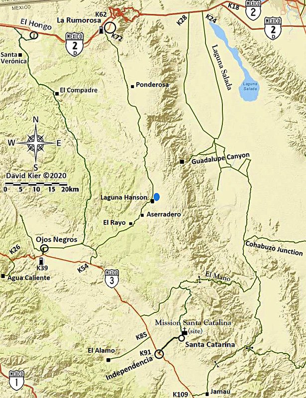
New Map showing new Coco's Corner

David K - 4-19-2021 at 03:34 PM


2018-13 BF.jpg - 251kB

[Edited on 4-20-2021 by David K]

Glidergeek - 4-19-2021 at 04:42 PM

"A new Baja map book is coming in 2021. You will just need to retrace all you past travels and make new notes! It will be fun!"

Is it 2021 yet :?: I'd love to have (buy) a full size map of Baja w/the KM's on it.

David K - 4-19-2021 at 05:12 PM

Quote: Originally posted by Glidergeek  
"A new Baja map book is coming in 2021. You will just need to retrace all you past travels and make new notes! It will be fun!"

Is it 2021 yet :?: I'd love to have (buy) a full size map of Baja w/the KM's on it.

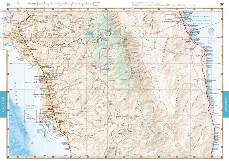
The new Benchmark Maps Baja Atlas has the kilometer points of probably every road in Baja with kilometer posts! The kilometer # is added every 5 kilometers and any special places, such as where Km. 168 magically becomes Km. 171 south of Gonzaga Bay!

BajaMama - 4-25-2021 at 08:18 AM

Stupid question #342: David, did you publish a book of the maps? If so, may I have the link to purchase?

Mr. Bills - 4-25-2021 at 08:56 AM

Link to Benchmark map book for Baja California scheduled for release May 5, 2021:

https://www.bajabound.com/baja-atlas.php

David K - 4-25-2021 at 09:03 AM

Quote: Originally posted by BajaMama  
Stupid question #342: David, did you publish a book of the maps? If so, may I have the link to purchase?


Good morning... and there are no stupid questions!
With so much Baja to learn and explore, keep them coming!
OK, so here is the deal as best I know it...

1) My 31 area maps of Baja (those posted here in this thread) will be used in an upcoming roadguide book I produced for Baja Bound Insurance. Half of that road guide (pre-publication edition) is also here on Nomad, in the Road Conditions forum, for you all to enjoy or just check out.

2) A professional person has been formatting my roadguide pages into a book so it looks really sharp for Baja Bound.

3) The roadguide was to have been released last year and Covid killed that idea. We are looking forward to it being published this year. Because of the delays, at least I could edit it to show a completed Hwy. 5 and a new location for Coco's Corner.

My 31 area maps were my creation, on my own time, and not something Baja Bound sponsored. That is why I am freely sharing them with anyone who can use them for their personal travels or simply enjoy seeing them.

The three (pre-publication) sections of the roadguide [2019 version] are here on Nomad with Baja Bound's permission, as they were created thanks to the sponsorship. Links to them:

Highway 5: Mexicali to Laguna Chapala + Hwy. 2 and side trips.
http://forums.bajanomad.com/viewthread.php?tid=95028

Highway 1: San Quintín to Guerrero Negro + side trips.
http://forums.bajanomad.com/viewthread.php?tid=91898

Highway 1: Guerrero Negro to San Ignacio + side trips.
http://forums.bajanomad.com/viewthread.php?tid=92377


===================================================================

What else have I done with maps?:

The Benchmark Map company contacted me over a year ago and asked if I would like to be a consultant on their new Atlas for Baja California. As it turned out, I could provide a lot of input having traveled so much of Baja in 2017-2019 (for Baja Bound's roadguide and two TV shows in 2019).
The base map comes from the same source as the Baja Almanac, the government. I did my best to correct the errors and update the roads that have been paved (all of Hwy. 5 and Abreojos to La Bocana, for example). I also added a couple of Nomad businesses that the base map missed.

It turned out that I did three rounds of editing, at first with big sheets covering my dinning room table. I may have missed things, but I really tried to make these maps as accurate as possible! I have nothing to do with the sales part beyond my enthusiasm by promoting the product on the Internet. They are not "my maps" just ones I helped to edit.

The new Atlas will fill in the gap left when Landon Crumpton died, as he had produced the Baja Topo Atlas (1986 & 1992) and the Baja Almanacs (1998, 2003, 2009). The new Atlas is a road and recreation guide and includes such things as the kilometer marker points, missions, Baja Divide route, El Camino Real route, campgrounds, hotels, mountain peaks with elevations. There are no contour lines on Benchmark maps but the mountain slopes are shown using color shading.

It is about the same overall size as the 2009 Almanac, but with more maps inside...


2021 Benchmark Atlas.jpg - 93kB

[Edited on 4-25-2021 by David K]

Benchmark samples

David K - 4-25-2021 at 09:12 AM


See more, and closer-up sample: https://www.benchmarkmaps.com/product/baja-california-road-r...

[Edited on 4-25-2021 by David K]

BajaMama - 4-25-2021 at 10:24 AM

That's fantastic, David, thank you so much for all your work putting it together. My dream is to spend weeks/months overlanding in Baja as soon as I can get my husband to retire. He has outfitted a Chevy Colorado ZR2 Bison (we love it in the desert, just sold the rock crawler Jeep) and I am just about talked into the new Bronco Wildtrak. My idea of a good time is being in the middle of Nevada 70+ miles out a dirt road in the middle of nowhere while scouting Antelope. I love the remoteness of Baja!

advrider - 4-25-2021 at 10:48 AM

BajaMama, we will have to connect for some trips. I will retire in November and we are building a new Jeep Gladiator as well as an off-road camp trailer for our Baja travels. We plan to spend months at a time traveling in Baja. We spend plenty of time in Nevada as well.
Not sure if I'm more excited about the new Atlas or David's road guide? I have all kinds of tracks for Baja but I'm a bit of a map geek!

BajaMama - 4-25-2021 at 11:01 AM

Ha ha - David I ordered the atlas, looking forward to it. I'm laughing because the first thing my husband asked is, "Is there an electronic version?" ( for Gaya Maps.)

Any chance that will be coming soon? He has the app on an old iPad that was set up for cell service or wi-fi so it has GPS and works really well.


PaulW - 4-25-2021 at 11:02 AM

Is Baja Bound taking preorders for the DK road book?
Or just the Benchmark map.

BajaMama - 4-25-2021 at 11:41 AM

Quote: Originally posted by advrider  
BajaMama, we will have to connect for some trips. I will retire in November and we are building a new Jeep Gladiator as well as an off-road camp trailer for our Baja travels. We plan to spend months at a time traveling in Baja. We spend plenty of time in Nevada as well.
Not sure if I'm more excited about the new Atlas or David's road guide? I have all kinds of tracks for Baja but I'm a bit of a map geek!


I like paper maps, my husband likes Gaya so we usually have both! I thought I had him talked into retirement October 2022 but now it looks like 2023. But he does get 5 weeks off a year! We built a camp trailer out of a Canadian military trailer, not for sleeping in but it carries a lot of stuff.

[Edited on 4-25-2021 by BajaMama]

[Edited on 4-25-2021 by BajaMama]

BajaMama - 4-25-2021 at 11:44 AM

Quote: Originally posted by PaulW  
Is Baja Bound taking preorders for the DK road book?
Or just the Benchmark map.


Click the bottom link on David's post for My 30 maps and it will take you to Benchmark Maps. You can order the atlas but it will not be released until May 5, about $37 with tax and shipping.

[Edited on 4-25-2021 by BajaMama]

David K - 4-25-2021 at 12:24 PM

Paul, the Baja Bound pre order link for the Benchmark Atlas is posted just above my post this morning, by mr.bills.
BajaMama, the price is just $20 + shipping (~$5), last I checked?

I look forward to helping anybody find their own Baja adventure!

BajaMama - 4-25-2021 at 06:32 PM

Quote: Originally posted by David K  
Paul, the Baja Bound pre order link for the Benchmark Atlas is posted just above my post this morning, by mr.bills.
BajaMama, the price is just $20 + shipping (~$5), last I checked?

I look forward to helping anybody find their own Baja adventure!


I bought the one from Benchmark Maps - was $26.95 plus shipping & sales tax.

PaulW - 4-26-2021 at 06:26 AM

I was asking about the preorder for the Bajabound DK road book not the Atlas

David K - 4-26-2021 at 09:23 AM

There is no preorder for the Baja Bound DK road book, yet.
Baja Bound is only taking pre orders for the Benchmark Atlas, which they are selling for only $20.

BajaMama - 5-9-2021 at 07:04 AM

David K I just received my Baja Atlas and I love it! Good job and thank you for all the hard work you put into it.

David K - 5-9-2021 at 07:12 AM

Good to hear!
It was a labor of love...
But, I only added or corrected to an already detailed map.
It was just great that Benchmark took on the project to fill the big void left after the 2009 Baja California Almanac.

AKgringo - 5-12-2021 at 02:59 PM

Got mine today! :biggrin: I am already finding roads that I need to check out on my next trip.

Now if AAA would only issue a 2021 update of their Baja map....

David K - 5-12-2021 at 09:50 PM

The Auto Club of Southern California fired their cartography and travel guide staff. 2010 map was the final edition. The 2004 Baja guide was the final one, as well.

David K - 6-21-2021 at 03:51 PM

Good afternoon, Nomads!

As some here know, the photo hosting site Photobucket.com has been really irritating the past couple of years! They were once a free site then decided if you wanted to post your images on a message board or forum, it would cost you. OK, so it was about $50-$60/year (but some were conned into paying more)... Then, they stopped providing the upload resizing to 800 pixels (needed to post on Nomad).
OK, so we manually typed in "=800x" after the IMG in the tag.

A couple weeks ago, even though I had an automatic monthly payment coming out for Photobucket, the Photobucket watermark was now plastered on my maps and photos (what happens when you don't pay).

So, when you look back on my trip reports on any posts with maps, when I was using Photobucket, please know they were once all sized to fit and had no watermark!

ADIOS Photobucket!

A while back, we found a new FREE site that also offered upload sizing for Nomad, and that site is www.Postimages.org

I just swapped all the maps in this thread from Photobucket to Postimages, so they are clear of any watermark and sized to fit this forum.

I doubt that I will take the time to change out all my trip report photos and maps to Postimages... But, I am slowly making web pages for my 8 Baja Bound research trips. The first trip page is done and on my website (www.vivabaja.com). Here is the direct link (Jan-2017): http://vivabaja.com/117/

Have a nice day!

 Pages:  1  2