BajaNomad

Santa Isabel Found - not joking - nomad wanted

 Pages:  1    3    5

elbeau - 3-29-2011 at 09:15 AM

Quote:
Originally posted by bufeo
The "path" is marked with pushpins.


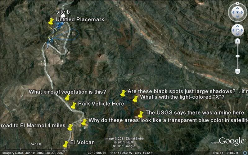
Just to be clear, there are a few push pins, but those aren't the path. They're just some questions I have about the area and some of them aren't even really along the way you guys are planning on going on this trip. In fact, some of them may be able to be answered by you guys already.

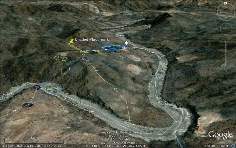
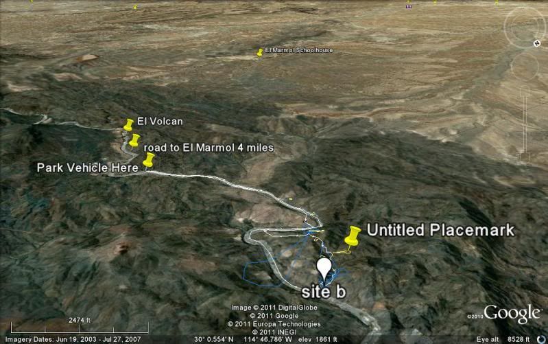
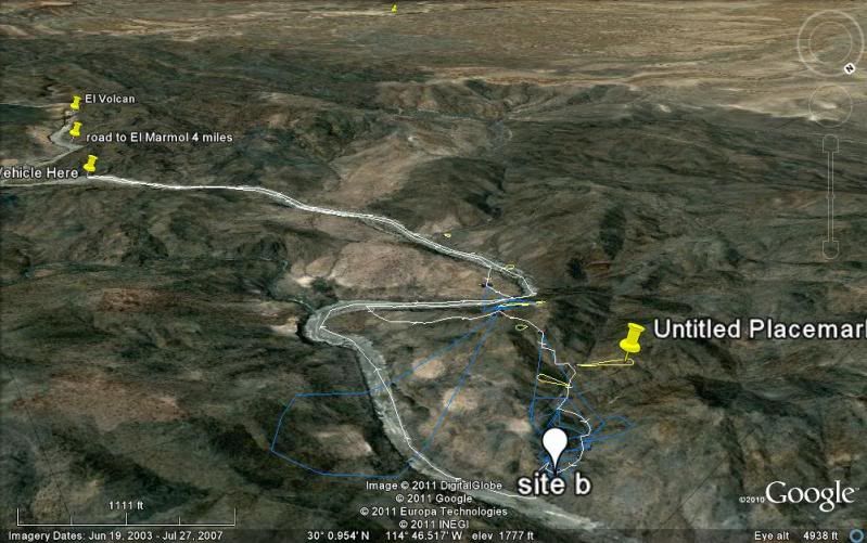
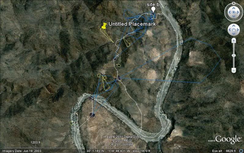
The "path" is marked as a white line with directional arrows. The path is about 4.65 miles long if I remember right. Along the path you will see "camera" icons which each have a blue or yellow bubble coming from the camera lense. These represent photos that I hope can be taken. The camera is placed at the spot were I would like you to stand and the blue or yellow bubble shows both the direction and scope of the target I am hoping you can photograph from that spot. (of course, if it turns out that my exact camera position is behind a huge rock, please don't take a picture of the rock :) Once you're there I'm sure you will be able to find the most reasonable place to take those photos from. The blue bubbles are photos that I think are critical to putting this matter to rest. The yellow bubbles are kind of "nice-to-have" photos of features I would like to understand, but which are explaining geological features rather than archaeological features or are things I just can't make much sense of from the satellite images.
Thanks.

David K - 3-29-2011 at 10:01 AM

Quote:
Originally posted by elbeau
Quote:
Originally posted by David K
Quote:
Originally posted by wilderone
Can you "save to" something other than a KML file? Can't open.


I can't open either... never have been able to... I get a pop up that asks what program to use to open it, and don't know what works... Google isn't one, I have looked...???


Weird. I really don't know why it does work on some computers but not on others. I just tried opening it from a completely different computer and operating system than the one I made it on and it recognized it just fine and it opened.

Try right-clicking the KML file link and then choose to save the file to your file system (In windows I think the menu option says "Save Target" or something like that). Then, open up Google Earth and using Google Earth's "File" menu, choose "Open" and select the file you saved. If it works, then the problem is simply that you don't have the .kml extension associated with Google Earth. If it doesn't work, then the problem is that Google Earth really can't read the file. This might happen if your Google Earth installation is not the current version, or it might happen if there's something wrong with my file itself.

Please let me know. I'd like this to work for people.

Thx.

(edited for grammar)

[Edited on 3-29-2011 by elbeau]


That worked! Thanks...

David K - 3-29-2011 at 10:04 AM

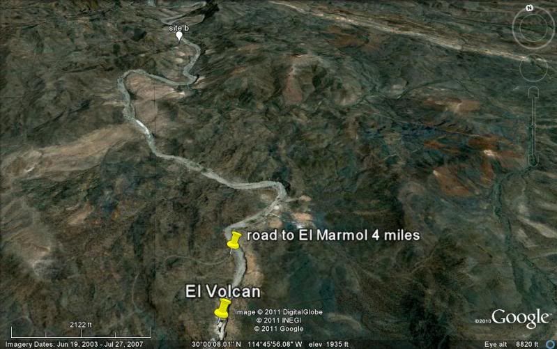
Okay, here are 5 images with elbeau's track and markings... The white balloon site b marker is mine at the spot where elbeau sees the lost mission.

The first three images are with north at the top, and the last two are southward, towards the El Marmol schoolhouse (yellow pin in distance):


[Edited on 3-29-2011 by David K]

David K - 3-29-2011 at 10:07 AM

elbeau, what is the yellow pin (untitled placemark) above the lost mission indicating?

elbeau - 3-29-2011 at 10:26 AM

Quote:
Originally posted by David K
elbeau, what is the yellow pin (untitled placemark) above the lost mission indicating?


Oops. That pin is labeling the trail that Tom and I believe goes through the site.

TMW - 3-29-2011 at 10:53 AM

OK, I'll set my camera on high Res. I think Bajacat has a digital camera too so we should get lots of pictures. I'll bring a happy snappy for backup too. It took us 2 hours to get to the corral area with a few stops going in. So we'll need to start early so as to get a full day in the area. By the way we could only get around the first bend to the first large vegitation area due to rocks in the wash. This is closest to where the road from El Marmol mkeets the wash.

elbeau - 3-29-2011 at 12:16 PM

I might have found a way to pull together enough money for my wife and I to join you on the trip. That doesn't mean I've convinced her to go ;D and I'd have to arrange for a relative to fly to town to watch my kids while we're gone, so it's not a done deal, but I'd like to try to come if you don't mind some more company.
I'm not sure who all is going on the trip yet, and I don't know what dates everybody is going. If someone's going to be driving down from San Diego the day before and coming back the day after and if you have some room and want to split gas money, please let me know. I'm thinking of taking an early morning flight into SD, renting a vehicle, then driving to the site one day, hiking in and out the next day, the driving back to SD the following day and flying home. It'd be a quick trip, but I sure would like to make it work.

Also, I'm having a hard time finding glowing reports on how safe it is for a consummate gringo who can barely pronounce the menu at Taco Bell to travel outside tourist destinations in Mexico, including Baja. I'm sure a lot of you will have a lot of different opinions about this, but seriously, I've got four kids and I don't want to be stupid and mess up their lives just so I could go for a day hike in Baja. Honestly, is it risky?

TW, how much of a difference would it make to rent ATV's for that terrain?

TMW - 3-29-2011 at 12:50 PM

I think an ATV would make it most of the way. Close to the site there are rocks that may be a problem.

As to safety many things are said both ways with those that love Baja it's great and I know people that will never come down. It's really a matter of to each their own. The language is really not a problem since many Mexicans that deal with Americans speak enough english that you would feel OK. I'm talking about hotels, resturants and gas stations mostly. It is better to have a simple dictionary that allows you to translate some words so you can better communicate. I am not fluent in spanish but I know enough words that I get by. My real problem is that when they talk it sounds like a machine gun and I can't make out anything. I travel thru out Baja by my self often and I get along fine. I do stay away from the border as much as possible and cross it during the day. I usually don't travel at night, at least not long after dark.

My plans right now are to come down with my brother on April 25th to meet Ken Cooke on the 26th and help him thru the mine road run that a little further down Baja. Ken was then going to LA Bay for the 27th and return to Catavina and do the mission Santa Maria run on the 28th. Bajacat and I were going there too. This is not set in stone yet and if Ken doesn't do the mine run I'll come down later for the mission run.

We should have the dates pretty much fixed in the next week or two.

elbeau - 3-29-2011 at 12:56 PM

That sounds good. Thanks for the info. I'll see if it looks reasonable to do from my end and let you know.

David K - 3-29-2011 at 03:48 PM

If my business ever gets going before then, I will come on down... Too much fun not to!:yes:

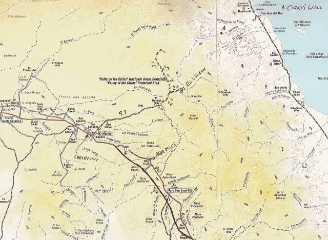
El Marmol is about 2 hours drive from El Rosario... or 7 hours drive from the border. Arroyo el Volcan is 4.0 miles from El Marmol (take right fork, 2.0 miles from El Marmol)... That left fork at mile 2.0 goes around the top of the arroyo drainage... the peninsular divide... above the lost mission site to a mine dig... Another left branch off of it goes to a ditched drug runner's runway (actually there are two you can see on Google Earth). Drove out to it in 2006 looking for a route to the gulf (this is near the Bill Nichols trail).

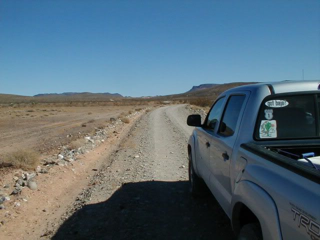
The 9 mile road to El Marmol from Hwy. 1 is fast and easy:


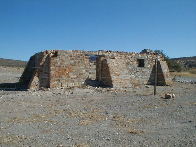
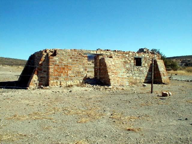
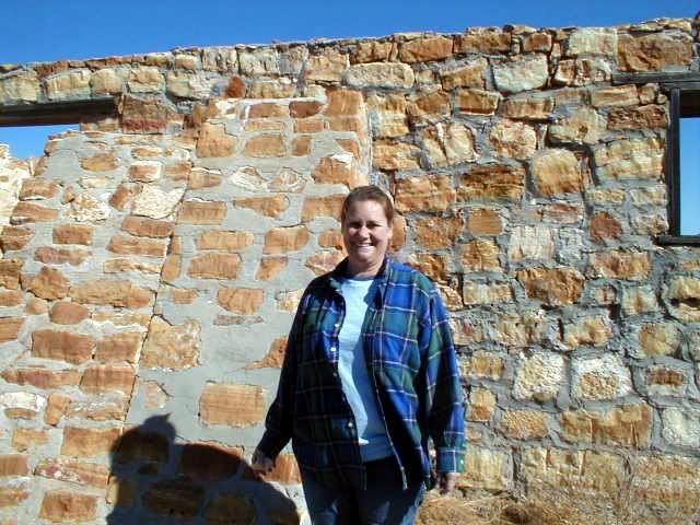
The onyx schoolhouse ruin is the only building remaining in this ghost town that closed up in 1958:


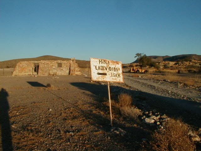
There may be a sign pointing the road that forks left, just before the schoolhouse:


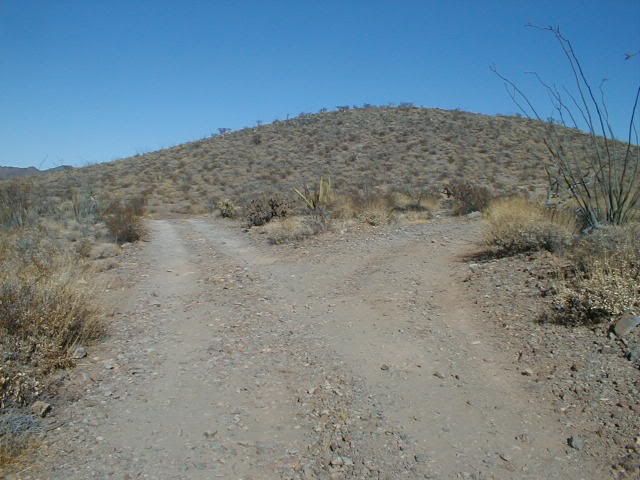
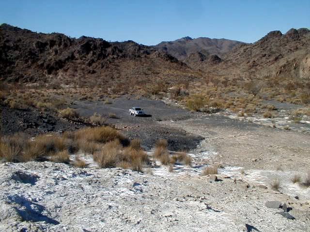
This is the fork at Mile 2.0 from the schoolhouse, right to drop down, down, down to El Volcan and on to La Olvidada or left to dead ends at prospects and ditched airplane runways:


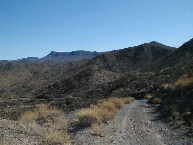
The long downgrade to El Volcan wash:


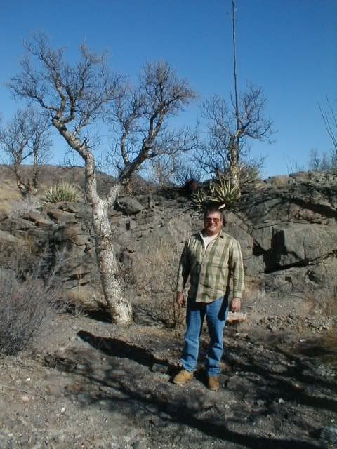
Lot's of Elephant trees grow here:


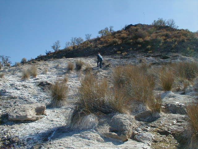
This is the white slope next to the road you come to if you cross the wash and head about 1/4 mile beyond:


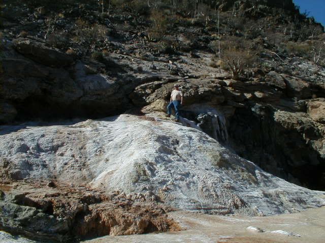
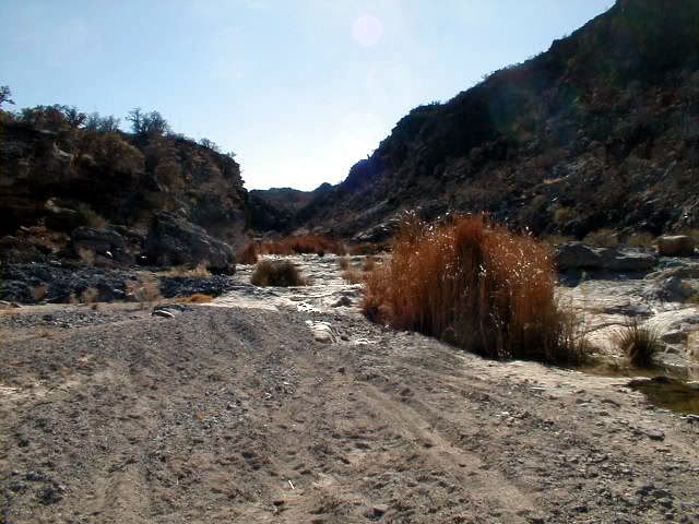
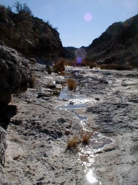
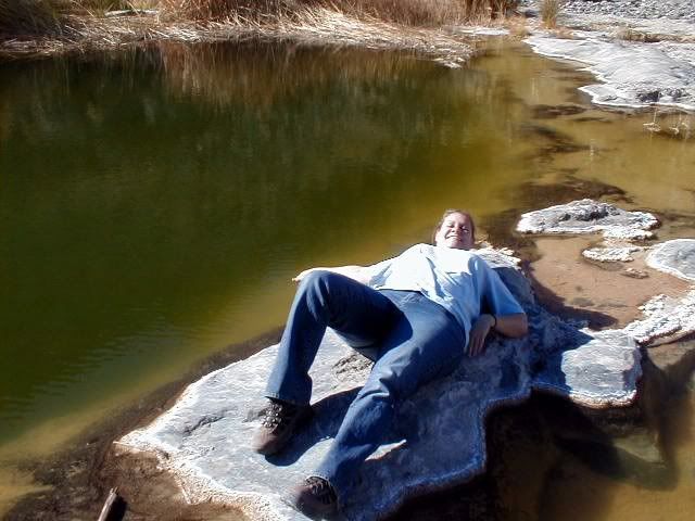
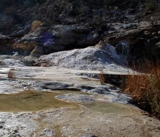
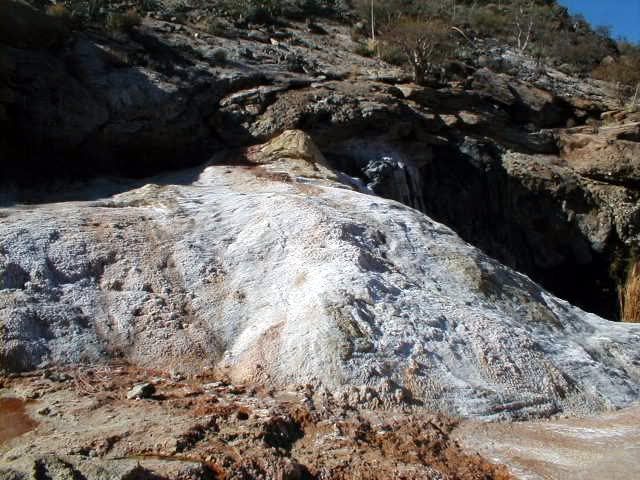
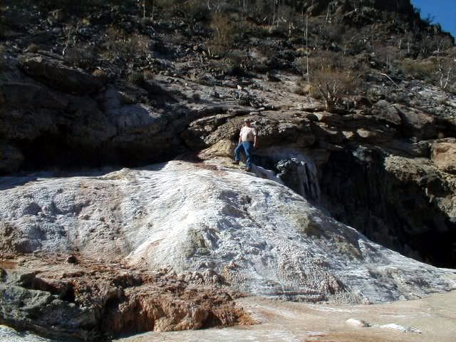
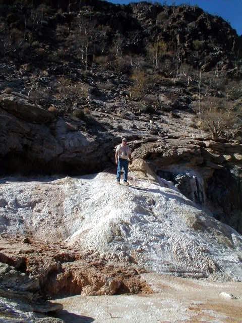
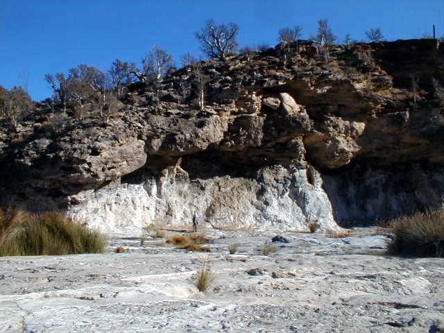
To see El Volcan... turn right in the wash and go about 1/2 mile (you may be able to drive about half that in the wash)... the onyx dome (geyser) is on the right side of the arroyo, against the cliff... Here's me standing on top:


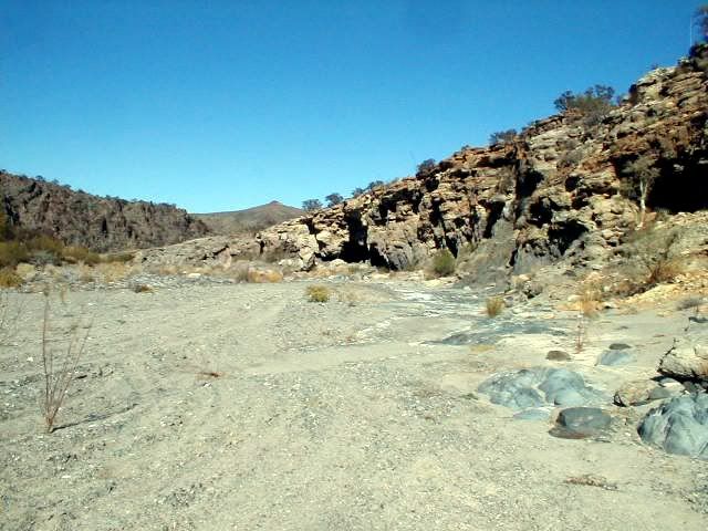
The Lost Santa Isabel Mission mystery site is to the LEFT in the arroyo where the El Marmol road crosses it.

[Edited on 3-29-2011 by David K]

TMW - 3-29-2011 at 06:06 PM

When we were there last month someone had graded the road from El Marmol to the wash and maybe further but we didn't go past the wash. Maybe someone is working a mine back there.

Opening KML's & KMZ's

bryanmckenzie - 3-29-2011 at 07:33 PM

Don't open from the Internet/forum/thread.
Save the file to your hard drive.
The locate the file, right-click and "open with" Google Earth.
A KML is nothing more than a text file. If you change KML in the file name to TXT, you can actually open it with notepad. Of course, that does you no good other than for editing.
I've had the same problem in the past posting/attaching.

Quote:
Originally posted by bufeo
I don't have a suggestion for any difficulties in opening elbeau's link. It opens for me in Google Earth®. The "path" is marked with pushpins.


Allen R
On edit: Unless I'm missing something here????


[Edited on 3-29-2011 by bufeo]

DOA. I'm not a believer

bryanmckenzie - 3-29-2011 at 08:23 PM

WOW! What a thread. I hate I'm 4 weeks late getting into it. But I patiently followed along anyway. What a way to kill an afternoon. I'm kind of glad I didn't see this earlier because I'd probably be weighing in everyday with my skepticism. I suspect that if you posted this same theory over on the GE BBS Forums you'd get the same feedback I'm about to provide.

I am a Google Earth afficiando and consider myself pretty good at interpretation (BajaLou would probably vouch for the quality & integrity of some of my past work over at GE BBS) --- the KML file and GE imagery disclose NOTHING to me to indicate man-made features. No need to ground-truth this at all. Or by wasting airplane fuel. TW et al, if you do go down, please read this post completely & count me in for the trip (just for the adventure). Much of this long thread is completely missing some of the most obvious.

Now it's time to weigh in with my observations and the obvious:

I am a licensed civil/environmental engineer with a concentration in water resources and fluvial geomorphology (how water courses behave). Wind, also being a fluid, can behave similar to water. I am NOT an archeologist. I just play one on TV.

"Geomorphology is the scientific study of landforms and the processes that shape them. Geomorphologists seek to understand why landscapes look the way they do, to understand landform history and dynamics, and to predict future changes through a combination of field observation, physical experiment, and numerical modeling." Ref.: GEOMORPHOLOGY

Scour and deposition with each rainfall/drainage event are natural occurences of water courses and floodplains; as are rock slides and land slides. In Google Earth, I see absolutely NO EVIDENCE of man-made activity.

Ancient cultures built arched viaducts to carry water. They had a purpose. Arches are inherently stable by virtue of GRAVITY ... on a FLAT PLANE (they work in COMPRESSION only). How does one build an arch on the side of a hill? A sloping surface? And for what purpose? Resources, especially time and water were/are scarce. in a place like Baja. Everything that was man-made had a purpose. What purpose would these arches-on-hillsides serve? Simply Google "stone arch" & select "images."

To the best of my knowledge, David K or Jack S help me out here, the mission structures and buildings were always built on flat ground (see above lecture about gravity). None of your placemarks are on a large level area for structures or gardening. And they certainly should NOT be in drainage courses. I'm pretty sure the good Friars were smart enough to know that.

Water courses, intermittent and perennial, always create "drops" or "dams" as was speculated. This is a natural erosion feature that is technically called a "head cut" and migrates upstream until it hits bedrock ... think Niagra Falls, which until it was stabilized with concrete and steel migrated many miles upstream to its present position. Again, no field trip or flyover needed for that.

The new post with the "two breasts" as MTgoat666 calls them is simply a hydraulic feature of the stream bed; most likely a bedrock outcrop. Sandy beds move around and this arroyo clearly carries a braided stream at different times and locations. Water simply takes the path of least resistance for a particular flow rate and slope and, voila, bed features are exposed and subsequently re-covered up. And the cycle repeats ... think of a sandy beach over bedrock cobbles --- depending on tides, season, current and wave action --- the bedrock may or may not be exposed.

"There is much more water in the arroyo than previously thought" --- Since when is rainfall or streamflow constant? It fluctuates 100% of the time. Besides, it's March right now; rainy season.

As to your remarks about discoloration, all images have some flaws: discoloration, streaks, glare, even color adjustments, depending on who took the photo and for what purpose. The GE BBS Forums have extensive information on this. More importantly, since this is a mining region, we have different soils and materials. Each leave their own marks and colors as the soils erode and underlying minerals beneath are exposed. It's kinda like why the mines are located here in the first place.

No need to ground truth what are obviously gullies. I came to that conclusion long before coming to the point in this thread & the trip report & seeing the ground photographs. All your "stairs" are in valleys/gullies, none on ridge lines or dry areas.

A walking path? A statue? Ornate tower? Decorated cave entrance (as opposed to undecorated)? You're kidding me, right? At this resolution (I'm also a land surveyor with photogrammetry expertise), you'd be hard pressed to see much detail. For what's worth, this photo is from Digital Globe (satellite --- not a 3000' level aerial surveying aircraft flyover) dated 18 June 2003. Click this image & turn on "more, DG Coverage" in Google Earth.

I cannot see evidence of a single structure or man-made object, with or without a shadow. Sorry, Elbeau, this KML (while well-made) is simply the product of an over-active imagination or a ruse on the rest of us. Sorry to be blunt, but there was never anything here after the initial post. In my book, this theory was DOA. I just calls 'em as I sees 'em. No hard feelings, I hope.

However, the previous trip would have been a fun one for me anyway. And if our intrepid road crew wants additional "staff" for the late April trip, count me in. I'll go for the adventure because I love all of Baja's nooks & crannies.


[Edited on 2011-3-30 by bryanmckenzie]

[Edited on 2011-3-30 by bryanmckenzie]

bajalou - 3-29-2011 at 08:40 PM

I think I'll try to get down for this search also. Maybe bring my quad to put around on.

I couldn't find anything there either, but exploring is it's own reward.

[Edited on 3-30-2011 by bajalou]

mtgoat666 - 3-29-2011 at 09:04 PM

Quote:
Originally posted by bryanmckenzie
The new post with the "two breasts" as MTgoat666 calls them is simply a hyraulic feature of the stream bed; most likely a bedrock outcrop.
blah, blah, bla...


well, my observation of breasts was just a joke inserted into the conversation between foolish treasure hunters (i see breasts everywhere).

didn't read your whole treatise, but you really should let the fools chase gold - keeps them off the internet and gives them some exercise!

bryanmckenzie - 3-29-2011 at 09:15 PM

And I liked your joke. I, too, saw boobies.
Wow, you just called one of my writings a treatise. Thanks. I'm going to sleep well tonight. ;D

Quote:
Originally posted by mtgoat666
Quote:
Originally posted by bryanmckenzie
The new post with the "two breasts" as MTgoat666 calls them is simply a hyraulic feature of the stream bed; most likely a bedrock outcrop.
blah, blah, bla...


well, my observation of breasts was just a joke inserted into the conversation between foolish treasure hunters (i see breasts everywhere).

didn't read your whole treatise, but you really should let the fools chase gold - keeps them off the internet and gives them some exercise!


[Edited on 2011-3-30 by bryanmckenzie]

elbeau - 3-29-2011 at 11:07 PM

Hey Bryan, I know you took a couple of digs at me, but truthfully I'm glad to have you in the conversation even if you are a bit late :)

You've covered a lot of ground, and most of what you've said is probably accurate, but let me make a few corrections:

First, you said:

Quote:
"All your "stairs" are in valleys/gullies, none on ridge lines or dry areas.A walking path? A statue? Ornate tower? Decorated cave entrance (as opposed to undecorated)? You're kidding me, right?


I know you read the whole post in one afternoon so I wouldn't expect you to remember every little phrase I wrote, so let me remind you of what I said in the same remark where I released the KML file you're referencing:

Quote:
Some features are easier to see than others, and a couple of them (ie: the statue) is admittedly a stretch


(pardon my poor grammer, but I didn't feel it proper to correct myself when quoting myself)

As far as the arches are concerned, you are correct that I can't explain why they would be where I say they appear to be. What I've said about the arches is that I see them in the imagery and they certainly don't look anything like something 18th century missionaries would build, so if they do exist, they may be quite old. On the other hand, DK has made a strong case that what we're looking at may simply be old mining implements. The point is that we don't know if they even exist, only that they appear to exist in the images.

Like I said, I can't explain why they would exist going up a hill, I can't explain why they would exist if they were "only" decorative...which I've never claimed, I would think that someone with your expertise would notice that when ancient structures slowly deteriorate, their arches are often the last part of the old structure that is left standing. Your questions about the arches are proper questions to ask and certainly deserve an answer that I can't give, in fact you may be completely correct in your logic and argument, but you're trying to rule out the possibility of their existence using the same images that I'm using to argue for their existence and the only additional evidence you site is that we should "Simply Google "stone arch" & select "images.""

so...I did:


Like I said, I like your questions about the arch, they are constructive to this conversation and have a logical basis, but I'll also bet that you'll agree that ancient unknown civilizations can surprise us. Imagine yourself discovering Easter Island before anyone knew who built those magnificent statues. Also imagine for a minute that this terrible, barren, water-starved peninsula you're looking at is right across the Gulf of California from civilizations like the Aztecs and hasn't received NEARLY the archaeological attention as the mainland.

I probably do have an overactive imagination. I'll readily admit that, but I would hope that after reading this thread you could rule out the idea that this is just a ruse. I might be crazy:lol:, but I'm not malicious.

C'mon, admit it, it's worthy of a day hike and a few good photos. I've ALWAYS said I could be wrong, and I even ADMITTED I WAS WRONG after Tom and Bill's first trip report, before I got to review the photos. Like yourself, I'm trying to make it on this trip too, just for the adventure of it if nothing else.

Welcome to the conversation. I'm glad to have someone with good expertise with GE chiming in. If these features really can be disproven from the images we have or others you can produce, you will find me ready to accept that result, but we're not there yet.:coolup:

I'd take up your argument about the water and the rainy season, but I'm just too tired. maybe tomorrow.


[Edited on 3-30-2011 by BajaNomad]

[Edited on 3-30-2011 by elbeau]

David K - 3-29-2011 at 11:28 PM

Thanks for the great scientific explantation Bryan... I am happy that elbeau joined Nomad and shared his quest with us... Adventure is a good thing. I had the pleasure of talking with elbeau over the phone after TW phoned me from San Felipe...

I also agree with you that the terrain at El Volcan is pretty twisted and can create weird shadows... that there no way is any structure at the site... or that it would remain a secret with so many prospectors covering those hillsides the past 100+ years. El Marmol was a 'large' town (by Baja standards up to 1958) and that whole region was well explored. Burro trips to see El Volcan were common too.

While it may not have been a typical mission, Santa Isabel (as the legend states) was more of a secret repository for the Jesuit treasures... so it didn't need to resemble the typical mission. However, there never was any time to build anything more than a simple room or a cave, with any brief time they had between learning of the king's orders and them being carried out.

In fact, the removal orders of the Jesuit priests was in a sealed secret envelope, not opened until that last moment before soldiers were sent to fetch the padres.

Finally, there never was the time and energy to collect treasures or mine gold by the Jesuits or their Indians... they barely could feed themselves, so all energy went into food production.

So, as with other 'lost missions' in Baja we have searched for, the treasure is just finding a site where men have built something... hundreds of years ago... even if it is just a wall or the Camino Real trail... that is a thrill well worth the voyage and effort!

More on 'lost missions', here:

http://vivabaja.com/1757
http://vivabaja.com/109

elbeau - 3-30-2011 at 07:04 AM

...yawn...stretch...grumble...sigh...ok, I'm awake now...let's cover a few more items from your post Bryan.

Quote:
I suspect that if you posted this same theory over on the GE BBS Forums you'd get the same feedback I'm about to provide.


I agree. We should post this theory to the GE BBS and get opinions from people who have more experience than me interpreting GE imagery. As we get feedback though, I would really like to make sure that the feedback makes it into this nomad thread because whether or not you agree with my imagination, this thread is the single best resource you can find on the internet describing the Arroyo El Volcan AKA: Zamora Canyon AKA: Arroyo El Tule. The area really is poorly documented online, and no matter what this investigation does or doesn't turn up, we should make sure the thread documents it well.

Now, on to more of the substance of what you said:

Quote:
To the best of my knowledge, David K or Jack S help me out here, the mission structures and buildings were always built on flat ground (see above lecture about gravity). None of your placemarks are on a large level area for structures or gardening. And they certainly should NOT be in drainage courses. I'm pretty sure the good Friars were smart enough to know that.


I have already addressed the substance of this statement a few times:
Quote:
I'm not saying this is a Jesuit mission, only that it is a possible source of the -legends- of a "Lost Mission of Santa Isabel". It doesn't have to actually be a Jesuit mission in order to generate the stories.


I also posed this question when I first opened the images and KML files up for everyone to see in this thread:
Quote:
The site looks cool, but there are two elusive questions:

1. Why would the Jesuits (or whoever) built a "secret mission" so elegantly?


The fact is, there are stories out there of lost "missions" and buried treasures. Personally, I REALLY don't think there's much of a chance of finding any treasure whether it ever existed or not...but not only is it fun to look into these stories, but who know what we might find along the way.

To address your statement about the mission being built on level areas away from drainage courses, well, that's a double-edged sword, because when you're dealing with the legends of the "lost mission" you often run into versions of the story that describe some kind of landslide that both destroyed (or partially destroyed) the so-called mission, and which covers the entrance to the cave or mine containing the Jesuit "Treasure".

...and...

Regardless of whether or not you think you see man-made structures in my photos, do you see the landslide?


Again, I know the landslide argument cuts both ways...it agrees with the legends, but choosing a location vulnerable to a landslide disagrees with the foresight the "friars" should have had (unless, of course, they built it for the purpose of being burried...hehe...don't you love arguing against legends that are not restricted to reason or facts?). But, on the other hand, I'm not exactly arguing that these so-called structures were built by friars.

elbeau - 3-30-2011 at 07:23 AM

And now, on to my rebuttal to your doubts about the water. You said:
Quote:
Since when is rainfall or streamflow constant? It fluctuates 100% of the time. Besides, it's March right now; rainy season.


Well...Since when is rainfall or streamflow constant? I never said it was. What I said is that we have reports of water pooled around rocks with green vegetation growing around it, and we haven't found any studies about the water table in the area. So, let's look at what we DO know. We know for a fact that right inside this same drainage, just a few short miles away, is El Volcan. El Volcan is a fresh-water geyser and from everything DK and others have posted, we have every reason to believe that not only does this geyser spout large amounts of soda-water every month or so, but that around the geyser are significantly-sized standing pools of water that do not dry up, whether or not it's rainy season. Perhaps there's evidence to contradict this, but nobody has presented anything about El Volcan except that you always find standing pools of water, including one that "doesn't seem to have a bottom".

We also know that both now and in the past large mammals, including big horn sheep, live around the arroyo. It's safe to say that those animals are drinking --something-- and since the two closest water sources seem to be the spring near the coast 12 miles away and El Volcan. The stories I've found of the big horn sheep and the antelope do not center around the geyser, so I'll ask you, where are they getting their drinking water?

The answer to this is that the evidence we have so far points to the idea of a high water table in the arroyo. Now, that's not an opened and shut case, but it's hardly been refuted by anything you have presented.

Honestly, it really confuses me how both you and DK think that the water argument has been made to such a point that you can use it as evidence against the possibility of an ancient culture in the arroyo area. Although DK readily points out that the Jesuits never mention a "Santa Isabel Mission" in their writings, it wasn't until late in this post that he passingly mentioned that they did record a mention of a Santa Isabel source of water.

My argument for this being a source of water might logically lead you to ask why nobody lives there now or in the recent past. That would be a good question, but it would also be one you could as about the Santa Maria mission. In the end, anecdotal arguments about "why would someone do something or not do something?" may lead you in a general direction of thought, but it is not evidence, and so far the evidence points towards the idea that although the arroyo isn't exactly the Colorado River, it may not be as dry as previously assumed either.


edited because quoting Bryan's whole remark just took up too much room :)

[Edited on 3-30-2011 by elbeau]

elbeau - 3-30-2011 at 08:22 AM

I have put a request for more professional eyes to look at this on the GE BBS at the following link:

Lost Civilization, Lost Mission, or Brain Damage?

TMW - 3-30-2011 at 08:37 AM

Wouldn't water in El Volcan be like a series of ponds? Trapped in the sand by the rocks under the sand. We did see several places where there was water near and around rocks. Several spots where there is green vegitation.

David K - 3-30-2011 at 08:50 AM

I thought I was clear about Aguaje Santa Isabel from the start? See the web page I made about 8 years ago: http://vivabaja.com/1757

It was Choral Pepper who believed that being the only 'Santa Isabel' mentioned on a Jesuit map, surely the lost mission would be near there, so it could be found when the time came that the Jesuits were allowed to return to California.

Since someone in the 1800's made up the legend, perhaps they used that name having seen the old map... I don't know, but I do know that there was never any money allocated for any mission of Santa Isabel, never any mention of it on a list (as there was for San Juan Bautista/Santa Clara and Santa Maria Magdalena).

elbeau - 3-30-2011 at 08:57 AM

Quote:
Originally posted by David K
I thought I was clear about Aguaje Santa Isabel from the start? See the web page I made about 8 years ago: http://vivabaja.com/1757

It was Choral Pepper who believed that being the only 'Santa Isabel' mentioned on a Jesuit map, surely the lost mission would be near there, so it could be found when the time came that the Jesuits were allowed to return to California.

Since someone in the 1800's made up the legend, perhaps they used that name having seen the old map... I don't know, but I do know that there was never any money allocated for any mission of Santa Isabel, never any mention of it on a list (as there was for San Juan Bautista/Santa Clara and Santa Maria Magdalena).


Perhaps I misspoke. I have a hard time remembering everything that has or hasn't been said too. If so, I apologize, and thank you for the history.

edited for spelling

[Edited on 3-30-2011 by elbeau]

Repost from 10-31-04

David K - 3-30-2011 at 09:01 AM

Another chapter form Choral Pepper's last (unpublished) book: 'Baja: Missions, Mysteries, Myths'
--------------------------------------------------------------------------------------
LOST MISSION TREASURE LEGENDS

Like the confusion that surrounds most lost treasure legends, so goes Baja's two legendary lost mission treasures? Santa Isabel and Santa Clara. In Northern Baja, and across the Gulf in Sonora, time has embroidered them into the fiber of a single legend. But in Southern Baja, where Jesuits once reigned, old-timers gather around their fires to tell of the lost Santa Clara treasure. It is understandable that the two legendary missions should have become enmeshed into a tale of one. Both were built by priests; both were designed as a cache for mission treasure at times when the priesthood anticipated political trouble with the ruling forces; both were constructed in remote areas.

However, the differences are as great as the similarities.

There is no confusion over the approximate location of the Santa Clara Mission, which we shall explore later. It lies not on the desert side of the San Pedro Martir mountains of Baja where the Santa Isabel is believed to be lost, but is located on the Pacific side of the Baja California peninsula. It was not built by the Dominicans who were responsible for the legendary lost Santa Isabel on the Gulf of California side of the San Pedro Martir, but was hastily constructed in 1767 from an unfinished Jesuit mission that was begun, and then abandoned a decade earlier.

American explorer/writer Arthur North, who made a lengthy trek by foot and mule throughout Baja California in 1904, ascribes Santa Isabel to the Dominicans, believing that when they were ordered to 'unroof the missions and depart' they collected 'jewels, treasures and sacred ornaments' from the older missions as well as from their own and hid them in a new foundation. In the southern half of the peninsula, North was told many times by Mexicans of the lost Santa Clara Mission, but in the northern regions, he heard only of the Santa Isabel. It was his idea that the legends had become one in the telling.

To further compound confusion, a third mission treasure called El Maldecion de Isabel, or 'Isabel's Curse, is told in Sonora and does involve the Jesuit Order. According to that tradition, several Jesuit missionaries along the western coast of mainland Mexico gathered up their gold from dozens of churches and impressed fifty Yaqui Indians to act as stevedores to carry the treasure to a small ship at a hidden port.

The treasure was taken aboard there and, with a contingent of loyal Yaquis, the ship sailed north. When the voyagers arrived at their unknown destination, either across the Gulf to Baja or en route to what is now Arizona, two priests met the ship to supervise the unloading of the treasure and its conveyance overland to an adobe mission secreted aside a steep cliff. After installing the treasure in the mission, the priest put a curse upon anyone who told of the sanctuary and directed the superstitious Indians to unsettled the earth above the small mission to cover it. The padres then sailed back to from wherever they had come. Shortly thereafter, the Jesuit Order was expelled from Spanish America.

Considering facts as we known them today, it is easier to build a case for the Jesuit's lost Santa Clara Mission in southern Baja than it is for the lost Santa Isabel Mission of the Dominicans, in spite of evidence that the Dominicans collected a few treasures too. Fur traders and whalers from England, France, Russia, and America who anchored in the quiet waters of lower California's Pacific harbors often traded rich cargoes for otter skins, hides, mission beef, grain, fruit, and oil brought to them by Indian slaves of the Dominican priests. Sometimes the exchange was made in gold coin. Further, it has been reported that while mission buildings were neglected, these errant missionaries dispatched Indian woman and children to gather 'gilt stones' while male Indians were forced to dig shafts in mountainsides and work smelters on mission grounds.

After taking over from the Franciscans in 1773, the Dominicans assumed responsibility for the existing missions left in the south and added nine [actually seven] more in the north. The Indian population, which had become all but entirely decimated in the southern part of the peninsula due to disease, did not fare any better under the administrations of the first hard-working Dominicans. This, along with loneliness and the hardships of living in an inhospitable land, apparently weakened the moral fiber of the missionaries who served during the Order's final years. Albeit unjustly, their errors reflect upon the Dominicans? total history.

In 1829, an order from Mexico decreed the expulsion of all Spaniards in Mexico. Many of the Dominican missionaries in Baja were Spanish. Most of them refused to take an oath of allegiance to the new Mexican government. Then, barely four years later, the Secularization Act forbade priests to collect fees for baptisms, burials, and other services and gave the mission churches and lands to parishioners. With no means of income left to them, the missionaries were told by their Order to 'unroof the missions and depart.'

By this time so many had already departed that there were hardly enough left to propose a mission repository, let alone build one. A Dominican priest at Loreto had been removed because of a scandal involving his housekeeper. A superior of the missions had been exiled for misconduct and rebellious natives had murdered several Dominican priests. Others had already retired to mainland Mexico or their homeland.

By the middle of the nineteenth century, the native population of Baja California could no longer support a mission chain. This, and a change in the Mexican government, was responsible for a series of events that by 1855 brought a complete collapse of the mission system in Lower California.

Following the departure of the remainder upon jurisdictional direction, only one, Father Gabriel Gonzales, is known to have returned, and that was in order to be with the twelve children he reportedly had sired. This was the final blow to the Dominicans? legacy.

Many adventurers have searched the upper gulf coast regions of the peninsula looking for a lost Santa Isabel Mission, the author among them. We have searched by boat, helicopter, plane, foot, mule, sand buggy and four-wheel-drive vehicle. So far, not one of us has produced a shred of evidence.

Perhaps the best clue is one garnered from an old Jesuit map. Dated 1757, the Venegas map identifies a point on the Gulf named 'Aguage Santa Isabel.' Aguage, translated, means 'a place where ships go for water [more accurately a waterhole].' The Jesuit map further mentions an area south of the San Pedro Martir range, below the present port of San Felipe, which it identifies as 'the Sierra Santa Isabel.'

If the Dominican priests actually did choose to hide treasures in a land they would be departing, it is conceivable that the hiding place would be one that future members of their Order could identify by a recognizable name. Santa Isabel on Baja was located directly opposite the rich missions in Sonora on the Mexican mainland shore of the Gulf of California, thus conveniently situated for the gathering of riches from both the Dominican's own as well as those of former Jesuit Baja California missions. At that time the Peninsula was still virtually unmapped and the Venegas map was in common use.

To further confirm this possibility, my exploration team compared the shoreline of a modern map with that of the ancient one and found that Agauge Santa Isabel on the old map matches the shoreline of Bahia San Luis Gonzaga on modern maps (now a popular fishing port). A deep arroyo extending inland in a southwesterly direction from the south end of Gonzaga Bay toward 'Cerro Isabella,' as identified on modern maps, would be a tempting place to begin a search for the Santa Isabel Mission stash, if such ever existed.

So now let's consider the Santa Clara lost mission legend.

To early visitors who crossed Baja's Vizcaino Desert, the change today is astonishing. Land that used to wallow in dust now blooms with vigor. Like Southern California's Imperial Valley, fed by the All American Canal from the Colorado River, all the incredibly rich soil of Baja's parched Vizcaino Desert needed was water to bring it alive. Mexico's government found a solution in the late 1960's when it pioneered a drip irrigation system utilizing 'fossil water.' Many thousands of years old, the water is not from recent rains, but rather is water percolated into the substrata during an age when water was plentiful, possibly before the last Ice Age. Once gone, however, it cannot be replaced. Tests indicate sufficient reserves for the future with conservation. Living fences along the highway prove the richness of the soil, their posts having taken root to sprout decorative, leafy tops.

Dauntless explorers in four-wheel-drive vehicles have struggled through Vizcaino's deep sands to the beach of Malarrimo, where oblique currents have heaped centuries of maritime refuse into dunes. Others have inhaled the dust of the Sierra Pintada, or scaled the rugged cliffs west of San Ignacio, or risked their boats against the rocky shore of Cedros Island, but only a few of us have flown low above the jagged red rocks that torture the clay mantle that holds the Santa Clara range in place, drawn there by the legend of the Santa Clara's mission treasure.

There are two reasons for this. One is that it lies in the most formidable, uninhabitable area of the peninsula. The other is that the legend of the lost Santa Clara Mission in relatively unknown. As previously related, time has confused with the Santa Isabel lost mission legend on the Gulf Coast. Conversely, Santa Clara is on the Pacific side of the peninsula. It is believed to have been hastily constructed in 1767 from an unfinished Jesuit mission that had been begun a decade earlier near gold mines once worked by mission Indians in the Sierra Pintadas.

But let us start at the beginning of the Jesuit story.

In 1697, two Jesuit missionaries and sixteen soldiers arrived at Loreto to institute a mission system that would last over a period of seventy years. By the time of their expulsion, fifteen Jesuit priests and one lay brother had died and were buried in Baja California, while exactly that same number left the peninsula. Although their expulsion was intended to come as a surprise, the royal decree to banish Jesuits from the Spanish empire was read in Mexico City on June 24, 1767, but not executed until five months later when Captain Gaspar de Portola entered the port of San Bernabe at the very tip of the peninsula to initiate seizures. Even taking into account the slowness of communications in that day, it is hard to believe that the powerful Jesuits would not have maintained spies both in the courts of Spain and Mexico City who could have sent a timely warning. Tension with the Crown had seethed for a number of years over rumors that the Jesuits forced Indian labor to exploit mines and pearl fisheries, thus depriving the Crown of its Royal Fifth.

Further evidence of Jesuit foreknowledge was observed by the King?s visitor general Jose de Galvez, who noted that the Jesuits destroyed certain mission records and that the missionaries had not purchased their customary supplies in the period previous to the expulsion. The Franciscans, who replaced the Jesuits, had already taken measures to fill their places and administer their estates before sailing from the mainland to assume their new stations.

According to legend, when forewarned in advance of King Carlos' edict to expel them, the Society of Jesus sent orders from Rome to safeguard the Order's treasures in a secret mission in the most inaccessible spot possible until such time as representatives of the Order could return and ensure its proper use in the name of the Jesuits. Treasures estimated to be worth up to $8 million included hoards of pearls, silver, gold, and personal wealth. Accordingly, the Jesuits secreted their treasures in a remote unfinished mission, blocked its entrance with a landslide, planted cacti in the trail leading to it, and destroyed any sign of its presence. Indian converts who labored to accomplish this end were either killed or sworn to silence with a perpetual curse of violent death upon betrayal.

Members of the Jesuit Order emphatically deny the actual existence of treasure to this day. While modern Jesuit apologists apparently consider it unattractive for their eighteenth-century brethren to have garnered wealth, those of the time took pride in the beauty and richness of their missions. So did the patrons who subsidized the holy fathers in order to insure for themselves a final benediction. The Marquis de Villapuente, possessor of broad estates in Tamaulipas on the East Coast of Mexico, contributed tens of thousands of pesos to the fund, which, along with other contributions, yielded a substantial income from investments in large haciendas and plantations. At that time, there was questionable propriety in the death of a Catholic of means who neglected to remember the missions in his will.

And yet when the Franciscans took over, where were the 'golden chalices, sacred vessels of gold, precious vestments, golden altars, images adorned with pearls' and other ecclesiastical paraphernalia described by the Jesuit Father Baegert while he was in charge one of the missions there? It seems odd that the treasury inherited by the Franciscans was relatively bare. Nevertheless, a few published inventories of mission goods turned over by the Jesuits to the newly arrived Franciscans do exist. All churchly appointments described in those inventories were made of silver.

With only five months warning, the Jesuits would have had to work fast to send runners over the length of the mission chain to arrange a treasure cache, but by utilizing a known location in a central region, it could have been accomplished.

Santa Clara had already been explored and pegged for a mission. According to Fernando Ocaranza's Cronicas y Relaciones del Occidente de Mexico, a missionary from San Ignacio recommended the founding of a new mission there in 1737 in response to a request from the friendly Walimea tribe in the area. In another reference, Venegas reported that the project was discussed in an official Jesuit report dated 1745 in order to Christianize wild Indians in the western area of the peninsula so none would be at their backs while they continued the mission chain to the north. A map in this same volume shows a mission located in the Santa Clara region called San Juan Bautista, while another Jesuit map dated 1757 notes a projected mission of that name in the Santa Claras. Mission San Juan Bautista is indeed a lost mission. If a secret Jesuit mission cache existed in the Santa Clara Mountains, Mission San Juan Bautista is it. Although listed as last among the sixteen missions reported in 1745 by the Jesuit fathers in Baja California, it was ignored on the mission inventory inherited by the Franciscans.

A requisite to a Jesuit treasure cache would be a location to which the Order could return later by sea, undetected from populated areas. Explorations of the Pacific Coast had been instituted by the Order as early as 1721 when Father Juan de Ugarte equipped an expedition to find a port for the Philippine galleon. His full report was in the hands of the Jesuits, with maps and explanations of three suitable Pacific harbors with sufficient timber and fresh water. One of these was convenient to the Santa Claras.

In 1745 the Father Provincial ordered a report describing the status of mission stations. It was stated in this document that the mission at San Ignacio, directly east of the Santa Clara range, supported eight mission stations radiating from distances of three to eleven leagues from San Ignacio. In which direction they lay was not indicated, but the two most distant were Santa Marta at eleven leagues and Santa Lucia close to the foothills of the Santa Claras. Considering the unusual friendliness of the Walimea Indians in this region, together with its proximity to a good port on the Pacific coast, it is possible that the Jesuits used the visita they had started there for temporary shelter while they hastily constructed a cache for treasure (which they referred to as the Santa Clara Mission to their unsuspecting Indian helpers). A further advantage to a mission cache located in this area, and one that may have been well known to the Jesuits, is that it lay in a region rich with gold.

It is known that by 1765 the Jesuits had visited the sharp peaks of the Santa Clara Mountains. Padre Sigismundo Taraval, for one, had drunk from the waters at San Angel as well as those of Ojo de Liebre while en route, heedless of the 'red insects' in the latter, and had continued on to the coast eventually reaching Cedros Island.

The Santa Clara region consists of a confusing mountain mass. Eons ago, when the Vizcaino Desert was submerged by the sea, two adjacent ranges formed part of a long group of islands of which Cedros, Natividad, and San Benito are the existing representatives. In time, the two adjacent ranges acquired different names, one Santa Clara, the other Sierra Pintada.

In a 1907 map, Arthur North lumps them together under 'Sierra Pintada.' However, miners in the 1900s differentiated between them, albeit like the natives, indiscriminately. Written accounts and maps of this isolated area are relatively scarce, with the mapmaker's information varying with the tradition of his informant. At one place, only a narrow pass separates the two ranges. Unfortunately, early perpetrators of the legend of the Santa Clara mission failed to consider which name modern geographers would give to which range.

The Santa Clara range has not been exploited, but in the 1890s a National Academy of Science expedition led by Edward Goldman made a brief side trip into it to search for antelope. At San Angel, where Padre Nicolas Tamaral had found water, Goldman found a deserted ranch. In a shallow arroyo beside springs that gave abundant water, they found date palms and other plants which made it a pleasant place to camp. Could these palms have been planted to shade the missionaries while their Indians worked secret mines?

Water in the Pintada range is also scarce. There are only two known sources. One is presently a small ranch close to the north of the range, San Jose de Castro. The other is San Andres, a ranch and old mining camp just south of the Sierra Pintada. A legend that the Indians had collected ?gilt stones? for the priests in this area is what led to the gold discovery there in 1893, which lasted for ten years and produced $75,000 in placer gold. There are still rich placers in the vicinity, but its extreme isolation put an end to mining long ago.

During the gold rush to the Pintadas, miners concentrated on the western slope, ignoring the eastern slope and the side of the pass now designated as the Santa Clara. An old trail from San Ignacio via San Angel is visible from the air through this pass, however. The most promising search would be one working both ends to the middle, launched from the pass that divides this single range with two interchangeable names.

It is unlikely that the Santa Clara Mission would consist of more than a rock shelter with thick walls and a deep foundation for securing and protecting the treasure. Only the subtle clues of proximity to water and stone chippings left by Indian workers would say to an astute treasure seeker, 'Dig here!'

For me personally, treasure hunting is not an end itself. Whether or not the vast riches of lost missions ever existed in fact is unimportant. What is important is how they stimulate our interest in Baja California history today. Having had the thrill of discovering two lost mission sites now officially recognized and first identified in my earlier Baja California book and in Desert magazine, the challenge of proving true the old Santa Clara legend remains a project for future historians.
--------------------------------------------------------------------------------------

For more on Choral Pepper: http://choralpepper.com

wilderone - 3-30-2011 at 10:15 AM

"...remain a secret with so many prospectors covering those hillsides the past 100+ years"

The Great Murals were a "secret" for 1000s of years. The miners would not have cared about any old stone walls or would not have done anything about them if one did decide to do any intellectual analysis regarding their origins.

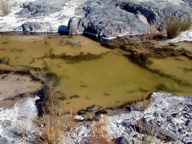
The standing pools to the right of the El Volcan junction, about 1/4 mi. down the arroyo, come from numerous seeps in the cliffs - I've seen them. I pumped this water through my Sweetwater filter and it was still too mineralized to drink. There are bubbling underground springs in the new onyx hill and in some of the standing pools - I've seen them. The water table would not make much difference to people or animals living here - I doubt there was much drilling for water of any sort. However, there may be have been much water collection and storage. This arroyo is simply a water course created by sporadic rainstorms (found all over Baja); there would be resultant fresh water-filled tinajas for some weeks afterward for animals. I would opine that the people who inhabited this area did so for hunting the sheep and other animals who came for the water source; the mineral pools would also offer some means of hygiene, and possibly certain plants grew here and nowhere else.

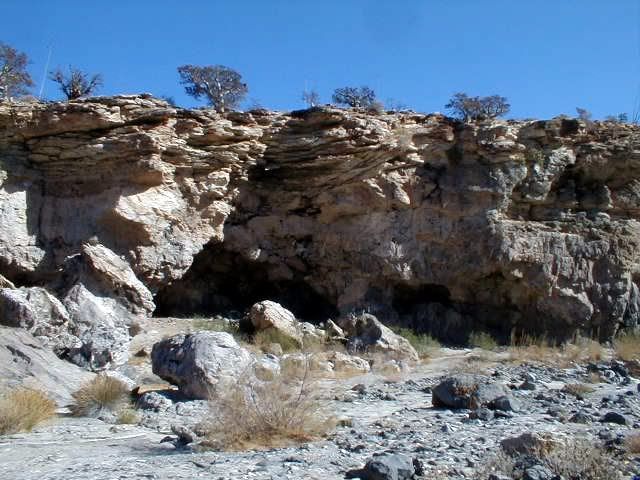
From these photos I could see where a Google image might produce an illusion of turrets or arches or steps in places, given the numerous rock outcrops and fracturing of the rock cliffs (at the junction and immediately to the right of the junction):


For sure, there were people here:


I hope the recent grading has improved erosion like this:


elbeau - 3-30-2011 at 11:47 AM

Quote:
Originally posted by wilderone
From these photos I could see where a Google image might produce an illusion of turrets or arches or steps in places, given the numerous rock outcrops and fracturing of the rock cliffs (at the junction and immediately to the right of the junction)


Those are great photos wilderone! thanks.

I would have to agree that from that first photo especially, it is likely that outcroppings as rich in color and texture as these could trick our eyes into seeing things that aren't there. I really do love that first photo. Even if this and other evidence finally produces the answer that this is just a geologic phenomenon, I still find the geology intriguing enough that I would like to put all this together and document it. With your permission I would like to add your photos to the Google Earth overlay I made of Tom and Bill's arroyo trip.

jimgrms - 3-30-2011 at 12:05 PM

are you the guy who was raising funds in San Felipe to float your,, styrafoam raft to china ?

wilderone - 3-30-2011 at 12:06 PM

"I would like to add your photos to the Google Earth overlay

Sure.

David K - 3-30-2011 at 02:42 PM

Nice photos Wilderone... glad you shared the rock art too... Arroyo el Volcan is highly interesting to be sure...

For those of you with the Baja Almanac or topo maps, this is mis-named as Arroyo Zamora on them... and another arroyo just south carries the name El Volcan (in error).

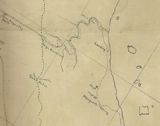
On maps made about 100 years ago by American prospectors, the arroyo was given the name 'Tule Wash'.

Note that El Volcan was a regular trail route from 'onyx' (El Marmol) to the gulf:

1905:


1905-1919:


1919:


1930:


[Edited on 3-30-2011 by David K]

elbeau - 3-30-2011 at 03:56 PM

I think I understand the "mission site" much better after viewing it some more today. I'm working on posting a major revision of what I see at the site, so please hold onto that skepticism until I get this done. It will take some real explaining on my part, and I assure you, you will find a target-rich environment for skepticism, but once the site is visited, I think this will play out much better than my previous posts.

mtgoat666 - 3-30-2011 at 04:12 PM

Quote:
Originally posted by David K
...a secret repository for the Jesuit treasures...
...a simple room or a cave,...


the legend dreams on!

TMW - 3-30-2011 at 05:57 PM

That would have been a very difficult trip. From the maps I see they were out of the wash several times. I've been down the wash about a mile further than our site and there is maybe a 30 foot angle drop with large boulders. That route they took must have been one heck of a route to go over. Is there any written info on the route?

David K - 3-30-2011 at 07:04 PM

Right... it parallels the wash, but seems to be above it rather than in it except where it crosses it. No story about it in my books, I looked!

elbeau - 3-30-2011 at 08:29 PM

Those shadowy sections uphill from my proposed "mission site" have always defied any logic I ever tried to apply to them. The best I could guess is that it was either a North West facing slope, like all the other shadowy areas you see in GE, but the drainage and shadows just didn't ever come together for that. I also thought that it might be thick vegetation of some kind, but that never looked right either. But today I think I started to understand them.

It's hard to try to reconstruct the details of this, but only because the event would have been pretty destructive...but here's the basic idea:


And here's a VERY, VERY, VERY, VERY imprecise, rough guess to help you see what I'm thinking happened at some point:


David K - 3-30-2011 at 10:05 PM

Quote:
Originally posted by elbeau
Those shadowy sections uphill from my proposed "mission site" have always defied any logic I ever tried to apply to them. The best I could guess is that it was either a North West facing slope, like all the other shadowy areas you see in GE, but the drainage and shadows just didn't ever come together for that. I also thought that it might be thick vegetation of some kind, but that never looked right either. But today I think I started to understand them.

It's hard to try to reconstruct the details of this, but only because the event would have been pretty destructive...but here's the basic idea:


And here's a VERY, VERY, VERY, VERY imprecise, rough guess to help you see what I'm thinking happened at some point:


Good evening Elbeau... did you have a chance to read Choral Pepper's chapter I reposted just above?

She would have loved to be here now and fan the excitement that the mysteries and myths of Baja's lost Santa Isabel mission give, that you have brought back to life on Nomad.

Another historic mystery that was the subject of great study and writings of another 'Baja person'... my late amigo Dave Deal.

Dave was a Baja racer, pilot, and world famous cartoonist... His last famous work was for the Pixar film 'Cars' in which he created nearly all the characters for. Dave passed away not long ago, but before he did his studies on the final resting spot for Noah's Ark were well documented on one of his web sites.

Dave's use of the satellite images of landslides totally reminds me of your images above... Enjoy Dave Deal's explanations and illustrations here and the linked web pages: http://www.noahsark-naxuan.com/1.htm

elbeau - 3-31-2011 at 06:37 AM

Quote:
Originally posted by David K
Quote:
Originally posted by elbeau
Those shadowy sections uphill from my proposed "mission site" have always defied any logic I ever tried to apply to them. The best I could guess is that it was either a North West facing slope, like all the other shadowy areas you see in GE, but the drainage and shadows just didn't ever come together for that. I also thought that it might be thick vegetation of some kind, but that never looked right either. But today I think I started to understand them.

It's hard to try to reconstruct the details of this, but only because the event would have been pretty destructive...but here's the basic idea:


And here's a VERY, VERY, VERY, VERY imprecise, rough guess to help you see what I'm thinking happened at some point:


Good evening Elbeau... did you have a chance to read Choral Pepper's chapter I reposted just above?

She would have loved to be here now and fan the excitement that the mysteries and myths of Baja's lost Santa Isabel mission give, that you have brought back to life on Nomad.

Another historic mystery that was the subject of great study and writings of another 'Baja person'... my late amigo Dave Deal.

Dave was a Baja racer, pilot, and world famous cartoonist... His last famous work was for the Pixar film 'Cars' in which he created nearly all the characters for. Dave passed away not long ago, but before he did his studies on the final resting spot for Noah's Ark were well documented on one of his web sites.

Dave's use of the satellite images of landslides totally reminds me of your images above... Enjoy Dave Deal's explanations and illustrations here and the linked web pages: http://www.noahsark-naxuan.com/1.htm


Yes, yesterday I read all the way through Choral Pepper's chapter that you posted. I love it! It's not hard to find one version of a legend or another version of a legend, but having her kind of put them all together and give her experienced interpretation and summary of them is really good reading. It tends to bring the stories together and ground them in more reality and I like that.

I also read through much of Dave's Noah's Ark research. That's a fun read too. Those stones that they're calling anchors in the photos appear to have some writings on them. Do you know if anybody has any ideas about what they say?

David K - 3-31-2011 at 07:46 AM

No, I don't know what is written on the anchor stones (it may have been added after 'Noah' used them)... However, I did hear that geologist confirm the stones did not come from where Noah built the ark, but from nearby mountains to where they now are. Of course, all is in dispute... as much history always will be as no one was alive still from when it happened!

wilderone - 3-31-2011 at 07:53 AM

Originally posted by David K
...a secret repository for the Jesuit treasures...
...a simple room or a cave,...

In one of Erle Gardner's books he tells of coming across a prospector in Baja on one of his trips who approached Gardner and asked for funding to excavate a cave which he discovered, and which he believed contained lost Jesuit treasure. The cave, he explained had suffered a landslide and the entrance was blocked. Gardner was skeptical and declined to finance the venture. At some point later, Gardner received in the mail a photograph of some of the treasure - no other communication or details.

Given the volatile geographic elements and seismographic (sp?) capability of the El Volcan area, I think landslide evidence must be considered.

Jack Swords - 3-31-2011 at 08:40 AM

Just to keerp this thread current: Here is another explanation about the Lost Mission Isabel (ysabel) from Greg Niemann's book Baja Legends. If I didn't have our annual trip to Death Valley and W. Nevada ghost town/4X4 trip planned for the end of April, I'd be there. Success or no, I love that area having hiked all over, down the arroyo, found remnants of an old plane crash, absorbed the history.

http://books.google.com/books?id=35WQOduN1F4C&pg=PA35&am...

David K - 3-31-2011 at 08:44 AM

Quote:
Originally posted by wilderone
Originally posted by David K
...a secret repository for the Jesuit treasures...
...a simple room or a cave,...

In one of Erle Gardner's books he tells of coming across a prospector in Baja on one of his trips who approached Gardner and asked for funding to excavate a cave which he discovered, and which he believed contained lost Jesuit treasure. The cave, he explained had suffered a landslide and the entrance was blocked. Gardner was skeptical and declined to finance the venture. At some point later, Gardner received in the mail a photograph of some of the treasure - no other communication or details.

Given the volatile geographic elements and seismographic (sp?) capability of the El Volcan area, I think landslide evidence must be considered.


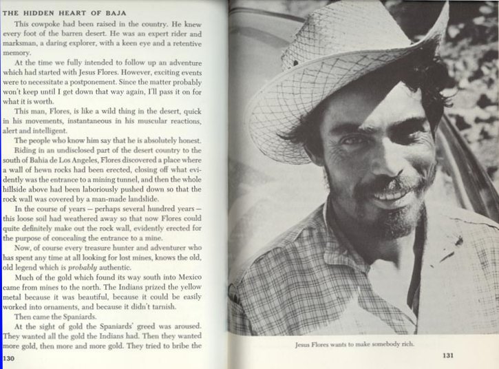
The person with the lost mine who wanted Gardner to buy into was Jesus Flores:


Jesus Flores who has a secret (lost) mine, has an entire chapter in Gardner's book. In 2001, he was our guide searching for the lost mission (www.vivabaja.com/van1). Both are still lost!

(At the time, I didn't realize it was the same person who guided Gardner, 40 years earlier!)

Since I made the web page of my 2002 trip, the lost mission was found... but I hadn't heard about the lost mine being found.


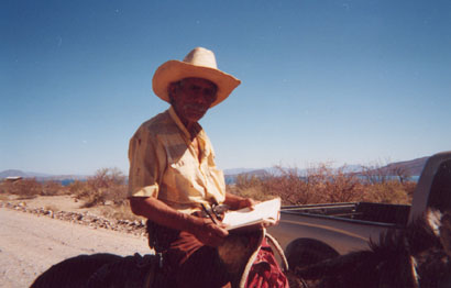
Here is Jesus in 2002, riding past Camp Gecko:


I naturally asked him to autograph his photo in my copy of Gardner's book (which I brought with me, just in case):


(Baja is just a great big adventure and wonderful experience!):light::bounce::cool:

elbeau - 3-31-2011 at 11:14 AM

Quote:
Originally posted by Jack Swords
Just to keerp this thread current: Here is another explanation about the Lost Mission Isabel (ysabel) from Greg Niemann's book Baja Legends. If I didn't have our annual trip to Death Valley and W. Nevada ghost town/4X4 trip planned for the end of April, I'd be there. Success or no, I love that area having hiked all over, down the arroyo, found remnants of an old plane crash, absorbed the history.

http://books.google.com/books?id=35WQOduN1F4C&pg=PA35&am...


I'd love to know the areas you've hiked and explored and hear your details and impressions of the area. Also, do you have any photos from your trip? Where was the old plane crash?

mtgoat666 - 3-31-2011 at 11:23 AM

if such truly existed, he could have dug it out by hand in the 40 years you speak of.
it is either gone or was never there.

i encourage you to go for it, explore away!
but take a bottle of water, we don't want you getting any more delirious than you already are!

David K - 3-31-2011 at 07:45 PM

Quote:
Originally posted by elbeau
Quote:
Originally posted by Jack Swords
Just to keerp this thread current: Here is another explanation about the Lost Mission Isabel (ysabel) from Greg Niemann's book Baja Legends. If I didn't have our annual trip to Death Valley and W. Nevada ghost town/4X4 trip planned for the end of April, I'd be there. Success or no, I love that area having hiked all over, down the arroyo, found remnants of an old plane crash, absorbed the history.

http://books.google.com/books?id=35WQOduN1F4C&pg=PA35&am...


I'd love to know the areas you've hiked and explored and hear your details and impressions of the area. Also, do you have any photos from your trip? Where was the old plane crash?


I have hosted many of Jacks photos on my site for 10 years... He recently sent me more I need to have added. Enjoy them (originally many seperate pages, but are linked together now: http://vivabaja.com/swords

elbeau - 3-31-2011 at 11:36 PM

Quote:
Originally posted by David K
Nice photos Wilderone... glad you shared the rock art too... Arroyo el Volcan is highly interesting to be sure...

For those of you with the Baja Almanac or topo maps, this is mis-named as Arroyo Zamora on them... and another arroyo just south carries the name El Volcan (in error).

On maps made about 100 years ago by American prospectors, the arroyo was given the name 'Tule Wash'.

Note that El Volcan was a regular trail route from 'onyx' (El Marmol) to the gulf:

1905:


You've got to give credit to the accuracy of whoever made that map. It lined up with three onyx quarries and the chain of islands fantastically. This gives you a great idea of exactly where the old "El Tule" trail went. Even those of you who are following this thread who think I'm crazy because of the Santa Isabel thing must admit that doing a trip down that old trail is a worthy adventure someday.

DK, I haven't heard anything about those two onyx quarries on the East side of the range. How well are they known?

KML File


elbeau - 3-31-2011 at 11:38 PM

Also, a lot of features of that map match up well, but not the shoreline. It's only been 106 years, does the Eastern Baja shoreline change that rapidly? Or is the map or my alignment of it wrong?

Rebuttal to Elbeau's Rebuttal to my rebuttal

bryanmckenzie - 4-1-2011 at 12:12 AM

Apologies for the silence. I've been away for 2 days on personal matters & am just now getting back into the fray. Me thinks I'm going to put many Nomads to sleep with my continued 'lecture series.' So if you're no longer interested, I take no offense.

Thanks David; not withstanding that this is apparently a NOT remote area and that miners, Nomads, ATV's and many people have passed through this arroyo for more than a century ... I'd actually enjoy a day trip out here, poking around for the first time and sending postcards back to the family. And mostly meeting my fellow Nomads, many whom I've not yet met.

"I would really like to make sure that the feedback makes it into this nomad thread" ... http://bbs.keyhole.com/ubb/ubbthreads.php?ubb=showthreaded&a...

"I REALLY don't think there's much of a chance of finding any treasure whether it ever existed or not...but not only is it fun to look into these stories, but who know what we might find along the way." ... AGREED

"I can't explain why they would exist going up a hill" ... of course you can't ... those arches CANNOT exist in the first place, much less exist beyond everything else. The arch pictures demonstrate this; arches come in all shapes and sizes --- BUT each footing MUST be at the same elevation (horizontal ground). Here, let's go back to square one --- "one downside is that an arch pushes outward at the base, and this needs to be restrained in some way, either with heavy sides and friction or angled cuts into bedrock or similar." Hence, if one end is higher than the other, the higher end blows the lower end out; ref.: http://en.wikipedia.org/wiki/Arch#Technical_aspects

"you're trying to rule out the possibility of their existence" ... they never existed, they could not have been constructed, or is there an anti-gravity machine I'm not aware of; ref.: http://en.wikipedia.org/wiki/Arch#Technical_aspects

"your questions about the arch, they are constructive to this conversation and have a logical basis, but I'll also bet that you'll agree that ancient unknown civilizations can surprise us." ... yes, they understood gravity; ref.: http://en.wikipedia.org/wiki/Arch#Technical_aspects

"it's worthy of a day hike and a few good photos" ... AGREED, I said I'd go for the sunshine and adventure

"do you see the landslide?" ... no, I see erosion/gullies on either side of your arrow

"it really confuses me how both you and DK think that the water argument has been made to such a point that you can use it as evidence against the possibility of an ancient culture in the arroyo area." ... very simple Elbeau --- look at every other mission site; the good friars chose locations (sometimes moved once, or even twice) that had CONTINUAL water, SURFACE water or GROUND water that could have been just a few feet below the surface. HOW DID THEY KNOW? Look for mature vegetation. Trees, palm oasis, whatever. Ref.: Mulege, San Ignacio, La Paz, El Rosario, etc., all situated in arroyos that indicated to them that this was a location with a reliable fresh water source. If I'm going to grow food, conquer savages and flush my toilet, I need water. So I looks for where trees and shrubs are growing naturally.

"it may not be as dry as previously assumed either" ... see above & this from Wilderone ... "This arroyo is simply a water course created by sporadic rainstorms (found all over Baja)" ... for the entire post … if water sources were here, they were (are) intermittent, not perennial.

"Finally, there never was the time and energy to collect treasures or mine gold by the Jesuits or their Indians... they barely could feed themselves, so all energy went into food production." ... thanks David; I make the point not because I'm the expert, but take a read from THE expert in Jared Diamond's book "Collapse: How Societies Choose to Fail or Succeed" which covers this topic in glorious detail.

Back to tunnels in the earth from a camera on a satellite at 20,000 miles above the earth in geo-synchronous orbit --- yes, I know the CIA et al can read license plates from up there if they want to, but this is us civies using commercial products for dummies --- but if you can see a cave or tunnel ... what can I say, that logic on these images is right up there with my buddy the Road Runner (and I love him) you're going to need a wee bit o' dynamite to make that a reality ...

Lastly Elbeau, the question remains --- that no one yet has asked (unless I missed it) --- how is it that you arrived at these particular coordinates at this tiny geographic location??? And then postulated this theory? I'm not even sure after several Margaritas that I'm using those words correctly.

Good night. I’m pooped. And my head hurts.

[Edited on 2011-4-1 by bryanmckenzie]

David K - 4-1-2011 at 07:30 AM

What fun this is!

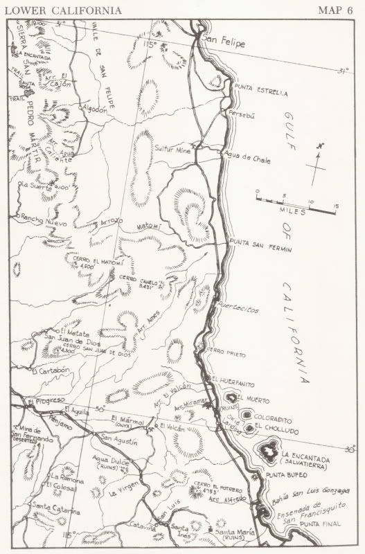
elbeau, I recommend getting a copy of the Lower California Guidebook by Gulick and Gerhard... last printing was 1970 (1967 edition) or the 1962 edition (or 1964 printing of it).

The spring 'Agua del Mezquitito' is on the 1905 map, as well as being in one of the lost mission stories.

In the 1980 book Rockhounding in Baja by W.R.C. Shedenhelm (La Siesta Press) on page 29: ... 33 miles south of Puertecitos, there is yet another deposit of calcite onyx in a canyon called "Tule Arroyo."

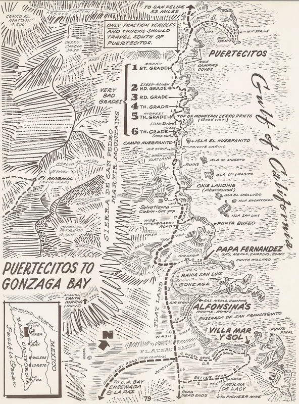
In the 1970 guidebook 'Baja California Mexico' by Cliff Cross on page 80: 33 (miles from Puertecitos, 4 from Okie Landing): Onyx mine on the hillside, to right.

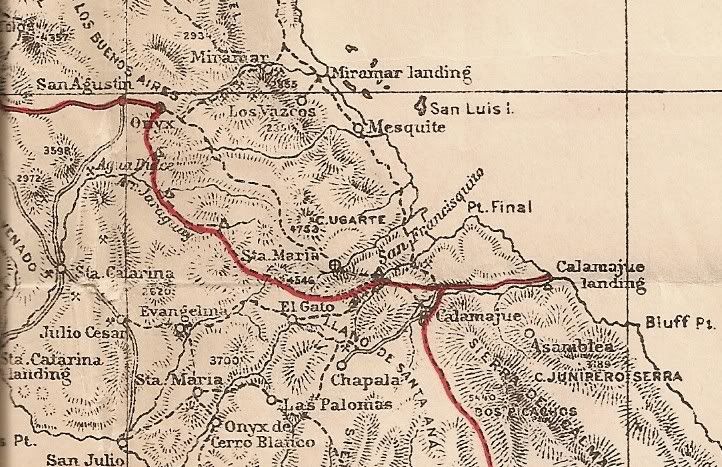
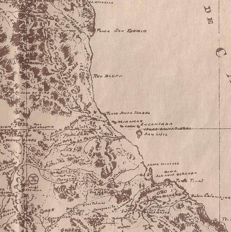
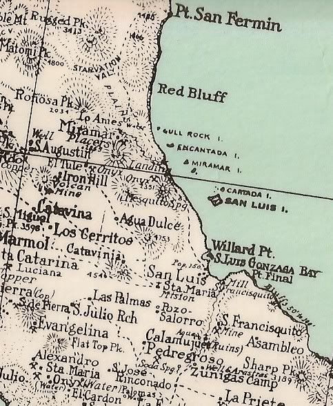
Here is Cliff's map:


(Agua del Mezquitito is 2.4 miles south of Okie Landing)

Lower California Guidebook map:


----------------------------------------------------------------------

Bryan... good to have you scientific eye here!

[Edited on 4-1-2011 by David K]

David K - 4-1-2011 at 07:36 AM

Quote:
Originally posted by elbeau
Also, a lot of features of that map match up well, but not the shoreline. It's only been 106 years, does the Eastern Baja shoreline change that rapidly? Or is the map or my alignment of it wrong?


It was a hand drawn map... I would read nothing into the shoreline location being off...

Onyx/ Soda Springs

David K - 4-1-2011 at 07:54 AM

There are a few soda springs in Baja where onyx is being made... most are between Puertecitos and Gonzaga Bay. El Marmol is only a dozen miles west of the gulf shore, as the crow flies.

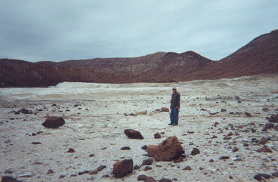
There is a huge soda spring overlooking Gonzaga Bay and there was even some pieces of onyx laying about at the site. My son and I went there in 2002:

It took a few tries to find it (it can be seen from the beach, but that is a few miles away).

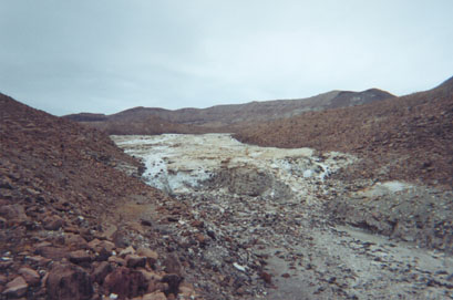
Hiking up the right arroyo, the lower end of the field looks like a glacier... only that isn't ice!:


Up further the spring deposit is giant, view west:


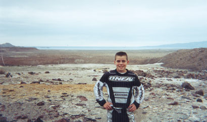
My son, 13 then with the sea in the distance, view east:


Baja is filled with magic places like this!

(if you find the onyx springs, please avoid walking on the crystal layers... also requested by a fellow Nomad to not post the GPS online.)

elbeau - 4-1-2011 at 09:23 AM

Quote:
Originally posted by David K
... also requested by a fellow Nomad to not post the GPS online.


Removed from KML

mtgoat666 - 4-1-2011 at 09:51 AM

Quote:
Originally posted by David K
There are a few soda springs in Baja where onyx is being made... most are between Puertecitos and Gonzaga Bay. El Marmol is only a dozen miles west of the gulf shore, as the crow flies.

(if you find the onyx springs, please avoid walking on the crystal layers... also requested by a fellow Nomad to not post the GPS online.)


DK:
you keep calling it onyx. then you say soda springs. which is it? onyx is silica (quartz). some people misuse the term onyx and apply the term to carbonates. i have not been to your onyx locations, so wonder which is it? silicates or carbonates?

fyi, neither mineral deposit is particularly rare, so don't know why you care about keeping it secret.

elbeau - 4-1-2011 at 10:17 AM

Quote:
Originally posted by bryanmckenzie
not withstanding that this is apparently a NOT remote area and that miners, Nomads, ATV's and many people have passed through this arroyo for more than a century ...


That's what people keep saying, but other than Tom and Bill's trip a few weeks ago, can you come up with any photos showing the hillsides up from the arroyo? David continues to be very helpful by both teaching us the known history of the arroyo and providing images, quotes, maps, etc. They are fascinating, but truthfully, do they show evidence of anybody actually being closer to this site than the El Volcan site? Apparently a few Nomads have driven down the arroyo on MC's trying to find a route to the Sea of Cortez, but they say they were unsuccessful and that they never went on the hillsides above the arroyo. My impression of what David had said about El Tule was that it was the old mining road that you are referring to, and it could have been an old route of some sort, but the maps David provided above do not show the trail going within a few miles of the site. It may not be terribly remote, and it may have had plenty of human traffic, but that's one thing I've been trying to search for and document and I'm coming up blank with any evidence of anybody ever having come within sight of the site. Do you have anything to present to back up your assertion that people have been to that site? If so, PLEASE present it. I've been searching for it and blanket statements like "somebody would have found it" may sound compelling, but it should be backed up with something. Now, I doubt the site has "never" been visited. There are and have been several mines in the area. It's logical that someone's been there, but if you're going to accuse me of over-speculation, please don't find yourself guilty of the same. Like I said before, it's great to have you in the conversation, but please don't assume that I won't expect you to back up what you're claiming to have disproven.

Quote:
"I would really like to make sure that the feedback makes it into this nomad thread" ... http://bbs.keyhole.com/ubb/ubbthreads.php?ubb=showthreaded&a...


...I'm not sure where you're going with that one, nobody has responded and the GE BBS post has been relegated to the forum containing mostly alien conspiracies. It was YOUR suggestion, and I quickly saw the value it could offer and followed through...is there something I'm missing here?

Quote:
"I can't explain why they would exist going up a hill" ... of course you can't ... those arches CANNOT exist in the first place, much less exist beyond everything else. The arch pictures demonstrate this; arches come in all shapes and sizes --- BUT each footing MUST be at the same elevation (horizontal ground). Here, let's go back to square one --- "one downside is that an arch pushes outward at the base, and this needs to be restrained in some way, either with heavy sides and friction or angled cuts into bedrock or similar." Hence, if one end is higher than the other, the higher end blows the lower end out; ref.: http://en.wikipedia.org/wiki/Arch#Technical_aspects


The thing I see as a possible arch DOES have heavy sides and is on what I think is a small leveling on the hillside. The photo Tom took that I think shows the top of the "arch" structure (or whatever it is) appears to show the top of it as being level with gravity, not the hillside. Assuming the sides and bottom follow suit, I don't see how your arguments apply yet.

I also wish that you hadn't skipped over many of your original arguments against the arches. The photos I posted showed clearly that arches can have purposes beyond being load-bearing and that they are one of the most likely features of a structure to remain standing. Your a civil engineer, I think you know that's true.

Quote:
"do you see the landslide?" ... no, I see erosion/gullies on either side of your arrow


OK, you see one thing, I see another. I'm fine with that. It's why I'm looking forward to better photos of the site.

Quote:
look at every other mission site; the good friars chose locations (sometimes moved once, or even twice) that had CONTINUAL water, SURFACE water or GROUND water that could have been just a few feet below the surface..."it may not be as dry as previously assumed either" ... see above & this from Wilderone ... "This arroyo is simply a water course created by sporadic rainstorms (found all over Baja)" ... for the entire post … if water sources were here, they were (are) intermittent, not perennial.


Perhaps you missed the converstion about El Volcan? It's just upstream from the site, according to several nomads it is a constant source of water year-round. I'd like to know the effects of drinking such mineralized water would have on people, but there is water within walking distance of the site at least. That's an established fact.

Quote:
"Finally, there never was the time and energy to collect treasures or mine gold by the Jesuits or their Indians... they barely could feed themselves, so all energy went into food production." ... thanks David; I make the point not because I'm the expert, but take a read from THE expert in Jared Diamond's book "Collapse: How Societies Choose to Fail or Succeed" which covers this topic in glorious detail.


OK, no biggie. I'm not thinking there's buried treasure either. Moot point.

Quote:
Back to tunnels in the earth from a camera on a satellite at 20,000 miles above the earth in geo-synchronous orbit --- yes, I know the CIA et al can read license plates from up there if they want to, but this is us civies using commercial products for dummies --- but if you can see a cave or tunnel ...


Like I said explicitly in the beginning, originally and quoted in my response to you, I knew I was really stretching it on those little features. Did you read my response?

Quote:
Lastly Elbeau, the question remains --- that no one yet has asked (unless I missed it) --- how is it that you arrived at these particular coordinates at this tiny geographic location??? And then postulated this theory?


It's been asked and answered, but I'll say it again. I love Geology and I sell a great geology iPhone app. This area of green in the middle of the Sonoran desert caught my attention a while back, then when I ran into a "lost mission" story, I thought of this place. Upon reading the article I reference in "The Californian", my mind immediately went back to that odd-colored mountain range near the eastern coast which had that leveled-off looking field I've called the "stone corral" in this post. I googled a little more and came across the magazine article that DK posted on page 1 of this thread where he drew the "12-mile line" and so I looked around where it went and saw some terrain I couldn't understand. It looked man-made, but didn't make out what it was without several hours of staring at it from different angles and making a few drawings. At that point I DID think I had found a real mission, but upon studying the surrounding terrain in GE, I came upon the arches and knew that those certainly weren't mission-area structures. I spent the next few weeks trying to research the "Zamora Canyon" area, but I was using the modern mis-label of the site and didn't learn much, except for the fact that there was hardly ANY online documentation of that whole canyon area. Very few photos, and all of those were of El Marmol, El Volcan, or the Olividada mine. I stared at the blue-colored arroyo a lot and came up with a theory for water conservation. I then tried contacting educators and industry professionals, with very little results. Only one guy would even hear me out, and he's still fascinated with the idea as far as I know, but he can't do anything without someone getting some on-the-ground photos to back up what I see.

...so...I joined BajaNomad.com and the rest is history.

In any case, we can speculate back and forth and rebut our rebuttals to our rebuttals all day long and still disagree without more evidence. I welcome the constructive nature of your arguments, but I'd rather not turn this into a tit-for-tat ego fest like most threads tend to digress into. Once again I'll say it:

It's either there or it's not. I can't talk it into existence and you can't talk it out of existence. Evidence and documentation is the most helpful thing I am looking for folks such as yourself to provide.

David K - 4-1-2011 at 11:17 AM

Quote:
Originally posted by mtgoat666
Quote:
Originally posted by David K
There are a few soda springs in Baja where onyx is being made... most are between Puertecitos and Gonzaga Bay. El Marmol is only a dozen miles west of the gulf shore, as the crow flies.

(if you find the onyx springs, please avoid walking on the crystal layers... also requested by a fellow Nomad to not post the GPS online.)


DK:
you keep calling it onyx. then you say soda springs. which is it? onyx is silica (quartz). some people misuse the term onyx and apply the term to carbonates. i have not been to your onyx locations, so wonder which is it? silicates or carbonates?

fyi, neither mineral deposit is particularly rare, so don't know why you care about keeping it secret.


1) Soda springs flow water charged with a gas that cause it to bubble at the surface. The minerals in this water are what form onyz or marble or limestone, depending on the form the crystals take on. Because this is one of the worlds largest onyx zones, I (and other authors) assume that today's soda springs are depositing layers that will become tomorrow's onyx beds. So, we use the terms soda springs and onyx springs because of what they are.


2) From 'The Forgotten Peninsula' by Joseph Wood Krutch c1961:

"This particular kind of stone the geologists prefer to call "onyx-marble" to distinguish it from the agatelike material also called onyx. Like marble it is essentially a water-deposited limestone but it differs from ordinary marble as much as marble differs from limestone. Limestone is soft; marble is hard. Onyx is so much harder than either that it takes a high polish; it is very resistant to stain and is often banded with brown, green, or (exceptionally) with rose-red; yet there is very little chemical difference amongst the three and all are formed in much the same way.

Lime is slightly soluble in water, rather readily so if the water has been acidified by the absorbtion of carbon dioxide gas. When lime laden water deposits its burden, either because it has evaporated or because it has lost its acidity by discharge of gas, you get a deposit of one sort or another; limestone, marble, or onyx, depending upon the form assumed by the crystals. ...

Each of these conditions is fulfilled at the springs near El Marmol but obviously the required conditions are so critical that marble, onyx and soft limestome are all present in different layers. The color banding is the result of various impurities- mostly iron and manganese for the buff, brown, and mahogany, probably organic material for the green.

The largest of the now active springs, hardly two feet across, seems to be boiling like those one sees in Yellowstone Park, but the bubbles are gas, not steam, and the water is quite cold. Here and there about it are smaller springs and a few cones of quite soft material built up by still others no longer flowing. ... Natives call this spot El Volcan..."


3) ", so don't know why you care about keeping it secret.":

>>>... also requested by a fellow Nomad to not post the GPS online<<<

Out of respect for what was aked of me. Despite what some have said, if given a GPS or shown a site by another Nomad,... and asked to not publish it here or in a book, I honor such requests.

elbeau - 4-1-2011 at 07:00 PM

Quote:
Originally posted by David K
Nice photos Wilderone... glad you shared the rock art too... Arroyo el Volcan is highly interesting to be sure...

For those of you with the Baja Almanac or topo maps, this is mis-named as Arroyo Zamora on them... and another arroyo just south carries the name El Volcan (in error).

On maps made about 100 years ago by American prospectors, the arroyo was given the name 'Tule Wash'.

Note that El Volcan was a regular trail route from 'onyx' (El Marmol) to the gulf:

1930:


[Edited on 3-30-2011 by David K]


Here's the 1930 map overlaid as good as I can figure. The coastline has two points anchored correctly, but a lot wrong in-between, but El Marmol and Santa Maria and other sites line up well, so I think our arroyo is pretty well represented by this map positioning. Again, it's impressive how accurately these maps were drawn when you consider they were done by hand.

KML File


David K - 4-1-2011 at 07:24 PM

COOL!

I sure like the way you do the overlays of old maps with satellite images... I think I know how to do it, but I have so much stuff going on when I am online, I am not ready to try.

Can you do an overlay of Howard Gulick's map (1962 Lower California Guidebook Map 6) with satellite image, please?

elbeau - 4-2-2011 at 12:06 AM

Quote:
Originally posted by David K
COOL!

I sure like the way you do the overlays of old maps with satellite images... I think I know how to do it, but I have so much stuff going on when I am online, I am not ready to try.

Can you do an overlay of Howard Gulick's map (1962 Lower California Guidebook Map 6) with satellite image, please?


Here you go:

KML File


David K - 4-2-2011 at 07:21 AM

Thanks... do you add the color enhancement or is that brown tone the way Google shows how the Earth looks from that elevation?

elbeau - 4-2-2011 at 09:42 AM

Quote:
Originally posted by David K
Thanks... do you add the color enhancement or is that brown tone the way Google shows how the Earth looks from that elevation?


I take some steps to enhance the markings on the map and to delete all the other pixels then I overlay the photo in GE and reduce the overlay's opacity so that you can see through the markings a little and still make out the terrain beneath them. I don't/can't change the color tone of GE itself.

Each image is different, but for this one I:

*increased gamma by 400%. This thickened up all the black lines, but also added some unwanted color.
*desaturated all the color out of the image.
*ran the image through a noise reduction filter.
*performed a light Gaussian blur.
*selected the background pixels by doing a color range selection then deleted them.
*saved it in PNG format, which preserves pixel transparency(jpg will not work).
*uploaded the photo to my server.
*added the image overlay in GE and set the overlay opacity to about 60% or so this allowed the "brown" you mentioned to bleed through the markings.
*manipulated the overlay around until the most features fit.

David K - 4-2-2011 at 10:24 AM

Wow...:wow: If you don't mind, I will just ask you to make overlay maps... okay?:biggrin:

Have a nice Saturday!

TMW - 4-3-2011 at 10:45 AM

I just finished reading Baja's Hidden Gold by Herman Hill. Herman had an interesting take on what happened to the treasure etc from the missions. Chapter 30 was interesting, maybe we should talk to Juan at the rancho and get our metal detectors out.

David K - 4-3-2011 at 10:47 AM

Quote:
Originally posted by TW
I just finished reading Baja's Hidden Gold by Herman Hill. Herman had an interesting take on what happened to the treasure etc from the missions. Chapter 30 was interesting, maybe we should talk to Juan at the rancho and get our metal detectors out.


:light:

Hermans Book-r.JPG - 31kB

woody with a view - 4-3-2011 at 11:06 AM

Quote:
Originally posted by David K
Quote:
Originally posted by TW
I just finished reading Baja's Hidden Gold by Herman Hill. Herman had an interesting take on what happened to the treasure etc from the missions. Chapter 30 was interesting, maybe we should talk to Juan at the rancho and get our metal detectors out.


:light:


without having read that book, let me tell you a story.

this story took place +/- 20 years ago and was told by the matriarch of the ejido where we go to be alone. she said that americans would come in trucks and they built a "casita" in the middle of nowhere. she said there was plenty of good [places to build the casita, but these guys basically made their own road out of a goat trail.

these gringos would come and go over the course of 4-5 months, always bringing more materials and keeping to themselves. one day it was noticed that they had not been seen in some time and one day, some of the men made their way back into the middle of nowhere to see what was up. they were surprised to find only a big hole in the ground surrounded by 4 basic walls and a roof. no furniture, just a big hole.......

true story, as far as i know.

TMW - 4-3-2011 at 11:13 AM

Woody, I think you would enjoy the book. An easy read with some interesting stories.

elbeau - 4-3-2011 at 12:59 PM

I think it's appropriate at this point to make sure I don't digress into being intellectually dishonest. I've made a lot of arguments pushing the idea that some features of this arroyo area might be man made and might be ancient, and while I still believe there's a good enough case for those arguments to warrant another photo-taking trip, my arguments also have the tendency to over-sensationalize these ideas to a point where it looks like there's no more critical thinking involved.

So, for the sake of being straightforward, instead of pushing my ideas in this post, I'm going to take a step back and show you what I think is "probably" there, rather than what "might" be there. Each argument falls in a different place on the scale of probability, so I'll try to explain each.

First, my biggest blunder...the really awesome fountain structure from my original post is really probably nothing more than me using the wrong camera angle and not understanding the shadows, and not being conservative enough in my thinking. Here's what I see these days:


Here's the raw image:


The "reservoir" I originally identified uphill from there still has a lot of explaining to do before I'll understand the high water marks, but I believe I can rule out the small features that made me say I thought I had a case for a man-made dam. This doesn't mean that I don't think there was standing water there, because I still do, but I see no evidence now that I can use to say it was intentionally made into a reservoir:


Here's the raw image:


Several features at my "mission site" still look man-made to me, but it is very possible that DK's suggestion that they may turn out to be old mine workings is a definite possibility...but not the only possibility :coolup:

I still see structures that may have sloughed off from an area uphill that seems to defy both a geological and an archaeological explanation to me. I REALLY would like to settle my mind on these features and I am REALLY looking forward to seeing what turns up from the April trip (which it is looking more and more unlikely for me to attend).

Here's what I currently see:


Here's the raw image:


The corral still seems to have been purposefully cleared to me, but quite possibly for placer mining...although this is just as speculative as other conclusions:


The arch feature is still quite intriguing to me, although there's a possibility that it's a trick of the eye as follows:


Here's the raw image:


I still think it looks more like an arch than a trick of the eye, especially given the photo that Tom and Bill took, but I have to admit that there are rock formations in Wilderone's photo that could explain that even if there is a standing formation right there, it may be natural with funny shadows, it may be natural with vegetation in front of it, or it may be natural with a hole cut through it. I look forward to learning more about it.

Anyways, I'm sure this post will provoke several I-told-you-so's, but my goal in this post is not to "be right", it's to understand these features and the area and whether or not it turns up something really cool, I'll still be glad I had this long-distance vicarious adventure. Thanks to all!

Cypress - 4-3-2011 at 01:11 PM

Jee

bajalou - 4-3-2011 at 01:46 PM

Now all of you GoogleEarth experts correct me if I'm misinformed, but Google Earth does NOT give you actual images from different angles as it tilts etc. It just projects the scent by resizing for distance etc. The shadows are from the different angles to the sun, not camera angles. The actual image is flat.

Now if that is true, it is just stretching shadows and colors that makes it appear to let you "see" features.

elbeau - 4-3-2011 at 02:50 PM

Quote:
Originally posted by bajalou
Now all of you GoogleEarth experts correct me if I'm misinformed, but Google Earth does NOT give you actual images from different angles as it tilts etc. It just projects the scent by resizing for distance etc. The shadows are from the different angles to the sun, not camera angles. The actual image is flat.

Now if that is true, it is just stretching shadows and colors that makes it appear to let you "see" features.


That's a good question, and a vital question to understand if you want to interpret GE images. There are several major things contributing to the images you see in GE:

1. GE does NOT contain 3-diminutional raster images. It displays 2-dimentional photos just like your own digital camera would take, except they are taken from several thousand miles away with a really good telephoto lens. Ideally, each image would be taken from directly above the target but it is not reasonable to change the satellite's trajectory for each photo, so the satellite usually takes each photo from a gentle angle, which means that as GE allows you to view a target from any angle, it usually adds some distortion of small-scale surface features. So, how do we know what "small-scale" means? Well, that depends on the "resolution" of the photo. It has been suggested on this thread that a satellite 20,000 feet above the earth can't be relied upon for determining surface features, but that is only half the equation. It's the combination of the satellit's altitude and the power of it's telephoto lense that determines the resolution of the final photo. My understanding is that this arroyo is photographed at 1-meter resolution, which means that each pixel in the original satellite image is a sample of the general color emitted by 1-square-meter of earth's surface.

2. GE purposefully modifies the pixels in the original satellite image to try to fudge the resolution to make it better. This is a good thing generally, but is a known cause of small-scale distortion. Basically, you can take a digital image and enlarge it by a power of two or more, then run it through algorithms that try to guess what smaller-scale colors were combined to make the original 1-meter pixel and then it invents pixels for those results. This generally gives good results and tends produce images that simulate resolutions better than the original 1- meter photo, but has the inherit ability to invent the wrong pixel.

3. GE stitches all these separate photos together, and they don't always line up easily, so it often has to guess what overlapping or missing pixels should look like. This stitching together produces distortion at small scales.

4. GE uses space shuttle 30-meter resolution STRM topography data to stretch the 2-dimensional satellite images into 3-dimensional views of the world. This stretches the images very substantially in many cases.

5. GE adds shadows to the images based on the topographic data...not based on the time of day the image was taken. This means that the original photo will have dark 1-meter resolution pixels because of real shadows that existed when the photo was snapped, then GE will darken pixels based on 30-meter resolution topo data to simulate times of the day. This looks good from a distance, but messes things up when you zoom in.

So, how can you tell if you're viewing a real feature compared to an accidental anomaly? Just view a nearby feature you know you can count on, like the El Marmol schoolhouse, then don't zoom in too much more than that in other places. This was clearly my mistake with the smaller features I thought I coud discern originally, but it tends to substantiate some of the other features I've pointed out.
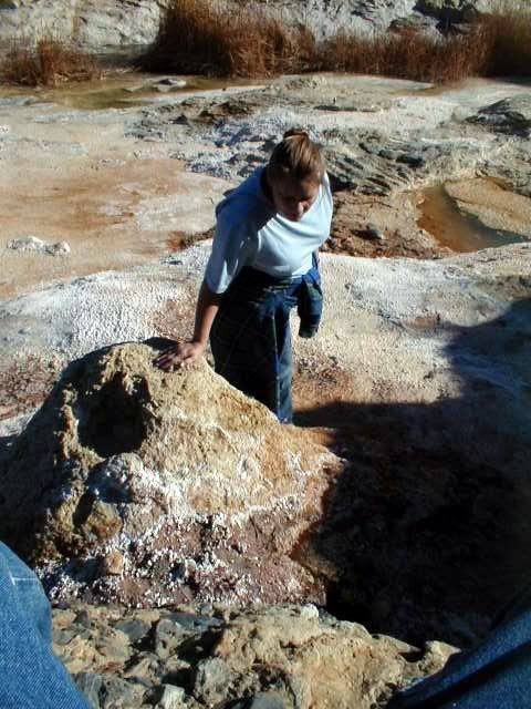
woody with a view - 4-3-2011 at 03:13 PM

elbow, get off the couch and get out there. i tell my wife, "this road ends at the beach, just past THAT hill." she has asked me to define WHICH hill i mean, dozens of times......

she ALWAYS thinks i'm lying..... until the beach presents itself. then, she looks back and i can hear the wheels grinding while i minimize how long it'll take to get back.

who are you, and what is your motive?
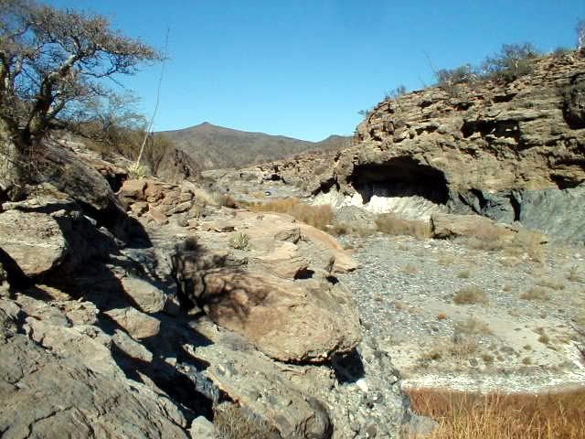
woody with a view - 4-3-2011 at 03:15 PM

FWIW, i only see scrub brush, and natural features.....

elbeau - 4-3-2011 at 03:53 PM

Here's the El Marmol Schoolhouse looking straight down to compare to other features at exactly the same camera altitude and compass angle, giving us an idea of size in comparison to the size of a known feature nearby.

First, a ground photo of the schoolhouse:


Then the overhead photos:


David K - 4-3-2011 at 03:54 PM

>>> edit, the images you just posted (above)... the last one is at El Volcan, the onyx dome/ geyser... and there are big pools of water on both sides of it.


elbeau, there are a LOT of minerals there in addition to the huge lime deposit (onyx, marble, limestone) that goes for a dozen miles.

Where that deposit is exposed by erosion of the newer volcanic overlay, then the white rock/stain can be seen (in dozens of places) at the source and deposited downstream during rains.

The other odd shapes are mostly lava flows where they have been cut through by arroyos/ gullies. Then there are some really big elephant trees and cardons in there, too.

I hope you can find a way to come to California to see for yourself... but when we get back there through TW's camera, mine, or other's... it should lay to rest your anxiousness.

While there are mines and mine claims (test holes) all over this region, I don't see them at the Santa Isabel site... They are all reached by road or very near a road and are obvious on Google Earth.

One of my favorite Baja mine tunnels you can see on Google Earth is the San Juan mine, near the top of the mountain southwest of Las Flores (south of L.A. Bay). There is an open pit mine northeast of Mision San Borja, serviced by a road heading east, just a couple miles north of San Borja,in the next valley. This is new since I was in that valley in 2001 looking at a petroglyph site.

[Edited on 4-3-2011 by David K]

elbeau - 4-3-2011 at 03:54 PM

Quote:
Originally posted by woody with a view
elbow, get off the couch and get out there...who are you, and what is your motive?


Yeah, I know...don't I wish.

If you're terribly interested in who I am, just read the thread, it's been asked and answered over and over...including two days ago.

elbeau - 4-3-2011 at 04:00 PM

Quote:
Originally posted by woody with a view
FWIW, i only see scrub brush, and natural features.....


Yeah, and you're probably right...but what's the worst that can come of this? We've already produced the best documentation available online for the area. The worst that happens here is that I'm wrong about all the archaeology and this thread turns into a resource on how NOT to interpret GE imagery and it becomes a resource for anybody wanting to understand or visit the area and it becomes a resource on the history of this area of Baja. Those are three VERY appropriate uses of a BajaNomad threas...wouldn't you agree?

And for what it's worth, people may mock dreamers, but I'd rather be a dreamer anyways :cool:

TMW - 4-3-2011 at 06:41 PM

elbeau you really should find a way to join us in the exploration of the site. It will put your mind at rest once and for all. Woody should join us too. If we find something good, if not we have at least answered many questions. I also hope DK can join us. This time my brother Bill will be with me, not the same Bill as before, and we are both retired and can spend as much time as necessary to satisfy our imaginations. Beside I would like to open the road to La Olividada if the washout isn't too bad.

elbeau - 4-3-2011 at 07:04 PM

Quote:
Originally posted by TW
elbeau you really should find a way to join us in the exploration of the site. It will put your mind at rest once and for all. Woody should join us too. If we find something good, if not we have at least answered many questions. I also hope DK can join us. This time my brother Bill will be with me, not the same Bill as before, and we are both retired and can spend as much time as necessary to satisfy our imaginations. Beside I would like to open the road to La Olividada if the washout isn't too bad.


Yeah, I've promoted this to a point that it's ridiculous if I don't come, but I really doubt I can. I've talked this thread to death at this point, and I'll continue to post stuff if it adds to what we know of the area, but I've got to admit that doing little more than debating the same points with different people on this thread each week is getting a little old and obsessive-looking. Let's just see what turns up and whenever I can get things together for a trip I'll come to the site myself even if the debate is already laid to rest before then. I've caught a little of the "Baja bug" and I'm sure I'll make it down there before too long.

David K - 4-3-2011 at 09:47 PM

Quote:
Originally posted by TW
elbeau you really should find a way to join us in the exploration of the site. It will put your mind at rest once and for all. Woody should join us too. If we find something good, if not we have at least answered many questions. I also hope DK can join us. This time my brother Bill will be with me, not the same Bill as before, and we are both retired and can spend as much time as necessary to satisfy our imaginations. Beside I would like to open the road to La Olividada if the washout isn't too bad.


Do you have a firm date for the El Volcan expedition Tom?

David K - 4-3-2011 at 09:50 PM

Quote:
Originally posted by elbeau
Quote:
Originally posted by TW
elbeau you really should find a way to join us in the exploration of the site. It will put your mind at rest once and for all. Woody should join us too. If we find something good, if not we have at least answered many questions. I also hope DK can join us. This time my brother Bill will be with me, not the same Bill as before, and we are both retired and can spend as much time as necessary to satisfy our imaginations. Beside I would like to open the road to La Olividada if the washout isn't too bad.


Yeah, I've promoted this to a point that it's ridiculous if I don't come, but I really doubt I can. I've talked this thread to death at this point, and I'll continue to post stuff if it adds to what we know of the area, but I've got to admit that doing little more than debating the same points with different people on this thread each week is getting a little old and obsessive-looking. Let's just see what turns up and whenever I can get things together for a trip I'll come to the site myself even if the debate is already laid to rest before then. I've caught a little of the "Baja bug" and I'm sure I'll make it down there before too long.


It's okay with me (and many more) to keep right on with this fun stuff, IMO. If anybody doesn't like it, they can read other threads, afterall.

I would far rather come to Nomad to read about a Baja lost mission, or an adventure, or just look at some satellite images and wonder a bit, then most anything else.. this is fun!

TMW - 4-4-2011 at 08:33 AM

David it looks like Friday April 29 to the wash and camp over night then get an early start Saturday morning.

I'm working around Ken Cooke and his Jeep group. They will be at Gonzaga Bay on Monday the 25th, then meet me at the Turquesa Mine on Tuesday the 26th to do the mine run. Then they are going to LA Bay. They will be at Catavina on the 28th to run into Mission Santa Maria. Bajacat and I will join them. We will come out on the 29th and Bajacat and I are heading to El Marmol and the wash. I've asked Ken to join us too but I don't know if his schedule will allow it. I also suggested he might skip the mine run and hit LA Bay a day early and the mission a day early and then join us at the wash to explore. That would mean getting to the wash on Thursday the 28th a day earlier. Not sure how that might affect Bajacat.

We'll work it all out somehow.

bryanmckenzie - 4-4-2011 at 04:18 PM

"...nobody has responded and the GE BBS post has been relegated to the forum containing mostly alien conspiracies. It was YOUR suggestion, and I quickly saw the value it could offer and followed through...is there something I'm missing here?"

Yes. Several things.
(1) Take out the words "lost civilization." Even with that you had 96 views, 0 responses, because ...
(2) You didn't attach the KML at GE BBS. You're asking people to change to another forum, then have to find the KML of page 3 which is daunting.
(3) Which forum did you post to originally? Do you know which moderator moved it? I know many of them and can maybe have it moved to the unmoderated PEOPLE & CULTURES or HISTORY forum.

bryanmckenzie - 4-4-2011 at 05:05 PM

Lou, the short answer is, KINDA-SORTA.
The longer, more correct answer is, NO.
To be able to determine the 3rd parameter (elevation), photo panels must overlap and be shot from 2 angles (stereo coverage). This is always done when using low altitude airplanes to map an area. I believe once elevation is known you can simply "drape" a flat photo onto the known 3-D surface. Just like Elbeau or I drape maps onto the known GE surface we call earth.

(Side note, GPS takes this one level higher to include a 4th parameter (time); this is why a minimum of 4 satellites are requires to calculate where you are. But I digress).

Here is a short intro ... http://www.stereoscopy.com/faq/photogrammetry.html


Quote:
Originally posted by bajalou
Now all of you GoogleEarth experts correct me if I'm misinformed, but Google Earth does NOT give you actual images from different angles as it tilts etc. It just projects the scent by resizing for distance etc. The shadows are from the different angles to the sun, not camera angles. The actual image is flat.

Now if that is true, it is just stretching shadows and colors that makes it appear to let you "see" features.


[Edited on 2011-4-5 by bryanmckenzie]

David K - 4-4-2011 at 05:38 PM

Bryan... you up for a El Volcan trip in April?

BAJACAT - 4-4-2011 at 09:04 PM

Quote:
Originally posted by TW
David it looks like Friday April 29 to the wash and camp over night then get an early start Saturday morning.

I'm working around Ken Cooke and his Jeep group. They will be at Gonzaga Bay on Monday the 25th, then meet me at the Turquesa Mine on Tuesday the 26th to do the mine run. Then they are going to LA Bay. They will be at Catavina on the 28th to run into Mission Santa Maria. Bajacat and I will join them. We will come out on the 29th and Bajacat and I are heading to El Marmol and the wash. I've asked Ken to join us too but I don't know if his schedule will allow it. I also suggested he might skip the mine run and hit LA Bay a day early and the mission a day early and then join us at the wash to explore. That would mean getting to the wash on Thursday the 28th a day earlier. Not sure how that might affect Bajacat.

We'll work it all out somehow.
Tom I had already ask for thurs-friday off I don't know if I can change dates... If you want we can leave the SMM trip for another day and just do the Marmol run, that will me a chance to relaxe More In El Rosario...(BAJACACTUS)..

[Edited on 4-5-2011 by BAJACAT]

David K - 4-4-2011 at 11:05 PM

Sounds like the original plan was getting to El Volcan the afternoon/ evening of Friday the 29th with the hike (where we can't drive) on Saturday the 30th and camp that night and return home Sunday.

I am hoping to make this happen...

bajalou - 4-5-2011 at 07:11 AM

Thanks Brian and elbeau for the detailed explanations of the terrain/elevation features of GE.

The point I was trying to make is that although the SRTM data creates higher and lower points on a wire frame, the photographic imaged has to be stretched to cover the distortion. The image itself is still from approximately straight down and not from the angel we are projecting.

A side comment - GE and VE images often appear very different for a area because of the shadows from the time of day the picture was taken.

TMW - 4-5-2011 at 09:45 AM

Bajacat I think your OK with Thursday and Friday.

bryanmckenzie - 4-5-2011 at 12:38 PM

Yes, Lou, that's a nice concise way of saying it. I was taught the word "draping" as a catch-all for that adjustment. It's why very often you'll see lakes or oceans seemly going up hillsides (or vice versa).

Quote:
The point I was trying to make is that although the SRTM data creates higher and lower points on a wire frame, the photographic imaged has to be stretched to cover the distortion. The image itself is still from approximately straight down and not from the angel we are projecting.

bryanmckenzie - 4-5-2011 at 01:03 PM

I am. I'd love to make this trip. I could meet you in San Diego & ride together.
However, given the (lack of) work situation, I'm hesitant to commit to diverting time and money for this when I need to be job hunting. Let me think on it a few days.


Quote:
Originally posted by David K
Bryan... you up for a El Volcan trip in April?

bajalou - 4-5-2011 at 01:18 PM

Thanks Brian, draping is an appropriate description I think.

BAJACAT - 4-5-2011 at 07:20 PM

Quote:
Originally posted by David K
Sounds like the original plan was getting to El Volcan the afternoon/ evening of Friday the 29th with the hike (where we can't drive) on Saturday the 30th and camp that night and return home Sunday.

I am hoping to make this happen...
Yes David, but Tom was saying that maybe the run to th SMM was going to be change to a day before from thu to wends..if it remains the same SMM on thurs exit on friday..drive to el Volcan and hike sat.. Im in

David K - 4-5-2011 at 08:59 PM

Quote:
Originally posted by BAJACAT
Quote:
Originally posted by David K
Sounds like the original plan was getting to El Volcan the afternoon/ evening of Friday the 29th with the hike (where we can't drive) on Saturday the 30th and camp that night and return home Sunday.

I am hoping to make this happen...
Yes David, but Tom was saying that maybe the run to th SMM was going to be change to a day before from thu to wends..if it remains the same SMM on thurs exit on friday..drive to el Volcan and hike sat.. Im in


Well, if the money thing gets solved, and others are going so we have some fun... I will go down Friday, camp at El Volcan arroyo or just beyond near the white slope (big area to camp) off the La Olvidada road. Hike in if can't drive down the arroyo... camp that night, and return Sunday through Tecate.

BAJACAT - 4-7-2011 at 07:38 PM

I think, that if something is there, somebody should have found it already.. is hard to belive that hasn't been discover, but Im up to the challenge... Hopefully I would not be spook again..when I went down the rd I scrape my front bumper in one of the sharp turns,that happens when you have a full size truck...

EL MARMOL & EL VOLCAN PICS

David K - 4-7-2011 at 10:32 PM

Since the trip involves being there.. and El Volcan (the cold water geyser) is only 4/10 a mile (2/3 a kilometer) up the arroyo from the road between El Marmol and La Olvidada, I am showing my 2006 pics again plus some never before posted in Arroyo el Volcan.

The Santa Isabel site is down stream from the road about 3 miles.

The first 5 are of the onyx schoolhouse:


The next two are at the mineralized white slope that is just 1/4 mile from the Arroyo el Volcan crossing, along the La Olvidada road... in the background is Arroyo el Volcan going down to the Santa Isabel site:


The next 6 photos are in Arroyo el Volcan driving and walking up to El Volcan geyser (also called the onyx dome)... one of the pools is too deep to see the bottom, and Baja Angel is lying next to it:


Looking up and down the arroyo from where we parked, 0.2 mile from the La Olvidada road:


The next 7 are at El Volcan:


See my silver truck way down the arroyo? That is all we had to walk to get to El Volcan, as we could drive half way to the geyser from the road, in the arroyo in 2006:


The final photo is walking back to the truck looking at the east side cliff of the arroyo and see Baja Angel for scale:


David K - 4-7-2011 at 10:35 PM

Map:


Image:


Site 'b' in white balloon is elbeau's Santa Isabel site, about 3 miles down the arroyo. El Volcan is 0.4 miles up the arroyo from the road to El Marmol/La Olvidada.


[Edited on 4-8-2011 by David K]

elbeau - 4-8-2011 at 07:23 AM

Quote:
Originally posted by David K
Since the trip involves being there.. and El Volcan (the cold water geyser) is only 4/10 a mile (2/3 a kilometer) up the arroyo from the road between El Marmol and La Olvidada, I am showing my 2006 pics again plus some never before posted in Arroyo el Volcan.


Very nice photos, thanks!

elbeau - 4-8-2011 at 07:55 AM

Realistically, I'm pretty sure that my interpretations of the GE imagery are overzealous. I've had some u2u's with bryanmckenzie and even though I've posted a lot of objections to what he sees, I'm just being hard-headed. As this plays out, he will likely be proven correct on most points.

On the other hand, the argument for there being year-round water in the area is still pretty solid, and based on the depth of the onyx deposits this water has probably been there for a very, very long time. The question of whether it is too mineralized to live on is a good one though...but let's hold off on any human experimentation of the theory for now...unless it's mcfez :lol:

just kidding man, you're cool.

One way or another, I'll make a trip to the arroyo myself this year. It's just been too fun to study about for me not to go.

I loved that BBC video that TW posted the other day, and one thing in it has peaked my attention. The climate change that has taken place in Baja during the last 15,000 years has been tremendous if they are correct in what they showed. If the majority of the peninsula had pine and oak forests that slowly changed into arid desert during the last 15,000 years, then the Baja residents that they are dating to thousands of years ago might have lived in a significantly different Baja than we know today. I've done a little googleing and haven't come across any climate data one way or the other for the last 15,000 years. Does anybody know if they are correct? and if they are correct, can somebody give any insights about how quickly things changed over those years?

TMW - 4-8-2011 at 08:47 AM

Bajacat you shouldn't have any problems going in this time as the road has been graded. I was in there in my GMC. The only problem is that once in the wash we will only be able to drive around the first bend due to rocks in the wash. The first bend is at the top of the yellow marker in the pix above labeled Road to El Marmol 4 miles. That green patch just past it in the middle of the wash is where the rocks are under some heavy grass type vegetation.

BAJACAT - 4-8-2011 at 09:52 AM

so what's up with keen is he changing dates to go to MSM.. or it remains the same..I think I will leave really early thursday..the 28th..

TMW - 4-8-2011 at 10:04 AM

His plan is to spent Wednesday night the 27th in LA Bay and Thursday night the 28th at Mission Santa Maria and Friday night at Baja Cactus in El Rosario. You and I can meet him at Santa Ines sometime on Thursday. We'll work out the meeting times etc the week before.

BAJACAT - 4-8-2011 at 04:46 PM

Souds, good I will keep checking this thread for info..I hope DK goes with us..or any nomads that would like to acompany us in this crazzy quest..
Elbeu, next time we see ya, you are going to have to buy the Victorias(cerveza), Pacifico's are so overated,(sorry DENNIS)..:lol::lol:

 Pages:  1    3    5