BajaNomad

Jimena

 Pages:  1  ..  4    6    8  ..  14

zforbes - 9-2-2009 at 08:03 AM

Juan Arce Marron, Bahia Asuncion's roving reporter, gives an update to the Associated Press. go Juan!

http://news.yahoo.com/s/ap/20090902/ap_on_re_la_am_ca/tropic...

Looks like Taco and I are reading the news at the same time.

[Edited on 9-2-2009 by zforbes]

Todos Santos Storm Report (Courtesy, Baja Western Onion)

BCSTech - 9-2-2009 at 08:05 AM

Maryann has been sending us regular updates on the weather situation in Todos Santos since yesterday morning. Following is a summary of her reports. - Alan

----------------------

Tue. Sept. 01, 11:00 A.M. - Fairly heavy, steady rain, but still no wind - satellite TV has gone so I have unplugged all electronics. Have heard that San Jose has already lost power.

----------------------

Tue. Sept. 01, 3:30 P.M. - Winds starting to pick up a bit but it has been very quiet - rain off and on. It looks now like it is starting to come in more from the west - which is not a good thing. All reports are that while we will certainly get wind and rain it is not going right over top of us and I believe it will be several more hours before the big stuff hits. I still have electricity and even TV.

----------------------

Tue. Sept. 01, 7:20 P.M. - Winds picking up again - not much rain. I can see the white caps from my porch - many many large white caps!! There are dark clouds moving fast all around - hard to tell which direction they are coming from. Actually the winds are higher now than they have been all day.

Depending on which site you look at - it may have already gone north of us or is still coming - I can sure see a wall of black clouds over the ocean. Still have satellite TV - only lost it briefly.

----------------------

Tue. Sept. 01, 8:30 P.M. - Strong winds and heavy rain - electricity going off and on.

----------------------

Wed. Sept. 02, 2:30 A.M. - Incredibly high winds since about 10:00 PM - surprisingly little rain - and amazing my electricity is mostly on. Thanks to Linda's 3G I am still on the internet. From what I can see from here the roof is still on my house. No thunder or lightning - just WIND.

----------------------

Wed. Sept. 02, 6:30 A.M. - Still blowing but just regular high winds - no more gale force. A very quick look around - everything appears fine. Electricity is on - amazing!!

----------------------

Wed. Sept. 02, 8:30 A.M. - Everything is just fine - amazing. The electricity hardly went out at all. Really very lilttlle rain. I checked inside my house and there is absolutely no problem. If Jimena had been 100 miles further east we would have been in big trouble - saved again.

----------------------

The Baja Western Onion

Frequently Asked Questions

* How Do I Submit an Article, Ad or Question? Visit Our Web Site at http://www.bajawesternonion.com/submitarticle.asp

* How Do I Subscribe? Visit Our Web Site at http://www.BajaWesternOnion.com/subscribe.asp

* More FAQs Here: http://www.BajaWesternOnion.com/faq.asp

David K - 9-2-2009 at 08:11 AM

Quote:
Originally posted by udowinkler
Quote:
Originally posted by desertcpl
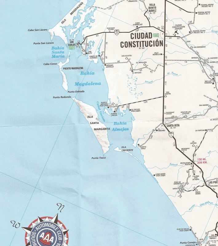
CNN just reported that it just made land fall at Santa Margarita


I do not see Santa Margarita on my AAA Baja map.:?::?::?:


Here you go Udo... the big island in the center that is the southern end of Mag Bay...


MitchMan - 9-2-2009 at 08:12 AM

Thanks Lencho and Morgaine7.

My area of concern is specifically Col. Chametla in CD. La Paz. Got a bunch of stuff in the freezer. Just trying to get a heads-up on what I will find in the freezer if the electricity goes out for a long time. Will be there tomorrow if Volaris doesn't cancel the flight.

My first hurricane, don't know what to expect. Have two large Mesquite trees in the back yard and a fantastic mango tree with a bunch of fruit ready to be picked. Hoping for the best. Based on recent posts, it sounds like La Paz, Cabo and neighboring towns may have missed the bullet. Not so sure about Loreto or Mulege or the pacific side, though.

[Edited on 9-2-2009 by MitchMan]

Gadget - 9-2-2009 at 08:20 AM

Been following closely and praying for our friends from Asuncion south.
Glad to see its busting up some.
Would be interested to know if you have any updates on folks down at Hipolito Shari.
Pretty cool, Juan, the roving reporter. The list is small of what you don't do, huh Juan? :cool:

comitan - 9-2-2009 at 08:24 AM

MitchMan

Being just down the road I wouldn't worry about anything. It was not bad enough to do damage, and you have not lost power long enough to loose anything in the freezer.

comitan - 9-2-2009 at 08:28 AM

Are there any reports from Mulege area,looks like its heading north.

GEMcC5150 - 9-2-2009 at 08:36 AM

Light winds in San Ignacio wit light on and off rain

oldlady - 9-2-2009 at 08:42 AM

Quote:
Originally posted by MitchMan
Thanks Lencho and Morgaine7.

My area of concern is specifically Col. Chametla in CD. La Paz. Got a bunch of stuff in the freezer. Just trying to get a heads-up on what I will find in the freezer if the electricity goes out for a long time. Will be there tomorrow if Volaris doesn't cancel the flight.

My first hurricane, don't know what to expect. Have two large Mesquite trees in the back yard and a fantastic mango tree with a bunch of fruit ready to be picked. Hoping for the best. Based on recent posts, it sounds like La Paz, Cabo and neighboring towns may have missed the bullet. Not so sure about Loreto or Mulege or the pacific side, though.

[Edited on 9-2-2009 by MitchMan]

I saw lights in Chametla this morning. Comitan is probably right about the freezer. Having lived in Chametla, it's low, the roads flood pretty quickly and can take a while to drain so moving about may be a challenge for a few days.
Have a safe flight.

shari - 9-2-2009 at 08:43 AM

oh that is rich...juan in the spotlight....those of you who know him will think it's funny...he is so NOT into getting attention.
At 6:30 this morning I stumbled out of the tent to find him on the phone speaking in english...I asked who the heck was that and he said...some lady from Mexico city wanting info on the storm...:O...too funny.

shari - 9-2-2009 at 08:45 AM

welcome GEM...nice to see someone reporting in from that area...please keep us posted and hang on...hope you are out of flooding danger where you are....oh yeah...one question...did they stop beer sales there??

it is gorgeous and sunny here right now...only a few clouds...so weird

[Edited on 9-2-2009 by shari]

oldlady - 9-2-2009 at 08:45 AM

A star is born! Good Luck up there today, Shari!

comitan - 9-2-2009 at 08:47 AM

Shari

If that crazy storm continues to wander you may have boarded the wrong side of the windows, if it does hit you guys it shouldn't have much strength left after meandering up the Baja. :lol:

flyfishinPam - 9-2-2009 at 08:47 AM

No power here since before 6 am.
Winds steady with gusts direction is east to west. My guess is some of the gusts are borderline cat 1 strength but not sustained. Not a lot of rain. I'm on a iPhone with full bats but want to conserve. So far has been easy on Loreto.

shari - 9-2-2009 at 08:50 AM

thanks for checking in Pam...we were wondering how you were doing...take good care

oldlady - 9-2-2009 at 08:50 AM

Glad you checked in FFP...sorry we sent this crap your way. Good Luck.

DianaT - 9-2-2009 at 08:52 AM

Quote:
Originally posted by shari
oh that is rich...juan in the spotlight....those of you who know him will think it's funny...he is so NOT into getting attention.
At 6:30 this morning I stumbled out of the tent to find him on the phone speaking in english...I asked who the heck was that and he said...some lady from Mexico city wanting info on the storm...:O...too funny.


Was a surprise to see his name in the AP report---nice one yes::yes:

But, if they call again, be sure he tells them that there are no people where the storm hit, not even slum dwellers. :fire:

Stay dry and safe.
Diane

fdt - 9-2-2009 at 09:03 AM

Quote:
Originally posted by jdtrotter
But, if they call again, be sure he tells them that there are no people where the storm hit, not even slum dwellers. :fire:

:fire:AP

An Encouraging Track.

MrBillM - 9-2-2009 at 09:08 AM

It was refreshing this a.m. to see the current NOAA track holding Jimena over the central portion of Baja, then veering Left and not influencing the San Felipe area. Hoping it holds true and there won't be any leaks to address next week.

shari - 9-2-2009 at 09:12 AM

Had Juan known it was a news network, he should have told them how great the fishing would be next week!!!

I imagine the folks in mag bay arent too encouraged by this mornings track.

DENNIS - 9-2-2009 at 09:17 AM

Quote:
Originally posted by shari
Had Juan known it was a news network, he should have told them how great the fishing would be next week!!!


Juan Cronkite reporting........."And that's the way it is, September 2, 2009."

woody with a view - 9-2-2009 at 09:20 AM

the latest model run from wx underground shows the thing hitting a wall over the vizcaino and then going every direction..... let's hope it doesn't stall and dump rain. i think the models are not very sure right now. usually, a couple/three are close to each other.....

Joelt - 9-2-2009 at 09:27 AM

A couple of years ago we spent the night about 5 miles north of Vizcaino because the Colorado river rerouted itself to the vado that crosses the highway. Looked to be about 8 to 10 feet deep. It had been raining in the mountains to the east for several days. Had a nice little party that night and were able to cross the next morning in only 3 feet of water.

austriaco - 9-2-2009 at 09:32 AM

we have a motorhome under a palapa in the rancho el coyote area (bahia concepcion). does anybody know how this area is doing?

Mulegena - 9-2-2009 at 09:44 AM

Quote:
Originally posted by austriaco
we have a motorhome under a palapa in the rancho el coyote area (bahia concepcion). does anybody know how this area is doing?

Bob and Susan are most close to Coyote.

Related-- have heard from Facebook friends in Mulege 9 a.m. today it is raining, town has electricity, river is not flooding, they are still in their home.

Good Luck Everyone.

Bob and Susan - 9-2-2009 at 09:46 AM

rain and wind
but not too bad

there are 6-7 BIG yachts parked over there too

austriaco - 9-2-2009 at 09:47 AM

thank You Mulegena, sounds not too bad.

BajaNews - 9-2-2009 at 09:55 AM


[Edited on 9-2-2009 by BajaNews]

BajaNews - 9-2-2009 at 09:58 AM

.

ep200913_model.gif - 27kB

BajaNews - 9-2-2009 at 10:03 AM

This is the "visible" image - the one above (yellow/red) showing water vapor...


BajaNews - 9-2-2009 at 10:07 AM

From 8am PDT - next intermediate advisory will be at 11am PDT, with a full advisory at 2pm PDT...

-----------------
AT 800 AM PDT...1500 UTC...THE CENTER OF HURRICANE JIMENA WAS
LOCATED NEAR LATITUDE 25.2 NORTH...LONGITUDE 112.2 WEST OR ABOUT
30 MILES... 45 KM...NORTH-NORTHEAST OF CABO SAN LAZARO MEXICO AND
ABOUT 255 MILES...410 KM...SOUTHEAST OF PUNTA EUGENIA MEXICO.

JIMENA IS MOVING TOWARD THE NORTH-NORTHWEST NEAR 13 MPH...20 KM/HR.
THIS GENERAL MOTION IS EXPECTED TO CONTINUE WITH A DECREASE IN
FORWARD SPEED DURING THE NEXT 24 TO 36 HOURS. ON THIS COURSE...THE
CORE OF JIMENA WILL BE NEAR OR JUST OFFSHORE THE WEST COAST OF THE
SOUTHERN BAJA CALIFORNIA PENINSULA TODAY...AND NEAR OR OVER THE
CENTRAL BAJA CALIFORNIA PENINSULA ON THURSDAY. DURING THE PAST FEW
HOURS...THE CENTER OF JIMENA HAS MOVED NEAR OR OVER THE COAST OF
MEXICO NEAR CABO SAN LAZARO.

MAXIMUM SUSTAINED WINDS ARE NEAR 100 MPH...160 KM/HR...WITH HIGHER
GUSTS. JIMENA IS A CATEGORY TWO HURRICANE ON THE SAFFIR-SIMPSON
SCALE. WEAKENING IS FORECAST DURING THE NEXT 24 HOURS...BUT JIMENA
IS STILL FORECAST TO BE A HURRICANE WHEN IT MOVES INLAND.

HURRICANE FORCE WINDS EXTEND OUTWARD UP TO 35 MILES...55 KM...FROM
THE CENTER...AND TROPICAL STORM FORCE WINDS EXTEND OUTWARD UP TO
140 MILES...220 KM.

BMG - 9-2-2009 at 10:07 AM

Quote:
Originally posted by MitchMan

Got a bunch of stuff in the freezer.

In the future, put an ice cube in a ziplock bag. That way you'll be able to tell if things thawed out and then froze again.

BajaNews - 9-2-2009 at 10:19 AM

HURRICANE JIMENA DISCUSSION NUMBER 20
NWS TPC/NATIONAL HURRICANE CENTER MIAMI FL EP132009
800 AM PDT WED SEP 02 2009

SATELLITE IMAGERY SUGGEST THAT AT LEAST THE UPPER-LEVEL CENTER OF
JIMENA IS OVER LAND. HOWEVER...EARLIER MICROWAVE IMAGERY SUGGESTED
THE VORTEX WAS TILTED WITH HEIGHT TOWARD THE NORTHEAST...AND THERE
ARE NO RECENT MICROWAVE DATA TO PINPOINT THE SURFACE CENTER. THE
BEST ESTIMATE IS THAT THE SURFACE CENTER HAS PASSED NEAR OR OVER
CABO SAN LAZARO DURING THE PAST FEW HOURS. THE SATELLITE
PRESENTATION CONTINUES TO SLOWLY DETERIORATE...AND BASED ON THIS
THE INITIAL INTENSITY IS REDUCED TO 85 KT.

THE INITIAL MOTION IS NOW 345/11. ALL GUIDANCE AGREES ON A
CONTINUED NORTH-NORTHWESTWARD MOTION WITH DECELERATION DURING THE
NEXT 24-36 HR. AFTER THAT TIME...MOST OF THE GUIDANCE SHOWS JIMENA
TURNING WESTWARD AS HIGH PRESSURE BUILDS NORTH OF THE CYCLONE AND
INCREASING WESTERLY UPPER-LEVEL WINDS SHEAR IT APART. THE NEW
FORECAST TRACK SHOWS A LITTLE MORE WESTERLY MOTION THAN THE
PREVIOUS TRACK...WITH JIMENA OR ITS REMNANTS FORECAST TO MOVE OVER
THE PACIFIC WEST OF BAJA CALIFORNIA BEFORE DISSIPATING. THE
GFDN...NOGAPS...AND LBAR MODELS ARE OUTLIERS IN SHOWING AN EASTWARD
TURN...A POSSIBILITY THAT IS NOT CONSIDERED LIKELY AT THIS TIME.

JIMENA SHOULD CONTINUE TO WEAKEN DUE TO LAND INTERACTION...THE
COLDER SEA SURFACE TEMPERATURES WEST OF BAJA CALIFORNIA...AND
INCREASING WESTERLY VERTICAL WIND SHEAR. THE CYCLONE IS FORECAST
IS WEAKEN TO A TROPICAL STORM IN ABOUT 24 HOURS...TO A TROPICAL
DEPRESSION IN ABOUT 48 HR...AND TO A REMNANT LOW IN ABOUT 72 HR.
EVEN IF THE CENTER EMERGES OVER THE WARM WATERS OF THE GULF OF
CALIFORNIA...THE FORECAST SHEAR SHOULD PREVENT ANY
RE-INTENSIFICATION.

INTERESTS IN THE HURRICANE WARNING AREA ARE ADVISED THAT STRONG
WINDS WILL PRECEDE THE ARRIVAL OF THE CENTER BY SEVERAL HOURS...SO
PREPARATIONS NEED TO BE COMPLETED VERY SOON
. REMEMBER NOT TO FOCUS
ON THE EXACT FORECAST TRACK SINCE DANGEROUS IMPACTS EXTEND SOME
DISTANCE FROM THE CENTER. THE FORECAST TRACK OF JIMENA IS ALMOST
PARALLEL TO THE COAST OF BAJA CALIFORNIA...AND SMALL DEVIATIONS
LEFT OR RIGHT OF THE TRACK COULD RESULT IN LARGE ERRORS IN BOTH THE
LOCATION AND TIMING OF LANDFALL.

FORECAST POSITIONS AND MAX WINDS

INITIAL 02/1500Z 25.2N 112.2W 85 KT
12HR VT 03/0000Z 26.4N 112.7W 75 KT...INLAND
24HR VT 03/1200Z 27.4N 113.3W 50 KT...INLAND
36HR VT 04/0000Z 27.8N 113.8W 35 KT...INLAND
48HR VT 04/1200Z 27.8N 114.5W 30 KT...INLAND
72HR VT 05/1200Z 27.5N 115.5W 25 KT...REMNANT LOW
96HR VT 06/1200Z 27.5N 116.5W 20 KT...REMNANT LOW
120HR VT 07/1200Z...DISSIPATED

jls - 9-2-2009 at 10:21 AM

Según el pronóstico del Servicio Meteorológico Nacional, Jimena estaría dejando el territorio estatal el viernes a las doce del mediodía, ingresando al mar de Cortés como tormenta tropical; no obstante, sigue la emergencia para todo el estado, particularmente para el municipio de Mulegé en donde ya se han instalado albergues para atender a la población de las comunidades de Guerrero Negro, Vizcaíno, Bahía Asunción, La Bocana, Punta Abreojos.
A shelter in Mulege??

Bob and Susan - 9-2-2009 at 10:25 AM

the municipio de Mulegé encompasses Guerrero Negro to just north of loreto

there is a shelter in the town of mulege
at the school near the post office for those who need it

Bob and Susan - 9-2-2009 at 10:27 AM

it's really windy and rainy right now!!! 11:25am

buckets of water comming down

DianaT - 9-2-2009 at 10:32 AM

Quote:
Originally posted by BMG
Quote:
Originally posted by MitchMan

Got a bunch of stuff in the freezer.

In the future, put an ice cube in a ziplock bag. That way you'll be able to tell if things thawed out and then froze again.


We do that and also, the people who watch our place while we are gone have keys to everything. When our electricity went out before, we had them go in and take all the food from the freezer---they shared it with neighbors.

If our electricity goes out in this storm, they will do the same thing, or even if the electricity does not go out, but they and friends have trouble obtaining food, our freezer supply will go to good use.

[Edited on 9-2-2009 by jdtrotter]

BajaBruno - 9-2-2009 at 10:32 AM

Quote:
Quote:
Originally posted by BMG

In the future, put an ice cube in a ziplock bag. That way you'll be able to tell if things thawed out and then froze again.


Very elegant tip, BMG!

Cypress - 9-2-2009 at 10:45 AM

Been to a few of those post-hurricane BBQ's. Better to cook it than toss it. And a good time was had by all.:biggrin:

sh**

mulege marv - 9-2-2009 at 11:10 AM

not to feak everyone out but mulege is getting hammered right now lots of wind and rain. the river is still where its supposed to be for the time being

[Edited on 9-2-2009 by mulege marv]

Bajagypsy - 9-2-2009 at 11:11 AM

Oh Mulege Marv, thinking of everyone there, hope it doesn't turn out to bad...

shari - 9-2-2009 at 11:14 AM

sorry marv...it's only just begun....I think that is just the front outer bands reaching you now....
really good to hear from you...please keep us posted so we know when your power goes down...thanks...the wind just picked up here to 25 knots from the east...sh**...still sunny though...the satellites show this thing tracking up fast through the middle...

will you stay at your place? do you have a boat to evacuate in?? I was wondering about those of you who stay with the ship till the last minute...how do you get out? Mick is there too i imagine.

it is scorching hot here...88 degrees in the house 56% humidity and it's cooler in here...never been this hot..should cloud up soon with this new wind.

[Edited on 9-2-2009 by shari]

Bajagypsy - 9-2-2009 at 11:21 AM

Shari, hopefully it dies out before it hits you.

Skipjack Joe - 9-2-2009 at 11:22 AM

Sorry to hear the news about Mulege. Let's hope the flooding of 2 years ago doesn't repeat itself. Maps show the storm right in that vicinity. At least the rainfall from this one seems to be less that the previous one.

Cypress - 9-2-2009 at 11:24 AM

mulege marv, You've been thru this before. Expect you've done all possible to be prepared, 'bout all you can do now is watch the river. Hope the worst of it comes at low tide. A foot or so can make a lot of difference. Good luck!

Cypress - 9-2-2009 at 11:29 AM

BCSTech, Thanks for the storm report. Missed by 100 miles. Glad to hear that Todos Santos didn't get nailed by Jimena.:)

Sharksbaja - 9-2-2009 at 11:31 AM

Yes Marv good luck, and thanks for the update.

vgabndo - 9-2-2009 at 11:37 AM

Sharks, FYI, my virus protection reports a Trojan associated with your attachment from Burro Beach. Norton and McAfee slew the bugger on the way in the door!

toneart - 9-2-2009 at 11:38 AM

Thank you, Marv!

Are you on satellite this time too?
You and Kathy be safe!
Saludos,
Tony

JESSE - 9-2-2009 at 11:46 AM

Category 5 that felt like a Tropical storm here in La Paz. Hope it does the same up north.

Johannes - 9-2-2009 at 11:49 AM

Sharks virus from your link (trojan) reported by my virus protection program too.

Wonderground

Sharksbaja - 9-2-2009 at 11:50 AM

Sorry bout that link and thanks for notifying them.

Since my machine seems ok I will copyu some data from that site and post here.

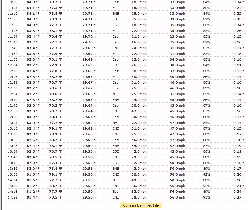
It's picking up down there now!


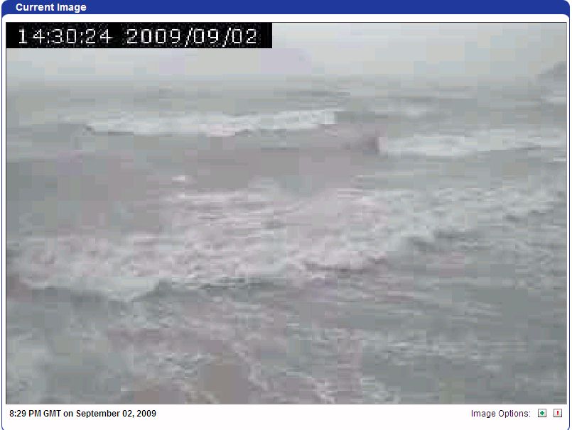
Here are the latest tabulations from Burro Beach:


[Edited on 9-2-2009 by Sharksbaja]

Johannes - 9-2-2009 at 11:51 AM

Hope you all in Mulege are safe. All the best

Hook - 9-2-2009 at 11:53 AM

In terms of Mulege, wasnt there some kind of catch basin that gave way during John? Is there still something upriver that can be overwhelmed and create the dreaded wall of water? Or can the arroyo now shed it gradually?

rpleger - 9-2-2009 at 11:53 AM

Marve...

Good luck to you and Cathy...Patsy and Grunt are now in El Rosaro at the BAJA BEST COFFEE bed and breakfast and are going to stay there until she can return home to clean up...I'm bringing lots of Fritos with me when I return next month from Oregon where I'm visiting with my brother.

JIMENA _ EAST CAPE

oldjack - 9-2-2009 at 11:54 AM

Now that the event has moved north of the East Cape... anyone there prepared to give a report on roads, water, elec, residential damage, etc??????

BajaNews - 9-2-2009 at 11:57 AM

HURRICANE JIMENA INTERMEDIATE ADVISORY NUMBER 20A
NWS TPC/NATIONAL HURRICANE CENTER MIAMI FL EP132009
1100 AM PDT WED SEP 02 2009

...CENTER OF JIMENA MOVING ALONG THE WEST COAST OF SOUTHERN BAJA
CALIFORNIA...

AT 1100 AM PDT...1800 UTC...THE CENTER OF HURRICANE JIMENA WAS
LOCATED NEAR LATITUDE 25.7 NORTH...LONGITUDE 112.3 WEST OR JUST
SOUTHWEST OF PUERTO SAN ANDRESITO MEXICO. THIS POSITION IS ALSO
ABOUT 60 MILES... 95 KM...NORTH OF CABO SAN LAZARO MEXICO AND ABOUT
220 MILES...355 KM...SOUTHEAST OF PUNTA EUGENIA MEXICO.

JIMENA IS MOVING TOWARD THE NORTH-NORTHWEST NEAR 13 MPH...20 KM/HR.
THIS GENERAL MOTION IS EXPECTED TO CONTINUE WITH A DECREASE IN
FORWARD SPEED DURING THE NEXT 24 TO 36 HOURS. ON THIS COURSE...THE
CORE OF JIMENA WILL BE NEAR OR JUST OFFSHORE THE WEST COAST OF THE
SOUTHERN BAJA CALIFORNIA PENINSULA THIS AFTERNOON...AND NEAR OR OVER
THE CENTRAL BAJA CALIFORNIA PENINSULA ON THURSDAY.

MAXIMUM SUSTAINED WINDS HAVE DECREASED TO NEAR 90 MPH...145 KM/HR...
WITH HIGHER GUSTS. JIMENA IS NOW A CATEGORY ONE HURRICANE ON THE
SAFFIR-SIMPSON SCALE. WEAKENING IS FORECAST DURING THE NEXT 24
HOURS...BUT JIMENA IS STILL FORECAST TO BE A HURRICANE WHEN IT
MOVES INLAND.

HURRICANE FORCE WINDS EXTEND OUTWARD UP TO 35 MILES...55 KM...FROM
THE CENTER...AND TROPICAL STORM FORCE WINDS EXTEND OUTWARD UP TO
140 MILES...220 KM. A FEW HOURS AGO...AN AUTOMATED STATION IN
CIUDAD DE CONSTITUCION MEXICO REPORTED SUSTAINED WINDS OF 67 MPH...
108 KM/HR...AND A WIND GUST OF 91 MPH...146 KM/HR AS THE CENTER OF
JIMENA PASSED TO THE WEST
.

[Edited on 9-2-2009 by BajaNews]

Natalie Ann - 9-2-2009 at 11:58 AM

Prayers - for all, especially those in Mulege.

nena

arrowhead - 9-2-2009 at 12:10 PM

I just pulled this off the satellite. It is 20 minutes ago. It shows Jimena is going to hit Mulege/Mag Bay dead center. The storm has not made the left hook turn yet.


BajaNews - 9-2-2009 at 12:13 PM

The debris of a building is seen after Hurricane Jimena passed through Puerto San Carlos in Mexico's state of Baja California, September 2, 2009. Hurricane Jimena made landfall halfway up Mexico's Baja California peninsula on Wednesday, slapping desert towns with howling winds and rain after drenching the Los Cabos resort area overnight. Jimena, a Category 2 storm, pummeled the peninsula's west coast with 100 mph (160 kph) winds and driving rain but had dropped considerably in force since the weekend when it blew into a highly dangerous Category 4 hurricane.
REUTERS/Henry Romero

jimena-psc001.jpg - 29kB

Russ - 9-2-2009 at 12:13 PM

Satillite servive comes and goes with the amount of rain falling. Love to post a photo but if I open a window or door I'd never be able to close it until the wind dies down a bit. Surf is between 4 to 6' near shore and breaking from onshore to a hundred or more yards out depending on shools and reefs. Wind ENE is between 35 & 48mph Baro is falling @ 29.71 now.
I don't understand the wind direction... Seems I should be out of the SE?? But even my plams say ENE? Appears we are almost thru a wet band of rain maybe slacking off before the really stron one hits. Jimena is SW of us now and I wouldn't hazard a guess as to whether it'll cross over the mountains or not. Predictions say not until she's north of us if then. Here's the latest Sat shot I have. Mulege River folks please don't be stubborn and wait for the next band of rain. The mountains appear to be getting it full on now.

Sat~9:2:09 11AM.jpg - 46kB

Mulegena - 9-2-2009 at 12:15 PM

Quote:
Originally posted by Hook
In terms of Mulege, wasnt there some kind of catch basin that gave way during John? Is there still something upriver that can be overwhelmed and create the dreaded wall of water? Or can the arroyo now shed it gradually?


A possibility only which has never been substantiated nor analyzed scientifically/geologically, as I've been informed. 24 inches of rain for 24 hours packs a whallop of water whether there were irrigation troughs in the arroyos or not, it would seem. Javier from Las Casitas remembers a flood 50 years ago with similar path and velocity as H. John. These things just happen in nature.

Tide chart for Sta. Rosalia/Mulege today and tomorrow:
High 12:27 pm today
Low 16:51 pm today
High 21:50 pm today
Low 04:50 am tomorrow

Thanks to everyone's continued positive thoughts. Maria

Cypress - 9-2-2009 at 12:16 PM

arrowhead, Ouch! It's looking like a lot of water will be coming down the arroyos.:no:

shari - 9-2-2009 at 12:17 PM

thank you russ...this is very valuable info for us over here...hope it clouds over soon here to beat the over 100 degree heat....we are cooking over here...wind feels like a santa anna too...northeast too. hang in there buddy

Bob and Susan - 9-2-2009 at 12:21 PM

holy cow!!!

you can't belive how much water and wind there is here!!!

BajaNews - 9-2-2009 at 12:23 PM

A family inspect their damaged office hit by Hurricane Jimena, in Puerto San Carlos, Baja California. Hurricane Jimena crashed Wednesday onto Mexico's Baja California peninsula, forcing thousands to seek shelter as it buffeted islands off the coast with high winds and heavy rain.
(AFP/Ronaldo Schemidt)

jimena-psc002.jpg - 27kB

bajajudy - 9-2-2009 at 12:23 PM

Quote:
Originally posted by oldjack
Now that the event has moved north of the East Cape... anyone there prepared to give a report on roads, water, elec, residential damage, etc??????

I have heard of no damage in this area. My friends in Los Barriles and Rancho Leonero reported not much wind, a good bit of rain.

Johannes - 9-2-2009 at 12:32 PM

Sharksbaja
I contacted wunderground.com and told them that their web site is contaminated. To all of you, if you do not have proper virus protection do not go to wunderground.com.
I am in WA state but my heart is in Baja. All the luck to you in BCS

[Edited on 9-2-2009 by Johannes]

Bob and Susan - 9-2-2009 at 12:34 PM

shari...prepare for punishment!!!

lots of water comming

shari - 9-2-2009 at 12:38 PM

uh...thanks susan...i think I'll go take some photos now before the deluge and get in the last swim.

crap...i opened that bloody wunderground...now what should i do?

Beachgirl - 9-2-2009 at 12:39 PM

To all of our Baja dear friends - we are sitting here in Sequim desperately hoping you are all going to be safe and ok. Any and all updates are like gold to us right now. Please take all measures to stay safe. Furnishings are replaceable...you guys are not.

Bajagypsy - 9-2-2009 at 12:42 PM

Stay strong everyone in Mulege, think of you all. Shari, hopefully the hurricane doesn't hit to hard.

rhintransit - 9-2-2009 at 12:51 PM

am waiting for word from Constitucion/Loreto area...anything yet?

Santiago - 9-2-2009 at 12:56 PM

Quote:
Originally posted by Bob and Susan
holy cow!!!

you can't believe how much water and wind there is here!!!


How the doxies doing? Mine hated storms.

lemons - 9-2-2009 at 12:58 PM

Hi - new here. I'm also wondering if anyone has updates on Loreto, my Dad is down there and he said he'd turn on his GPS tracker if they lost power and sure enough his tracker is on, but that's about all I know. Hoping everyone is okay.

virus

LaRibereña - 9-2-2009 at 01:00 PM

Yup, my AVG caught a bunch of stuff this morning. Let us know when we can access Wunderground again, please.

Bob and Susan - 9-2-2009 at 01:10 PM

the doxies HATE this

the wind is easily 50mph

the water is horizantal:o

stuff is flying all over the place

just lost the PACIFICO SIGN out back:o

i guess ill find it in the desert later:o

i thought this storm was supposed to turn!!!

arrowhead - 9-2-2009 at 01:14 PM

Quote:
Originally posted by Bob and Susan
the doxies HATE this

the wind is easily 50mph

the water is horizantal:o

stuff is flying all over the place

just lost the PACIFICO SIGN out back:o

i guess ill find it in the desert later:o

i thought this storm was supposed to turn!!!


The current satellite loop shows Jimena is now making the turn towards Asuncion. Unfortunately, this turn is making it loiter longer over the mountains behind Mulege.

Beachgirl - 9-2-2009 at 01:16 PM

Arrowhead, thanks for keeping is in the loop. No word at all from Mulege. Power must be out, people hunkered down. Any info is helpful.

JESSE - 9-2-2009 at 01:20 PM

Still can't figure out why theres more wind and rain now than last night in the middle of the Hurricane:?:

BajaNews - 9-2-2009 at 01:20 PM

.

ep200913_model.gif - 26kB

Bob and Susan - 9-2-2009 at 01:23 PM

its getting WORSE!!!

lots of wind and rain

Beachgirl - 9-2-2009 at 01:29 PM

Bob and Susan have you heard anything from anyone else in Mulege? Too quiet...

Barry A. - 9-2-2009 at 01:30 PM

Quote:
Originally posted by JESSE
Still can't figure out why theres more wind and rain now than last night in the middle of the Hurricane:?:


Looking at the "live" Pacific IR Loop, it looks to me like the eye has crossed over the land mass to the gulf side around Loreto, or close to it.. I don't believe that any of the "models" predicted that at this time--------we have a lot to learn about hurricane science, it would appear.

Barry

Bob and Susan - 9-2-2009 at 01:34 PM

no news from town and i'm NOT leaving:rolleyes:

WOW

we've seen some wind before but this tops it all

Bajagypsy - 9-2-2009 at 01:36 PM

Bob & Susan, hope everything turns out ok for you guys.

shari - 9-2-2009 at 01:42 PM

I just took a spin around town...will be the last for awhile...things got very nasty VERY fast...good thing I hit the store first for coke for those Cubas Gypsy told me to drink....whew.... it's like a white out with sand flying around..wind about 45 knots...no rain but a wall of it looks like it's getting close. We may lose our power...i saw the CFE guys putting their gloves on and getting into their truck....didnt get my last swim...dang....will do if there is a lull...lots of people on roofs tying ropes over them and nailing up plywood....looking pretty dismal...gonna make that drink now.

Bajagypsy - 9-2-2009 at 01:45 PM

Hang on Shari, glad you got home before it got to bad, drink drink drink, that is what this gypsy doctor orders!

pacside - 9-2-2009 at 01:50 PM

Quote:
Originally posted by Bob and Susan
no news from town and i'm NOT leaving:rolleyes:

WOW

we've seen some wind before but this tops it all


Bob and Susan,

Glad I was able to visit you as I can relate to your reports. Your place is quite sturdy so I'm sure you and your beautiful property will be just fine. Keep those cute little doxies inside so they don't blow away :wow:

How come you guys are on internet but folks in Mulege seemingly aren't able to log on? Unless they are too busy...

Stay safe and good luck to everyone.

Update from Playa Los Cerritos: Casa and caretaker are fine. Ocean made it up to within 6 feet of the dune...usually it is a football field length. Only problem is a leak from the roof where the plywood installation damaged it and a leak in one window...not too bad considering new construction and horizontal rains.

pacside

motoged - 9-2-2009 at 01:57 PM

Quote:
Originally posted by shari

crap...i opened that bloody wunderground...now what should i do?


Shari,
Check your U2U re: virus stuff.

Bueno suerte

Johannes - 9-2-2009 at 01:57 PM

Looks that the hurrrricane forse winds are going to hit Mulege. Looking on
<http://www.nhc.noaa.gov/refresh/graphics_ep3+shtml/203915.shtml?swath#contents>
The wind history looks like it is updating in realtime. Please be safe. All my wishes are with you.

<http://www.nhc.noaa.gov/refresh/graphics_ep3+shtml/203915.shtml?swath#contents>

its breaking up the link here the base, navigate to Wind History
<http://www.nhc.noaa.gov/graphics_ep3.shtml?5-daynl#contents>
[Edited on 9-2-2009 by Johannes]

[Edited on 9-2-2009 by Johannes]

[Edited on 9-2-2009 by Johannes]

shari - 9-2-2009 at 01:58 PM

pacside... I'm so happy for you and will gladly eat my words...is the bet still on who has worse damage? ...I'll let ya know when our dilapidated palapa spins off towards san roque island....we wanted a new one anyway.

I talked on the cell phone to some Chivato folks who were in the thick of it...they are all OK but raining and blowing HARD.

Juan always told me...ya just never know where they are gonna go.

BajaNews - 9-2-2009 at 02:01 PM

HURRICANE JIMENA ADVISORY NUMBER 21
NWS TPC/NATIONAL HURRICANE CENTER MIAMI FL EP132009
200 PM PDT WED SEP 02 2009

AT 200 PM PDT...2100 UTC...THE GOVERNMENT OF MEXICO HAS ISSUED A
TROPICAL STORM WARNING FOR THE BAJA CALIFORNIA PENINSULA NORTH OF
PUNTA EUGENIA TO SAN JOSE DE LAS PALOMAS ON THE WEST COAST...AND
NORTH OF BAHIA SAN JUAN BAUTISTA TO BAHIA DE LOS ANGELES ON THE
EAST COAST.


AT 2 PM PDT...2100 UTC...THE GOVERNMENT OF MEXICO HAS DISCONTINUED
ALL WATCHES AND WARNINGS FOR THE WEST COAST OF THE BAJA CALIFORNIA
PENINSULA SOUTH OF BAHIA MAGDALENA...FOR THE EAST COAST OF THE BAJA
CALIFORNIA PENINSULA SOUTH OF SAN EVARISTO...AND FOR MAINLAND OF
MEXICO SOUTH OF HUATABAMPITO.

AT 200 PM PDT...2100 UTC...THE CENTER OF HURRICANE JIMENA WAS
LOCATED NEAR LATITUDE 26.4 NORTH...LONGITUDE 112.3 WEST OR JUST
SOUTHEAST OF SAN BUENAVENTURA MEXICO. THIS POSITION IS ALSO ABOUT
ABOUT 60 MILES...100 KM...SOUTH OF SANTA ROSALIA MEXICO.

JIMENA IS MOVING TOWARD THE NORTH NEAR 13 MPH...20 KM/HR. A TURN
TOWARD THE NORTHWEST AND A DECREASE IN FORWARD SPEED IS EXPECTED
TONIGHT...WITH A TURN TOWARD THE WEST EXPECTED ON THURSDAY. ON THE
FORECAST TRACK...THE CENTER OF JIMENA WILL MOVE OVER THE CENTRAL
BAJA CALIFORNIA PENINSULA TONIGHT AND THURSDAY...THEN MOVE INTO THE
PACIFIC WEST OF BAJA CALIFORNIA LATE THURSDAY OR THURSDAY NIGHT.
DURING THE PAST FEW HOURS...THE CENTER OF JIMENA MADE LANDFALL
BETWEEN PUERTO SAN ANDRESITO AND SAN JUANICO MEXICO.


MAXIMUM SUSTAINED WINDS ARE NEAR 85 MPH...140 KM/HR...WITH HIGHER
GUSTS. JIMENA IS A CATEGORY ONE HURRICANE ON THE SAFFIR-SIMPSON
SCALE. ADDITIONAL WEAKENING IS EXPECTED DURING THE NEXT 24 TO
48 HOURS...AND JIMENA SHOULD WEAKEN TO A TROPICAL STORM TONIGHT.

HURRICANE FORCE WINDS EXTEND OUTWARD UP TO 35 MILES...55 KM...FROM
THE CENTER...AND TROPICAL STORM FORCE WINDS EXTEND OUTWARD UP TO
140 MILES...220 KM.

ESTIMATED MINIMUM CENTRAL PRESSURE IS 978 MB...28.88 INCHES.

AN INTERMEDIATE ADVISORY WILL BE ISSUED BY THE NATIONAL HURRICANE
CENTER AT 500 PM PDT FOLLOWED BY THE NEXT COMPLETE ADVISORY AT 800
PM PDT.

Sharksbaja - 9-2-2009 at 02:01 PM


Cypress - 9-2-2009 at 02:02 PM

The projected storm track is looking sorta weird.:o Never saw one cut a loop-de-do. There's a lot more rain inside the loop. A lot more rain!:(

Bob and Susan - 9-2-2009 at 02:03 PM

this is really bad...

i dont EVEN want to step outside:o

tttt.jpg - 10kB

BajaNews - 9-2-2009 at 02:04 PM

HURRICANE JIMENA DISCUSSION NUMBER 21
NWS TPC/NATIONAL HURRICANE CENTER MIAMI FL EP132009
200 PM PDT WED SEP 02 2009

THE CENTER OF JIMENA HAS MADE LANDFALL ON THE WEST COAST OF THE BAJA
CALIFORNIA PENINSULA WITH AN ESTIMATED INTENSITY OF 75-80 KT. THE
FORECAST TRACK KEEPS THE CENTER INLAND FOR THE NEXT 24-30 HR BEFORE
EMERGING OVER THE PACIFIC WEST OF BAJA CALIFORNIA. THE PACIFIC
WATERS ALONG THE TRACK ARE COLD...AND THE FORECAST VERTICAL WIND
SHEAR INCREASES SIGNIFICANTLY AFTER 24 HR. THUS...THE CYCLONE
SHOULD CONTINUE TO WEAKEN...BECOMING A TROPICAL STORM LATER
TONIGHT...A TROPICAL DEPRESSION IN 36-48 HR...AND A REMNANT LOW BY
72 HR. THERE IS A CHANCE THE CENTER COULD BRIEFLY EMERGE OVER THE
GULF OF CALIFORNIA TONIGHT...BUT IF THIS HAPPENS IT WILL LIKELY NOT
STAY THERE LONG ENOUGH TO AFFECT THE INTENSITY OF JIMENA.

THE INITIAL MOTION IS 350/11. ALL GUIDANCE AGREES THAT JIMENA
SHOULD DECELERATE AND TURN NORTHWESTWARD DURING THE NEXT 24 HR OR
SO AS HIGH PRESSURE BUILDS TO THE NORTH OF THE CYCLONE. THE BULK
OF THE TRACK GUIDANCE SUBSEQUENTLY MOVES JIMENA SLOWLY WESTWARD
INTO THE PACIFIC...A MOTION THAT SHOULD CONTINUE UNTIL THE SYSTEM
DISSIPATES. THE NEW FORECAST TRACK IS AN UPDATE OF THE PREVIOUS
FORECAST...NUDGED A LITTLE NORTHWARD DUE TO THE INITIAL POSITION
AND MOTION.

INTERESTS IN THE HURRICANE WARNING AREA ARE ADVISED THAT STRONG
WINDS WILL PRECEDE THE ARRIVAL OF THE CENTER BY SEVERAL HOURS...SO
PREPARATIONS NEED TO BE COMPLETED VERY SOON. REMEMBER NOT TO FOCUS
ON THE EXACT FORECAST TRACK SINCE DANGEROUS IMPACTS EXTEND SOME
DISTANCE FROM THE CENTER.

FORECAST POSITIONS AND MAX WINDS

INITIAL 02/2100Z 26.4N 112.3W 75 KT
12HR VT 03/0600Z 27.4N 112.7W 60 KT...INLAND
24HR VT 03/1800Z 28.1N 113.3W 45 KT...INLAND
36HR VT 04/0600Z 28.2N 114.2W 35 KT...OVER WATER
48HR VT 04/1800Z 28.1N 114.7W 30 KT
72HR VT 05/1800Z 28.0N 115.5W 25 KT...REMNANT LOW
96HR VT 06/1800Z 28.0N 116.5W 20 KT...REMNANT LOW
120HR VT 07/1800Z...DISSIPATED

dougf69 - 9-2-2009 at 02:07 PM

Bob and Sue;;; We are thinking of you.
I hope the people who bought our place won't put a hex on us.
Any sign of Dustin? Haven't heard from him for awhlie.

Cypress - 9-2-2009 at 02:07 PM

Bob and Susan, Good luck. It's looking like you all are in the "eye" of the storm.

Skipjack Joe - 9-2-2009 at 02:15 PM

Bob and Susan,

This is the time to use that pool. Do it.

What a memory that'll be.

Yahoooooo!!

I'm getting excited just thinking about it.

P.S. ... and you won't need a towel to dry off.

[Edited on 9-2-2009 by Skipjack Joe]

 Pages:  1  ..  4    6    8  ..  14