
ftrphb - 7-4-2024 at 10:35 PM
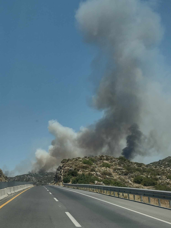
East of Tecate, just west of the wind farm there was a fire. Good size fire. The smoke was blowing onto the wind farm. I saw it from the window of
a plane on 7-1-24 Any idea what it was?
Maderita - 7-4-2024 at 11:53 PM
That was almost certainly the McCain 4 fire in the USA. It started on July 1. It burned 1,595 acres
https://www.nifc.gov/nicc-files/sitreprt.pdf scroll to page 4
The NASA - FIRMS fire map doesn't show any fires on the other side of the border between La Rumorosa (wind turbines) and El Hongo to the west. I
happened to be on the FIRMS website earlier today to check on northern Baja California due to the extreme heat and fire danger.
https://firms.modaps.eosdis.nasa.gov/usfs/map/#d:7days;l:fir...
Maderita - 7-5-2024 at 04:27 PM
A new fire started this afternoon approx. 2:00 PM on the carretera cuota 2D, km108 east of Tecate, near Rancho Bancheti. Fires along highway 2 and 2D,
between Tijuana and La Rumorosa, are frequent.
edit to add a PSA:
For those who are interested in the NASA-FIRMS imagery, with near-real time satellite data, I've added a screenshot. It is a valuable tool to become
familiar with. 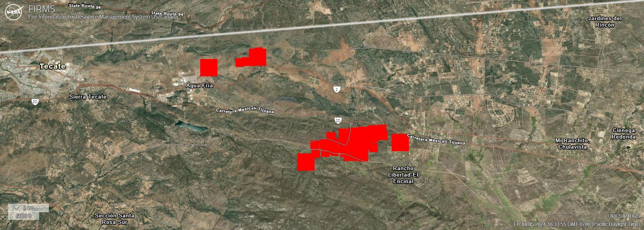
Wind maps, such as, https://www.windy.com/ are useful to predict wind direction and speed. From my PC at home, I am able to advised numerous ranchers and wilderness
enthusiasts, providing advance warnings for evacuation.
https://firms.modaps.eosdis.nasa.gov/usfs/
[Edited on 7-5-2024 by Maderita]