Does anyone have the grid coordinates for the mine at Huerfanito? I have tried to find the mine on Google Earth and just cannot find it.
Many thanks,
PablitoDavid K - 7-10-2024 at 03:53 PM
I am not familiar with any mine at El Huerfanito... Can you provide more details (type of mine, distance from El Huerfanito, etc.)?
Thank you!
There is placer gold mined, on and off, in Arroyo Miramar (to the south) and onyx was mined to the west at El Mármol and to the south at San Judas
(near Okie Landing). Slate or ? was mined closer to Puertecitos, north of El Huerfanito, in Arroyo Los Heme.
Los Heme: 30.2615, -114.6700
Miramar: 30.0518, -114.6237
San Judas: 29.9926, -114.5750
El Mármol: 29.9689, -114.8072 Tioloco - 7-10-2024 at 04:22 PM
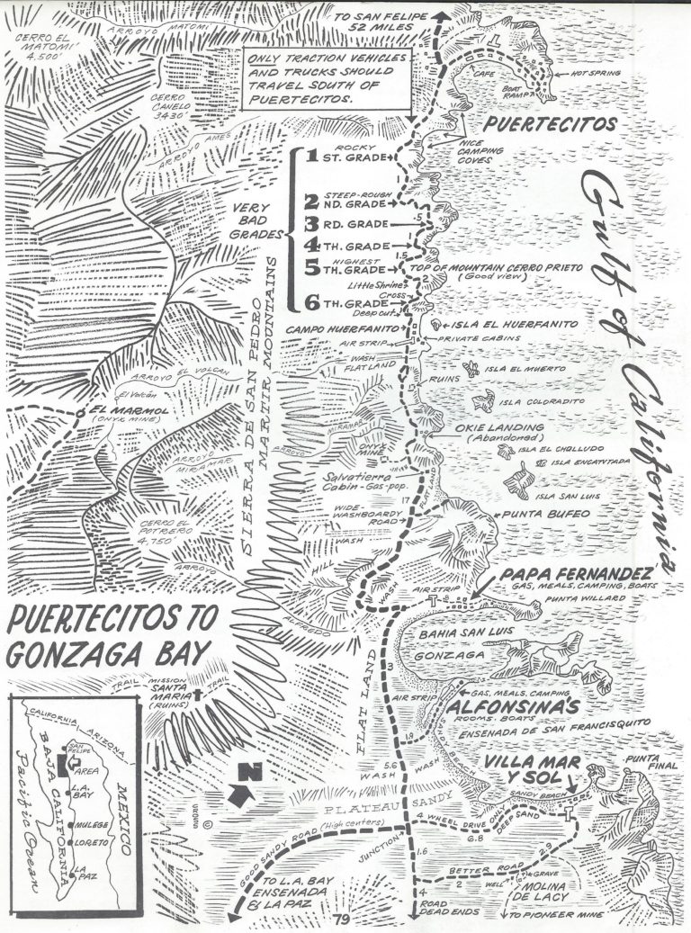
Pablito, the island or.... Puertecitos----->Gonzaga Bay area?
[Edited on 7-10-2024 by Tioloco]Pablito1 - 7-10-2024 at 05:38 PM
In the 1960s early 70s there was an onyx mine a little to the south and a very few miles west of that big cantina that burned down at Huerfanito. I
was at the mine 2 times I think. I have a beautiful piece of onyx from that mine. When they put in the pavement a lot of the small roads were
destroyed. Tioloco - 7-10-2024 at 06:16 PM
In the 1960s early 70s there was an onyx mine a little to the south and a very few miles west of that big cantina that burned down at Huerfanito. I
was at the mine 2 times I think. I have a beautiful piece of onyx from that mine. When they put in the pavement a lot of the small roads were
destroyed.
Big cantina? Any details on that? When did that close or burn?
That whole area is fascinating with all the old abandoned homes and foundations left over from an era gone by.
[Edited on 7-11-2024 by Tioloco]Pablito1 - 7-10-2024 at 08:03 PM
Tio, when you were headed south and came down that that last hill there was a turn off that went to the beach and cantina. The cantina was a sort of
large wooden building and it burned down probably around 1970-71 or so. It never reopened. I knew the people there but can't remember their names.Tioloco - 7-10-2024 at 09:27 PM
Gracias Pablito. Running thru there tomorrow morning, will look around. David K - 7-11-2024 at 07:20 AM
Pablito, the onyx mine is San Judas... see my reply above for the exact GPS.
Directions from the highway:
San Judas Onyx Mine west of Hwy. 5, access turnoff at Km. 118.5. There's a gap between the end of the guardrail and the white curb after. Go to the
right between those two. GPS here is: 30° 0.140'N, 114° 33.950'W (Hwy. 5 road) You will be on the older or detour road just a bit, going southerly
~0.5 mile, then fork west towards the mountain along or on the ditched runway, and come to the west end of the old airport runway ~0.9 mile from the
highway at: 29° 59.581'N, 114° 34.375'W (San Judas). On Google Earth you can see the run-up pad at this point. The ruins of some small buildings or
homes are just 600 feet north and the onyx was quarried just 500 feet beyond (it appears).
Gracias Pablito. Running thru there tomorrow morning, will look around.
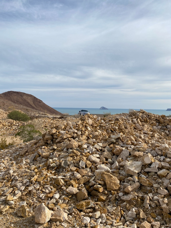
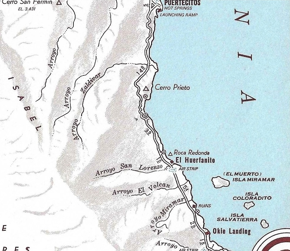
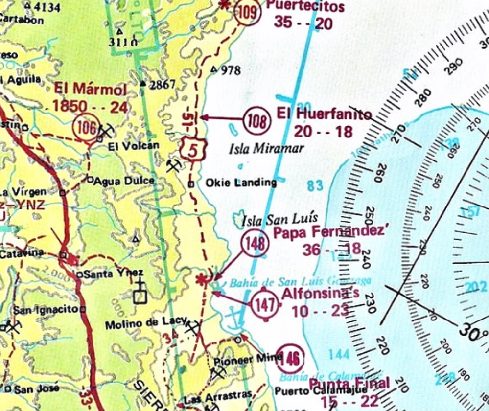
The campo of El Huerfanito was called Nacho's for a number of years... Nacho's El Huerfanito. It is on the shore opposite the island, Isla El
Huerfanito (Little Orphan Island). Today, that is 0.4 mile east of Km. 103.
In 2017, there was just some poor condition palapas for camping.
Pablito1 - 7-11-2024 at 08:37 AM
David, that San Judas place may be the mine but I thought that it was closer to Huerfanito. For sure a couple of years have passed and maybe I don't
remember exactly.
Thanks and Regards David K - 7-11-2024 at 08:46 AM
David, that San Judas place may be the mine but I thought that it was closer to Huerfanito. For sure a couple of years have passed and maybe I don't
remember exactly.
Thanks and Regards
That old road, at 10 mph max, made it hard to remember distances.
That San Judas mine was shown on the 1970 Cliff Cross Baja map as 'onyx mine' just past Okie Landing:
Pablito1 - 7-11-2024 at 09:43 AM
That map shows the place.
Any way what got me on this subject was that I was remembering a trip and was at Papa Fernandez camp. Papa asked me to go to San Felipe because he was
out of beer, soda pop and water in the cantina. So on Saturday me and a couple of young guys went to town and told Chi Chi and Tito the situation. On
the way back my pick-up was loaded with supplies plus the people from that mine were riding with me. The people had been to San Felipe for some
reason. When we arrived at the mine there was a big surprise in that the chickens had ran out of water so they jumped up on the water barrel which was
an open top barrel, feel into the water and died.
So I was wondering about the location of this mine.
Sorry for the long post.Tioloco - 7-11-2024 at 09:06 PM
Pablito, thank you for the input. Cool story. Things have changed but still have some of that old charm still. Okie Landing is an interesting place
too
Have any info on Salvatierra Cabin?
[Edited on 7-12-2024 by Tioloco]David K - 7-12-2024 at 08:56 AM
Yes, thank you for a refreshing topic of discussion, Pablito1. Also, for the chicken story.
Salvatierra (with a cabin, gas, and pop named after the offshore island) was (as I recall) the business created by the man who had the pick and wheel
barrel doing repair work on the road.
*The 1975 AAA guide has: "Campo Salvatierra (Mateo's Place), a camping spot in an arroyo near the beach where gasoline and refreshments are
available". It was 13.3 miles south of El Huerfanito (Nacho's Camp)/ 33.4 miles from Puertecitos.
*The 1979 AAA guide has Campo Salvatierra as 33.5 miles south of Puertecitos and abandoned.
*The 1991 AAA guide says it is 35.1 miles south and the same abandoned condition.
Pablito1 - 7-12-2024 at 04:06 PM
I can't add anything about Campo Salvatierra. The guy that I remember repairing the roads was always near the hills. Sometimes he was working and
sometimes only his tools and wheel barrow was there. I always left him some money.
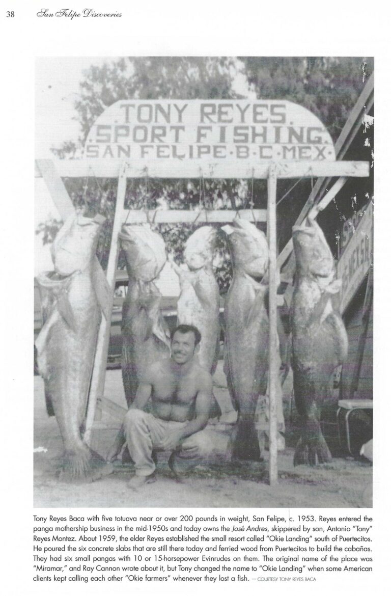
I thought that Tony Reyes was the person that started Okie's Landing. At least I was told that he had put in that cement slab that had the palapa
shade.
And speaking of that shade one day around 1971-72 there were 3 men there that I did not know. They had 16 turtles under the shade and were waiting for
a truck to come and haul them to somewhere.
Remember that big pile of tartuava heads at Okies. But those piles of big heads were at all the camps in that area.
Interesting time but it's long gone and remember "el reloj no vuelve atras" or "the clock doesn't turn backwards".
Regards PabloDavid K - 7-13-2024 at 07:59 AM
I can't add anything about Campo Salvatierra. The guy that I remember repairing the roads was always near the hills. Sometimes he was working and
sometimes only his tools and wheel barrow was there. I always left him some money.
I thought that Tony Reyes was the person that started Okie's Landing. At least I was told that he had put in that cement slab that had the palapa
shade.
And speaking of that shade one day around 1971-72 there were 3 men there that I did not know. They had 16 turtles under the shade and were waiting for
a truck to come and haul them to somewhere.
Remember that big pile of tartuava heads at Okies. But those piles of big heads were at all the camps in that area.
Interesting time but it's long gone and remember "el reloj no vuelve atras" or "the clock doesn't turn backwards".
Regards Pablo
Well, with maps, photos and old books we can look back in time.
I remember Okie Landing when it wa sactive in the 1960s. I don't think we stopped there or for very long. I think they used a cave for ice and fish
storage? When I was 16 and driving myself in 1974 (and after) it was abandoned, as I recall.
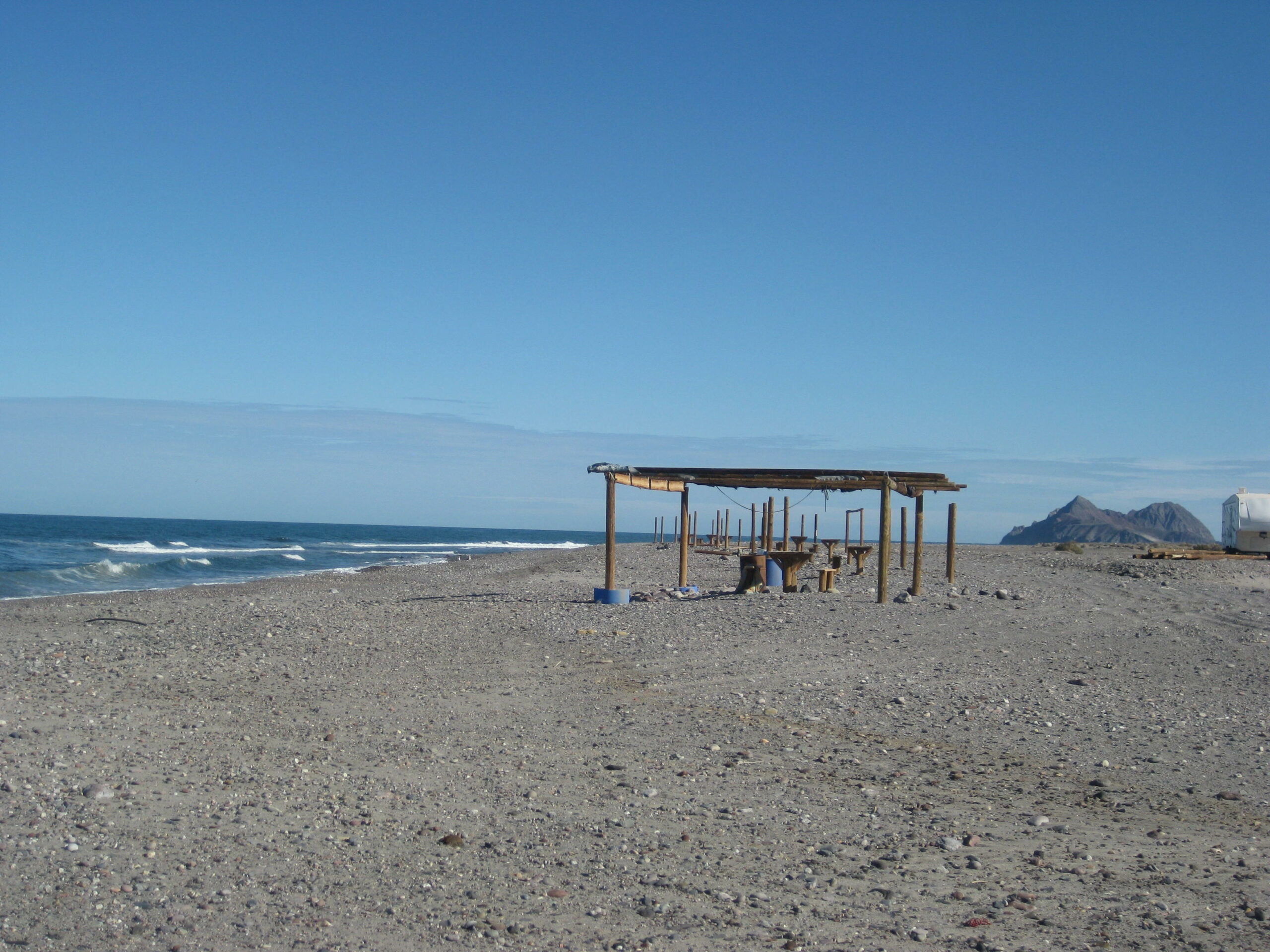
Here are photos I took of the concrete floors of the Okie Landing cabins:
2011
2007
Interesting.......
AKgringo - 7-13-2024 at 08:07 AM
On all of my trips, I try to find a road or trail that I have not explored before. Coincidentally, I found those old slabs on my way north at the
end of April!
I was wondering what the story was about that spot.
Okie Landing on Maps
David K - 7-13-2024 at 08:38 AM
On the 1962 Howard Gulick/ Lower California Guidebook Map
On the 1967 Automobile Club of Southern California Map
On the 1970 Cliff Cross Map
On the 1975 Arnold Senterfitt Airports of Baja California Map
On the 1975 Baja California Guidebook Map
On the 1975 Auto Club Map
[Edited on 7-13-2024 by David K]Pablito1 - 7-13-2024 at 11:13 AM
David, you mentioned that at Okie's there was a cave that they kept ice and fish in. and Papa Fernandez camp there was also a similar set-up but I
never knew where it was.
At Papa's there was a door on this cave. In the mid to late 1960s a man somehow got locked in that cave and died. I think his name was Rodrico.
I had a friend [RIP Ron] that was at the camp when the accident happened and he told me about it. I never knew Rodrico but met his family later.David K - 7-13-2024 at 12:14 PM
David, you mentioned that at Okie's there was a cave that they kept ice and fish in. and Papa Fernandez camp there was also a similar set-up but I
never knew where it was.
At Papa's there was a door on this cave. In the mid to late 1960s a man somehow got locked in that cave and died. I think his name was Rodrico.
I had a friend [RIP Ron] that was at the camp when the accident happened and he told me about it. I never knew Rodrico but met his family later.
It was something I had heard of or read about... It very well could be your Papa Fernandez' story...? If i find it, I will share.
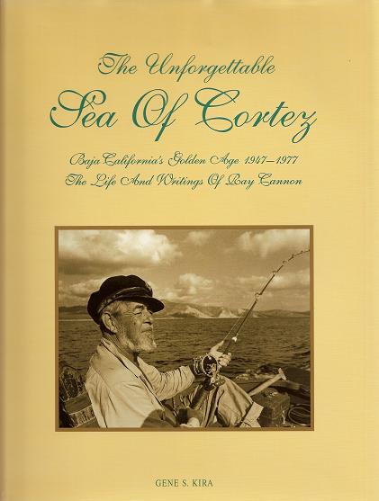
So much can be found in Gene Kira's wonderful book about the history of Ray Cannon and his Sea of Cortez, plus history of the 'golden age' of Baja...
1947 to 1977:
Eureka, see caption below photo...
David K - 7-13-2024 at 12:42 PM
From Gene Kira's book, The Incredible Sea of Cortez. Pablito1 - 7-13-2024 at 02:13 PM
That is great information. I had been informed by a very reliable source that Tony had put in those pisos.
Also I want to thank you for posting those beautiful pictures of Okies. I made almost the same shot even down to those rocks in the foreground.
Thanks. PabloDavid K - 7-13-2024 at 06:17 PM
Hi David...Took a look in my flight logs (in the way back machine)....for Turqoise Mine....Pretty close...
29 34.361 N
114 22.036 W
Hi Patty.
That is the road to La Turquesa Canyon, and up to Highway One (for 4x4s). It passes the green pools and turquoise mine.
Here is the mine as it was in a 1970 Baja Guide (by Cliff Cross):
Las Arrastras is now the location of Coco's Corner
[Edited on 7-15-2024 by David K]4x4abc - 7-15-2024 at 10:00 AM
closes mine to Huerfanitos is the Miramar mine
on the Gulick map
I remember when it was last active it had a nice road branching off from the highway
there was either a guard or a gate
a 1909 Pila is up Arroyo Miramar
David K - 7-15-2024 at 02:06 PM
Yes, the Miramar placer mine is old. Recent flash floods have erased past diggings. 'bajarik' has YouTube episodes filmed there and you can read about
it in his book, The Gold Mines of Northern Baja by Jens Tobias (Rik's pen name).