As most of you can guess, I have been anxious to return to the peninsula. My most recent trip was a friends & Nomads group trip to Mission Santa
María, in March of 2022 https://vivabaja.com/msm2022/
One of my newer friends, who I met through association with Baja Bound's Geoff, is Dave W. Dave and I co-manage the Toyotas in Baja Facebook group, he
owns a Tundra and 4Runner. Dave likes the kind of places I also like to visit (history and geology sites). Last weekend (May 10-12, 2025), we did a
whirlwind tour around northern Baja in order to see some interesting (to us) places. For me it would be a revisit to many sites I have not seen since
2017, when I was researching for the Baja Bound Interactive Map https://www.bajabound.com/map/ and how I was able to produce my Road Guide https://vivabaja.com/baja-bound-road-guide/ and Guide Maps https://vivabaja.com/davids-2018-maps/. For Dave, it would be the first time he would see most of these places. His passion for Baja had been
surfing and off-road racing. Dave was pretty important with the Mag 7 Pit Team.
We reached the border just before 8 am, Saturday. The U.S. has officers stationed on each southbound lane and there was a backup, but we moved
quickly. Things were different than in 2022 with a new building and lane changes. Be sure to be in the right lane, to get your FMM. While there was an
exit to go over to the building by the giant flagpole, prior to the electronic gates, Dave had a quick route to do that. First, we passed the gates,
then we got waved over for an inspection (Dave's Tundra has a shell and it looks loaded with camping gear, etc.). The inspection was quick, and we
were 'released'. Just a few feet from the parking area inspection area, we pull off to the right where new lanes (not used other than for parking)
merge with the existing ones and turn northward to park.
We walk to the north side of the building (construction going on) and quickly find the INM kiosk, present passports, and get the free FMM (good for 7
days or less). The text on the forms is small so bring reading glasses if you need them. We were back in the Tundra in just twelve minutes.
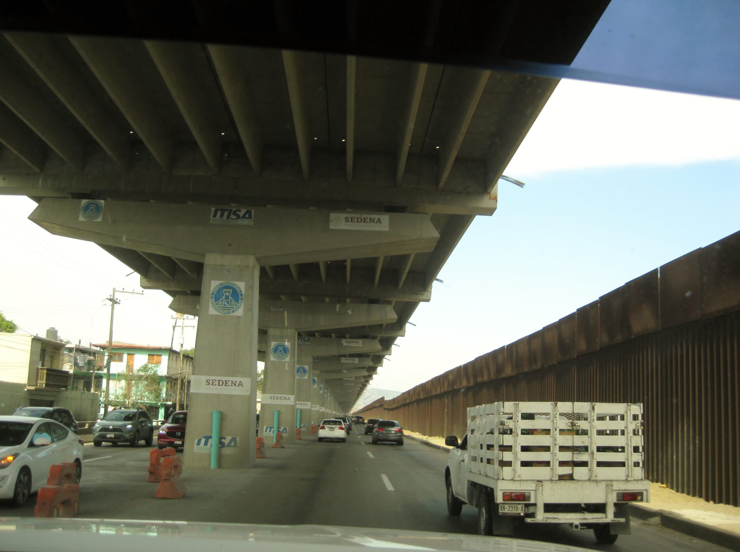
Leaving the border crossing and getting to the street along the border was easy. The new thing about the route is they are building a double deck or
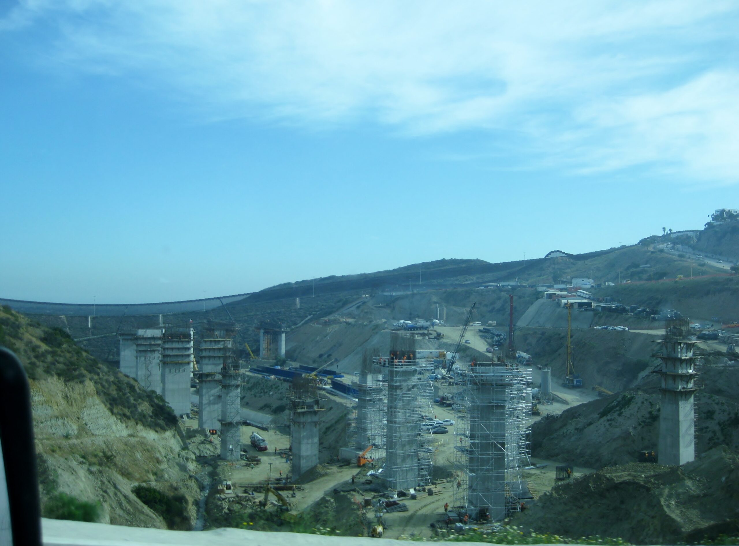
raised roadway above the original. Where the road joins in with the 1-D from downtown Tijuana is quite an elaborate project in the canyon where the
road was washed out and traffic squeezed to two lanes. No more, we flew freely into the other roadway then out towards Playas de Tijuana and the first
toll booth.
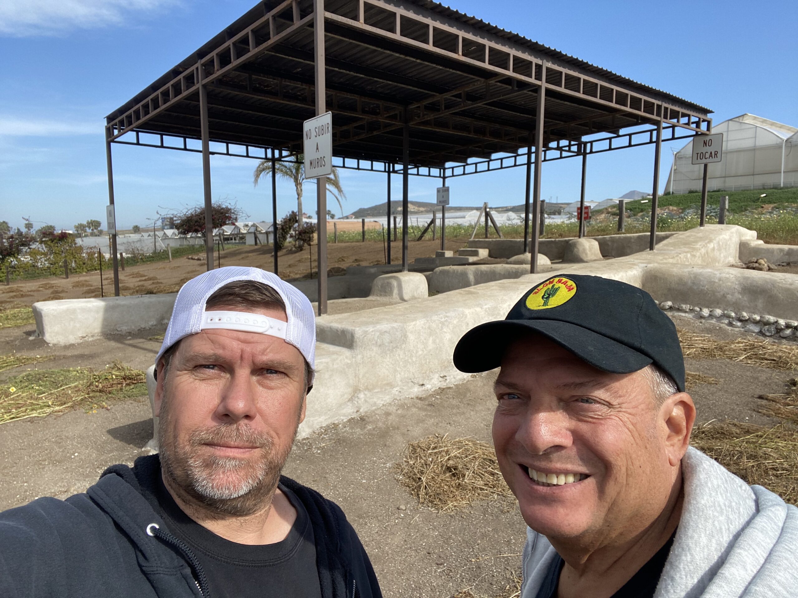
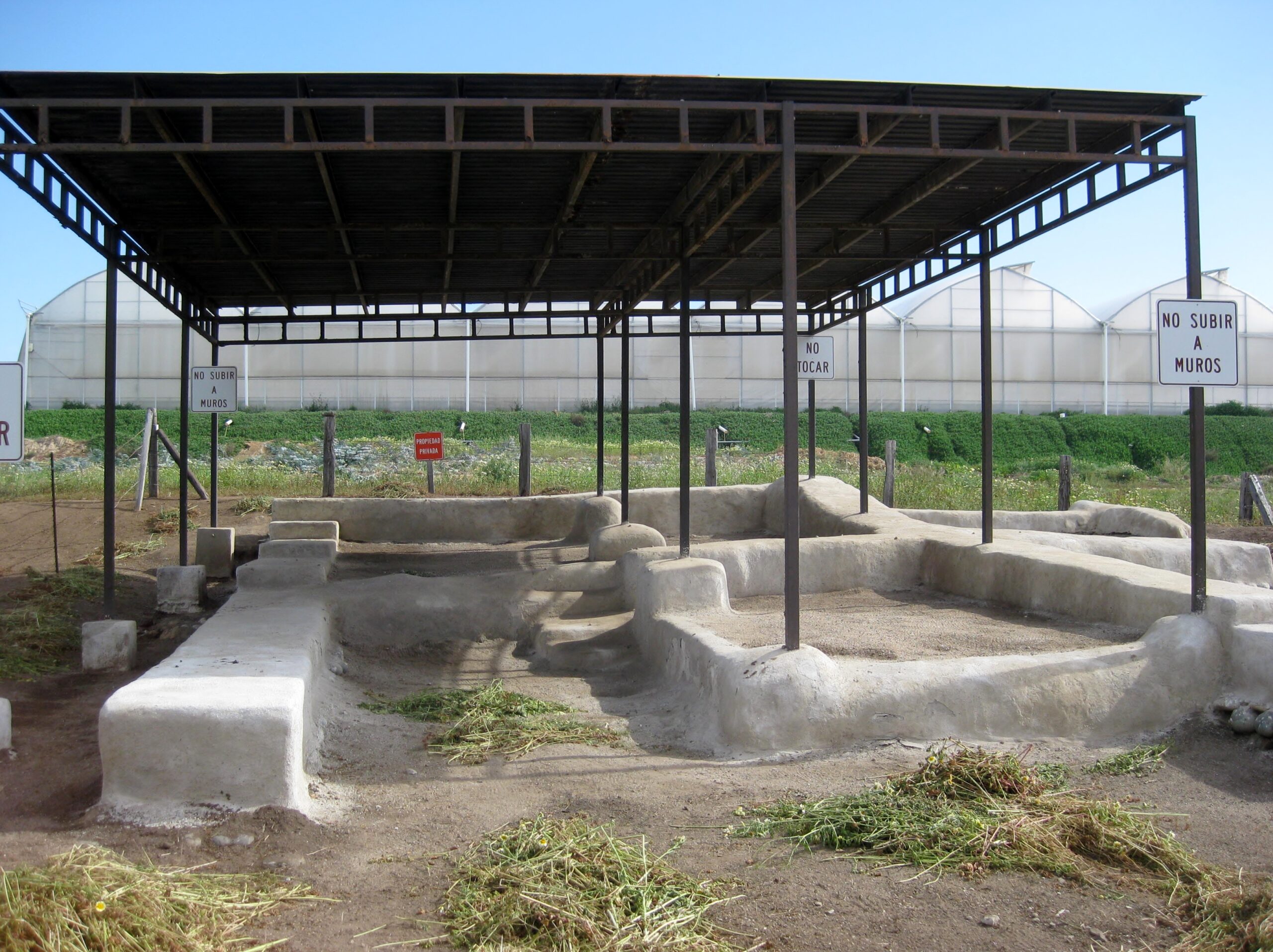
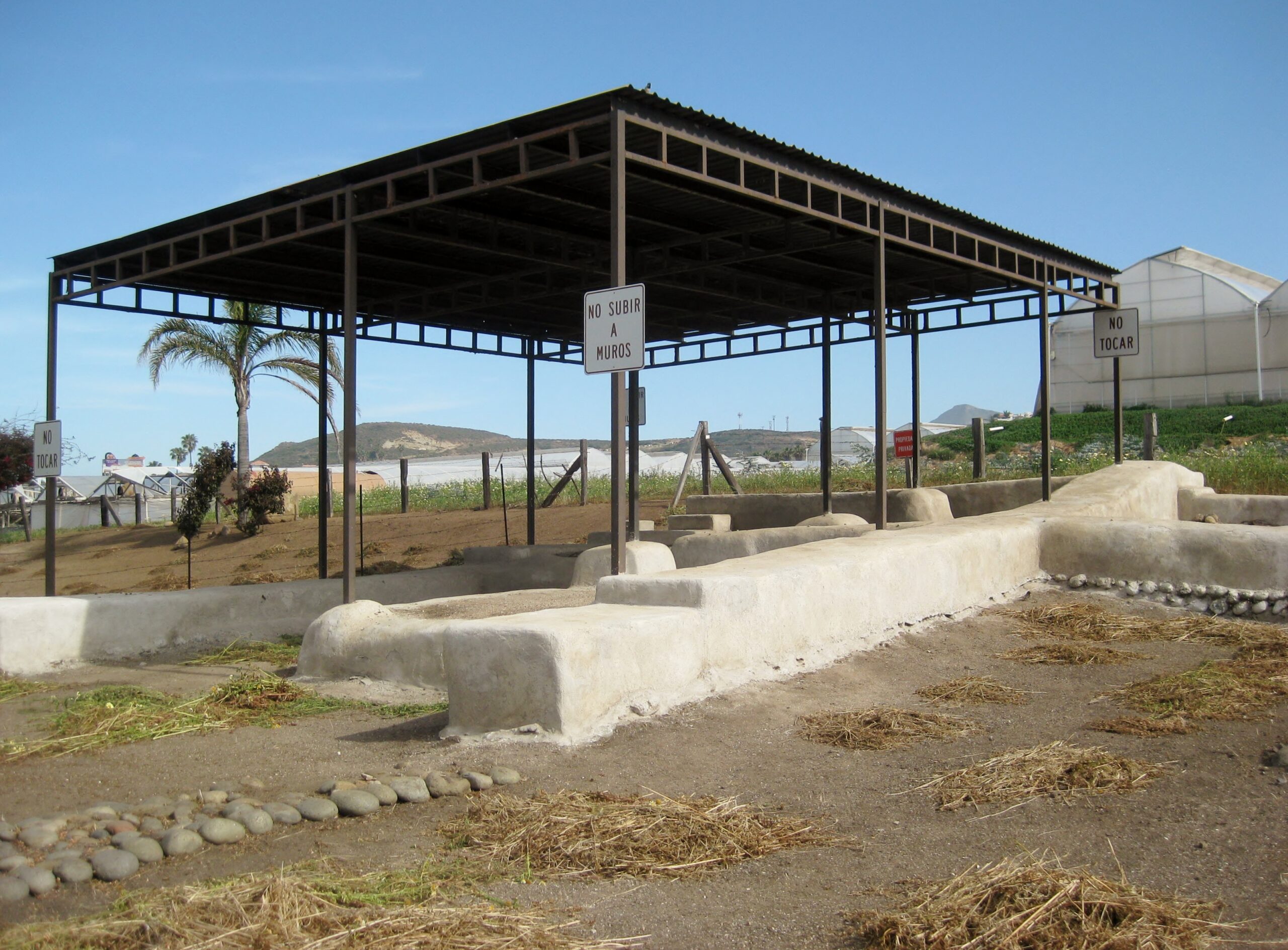
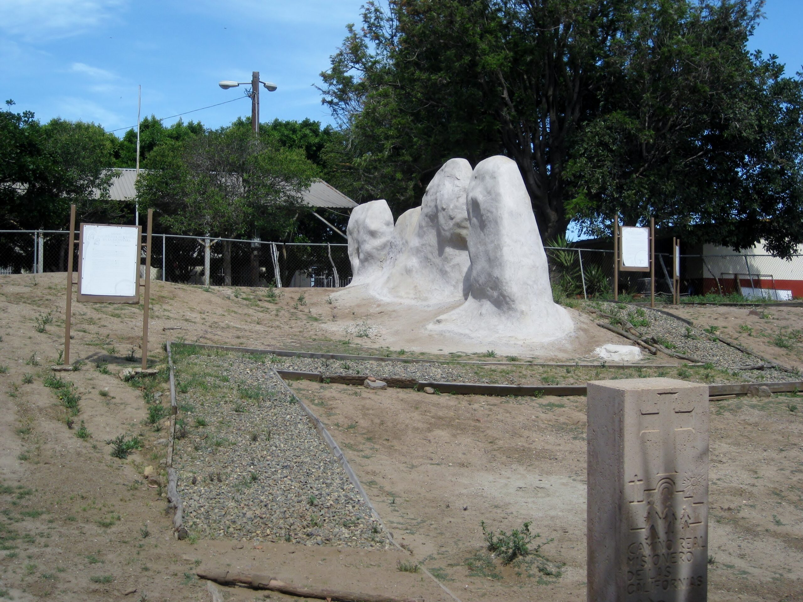
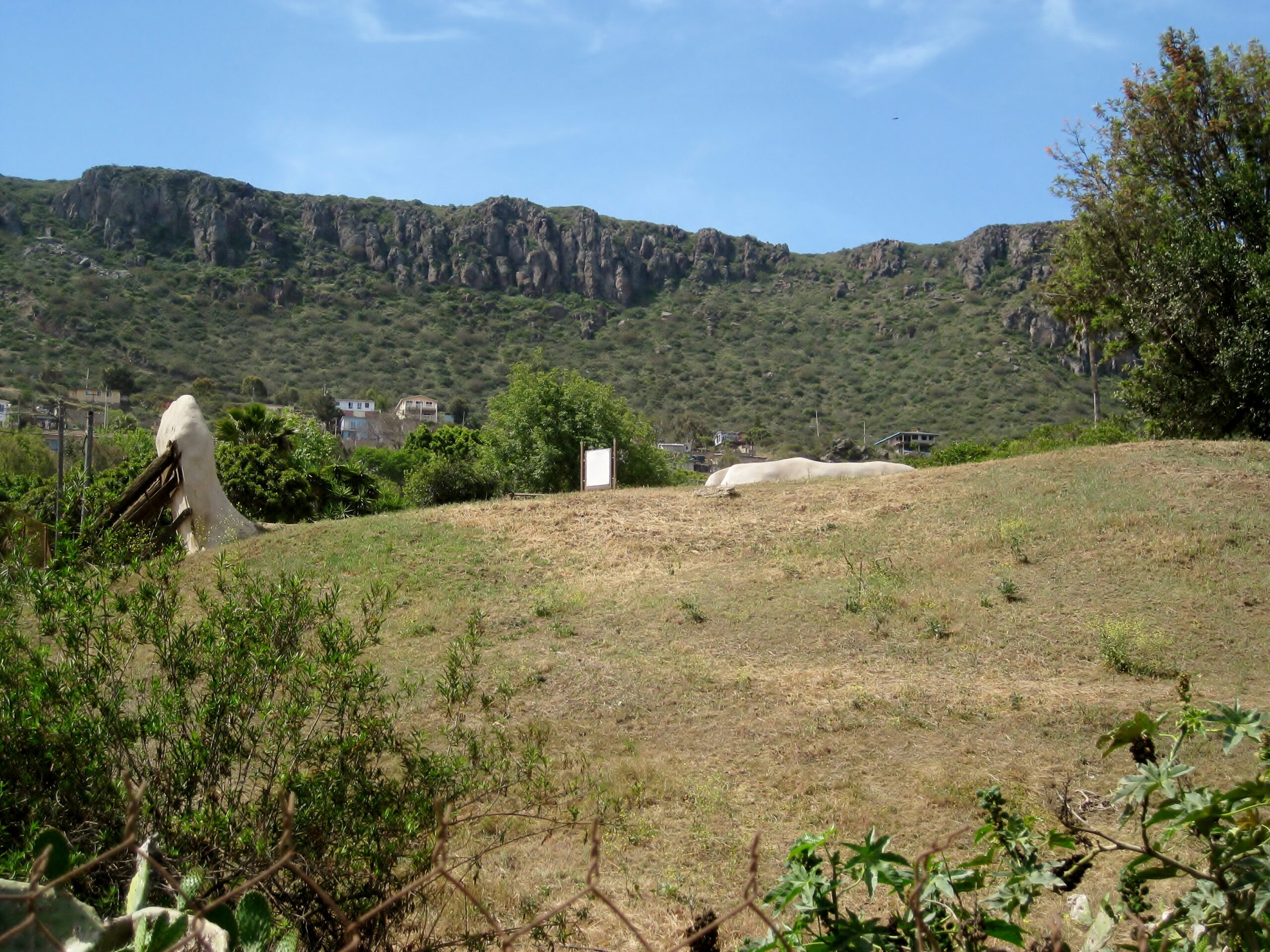
Mission El Descanso was the first site, accessed off the free road, then drive under the toll road on a dirt street, for 1/2 mile. Park by the church
and walk behind the church where the awning-covered mission foundations are located.
Descanso is a bit of a confusing story to tell. The mission in this area was originally established about 1810 as a new location for Mission San
Miguel (the mission in the town of La Misión) after floods destroyed the croplands there. After about 4 years, Padre Tomás Ahumada returned to the
previous site. His Descanso mission was called 'San Miguel la Nueva' and it was located on the south edge of the Descanso valley, where a cemetery is
today.
The site with the awning overhead was actually a new mission founded by Padre Felix Caballero, in 1830. Of course, Mexico won their independence nine
years earlier, so Descanso is not a 'Spanish mission', just one created by a rouge Dominican, one of a few who were allowed to remain in Baja
California to continue to 'serve' the Indians. More confusion comes when the year of the first Descanso mission (San Miguel la Nueva) was unpublished
when Peveril Meigs wrote is great work on the Dominican missions, in 1935. Meigs guessed Descanso was established in 1817. Information signs and many
books written after Meigs continue the 1817 guess-date rather than the (1960 published) 1810 date. That, and the fact that we are seeing two different
projects in this valley. Meigs thought the adobe remains on the edge of the valley was a fort, not Ahumada's moved San Miguel mission.
I wrote the newer and more accurate history in my book and in this article: https://www.bajabound.com/bajaadventures/bajatravel/el_desca...
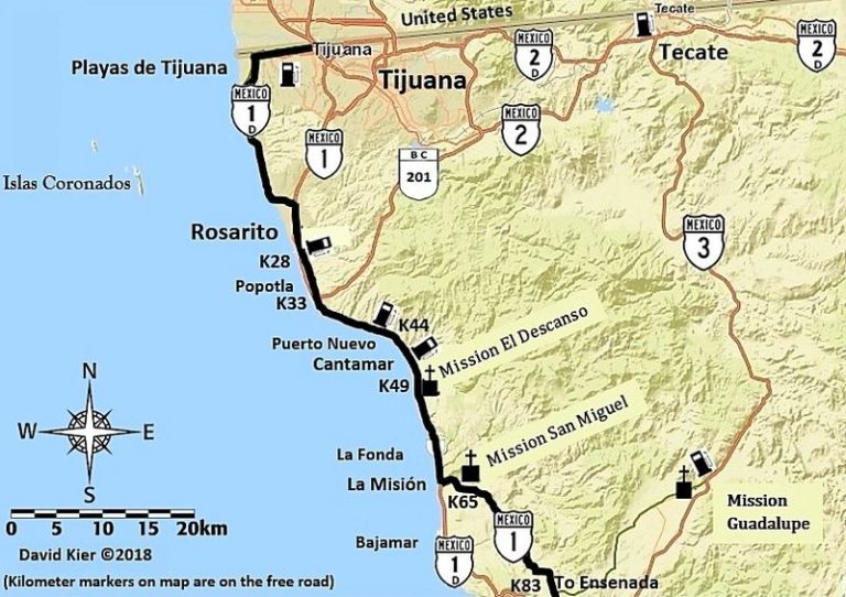
Map of the Descanso & San Miguel mission area:
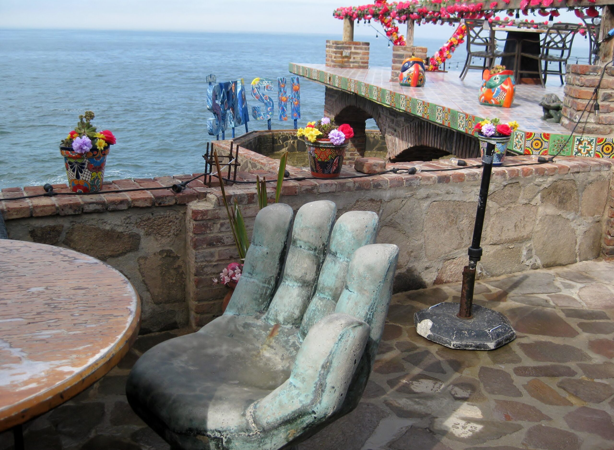
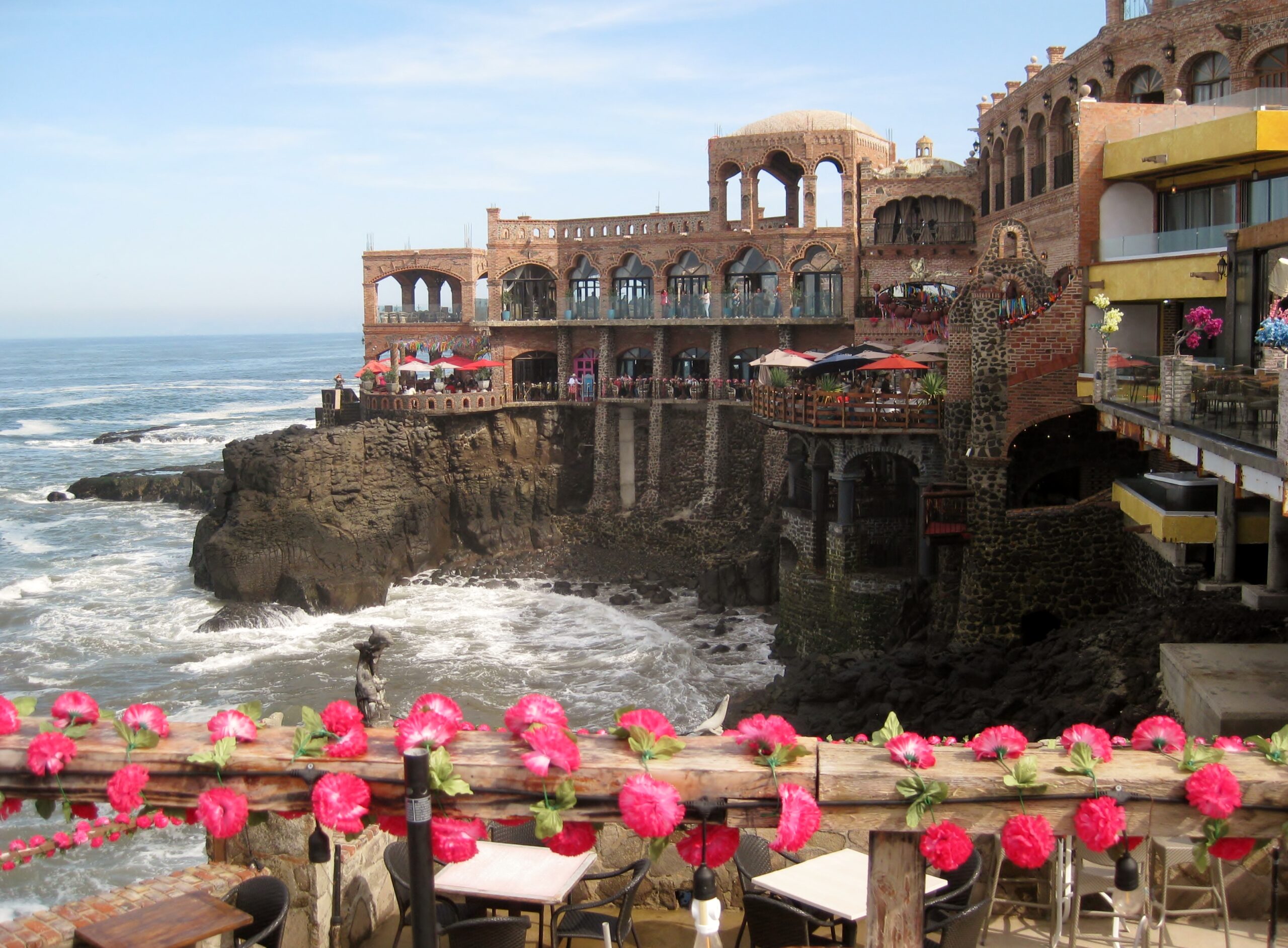
Next, we went to Splash, for breakfast. I had never been, and it was pretty amazing, above the rocks and Splash was a great name! We both had the
machaca and eggs with OJ. It was excellent!
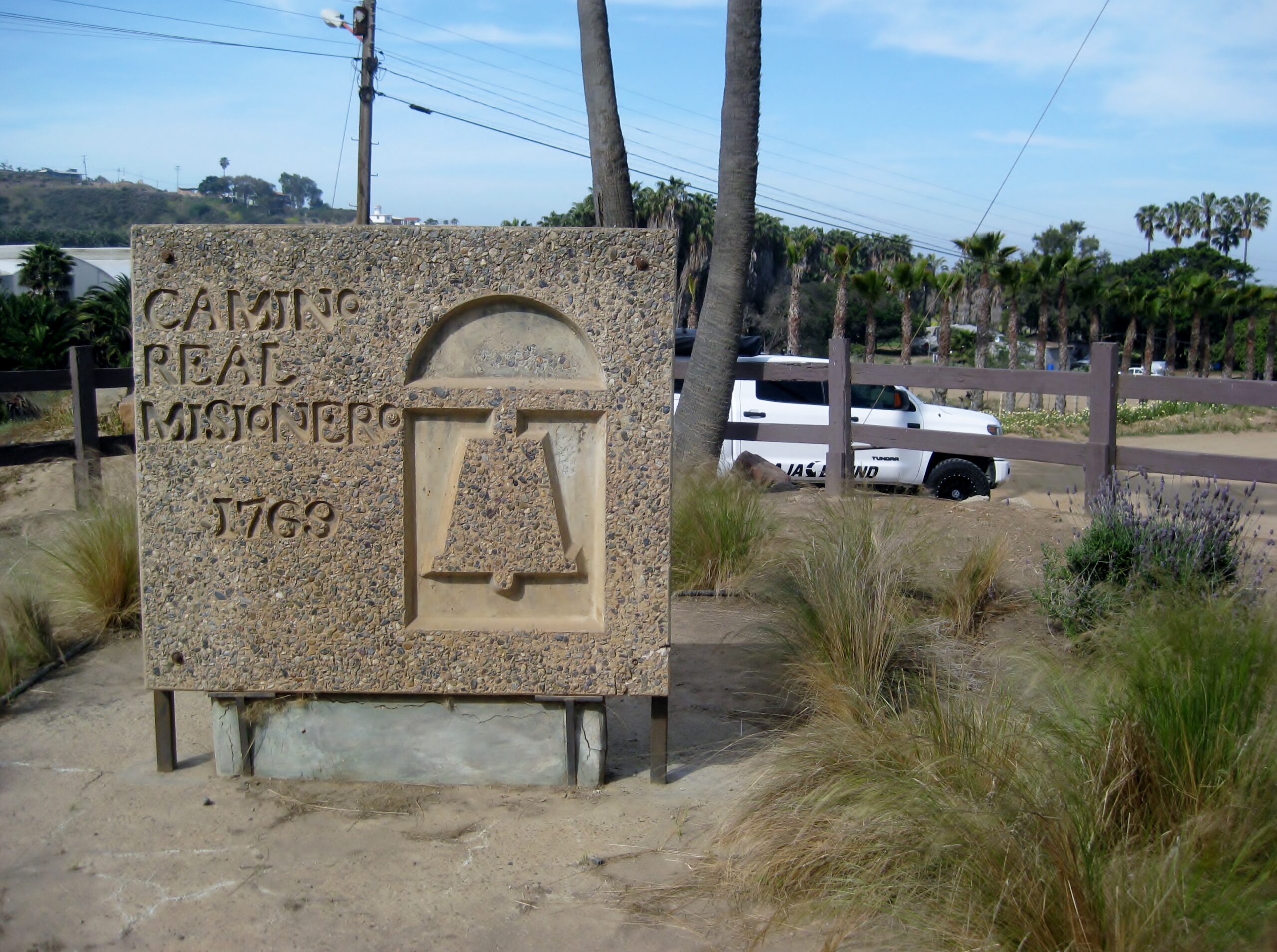
On south (on the free road) we next went to La Misión to see Mission San Miguel. It is in/ next to the school, on the left as you enter the main
town. It was a Saturday, so there was no school and the mission is fenced with a locked gate. We took photos through the fence. More on this mission,
in my article: https://www.bajabound.com/bajaadventures/bajatravel/la_misio...
The free road on south to Ensenada was a very nice, scenic drive and it wasn't long before we were in Ensenada, passing through town with ease. The
bad traffic began at Maneadero, just after the La Bufadora junction. The road narrows from 4 to 2 lanes in town.
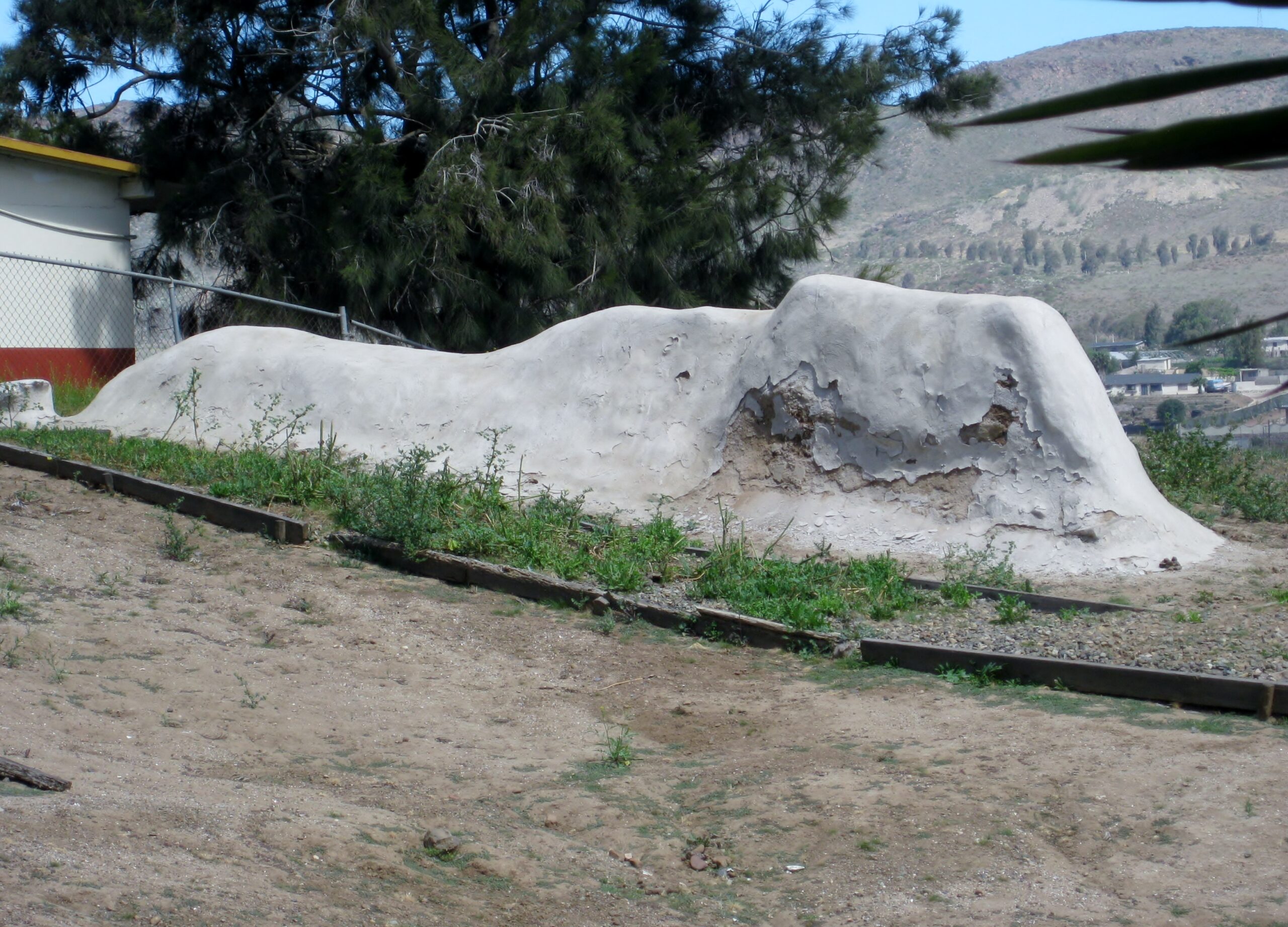
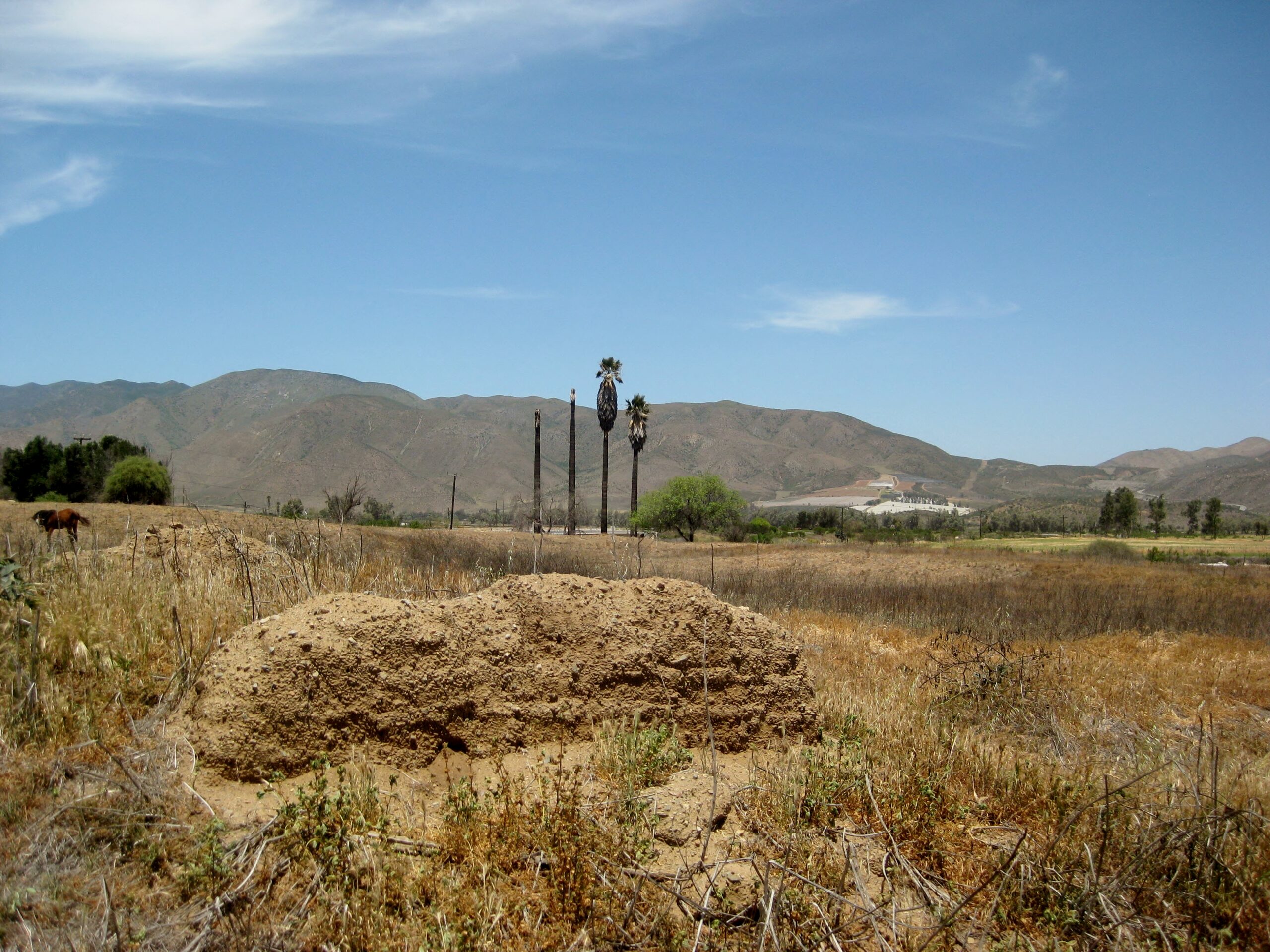
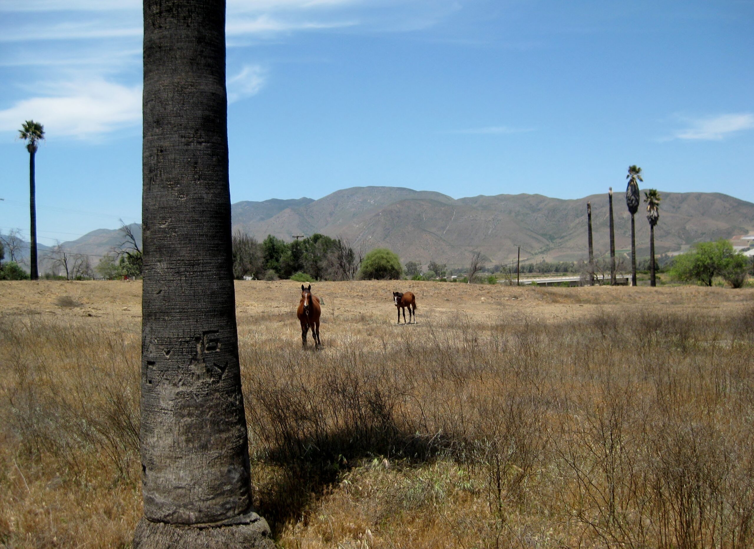
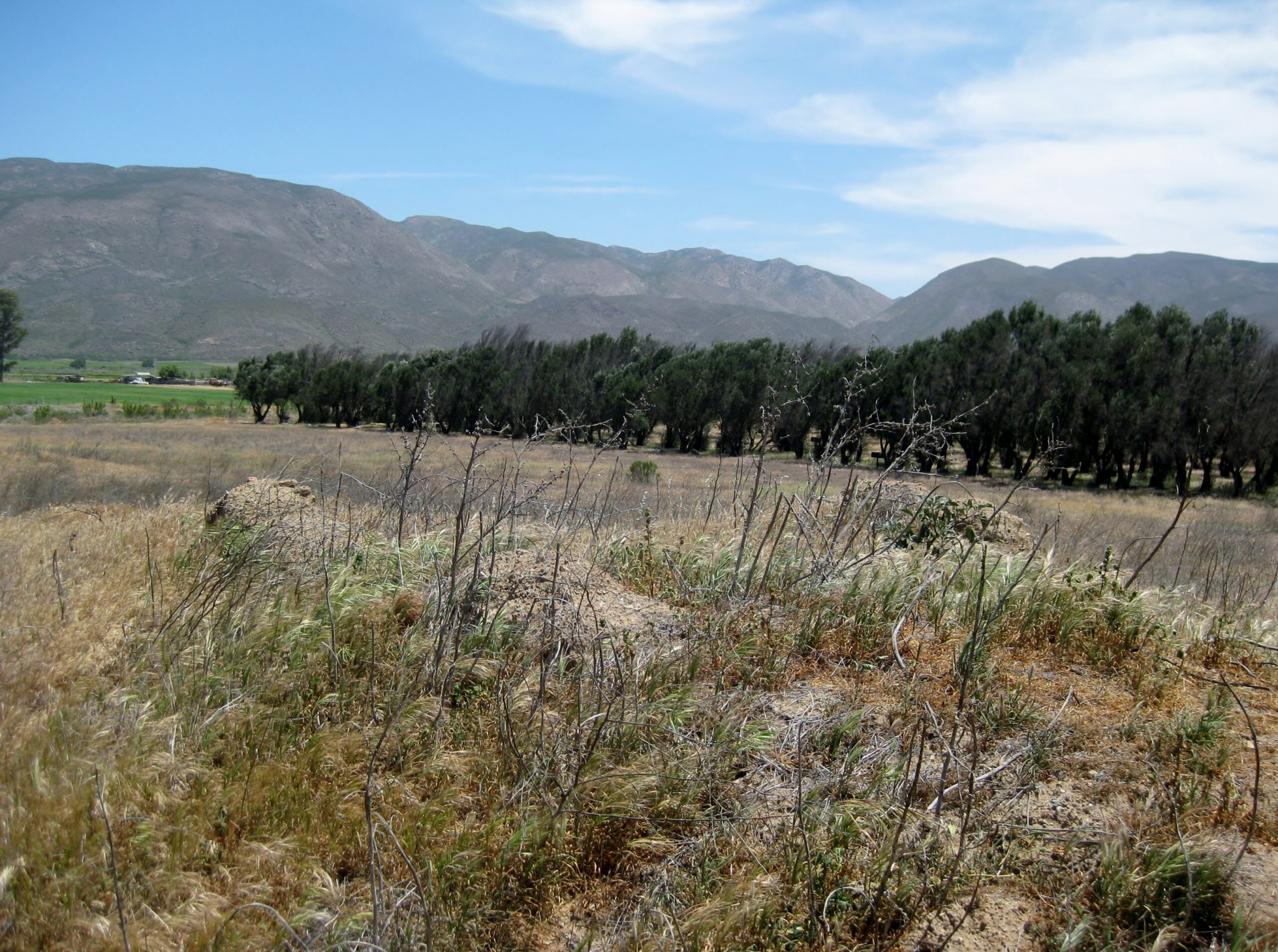
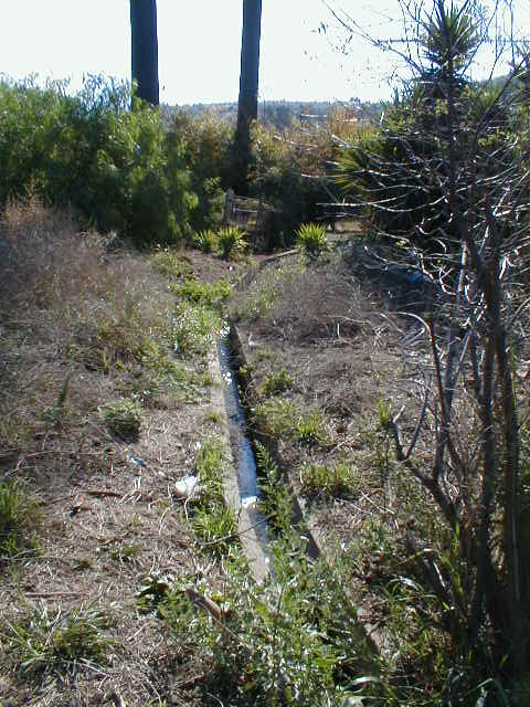
At Santo Tomás, the big shock was the El Palomar campground, gas station, and curio store was all closed. That was a beautiful campground. Stayed
there in 1975, 1976, and 2000 (maybe more). In 2017, I drove to the mission site, through the campground. Can't get there that way, anymore!
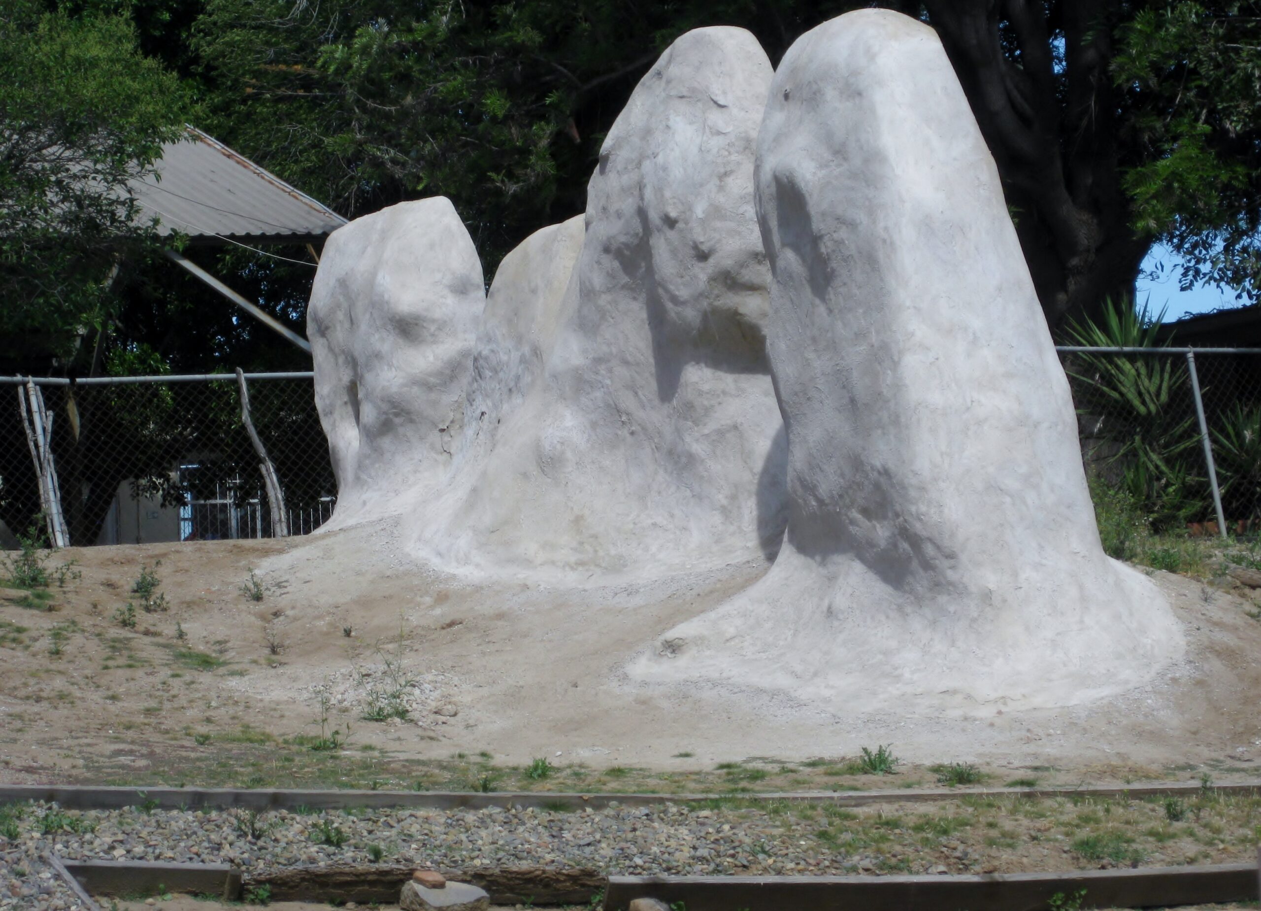
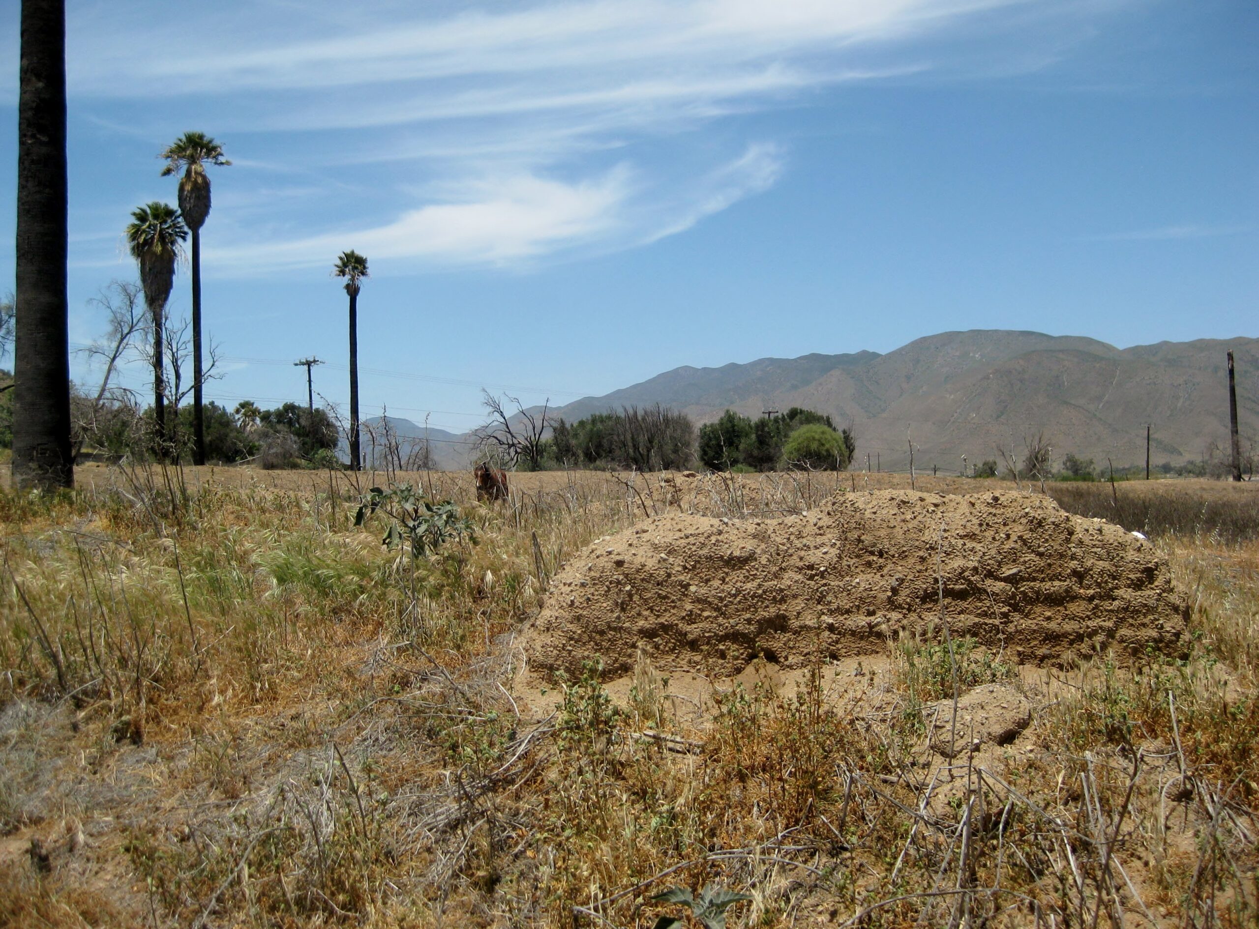
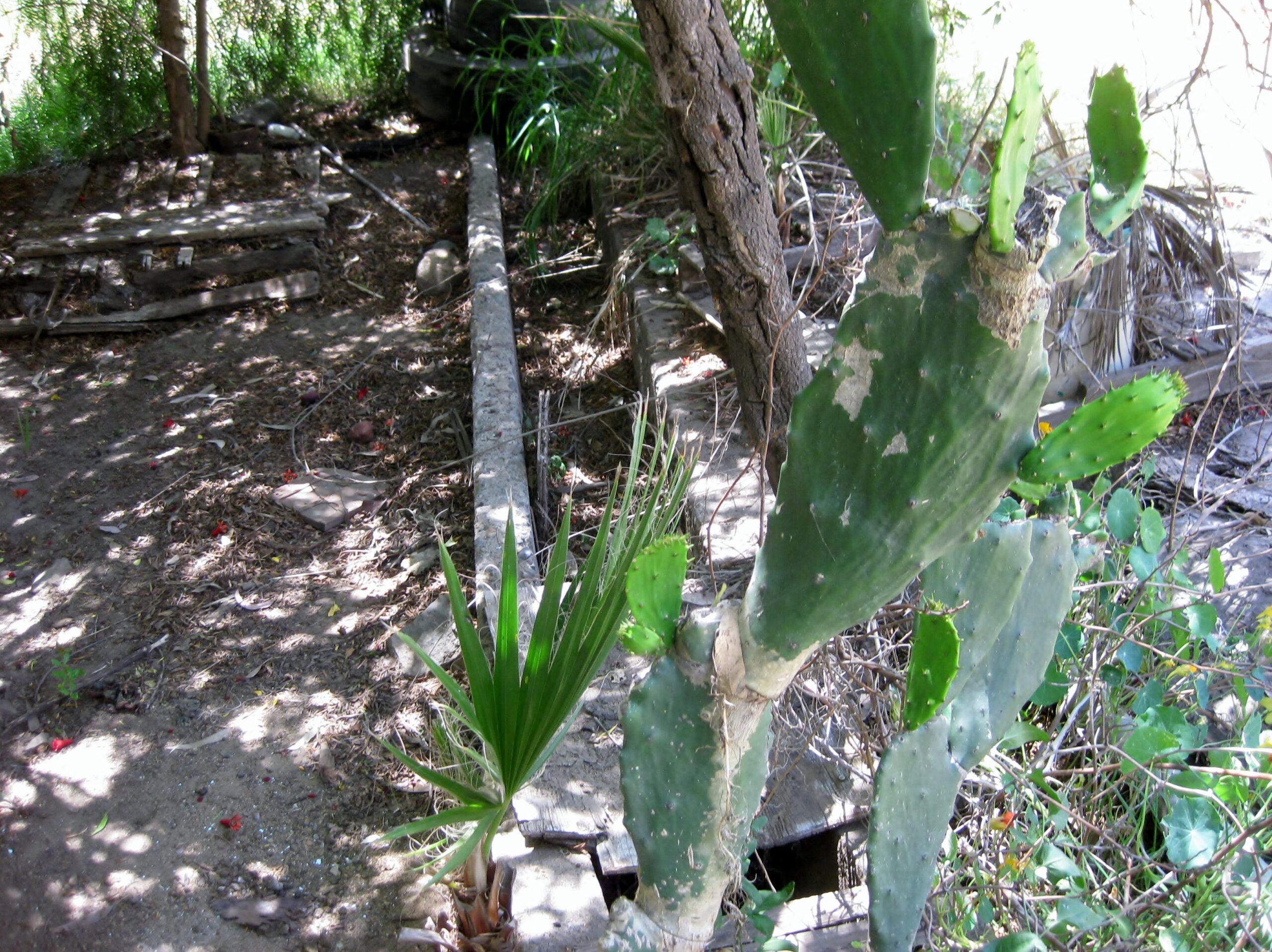
We parked along Mex 1 by a home's driveway, closest to the mission (see the tall palms as you enter Santo Tomás) and asked permission to pass through
the home's front yard. My wife and I did this back in 2005. You step over the mission's water canal as you leave the home's yard and enter the big
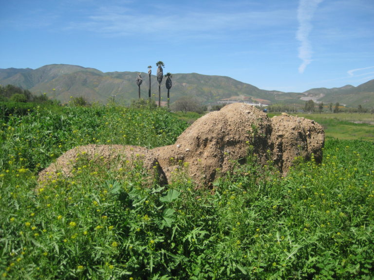
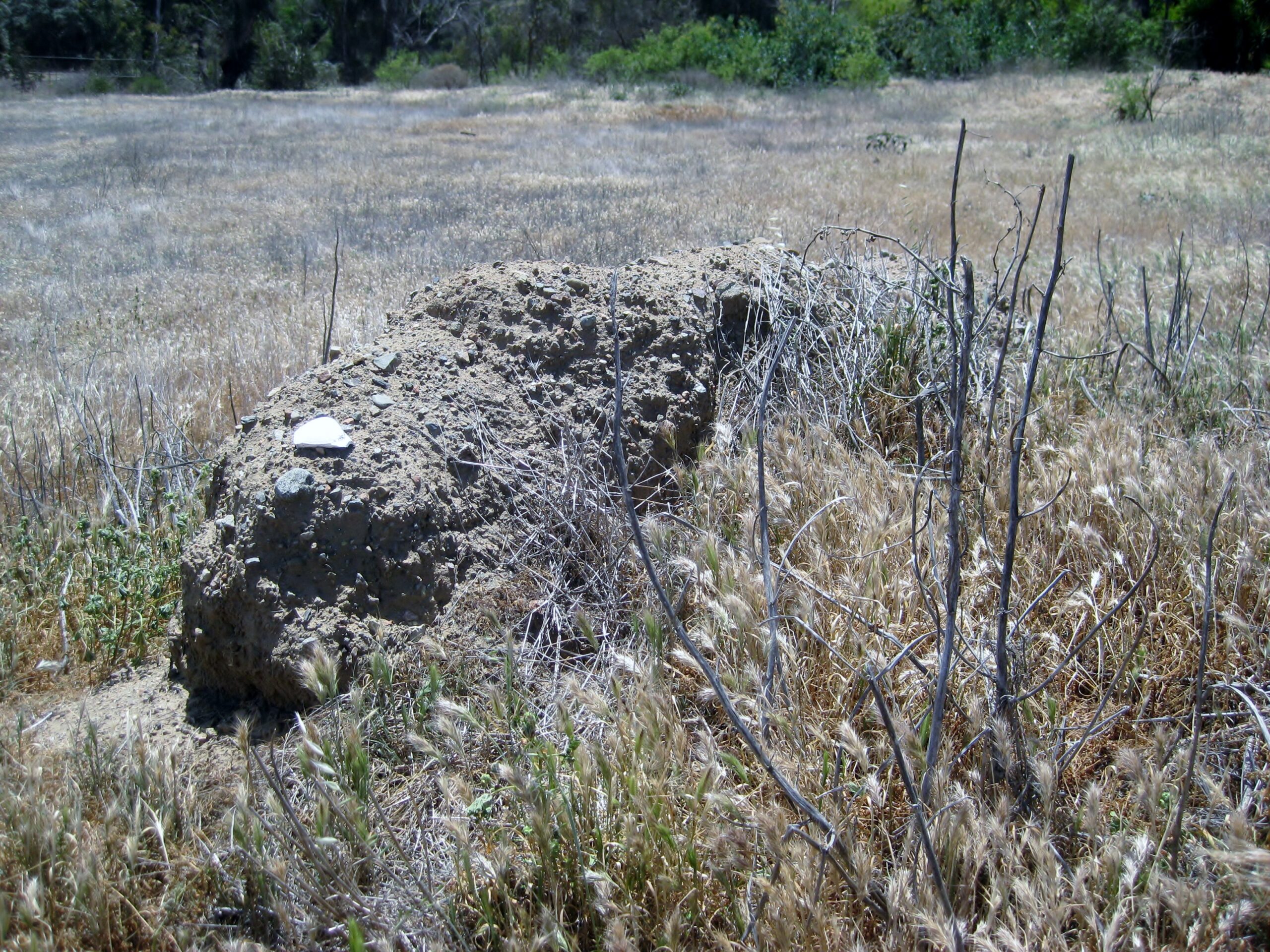
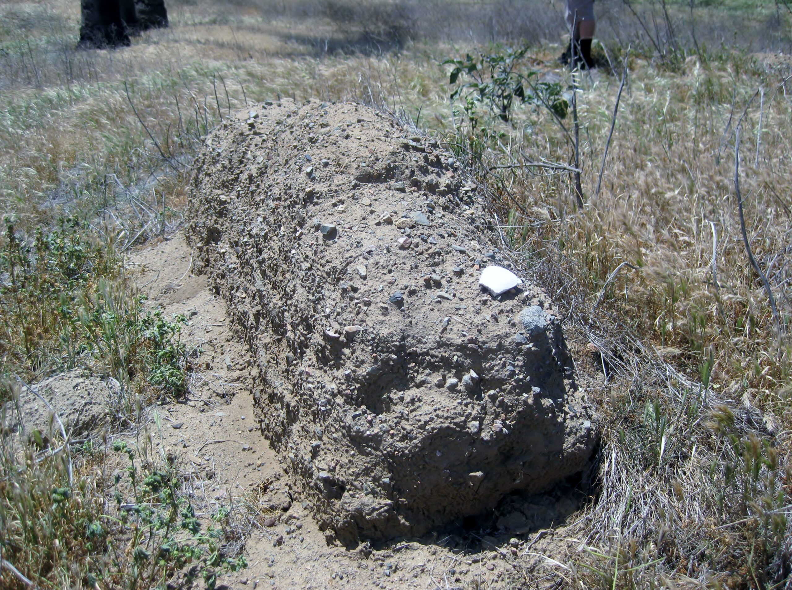
field, with the palms. The mission is just a bit of adobe wall, still there from the 1799-1849 mission location. It was the third site for the mission
as the previous two (1791 & 1794) were unfit or not too successful. Read the story of all three locations, in my article: https://www.bajabound.com/bajaadventures/bajatravel/santo_to...
There were a lot of foxtails in our shoes and socks to deal with after visiting this mission! We go next to San Vicente... stay tuned for Part 2.
Map of the Ensenada-Santo Tomás area:
Here now are some photos:
Double deck road along border, Tijuana
New elevated road junction with 1-D, is washout canyon
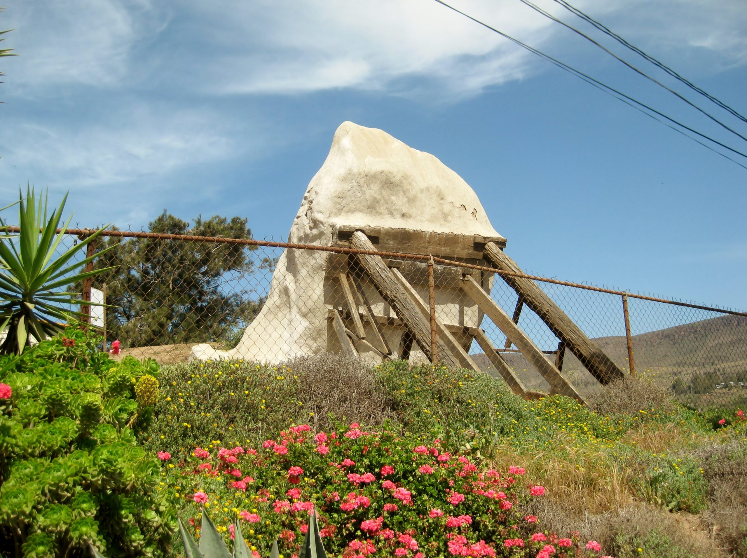
EL DESCANSO
El Descanso mission (1830-1834)
Dave W. & David K (Dave W. photo)
Splash for breakfast
SAN MIGUEL (in La Misión)
Mission San Miguel
Santo Tomás
Santo Tomás, third mission site ruins
In 2017:
Mission and in the background, trees in the El Palomar (now closed) campground
[Edited on 5-19-2025 by David K]BoenBaja - 5-14-2025 at 09:07 AM
Wow, whirlwind trip! Great report, thanks David!Tacayo - 5-14-2025 at 10:04 AM
Thanks David. Always good to read your trip reports and to check out your photos.BornFisher - 5-14-2025 at 11:03 AM
Bummer about El Palomar. I loved the restaurant/bar with the thousand stickers from so many travelers and racing crews The fried beef tacos were
fantastic for lunch and the huevos rancheros were perfect for breakfast. David K - 5-14-2025 at 12:10 PM
Bummer about El Palomar. I loved the restaurant/bar with the thousand stickers from so many travelers and racing crews The fried beef tacos were
fantastic for lunch and the huevos rancheros were perfect for breakfast.
Yes, a real surprise that the family didn't have an interest in maintaining the huge business (Bar, restaurant, motel, campground, Pemex). It was all
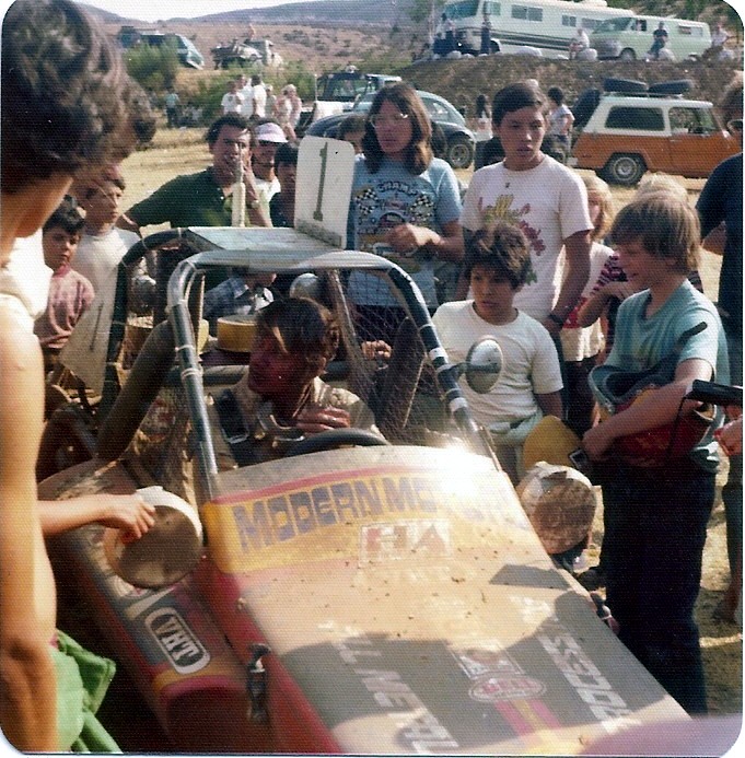
open in 2017. Ate there in 2000 and had margaritas there, with Roy (The squarecircle) in 2007. The campground was where the 1975 Baja 300 race started
and ended, as well as other years. I got a close photo of Ivan Stewart winning that race and taking his helmet off then, handing it to his son:
David K - 5-14-2025 at 12:12 PM
Another racer broke down and borrowed a rancher's horse to ride back to the start/finish line, leaving on his helmet and fire suit:
David K - 6-2-2025 at 07:43 AM
I made a webpage to see the trip all on one link, it is refined from the trip report, more selective photos, maps added, etc.
Have a look and let me know how it appears for you. Do all the photos load okay? If not (slower Internet), I can break it into two pages.
>>> https://vivabaja.com/baja-525/cupcake - 6-2-2025 at 10:49 AM
The webpage loads quickly and completely for me. All photos are clear, except for the one entitled: "A new-to-me painting of the Cataviña gas
dealer", which is a little fuzzy.
I enjoy how you show old photos (some from 100 years ago) alongside the images from 2025 of the same locations.
[Edited on 6-2-2025 by cupcake]David K - 6-2-2025 at 11:10 AM
Thank you. The Hugo painting is a zoomed in, cropped one, which may account for the fuzzy.
Yes, I dig the old vs new photo comparison, too!Ken Cooke - 6-2-2025 at 03:38 PM
Its a shock that El Palomar gas station and Curio store are now closed. Same for the restaurant and hotel?David K - 6-2-2025 at 08:56 PM