
David K - 5-21-2026 at 09:25 AM
The first place I read about this ruin was in the Lower California Guidebook, 60 years ago. Homer Aschmann's 1959 book (The Central Desert of Baja
California: Demography and Ecology) has an aerial photo of the location, on page 300. Harry Crosby details the actions involved to stage soldiers
at the bay to secure the dropped off supplies in his book, Gateway to Alta California. In Junipero Serra's diary, he describes the short-cut
route to the bay (from Mission Santa María) and orders a road built to it. Much of hat 'road' can still be seen in satellite images and in person.
The route is shown in the Benchmark Baja California Atlas, researched by CaminoRealBaja.com.
I first went to the site in 2002: 29°48'55.2"N 114°24'36.6"W
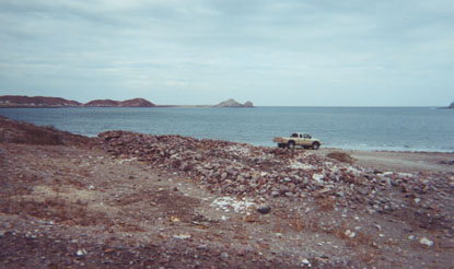
Dr. Eric Ritter performed an archeological examination, in 2011. See his photos, floor plan, and a sketch of what the warehouse may have looked like:
https://vivabaja.com/wp-content/uploads/2022/12/GONZAGA-2-EX...
I included the site on my 2018 map:
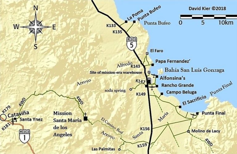
The access road no longer is from Mex. 5, as shown. Near where Alfonsina's road turns from east to north, the access road heads northwest, towards the
ruins.
On May 15, 2026:


That's Alfonsina's, in the distance:

Jack Swords - 5-22-2026 at 06:03 AM
Wow David! Your photographs and articles on Baja history are keeping it alive. The most recent "mission-era warehouse" posting surely will encourage
others to follow the history in Baja. There is more out there for the motivated.
Tioloco - 5-22-2026 at 07:42 AM
Gracias Sr David. So much to see, so little time!
David K - 5-22-2026 at 12:50 PM
Yes indeed! One can take in a lot of different sites in a single day. Baja is such a gift for those who love geology and history.
On the main trip report post, I added the visit to the soda/onyx spring-glacier behind Rancho Grande about 2.5 miles. Like this warehouse ruin, I have
not been there since 2002.
As back then, it remains unmolested with just a single motorcycle track in one part. Do check it out!
Next, Coco's Corner then Calamajué mill, mission, and arroyo.
bajatrailrider - 5-22-2026 at 03:43 PM
Great pictures and Story Thanks DK
David K - 5-22-2026 at 04:27 PM
Nice to hear from you Larry!
It will be a few days to get all the photos organized and create interesting history to go with them.
On the web page I am building, there will be several comparison photos from me in the past or Howard Gulick's 1950s photos.
I hope this inspires others to explore more Baja!