BajaNomad

Los Corrales

Sharksbaja - 5-18-2005 at 06:42 PM

Has anyone been out to Los Corrales lately or is it possible by truck?
Is it easier to get to from the El Arco road?

The squarecircle - 5-19-2005 at 12:06 AM

Greetiings, >>>> Been there. Done that. Just "DO IT" Its a very interesting ride. La Sirena (ab) mine is well worth the effort just So. of El Barril. When you get to Los Corrales keep going So. and you'll cross the N./So. line into Baja Sur. Fantastic white sand beach camping with excellent shore fishing. Be prepared to be by yourself in this area. Its a long walk out with the nearest humans found at the Santa Barbara Rancho site a self- contained remote working rancho. This is a must see area. Visit the rancho on your return back toward El Barril. Local info can be gleaned at San Francisquito of the Ensenada Blanca location. I look foward to a return trip to this astonishing local. >>>>Best Regards, >>>> sq.

Los Corrales

Barry A. - 5-19-2005 at 09:10 AM

We made this trip in April of 2000. Took a very good graded road SW out of El Barril to the vacinity of where it leaves Las Cuevitas Wash, where it turns into an "old-style" baja desert track all the way up over Cuesta don Reyes and down to Rancho San Miguel. Rancho San Miguel was a very nice, active, prosperous-appearing Rancho then, with very friendly folks living there. At the Rancho you drive right thru the Rancho grounds in a NE direction to a very rocky beach at Estero La Palmita, passing an incredible abandoned Ejido along the way. Take time to walk around the Ejido grounds and see all the complicated irrigation systems, dams, and the wonderful old main bldg. that is still standing. The rocky beach was not that impressive, but interesting., at Estero La Palmita. We camped there, behind a huge cobblestone berm, in an abandoned fish camp.

We then drove back to Rancho San Miguel and tried to drive our F-250 4x4 with big, wide tires to Los Corrales. We soon encountered VERY DEEP sand in the wash about 1 mile SE of San Miguel. We struggled with the deep sand for about .7 of a mile further SE but it was so bad that we became alarmed and decided to turn around and go back to San Miguel. The road was almost non-existant between San Miguel and Los Corrales, at least the one that we discovered. If there is a better road we never found it. Very disappointing.

As squarecircle said, this is fantastic country, with palo blanco trees all around, and lush vegetation in the washes. The drive down La Fortuna canyon to San Miguel is classic, and worth the whole drive down from the states, IMHO. Lots of interesting things to see along the way. We did not go into Rancho Santa Barbara---we will do that another time. The road to Rancho San Miguel was passable by any high-clearance 2-wheel drive vehicle with wide tires, at that time, but any big storm could have changed all that. I would love to try to get to Los Corrales in a lighter vehicle some time. I am sure it is doable. Our vehicle had a 1000 lb CALLEN camper on the back and was just too heavy for the deep sand, SE of Rancho San Miguel.

We did not visit the mine at La Sirena, but wish we had. Also, we returned to El Barril on our way out, and did not try the cut-off road shown in the "Baja Atlas" that cuts over to the El Arco road, by-passing El Barril. The road out to El Arco from El Barril was in excellent shape in 2000, recently graded.

We spent a total of 3 full days south of El Barril, on this trip.

If you make this trip, please post when you get back and tell us how it went. I do hope you are able to get to Los Corrales, and the "white sand beach" that Squarecircle talks about, south of Los Corrales. I have a feeling that he was on a motorcycle, tho I do not know that for sure. Maybe he will see this, and tell us. I hope you have the time to spend there, as I believe that you could spend a week south of El Barril and not cover it adaquately. Buena Suerte.

The squarecircle - 5-19-2005 at 10:24 AM

Greetings, >>>> Negative on the motorcycle. I was in a cage. i.e. 1991 Toyota 4-runner (230,000 + miles young). >>>>> Happy trails,>>>>sq.

El Barril

Sharksbaja - 5-19-2005 at 11:53 AM

Quote:
Originally posted by Barry A.
We made this trip in April of 2000. Took a very good graded road SW out of El Barril to the vacinity of where it leaves Las Cuevitas Wash, where it turns into an "old-style" baja desert track all the way up over Cuesta don Reyes and down to Rancho San Miguel. Rancho San Miguel was a very nice, active, prosperous-appearing Rancho then, with very friendly folks living there. At the Rancho you drive right thru the Rancho grounds in a NE direction to a very rocky beach at Estero La Palmita, passing an incredible abandoned Ejido along the way. Take time to walk around the Ejido grounds and see all the complicated irrigation systems, dams, and the wonderful old main bldg. that is still standing. The rocky beach was not that impressive, but interesting., at Estero La Palmita. We camped there, behind a huge cobblestone berm, in an abandoned fish camp.

We then drove back to Rancho San Miguel and tried to drive our F-250 4x4 with big, wide tires to Los Corrales. We soon encountered VERY DEEP sand in the wash about 1 mile SE of San Miguel. We struggled with the deep sand for about .7 of a mile further SE but it was so bad that we became alarmed and decided to turn around and go back to San Miguel. The road was almost non-existant between San Miguel and Los Corrales, at least the one that we discovered. If there is a better road we never found it. Very disappointing.

As squarecircle said, this is fantastic country, with palo blanco trees all around, and lush vegetation in the washes. The drive down La Fortuna canyon to San Miguel is classic, and worth the whole drive down from the states, IMHO. Lots of interesting things to see along the way. We did not go into Rancho Santa Barbara---we will do that another time. The road to Rancho San Miguel was passable by any high-clearance 2-wheel drive vehicle with wide tires, at that time, but any big storm could have changed all that. I would love to try to get to Los Corrales in a lighter vehicle some time. I am sure it is doable. Our vehicle had a 1000 lb CALLEN camper on the back and was just too heavy for the deep sand, SE of Rancho San Miguel.

We did not visit the mine at La Sirena, but wish we had. Also, we returned to El Barril on our way out, and did not try the cut-off road shown in the "Baja Atlas" that cuts over to the El Arco road, by-passing El Barril. The road out to El Arco from El Barril was in excellent shape in 2000, recently graded.

We spent a total of 3 full days south of El Barril, on this trip.


Is this El Barril??
http://maps.google.com/maps?ll=28.323033,-112.874093&spn...

Barry A. - 5-19-2005 at 02:07 PM

Sharks, --------Negative, does not look like the El Barril below Ensenada Blanca and San Francisquito. I do not know where that is. El Barril is a large Ranching complex just up an arroyo from the Sea of Cortez, and consisting of many buildings, and some new ones that belong to ex-pats, I believe. I understand that there is a huge house up the coast a ways that belongs to some very wealthy Mexican. Maybe that is the place in the aerial photo. I only saw it from along ways away----we could not figure out how to get over to it without going thru locked gates.

Squarecircle-------Did you just plow though (float over?) the deep sand SE of San Miguel, or did you find another road that was in good shape? Barry

The squarecircle - 5-19-2005 at 06:02 PM

Greetings,>>>> There are perhaps two paths of accessibility to Los Corrales and beyond (south). One is close to the shore and is in deep and loose sand requiring severely atmospherically challenged tyres and heavy throttle application. The other path is slightly inland using the estero avoiding water and mud traps. I've used both paths. Both can overwhelm
a 2 or 3 wheel drive vehicle. Might be best to have a real 4 wheel drive cage here. Do not worry, it gets worse as you approach the 28 th. Parallel, if you are persistant you can go a long way and find that white sand beach which is probably the end of the line on 4 rollers. Lots of neet stuff North of San Miguel Rancho like north of Cabo San Miguel (Punta Jerga) i.e. Los Puertecitos, A very cosy camping cove from which one can see the floodlights of that wealthy Mexicano HI- dollar pad that looks like a hospital complex. Owner does't show up very often and has several Mexican families there year-round just for maintainence. Large air strip allows owner to fly some pretty heavy birds in and out. I found the locals not to friendly in El Barril with all the locked gates and fencing. Sorry----MY tongue is running away again! >>>>Best Regards, >>>> sq.

Squarecircle------

Barry A. - 5-19-2005 at 08:03 PM

Sorry to keep pounding on you for info, but----are you saying that you were able to drive north of Rancho San Miguel all the way to Los Puertecitos?????Wow---we were afraid to cross the Estero la Palmita slews as they were very muddy when we were there, and we never dreamed that the road continued north. We could not find a way around the slews, but maybe we did not look hard enough. That is very exciting!!!

And, you were able to drive south beyond the 28th parallel??-----that is truly fantastic----that is further north, and further south, of Rancho San Miguel, than I have ever heard of anybody driving.

Is it possible, like say on a motorcycle, to drive all the way south along the shoreline to Ensenada la Trinidad? If so, then I know that there is a road from Ensenada la Trinidad that goes inland there, and then south to Mex 1, hitting Mex 1 between Santa Rosalia and San Ignacio. If this could be done, then that opens up all kinds of possibilities, none of which I have ever heard of before.

Actually, I have never spoken to anyone that drove north from Mex 1 to Ensenada la Trinidad, but I have heard that yachties have reported seeing camp-rigs on the beach at La Trinidad, so there must be a road somewhere.

This is all neat stuff!!! Barry

Sharksbaja - 5-19-2005 at 09:06 PM

After scanning the area between the coast and Hwy 1 I see many(at least 5)dirt tracks heading off in a easterly direction from the G. Negro area. It seems like most connect inland but then split off in several locations all heading east towards the Sea.

http://maps.google.com/maps?ll=28.031359,-114.009161&spn...

If you zoom in on Hwy 1 at the G. Negro Airport you will see a road directly across leading east . As you can see the roads criss-cross, but their are a few that all seem to lead over to the coast. To bad the resolution is bad in that area. Or maybe you could find and point out El Barril on the map.Thanks.

Maybe you can identify this place.:?:http://maps.google.com/maps?ll=28.307819,-112.875252&spn...

Sharks----that is El Barril !!!

Barry A. - 5-19-2005 at 10:33 PM

I do not believe that any of those many roads stretching east from the G. Negro area penetrate the huge mountain range between the Vizcaino desert and the gulf, with the exception of the El Arco/San Francisquito/El Barril road on the north, and, of course Mex. 1 on the south. If any of the others do, that would be incredible, and totally unknown to me. About the closest to a connection is the Santa Gertrudis Mission road in from the west, and the Rancho Santa Barbara Rancho road in from El Barril on the east. Unfortunately, a huge bunch of mountains lies in between them. I have been to Santa Gertrudis Mission (a remarkable place) and have seen the huge mountains to the east. Unfortunately the resolution is not the best in the SAT shots in this area, and I cannot really see what I want to see with any clarity. Even El Barril is pretty fuzzy, but that is for sure what you are looking at. Barry

The squarecircle - 5-20-2005 at 12:02 AM

Greetings again, >>>> El Barril topos approx. W 112 deg. 52.5 min. X N 28 deg. 17.5 min. or about 8 mi. so. of San Francisquito as the birdie flies!! >>>> I am thinking you should wheel more forceably in the general direction you desire to go. There are some situations that require you to make a pass thru on your own best choices regardless of the minor fact that passage thru may appear to be difficult or near impossible. I've wheeled into areas that I have been told "NO WAY". But is not a challenge a summons to insert your intensions? >>>> It is true, two very dertermined individuals on trials bikes made it thru towards Ensenada la Trinidad out of a whole HERD that tried, but they had air support (eggbeater) for gas, water and food drops along with air-borne scouting. >>>> I did roll into Ensenada la Trinidad last July and it was not easy. Don't think you will see any camp-rigs there as the trail has not been used in a very looooong time and is very difficult to traverse. Wasted six tyres in and out on two very determined vehicles with two loose nuts behind the wheel. >>>>Happy trails >>>> sq.

Sharksbaja - 5-20-2005 at 01:50 PM

Quote:
Originally posted by The squarecircle
Greetings again, >>>> El Barril topos approx. W 112 deg. 52.5 min. X N 28 deg. 17.5 min. or about 8 mi. so. of San Francisquito as the birdie flies!! >>>> I am thinking you should wheel more forceably in the general direction you desire to go. There are some situations that require you to make a pass thru on your own best choices regardless of the minor fact that passage thru may appear to be difficult or near impossible. I've wheeled into areas that I have been told "NO WAY". But is not a challenge a summons to insert your intensions? >>>> It is true, two very dertermined individuals on trials bikes made it thru towards Ensenada la Trinidad out of a whole HERD that tried, but they had air support (eggbeater) for gas, water and food drops along with air-borne scouting. >>>> I did roll into Ensenada la Trinidad last July and it was not easy. Don't think you will see any camp-rigs there as the trail has not been used in a very looooong time and is very difficult to traverse. Wasted six tyres in and out on two very determined vehicles with two loose nuts behind the wheel. >>>>Happy trails >>>> sq.


I understand competely, thanks a million. 6 Tyres? And who said one was all ya need?? By the way. How many do
you carry?

SquareCircle and Sharks--------

Barry A. - 5-20-2005 at 02:43 PM

Great information------thank you very much.

I personally enjoy Baja much more when I stay within my comfort zone, and my comfort zone does not include getting my vehicle stuck, or broken down, with little hope of recovery, especially at age 67. No problem getting stuck when help is within reach, but this is wild country, as you know, and no place to be messing around with fate, IMHO. Still, I understand that you are going to get to places long before I do, and that is ok. I am not looking for that type of thrill-----I just love to see new places that few others have seen-----and I like to savor these places, and go slowly. I do admire your style----it is just not my style. I get there eventually, with help from folks like you.

Thanks again for your very helpful information.

Sharksbaja - 5-20-2005 at 03:20 PM

In that thread about "the list" they forgot to throw in "common sense and education"

Sounds to me you have both.


Quote:
Originally posted by Barry A.
Great information------thank you very much.

I personally enjoy Baja much more when I stay within my comfort zone, and my comfort zone does not include getting my vehicle stuck, or broken down, with little hope of recovery, especially at age 67. No problem getting stuck when help is within reach, but this is wild country, as you know, and no place to be messing around with fate, IMHO. Still, I understand that you are going to get to places long before I do, and that is ok. I am not looking for that type of thrill-----I just love to see new places that few others have seen-----and I like to savor these places, and go slowly. I do admire your style----it is just not my style. I get there eventually, with help from folks like you.

Thanks again for your very helpful information.


Well, thanks for the perspective. If you think I want myself, the truck and all within stuck in some godforsaken' place "NO WAY". Problem is.... Murphys law: "if you can get stuck, you will get stuck" sooner or later that is. As you read about Neal Johns ordeal you find it doesn't take a long dirt track to be out in the boonies. Common sense and a well stocked vehicle can make you or break you in the back-country. Knowledge of basic aoutmotive and electrical are a must and anyone without these should either bring someone that does or learn it yourself. Foolish off-road travelers that cannot cover the ups and downs out there has no right to compromise others in the process. Of course, shi_ happens anyway, and nobody can perform miracles. You won't find ice climbers without cramp-ons and rope and the skills to climb a ice wall so why would people take a vehicle into a remote area without the ability to change a tire or even know when to air-down etc. Hey, don't get me wrong...... if an adventurer wants to take extreme chances and gamble, so be it, just don't snivel about it later.


Gotta go...

The squarecircle - 5-21-2005 at 01:25 AM

Greetings, >>>> For the longer and more difficult trips I take two spare tyres and am somewhat self-sustaining and for good reason for I also have wandered the wilds of Baja solo. Not the smartest thing to do but doable when nobody else shares my same adventure interests and drive. I really love seeing all that Baja has to offer and am also fond of most driving adversities. Have not had to walk out yet but if I do, you will not hear me snivel and what did you say your phone number is just incase? >>>> Enjoy The Ride >>>> sq.

Sharksbaja - 5-21-2005 at 02:32 PM

"ditto" thanks Square. Next time"they" won't go witcha, maybe I can/will give me a shout. I've a hankerin' to chase down them backroads and tracks ALL THE TIME, but, alas, still workin'. I can break away by myself sometimes but I preferably take the more aggresive trips when it's a tad cooler.

honda tom - 5-22-2005 at 12:07 AM

I rode from san fran through los corrales, south on the beach to trinadad.... then inland to santa marta and down to hwy 1. friends of mine refer to it as the Malcolm Smith trail. I dont know who showed Malcolm... but thats what i call it. The beach south of los corrales is beautiful, it is the most "alone" i have ever felt in baja. 4 of us did it on bikes with oversized tanks and about 1/2 a gallon of gas in plastic jugs. I think the total mileage to san ignacio was about 150.

All the way?

Sharksbaja - 5-22-2005 at 12:48 AM

Quote:
Originally posted by honda tom
I rode from san fran through los corrales, south on the beach to trinadad.... then inland to santa marta and down to hwy 1. friends of mine refer to it as the Malcolm Smith trail. I dont know who showed Malcolm... but thats what i call it. The beach south of los corrales is beautiful, it is the most "alone" i have ever felt in baja. 4 of us did it on bikes with oversized tanks and about 1/2 a gallon of gas in plastic jugs. I think the total mileage to san ignacio was about 150.


Wow, that is cool. That is whta many of us would like to see. A totally unspoiled place where you can feel in control. But, is it doable in a good 4X4?

TMW - 5-22-2005 at 09:55 AM

If Squarecircle and Sharksbaja and anyone else want to try it I'm in too. Looks like a great adventure in a 4x4.

[Edited on 5-22-2005 by TW]

The squarecircle - 5-22-2005 at 06:42 PM

As Gov. Arnold would say >> "LETS DO IT" >> sq.

well then.....

Sharksbaja - 5-22-2005 at 07:51 PM

Quote:
Originally posted by The squarecircle
As Gov. Arnold would say >> "LETS DO IT" >> sq.


OK! Methinks October would be best. Time to plan and research and the weather perfect.

honda tom - 5-23-2005 at 09:02 PM

About half way between los corrales and the "head west point " (la trinidad) there is a 60 foot deep canyon that goes out to the ocean. We went inland somewhat and dropped into the canyon, headed back toward the ocean, then "cow tracked" up a 2 foot wide single track. At the time that was the only way across this deep ravine. Idont think anyone is going through in a 4 wheeled vehicle. Some friends did this on quads, and at the ravine they had to walk the quads up.... 3 guys 1 quad.. then repeat. If i was going to check this place out in vehicles i would come in from the north. santa marta is really a cool place surrounded by giant mountains, but the road to trinadad from there hits some really slow going rocky sections. Bring lots of gas and prepare to be ALONE.

Honda, TW, Square C.......

Sharksbaja - 5-23-2005 at 11:21 PM

It looks from space that there is not a passable route near the coast. Here I have drawn over what appears to be tracke or dirt roads. Some are very vague and may not be a route at all. Cant get good res so I need better sat maps. Does any of this look familiar?


here is a road north of S. Rosalia that has potential:
http://maps.google.com/maps?ll=27.523499,-112.627029&spn...

TMW - 5-24-2005 at 07:32 AM

In comparing the satellite photo to the Baja Almanac, the top right point looks like El Barril and the bottom right point looks like Punta San Carlos. Los Carrales would be the next point above San Carlos.

[Edited on 5-24-2005 by TW]

honda tom - 5-24-2005 at 08:22 AM

use the almanac to get to los corrales.... then you'll follow tracks along the beach sometimes heading inland a few hundred yards. the gorge will probably be your dead end.

sharks----

Barry A. - 5-24-2005 at 10:10 AM

Wow, good work with the SAT photos-----opens up all kinds of possible roads to explore, or confirm that they are there, or not, not only for the coast, but inland also.

Good stuff!!!!!

Thanks, Barry

water source?

Sharksbaja - 5-25-2005 at 01:00 PM

Does someone know if there is a water source en route to Los Corrales via El Barril?

Sharks----

Barry A. - 5-25-2005 at 04:24 PM

We had all our own water with us in 2000, but I would assume that there is water available at the active Rancho San Miguel----assuming that it is still active. We saw no natural flowing water in April of that year, that I can recall.

cpg - 4-26-2006 at 08:02 PM

The road is washed out in a few places but there are work arounds. Very long drive in a 4x4 and the deep sand washes suck gas. Here is a pick of as far as I made it. I drove for about 4 hours south of el barril.

cpg - 4-26-2006 at 08:08 PM

heres the pick n 28 09.721 w 112 55.613

cpg------

Barry A. - 4-26-2006 at 10:38 PM

----did you get south of Rancho San Miguel????? and is your pic of the end of the line??

cpg - 4-27-2006 at 06:32 AM

Hi Barry
It was not the end of the line. The gps cord's above is where we turned around. We had to re route because of wash outs and used a lot of gas in the deep sand (4 low).
I was way of the baja almanac and the lb map trach for los coralles. From the gps seemed like I was over half way there. Some of the road was great some places no road and some very rough and steep. Very wide range of terrain. The baja almanac makes it seem to be a flat road most of the way. The pat we took was not flat. I will try to post the route at some point. This pic is near where we turned around. About a mile after a very steep climb.

cpg - 4-27-2006 at 06:32 AM

another

cpg - 4-27-2006 at 06:33 AM

the last 2 about half way in

KurtG - 4-27-2006 at 09:44 AM

Quote:
Originally posted by honda tom
I rode from san fran through los corrales, south on the beach to trinadad.... then inland to santa marta and down to hwy 1. friends of mine refer to it as the Malcolm Smith trail. I dont know who showed Malcolm... but thats what i call it. The beach south of los corrales is beautiful, it is the most "alone" i have ever felt in baja. 4 of us did it on bikes with oversized tanks and about 1/2 a gallon of gas in plastic jugs. I think the total mileage to san ignacio was about 150.


Kacey Smith's Baja GPS Guide gives that entire route, I have heard lately that the trail is in very bad shape and may not be doable but have no first hand info.

cpg----

Barry A. - 4-27-2006 at 10:06 AM

----Great pictures, and thanks for your response.

In 2000, we got about a mile (maybe 2?) SE of Rancho San Miguel in a F-250 4x4 ext. cab, long bed, w/1000 lb. Callen camper, and 285x16 tires, but the wash sand was so soft, and we were so far from help, that we chickened out. Vague tracks did head on from where we turned around, tho, on towards Los Corrales and La Calera. You obviously went much farther SE than we did. I can certainly vouch that there is VERY soft wash sand----the worse (softest) I have ever encountered in Baja-----(after a good rain I think it would be fine, tho.)

In the Almanac, there is a dotted line from Rancho San Miguel NE out to the coast. In fact, that is a good road, easily driven by our vehicle, and we camped right on the coast, behind a cobble coastal berm, at an old abandoned Fish Camp----location being right about where the Almanac shows the end of the dotted line at Estero la Palmita. Long and nice beaches north of our campsite along the face of a "barrier island" (sand spit?). There were extensive coastal marshes and tidal flats just north of our camp, as is indicated in the Atlas. We did not venture out on that mud flat because of our horrible "stuck" experience at Boca Grande above San Rafael, (N. of San Francisquito) a few days before. Of interest, there is a very sophisticated but abandoned Ejido with many structures, dams, cement irrigation canals, etc. half way between Rancho San Miguel and the coast, along this road to Estero San Palmita. They had been relying on the waters from Canon San Miguel, but apparently the weather let them down and there was not enough water. (Typical Baja story) At the ejido site is a really beautiful masonary bldg. in excellent condition, and then a lot of foundations and small rock shelters scattered all over the place. Somebody (Mex. govt?) spent a lot of dinero at this place, once upon a time.

From the time we left El Barril heading south (total 3 days) we saw only the folks living at Rancho San Miguel (very nice folks)-----nobody else, and no vehicles. This is magnificent country--some of the best I have ever seen in Baja-----and the Palo Blanco trees along La Fortuna wash (San Miguel wash?) are spectacular. This IS old-time Baja, for sure. We did not try any coastal fishing----just not time.

When I buy a new Toyota FJ Cruiser:lol:
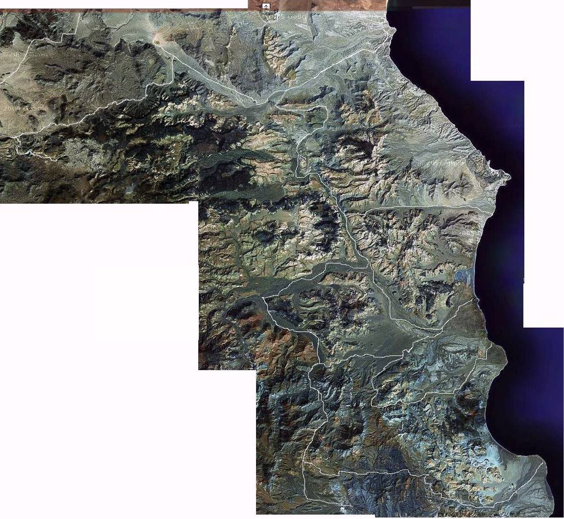
, I will return to see more of this country, for sure.:yes:

Thanks for your reports, and I hope you are able to return someday and continue the "push south".

ArvadaGeorge - 4-27-2006 at 11:44 AM

This story is that route
in 1985 w/photos

http://forums.bajanomad.com/viewthread.php?tid=16345&pag...

cpg - 4-27-2006 at 07:42 PM

Barry

Did you drive up a very steep 4 lo hill? About 2,000 yards with 3 switch backs. Up to the top than down into a large wash. There was a shelter and a lot of barbed wire laying about near the bottom looks like it was there for years.

The changes in terrain are very spectacular. We saw lush sand washes, Flat desert, Caves, Mountains, Rock gardens, many different plants. My wife and I alone in our trusty 96 cruiser with 169,900 miles felt very remote. Made trips to Death Valley like going to the corner market.

George your story is one hell of a adventure. I hope to take my XR 600 next time to scout. Thanks for posting that story. Cant wait to get back there again.

cpg----

Barry A. - 4-27-2006 at 07:54 PM

------no very steep hill-----we apparently did not get as far south as you, or were on a different track out of Rancho San Miguel (of which there were several). We essentially were driving down a very sandy wash to the SE of the Rancho and the traction was getting more and more squirrly-----since we were driving down the wash, this made me very apprehensive knowing that we probably had to drive back up the wash to get out of there. Like I said, we just chickened out.

cpg - 4-27-2006 at 08:09 PM

barry,

Yes we drove for a long time in a wash like tha for a long time I went down to 12 psi and locked the rear diff. It was taking lots of fuel to make it down. When I started to think about getting stuck it was a little spooky. How much gas do you carry?

cpg----

Barry A. - 4-27-2006 at 10:07 PM

-----57 gal., and we topped off in BOLA on the way south. I have two 18 gal. tanks, plus a 20 gal. tank on the roof rack. When we hit the little town of Vizcaino back at the pavement I had about 8 gal. left. But, my "beast" only gets 10mpg (big 460 cc engine) no matter what the conditions.

David K - 4-27-2006 at 10:36 PM

Here's a look at the general area, thanks to The Baja Almanac... reduced for Nomad posting...

David K - 4-27-2006 at 10:40 PM

and a zoom in of Los Corrales... and the state border, just south...

cpg - 4-28-2006 at 07:16 AM

Thanks Barry,
I have 38.2 with about 13.5 mpg.

David

The almanac seems inaccurate south of el barril. The original road is washed out. I went inland got in a river bed and tried to work to the trail on the almanac. I dont think i made it. There was a definite main dirt trail.
It seemed further inland than that on the almanac. Have you been down ther lately?

south of El Barril-----

Barry A. - 4-28-2006 at 08:43 AM

David K---absolutely outstanding that you are able to show the Atlas maps in this thread----that is really helpful.

-----Guys-----being a Geographer by training, and an amatuer cartographer by hobbie (like David K), I am mentally locked into "maps", and believe in them until proven otherwise. The Atlas maps are, by and large, very accurate, in my opinion. However, I realize that GPS's are revealing otherwise, lately.

The road as indicated in the Atlas between El Barril and Rancho San Miguel appeared to me to be very accurate. South of Rancho San Miguel may be another story. The small dotted "trail" from the Rancho NE to the coast is approximately correct, or it seemed to me to be. When I left the Rancho to head for Los Coralles I attempted to follow the map, i.e. I headed out SE like the road on the map is shown. We did note that there were several tracks heading out from the Rancho like the spokes of a wheel, all heading generally in a southernly direction. I took the one that appeared to me to be the one on the map, however the track soon veered to the east, unlike what the map showed. As I was only able to go about 2 miles, I cannot vouch for anything beyond that distance. Now, after reading what you guys say, I am wondering if I did the right thing------I certainly wish I had taken the time to investigate ALL the tracks heading south from the Rancho--------which tends to make me want to go back and check it out, like next winter when it is cool.:bounce:

cpg - 4-28-2006 at 01:08 PM

Barry

How long ago where you there?

cpg----

Barry A. - 4-28-2006 at 02:09 PM

----April of 2000--------which is "ancient history" by some standards. :lol:

cpg - 4-28-2006 at 06:53 PM

Barry

Here is the road out of el barril. This wash out was a no go. A few tries around and then back down to el barril and in the large wash we went.
I tried to stay in the right direction.

[Edited on 4-29-2006 by cpg]

Wow-----

Barry A. - 4-28-2006 at 07:09 PM

-----I see what you mean. Things have changed haven't they, since 2000.

cpg - 4-28-2006 at 09:36 PM

I think I was to far west take a look

[Edited on 4-29-2006 by cpg]

[Edited on 4-29-2006 by cpg]

cpg----

Barry A. - 4-28-2006 at 10:48 PM

-----if that is a GPS "track", something is drastically wrong with something. There is no way that the track plotted could be correct------the road is in the bottem of the major drainage that shows on the aerial photo. The plotted appears correct at the top of the visual aerial, but way off as you travel south thru the visual aerial. What do you think is going on?? Aerial photos don't lie. For some reason, the aerial photo and the GPS "track" are not corresponding-----all this makes me really suspicious of "modern technology"???? Can you enlighten me???

cpg - 4-29-2006 at 07:59 AM

Well Thats what i thought. The LB Map and the almanac show a semi straight shot down a major wash. We were traversing major washes and going up and down hills. And as we headed south getting lower on fuel we were not getting to close to the ocean. We keep saying ok after this ridge top. But it was always more mountains to pass. I am thinking that what I was on was a newer road to work over to los coralles. I might have missed a left on the way down but I think I tried all of the lefts. If you look at the s turn of the wash maybe thats were we should have turned. But there was no way in it was full of big rocks. The photo is around were we left the lb map route. I was watching hard for a left.

cpg - 4-29-2006 at 08:00 AM

This was on are left in that area. Anyone seen this?

cpg----the plot thickens-----

Barry A. - 4-29-2006 at 01:37 PM

The only thing I can think of is that the road I took in 2000 has been completely washed out after it entered La Fortuna/San Miguel wash-------back in 2000 it was totally in that major drainage that shows in the aerial photo as a pretty straight shot from the NW to the SE. However, at the top of the aerial photo, the road as plotted on the aerial does look the same as it did in 2000-----i.e. back then you are climbing slightly after you leave El Barril on a wide graded road for many miles, then the graded road ends (as I remember), and you drive up Las Cuevitas wash (a really monster wash) a little way until you make a 90 degree left turn up a small sandy arroyo, climbing up to a plateau, and then you cross that plateau (Mesa el Alambrado) topping out at a divide (Cuesta don Reyes) and then start down a very steep and rocky grade (with switch backs) into that major drainage (la Fortuna wash) pictured in the aerial photo, and upon reaching the bottom of that canyon (near La Fortuna [big stone corral]) you then stay in the canyon bottom until reaching Rancho San Miguel (exactly as the Almanac shows). La Fortuna wash is (was?) full of big and beautiful Palo Blanco trees.

Perhaps they have bulldozed a new road that is out of, and west of, the La Fortuna wash??? (which would make the GPS data/plotting correct???)

Did you guys cross over the road to Rancho Santa Barbara (which runs east and west) as you made your way south??

By the way, did you guys ever actually get to Rancho San Miguel, or do you think you were west of it?? The Rancho was a very well maintained, pretty big, neat and tidy, and active when we were there in April of 2000.

You both may be correct

Sharksbaja - 4-29-2006 at 02:32 PM

If you look with a horizon view it looks like there is another route that circumvents the original wash track and reenters possibly at the next huge wash not far from where cpg ended up(orange circle) yellow line indicates the old road.
It looks as if the elevation gain is not more than 250-300 ft so I am convinced that an alternate track has been established.
CPG did you see any bike tracks along the way or heading off down the wash-out. It's probably doable on bikes.

cpg - 4-29-2006 at 04:42 PM

Barry

We did not make it to any Rancho on this trail. There was that concrete and a open gate (falling down gate) no fence.
After that we saw something that looked like it was used to hang things maybe butcher cows not sure. It was strange. Then alot of diverse terrain. We saw lots of trees in a wash some where along the middle. My wife thinks they were Olive trees?.

Skark

That looks alot like are drive. There were no bike tracks.
That road was gone for about 75 yards just dropped both sides straight up and down. I wish I had my bike there to scout it was real slow going in the Land Cruiser.

cpg - 4-29-2006 at 04:49 PM

Hers a pick of the trees

cpg - 4-29-2006 at 04:51 PM

hangin thing

cpg - 4-29-2006 at 04:52 PM

more wash

Barry A. - 4-29-2006 at 05:54 PM

Sounds to me like both Rancho San Miguel and Rancho Santa Barbara have been cut off by humongous storms in the recent past (since 2000). This, if true, is a real shame as both these ranchos are well established and truely successful (appearing??) old-time Baja Ranchos. OF course they got along fine before the road was there, so maybe they are still operational. I have not personally been to Rancho Santa Barbara, but I have heard good things about it.

All you folks have certainly been helpful to me, and I want to thank you all. I am so curious now that I have to go back.

I am thinking that maybe the trees in your photo are what your wife says look like olive trees??? and the one's in the background DO look like Palo Blanco trees (distinctive white bark) to me. Palo Blanco trees look very much like Palo Verde trees except the Palo Verde have med. green bark, and Palo Blanco have white bark. This is the furthest north that I have ever seen Palo Blanco trees. We have Palo Verde trees all over northern Baja, and the low desert of California and SW Arizona. The closeup one in your picture could be any of several varieties----I am just not sure----it could even be an OLIVE tree, like your wife says.:yes:

cpg----

Barry A. - 4-29-2006 at 06:03 PM

Those pictures look like Las Cuevitas wash just SW of El Barril--------is that correct? Las Cuevitas looks like the "mother of all washes", and has bluffs on the NW side of the wash that were full of wind caves. Also, lots of trees in the wash, plus very deep, soft, white granitic sand. We camped there twice, and it was a truly neat place to camp with coyotes howling, and the wind groaning in the wind caves. Lots of firewood, too. Great place, but lots of cattle lurking everywhere in 2000.

bajalera - 4-29-2006 at 06:03 PM

IMO Barry's got it right on the Almanac--those roads are mostly okay. I've worked professionally as a cartographer, and there's always an expectable gap between surveyors and drawing boards--particularly with roads that aren't surfaced and get very little in the way of upkeep.

Barry, would you consider El Mogote, like El Requeson, to be a tombolo, or is the connection too wide?

Lera-----

Barry A. - 4-29-2006 at 06:13 PM

I don't think of El Magote (La Paz offshore) as being a true Tombolo unless there is evidence that an island of substance (bedrock) was once located off La Paz, and is now erroded away from view. However, El Requeson is deffinitely a Tombolo, in my opinion, and a classic one. I have never been out to El Magote---just seen it from the air, and from shore inland. El Requeson I have camped at many times, long ago-----one of my favorite places, and had good clams.

It is funny, but I actually had to run back to my Lobeck's "Geomorphology" to look up "tombolo"----I just could not remember what one was :lol:

woody with a view - 4-29-2006 at 06:17 PM

Quote:

I am so curious now that I have to go back.


right on barry, that is the mystical allure of baja. it's a different calling for each of us but i can still relate to the sound? of your voice....


Quote:

there's always an expectable gap between surveyors and drawing boards


kinda like what a carpenter says looking at the blueprints whilst cursing the architect, no?

Woody and Lera----

Barry A. - 4-29-2006 at 07:16 PM

Thanks, Woody, you are so right. Anything that has to do with the Sea of Cortez, the wild inland, the native people, and the food, is of high interest to me. I even love downtown La Paz, and San Jose del Cabo, in the south, and most of the villages and towns all along the peninsula, including Santa Rosalia-----for some reason, that place fasinates me, and I am always lingering there for a few days as I pass thru (but I don't buy gas there)-----I think it is the "mining" past (and present?) that interests me the most. The west coast allure is less, to me, as I usually freeze. Heck, I even freeze in San Diego.

Lera----When I worked for BLM and the CA Desert Program in the mid-70's, we were making maps of all the existing roads in the low desert so that we would have baseline data for figuring out it roads were proliferating. I was in charge of mapping Imperial County, Riverside County, and eastern San Diego county. About a 1/3 of the way into the mapping program, the politics of it got confusing and frustrating. When the environmentalists within the Bureau (most of the folks) found out what we were doing, and that this info would be available to the public, there was tremendous internal pressure to omit many of the roads from the maps because they lead to "sensitive" areas that "they" did not want the public to find, or know about. I was furious!! To me, an ideal map "shows what is actually there"---that is the whole purpose, right?? But it was a losing battle, and what would have been the best maps ever made of the CA Desert ended up being something less than that when the bureaucrats were thru with it. Later, my (and a few others) "values" prevailed, and the second, third, and 4th addition of the maps came closer to being ideal, and that made me very happy.

The entire phylosophy of mapping is so subject to politics that it really gets discouraging. I love maps, but I hate maps that are intentionally, or carelessly, made to not be accurate, or leave things intentionally out.

OK, I got that off my chest. :lol: I am very impressed with the quality of the Baja Atlas----it ain't perfect, but it comes pretty darn close.

David K - 4-29-2006 at 07:25 PM

Barry, YOU 'DA MAN!

I like your philosophy and agree.

FYI... I loved exploring around the Imperial Valley as a kid and later when I could drive. Used to hunt for fossils and oyster shells in the Yuha Desert... Camped in the oyster shell beds or stayed at a motel in Ocotillo when the wind was fierce.

I found a matched pair of oyster shell, and an old timer in Ocotillo said that was a rare find... He had only found two matched pairs in his 80 years!

The hillside covered with those round sandstone balls was pretty wild too.

This was back in the 60's before Interstate 8 was built...

The old timer told us there used to be lot's of trees, like around the Yuha Well, but that Patton training his tank corps for North Africa in WWII knocked them down.

Painted Gorge, Fossil and Shell Canyons, boiling mud pots near the Salton Sea, lot's of great stuff in the desert!

David---

Barry A. - 4-29-2006 at 07:46 PM

Imperial County looks to many as pretty bleak-----but as you know, there are a lot of treasures out there if you know where to look, or stumble upon them.

I was under the impression that Gen. Patton did not get further south than the Imperial Dunes, but I may be wrong. He sure tore up the desert north of the dunes-----like big time, all the way up into Riverside County, too. I did not get to the Yuha Well site until 1974, but there were no trees there then. Your matched oyster fossils are indeed rare-----in fact I don't think I have ever seen any. I camped out with my Grandma and Aunt in the other places you mentioned thruout the mid-late 40's and early '50's, including what is now the Carrizo Bad Lands Closed Area. At that time, there were demolished tanks, and ordnance all over the place, but not from Patton, it was from the US Navy. My Dad and uncles and grandparents camped out in the Carrizo Bad lands Closed area starting in about 1932 (way before it was closed). We Loved it all!!!

cpg - 4-29-2006 at 08:19 PM

Those pictures look like Las Cuevitas wash just SW of El Barril--------is that correct? Yes those are right out of el barril'

were full of wind caves.

Is this pic a wind cave?

Also, lots of trees in the wash, plus very deep, soft, white granitic sand.

Was in Las Cuevitas than to what I thought was La Fortuna
Than out of that on a new road that I thought would take us back to La Fortuna. Just did not as far as went. If you look at the track it seems we stayed west and somewhat parraled it. There was a trail heading of to the right (due west) I thought it might be the Santa Barbara turn no signs though.

We camped there twice, and it was a truly neat place to camp with coyotes howling, and the wind groaning in the wind caves. Lots of firewood, too. Great place, but lots of cattle lurking everywhere in 2000.

Lots of cattle in the begining than they were gone. Lots of Coyotes for sure and a million jackrabbits!!

bajalera - 4-29-2006 at 09:57 PM

Small world, Barry--before asking the tombolo question, I looked it up in my Lobeck's Geomorphology to see if I was spelling it right.

Tombolo has always been one of my very favorite words--such a nice mellow ring to it. And I'd read about them in Lobeck and in Erwin Raisz's General Cartography for years before ever getting to see one. That one was El Requeson. I was hoping you might consider El Mogote was another--that would give me two--but when you're over there it looks like a sandspit.

Maps based on political correctness--ya got my sympathy on that! My only bad experiences were with college professors like the guy who wanted every country in the friggin' world to be overlaid with a pattern that measured its percentage of something-or-other--I forget just what--and then said, "I'd pay a student $25. How much do you want?"

cpg - 4-29-2006 at 10:09 PM

http://www.kayaker.net/php/pageloc.php?id=bajan19

This has some coastal photos of the area from 2002

cpg-----Lera----

Barry A. - 4-30-2006 at 04:57 AM

Those pics of Bahia San Juan Bautista are so cool that I am in awe. Now THAT is "old-Baja", the way I remember it from 50 years ago, and it was scenes like that that lured us back to Baja over and over again.

CPG----You obviously took a wonderful trip with your friends. I have provided land based "logistics" for small Kayak groups of friends of mine doing the same thing------in fact, it was doing logistics that took us into the area of Los Corralles in the first place. We restocked our kayaker's at the beach NE of Rancho San Miguel. They were kayaking from BOLA to Mulege---just two of them, and we resupplied them several times along the way (at Bahia Animas, San Rafael [fish camp], San Francisquito resort, Rancho San Miguel [fish camp], and Punta Chivato)----mostly with fresh water, companionship, and fresh water showers using our sun-showers. Such luxuary!!!!

Those particular friends have now completed the entire East Coast of Baja from Yuri Muri on the Colorado Delta, to Cabo San Lucas. They are right now, as I write, kayaking the coast of Sonora from Rocky Point to the south end of Tiburon (circumnavigating Tiburon) and landing at Bahia Kino, I think. I could not go this time because of some health problems (having some melanoma cancers removed from my back due to all that Baja sun over the years).:lol::lol:

Lera------speaking of "Tombolos"-----Punta Chivato is also a classic TOMBOLO, I believe.

ArvadaGeorge - 4-30-2006 at 12:55 PM

this is the new road

[Edited on 4-30-2006 by ArvadaGeorge]

[Edited on 4-30-2006 by ArvadaGeorge]

Arvada George------

Barry A. - 4-30-2006 at 01:27 PM

---that is really neat, but how do you know that? The new road appears to be the one that cpg used.

And is the "new" road in passable shape? It looks like it intersects the old road to Rancho Santa Barbara quite a ways west up the canyon (from La Fortuna canyon) on the way to R. Santa Barbara---right?? (turn left to R. San Miguel and La Fortuna canyon----turn right to R. Santa Barbara????)

ArvadaGeorge - 4-30-2006 at 01:56 PM

It was cut by a cat and a riding buddy road it Jan. 2006 on m/c
Sent me the the tract log
He told me the ranchers are using it.

[Edited on 4-30-2006 by ArvadaGeorge]

cpg - 4-30-2006 at 07:17 PM

That looks like were i went
compare the tracks

[Edited on 5-1-2006 by cpg]

cpg - 4-30-2006 at 07:22 PM

Yep thats the new road. I just did not go as far. Do you have the track of were the ended up?

Nice beach at the end of the road?

Here is a picture of the Tractor. It was made in gilroy ca.

It looks like the new road meets the Santa Barbara road than back to the old road.

La Fortuna most be washed out real bad to go that far out of the way. Probally Hurricane Marty

[Edited on 5-1-2006 by cpg]

[Edited on 5-1-2006 by cpg]