
Taco de Baja - 11-27-2005 at 12:58 PM
As many of you remember Jack Swords led a hike into the remote San Pedro Martir Mission in April 2004 that I was lucky enough to be on. It was
grueling, but well worth it. I have finally been able to get the GPS points off my old computer, and upload them to Google Earth. The entire trail
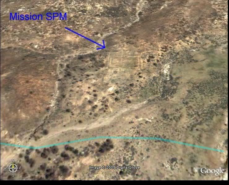
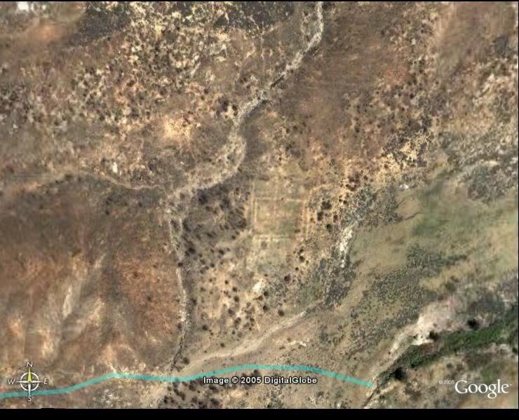
happens to be on high-resolution aerial photos and the mission ruins are visible when you zoom in! Even the tree we camped under at the end of the
trail shows up.
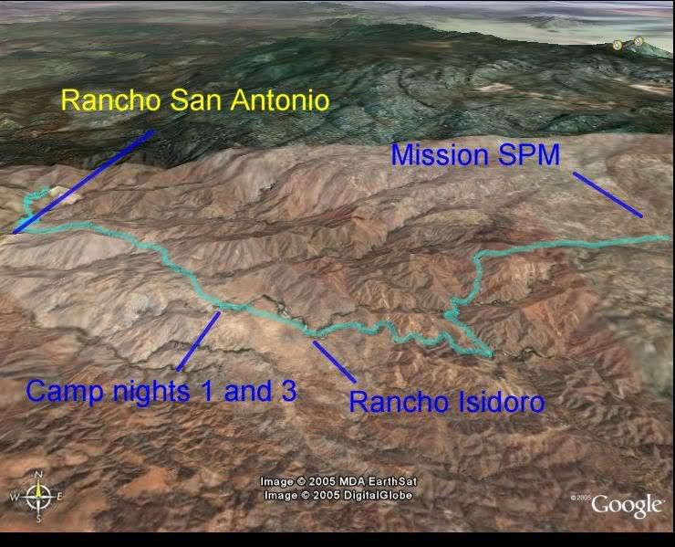
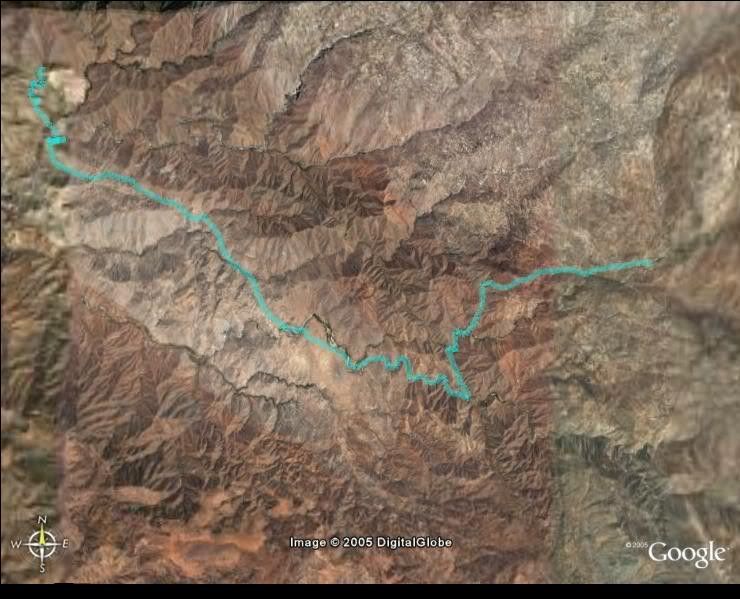
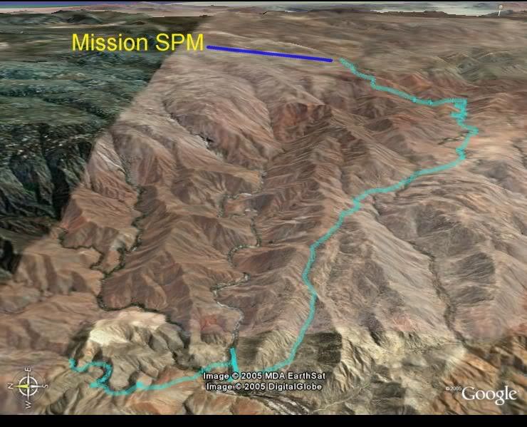
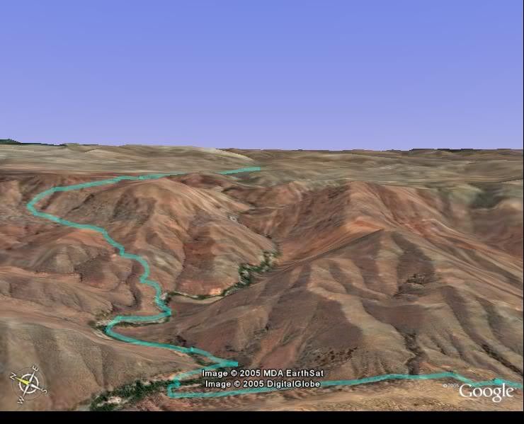
I have attached several images below, and have labeled key points on some of the images. Google Earth still blows me away every time I use it.
Enjoy
Oblique view to the north of trail.
Overhead view of the trail
Oblique view to the north of trail
The steep palisades
Oblique view of Mission ruins
Overhead view of Mission ruins
Wow-----------
Barry A. - 11-27-2005 at 01:10 PM
Taco, that is incredible! Wild and wooley place.
Thanks for posting this.
comitan - 11-27-2005 at 01:25 PM
At the mission SPM you can see squares, which were probably for growing crops..
Jack Swords - 11-27-2005 at 01:40 PM
Comitan:Actually the squares are walls of the mission (or what is left). Very visible from this photo and on the ground. We were lucky in that a big
fire burned off all of the usual brush that covered the site (also allowed us to take a different trail since the brush was gone.)
Taco de Baja: good job! This would be an interesting way to locate other sites of visitas and old trails throughout this region. Thanks for doing
this. I picked up and saved all of them from the Photobucket site. What a great way to highlight a trip.
bajalou - 11-27-2005 at 03:35 PM
Good work on the tracks with Google Taco - GoogleEarth really is amazing

SPM MISSION
BAJACAT - 11-27-2005 at 09:31 PM
So remote and so beautifull scenery, makes you wounder why they pick such a far away site for the mission.great 411 taco de baja
David K - 11-27-2005 at 09:43 PM
Great stuff Brooks!
To see and read more on Mision San Pedro Martir, photos by Jack Swords and the first version maps by Taco de Baja, go to: http://www.vivabaja.com/bajamissions/page12.html

[Edited on 11-28-2005 by David K]
ursidae69 - 11-27-2005 at 09:44 PM
Hella freakin cool Taco de Baja! 
[Edited on 11-28-2005 by ursidae69]
The hike
John M - 11-29-2005 at 06:48 AM
Taco - what was the distance of the hike in miles? How many hours on the trail each day?
John
David K - 11-29-2005 at 07:43 AM
Until Taco de Baja gets back to you, here is what I have from them... posted on my mission page ( http://www.vivabaja.com/bajamissions/page12.html )
Mision San Pedro Martir Trail Details
GPS map datum is NAD27 Mexico
a) Trail Head: 30?49.974', 115?37.718' elev. 2,710' (4 mi. so. of Santa Cruz)
b) Rancho San Antonio: 30?49.004', 115?37.643' elev. 1,934'
__Rio Horno (campsite): 30?46.422', 115?33.875' elev. 2,833'
c) San Isidoro: 30?45.905', 115?32.745' elev. 2,982'
__Base of Palisades: 30?46.337', 115?31.010' elev. 3,407'
__Top of Palisades: 30?47.073', 115?30.130' elev. 4,917'
d) Mision San Pedro Martir: 30?47.395', 115?28.268' elev. 5,092'
Hiking Time & Estimated Trail Distance (plus direct line on map distance)
a to b : 1 hr., 2 miles (1.1 mi.)
b to c : 4 hrs., 8 miles (6.0 mi.)
c to d : 7 hrs., 10 miles (4.9 mi
Taco de Baja - 11-29-2005 at 09:14 AM
David covered the times and distances.
The portion from the "camp nights 1 and 3 (Rio Horno)" to the mission was one of the toughest hikes I have ever done. (The Grand Canyon hike where I
whet from the South Rim to the Colorado and back to the South Rim in one 6 hour period was tougher- but I did not have a pack then  ) Not only did we have to brush whack through the canyon bottoms, we had to search for
stream crossing where we would not get wet feet. Our guides were on horses, so they had it easy. We also had to spend time searching for the trail as
well in some areas. If we did not have guides, we never would have made it.
We also had radical elevation changes. And when you set your mind to going up in elevation and think you are gaining, and all of a sudden the trail
begins descending and you know you will just go up again..... We also had rain to contend with. As well as 45 pound pack, on some of us.
For the write up immediately after the hike go here
[Edited on 11-29-2005 by Taco de Baja]
SPM Mission
academicanarchist - 12-4-2005 at 03:47 AM
The location of the mission explains why it did not last very long, and was the first of the Dominican missions in La Frontera to be abandoned.
SPM Mission
academicanarchist - 12-4-2005 at 04:00 AM
rpleger - 12-4-2005 at 09:00 AM
Wow....Super interesting.
Thank you for the posting..enjoyed it.


 ) Not only did we have to brush whack through the canyon bottoms, we had to search for
stream crossing where we would not get wet feet. Our guides were on horses, so they had it easy. We also had to spend time searching for the trail as
well in some areas. If we did not have guides, we never would have made it.