BajaNomad

Mision Sta. Maria - "Mission Impossible"

Ken Cooke - 11-28-2005 at 07:45 PM

Our group of 4WD rigs is back from tackling the notorious Mission Impossible trail just south of Catavina. Each of our vehicles contain a plethora of hard parts; Brad's Cherokee XJ contains a Rusty's Long-Arm suspension with 33" BFG AT rubber, ARB air-locking differentials, Super Dana 35 axle kit, Advanced Adapters transfer case, York/Kilby onboard air, power tools, all all of the electronic goodies. Chris Glass' Ford Explorer features a 2" Torsion Twist w/heavy duty aftermarket torsion bars up front and a spring-over-axle flip over the Ford 8.8" rear axle. Fender clearance is rounded up by a 3" Performance Accessories body lift and some subtle fender trimming. Traction is aided by an Ected cable-actuated locker system in the rear and Powertrax locker in the front differential. 33" Pro-Comp X-Terrains provide traction and style to his well-appointed "Tijuana Taxi." Chris' Explorer provides comfortable seating for the entire family! Ken and Suzanne Cooke's Jeep Wrangler Rubicon features an All J Products interior basket that provides virtually the same amount of interior storage as his Ford Ranger provided. With sturdy Dana 44 axles, and a 1 ton drivetrain, there is less fear of overloading the Rubicon like the Ford Ranger. A 4" Pro-Comp suspension, TeraFlex swaybar disconnects, and a Rock-It City oil pan skidplate provide the means of traveling some of Baja's more demanding stretches of "road."

Our party got an early start and dropped a majority of our water and heavy supplies off at the Shoemaker's residence in Rancho Santa Ynez before tackling Mission Impossible. With Suzanne tracking our movement using a Garmin GPS unit and the new and updated Baja Almanac, we were well on our way w/o any worries of getting ourselves lost.

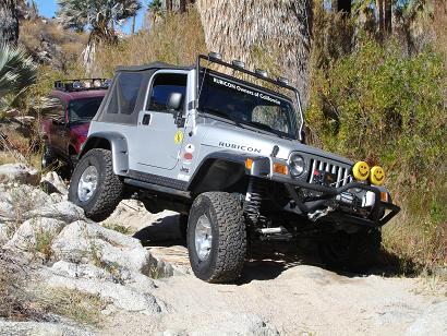
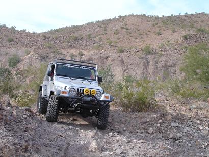
The Widowmaker sections of trail were amazing stretches of trail. Just like David K. had described, our Jeep was pointing straight down as it scrambled for traction on the loose rock and powdery dirt. Both Brad and Chris had an easier time due to their driving longer wheelbase rigs.

Our group came upon a nice group of gentlemen from the Tijuana area who were driving out of the Mexican Blue Fan Palm oasis after camping for 2 days in the backcountry. This group started out as an all Toyota 4WD Club, but eventually, some members bought newer SUVs, and you could see a Land Rover Discover tackle upper Widowmaker along with a Hummer H2 and H3!:wow: These gentlemen were very nice, and when speaking among themselves, described us as being "Nice Americans." :yes:

We drove into the muddy swamp that lie below, and afterwards, I scrambled atop a rock garden where I scraped the boulder bars of my Jeep. After repositioning my Rubicon, it was an easy drive back onto the trail - and off we were to the adobe mission! :bounce:

We reached the mission, and immediately, it was time for some hard-earned lunch. Ravens circling overhead landed, and walked towards our party even though our two Chihuahuas barked hysterically at them. Just across the ridge to our east lie the turquoise Sea of Cortez!

Thanks goes out to David K. and all of the Baja Nomads for his tireless responses to all of the questions I had about traveling into this region with our 4WD group. It was plenty of fun getting out for 5 days of adventure in the backcountry of Baja.

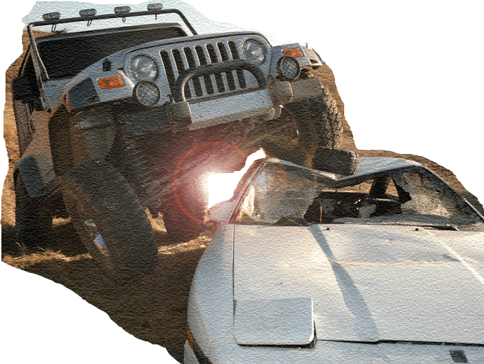
Oh, before I forget. On our way from Coco's Corner to Catavina, my pristine Silver Rubicon was struck by a young deer that had been eating on the side of the road (Hwy 1). The deer was okay and it even ran off into the grassland with its mate, but my drivers side door was dented heavily. Some bodywork will solve this. In late December, our group will travel to the Pole Line Road which we consider to be just a tad more difficult than the "Mission Impossible" trail. :?:

Ken Cooke - 11-28-2005 at 07:47 PM

Members of the Tijuana 4WD Club looking at video, and talking among Suzanne and Rhoda:


Tackling a rock garden just outside of the Swamp on the Mission Impossible trail:


David K - 11-28-2005 at 08:03 PM

GREAT KEN!!!

It was great seeing you, Suzanne and your friends Sunday morning at Baja Cactus and Mama Espinoza's!

More photos please!!

Here is Hugo Lopez's vision of the Santa Maria area...

[Edited on 11-29-2005 by David K]

Ken Cooke - 11-28-2005 at 08:18 PM


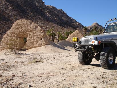
Parked on level ground beside the Mission Santa Maria.

Ken Cooke - 11-28-2005 at 08:20 PM


David K - 11-28-2005 at 08:22 PM

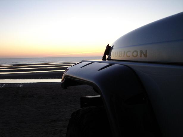
Great shot at Gonzaga Ken!!! Send it into Jeep! How was Beluga?

Ken Cooke - 11-28-2005 at 08:50 PM

We didn't make it into Gonzaga on the 2nd night. Too much good food, shopping, and just taking our time. So, we slept about 12 mi. north of Gonzaga on the beach, and had a wonderful time.

We checked out Beluga and it looked like a nice place with plenty of soft sand to keep the pesky tourists away! :lol:

Suzanne said that this was her favorite Baja trip ever!

David K - 11-28-2005 at 10:02 PM

" Suzanne said that this was her favorite Baja trip ever! "

Maybe you were more relaxed and didn't stick to a ridgid schedule?

I was quite surprised to find you tapping on our window at Baja Cactus Sunday morning!!! You were supposed to be back home Saturday night... per your schedule...

Now, the next step is to see you put away that watch when you cross the border!!! Learn 'Mexican Time' or even better, 'Baja Time' (Eat when you are hungry and sleep when you are tired)!!

The more you abandon ridgid 'gringo-like' habits, the more you will enjoy Baja and the longer you will live!

Get an annual auto. insurance policy for the Jeep, so no mad rush north if something comes up that makes you want to stay more days... PLUS it is a LOT cheaper... like 10-15 days of daily coverage is about the same $$ as an annual policy!

More photos please!

TMW - 11-29-2005 at 08:05 AM

Ken, sounds and looks like you had a great trip. Fun fun fun.

Ken Cooke - 11-29-2005 at 08:52 AM

Quote:
Originally posted by David K
" Suzanne said that this was her favorite Baja trip ever! "

Maybe you were more relaxed and didn't stick to a ridgid schedule?

I was quite surprised to find you tapping on our window at Baja Cactus Sunday morning!!! You were supposed to be back home Saturday night... per your schedule...

Now, the next step is to see you put away that watch when you cross the border!!! Learn 'Mexican Time' or even better, 'Baja Time' (Eat when you are hungry and sleep when you are tired)!!

The more you abandon ridgid 'gringo-like' habits, the more you will enjoy Baja and the longer you will live!

Get an annual auto. insurance policy for the Jeep, so no mad rush north if something comes up that makes you want to stay more days... PLUS it is a LOT cheaper... like 10-15 days of daily coverage is about the same $$ as an annual policy!

More photos please!


David,

I felt that we had to make the rush to Gonzaga Bay from San Felipe because the man who runs the Pemex Station there only operates the gas station from 7 a.m. until 5 p.m.

The reason we took longer to reach Catavina is because of the accident I got into with the deer, and my fear of heights when driving Hwy 1 at night with all of those semi trucks.

I haven't bought an annual policy for auto insurance since my horrible experience with Discover Baja - Never got around to researching other insurance companies, but I may get around to it early in '06.

The reason we had such a good time on this trip is because of the good friends and good times. We planned to see lots of new places in a short span of time, so it was expected that we would travel long distances during the daylight hours. On the Pole Line Run, we plan to spend 2 nights at Canyon Jaquegel which will give us time to relax and just unwind. But, that last morning out of Jaquegel, we plan to be up and on the trail at 8 a.m. in order that we will be across the border by dusk - I'll be wearing my wristwatch that day...you can count on that! :yes:

Neal Johns - 11-29-2005 at 11:12 AM

Tell the truth, Ken! Did that Tiajuana Toyota Club tow you into Mision Santa Maria? :lol::lol::lol::lol: :yes::yes::yes:

Ken Cooke - 11-29-2005 at 12:15 PM

Quote:
Originally posted by Neal Johns
Tell the truth, Ken! Did that Tiajuana Toyota Club tow you into Mision Santa Maria? :lol::lol::lol::lol: :yes::yes::yes:


Actually, I caught a ride on this neat Toyota that they loaned me! :O:O:O:no::no::no:


Neal Johns - 11-29-2005 at 12:57 PM

Very good, Ken! :o :mad: :lol:

David K - 11-29-2005 at 06:56 PM

"I haven't bought an annual policy for auto insurance since my horrible experience with Discover Baja"

Ken, since you brought that up, perhaps some additional info. would be only fair here...

I know much of the story, but it would be better if you wanted to tell more. Graham Mackintosh mentioned the incident in his third book, as you went to him for advice while he was camping there (no car) with the dogs.

I know that Hugh and Carol (owners of DB) did a lot to solve that insurance company's telephone contact issue, but I don't know what else you needed or expected from them. They knew you from my Viva Baja events you both attended.

Mexican auto insurance is to keep you out of jail if there is a collision or injuries. You weren't in a collision. After you left the truck up there because you had to leave, some items were taken... and that happens in Mexico (and here to).

I know it was a rough time for you guys with the sad event and Desert Bull was a hero with his assistance in getting your Ford towed back.

I am still with Discover Baja (GE Insurance now), but Bedman and others swear by Lewis & Lewis (Qualitas Insurance)... I am not sure what company DB was using when you were insured with them... ??

Ken Cooke - 11-29-2005 at 10:12 PM

Quote:
Originally posted by David K
"I haven't bought an annual policy for auto insurance since my horrible experience with Discover Baja"

Ken, since you brought that up, perhaps some additional info. would be only fair here...


David,

I feel I have provided plenty of personal info for you and the rest of the Nomads to read. I'm not interested in explaining myself further.

Ken------

Barry A. - 11-29-2005 at 11:26 PM

that is a shame, as many of us are insured thru Discover Baja, and would be very interested in what happened to sour you on them-------------???

Bedman - 11-30-2005 at 01:13 AM

DB, Desert Bull, Tim S. any name you call him doesn't do him justice. If I ever have a need in Baja (or anywhere else for that matter) HE and a very few others will be at the top of my list.

Yes, Ken. I like Lewis and Lewis. They have always treated me well. I have never filed a claim with them and I (God willing) never will. I do know of a few folks that have and have been treated well and fairly.

UNLIKE my Progressive insurance policy for my Motorhome.

Bedman

Ken Cooke - 11-30-2005 at 06:17 AM

Initially, the phones did not work for Zurich when I needed to ask questions about my vehicle insurance policy while in Baja. With my transmission completely burned up, and no 2nd vehicle to help tow or drive out of Sierra San Pedro Martir, Suzanne and I had to rely on strangers to drive us down the Observatory Road to meet with friends from our area who were traveling from "Shipwrecks" (outside of Camalu) back to the Riverside area.

While in Camalu, a good friend tried repeatedly to connect with the Zurich insurance co. but could not because the companys phones were not working all weekend (supposedly). That friend who drove us around and tried calling, purchasing Ladatel phone cards, etc. died exactly 6 months after this situation took place. Leaving 5 young daughters and a great husband. Her words to all of us were not very good about Zurich or DB.

Back in the 'states, I called around and David K. put me in connection with Desert Bull (Tim Sanchez) who loaned me his trailer without ever meeting me. My buddy Andrew Simpkins drove south from San Jose, CA and picked up the trailer and hauled the disabled Ford Ranger back to the 'states.

Once back in the USA, my wife discussed the passing of her Grandfather and how she wished I could have been at her side. We both purchased plane tickets to Michigan and I could not leave with her since I had to wait for Andrew to arrive from the Bay area, etc.

Discover Baja investigated what had happened with Zurich and followed up other complaints that Zurich's phones were inoperable during that duration of time. I was told that my claim and the claims of others was "Driving up the price of carrying Zurich" for Discover Baja. Now, I did not feel this was my fault. I did not intentionally set out to watch my Ford Ranger bite the dust, miss a plane to see a man in his last days, and find out that I could not reach an Insurance Co. while in Mexico.

What I did find out was that David K., Desert Bull, and all of the other Amigos turned out to be a tremendous asset to a person in need while stuck in Baja - I found out who my real friends are.

I felt that this was a horrible experience because; 1) I could not reach Zurich International on their telephones to discuss coverage. 2) I was ridiculed for allegedly "raising the rates" for Zurich Coverage by DB. 3) I missed a plane to see someone before he died. 4) The shock and anxiety of trying to figure out a way home from Sierra San Pedro Martir.

As a learning experience, I now travel with other people/vehicles while in remote stretches of Baja and I purchase policies over short stretches of time (this may change) from Instant Baja. Hopefully, I will not have to experience this kind of experience in the future.

Thanks, Ken. I know that---------

Barry A. - 11-30-2005 at 07:38 AM

------I appreciate hearing of your experience, and I am pretty sure that many others do to.

Thanks again.

David K - 11-30-2005 at 08:08 AM

Thanks Ken... DB no longer uses Zurich (perhaps because of your experience)!

I am still not sure why you needed to call them as there was no accident.

But, that is your business and you may want it left burried...

I am sure the newer Nomads appreciate the details of this past dark moment for you both... Thanks!

Ken Cooke - 11-30-2005 at 06:49 PM

David,

I'm not one to dwell on the past...just learn from it as best I can. One more thing I do differently is I go in and get all of the fluids checked by a professional before I leave for an adventure. You just can't be too careful out there...

msm

seth - 2-2-2006 at 02:17 PM

i'm never the driver in baja, don't even have a driver's license in the states, so take this question with a grain of salt...

how the heck do you *drive* out of mission santa maria? we were there a couple of weeks ago and did the drive in 12 mi, walk the last 2 thing. awesome area. going down the hill the last 2 miles doesn't seem that outlandish, but coming out? do people actually drive it, or do they just winch themselves out? the steepness is bad, but much worse is there isn't any traction with all that loose rotten granite gravel/dirt. airing down tires and off road gears and lockers and all that, yeah, but still.

Ken Cooke - 2-2-2006 at 05:48 PM

Quote:
Originally posted by sethhow the heck do you *drive* out of mission santa maria?


Easy, you just hit your rear locker button, make sure the transfer case is in 4LO and you drive...slowly. Each of these three vehicles made the drive w/o any problems or issues:

My Wrangler Rubicon
My friend Chris Glass' Ford Explorer
My friend Brad Green's Jeep Cherokee XJ

All of us have locking rear differentials, and selectable front locking differentials - locking differentials transfer 100% traction to each wheel, turning simultaneously.

Brad:


Chris:


Ken (me):


Neal Johns - 2-2-2006 at 11:59 PM

Here is the Toyota with Camper that pulled Ken's Jeeps up the hill.:lol::lol::lol:

David K - 2-3-2006 at 09:12 AM

Neal, time to clean your glasses!

seth, it is steep yet doable with ground clearance, low range 4WD and a locking rear differential! It was easier in my truck then when I went up it on a quad in '99 (and got bounced off... see the blood on that rock, lol?)

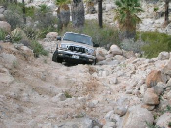
Here is my Tacoma in 2003 climbing up that grade I call The Widowmaker:


David K - 2-3-2006 at 09:14 AM

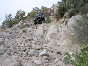
Here is chicagoross' Jeep going down the Widowmaker on that same trip:


seth - 2-5-2006 at 12:35 PM

so lockers really do make all the difference, huh? good to know. while we are posting rig pictures, here is my brother's beside the 1 really noticeable cactus on the MSM road, about 1/2 way out.

[Edited on 5-2-2006 by seth]

David K - 2-5-2006 at 01:01 PM

So you hiked the last 2 miles? The photo of your brother's rig (Toyota) says to me, he could have made it. But, without a second vehicle along... better to play it safe!

The 'auto' road continues beyond the mission about a mile and a half (take left fork out of arroyo) to a bulldozed grade where the folks at Rancho Santa Ynez finally abandoned their effort to build a road to Gonzaga Bay.

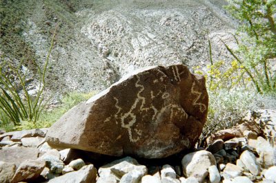
The top of that grade (a short hike from the point deep ruts stop your rig) are some petroglyphs and a view down into the Santa Maria Canyon... An Indian trail (also used by the Jesuits as the El Camino Real) drops into the canyon.

When Junipero Serra passed over it in 1769 he ordered a better route be constructed, along with a cargo trail to Bahia San Luis Gonzaga where supplies arrived for the mission program.

The newer El Camino Real stayed out of the canyon, near the north rim. It decends the mountain and joins the bulldozed grade near the point you can no longer drive further.

The cargo trail is further north, more direct to Gonzaga Bay (near Papa Fernandez') from a point about 11 miles from Santa Ynez (down from the highpoint where you see Punta Final and the gulf).

Photos at http://vivabaja.com/403 and El Camino Real details on Don Jorge's web page http://www.southcoastfarms.com/gonzaga_to_mission_santa_mari...


[Edited on 2-5-2006 by David K]

Ken Cooke - 2-5-2006 at 10:44 PM

When out in a lone vehicle, its always better to play it safe. This particular trail is very slick with all of the loose dirt and granite. Plus, with that swampy bog, it would be easy to get stuck in the mud. Me, I jumped my Rubicon over a submerged tree stump in the bog, and got a little air under those BFGs in the process...:spingrin:

bajataco - 2-7-2006 at 08:59 AM

Quote:
Originally posted by Ken Cooke
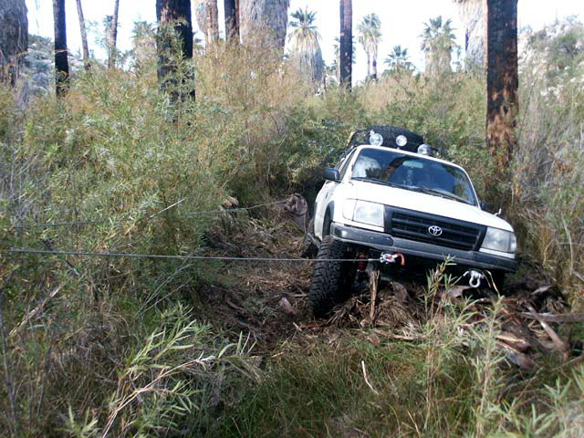
Plus, with that swampy bog, it would be easy to get stuck in the mud.


From personal experience, I can say that Ken is absolutely correct :P


bajataco - 2-7-2006 at 09:04 AM

A very cool video of my friend Doron driving his Toyota Landcruiser through that same bog. (2.89mb - right click and "save target as" )

David K - 2-7-2006 at 09:09 AM

Wow, he sure got way airborn!

Ken Cooke - 2-7-2006 at 07:10 PM

Great video!!

David K - 2-7-2006 at 07:12 PM

Ken... we need a video like that showing the deer ramming into your Jeep's door in Baja!!!:lol::light::rolleyes:

Ken Cooke - 2-7-2006 at 08:16 PM

Quote:
Originally posted by David K
Ken... we need a video like that showing the deer ramming into your Jeep's door in Baja!!!:lol::light::rolleyes:


How about an in-cab camera showing me and Suzanne while it happened? The tires were aired down to 10 p.s.i. going 40 m.p.h. - front antiswaybars were also disconnected!! I held the steering wheel in a DEATH GRIP as I went around the turn, and luckily I didn't get knocked off the Hwy - it would have been a nice roll all the way down...

BAJACAT - 2-7-2006 at 08:41 PM

Quote:
Originally posted by bajataco
Quote:
Originally posted by Ken Cooke
Plus, with that swampy bog, it would be easy to get stuck in the mud.


From personal experience, I can say that Ken is absolutely correct :P


Bajataco where is this picture taken it'sthe road towards the santa maria mission:?:

Neal Johns - 2-7-2006 at 10:38 PM

Great picture!
The bog is usually not too bad. But it is frequently overgrown like that. It's at the bottom of the "Widowmaker" for about 50 yards. What do you say, guys? Is it about 50 yards long? I can't remember the easy parts since I hit 75 years old a couple of weeks ago. :lol::lol::lol:

David K - 2-7-2006 at 11:00 PM

Yes Neal... it is perhaps a hundred meters from the bottom of the widowmaker and another 100 meters in the bog.

I had no problem driving in the creek/bog... just slow and sure in low range 4WD...

After the bog, the road climbs out of that arroyo, over a boulder hill and into the mission valley... a mile and a half from the widowmaker.

bajataco - 2-8-2006 at 09:03 AM

Quote:
Originally posted by BAJACAT
where is this picture taken it'sthe road towards the santa maria mission:?:


Yep, just as Neal and DK described above. It is shortly before you get to the mission. On this particular trip, the bog had been "wallowed" out by previous vehicles, and the resulting hole was completely submerged under muddy water. To make matters worse, the whole thing was covered with fallen palm debris, which upon exit from the "hole" made for a nasty blockade of slippery mess to get over. My little 32" tires weren't up to the task, not even with the rear differential locked. My buddy's TLC was on 35" tires and locked up. Here is a pic of the TLC on 35's getting into the hole to give an idea of what I mean :lol:


The trip gallery can be seen HERE


:)

From Space

bajalou - 2-8-2006 at 09:13 AM

Here's David and Don Jorge's waypoints from far away--

[Edited on 2-8-2006 by bajalou]

David K - 2-8-2006 at 09:27 AM

Lou, that's great! I think I can relate your numbers...

GONZAGA TO SANTA MARIA


Trip log: GPS Directions (map datum NAD27 Mexico)

1) Take Hwy. 5 south 7.4 miles from Rancho Grande, turn west: 29?41.094'/ 114?24.566'

2) 3.2 miles west of Hwy. 5, go straight where most traffic curves left for Las Palmitas: 29?41.278'/ 114?27.639'

3) 0.8 miles from above, park at huge boulder: 29?41.68'/ 114?28.20'

4) Hike to north bank of Arroyo Santa Maria to: 29?41.733'/ 114?28.175' elev. 609'

Go northwest and climb out of valley, note ocotillos.

5) Along left side of side valley: 29?42.374'/ 114?28.566' elev. 741'

6) On first padre built switchback up: 29?42.669'/ 114?28.937' elev. 906'

7) On a ridge, trail continues northwest: 29?42.671'/ 114?29.425' elev. 1308'

8) On the Camino Real: 29?42.748'/ 114?29.482' elev. 1391'

9) Crossing ridges and little mesas: 29?43.008'/ 114?29.967' elev. 1477'

10) Drop along side of ridge, trail narrow: 29?43.074'/ 114?30.128' elev.1610'

11) End of today's hike just beyond this last clear sign of the old trail: 29?43.141'/ 114?30.189' elev. 1702'

12) From Don Jorge: JCN. ECR & bulldozed road: 29?43.12'/ 114?31.71' elev.1421' (End of bulldozed road, east of the mission: 29?43.033'/ 114?31.556' elev. 1,615' )

Mision Santa Maria: 29?43.888'/ 114?32.791' elev.1651'


[Edited on 2-8-2006 by David K]

bajalou - 2-8-2006 at 09:34 AM

Right David, I just number them in the order you have them listed on your post.

David K - 2-8-2006 at 09:38 AM

Lou, can you add Las Palmitas to the map?

Las Palmitas Oasis: 29?40.35'/ 114?28.29'

David K - 2-8-2006 at 09:44 AM

Here is Don Jorge's map of the Camino Real and canyon...

From his great Gonzaga to Santa Maria web page: http://www.southcoastfarms.com/gonzaga_to_mission_santa_mari...


[Edited on 2-8-2006 by David K]

bajalou - 2-8-2006 at 09:49 AM

I edited the Sat view above to include la Palmitas

bajataco - 2-8-2006 at 09:58 AM

Man, what an absolutely incredible journey :cool:

David K - 2-8-2006 at 10:03 AM

Terrific Lou, many thanks!

Mcgyver and others... One can drive from Hwy. 5 (#1 on Lou's map) to #2 (3.2 mi.), then either go south from #2 to Las Palmitas to see the oasis (1.5 mi.) or continue west from #2 to #3 (0.8 mi.). There is a steep grade just before #2 where the road drops into the Santa Maria river basin. Those with 4WD will have no problem.

#3 is a parking spot by a large boulder on the edge of the sandy arroyo. Tire tracks go up the arroyo a very short distance only to be blocked by rocks and brush. You can continue on foot about a mile to pools of water and palms or even hike up the canyon to the mission... But, you will need to get wet and climb boulders, according to Don Jorge.

Tracks also go from #3, in the arroyo back to Hwy. 5 at the big vado 5.6 miles... On the north bank of the arroyo, across from #3, is where the Camino Real climbs out of the arroyo... cattle tracks converge as this is the point they are able to climb out as well... #4 on Lou's satellite map or #1 on Don Jorge's map.


[Edited on 2-8-2006 by David K]

seth - 2-9-2006 at 03:02 PM

the swamp was in full effect January 2006. was quite overgrown and what not. we ended up not crossing at the bottom of "widowmaker", just stayed on the N bank for a hundred yards or so, then crossed where it got dryer (on foot, eh?). there were some cool horses and burros kicking it in the palms it was pretty nice.

Waypoints

bajalou - 2-11-2006 at 08:08 AM

Here's a new spaceshot with Don Jorge's waypoints as well as David K's waypoints. Looks like I forgot to remname 13 as the Mission.

[Edited on 2-11-2006 by bajalou]

David K - 2-11-2006 at 08:51 AM

Now, with Don Jorge's added, you can clearly see the route of El Camino Real north of the canyon... Many thanks Lou!!

in 3D

bajalou - 2-12-2006 at 07:58 AM

Here's the same general area projected in 3D using eleverations from the SRTM files.

Gives a new perspective --

Too big - (wrong jpg)

[Edited on 2-12-2006 by bajalou]

TMW - 2-12-2006 at 10:43 AM

Thanks Lou, you are the master.