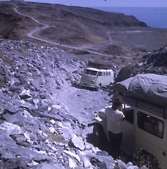
Quote: Originally posted by 4x4abc  |
| Quote: Originally posted by David K |
| Quote: Originally posted by 4x4abc |


| Quote: Originally posted by JZ |


| Quote: Originally posted by Three2tango |


| Quote: Originally posted by Russ |


| Quote: Originally posted by David K |


| Quote: Originally posted by Fatboy |
| Quote: Originally posted by Fatboy |


| Quote: Originally posted by 4x4abc |
| Quote: Originally posted by 4x4abc |

| Quote: Originally posted by 4x4abc |
| Quote: Originally posted by Pablito1 |
| Quote: Originally posted by Russ |

| Quote: Originally posted by TMW |
| Quote: Originally posted by JZ |


| Quote: Originally posted by 4x4abc |