BajaNomad

Quick tour to Catavina, any suggestions?

oslotboom - 1-25-2007 at 10:53 PM

I'll be in the San Diego area in late March (spring break) and I really want to see the boojum forest and prime desert fauna/flora around Catavina.

I'm thinking this is a two-day, one night trip. I can't find any organized tours that just go to Catavina, and I am definitely not qualified to attempt driving (don't speak Spanish and I'm not Mexico street smart.)

So I'm thinking of a personal tour guide/driver service that would take me and a buddy on the trip, including supplying the vehicle. I found one listing in San Diego (Baja Guia) but it is non-responsive.

I'm looking for suggestions on how I could make this happen, or any recommended personal guide services.

Thanks,
Dallas,TX

Drive it man!!!! Go for it!!

thebajarunner - 1-25-2007 at 11:06 PM

Hey, you only live once, and this is not like driving the Dakar Rally.
You don't need Spanish, shoot, you don't even need pesos.
I am sure you will be inundated with comments, but let mine register first.... buy an insurance policy at the border and let 'er rip!
My wife and I took a fast dash down to Catavina the day after Christmas.
It is certainly a drive that will fill a good part of the day, each way, but you will have plenty of time to see, wander, and be amazed.
More later, after you let this sink in.
In fact, our Central Cal. Baja Boyz are cruising down there that week, hook up and follow us, and see how easy it can be.

DavidT - 1-25-2007 at 11:07 PM

Drive time to Catavina is 7& hours from San Diego, take an extra day or two if you can.
Rent a car and drive as far as you can, the most difficult part of your trip will be returning to the US.

David K - 1-26-2007 at 01:02 AM

I would be happy to help as a guide, with my 'self-guided tours web site'!

There is MUCH to see in the Cataviņa region (El Rosario to Punta Prieta)!

Go here and see the list of links to sites to see around El Rosario, Cataviņa, Bahia San Luis Gonzaga and Bahia de los Angeles: Baja Self Guided Tours

When you click on that link, scroll down to this group... each listing is a direct link to photos of that place:

EL ROSARIO AREA:

Missions, Museum, La Bocana, La Lobera

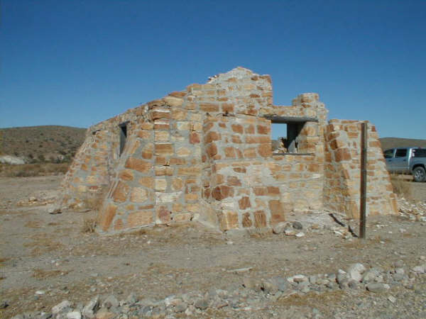
Cactus Garden and Sauzalito mine ruins

Punta Baja and south (coast road)

Petrified Forest (guide required)

El Camino Real near Km. 80

Las Pintas Fossil Grotto

Los Martires to El Socorro, cactus forests, petroglyphs found!

Mision San Fernando and petros '05

Mina de San Fernando (plus mission and petros in '00)

El Marmol & El Volcan

Agua Dulce historic spring (plus Baja Cactus Motel)


CATAVIŅA AREA:

Colorful Petroglyph Cave

Rancho Santa Ynez cafe '01

Rancho Santa Ynez and road to Mision Santa Maria '03

Mision Santa Maria '99

More of the road to the mission in '03

Mision Santa Maria de los Angeles

Hiking the El Camino Real and canyon trails between Santa Maria and Gonzaga Bay

Petroglyphs near Santa Maria


BAHIA SAN LUIS GONZAGA AREA:

Mission-era warehouse ruins on the shore of the bay

Alfonsina's Beach

Onyx Springs create a mineral glacier

Molino de Lacy ruins & grave

Las Palmitas oasis and Santa Maria Canyon

El Camino Real to Mision Santa Maria

Santa Maria Canyon from the air

La Turquesa Canyon

Coco's Corner

Calamajue mission site


BAHIA DE LOS ANGELES AREA:

Tinaja de Yubay

Punta Candeleros & Remedios (Bahia Guadalupe)

El Toro Copper Mine

Camp Gecko cabin, turtle research station, & La Gringa

Bahia de los Angeles highway, Pemex, etc. '05

Bahia de los Angeles Museum

Mision San Borja

Mision San Borja (inside)

Old San Gregorio

Santa Ana, San Ignacito

Montevideo Petroglyphs

Las Tinajitas Petroglyphs

Camp Gecko '03

Las Flores

Los Paredones, La Bocana, Bahia San Rafeal

Las Flores Railroad and Tramway

Rock Palm Hill (near Yubay)

=========================================================

Here's a sampling of the Cataviņa and nearby area!:

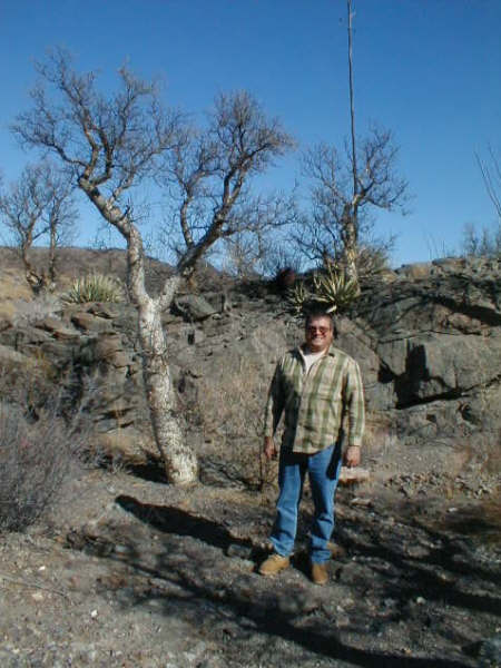
BOOJUM (Cirio) TREE:


BOOJUMS behind my truck:


CATAVIŅA CAVE ART:


MISION SANTA MARIA:


OASIS near Santa Maria:


GONZAGA BAY


EL MARMOL & WORLD'S ONLY ONYX SCHOOLHOUSE


ELEPHANT TREES (El Marmol-El Volcan road)


EL VOLCAN (Cold Water Geyser)


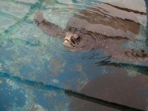
TURTLE RESEARCH STATION, Bahia de los Angeles


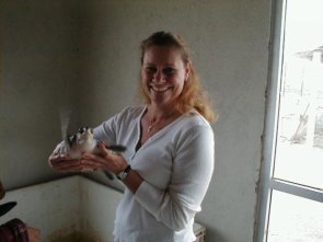
CUTE BABY TURTLE


ARCH BOOJUM


STRAIGHT BOOJUM


MONTEVIDEO PAINTED CLIFF


OLD BAJA NUT & YOUNG BOOJUM


Contact me if I can be of further assistance! (u2u or email: info*at*vivabaja.com)


[Edited on 1-26-2007 by David K]

TMW - 1-26-2007 at 08:20 AM

And after you get back give us a trip report.

larry - 1-26-2007 at 10:59 AM

I have to agree with those above: you should drive this yourself. For the most part, you are talking about slower driving conditions than on US freeways. Tijuana urban traffic can be avoided completely. You will hit some traffic in Ensenada and San Quintin, but most of the trip on Highway 1 is one lane in each direction with very little traffic. Not everyone will speak English but if you really need to communicate you will be able to do so in English. Most of the tourism in this area is gringo and many don't speak Spanish.

You can do this trip in two days, one night but it is a long drive which will allow you only a few hours to look around.

David K - 1-26-2007 at 01:03 PM

Perhaps the guy just wants to kick back and enjoy the trip without learning the ins and outs?

Two days there would allow you to see so much stuff, but two days total is not enough... Cataviņa is 300 miles from San Diego (6 hours+).

If you are going to already be in San Diego for other reasons, then give yourself at least one more day... You won't regret it!

Day 1: Head south, if at midday or afternoon then stop for a lobster lunch at Puerto Nuevo (Chela's) or dinner at the Half Way House. If rushed, then a fast meal at Tacos el Yaqui in Rosarito!

As seeing the central desert is the primary purpose, then breeze through Ensenada and head straight for the finest, inexpensive accomodations... Baja Cactus Motel, El Rosario.

If the trip starts from San Diego in the morning, then visit La Lobera... the sea lion crater (3 miles from Km. 47.5), 6 miles north of El Rosario...

A guide could take you to the petrified forest of El Rosario.

There are two mission sites in El Rosario, a museum, Mama Espinoza's (just to see the stuff inside, if not a meal there), other restaurants and taco satnds... Hugo's art gallery/taco shop 'Mision', as well.

Day 2, breakfast at Baja's Best on your way south and head into the boojum hills!

A trip of about 10 miles north on the Los Martires road takes you into a great boojum forest, past abandoned copper mines.

Mision San Fernando (1769) is just 3 miles off the highway and a cliff of petroglyphs is a mile beyond.

El Marmol and El Volcan is 9 + 4 miles more from the highway.

Agua Dulce is a historic spring on the padre's El Camino Real, just a couple miles from Hwy. 1... You can drive a section of the original Baja main road (pre 1973) to Cataviņa from Agua Dulce ... the famous Mexican 1000 & Baja 500 race used it.

The Cataviņa painted cave is a must see...

Depending how much of the Day #2 places you visit and spend time at, you can either head back to Baja Cactus in El Rosario, continue on to Bahia de los Angeles (many motels), or stay at Cataviņa (2 motels or dorm room at Rancho Santa Ynez).

Day 3, if starting from Bahia de los Angeles... a quick tour of town and the bay, breakfast at Las Hamacas Restaurant... Visit Montevideo and perhaps Mision San Borja, then head to San Diego. The tallest (or one of the tallest) boojum trees in Baja was along the Montevideo road... A hurricane toppled it. The best cactus garden in Baja is here. Montevideo has wonderful painted pictographs.

It will be a 9 hour trip to San Diego from Mision San Borja, so you will arrive late on day 3, if you want to get all of the above in.

Another option would be to start day 3 in Cataviņa, go to Gonzaga Bay via Coco's Corner and to San Diego past San Felipe... You get to see a whole lot more of northern Baja!

Photo at Gonzaga Bay...

1106 217xr.JPG - 48kB

oslotboom - 1-27-2007 at 01:09 PM

Thanks to everyone for the responses. The info and photos make me want to go even more!

I'll have to give closer consideration to driving myself. If I can find a travel partner who has some experience in Mexico, I'll be ready to go for it.

The comment about spending 3 or 4 days on the trip makes a lot of sense, especially with the time required to get back into the U.S.

fdt - 1-27-2007 at 01:20 PM

Check you U2U oslotboom

David K - 1-27-2007 at 08:04 PM

oslo... I have a lot of nice photos, honest! You aren't seeing them today because the Internet server is off line... The one at Gonzaga Bay is off my PC, the rest off VivaBaja.com

So, do come back later!

Between fdt (Fernando de Tijuana) and the I and the other Nomads, we will help you enjoy a boojum tree wonderland!

wilderone - 1-29-2007 at 10:21 AM

"but most of the trip on Highway 1 is one lane in each direction with very little traffic. "
There is plenty of traffic, and most of it is huge trucks, motorhomes and buses, or people towing boats with wide trailers which sway into your lane. That portion - TJ to Catavina - also crosses two mountain ranges - plenty of hairpin turns and slow uphill pulls. With all those speeding SUV's with US plates, the huge trucks, buses and military vehicles carrying 20 soldiers in the back, they all cross over to your lane, some even pass on blind turns, and often there rocks and debris in the road which has fallen of the abutting cliff. And you may enounter slow trucks going uphill, which will necessitate a risky passing maneuver; and lord help you if you get behind a caravan of motorhomes. Or a howling windstorm or dust storm. In short, it is not a carefree drive - white knuckles and be alert at every moment. The traffic does start to thin past the turnoff to Bahia de Los Angeles.

What a great encouragement.... NOT!!!

thebajarunner - 1-29-2007 at 11:17 AM

Quote:
Originally posted by wilderone
"but most of the trip on Highway 1 is one lane in each direction with very little traffic. "
There is plenty of traffic, and most of it is huge trucks, motorhomes and buses, or people towing boats with wide trailers which sway into your lane. That portion - TJ to Catavina - also crosses two mountain ranges - plenty of hairpin turns and slow uphill pulls. With all those speeding SUV's with US plates, the huge trucks, buses and military vehicles carrying 20 soldiers in the back, they all cross over to your lane, some even pass on blind turns, and often there rocks and debris in the road which has fallen of the abutting cliff. And you may enounter slow trucks going uphill, which will necessitate a risky passing maneuver; and lord help you if you get behind a caravan of motorhomes. Or a howling windstorm or dust storm. In short, it is not a carefree drive - white knuckles and be alert at every moment. The traffic does start to thin past the turnoff to Bahia de Los Angeles.


Wow, after 35 years of driving that road I now feel like I should be afraid....
Maybe that is why my hair is turning gray.
Oh well, even if your assessment were accurate- which I do not feel that it is- that wonderful liberating sense when I pass the last plowed field of San Quintin somehow makes it all worthwhile
BAJA VIVA!!