BajaNomad

Back roads - BLA to Gonzaga?

gringorio - 9-30-2007 at 08:38 PM

Hola

Does anyone know if there are back roads (4-wheel drive)that go from Bahia de los Angeles to Bahia Gonzaga rather than going back out to Hwy 1? If so can you share some details?

Thanks!

gringorio :bounce:

baja Steve - 9-30-2007 at 08:45 PM

The road going south starts east of Coco's. I asked Coco earlier this year about the road and he said it was very had due to the storm last Sept 06.

Ken Cooke - 9-30-2007 at 09:55 PM

Quote:
Originally posted by baja Steve
The road going south starts east of Coco's. I asked Coco earlier this year about the road and he said it was very had due to the storm last Sept 06.
Yet another challenge to plan for in years to come! :bounce::yes::spingrin:

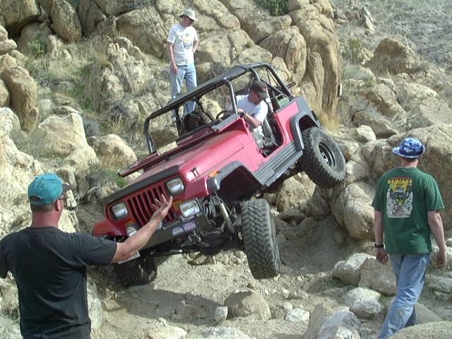
Jeeps and rocks are like Peanut Butter & Jelly! :bounce:


4baja - 10-1-2007 at 06:33 AM

we like to do the road from the large arroyo (just east of the bola turnoff and allso the baja 1000 rout) that goes to la crucera and then down the calamajue wash. continue on and you pass the old mission and a mine on your right. make a left at the tee and you end up at co-cos. fun if you dont mind getting your truck scratched a little.:coolup:

David K - 10-1-2007 at 08:28 AM

Hi Greg,

Here is the route outlined by 4baja and others... It is the Baja 1000 route between L.A. Bay and Coco's Corner... As you can see it uses roads shown on this map except for about 5 miles which I drew in... It is a road parallel to Mex. 1 from 'El Crucero' south to the old L.A. Bay road (1.5 mi. of it is shown between the old L.A. Bay road and the road that goes 13.9 mi. NE (goes to a ranch at the headwaters to Arroyo Salsipuedes).

For a few miles it drives in water filled Arroyo Calamajue (the only challenging part)... Where the arroyo opens up, the road north climbs up a grade, out of the arroyo. At this point, look for tracks going ahead and to the right side of the arroyo, which climbs up to the terrace where the mission/ visita ruins of Calamajue are located... See my mission web page for photos. This was the first site for Mision Santa Maria... moved after a few months when the water was discoverd to be to heavily mineralized to grow crops!

LABay-Gonzaga-r.JPG - 49kB

Comments on route shown by David K

John M - 10-1-2007 at 01:47 PM

Not to be confused, the paragraph where David says "for a few miles it drives..." he is traveling north, or northeast from Highway 1 starting at Crucero and eventually going to Coco's Corners. I have the gps for the exit out of the wash - near the turn to Calamajue ruins. The bushes along the muddy portion of Calamajue wash often touch in the middle and you drive between them!

Also a comment about the route of the Baja 1000 south from Crucero - the road David penciled in - last time we were on that it was a constant series of whoop-de-doos - and big ones at that - for most of the five miles of the penciled in road. Slow, slow, slow

John M

David K - 10-1-2007 at 05:25 PM

Yes, I worded it going north because Greg asked for a route from L.A. Bay NORTH to Gonzaga Bay, off pavement. Good to point out, thanks John... as most directions are going south!

gringorio - 10-1-2007 at 05:35 PM

hey thanks everyone,

this is great information! my brother and I are being shuttled by a friend from BLA to Gonzaga after we drop our car off in BLA - to paddle back to BLA and our car. When we drive the truck and kayaks back up to Gonzaga from BLA to start the paddle we really want to try this route. So yes, we'd be driving it going north. thanks for the map David! John M, any chance you can email me any of the gps coordinates you have for this route?

Gracias!

gringorio

TMW - 10-2-2007 at 07:31 AM

gringorio when will you be doing this trip. Preunning for this years Baja 1000 starts Oct 13 up until race day of Nov 13. If those are your days it would not be advisable to run backwards on the race course (the dirt sections). If it's not during those dates it's OK. Have fun.

gringorio - 10-2-2007 at 07:40 AM

hey TW, thanks for the important info - makes me very sad 'cause we'll be back and forth between Gonzaga and BLA around those dates. bummer!

:no:

Quote:
Originally posted by TW
gringorio when will you be doing this trip. Preunning for this years Baja 1000 starts Oct 13 up until race day of Nov 13. If those are your days it would not be advisable to run backwards on the race course (the dirt sections). If it's not during those dates it's OK. Have fun.

David K - 10-2-2007 at 10:13 AM

Greg, see my GPS waypoint web page for several points between L.A. Bay and Gonzaga Bay: http://community-2.webtv.net/thebaja/bajagpslist/

Page 3 & 4 for your trip... Map datum is set to NAD27 Mexico.