BajaNomad

Free 1:50,000 Maps

JamesBC - 3-16-2008 at 07:33 AM

Detailed topo maps are available for download from the Servicio Geologico Mexicano at this site:

http://www.coremisgm.gob.mx/

Go to 'productos' in the top bar, then choose 'cartas' on the left of the menu bar that appears below. Then choose '1,50,000'

From there, choose 'Número de carta' under 'GEOFÍSICA, Campo Magnético'
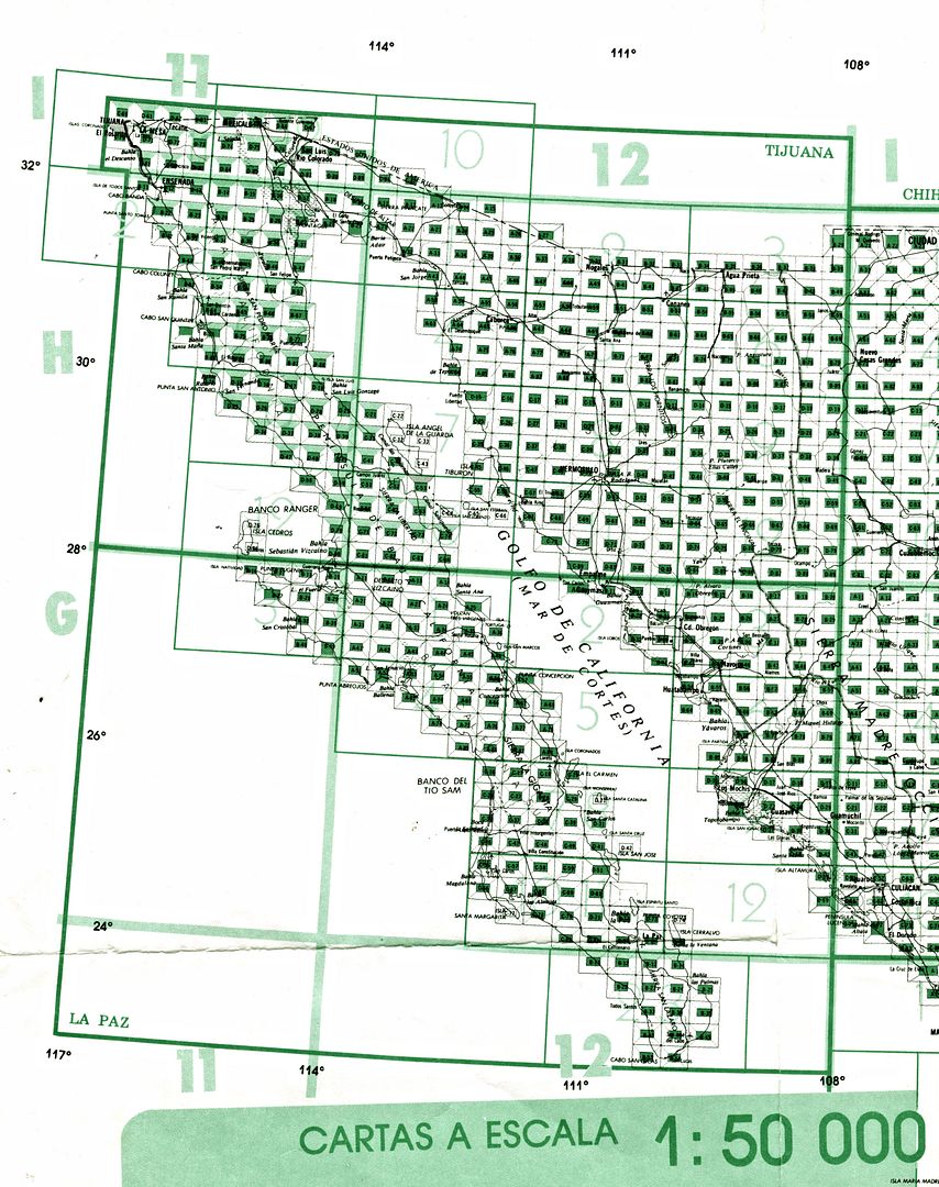
This will bring up a map of mexico with red squares for every quad available. Maps are very detailed, with topo lines, trails, creeks, etc. They can be viewed online, or, more importantly, downloaded in .pdf format.
The thing is - the are designed to be printed on very large paper, so you'll need to zoom in quite a bit to see the detail, but it is there.
You have to deal with the colors representing the magnetic fields of the terrain, but you can't beat the price.
If anyone (with more time than I have) wants to download all of them for baja, and offer them to other nomads in a zip file, that would be really cool.
For now, I'm just downloading what I need for a trip, and taking them along on my laptop as a backup for my less-detailed 1:650,000 paper map.

[Edited on 3-16-2008 by JamesBC]

bajalou - 3-16-2008 at 08:29 AM

Thanks - this is great-

There is a program, ABCAmber, which will change PDFs to JPEJs which can be calibrated for use in OziExplorer and other map programs. (probably others, but this is the one I found a while back)

[Edited on 3-16-2008 by bajalou]

Jack Swords - 3-17-2008 at 07:38 AM

Glad to see that some folks are getting out of the cities/pueblos. A great source for topo maps is INEGI (Instituto Nacional de Estadístico Geográfia e Informática) which in La Paz is at Altamirano 2790. They have 1-50000, 1-250000, and 1-1000000 topos of all of Mexico. Very well done, you pick your quadrangle from a large map and they bring it to you. Best of all, you can get each quad in digital form with as many as you wish on a single CD. Each digital image is in duplicate in TIFF and JPG format. Once on your computer, you can zoom in, cut and paste, and print off just the area you wish. We have used the INEGI digital maps for offroading and backpacking all over Baja Sur. You can Google INEGI for other locations and more information (Spanish).

islandmusicteach - 3-17-2008 at 10:47 PM

Thanks for the tip, JamesBC. I was able to download a few very useful pdf's for hiking this spring, can't wait to put them into action.

Neal Johns - 3-18-2008 at 05:27 AM

And to get the ABC Amber PDF2Image Converter to convert PDF images to .jpg or other image formats, you go here with your $20: http://processtext.com/abcpdf2.html

David K - 4-28-2015 at 02:20 PM

2015 Update, new link
: http://www.inegi.org.mx/geo/contenidos/topografia/default.as...

Top of page click top link: Cartas topográficas
Top of page, remove: "Cartas Topográficas" (in the 'Buscar' (search) box
Enter a map number (you will need a key or do a lot of searching).
Click: Descarga
Click: PDF
Enjoy the map... you can zoom in and move around, just bring your mouse down to the bottom right of the map and a menu bar will appear for these features.

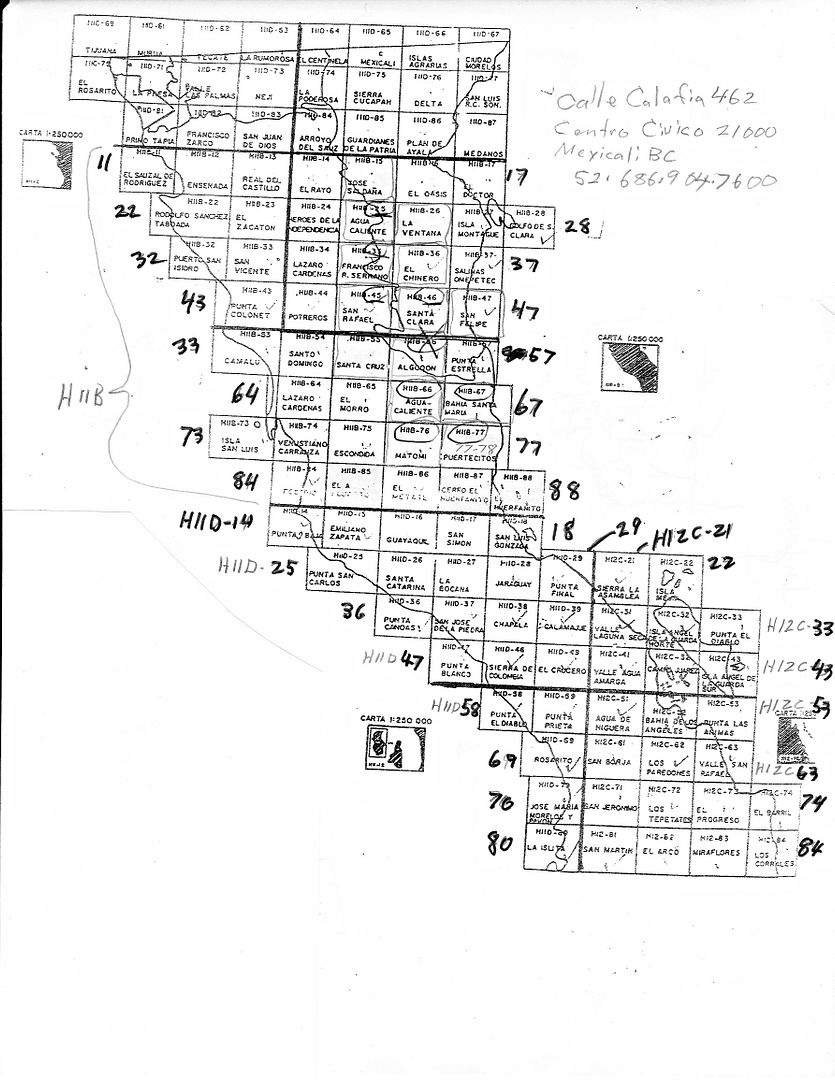
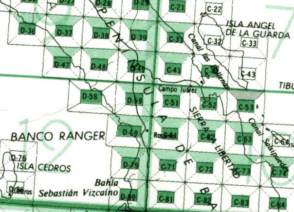
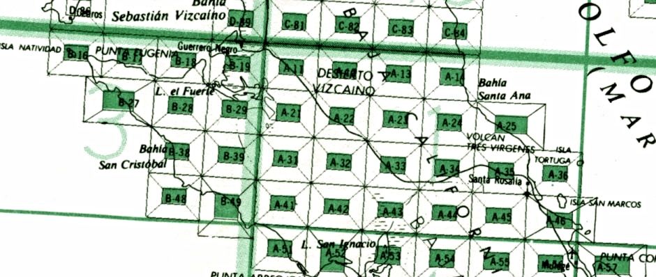
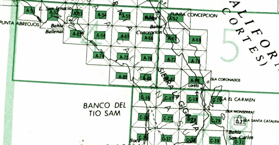
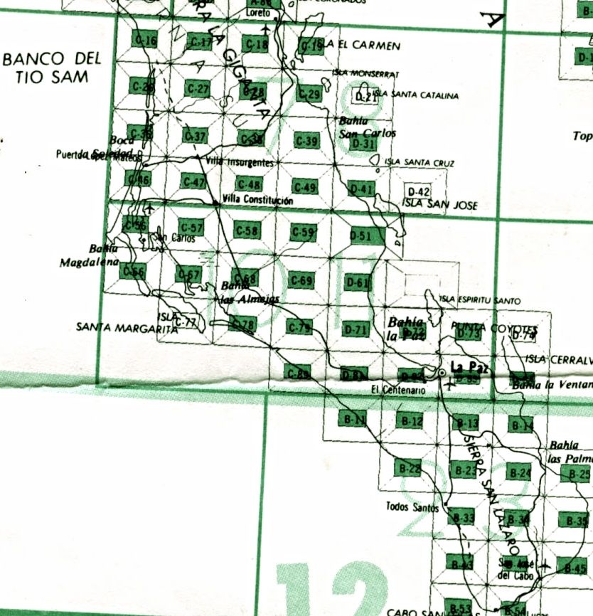
PaulW made this key to help:


Example, San Felipe is H11B47

[Edited on 4-28-2015 by David K]

David K - 4-28-2015 at 10:15 PM


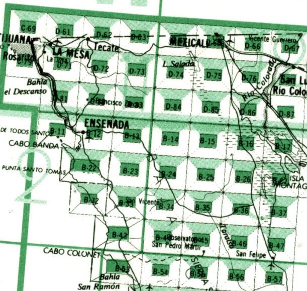
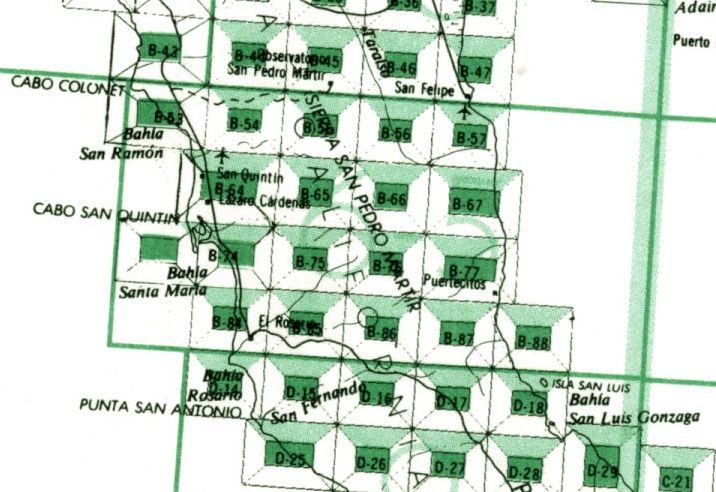
H11 or H12 + map name


Baja California Sur

USE G11 or G12 then the single map # from key...


Mexitron - 4-29-2015 at 06:30 AM

Awesome, thanks David.

Mexitron - 4-29-2015 at 06:50 AM

The 2004 maps of the Matomi area are nice, more detail than older versions. I opened the printing window but could only get the full map on an 8.5x11 even when I had gone to a zoomed up scale though.

PaulW - 4-29-2015 at 07:21 AM

Quote: Originally posted by Mexitron  
The 2004 maps of the Matomi area are nice, more detail than older versions. I opened the printing window but could only get the full map on an 8.5x11 even when I had gone to a zoomed up scale though.

=
If you have a PC
Once you have a view of the PDF go to a zoom level of 125 or 150 the use the slide bars to your point of interest then click "print screen" then open "Paint", "Paste" then "print". If you want the whole canyon then you have to do the exercise many times.
Paul

David K - 4-29-2015 at 07:36 AM

Quote: Originally posted by PaulW  
Quote: Originally posted by Mexitron  
The 2004 maps of the Matomi area are nice, more detail than older versions. I opened the printing window but could only get the full map on an 8.5x11 even when I had gone to a zoomed up scale though.

=
If you have a PC
Once you have a view of the PDF go to a zoom level of 125 or 150 the use the slide bars to your point of interest then click "print screen" then open "Paint", "Paste" then "print". If you want the whole canyon then you have to do the exercise many times.
Paul


Yes, Print Screen is how I make the custom versions of the Inegi maps. On Photobucket, the edit feature is how I add arrows, text, etc. and then save as High Definition to make the maps clearer to view.

At the moment, Nomad Bryan McKenzie is helping me learn how to do map overlays on Google Earth... I don't have that skill down yet, but he made an overlay using the 1962 Gulick map of central Baja and I will add a zoom in of it in the thread we are discussing Leon Grande near Punta Prieta.

Mexitron - 4-29-2015 at 12:48 PM

Ah, got it, thanks David and Paul. Believe it or not this is the first time I've used 'Print Screen' in the 5 years I've had this laptop---had to look up the combination of keys to press to make it work---not just a single button like the desk keyboards.

David K - 4-29-2015 at 02:43 PM

Discovery: While a whole bunch of maps loaded fine inserting the name, without a dash... I started to find some that needed a dash to work! H11B88 needs to be H11B-88 and then it opens fine!