BajaNomad

Salsipuedes canyon trip

larryC - 8-11-2008 at 12:17 PM

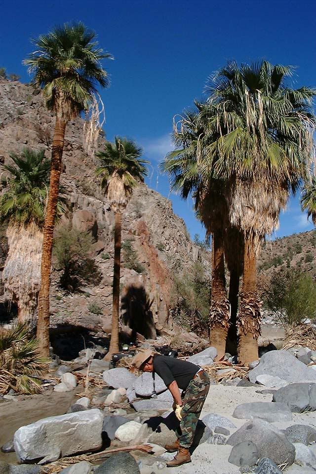
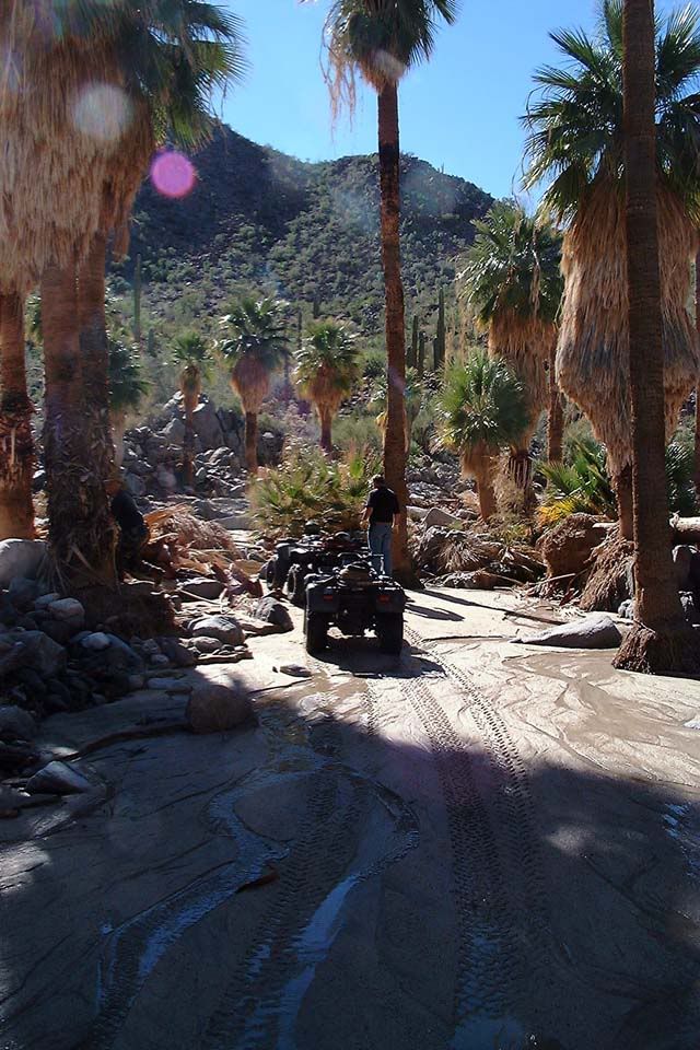
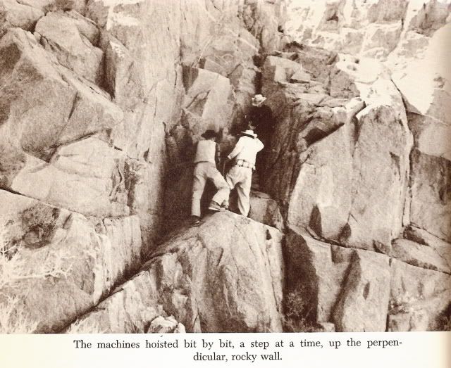
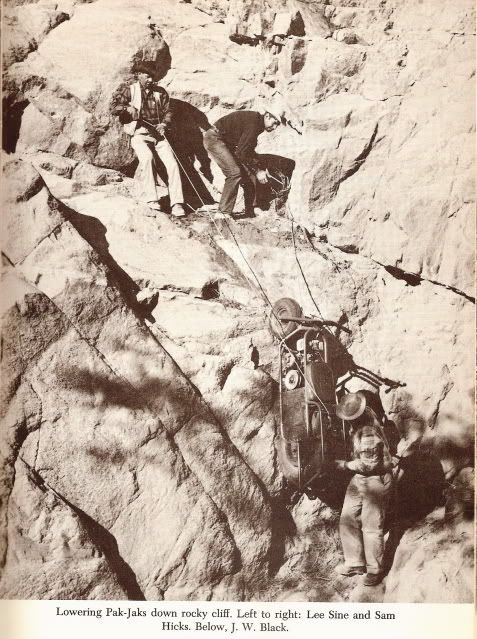
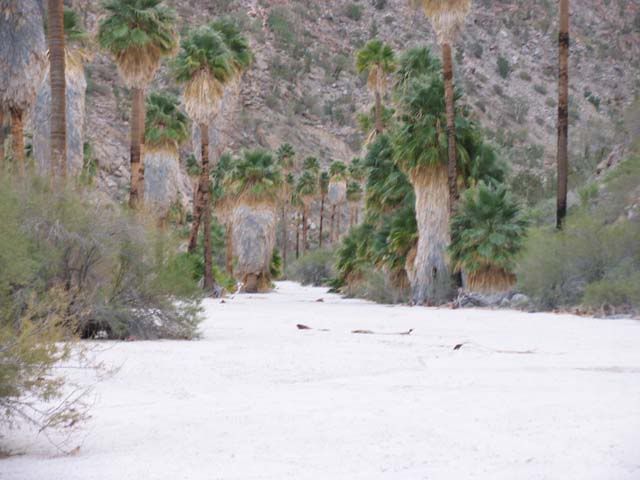
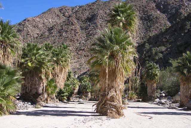
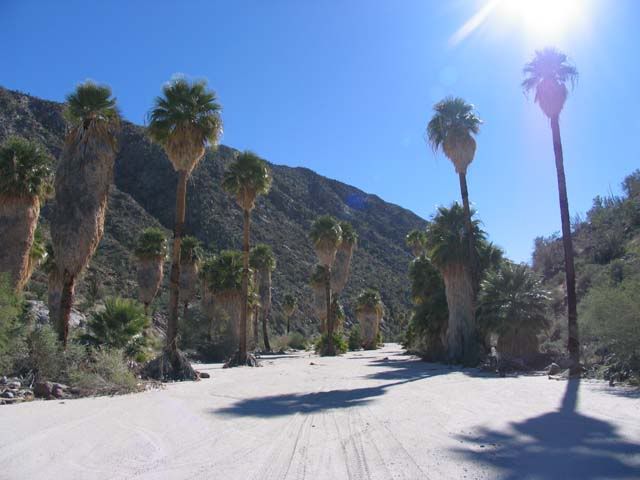
A few years back I had the opportunity to go to this truly remote and beautiful canyon. Earle Stanley Gardener wrote about it is his book "Hoovering over baja". we found the place where he had to lower his "pack Jacks" down a cliff. After seeing that cliff it is amazing they were able to do it. The canyon itself is also spectacular with running water and thousands of palm trees.
Larry

[Edited on 8-11-2008 by larryC]

scenery3 BN.jpg - 43kB

Paulina - 8-11-2008 at 12:26 PM

LarryC,

Welcome to the board and post more photos if you have them. My "dad" Herman Hill has visited this canyon and talks about it often, telling me, "Get out while you can!" It's on our "to do" list.

Saludos!
P<*)))>{

BAJACAT - 8-12-2008 at 06:11 PM

Welcome to BAJA NOMAD LARRYC,where is this canyon?.

[Edited on 8-14-2008 by BAJACAT]

David K - 8-12-2008 at 07:40 PM

Larry, I want to hear more... I am a fan of the Gardner expeditions and am still searching for a lost mission site (well a lost site from the mission era, anyway) that his 1966 expedition found south of Bahia de los Angeles! http://vivabaja.com/1757 (on page 2).

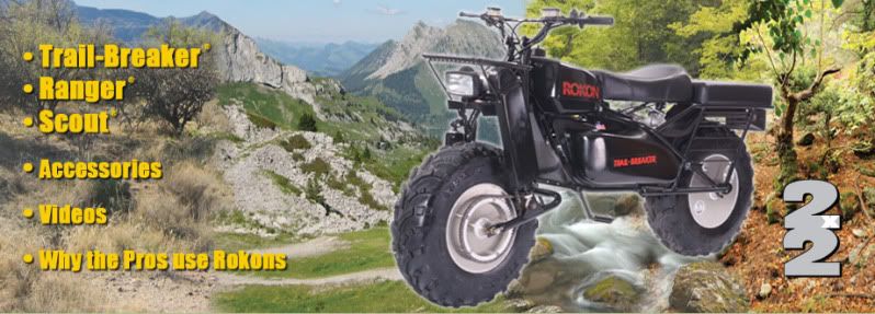
Another Nomad who rarely posts (Bill B) has a Rokon 2WD scooter.... he wants to get into Salsipuedes from the north dry lake bed (like Gardner's team did).

Bill B also went up to the DC-3 plane wreck on Gobernadora peak which is the headwater of Salsipuedes... that Gardner mentioned.

Anyway, welcome to Nomad and please tell more!!

bajaboolie - 8-12-2008 at 08:36 PM

I'd like to know where it is too. Thanks for attaching a photo. It's beautiful. Welcome to the forum!

BajaWarrior - 8-12-2008 at 09:54 PM

Quote:
Originally posted by David K
Larry, I want to hear more... I am a fan of the Gardner expeditions and am still searching for a lost mission site (well a lost site from the mission era, anyway) that his 1966 expedition found south of Bahia de los Angeles! http://vivabaja.com/1757 (on page 2).

Another Nomad who rarely posts (Bill B) has a Rokon 2WD scooter.... he wants to get into Salsipuedes from the north dry lake bed (like Gardner's team did).

Bill B also went up to the DC-3 plane wreck on Gobernadora peak which is the headwater of Salsipuedes... that Gardner mentioned.

Anyway, welcome to Nomad and please tell more!!


David,

I just skipped across my AAA map but did not find Salsipuedes on it, is it near L.A. Bay?

Chuck

David K - 8-13-2008 at 08:12 AM

Hi gang,

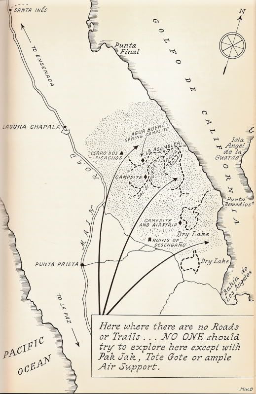
Salsipuedes (Get out, if you can) Canyon is between Gonzaga Bay and L.A. Bay, and is a branch arroyo off of Arroyo La Asamblea (which is on most maps).

Erle Stanley Gardner saw the palms from high above and was determined to get in there! Read his 1961 'Hovering Over Baja'

Here's the map from his book:


[Edited on 3-17-2012 by David K]

larryC - 8-13-2008 at 09:54 AM

Hi All
Glad to see there is some interest in the canyon, I have lots more pictures but don't see any way to upload them in a reply. I'm not a bulletin board expert by any means.
DavidK,
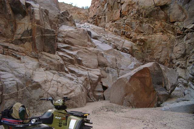
I think we found Gardeners original camp site from when they took the overland route. We found an old campsite at the base of a rocky hill with a marked trail that goes over to a dry lake bed and then from there you can travel down a wash to the cliff where they lowered the pac jacks over the cliff. I compared the phots of the cliff in the book with my photos of the cliff and it is the same cliff. We couldn't get our quads over the rocky hill so we had to walk a long ways. That cliff would be a trip stopper. 40' high and pretty much straight up and down. I wouldn't want to lower my quad over it and then have to pull it back up.
You can also get into the canyon from the mountains above Asamblea and Salsipuedes, there is a road that goes up to a seasonal rancho and from there you can drop down into Asamblea, or a mile or so before you get to the rancho you can drop off to the right and get into Salsipuedes. That would be a fun trip, you could walk all the way down to the coast and then have someone pick you up by boat and get back to BoLA.
As far as the mission ruins Gardner found, he was in a helicopter so who knows where he was exactly, I asked Francisco Munoz before he died, but he didn't know either. Anyway I wonder if it is somewhere near Santa Gertrudis in the El Arco area? Neat area and needs to be explored alot more.
Larry
I think I figured out how to add photos.

[Edited on 8-13-2008 by larryC]

[Edited on 8-13-2008 by larryC]

DianaT - 8-13-2008 at 11:48 AM

Welcome! Sure would like to see more pictures of that canyon and a little larger.

So, here is a link to a recent thread about using Photobucket for posting pictures here. It helped a few people----hope it helps you and if you need more help, just ask


Using Photobucket

Good luck---will be waiting to see more pictures.

Diane

larryC - 8-13-2008 at 05:07 PM

One more try.

David K - 3-17-2012 at 04:04 PM

Larry, still would like to see more of your palm canyon photos!

Bug - 3-18-2012 at 06:44 AM

I would like to go there.. Anyone up for a trip...

Barry A. - 3-18-2012 at 09:01 AM

Bump!!! This is the coolest thread in months.

Many thanks, Larry, and the rest of you folks.

Barry

you asked for it

larryC - 3-18-2012 at 09:01 AM

Here are a few more pics


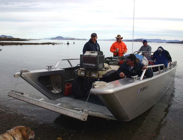
This was our transportation up to Sasipuedes canyon, we could take 2 quads and one utility trailer per trip, it took 2 trips to get all our stuff up there. We were lucky going, mirror smooth water for 40 miles.


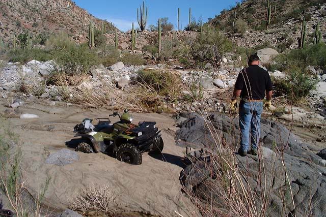
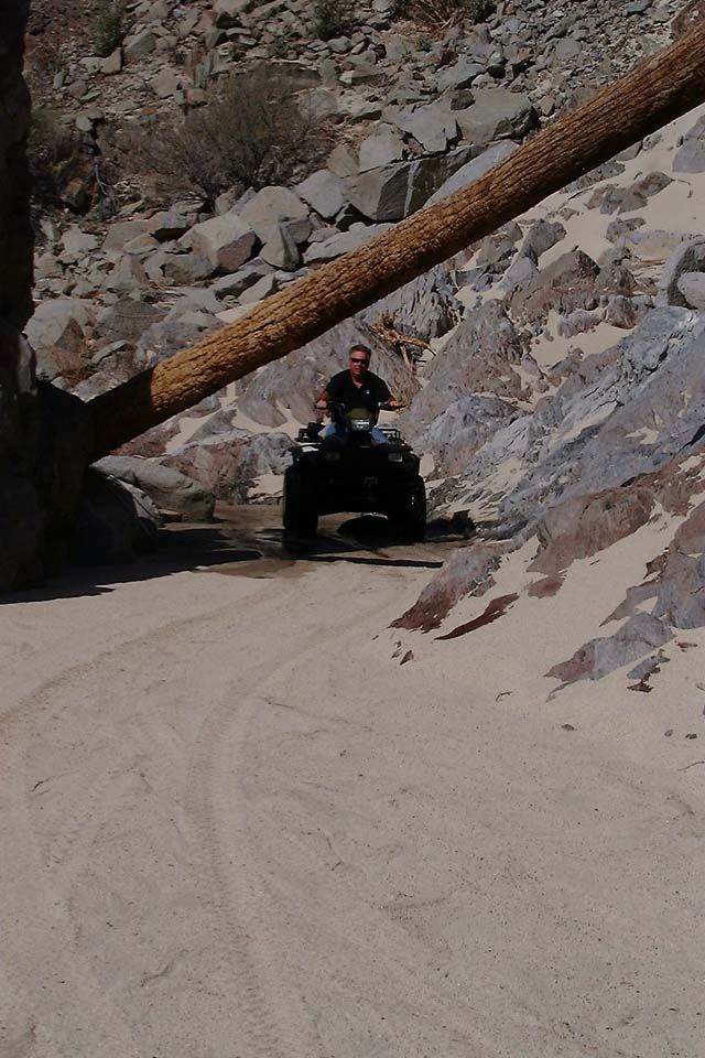
Once off the boat we headed up the canyon, and guess what? We found quick sand


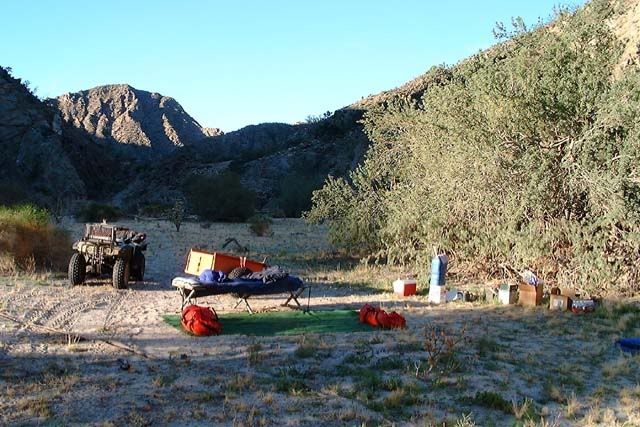
Found a place to make camp

then we went exploring


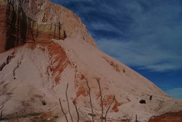
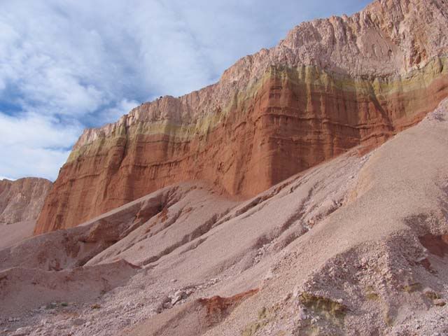
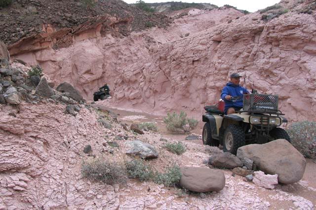
To give this shot some perspective, the black dots in the lower right corner are a quad and a person walking away from the quad. The colors in this shot are not photoshopped, there are lots of giant pink volcanic ash formations, Very pretty country


This is the cliff where Gardener and crew lowered the Pak- Jaks down and back up. I climbed the wall and would not have wanted to attempt what they did, better men than me.

Getting back to BoLA was another story, when we went back down to the coast the wind had come up and the boat could not get in close enough to load the quads so we ended up leaving the quads on the beach and we had to wade out into chest deep water so we could get on the boat. The quads sat on the beach for 6 days before the weather cleared enough so that we could go get them. All in all quite an adventure.
Larry

bajario - 3-18-2012 at 09:15 AM

More! Awesome trip.

Barry A. - 3-18-2012 at 09:55 AM

I am truly blown away, Larry. What a fantastic adventure, and accomplishment. I am sooooooooo envious of you guys------this "trip" of yours has been a dream of mine for 30+ years.

Your over-water transporter alone is incredible-------where did THAT boat come from?? Love it!!!!

Yes, more pics please.

Is there any chance of getting a quad or MC down to the canyon bottom (Sal Si Puedes) from the road to the Rancho at it's headwaters, you think?

Barry

Hovering Over Baja (1961)

David K - 3-18-2012 at 11:55 AM

Thank you Larry! You mastered the photo posting, and these are great!


[Edited on 3-18-2012 by David K]

bufeo - 3-18-2012 at 12:01 PM

Really interesting, Larry. Many thanks for the posts. Great photos.

Allen R

larryC - 3-18-2012 at 04:13 PM

Barry
Not my boat, but it is a very practical boat for down here, pretty neat to be able to beach the boat and ride your quad off into the hills.
There is no way that I know of to take a quad or bike down through salsipuedes or asamblea from the ranchos at the top. There might be a way from the dry lake bed up top, we are going to explore that more in the near future and see what we find.
Here's a few more pics:


More pink volcanic ash


David
Not sure "mastered" is the right term, but at least I can now get them on here in less than a day.
Larry

woody with a view - 3-18-2012 at 04:22 PM

good stuff!

BajaWarrior - 3-18-2012 at 04:35 PM

Larry, we're going to need a barge type vessel pulled by your aluminum boat to deliver ATV's to the Canyon!

We're ready!


Or perhaps pulled by Seadoos?

Bug - 3-18-2012 at 05:03 PM

Larry,,,

Thanks for the pictures there wonderful.. I will put this on my bucket list to do..
one day..

David K - 3-18-2012 at 05:05 PM

Beautiful canyon... no wonder Erle Stanley Gardner tried so hard to get in there!

The prospector's pick story is a classic, too! (be careful of Red Diamondbacks!)

Mexitron - 3-18-2012 at 05:16 PM

Awesome trip! That's the stuff I love doing, looks like a beautiful canyon. Thanks for posting.
BTW those look like Washingtonia robusta---Mexican Fan Palms---which oddly enough aren't too common in the wilds...

David K - 3-19-2012 at 10:00 AM

Quote:
Originally posted by Mexitron
Awesome trip! That's the stuff I love doing, looks like a beautiful canyon. Thanks for posting.
BTW those look like Washingtonia robusta---Mexican Fan Palms---which oddly enough aren't too common in the wilds...


Looks like it might be their point of origin?:light:

BAJACAT - 3-19-2012 at 12:53 PM

So manny canyons, so little time," watch out for RED DIAMOND BACKS".
nice trip report...

wilderone - 3-20-2012 at 09:33 AM

Great report - great photos. Where are the water sources? Do you think any are permanent?

Neal Johns - 3-20-2012 at 10:52 AM

One of the best, if not the best, trip reports and photos I have ever seen. Wow!
Neal Johns - Wish I were 60 years younger. :lol::lol::lol::lol:

Santiago - 3-20-2012 at 11:19 AM

Quote:
Originally posted by Neal Johns
Neal Johns - Wish I were 60 years younger. :lol::lol::lol::lol:

That's odd - exactly what the various WIW say.

David K - 3-20-2012 at 12:11 PM

Quote:
Originally posted by Santiago
Quote:
Originally posted by Neal Johns
Neal Johns - Wish I were 60 years younger. :lol::lol::lol::lol:

That's odd - exactly what the various WIW say.


That's low Santiago! :lol:

Neal Johns - 3-20-2012 at 07:23 PM

Santiago,
The next time my covered wagon heads your way, watch out! :mad::mad::mad::lol::lol::lol:

Barry A. - 3-22-2012 at 09:32 AM

LarryC (or anybody that can help)----

Did you get GPS coordinates of the exact location of the "cliff" (dry waterfall) in your photo----the one that Gardner and crew lowered their Pac-Jacs over?

----or even better, a "stick pin" in the Google earth view of the
dry waterfall location?

(I think I need to buy a couple of ROKON's) :lol:

barry

larryC - 3-22-2012 at 06:03 PM

Barry
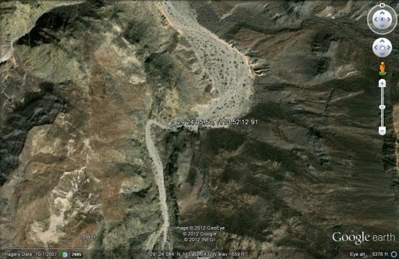
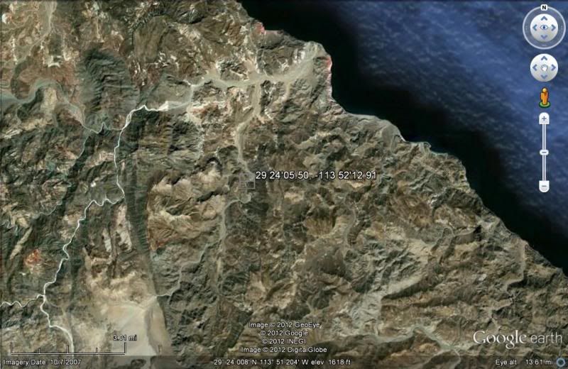
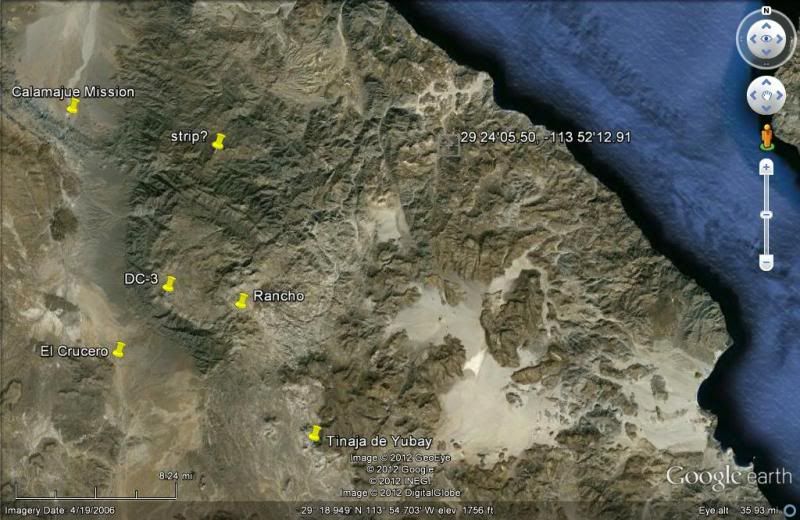
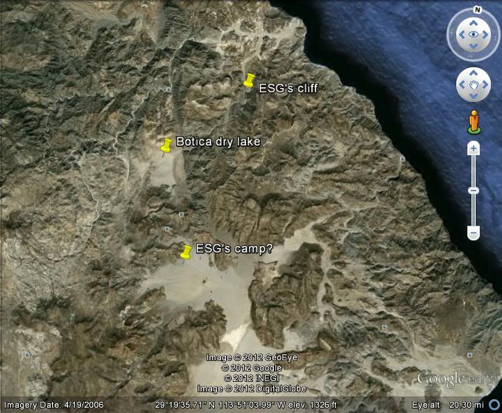
The GE coordinates are N 29 24'05.50 and W 113 52'12.91. It is in La Botica wash 5 or 6 miles from the coast. If you go in by boat you do not need to lower the bikes over the cliff. If you go in from above as ESG did then you will have negotiate that drop off one way or the other. If you follow Botica wash up to the dry lake and look in a northerly direction you will see Salsipudes canyon. I think if you were able to get to that dry lake somehow you could find a way into the canyon without going through La Botica. Be fun hunting for that path. Maybe through Mesa Yubay and down the wash.
Larry
Larry

David K - 3-22-2012 at 06:08 PM

Quote:
Originally posted by Barry A.
LarryC (or anybody that can help)----

Did you get GPS coordinates of the exact location of the "cliff" (dry waterfall) in your photo----the one that Gardner and crew lowered their Pac-Jacs over?

----or even better, a "stick pin" in the Google earth view of the
dry waterfall location?

(I think I need to buy a couple of ROKON's) :lol:

barry


Baja Nomad 'BillB' has a Rokon just for getting into Salsipuedes from the dry lake bed...

larryC - 3-22-2012 at 06:10 PM

But has he figured out how to get the rokon to the dry lake bed?

larryC - 3-22-2012 at 06:12 PM

And David, can you tell me how to post a GE shot on here. You do it all the time and I can't figure it out.

David K - 3-22-2012 at 06:17 PM

Quote:
Originally posted by Barry A.
LarryC (or anybody that can help)----

Did you get GPS coordinates of the exact location of the "cliff" (dry waterfall) in your photo----the one that Gardner and crew lowered their Pac-Jacs over?

----or even better, a "stick pin" in the Google earth view of the
dry waterfall location?

(I think I need to buy a couple of ROKON's) :lol:

barry


David K - 3-22-2012 at 06:24 PM

Quote:
Originally posted by larryC
But has he figured out how to get the rokon to the dry lake bed?


That is the easy part... you can drive right onto the north dry lake bed... in 2WD (dry weather) even! It is finding a route to Salsipuedes that has been the chalange.

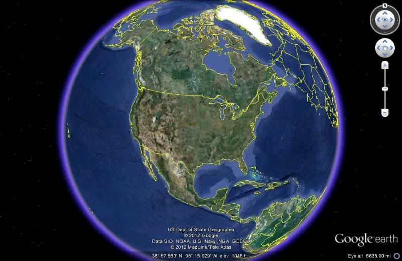
Now, the waypoint you gave for the dry waterfall (which I just posted (and yes, I will tell you how) does not seem logical location-wise from the Gardner camp on Laguna Seca... But, you have been there and if you say that's the spot, then great! Did they just ride down the entire length of La Botica and got to there from Laguna Seca across the desert?

[Edited on 3-23-2012 by David K]

Google Earth on to Baja Nomad

David K - 3-22-2012 at 06:38 PM

1) Once you have the Earth area on your screen, click File (top left), then Save, then Save Image...

2) Give that image a file name ('ssp1' was mine for SalSiPuedes-1)

3) Click Save (this will put the image into your 'My Pictures' folder, or where ever you want).

4) Open up you Photobucket album... make a new sub-album if you want to store these in their own place, easy to find, etc.

5) Click 'Upload', then 'Customize Upload Options' and select 800 x 600 (the max. size for Nomad without distorting the page, also per Doug's request), then click SAVE at the bottom of that sizing menu pop up.

6) Upload the Google Earth files from your PC folder (My Pictures or other) to your Photobucket album.

7) Click the IMG code under the image you want to post on Nomad and copy it with your mouse, then paste that link onto the Nomad page! :light:


Santiago - 3-22-2012 at 06:42 PM

OK guys, I give up, what's a rokon? And in my view, going up the canyon from the water is far more interesting.

Santiago - 3-22-2012 at 06:49 PM

OK I googled "rokon" and came up with this. SWMBO is not gonna very be happy.
[img]http://[/img]

David K - 3-22-2012 at 07:15 PM

Quote:
Originally posted by Santiago
OK guys, I give up, what's a rokon? And in my view, going up the canyon from the water is far more interesting.


A Rokon is a 2 wheel drive motorcycle... Like a 4 wheel drive car... the front and rear tires are both driven! Made in Sweden, I believe. Search Nomad too.

Rokon.com

David K - 3-22-2012 at 07:22 PM


[Edited on 3-23-2012 by David K]

El Camote - 3-22-2012 at 07:27 PM

Nice pic DK but I liked Santiago's photo better. Just seemed to have a little more.....bounce.

David K - 3-22-2012 at 07:34 PM

Quote:
Originally posted by El Camote
Nice pic DK but I liked Santiago's photo better. Just seemed to have a little more.....bounce.


There isn't a photo (I can see) posted by Santiago... just a marker of where there was one. It must have been removed pretty fast??!!:light::lol::wow:

BajaBlanca - 3-22-2012 at 08:32 PM

this is a really neat thread ...amazing photos you posted Larry ... wish I were 30 years younger too .....

larryC - 3-23-2012 at 07:56 AM

David
Thanks for the tutorial, that helped alot. I new it was simple just had to know which buttons to push and in what order.


The dry lake I am talking about, I call Botica dry lake, probably not the real name. From what I could gather from Francisco Munoz, ESG camped in the dry lake you talked about driving to, and then took the bikes across some rocky hills to another dry lake and down a wash to where they dropped the bikes off the cliff and then around to the north and into Salsipuedes and Asamblea canyons. Makes sense when you look at the picture from GE.
The guys I went into Salsipuedes with in 05 made another trip in 2010 that I was not able to go on. Anyway they went all the up Salsipuedes and got to the Botica dry lske without going over ESG's cliff. So I was thinking that maybe there is a way into Botica dry lake from maybe Yubay area and if so you could then access salsipuedes by land and not be at the mercy of the sea and winds. After looking more at GE that does not seem possible.
Larry
PS Glad others on here like this thread, it was one of my favorite trips since I have lived here in the area.

LaPazGringo - 3-23-2012 at 08:02 AM

Larry, I think I met you or someone in your trip a few years ago while staying at Racquel and Larry's in BoLA cause I remember that boat. Part of the group was fishing and part of the group was taking quads into Salsipuedes. The group was from Sacramento (I think!). Was that you? I'm tall and was staying in one of the rooms downstairs and was on a black enduro motorcycle.

larryC - 3-23-2012 at 08:55 AM

Yes that was us. If you were there in 2010 then that was the trip I was unable to go on. I went on the 05 trip. Hoping to do another this coming Nov.

Barry A. - 3-23-2012 at 09:05 AM

Larry says,

"The guys I went into Salsipuedes with in 05 made another trip in 2010 that I was not able to go on. Anyway they went all the way up Salsipuedes and got to the Botica dry lake without going over ESG's cliff. So I was thinking that maybe there is a way into Botica dry lake from maybe Yubay area and if so you could then access salsipuedes by land and not be at the mercy of the sea and winds. After looking more at GE that does not seem possible.
Larry"

I am thinking that since we know that the ESG crew went over the "cliff" (dry waterfall) in La Botica Canyon with his Pac-Jacs and therefore had to have driven the Pac-Jac's across "Botica dry Lake" to get to the upper reaches of La Botica canyon, and we know that ESG's base camp was somewhere in the big dry lake area to the south (Valle Laguna Seca), then it seems logical to me that since we know that ESG's crew found a way to drive their Pak-Jacs from the base camp to Botica dry lake, and we know that any good 4x4 can reach the Valle Laguna Seca, then there IS a way to drive at least motorcycles between the two dry lakes. And NOW we know (?) that Larry's friends accessed Botica Dry lake from Sal Si Puedes canyon without going over the dry waterfall, then it follow that THERE IS a way to drive overland to the big canyon complex without going there by water, or going over the dry water fall.

All that remains is to discover those overland routes that these 2 different groups have already traversed, and connect them up?!?!?!?!?!?!?

Does this make sense???

(Neal Johns could probably drive his pickup camper over the route, based on past experience) :lol:

Barry

Neal Johns - 3-23-2012 at 10:04 AM

Barry A.
I don't think so, Barry.
I have been in the area but it looks like two miles of hills/mountains between "ESG's Camp?" north to get to Botica dry lake. There is a very faint road to near "ESG's Camp?" from the south. See small red circles (You must look a Google Earth to see road).
Neal

Botica area [800x600].jpg - 42kB

Barry A. - 3-23-2012 at 11:30 AM

I see your point, Neal. But am I correct in that ESG's crew drove their Pak-Jac's from the supposed location of ESG's base camp in Valle Laguna Seca to, and over the dry waterfall in Botica canyon, presumably also driving by or across Botica Dry Lake to get there?

I have reviewed the book "Hovering----" but I can't (so far) find the section that explains that (if it is even in there).
So, I am making the assumption that is what happened, which means that at least a ROCON, or light motorcycle, COULD get to Botica Dry Lake from Valle Laguna Seca, and then perhaps down to Sal Si Puedes via some route other than over the dry waterfall & Botica Wash. (ref. what the 2010 explorers are reporting)

I admit that looking at GE it looks like it would be more feasible to come from the Mesa Yubay area, but only ground exploring or a new report would solve the issue, I suppose.

Barry

LaPazGringo - 3-23-2012 at 11:43 AM

Quote:
Originally posted by larryC
Yes that was us. If you were there in 2010 then that was the trip I was unable to go on. I went on the 05 trip. Hoping to do another this coming Nov.


Okay, the guys I made friends with were a father and sons I think? He referred me to ESG's Hovering book which Larry (Racuel & Larry owner) loaned me. That was the first I ever heard of ESG's baja books and I started reading it at 10pm, hanging on every word until the wee hours when I turned the last page. It's be mind-blowingly fun to do that today, but can you even imagine how excited ESG's crew were to go in there, having no idea if man had even been there before?

larryC - 3-23-2012 at 06:02 PM

Quote:
Originally posted by Barry A.
I see your point, Neal. But am I correct in that ESG's crew drove their Pak-Jac's from the supposed location of ESG's base camp in Valle Laguna Seca to, and over the dry waterfall in Botica canyon, presumably also driving by or across Botica Dry Lake to get there?

I have reviewed the book "Hovering----" but I can't (so far) find the section that explains that (if it is even in there).
So, I am making the assumption that is what happened, which means that at least a ROCON, or light motorcycle, COULD get to Botica Dry Lake from Valle Laguna Seca, and then perhaps down to Sal Si Puedes via some route other than over the dry waterfall & Botica Wash. (ref. what the 2010 explorers are reporting)

I admit that looking at GE it looks like it would be more feasible to come from the Mesa Yubay area, but only ground exploring or a new report would solve the issue, I suppose.

Barry


Barry
They didn't actually drive their pakjaks over the hill and into botica dry lake. they were able to manhandle the pakjaks over there. If you read that part again you'll see the ESG couldn't do it himself and had to have help. I have been there looking for their route over that hill. There is sort of a path, but lots of big boulders and sharp jagged rocks to negotiate. I don't mean to imply that it is not possible but I have yet to find a route over that hill. If you are ever in this area and want to go look at it let me know.

La Paz gringo
Sounds like you met Craig and his son in law Dane. They went in in 2010, I think in November or so. They had perfect weather the whole week.

FRICKEN AWESOME

captkw - 3-23-2012 at 06:10 PM

THANK's someplace I havnt been,,cool !! K&T

Barry A. - 3-24-2012 at 08:13 PM

Many thanks, Larry. I will go back and review the book more carefully. What you say explains a lot.

Darn, I thought I was "on to something". :lol:

Barry

edit------I finally found the part of the book that explains what you are saying (and got so involved that I read the book for the second time all night)---- ESG is vague, but they sure had their struggles getting their equipment into Botica dry lake over those mountains before they used a helecoptor.

Back to the drawing board--------the challenge continues!!! :?:

[Edited on 3-25-2012 by Barry A.]

larryC - 3-26-2012 at 06:07 PM

It amazes me that 50 years later salsipuedes is still so hard to get into. Without a helicopter a boat is the next best vehicle, and if the water gets rough all your stuff and quad gets soaked. Oh well the cost of adventure.
Larry

Mark_BC - 12-1-2013 at 11:21 AM

OK guys ... I plan to do this canyon solo in a few weeks. I don't think it's rained lately but I'm taking all my own water anyways. I have a Surly Pugsley fatbike with a trailer. Then I'll packraft back down the coast. I'll have two seawater desalinators -- one a hand pump and one a campfire distiller.

We checked out the dry lakebeds last year and it looks like you could haul your bike over into the canyon but I discovered an easier way to enter. I'll go in from the west, there is a dirt road leading from the main Baja highway that goes right into the head of the canyon. From there I'll just follow it all the way down.

Barry A. - 12-1-2013 at 11:26 AM

Quote:
Originally posted by Mark_BC
OK guys ... I plan to do this canyon solo in a few weeks. I don't think it's rained lately but I'm taking all my own water anyways. I have a Surly Pugsley fatbike with a trailer. Then I'll packraft back down the coast. I'll have two seawater desalinators -- one a hand pump and one a campfire distiller.

We checked out the dry lakebeds last year and it looks like you could haul your bike over into the canyon but I discovered an easier way to enter. I'll go in from the west, there is a dirt road leading from the main Baja highway that goes right into the head of the canyon. From there I'll just follow it all the way down.


Wow, this is GREAT!!! Please let us know how it goes-------that DOES look like a very logical approach, to me.

Barry

woody with a view - 12-1-2013 at 11:33 AM

Mark why don't you start a new thread and link to this one. it would help visibility for your trek if you want it.

suerte!

SPOT

bajaguy - 12-1-2013 at 11:53 AM

Mark.........if you are going solo, I highly suggest that you take SPOT along:

http://www.findmespot.com/en/index.php?cid=100

Nomads can track you, we can provide help if necessary and the 911 function will provide an emergency response in the event of injury

Don't leave home without it!!!!


Quote:
Originally posted by Mark_BC
OK guys ... I plan to do this canyon solo in a few weeks. I don't think it's rained lately but I'm taking all my own water anyways. I have a Surly Pugsley fatbike with a trailer. Then I'll packraft back down the coast. I'll have two seawater desalinators -- one a hand pump and one a campfire distiller.

We checked out the dry lakebeds last year and it looks like you could haul your bike over into the canyon but I discovered an easier way to enter. I'll go in from the west, there is a dirt road leading from the main Baja highway that goes right into the head of the canyon. From there I'll just follow it all the way down.

Mark_BC - 12-1-2013 at 11:56 AM

OK I will. BTW, does anyone have opinions on the Katadyn water desalinators? I was planning on a Survivor 6 which is small but slow. Someone on another mountain bike forum recommended the 35 model which is quite a bit larger. I see them on ebay for $335 which seems ridiculously cheap, don't know if there's a catch.

http://forums.mtbr.com/fat-bikes/does-stans-work-tubes-88914...

Mark_BC - 12-1-2013 at 12:00 PM

Quote:
Originally posted by bajaguy
Mark.........if you are going solo, I highly suggest that you take SPOT along:

http://www.findmespot.com/en/index.php?cid=100

Nomads can track you, we can provide help if necessary and the 911 function will provide an emergency response in the event of injury

Don't leave home without it!!!!


Yea I have one. I presume that if I have the regular insurance they will pluck me out of Mexico no problems, no charge?

It's not actually a big deal to rescue someone because there is no "search" component to it which is what most of the effort in rescue involves, only "rescue", since they know exactly where I am.

woody with a view - 12-1-2013 at 12:05 PM

when are you going in?

bajaguy - 12-1-2013 at 12:14 PM

Correct

Quote:
Originally posted by Mark_BC
Quote:
Originally posted by bajaguy
Mark.........if you are going solo, I highly suggest that you take SPOT along:

http://www.findmespot.com/en/index.php?cid=100

Nomads can track you, we can provide help if necessary and the 911 function will provide an emergency response in the event of injury

Don't leave home without it!!!!


Yea I have one. I presume that if I have the regular insurance they will pluck me out of Mexico no problems, no charge?

It's not actually a big deal to rescue someone because there is no "search" component to it which is what most of the effort in rescue involves, only "rescue", since they know exactly where I am.

Mark_BC - 12-1-2013 at 12:30 PM

Quote:
Originally posted by woody with a view
when are you going in?


I fly to LA Dec 17, then I'm not sure how I'll get down. The dirt road starts ~95 km south of Catavina, off the highway in the middle of nowhere.

woody with a view - 12-1-2013 at 12:35 PM

start a new thread. plenty of people will want to help.

David K - 12-1-2013 at 04:03 PM

Mark, like Graham Mackintosh does, you may add me to your SPOT email notification list, and I will post a new map of your SPOT location each day you send one in. I am at info *at* vivabaja.com (change *at* to @).

BajaBlanca - 12-1-2013 at 04:29 PM

so cool! we will hopefully be able to follow your trip .... all of us who can not go on this adventure in person.

Best of luck!

Maybe

bajaguy - 12-1-2013 at 04:49 PM

Maybe he can send the link to Doug so we can all see it whenever we want to look


Quote:
Originally posted by David K
Mark, like Graham Mackintosh does, you may add me to your SPOT email notification list, and I will post a new map of your SPOT location each day you send one in. I am at info *at* vivabaja.com (change *at* to @).

David K - 12-1-2013 at 04:55 PM

Quote:
Originally posted by bajaguy
Maybe he can send the link to Doug so we can all see it whenever we want to look


Quote:
Originally posted by David K
Mark, like Graham Mackintosh does, you may add me to your SPOT email notification list, and I will post a new map of your SPOT location each day you send one in. I am at info *at* vivabaja.com (change *at* to @).


Sadly, I have a lot more free time than Doug, so everyone would see the location probably sooner if I did it. Once the map is posted, it will be here on Nomad to see whenever you want. That is if it is a single transmit, as the way Graham does it to save battery life.

Naturally, they could do the live continuous transmit like the two guys did walking down Baja... until they lost the Spot device when it fell off their backpack near San Ignacio. In that case, just a link posted here would work. That would be great too, as making the maps appear here does take some work.

Mark_BC - 12-1-2013 at 07:52 PM

OK, I posted my trip report so now I can stop hijacking Larry's thread.

http://forums.bajanomad.com/viewthread.php?tid=70746