Originally posted by David K
Taken from an earlier thread 'Baja Locations from Space' I will re-post the links to the Google Map satellite images of various Baja locations. From
the link, you can zoom in/ out and fly around over an area by sliding your mouse or using the arrows provided.
Since I did this work, I have found easier to use and full screen http://www.wikimapia.org I have been locating mission sites and the Camino Real there...
Just zoom in on Baja and fly around!
Here are the Google links to Baja places... After clicking the link, click to enlarge the image (full screen)... Then you can enlarge the image even
more by placing the mouse on the left top of the image and click to enlarge to the left.
| Quote: | Hey David!
Thanks for posting the links...however, you know I am somewhat technologically (phew!) challenged. How do I save the links on my own GOOGLE maps page?
Thanks
Udo |
PACIFIC COAST:
La Bufadora, Punta Banda
Punta Cabras
Punta Colonet
Bahia San Quintin
Punta Baja
Punta San Carlos
Punta Canoas
Punta Vibora
Punta Blanco
Punta Cono
Punta Maria
Escalera Nautica at Santa Rosalillita]
El Tomatal & Miller's Landing
Morro Santo Domingo & Laguna Manuela
Laguna Guerrero Negro (Black Warrior)
Laguna Ojo de Liebre (Scammon's Lagoon)
Bahia Tortugas
San Roque
Bahia Asuncion
Punta Abreojos
San Juanico/ Scorpion Bay
Puerto Lopez Mateos, Mag Bay
Puerto San Carlos, Mag Bay
Puerto Cancun, Mag Bay
Punta Conejo
Cabo San Lucas
GULF COAST:
San Felipe
Punta Estrella
Rancho/Laguna Percebu & north end of Shell Island
Bahia Santa Maria, south of San Felipe
El Coloradito
Punta San Fermin
Puertecitos
Isla El Huerfanito (The Little Orphan) and Nacho's Camp
Gonzaga Bay (Punta Willard to Punta Final)
Puerto Calamajue
End of new track to coast (so. of Calamajue)
Punta Remedios, Bahia Guadalupe
Bahia de los Angeles
Punta San Francisquito
La Trinidad
Santa Rosalia
Mulege
Santispac to Coyote, Bahia Concepcion
El Requeson, Bahia Concepcion
Loreto
Puerto Escondido
Agua Verde
Timbabichi
Los Burros and Valle Kakiwi lake
San Evaristo, Valle el Venado lake, Isla San Jose's Punta San Ysidro
San Juan de la Costa
El Magote, Ensenada de Aripes, El Centenario, part of La Paz
Pichilingue (ferry terminal)
Las Arenas, Ensenada de los Muertos
Los Barriles
La Ribera
Cabo Pulmo and Los Frailes
Estero San Jose, San Jose del Cabo
New harbor
See Pacific Coast list for Cabo San Lucas
ALONG HIGHWAY ONE (within 6 miles):
Tijuana Border Crossing
Popotla (Fox Studios to Punta el Descanso)
San Pedro Martir/ Observatory Road Jcn.
San Telmo de Arriba (on Observatory road)
Turnoff to Punta San Carlos (Km. 80-81)
Rancho El Arenoso (abnd.)
Mision San Fernando access at Hwy. 1
El Progreso (on Hwy. 1), signed access to San Fernando
Mision San Fernando
San Agustin (Abdn. Pemex, trailer park)
El Marmol Road at Hwy. 1 (next to Cafe Sonora)
Arroyo Agua Dulce & 1973 water truck access road at Hwy. 1
Agua Dulce (historic spring on El Camino Real)
New/good access to Agua Dulce
Old Southern road to/from El Marmol at Old Main Baja Road
Agua Escondida access (?) at old Baja road
Faro San Jose Road at Hwy. 1
Catavina Rock Art Site (near Hwy. 1 at north arroyo crossing)
Catavina
Laguna Chapala
Turnoff to San Antonio & Pacific Coast
El Crucero (old San Felipe & Gonzaga road jcn. with Mex. 1)
Old L.A. Bay Road crossing Hwy. 1, New Rancho San Luis road jcn.
Shortcut road to San Antonio (Codornices) at Hwy. 1
L.A. Bay Hwy. Jcn. (ex-Parador Punta Prieta)
Punta Prieta (old dirt strip upper left & paved runway lower right)
Turnoff to Santa Roaslillita & paved part of Escalera Nautica highway
(Nuevo) Rosarito, road east to San Borja
Turnoff to El Tomatal
Villa Jesus Maria, road to Laguna Manuela
Eagle Monument, Guerrero Negro
Turnoff to El Arco
Turnoff to Guillermo Prieto, Mision Santa Gertrudis, Punta San Francisquito
Vizcaino, Turnoff to Bahia Tortugas
Turnoff to San Francisco de la Sierra
Turnoff to Punta Abreojos
San Ignacio
San Bartolo
Santiago
Agua Caliente (near Santiago)
Miraflores
MISC. BAJA LOCATIONS (not covered above):
Tijuana/Tecate Toll Gate & Blvd. 2000 Jcn.
Tecate Border Crossing
Laguna Salada Road at Mexico #2
Guadalupe Canyon
Colorado River (near gulf)
Ojos Negros
Laguna Hanson
Mike's Sky Rancho Jcn., Hwy. 3
San Matias Pass, Hwy. 3
Crucero La Trinidad (Hwy. 5 & Hwy. 3 Jcn.)
Mike's Sky Rancho
Meling Ranch
Observatorio
Diablo Mountain & Canyon
San Isidoro
Trail to San Pedro Martir from San Isidoro
Mision San Pedro Martir
San Felipe Airport
Sulfur Mine (El Apache)
Agua Caliente Canyon (off Valle Chico)
Agua Caliente Hot Spring
Rancho el Matomi (west of Puertecitos)
Mine west of Puertecitos, at end of long road from Mex. 1
Rancho San Antonio
El Marmol (onyx school house)
El Volcan
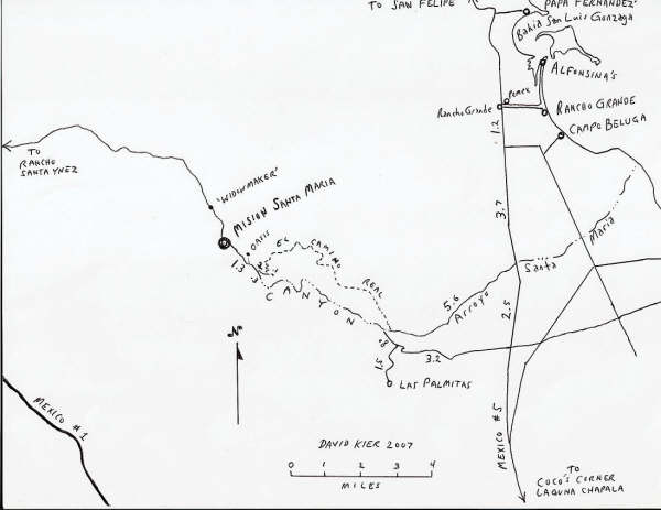
Peninsular Divide, Mision Santa Maria Road
Las Arrastras (site)
Pioneer Mine
Coco's Corner
Calamajue Mission Site
Tinaja de Yubay
El Toro Copper Mine
Mision San Borja
El Camino Real switchback
Las Flores Railroad, south end
Rancho La Bocana, south of L.A. Bay (called 'San Pedro' in Almanac)
El Arco
Guillermo Prieto (north of Vizcaino)
Geothermal Plant N of Santa Rosalia
Todos Santos
[Edited on 10-10-2008 by David K] |