Originally posted by David K
You guys are getting better!
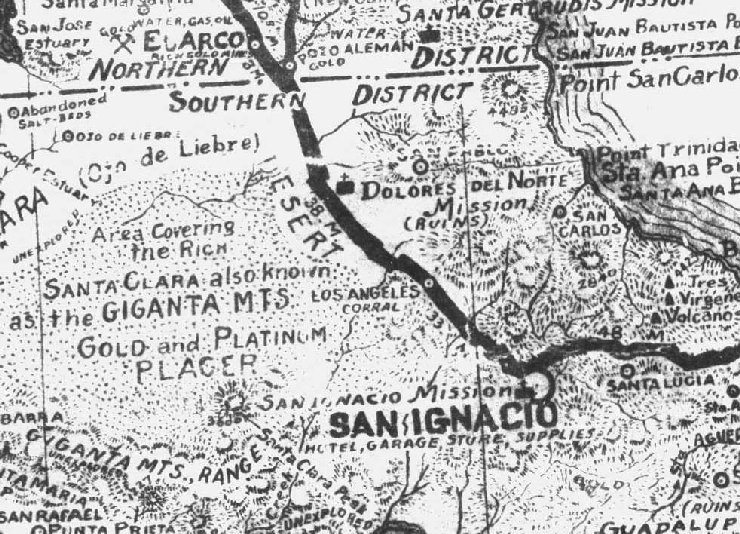
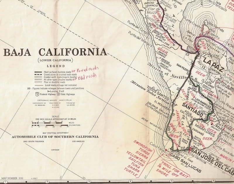
There are 3 missions shown on that map: Santa Gertrudis, Dolores del Norte, and San Ignacio. Another mission is just off the map, but part of the name
'Guadalupe' is seen at the bottom.
Cristobal is correct on one item: Santa Gertrudis was initially to be called Dolores del Norte! But, since Jesuit records were not fully understood by
some writers... When they saw the name 'Dolores' mentioned and on the 1757 map, north of San Ignacio, it was assumed to be another mission besides
Santa Gertrudis.
The visita ruins of San Pablo have been mistaken to be the mission of Dolores del Norte by some authors and even INAH!
On this map, both San Pablo and Dolores del Norte are shown... but the Dolores del Norte shown, is an error... No such site (seperate from San Pablo
or Santa Gertrudis) exists. This error was repeated on many maps, including the older Automobile Club of So. Calif. Baja folding map and the Mike
McMahan wall maps.
Great to see you here, cristobal!
As for the 'Unexplored', Woody wins (as I saw it in three places, too).
The year... well... one of you was really close! |

 (not only does he have this map,
but he probably drew it!)
(not only does he have this map,
but he probably drew it!)