BajaNomad

MAPS showing the East Cape (Los Frailes), over the years

David K - 12-9-2008 at 04:35 PM

A rerquest from 'Gaucho':

"Hi David,
Can you show an area of the lower east cape say from Los Frailles to Los Zacatitos?
Thanks"

1757


1888


1907


1919


1930


1941


1962

El Jefe - 12-9-2008 at 06:09 PM

Hey, that's our neck o the woods! Thanks David. Interesting to see the evolution of some of the place names. Tom

Gaucho - 12-9-2008 at 09:50 PM

These are great David, thanks. It's interesting how the name Cabo de San Lucas came around full circle after being Cape San Lucas for 100+ years!

jodiego - 12-10-2008 at 08:41 AM

I noticed in map #5 all the sugar mills and sugar fields in the area. Anyone know what became of all that sugar production?

El Jefe - 12-10-2008 at 12:20 PM

Regarding all the sugar mills, I believe they had some dry years and ended up lowering the water table way, way down. Many wells went dry so the producers up and left. After several years the water tables came back up, but the cane farmers never returned.

Heather - 12-10-2008 at 02:40 PM

Interesting maps, I didn't see some of the places that we visit in the area, and I know they've been there for at least a hundred years or so. We usually take a trip to Candelario, but also visit: Sausal, and some Ranchos, Rancho San Felipe, and Rancho San Francisco. We leave from Cabo, and go inland, would be interesting to locate those areas on a map. Maybe they're too small to make the cut. Heather

David K - 12-10-2008 at 02:57 PM

Hi Heather,

I focused the map on the Los Frailes area of East Cape per request from Gaucho...

If you want, I will show the South-West cape region, if I cut it off in some of the maps.

The 1930 map shows the most places (ranchos, villages)... of the early 20th Century...


[Edited on 12-10-2008 by David K]

David K - 12-10-2008 at 06:31 PM

Quote:
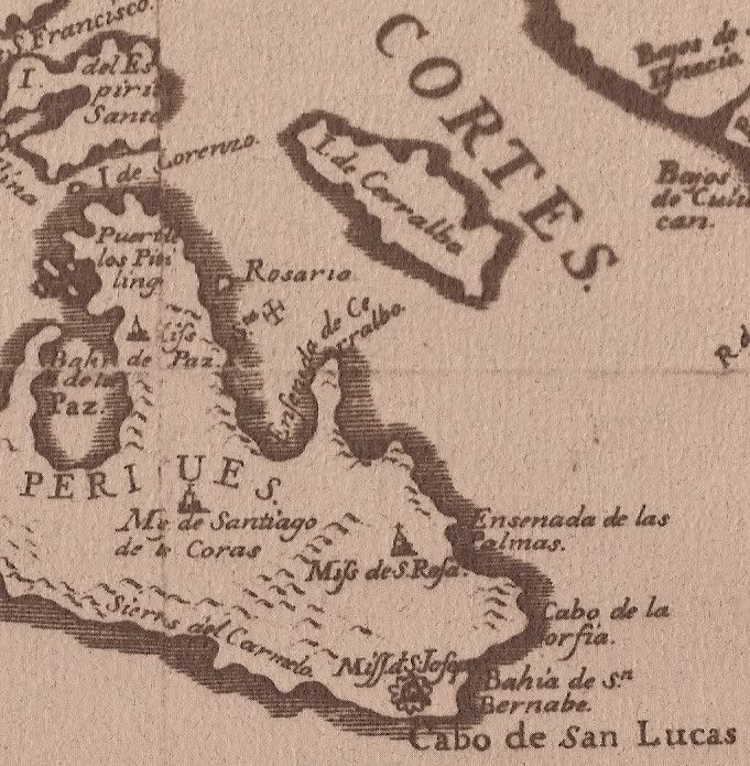
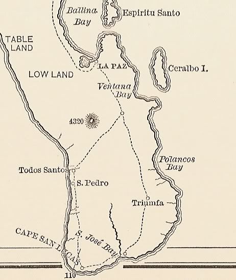
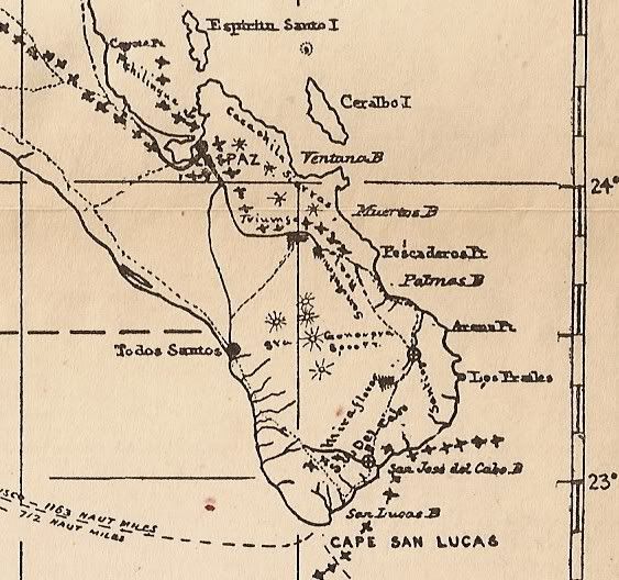
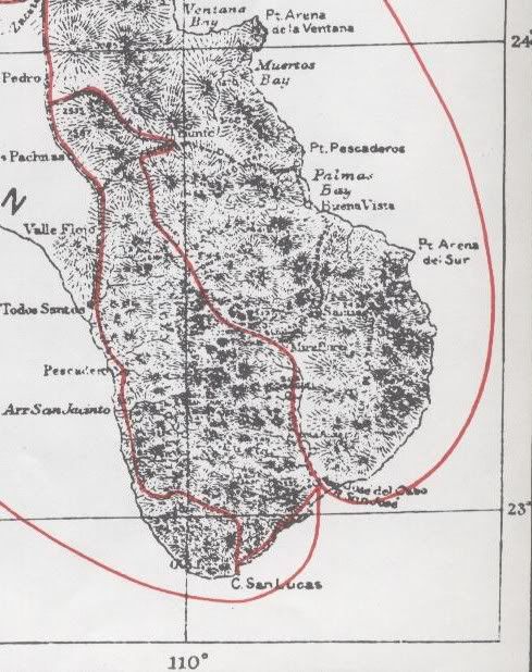
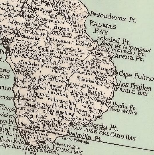
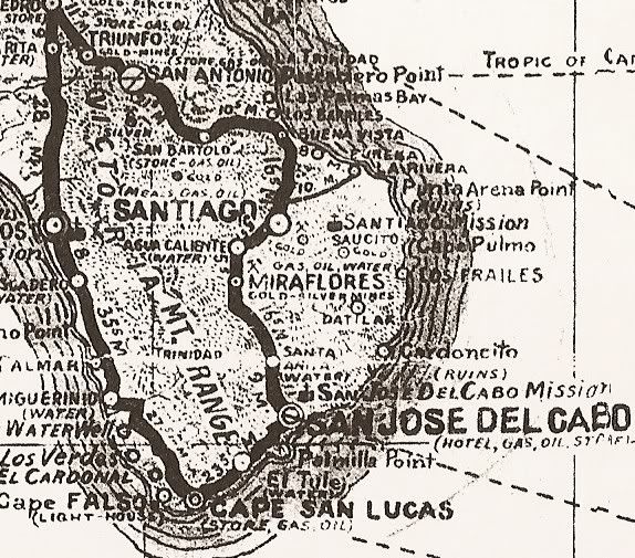
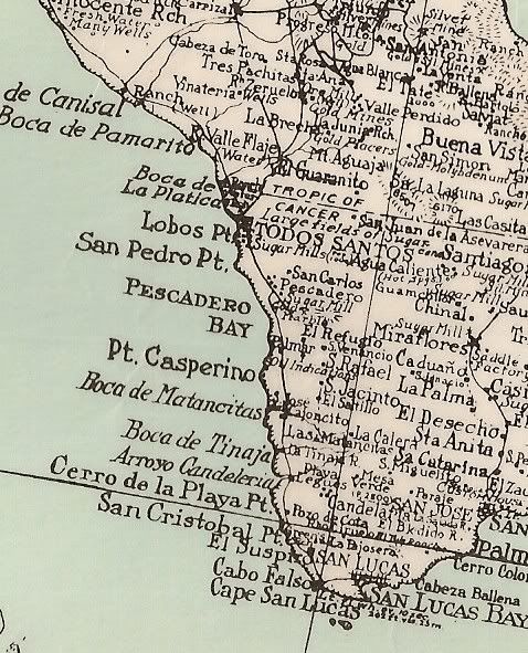
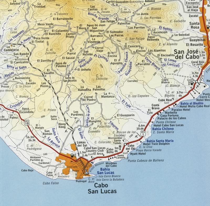
Originally posted by Heather
Interesting maps, I didn't see some of the places that we visit in the area, and I know they've been there for at least a hundred years or so. We usually take a trip to Candelario, but also visit: Sausal, and some Ranchos, Rancho San Felipe, and Rancho San Francisco. We leave from Cabo, and go inland, would be interesting to locate those areas on a map. Maybe they're too small to make the cut. Heather


Okay, to see some of the places you named: 'Sausal' (El Sauzal?), 'San Felipe'... I found them on my 2003 Almanac... Here is the close up map... There is a church and graveyard shown at or near Rancho San Felipe, is it historic (mission-era)?


[Edited on 12-11-2008 by David K]

David K - 12-11-2008 at 09:09 AM

Heather, what is Rancho San Francisco close to, on the map above? Do you see San Felipe and El Sauzal okay?