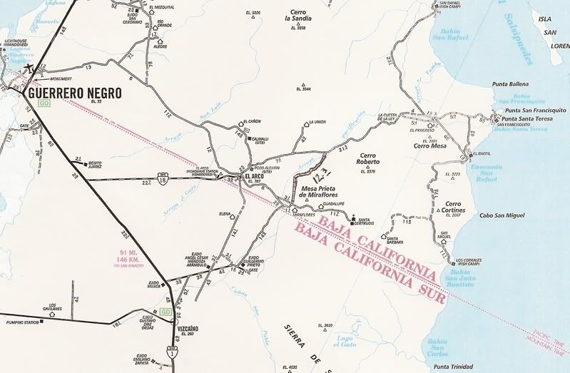
Originally posted by Santiago
Went South to North in January and found the road easy w/ pickup, never use 4X4. A little rocky in spots but mostly sandy soil. Going north from
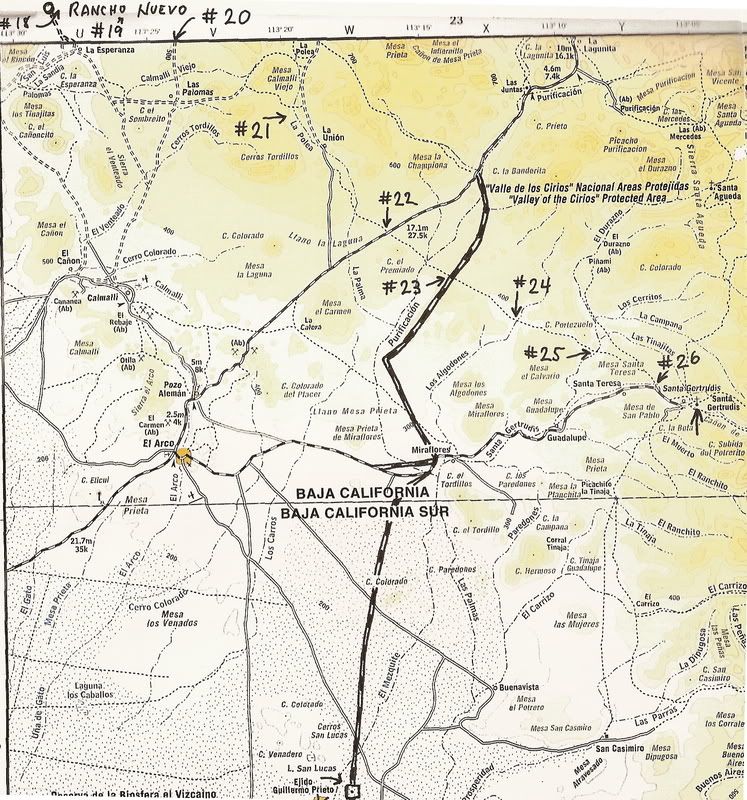
Vizcaino, it is very easy to miss the turn off at Ej. Guillermo and continue east. As soon as you see the houses/buildings, turn north. At about #23
on DK's map is a great cardon forest. Plan on at least a 30 minute stop to walk around. The weirdest thing is we had a 2-bar cell signal there but
it was a funny ID name of the carrier. We had just passed a ranchero with a radio tower and I wonder if they had a small cell site for local
communication? Anyone else notice this? By the way, the ranchero has gas and groceries for sell per their sign (we did not stop in). Also,
traveling north, the road "T's" at El Progresso. There is no signage (duh), but right (east) is to San Francisquito and left (west) is on to Poncho's
(San Rafael Beach Camp on the first map) and BOLA. Doesn't feel right but that's it.
I think BajaBoy's got this covered, but anyone stopping by Poncho's - take him a corkscrew. Dude's trying to use an icepick for his evening's Merlot.
This trip is do-able on any medium-high clearance vehicle - some sandy spots north of the ejido with deep ruts - a low car might scrape the sand.
Plan on about 6 hours from Vizcaino to BOLA if you're taking it easy. There are no bathrooms. |


