Originally posted by Ken Bondy
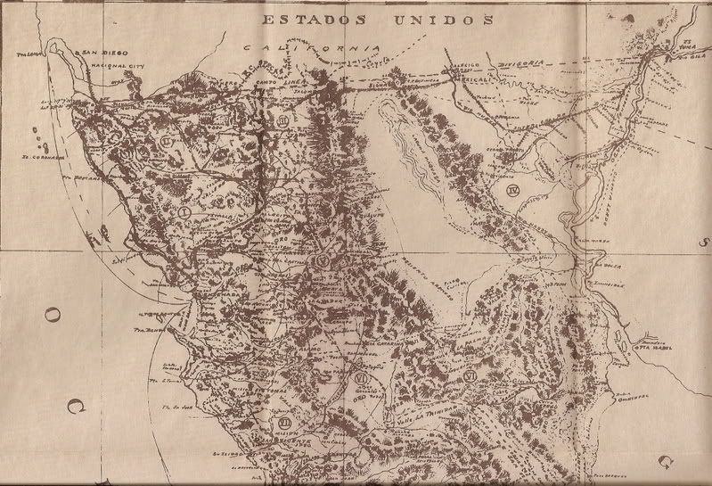
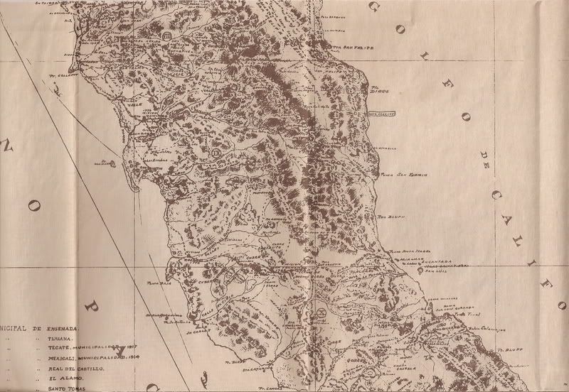
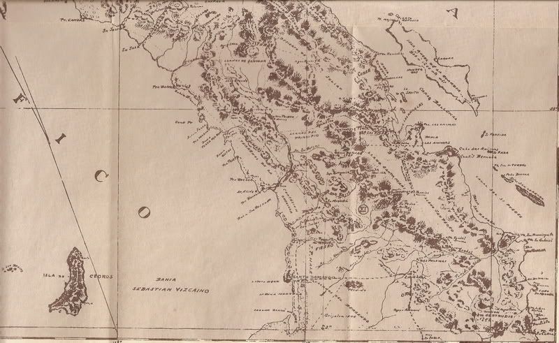
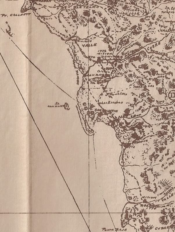
"Towns of Baja California, A 1918 Report by David Goldbaum" is an interesting little book, translated by William O. Hendricks. Goldbaum was born in
Mexico in 1858, lived in Ensenada for over forty years, and writes about the early development of: Calamahi (Calamajue ?*), El Barril, San Fernando
(?), Santa Catarina, El Rosario, San Quintin, Santo Domingo, San Telmo, San Rafael Abajo, San Vicente, Santo Tomas, Punta Banda, Real Del Castillo, El
Alamo, Valle de Trinidad, San Felipe, Guadalupe, Ensenada, Collnett (sic), and El Centinela. Those are all the way the towns are listed in the table
of contents. My copy has a great old map dated 1919. |

 for example.