Originally posted by David K
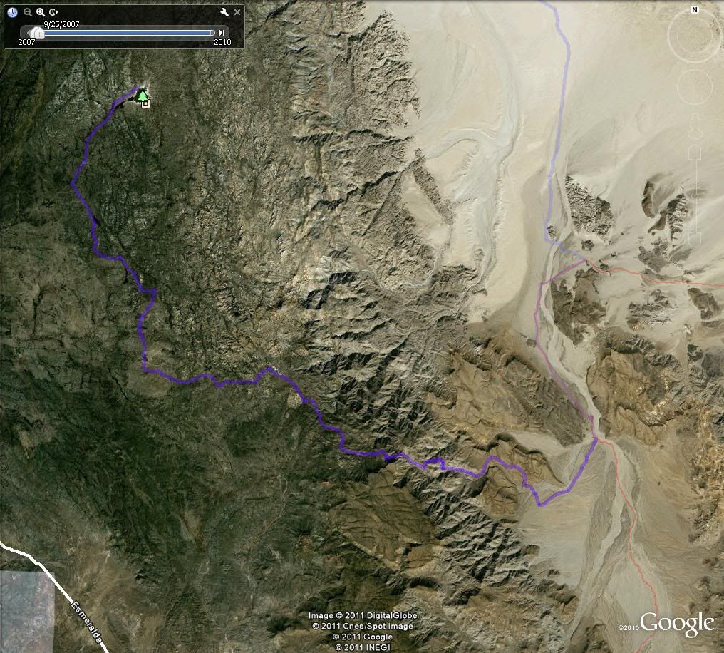
Here is part of the page of waypoints that take you from Guadalupe Canyon up to Hwy. 3 via Mano Canyon... this is from 2003 and the map datum is set
at NAD27 Mexico:
Guadalupe Canyon Entrance: 32°09.40'/ 115°47.29'
Cohabuzo Jcn: 31°55.74'/ 115°36.22'
South of Cohabuzo 8.2 mi. is a fork, go right for El Mano (4WD): 31°49.81'/ 115°33.89'
Jcn. with road to left. Ahead-right goes up the mountain via El Mano canyon: 31°47.68'/ 115°36.65'
Rancho El Mano driveway left, road begins major climb: 31°48.56'/ 115°40.39'
Rancho Los Pinos, elev. 5,086': 31°48.77'/ 115°46.26'
Jcn. Santa Catarina left (S)/ Agua Blanca right (SW): 31°45.20'/ 115°51.52'
Jcn. Agua Blanca left (S), Hwy. 3 right (N): 31°42.24', 115°54.25' |


 :lol
:lol but on my trips a few years ago, a couple of years apart, it looked like it had never been used in years.