Jump-Up George, the river's fish that routinely clear the water in great leaps almost capsized my kayak
Waved to the Navy Guys on exercise at the Lighthouse
Got some exercise and absorbed some Vit. D
All Looks Wonderful...
but the river channel is too shallow in places for a kayak to negotiate.
The river has filled in at the mouth so no boat can navigate in or out!nancyinpdx - 3-19-2009 at 05:49 AM
Sounds so beautiful. Que lastima que no puedes navigar el rio con tu kayak....
Mulegena
Pompano - 3-19-2009 at 06:29 AM
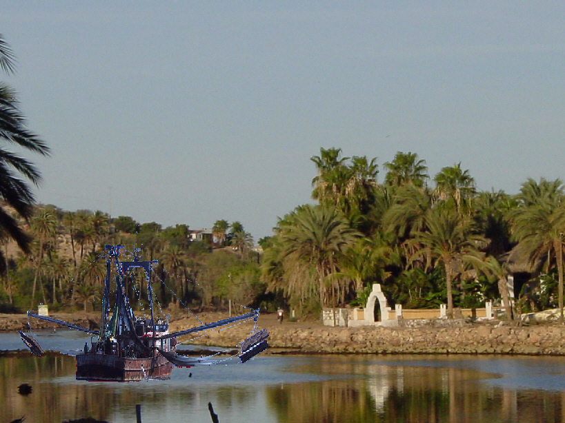
Are you sure you are taking the right channel through the estuary?
This photo was just taken a week or so ago. Plus we have been in and out of the river many times in our fishing boats, which draw considerably more
water than kayaks.
Maybe you are approaching at low tide thru one of the very shallow side channels near the mouth, if so, don't worry..as there are deeper places ahead
and to the sides. You will find them with no problem. Have fun with the river kayaking.
.
Give some thought to kayaking inland from the highway bridge..it's just plain gorgeous upriver. Take some pics and post them, por favor.
. mulegemichael - 3-19-2009 at 07:16 AM
ya have to pick the right tide too, maria....when you guys went out yesterday it was reeeealll low..and..stick right up close to the lighthouse
rock..i can still get up and down it in my 28' panga on the right tide so i know you can do it in your kayakMulegena - 3-19-2009 at 07:28 AM
Yes, Pompano, I think I was going through the main channel. Its marked with a bottle on a stick. Last year MM and BeachGirl put rubber duckies to mark
the deepest part of the channel; they've flown south for the winter now.
I'm not a fisherman so am not an authority on the channel. However, just this morning, 7 a.m. tide outgoing, I watched a pangero lift his engine prop
and "pirogue" out through the channel-- he made it. A couple days ago I saw him unable to drag his boat in; ended up leaving it downriver and walking
in with his catch and gear.
Two years ago we were able to kayak around the estuary closest to the mouth of the river. It is now connected to the south side of the river.
Going to Pancho Villa's or El Patron by water was not an option yesterday as we've done before.
My concern is that because of the infiltration of dirt left from the floods that the river is filling in, quickly becoming a tidal plain.
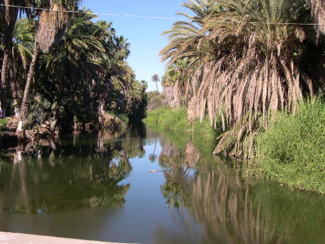
As to the beautiful new face of the river west of the bridge-- you betcha! Its gorgeous. Cleared of the bamboo which was choking it. Lovely to kayak
or just wander the riverbanks which was not possible before the cleanup efforts.Bajagypsy - 3-19-2009 at 08:08 AM
sounds like you had a blast, wish I was there, I have never kayaked!Pompano - 3-19-2009 at 08:23 AM
Quote:
Originally posted by Bajagypsy
sounds like you had a blast, wish I was there, I have never kayaked!
Gypsy, I am surprised by that..you have never kayaked? You've missed much of the Baja Experience then. In fact, it may even be against Baja Law.
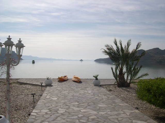
When you and your family are next in the Mulege area, come on down to Coyote and you guys can all take kayaks out into the Bay.
Paddle with the porpoise...have a ball. Your ride awaits.
. fixtrauma - 3-19-2009 at 08:31 AM
What a view Pompano!!Bajagypsy - 3-19-2009 at 09:20 AM
Pompano thanx, we totaly will take you up on your offer! I'm usually to busy under the water (diving) or snorkeling, to think about kayaking!Bob H - 3-19-2009 at 09:25 AM
Roger, you have photos of any topic, I swear!
Bob HIflyfish - 3-19-2009 at 10:47 AM
How absolutely beautiful, stunning!
Iflyfish
Kayak....Si!
toneart - 3-19-2009 at 12:14 PM
Yesterday I kayaked the river from The Orchard and then south down The Sea of Cortez about three miles, and back. It was about 0 tide much of the day.
That part with the stick and plastic bottle was a bottom scraper, but I got through. There have been some times when you just have to get out and walk
the kayak over that part. There are other parts of the river where you have about 5 inches clearances over sand. When you reach the channel, it is
clear paddling. Certainly deep enough for kayaks. Fishing boats make it in and out. You just have to know how to navigate through. The riverbed
changes with each hurricane caused flood.
The dredging that was done closer to town was done by scooping from the roads. Not very effective. You still can't motor a boat up there. Some
Pangueros do at high tide, but they also have to lift their outboards and paddle in some places.
The huge problem is that, with each flood, the river becomes more filled in with silt. It doesn't take much to put the water over its banks. The
combination of a sustained downpour at low tide will do it. That is sometimes the case when a hurricane (downgraded to TS status, but still carrying
lots of water) comes in at the right trajectory in late August or September. The rock work along the sides looks impressive but it doesn't stop the
water from spilling over.
The river is beautiful and what a joy to kayak in the sun, looking at all that beauty.
The fish and the birds are a wonder to observe. We have no poisonous water snakes or crockodiles to worry about either. It is always a good break to
paddle around the lighthouse and pull up in front of El Patron and have a cold cerveza and maybe lunch. We are very lucky to be able to live here.
All of this is not to contradict Mulegena. I think she just hit the wrong spots on a super low tide. You can download tide charts and that helps to
plan when to kayak and when not to. I always refer to them when putting my fishing boat in at Donation Pier. Most make it and some rock their props.
The first time launching after a flood is always new adventure. I stand on the dock and watch the local fishermen first and then follow their route.
There isn't a lot of depth to allow for error. CaboRon - 3-19-2009 at 02:44 PM
There is nothing unusual about any of this ....
It is the way rivers create deltas ....
Regular maintenance and dredgeing is the only answer ....
Regular is the key word here ....
And yes someone has to pay for it , perhaps a river association could be created to manage the estuary and river.

 Sounds so beautiful. Que lastima que no puedes navigar el rio con tu kayak....