BajaNomad

Agua Dulce Spring on the Camino Real

David K - 3-29-2009 at 08:41 AM

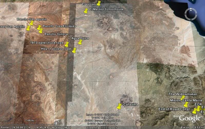
Agua Dulce (Sweet Water) was an important spring along the Camino Real between Mision Santa Maria and Mision San Fernando. During the construction of Highway One, in 1973, road crews bulldozed the spring for easy access to water trucks as water was needed for highway construction. The spring is 2.0 miles from Highway One over a fair road.

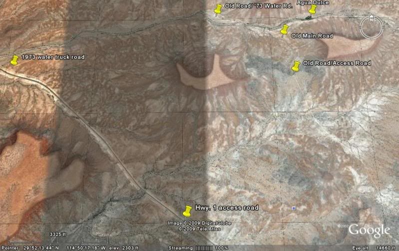
A good access road was found by Neal Johns after I had used the original construction access road (badly washed out) a couple years ago... that original road is at Km. 157-158. The improved, shorter access is at Km. 160-161, just south of a small 'rancho on the west side of Mex. 1. The road goes east (left) from the highway and travels 1.4 miles to where it intersects with the original dirt road to La Paz (pre-1973).

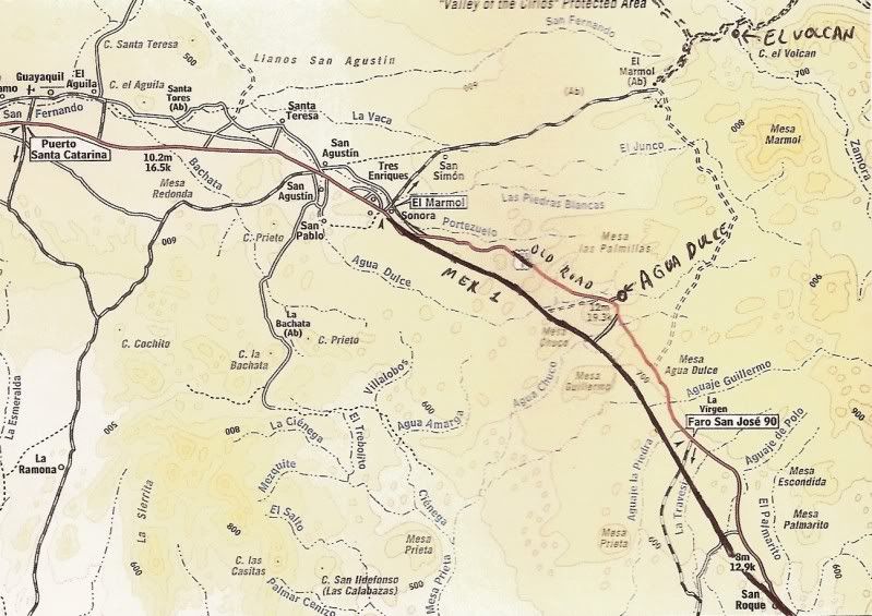
The Baja Almanac shows Arroyo Agua Dulce (Map 16, D-5) crossing the highway... however, the highway is wrong... that is actually the old main road location 1.4 miles east of the actual highway location. The spring is 1/4 mi. up the arroyo from the (incorrect) highway crossing, on the map.

In this photo, my truck is at the junction of the access road and the old main road (the original Baja/Mexican 1000 course), 1.4 mi. from Mex. 1...


AGUA DULCE : 29°52.97', 114°49.38'


Elizabeth at Agua Dulce... Turn north from Hwy. 1 between
Km. 160-161 (29°51.56', 114°50.35'). Go 1.4 mi. to old Baja main road
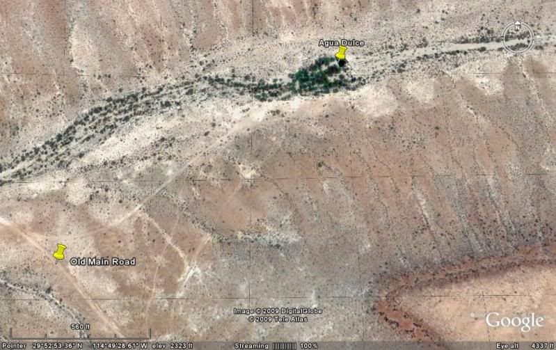
(previous photo), turn left for 0.3 mi. then right 0.3 more. Hike into gully.


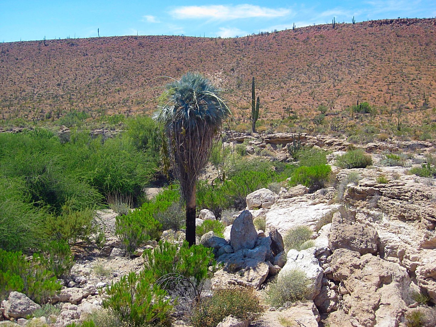
A lone blue palm grows from the gully containing the large spring. Located along the El Camino Real, Agua Dulce was a vital water source for early travels. GPS at the water's edge is N29°52.97'/ W114°49.38' (NAD27).

2003:

Agua Dulce, from the north side of the historic spring. Neal Johns photo.

2002:

I came back for look in 2002. We camped here in 1966 during our big trip to the tip and came by again in 1973 when the highway was under construction.


Agua Dulce from space:


David K - 5-21-2009 at 02:45 PM

Agua Dulce is on El Camino Real... the mission road from Loreto to San Francisco, Alta California.

Mexitron - 5-22-2009 at 04:33 AM

Been there--cool to see a place that was so vital to travelers over Baja's long history. Just want to plant another Blue Palm to give that lone one company... :biggrin:

David K - 5-22-2009 at 08:54 AM

Quote:
Originally posted by Mexitron
Been there--cool to see a place that was so vital to travelers over Baja's long history. Just want to plant another Blue Palm to give that lone one company... :biggrin:


That's a great idea! Nomads? Project: Agua Dulce Palma Azul Dos.

Neal and Marian Johns camped there and took sunrise photos: http://vivabaja.com/neal2

Bob H - 5-22-2009 at 10:32 AM

That would be a very cool Presidents Day Weekend run David! Or, do you think that's too far away for a three day weekend?
Bob H

[Edited on 5-22-2009 by Bob H]

David K - 5-22-2009 at 12:58 PM

That alone is not enough, after such a drive. However, it is very near El Marmol and El Volcan... and that would make it more interesting... Just imagine being at El Volcan when the monthly geyser erupts??? Alas, the odds are pretty slim we would be lucky enough to be there, in the daylight to see the rare cold water geyser erupt! February would be very cold there, too... Keep the ideas flowing Bob!

See: http://vivabaja.com/marmol

Mexitron - 5-23-2009 at 07:16 AM

I was just perusing the road to El Volcan and beyond and the road looks like its in good shape...? I was there around 8 years ago and there was a huge washout--has it been fixed? Or is it just that the old roads stick around for a long time...there is some interesting red rock by the end of that road (which apparently was a mine) and it wouldn't have to go much farther to cut across to the Gulf. Looks like some interesting country out there.

David K - 5-26-2009 at 09:15 AM

Quote:
Originally posted by Mexitron
I was just perusing the road to El Volcan and beyond and the road looks like its in good shape...? I was there around 8 years ago and there was a huge washout--has it been fixed? Or is it just that the old roads stick around for a long time...there is some interesting red rock by the end of that road (which apparently was a mine) and it wouldn't have to go much farther to cut across to the Gulf. Looks like some interesting country out there.


See posts by ELINVESTI8 (David) with photos of the La Olividada mine, at the end of the road past El Volcan... He traveled out there with Soni Espinoza's family... They had to walk the final part.

David K - 7-3-2015 at 08:19 AM

I heard from someone that a rancho was established at Agua Dulce spring and the area may be fenced off or the road gated.... ?

Anyone have new information on the historic spring?

TMW - 7-3-2015 at 09:56 AM

David on Google Earth you can see the ranch at the water site. The GE image is dated 1-25-14.

David K - 7-3-2015 at 11:03 AM

Quote: Originally posted by TMW  
David on Google Earth you can see the ranch at the water site. The GE image is dated 1-25-14.


Thanks Tom... wow Google Earth is sure improving on newer images of Baja!


Agua Dulce 1-25-14.jpg - 212kB

David K - 7-4-2015 at 12:45 PM


2003 Baja Almanac with corrected highway location:


EL CAMINO REAL MAP:


[Edited on 7-4-2015 by David K]

David K - 7-6-2015 at 11:21 AM

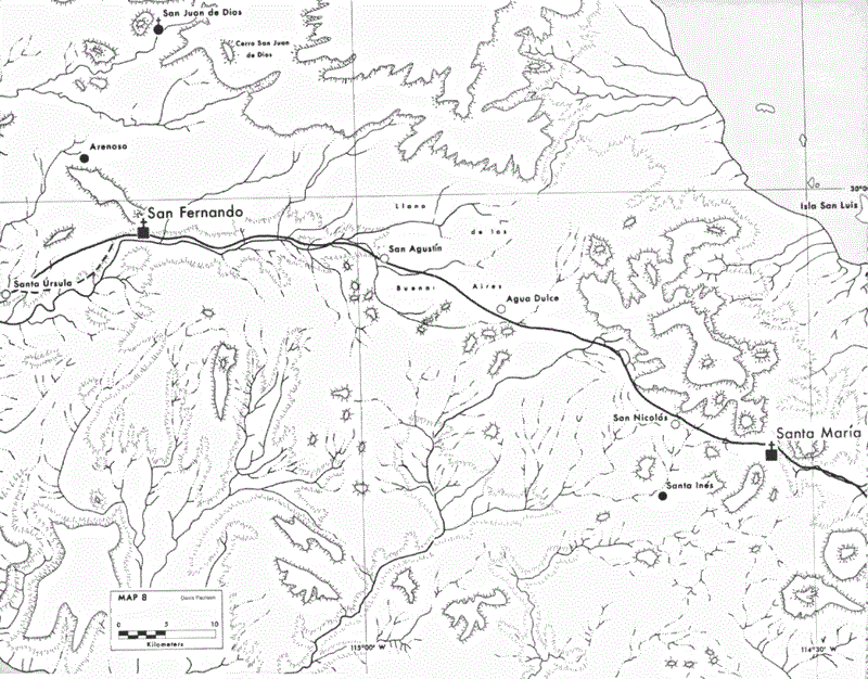
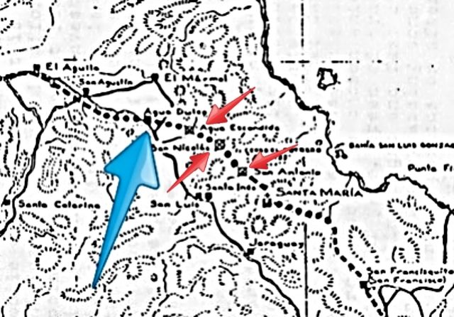
Here is the El Camino Real map made by Howard Gulick in 1954 showing Agua Dulce and the auto roads of the time. The Camino Real is indicated by dashes where the road is visible and by dots where the route is fairly certain, but not road work is seen. The Camino Real west of Agua Dulce to El Aguila is shown just south of the auto road of 1954-1973... and that is where Highway One was built.

elcaminoreal3.jpg - 230kB

Neal Johns - 7-6-2015 at 08:50 PM

David, that was me that told you a ranch was there now. Gated with nasty signs saying Keep Out. Horses visible. I did not make contact with the people. Was going to show it to Art.
Neal

David K - 7-7-2015 at 08:33 AM

Quote: Originally posted by Neal Johns  
David, that was me that told you a ranch was there now. Gated with nasty signs saying Keep Out. Horses visible. I did not make contact with the people. Was going to show it to Art.
Neal


Then, as with the disappearing missions, our photos have preserved another historic site no longer seen by the public. Thanks Neal.

TMW - 7-8-2015 at 01:35 PM

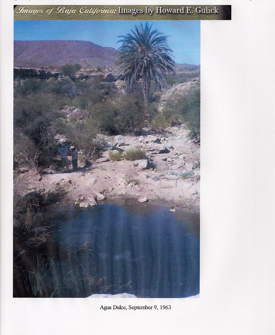
As it once was in 1963

rts551 - 7-8-2015 at 02:19 PM

You can always open the gate, after all the road was there for a long time.

David K - 7-8-2015 at 04:39 PM

See Neal's post above.

The old main trans-peninsular road passes by, 0.3 mile west of the spring, which was reached by a 0.3 mile driveway.

Now a ranch is there.

Perhaps if Baja Bucko or others on muleback, was riding on the Camino Real, coming up from the south, they could reach the spring, but need the rancher to let them out on the other side, at the old main road?

rts551 - 7-8-2015 at 04:41 PM

Quote: Originally posted by David K  
See Neal's post above.

The old main trans-peninsular road passes by, 0.3 mile west of the spring, which was reached by a 0.3 mile driveway.

Now a ranch is there.

Perhaps if Baja Bucko or others on muleback, was riding on the Camino Real, coming up from the south, they could reach the spring, but need the rancher to let them out on the other side, at the old main road?


You have experience in dealing with gates. enough said.

David K - 7-8-2015 at 05:44 PM

I do? You have me confused with someone else, again...

dtbushpilot - 7-8-2015 at 05:59 PM

Jesus rts, aren't there enough ruined threads out there for you? Do you really need to ruin this one too? DK wasn't bothering anybody, not trying to sway anyone to his political view, actually just participating in what Baja Nomads is about. You sir are a troll, you and your lot are driving more and more people away from this site. Have you noticed that "today's posts" fit on one page these days? I'll bet Doug has. Have you noticed that a good majority of "todays posts" are just a bunch of old drunks arguing and calling names? I'll bet Doug has. Have you ever wondered what kind of businesses might want to advertise on a dying web site were a bunch of old drunks on SS run their mouths all day? I'll bet Doug has.

Crawl back under a rock rts and take your gang of 5 with you...

DianaT - 7-8-2015 at 06:11 PM

Quote: Originally posted by dtbushpilot  
Jesus rts, aren't there enough ruined threads out there for you? Do you really need to ruin this one too? DK wasn't bothering anybody, not trying to sway anyone to his political view, actually just participating in what Baja Nomads is about. You sir are a troll, you and your lot are driving more and more people away from this site. Have you noticed that "today's posts" fit on one page these days? I'll bet Doug has. Have you noticed that a good majority of "todays posts" are just a bunch of old drunks arguing and calling names? I'll bet Doug has. Have you ever wondered what kind of businesses might want to advertise on a dying web site were a bunch of old drunks on SS run their mouths all day? I'll bet Doug has.

Crawl back under a rock rts and take your gang of 5 with you...


As always, it is a matter of one's personal perspective .......


[Edited on 7-9-2015 by DianaT]

dtbushpilot - 7-8-2015 at 06:32 PM

Only 4 more to hear from...

rts551 - 7-8-2015 at 06:36 PM

I did not say anything but the truth. And said it short and sweet. David has made it known he feels that gates should not be on roads that have pre existed. I don't think I ruined the thread by saying that. You did more DT to take it off-topic than anyone.

dtbushpilot - 7-8-2015 at 06:43 PM

Quote: Originally posted by rts551  
I did not say anything but the truth. And said it short and sweet. David has made it known he feels that gates should not be on roads that have pre existed. I don't think I ruined the thread by saying that. You did more DT to take it off-topic than anyone.


Your post had one purpose only, to pick a fight with DK. You can't stand to see a post where DK is involved where nobody is kicking him in the crotch.

DianaT - 7-8-2015 at 06:48 PM

Quote: Originally posted by dtbushpilot  
Quote: Originally posted by rts551  
I did not say anything but the truth. And said it short and sweet. David has made it known he feels that gates should not be on roads that have pre existed. I don't think I ruined the thread by saying that. You did more DT to take it off-topic than anyone.


Your post had one purpose only, to pick a fight with DK. You can't stand to see a post where DK is involved where nobody is kicking him in the crotch.


You putting words, thoughts and feelings into someone else's head is truly destructive and give it a break. Four to go? That is funny! Maybe it is some kind of deep dark conspiracy --and DK is definitely a victim

But seriously, your post did take this thread off topic ----- way off topic.

Back to the topic --- sounds like someone does not want people driving over their ranch anymore, and that is their right. Seems like more and more of that is happening in Baja and probably for good reason.

Times are changing, and will continue to change. Open access is fading for better or worst


[Edited on 7-9-2015 by DianaT]

rts551 - 7-8-2015 at 06:49 PM

Quote: Originally posted by dtbushpilot  
Quote: Originally posted by rts551  
I did not say anything but the truth. And said it short and sweet. David has made it known he feels that gates should not be on roads that have pre existed. I don't think I ruined the thread by saying that. You did more DT to take it off-topic than anyone.


Your post had one purpose only, to pick a fight with DK. You can't stand to see a post where DK is involved where nobody is kicking him in the crotch.


He handled it well. Now back to gates and old roads.

dtbushpilot - 7-8-2015 at 06:54 PM

Quote: Originally posted by rts551  
Quote: Originally posted by dtbushpilot  
Quote: Originally posted by rts551  
I did not say anything but the truth. And said it short and sweet. David has made it known he feels that gates should not be on roads that have pre existed. I don't think I ruined the thread by saying that. You did more DT to take it off-topic than anyone.


Your post had one purpose only, to pick a fight with DK. You can't stand to see a post where DK is involved where nobody is kicking him in the crotch.


He handled it well. Now back to gates and old roads.


How about we go back to the Agua Dulce Springs, that's what this thread is about, not gates and roads...

LancairDriver - 7-8-2015 at 07:10 PM

I think DT correctly saw this thread veering off track by the usual suspects, with rts firing the first shot and queing the rest to jump in, as normal when DK is involved in any way. There have been many new nomads lately who have legitimate Baja questions and unfortunately are exposed to this elementary school name calling and vicious little slams by the same people who apparently have nothing going in their life.This forum is too valuable a source for Baja information to be wasted with petty jealous sniping.

rts551 - 7-8-2015 at 08:05 PM

Quote: Originally posted by LancairDriver  
I think DT correctly saw this thread veering off track by the usual suspects, with rts firing the first shot and queing the rest to jump in, as normal when DK is involved in any way. There have been many new nomads lately who have legitimate Baja questions and unfortunately are exposed to this elementary school name calling and vicious little slams by the same people who apparently have nothing going in their life.This forum is too valuable a source for Baja information to be wasted with petty jealous sniping.


Then why are you doing it?

bajacamper - 7-14-2015 at 09:22 AM

An absolutely perfect and correct observation of the gang of 5. People are leaving or have left the forum in droves. Could be a connection?

[Edited on 7-14-2015 by bajacamper]

Agua Dulce in 2017: Km. 160.5+ (+ 2 miles in)

David K - 7-7-2017 at 09:45 AM

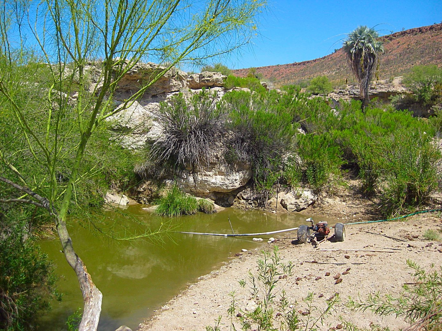
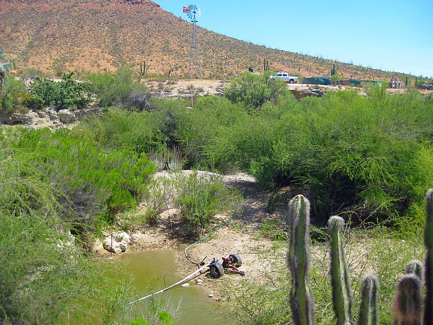
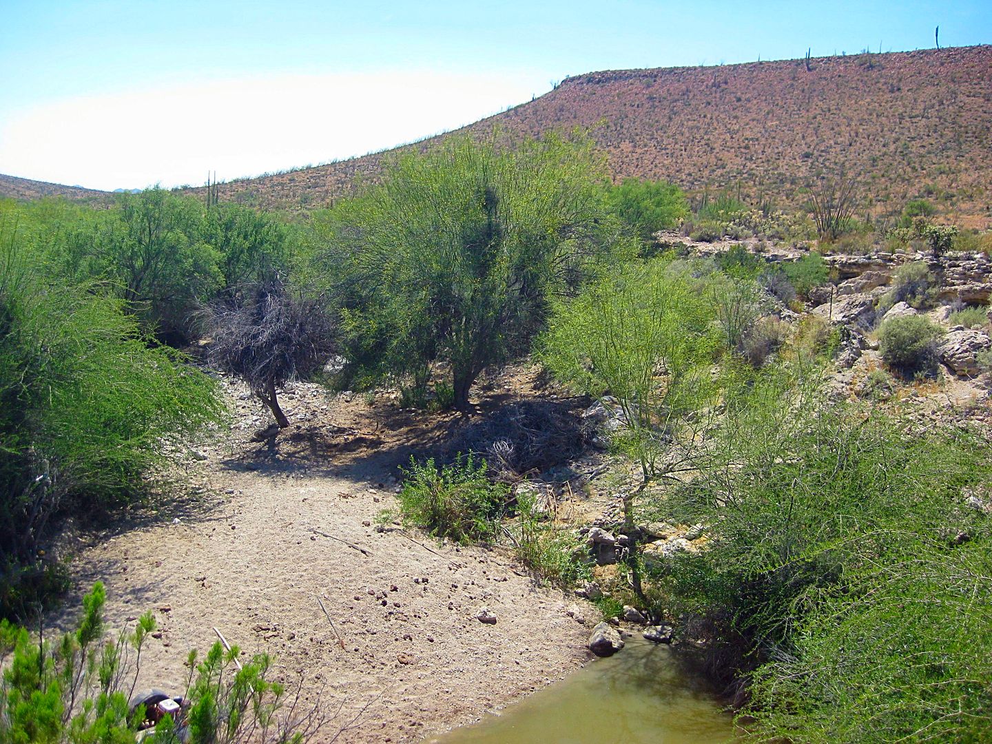
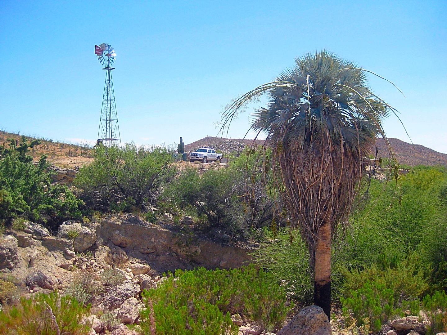
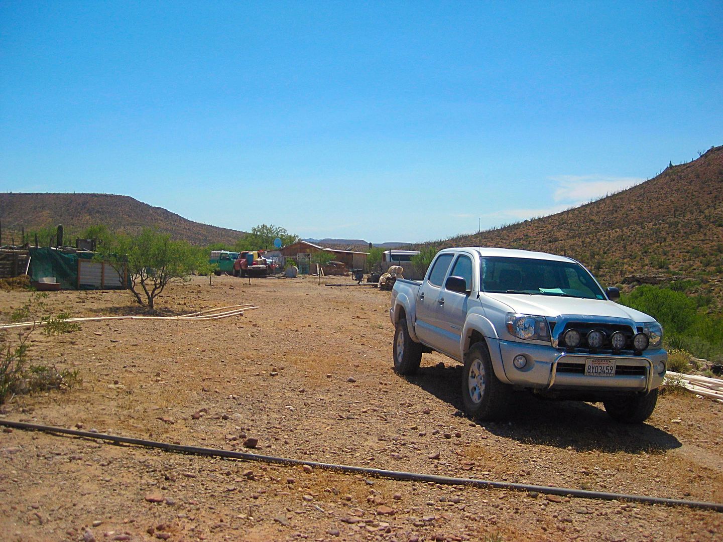
To update this thread, here are my June 2017 observations:

*There is no closed gate, at least not this time.
*The ranchers were welcoming and gave me permission to take photos at the spring (which is about 1,000 feet past the ranch and down in a gully).
*A windmill was installed to pump the spring water up to the ranch but a gasoline pump was in the pond (not running when I was there).
*The ranchers confirmed their ranch name is Rancho Agua Dulce.

I parked near the windmill, walked down to the pond then back out of the gully on the opposite side. I walked around the east side of the spring/ gully back to my truck. The final photo is the ranch as seen from where I parked.


kevin_in_idaho - 7-7-2017 at 09:50 AM

If it's agua dulce, did you try it and confirm? :-)

David K - 7-7-2017 at 10:00 AM

Quote: Originally posted by kevin_in_idaho  
If it's agua dulce, did you try it and confirm? :-)


Not since the cows began drinking there, which was before my time! It looked cleaner in my 2002 and 2005 photos!

Here is a 1963 photo from Howard Gulick: http://libraries.ucsd.edu/speccoll/baja/gulick/m91-38-03.htm...

gueribo - 7-7-2017 at 09:20 PM

Lovely little spot.

4x4abc - 7-8-2017 at 08:30 AM

Quote: Originally posted by David K  
Here is the El Camino Real map made by Howard Gulick in 1954 showing Agua Dulce and the auto roads of the time. The Camino Real is indicated by dashes where the road is visible and by dots where the route is fairly certain, but not road work is seen. The Camino Real west of Agua Dulce to El Aguila is shown just south of the auto road of 1954-1973... and that is where Highway One was built.


David,

do you have exact locations for the ranchos San Nicolas and San Antonio?

David K - 7-8-2017 at 09:34 AM

They are (or were) not ranchos, but water locations on El Camino Real between Santa MarĂ­a and Agua Dulce.

On the road to Mission Santa MarĂ­a there is a monument and a track north to, or near to, San Antonio. You can see the road on GE... It is 4.7 road miles from Santa Ynez. I don't recall if I found where San Nicolas is.

Another nearby oasis on El Camino Real is called Agua Escondida (in old times) and is in Arroyo Aguaje Guillermo, which crosses to old main road 0.4 mi. north of La Virgen.

From Neal Johns:
Drive up the arroyo, 4.4 miles, then hike 1 mile to '100' palms.
Photos from Neal are hosted by me: http://www.vivabaja.com/neal2/page5.html
From that page:
Arroyo Aguaje Guillermo Palms

Over 100 blue and fan palms were found by Neal and Marian
after a mile hike from the road end.
The unmapped road is 0.4 mile north of La Virgen, and then a 4.4 mile drive east.
Another great discovery by the Johns', thanks for sharing with us!

El Camino Real Map by Howard Gulick

David K - 7-8-2017 at 09:48 AM

Here is a zoom in, with a big blue arrow on Agua Dulce and small red arrows on the three waterholes of Agua Escondida, San Nicolas, and San Antonio:


Note location of Rancho Santa Ines (Ynez) and Mission Santa MarĂ­a for reference points as well as the auto road in 1954.

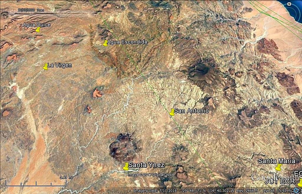
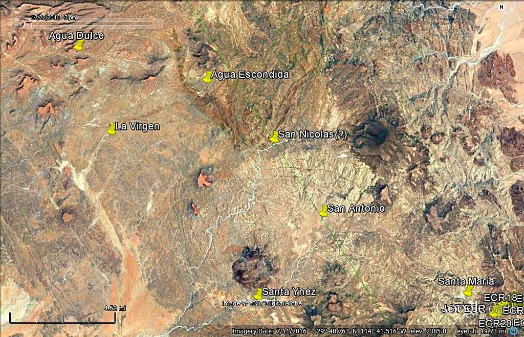
On Google Earth

David K - 7-8-2017 at 10:45 AM


Agua Dulce, La Virgen, Santa Ynez and Mission Santa MarĂ­a are excatly located. Agua Escondida and San Antonio are close if not spot on.

With San Nicolas estimated...

David K - 7-8-2017 at 10:52 AM


Watering locations were 5-10 miles apart. There were exceptions on other parts of El Camino Real!

4x4abc - 7-8-2017 at 05:32 PM

I will see what I can find

David K - 7-8-2017 at 05:56 PM

As long as you stay off your feet and heal up first!

San Nicolas: On GE you can see big ponds just upstream of the push pin location of mine.

San Antonio: The pin is where the road meets the arroyo. No visible water or dense palms.