BajaNomad

Unusual object or farm on Google Earth

Santiago - 12-7-2009 at 05:44 PM

[img][/img]

Anyone know what this is? It's about 25 miles south of El Rosario and I see some farming in the general area to the north.

David K - 12-7-2009 at 06:02 PM

New location for Area 51! :O

Tano - 12-7-2009 at 06:40 PM

Una pista de aterrizaje para OVNIs. What else?

woody with a view - 12-7-2009 at 06:54 PM

the governor, or Teo has a landing strip near his spread. why do you think they started the road widening in that area, of all places?

BMG - 12-7-2009 at 07:07 PM

Quote:
Originally posted by lencho

Data error of some sort-- doesn't look at all like actually part of the terrain it covers. There are a number of other partially transparent blotches up to the north and west a couple of km.

BTW your imbedded latitude is about 10 degrees off... :lol:

--Larry
Larry, Larry, Larry, that's just what they want you to think. These 'data errors' are going to keep showing up, moving and growing until 2012.

BornFisher - 12-7-2009 at 08:18 PM

Noah`s ark?

Santiago - 12-7-2009 at 08:27 PM

I think this is man made: look at the edges and you'll see little half circles as if a tractor was pulling a blade or something and made a turn.
There are clearly farming patches to the north a few miles but I can't tell if this is a crop of some sort or a building. At .40 miles I doubt it's a building.
As the surfing in this area is A-1, maybe Mr. Clark of the old Clark Foam has secretly set up shop?? He used to always rage against the machine in his year-end newsletters if I recall.

JESSE - 12-7-2009 at 08:37 PM

The area was definately cleared by tractors, you can see the typical patterns they leave on the edges. The area is not paved, and theres no structure in there. Now, its definately too wide for a landing field, so my guess is that its some sort of plantation. It appears to be in a sort of canyon, so that might explain the shape of the field.

Frigatebird - 12-7-2009 at 08:45 PM

I agree with the ag thesis. The area appears to be bottomland, not unlike what they cultivate near the highway east of El Rosario. The area immediately to the northeast appears to be a fallow field. On the Inegi topo, it also appears relatively flat. Onions or peppers anyone?

Santiago - 12-7-2009 at 08:46 PM

DK had to drive right passed this on his trip. You see anything Daveed?

Santiago - 12-7-2009 at 08:49 PM

And also, if it were a plowed field, why are the ends such perfect half circles? Is there a way of knowing when a photo was taken in GE?

[Edited on 12-8-2009 by Santiago]

Skipjack Joe - 12-7-2009 at 08:50 PM

Quote:
Originally posted by Santiago


Anyone know what this is? It's about 25 miles south of El Rosario and I see some farming in the general area to the north.


Looks like Mark Spitz is secretly training to make a comeback.

BajaGringo - 12-7-2009 at 08:52 PM

It's a uranium enrichment facility...

Frigatebird - 12-7-2009 at 09:03 PM

Quote:
Originally posted by Santiago
Is there a way of knowing when a photo was taken in GE?

[Edited on 12-8-2009 by Santiago]


In the View Menu you can check the Historical Imagery. While mousing over the area of interest, the date of the image will be displayed in the lower left corner of the view. The latest date appears to be April 4, 2005.

[Edited on 12-8-2009 by Frigatebird]

Diver - 12-7-2009 at 09:04 PM

Perhaps .... ?

bandaid_bandage.jpg - 3kB

Frigatebird - 12-7-2009 at 09:11 PM

Quote:
Originally posted by Santiago
And also, if it were a plowed field, why are the ends such perfect half circles?
[Edited on 12-8-2009 by Santiago]


I'm no commercial farmer, but it looks like the radius of those circles is equal to half the width of the field. Perhaps the equipment traces out those semicircles when it pulls the U-ee. Looks like the northeast end got done first as it is not as circular as the other. Practice makes perfect.

Frigatebird - 12-7-2009 at 09:20 PM

Quote:
Originally posted by Frigatebird
Quote:
Originally posted by Santiago
And also, if it were a plowed field, why are the ends such perfect half circles?
[Edited on 12-8-2009 by Santiago]


I'm no commercial farmer, but it looks like the radius of those circles is equal to half the width of the field. Perhaps the equipment traces out those semicircles when it pulls the U-ee. Looks like the northeast end got done first as it is not as circular as the other. Practice makes perfect.


Upon further review, the field seems to wide for any equipment I've seen to be done on a single pass.

How 'bout this, maybe they have a GPS based tractor guidance, or a history with NASCAR.

Mexitron - 12-7-2009 at 09:50 PM

Its in the San Carlos Valley--along the road to Punta San Carlos, a pretty popular destination---maybe someone can check it out if they're heading that way....that's a pretty dry area to be setting up sophisticated farming but who knows....there are some mines nearby as well.....


Years ago, sometime in the early 80s my brother and I went out to Punta San Carlos...on the way out we passed a huge stakebed truck filled to the top with sacks of potatoes...I knew there was a little farming out there in the valley but potatoes need substantial water...I looked and looked on the way in for a farm that perhaps had drilled for some groundwater but didn't see anything except dry pasture....it wasn't until we got to the beach and seeing guys with shovels that we realized that the potato sacks were filled with beach pebbles!

motoged - 12-7-2009 at 11:49 PM

I first thought it was an agricultural project covered with the ubiquitous plastic greenhousing....but then began to think outside the box....the cave art in Baja has suggested that Baja was once inhabited by tall people (didn't someone find an unusually long thigh bone in Baja once, a find adding credence to the myth?)....well, the tall people DO exist in Baja and have taken up the sport of curling....that's one big mutha sheet of ice:lol::lol:

Neal Johns - 12-8-2009 at 01:22 AM

I'm with Diver on this one.
Damn! Those Inguns were big!

TheColoradoDude - 12-8-2009 at 01:45 AM

Will someone please google earth those sand circles near puertecitos???

David K - 12-8-2009 at 06:56 AM

Lencho is right, the latitude is 29º not 19º

Here is the overall area, with Santiago's field pinned as 'Area 51'

It is right along the road to Punta San Carlos...


David K - 12-8-2009 at 07:03 AM

Quote:
Originally posted by TheColoradoDude
Will someone please google earth those sand circles near puertecitos???


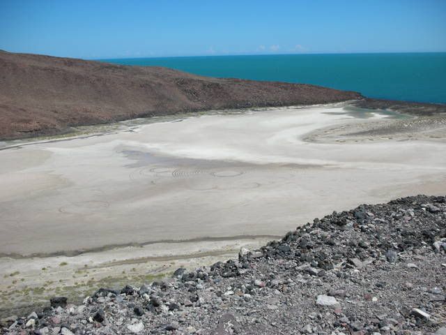
THESE?:light:


Google Earth

David K - 12-8-2009 at 07:21 AM

The resolution isn't high enough to see the tire tracks, when I was zoomed in at max... or the photo was taken before they were added... Here is up a bit to see the area...


The Cerro Prieto volcano crater has salt flats (potassium nitrate?) too!


TheColoradoDude - 12-8-2009 at 08:08 AM

Excellent David! Buenas!

surebought - 12-8-2009 at 08:35 AM

Hey - In your google maps searches, have you ever seen anything that looks like pay dirt. You know like old abandoned Silver Mines. A discolorisation lead colored outcroppings? Please contact me through sales@lolayala.com

David K - 12-8-2009 at 09:25 AM

Quote:
Originally posted by surebought
Hey - In your google maps searches, have you ever seen anything that looks like pay dirt. You know like old abandoned Silver Mines. A discolorisation lead colored outcroppings? Please contact me through sales@lolayala.com


No old silver mines... yet!

Does a 'lost mission' count?

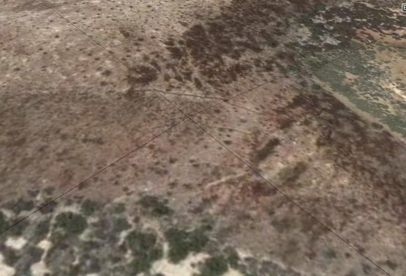
Well, strange walls anyway... I have been searching for several years for the site Choral Pepper and the Erle Stanley Gardner expedition of 1966 found that Choral later believed to be a Jesuit proposed mission site, but was abandoned... Choral and other on that trip could not recall where it was, but somewhere south of Bahia de los Angeles and north of San Francisquito.

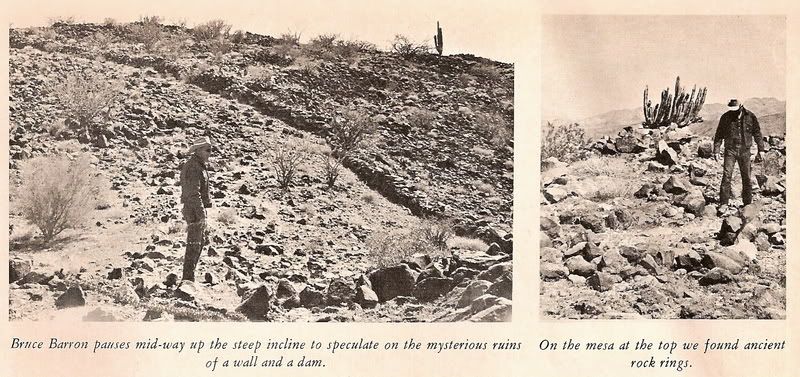
Sharksbaja spotted the walls on Google Earth and asked me if they could be the ones. I went as soon as I could to see if it was the same place... Going there was the only way to know for sure. Choral put two photos of the site in her Desert Magazine (July, 1966).


See http://vivabaja.com/109 or the latest edition of Discover Baja Travel Club's online newsletter cover story http://discoverbaja.com

From space:


1966 Desert Magazine photos:


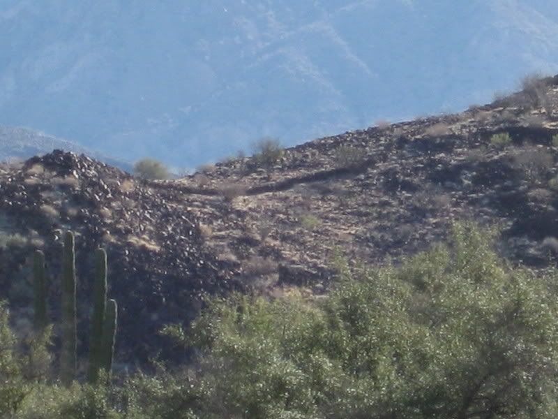
From the road:


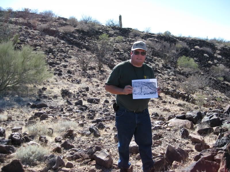
On top the hill, holding the 1966 photo:


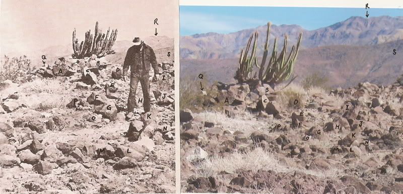
1966 photo and 2009 photo with rocks matched:


The site was very special to Choral and wanted me to find it very badly. She passed away in 2002 after my first two searches... Anyway, Tom Miller published the discovery in his 1974 'The Baja Book' a year after Choral's Baja book was published with the approx. location.


I contacted an archeologist who has published papers on the nearby Bahia las Animas sites. The wall and sleeping circles we saw are not anything unique to the area, and are not 'unknown'. They mean more to Baja history enthusiasts and desert rats as a curiosity than anything else and are just one of the many things that are so interesting to get us to get out to the desert and enjoy what we find there.

What made Choral think this was a Jesuit site, was the proposed mission of Santa Maria Magdalena on the 1757 Venegas map, south of L.A. Bay and north of Santa Gertrudis (Dolores del Norte on that map)... and the palm tree, reservoir, walls all seem to be more than what the natives alone would build.