KurtG - 3-6-2010 at 05:01 PM
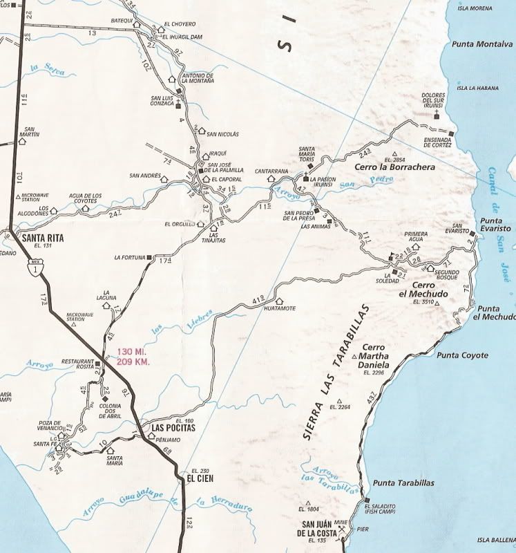
Has anyone recently been up the road from La Paz to Punta Evaristo and then over the mountains to San Luis Gonzaga? I have wanted to do this for
years and in two weeks we are going to give it a try. Ford Explorer 4wd, not a heavy duty 4x4 but driven carefully it has taken us down some pretty
rough roads. Reports on the road inland from Evaristo that I have found are not recent but at that time it was not too bad. We will be prepared to
turn around if it gets too rough. Looking for recent first hand experience and advice. I scouted the road from the air a few years ago and even back
then it looked fairly well used.
Thanks,
Kurt
David K - 3-7-2010 at 09:04 AM
Please give us a report when you do the trip!

Note the mission symbol just off the route to San Luis Gonzaga 'La Pasion'... that is the final location of the Dolores mission which previously was
near the coast to the east.
Nuestra Seņora de los Dolores Chilla 1741-1768
Photo by Jack Swords:

The final move for the mission of Los Dolores was over 15 miles to the southwest, in the region called Chilla by the Indians. This mission location
was usually called 'La Pasion', the name of the visita that was here. Some books list a seperate mission of 'La Pasion' instead of this being the
final location for Los Dolores. GPS: 24°53'14.4" 111°01'49.8"
Here's the site in 1950, photo by Marquis McDonald:

[Edited on 3-7-2010 by David K]


