BajaNomad

PUERTECITOS TO HWY. 1 on JULY 19, 2010

David K - 7-21-2010 at 07:24 PM

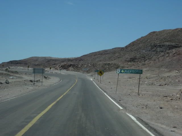
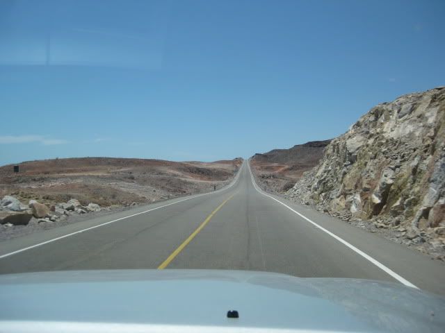
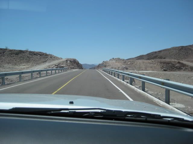
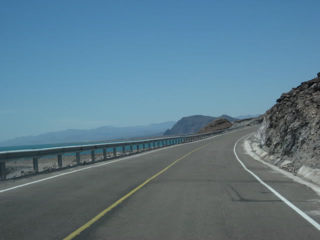
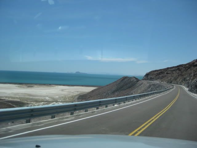
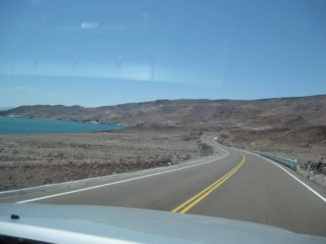
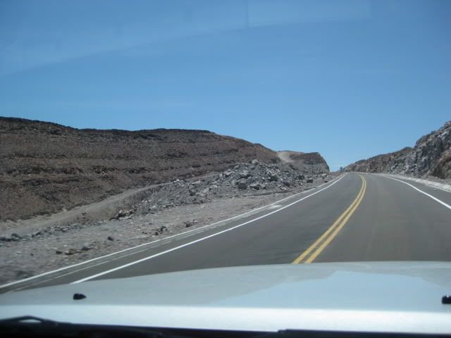
The new highway south of Puertecitos is totally different than the poor highway that runs the 55 miles from San Felipe to Puertecitos... It is built to the new standard, wider, with shoulders that will make riding bikes safe... and designed for high speed. As of Monday, 7-19-10:

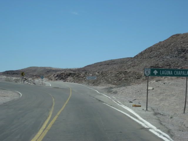
0.0 (0 min.) Puertecitos Entrance Road, sign ahead for Laguna Chapala.

5.2 (6 min.) Playa Cristina

6.2 La Costilla

17.6 (20 min.) El Huerfanito (off to east of highway, no sign)

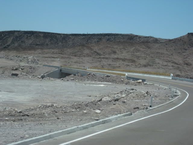
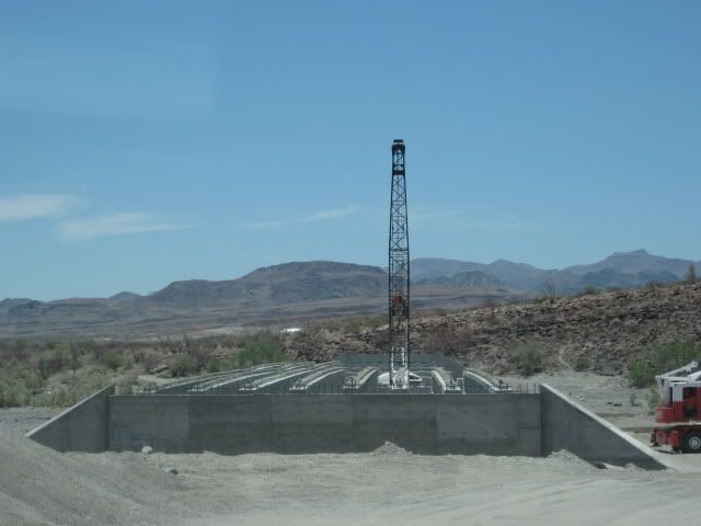
18.5 Detour off pavement onto older road, regraded for construction traffic. Piles of sand on road mark this point, no sign. Ahead on pavement is sign for Campo Tano at Mile 19.0. At 19.3 is a sign 'End of Pavement, 200 mtrs.'). At 19.5 is the absolute end at an unfinished bridge. No sign of road work on the opposite side of arroyo. Road work does continue beyond, out of sight from here.

Return back to Mile 18.5, detour onto dirt... log continues from this point.

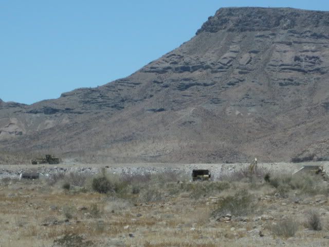
25.1 (34 min. from Puertecitos, not including run to end of pavement) End of new road construction alongside old road. Old road new grading ends... very rough, rocky road on to Gonzaga. Motorhomes and trailers should avoid!

26.0 'Okie Landing' to east (note cement pads along end of gravel beach marking the fish camp of the 1960's.

33.1 (1 hr. 14 min.) Campo Delfines

36.3 (1 hr. 26 min.) Las Encantadas

37.9 (1 hr. 31 min.) Punta Bufeo

43.1 (1 hr. 59 min.) El Faro

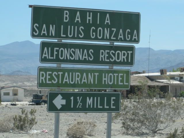
43.4 (2 hr. 1 min.) Papa Fernandez' Bahia San Luis Gonzaga

Military Checkpont is just a mile + ahead.

46.1 (2 hr. 12 min.) Alfonsina's Pemex (closed from 2-4 pm), Rancho Grande Market just ahead on right.

Clear odometer for next section... The main road south from Gonzaga is much better than the road north, but the rough surface still limits maximum speed to ~30 mph (twice that of the north section) in a Tacoma, loaded.

0.0 Rancho Grande 'Gonzaga Bay'

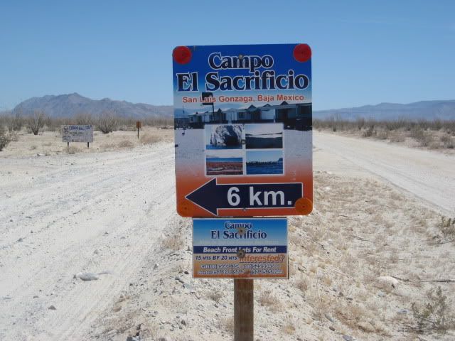
1.3 (8 min.) Road to Campo Beluga and Sacraficio

7.5 (22 min.) Road west to Arroyo Santa Maria and Las Palmitas oasis on the old mission trail 'El CaminoReal'

10.0 (28 min.) Road in from left is the south access route to Punta Final

16.7 La Turquesa Canyon road to west (green pools of water, turquoise mine, and very difficult off road and abandoned mine road shortcut to Hwy. 1 near El Pedregoso)

19.2 (52 min.) Las Arrastras site access road. Gold ore grinding mills, well, nearby waterhole of San Francisquito on the Camino Real.

23.0 (1 hr.) Coco's Corner (cold Pacifico for sale $2) Coco in Ensenada, helper Ramón on hand.

36.1 (1 hr. 30 min. driving time) HWY. 1, Laguna Chapala. Gasoline and tire repairs advertised, 1 km. south.

Some photos...


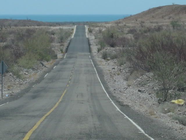
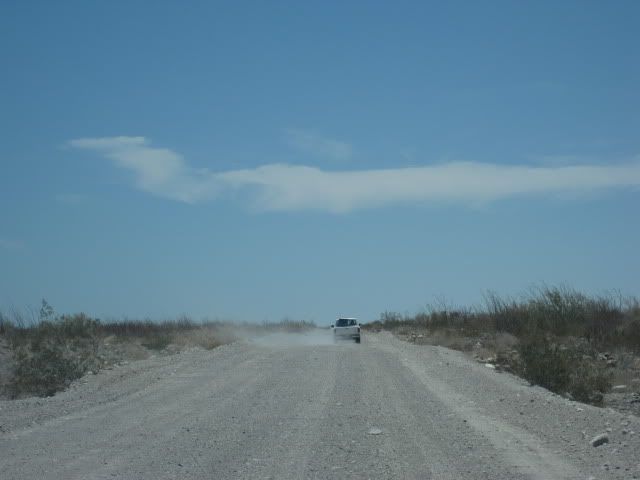
Poor hwy. north of Puertecitos


Road log above, begins here.


Old old road on left... looks like it was graded for detour.


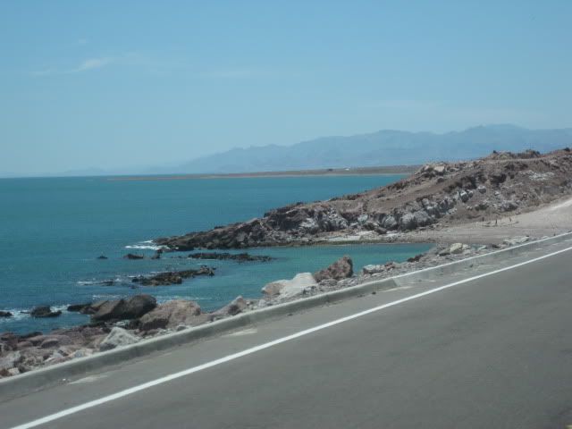
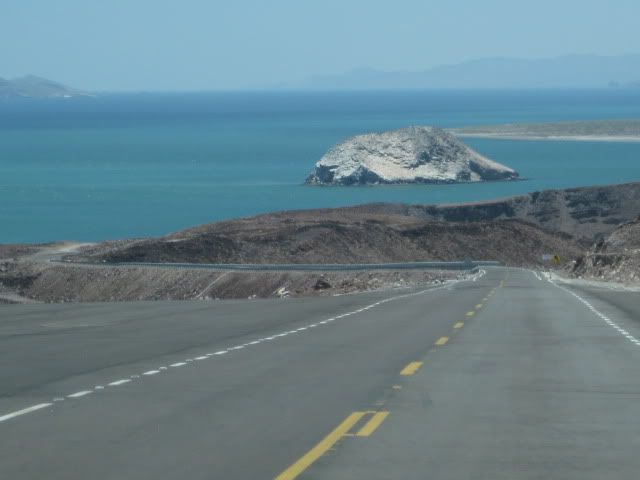
El Huerfanito Island


Bridge at very end of pavement


Old road, regraded along new road.


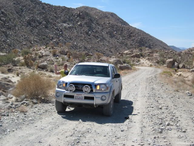
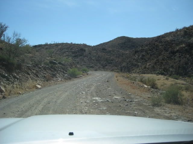
It's rougher than it looks!


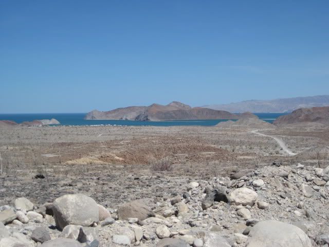
First view Gonzaga Bay


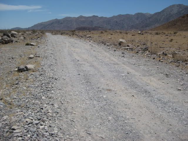
Road south of Coco's Corner.

More photos will be in the trip report... coming soon!

[Edited on 7-22-2010 by David K]

edm1 - 7-21-2010 at 08:29 PM

Great report and photos, as usual. Thanks David.

"Huerfanito Island . . . pavement in the foreground"

Oh no!!!

"At 19.5 is the absolute end at an unfinished bridge. No sign of road work on the opposite side of arroyo."

I hope construction ends there, for a while.

"... very rough, rocky road on to Gonzaga. Motorhomes and trailers should avoid!"

Huh :-)

" . . . La Turquesa Canyon road to west . . . shortcut to Hwy. 1 near El Pedregoso) . . "

Didn't know the trail goes all the way to Hwy 1 - gotta try that next time.

Looks like October is the next good Baja weather for the next trip, is Aug/Sept (labor day weekend) really that bad?

Art


[Edited on 7-22-2010 by edm1]

Udo - 7-21-2010 at 08:43 PM

DK

I never though I would live long enough to see Isla Huerfanito and a paved road in the same photo frame.
In another year I should be able to drive my RV all the way to Mexicali to Mex 1 and bypass the mountains (and truck/bus traffic) on the Pacific coast of Baja.

Thanks for the guided tour and the mileage legend.

bajalou - 7-21-2010 at 09:09 PM

Labor Day weekend is one of the hottest and most humid times in the San Felipe area. About the worst weather in my thinking.

DavidT - 7-21-2010 at 09:37 PM

Damn that sucks.

Now even people with toyotas will be down there.

Lista - 7-21-2010 at 09:53 PM

You're right about rougher than it looks! Photos never do that road justice. Thanks for the pic's, 102 days and I'll be taking in that view myself! Your photos make me jealous...
curious about the pavement over the mountains, I was worried there might be falling rock issues.

redhilltown - 7-21-2010 at 11:03 PM

OMG! Are those.................guard rails????????? In Baja? What is this freaking world coming to!!!!!

David K - 7-22-2010 at 07:55 AM

Quote:
Originally posted by Lista
You're right about rougher than it looks! Photos never do that road justice. Thanks for the pic's, 102 days and I'll be taking in that view myself! Your photos make me jealous...
curious about the pavement over the mountains, I was worried there might be falling rock issues.


There were some loose rocks on the pavement, but not much.

David K - 7-22-2010 at 07:57 AM

Quote:
Originally posted by redhilltown
OMG! Are those.................guard rails????????? In Baja? What is this freaking world coming to!!!!!


Yes... Baja Angel was really impressed with the size of them!

They are doing highways totally different than before... No longer dancing with Death!:light:

David K - 7-22-2010 at 07:59 AM

Quote:
Originally posted by edm1
Great report and photos, as usual. Thanks David.

"Huerfanito Island . . . pavement in the foreground"

Oh no!!!

"At 19.5 is the absolute end at an unfinished bridge. No sign of road work on the opposite side of arroyo."

I hope construction ends there, for a while.

"... very rough, rocky road on to Gonzaga. Motorhomes and trailers should avoid!"

Huh :-)

" . . . La Turquesa Canyon road to west . . . shortcut to Hwy. 1 near El Pedregoso) . . "

Didn't know the trail goes all the way to Hwy 1 - gotta try that next time.

Looks like October is the next good Baja weather for the next trip, is Aug/Sept (labor day weekend) really that bad?

Art


[Edited on 7-22-2010 by edm1]


MY COMMENT WAS NOT FOR YOUR MOTORHOME, Art! Yours can GO ANYWHERE!!! :cool::yes:

Bob H - 7-22-2010 at 09:57 AM

Wow, David, I almost cannot believe my eyes. So much good pavement and guard rails going in down there.

Was there still active construction going on at the end of the pavement, at the bridge, etc.?

Great photo log!
Bob H

Natalie Ann - 7-22-2010 at 01:34 PM

I looked at these pix, sat right down and cried.
Nothing about you DK, everything about that highway.

nena

Skipjack Joe - 7-22-2010 at 01:47 PM

Yes that paved road will come right down next to Islas Encantadas. Five year from now there will be nothing but 10" spotted bay bass around those islands. That's what happened to Danzante. There was a time you could hook 20-30 leopard groupers just trolling around the shoreline. But that was over 30 yrs ago and the hwy changed that.

The locals said another 2 years to reach Gonzaga but I think it'll be probably sooner. Very little going on right now, though, as the heat is overwhelming.

bufeo - 7-22-2010 at 02:05 PM

Thanks for posting those photos, DK. My wife and I have mixed feelings, but I think both of us agree that we sold our house at Punta Bufeo at the right time.

A great man once said, "You can't pave a road to get away from people."

Allen R

dizzyspots - 7-22-2010 at 03:00 PM

When we went down in July...the fallen rock was wide spread, some baseball size, some basketball size...curious the "falling rock sign was AFTER the hills with falling rock :bounce:

David K - 7-22-2010 at 03:48 PM

Quote:
Originally posted by Bob H
Wow, David, I almost cannot believe my eyes. So much good pavement and guard rails going in down there.

Was there still active construction going on at the end of the pavement, at the bridge, etc.?

Great photo log!
Bob H


The bridge at the end of pavement had no activity... Perhaps that is where they found the archeological site (ancient village reported here on Nomad) and they are avoiding that until they remove or examine it. On south, where the old and new road are within sight of each other, work is progressing... You can see a grader in the one photo I posted... It was moving.

David K - 7-22-2010 at 03:50 PM

Quote:
Originally posted by dizzyspots
When we went down in July...the fallen rock was wide spread, some baseball size, some basketball size...curious the "falling rock sign was AFTER the hills with falling rock :bounce:


It has been cleared up since you drove it, it would seem... just a couple places with some loose, small rocks on the pavement.

David K - 7-22-2010 at 03:55 PM

Quote:
Originally posted by Natalie Ann
I looked at these pix, sat right down and cried.
Nothing about you DK, everything about that highway.

nena


Thanks for not 'shooting the messenger'!:light:

As you know, I fondly remember the older road from the 1960's that really required low range 4WD or a dune buggy to travel safely... Last drove in '79 when it took about 5 hours to go from Puertecitos to Gonzaga... Then the new graded road of '86-'87 that was never regraded after the 2005 Baja 1000 and storm damage, and was really rough to drive since.

Bad roads bring good people!

Natalie Ann - 7-22-2010 at 04:16 PM

I've traveled that old 'old road' too, David, and I thought the upgrade (the old road) was just fine.
Don't understand why folks need to keep messin' with what works perfectly well.;D:biggrin:

nena

bufeo - 7-22-2010 at 04:20 PM

Quote:
Originally posted by David K...As you know, I fondly remember the older road from the 1960's that really required low range 4WD or a dune buggy to travel safely...


Just a comment. Not to one-up or anything, but we drove the old road in 1970 in our '69 Ford Ranger (the 'real' Ranger, not the shrinked version) 2WD. Yep, 2WD.

We had failed on our first attempt, but after I backed down a ways to a spot where I could turn the truck around. I dropped the air some more in the rear tires and went up and over that last (southbound) crest in reverse, thereby having a fairly low-range, "front-wheel-drive". Dicey, but it worked.

Diana was at the top to stop anyone who may have been coming north, but, fortunately, there was none.

Allen R

David K - 7-22-2010 at 09:01 PM

Yep, one of us would hop out the Wagoneer and look or listen for any traffic... as there were sections of the old, old road that were one lane wide, and dangerous to try and back up or down to a turnout.

Many crosses lined the edge of the old road, with wrecked cars in the canyon below... The old road got REALLY bad after 1974... When the Transpeninsular Highway was completed, all cargo and tourist traffic for Gonzaga Bay came up from El Crucero/ Calamajue... and then the new Laguna Chapala-Puerto Calamajue road (1983)... as a faster route than south from San Felipe.

Any maintenance on the road below Puertecitos ended, and it was suitable almost only to off road racers!

The newer road was built in starting in '85-'86 and joined the '83 Puerto Calamajue-Chapala road at the place we now call COCO'S CORNER!

willyAirstream - 7-23-2010 at 07:34 AM

Thanks for the great report David. I'm heading down Sept 1st and can't wait!

David K - 7-23-2010 at 08:01 AM

You're welcome!

The full trip report begins here, with Part 1: http://forums.bajanomad.com/viewthread.php?tid=46866

deanoid - 7-23-2010 at 04:20 PM

Thanks for the report David. Sounds like not much has happened on the road construction front since I was down there over Memorial Day. I suspect they're actually working out of view and when the next section of road opens, the entire stretch to Cinco Islas (25.1 miles) will be done.

Primarily, this reply is in reference to Skipjack Joe's post above. I've been going down to the Gonzaga Bay/Encantadas area numerous times per year since 1990. We already catch too few nice bass. I personally don't think the new road will do anything other than perhaps expedite what's already been occurring for over a decade. The real problem is the commerciales fished out San Felipe. With that fishery done, they then came down south to visit us. To top it off, the shrimp trawlers hit this area pretty hard and we all know what that does.

The crash of the fishery down there started in 1997 by my estimation. A band of scallop divers showed up and settled at Coñejo Feliz. They established a small town of 50 - 75 people. When diving got bad, they used their time-off to rip-off everyone from Gonzaga Bay to Los Delfines. I've always wanted to do an estimate of the number of scallops they took from the area, but never have gotten it together. A 5-gallon bucket, tape measure and some (fairly) simple math is all that would be required. My rough estimate of the take was in the high hundreds of thousands. You just can't remove that amount of biomass from a small area without consequences. My theory is that that started the crash of the entire food chain. Scallops are amongst the most prolific of breeders of shellfish. Their larvae are free swimming in the water column for about six weeks, I've read. Young fish, other filter feeders and whatnot feed off them. One thing's for sure, the rocks in the tidall zone in our area were formerly covered with mussels. Their predators, the black murex snail and Caracol Burro (I don't know either the english or latin name for them) were plentiful. Now, there are no, and I mean not a single one, mussels anywhere near my campo. Murex are very rare. I haven’t seen a Caracol Burro in over 15 years.

The other onslaught of commerciales came in the form of gillnetters. They've increased in number and permanence every year since about the same time. We no longer catch corvina from shore, except on rare occasion. The bass are smaller and fewer. Last Christmas-New Years, there were so many pangas out at the islands gillnetting Sierra that I just gave up fishing out there. Every time you'd see birds working or a boil, 25 pangas would speed to the area and set nets. Funny thing is, according to the Punta Bufeo folks, there's not even any market for Sierra in Baja, but there is in Sonora, so the fishermen were running them all the way over there.

David K - 7-23-2010 at 05:38 PM

Thanks deanoid, your observation is good... Tourist sportfishing is not destroying the fish population... Anyway, there are almost no tourists anymore... good roads or bad.

Welcome to Nomad!!