Originally posted by David K
Thanks TW... Km. 0 at Mexicali is at the split of Hwy. 5 and Hwy. 2 (5 miles from the border, southbound).
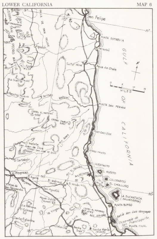
San Felipe is 120 more miles south (192 kms.)... Now, Km. 0 where the current paved Puertecitos road begins (at the airport road) is 6.3 miles from
the traffic circle in San Felipe (10 km.)
192 km. + 10 km. = 202 km. (125 mi.)
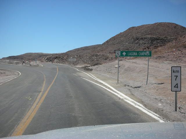
Let's add that 74 km. (46 mi.) from the km. sign at the Puertecitos exit... = 276 km. (171 mi.)
You noted a Km. 282 sign...
282 - 276 = 6 km. (3.6 miles) This is close to your 8 km. figure.
I bet that is what they are doing? Perhaps they have the distance on the proposed new Hwy. 5 alignment figured out... It would be a bit shorter than
the current route that runs out past Punta Estrella... maybe 6 kms. shorter (subtract 6 km. from the 276 km. figure for Puertecitos = 270 km.)
Your Km. 282 - my estimate of 270 via the sulfur mine = 12 km., a bit over your 8 km. figure, but close. |