BajaNomad

the HOTSPRING thread

micah202 - 1-22-2011 at 01:11 AM

It'd be nice to have hotspring information in one easy thread!

...maybe those who have been to various locations can leave directions for others,,,or drop a link to another thread for a given spring!

In various searches ,I've found mention to hotsprings at
....gaudalupe
,,,,,san felipe
,,,,south of Ensenada
,,,,,between La Paz and Cabo

.........any others in Baja??


[Edited on 11-25-2015 by micah202]

puertecitos hot springs

mcfez - 1-22-2011 at 01:17 AM

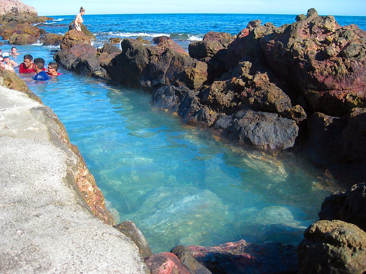
Right next to the ocean, at high tide the springs are completely submerged. As the tide recedes pools of various temperatures are created. Eventually the springs will get too hot and you have to wait for the tide again. $5 per car per day (or pending the gate keeper's mood!), or free if you live in the area.

#5 Tidal Hot Spring Pool with tide getting high.JPG - 31kB

micah202 - 1-22-2011 at 01:21 AM

Quote:
Originally posted by mcfez
Right next to the ocean, at high tide the springs are completely submerged. As the tide recedes pools of various temperatures are created. Eventually the springs will get too hot and you have to wait for the tide again. $5 per car per day (or pending the gate keeper's mood!), or free if you live in the area.


that sounds like the one I listed as SanFelipe--the 'gatekeeper' funny gal who's property adjoins?
....do you have a link handy for inf on it?

mcfez - 1-22-2011 at 02:00 AM

Some folks thinks this place is in SF....it's not:
Puertecitos (GPS coordinates 30'92 N ~ 114'70 W)

The highway to Puertecitos is now a smooth run, being rebuilt this past year. Takes a hour to get there from SF

Puertecitos has a boat ramp, decent campground, tight security. Look in the search link here on this page (above)...you find a very detail account of this place that I wrote about 6 months ago.

Puertecitos has a reputation....never mind the rumors.

PUERTECITOS

David K - 1-22-2011 at 08:51 AM

Located about 55 highway miles south of San Felipe...

The hot springs are located between the high and low tide lines on the far (or gulf side) of the point that creates the cove of Puertecitos. Each day, the springs are flushed with fresh sea water. Ideal soaking time is after the high tide has dropped below the pools. The mix with sea water makes the temperature acceptable. The springs do emit a strong sulfur odor.

In the photo taken from the old road just south of town looking northeast, the springs are just over the low spot in the hill on the point across the cove:


Since the springs are in the Federal Zone, they are public... but unless you get there by boat... the land owner has charged an access fee (beginning in 1992).

AGUA CALIENTE/ VALLE CHICO

David K - 1-22-2011 at 09:33 AM

As most hot springs in Mexico seem to be named 'Agua Caliente', I added the region with the name.

Valle Chico is located at the foot of the Sierra San Pedro Martir range, southwest of San Felipe. Many canyons drain into Valle Chico and one canyon is named Agua Caliente because it contains a large hot spring.

So much water flows from this spring that it creates a hot steaming stream that runs for several hundred feet before merging with the cool mountain stream in the middle of the canyon... Hot and cold running water in Baja!

The temperature has been measured at 140ºF, so bathing is only possible down the stream a ways unless the cool stream water could be mixed in the tub that was built just below the spring. Perhaps bring a roll of drip irrigation tube to stretch to the tub from the stream?

2001:


Hot Spring location in Agua Caliente Canyon. Photo looking north, down the stream from where we came. The hot stream is to the left of the tub and flows hot for a good distance before joining the cool stream.


Steaming streams on both sides of me! I am just below the source spring, located on a bench alongside of the canyon arroyo.

2004:


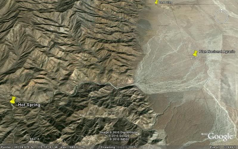
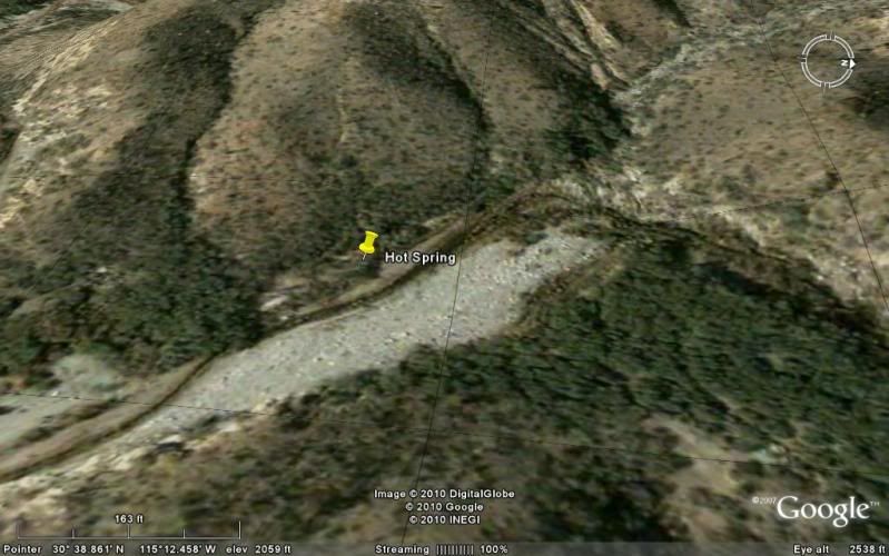
Here see great amounts of super hot water flow out and go about 400 feet to where it merges with the cool mountain stream. HOT SPRING GPS: 30°38.85', 115°12.41', elev. 2,041'

HOT WATER STREAM


Jide is by a hot water tub built where the spring water flows down from the terrace, then heads downstream. The water was too hot in the tub. Photo looking south.


Photo looking north/ downstream. Here is the tub just below the spring, but the water is a scalding 140°F! We go over 300 feet downstream and make a tub where the temperature is closer 105°F.


I climb high up the canyon for an 'almost aerial' photo (looking south) of the hot springs and hot stream, along right edge of arroyo. Beyond, at the next bend is a lone blue palm tree.

This barrel cactus in the is about 7 feet tall. I stood next to it and it was over a foot taller than me. You just never know what wonders you will find in Baja!

SKY VIEW (Thanks to Baja Lou!)


Photo looking eastward, down stream. Shown (going upstream) is: the end of the 4WD road, a former cilantro* farm area, hot springs, and a palm tree location. (*or other cash crop)

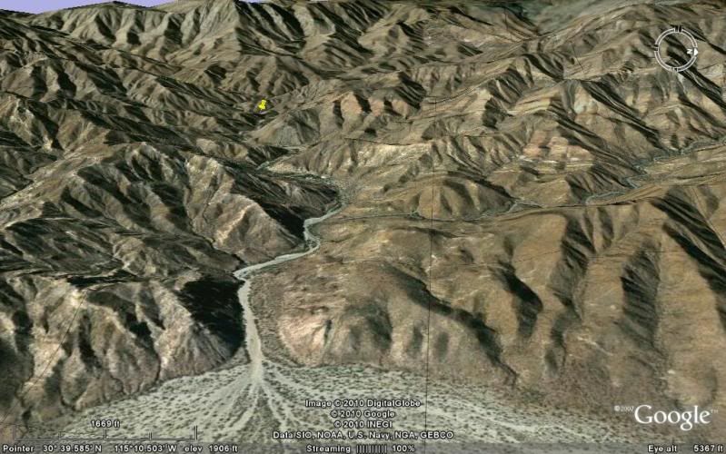
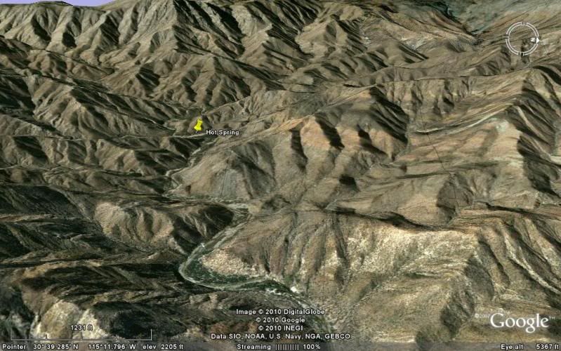
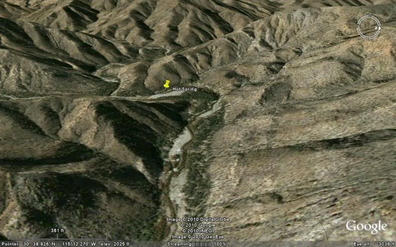
Spring location from satellite views:


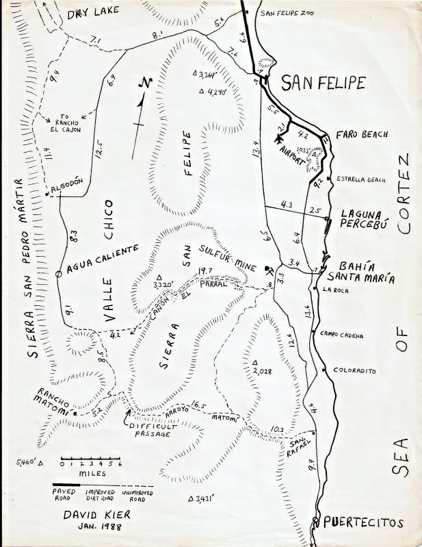
Maps:

2004:


1988:


[Edited on 1-22-2011 by David K]

Hey, Fez

bajaguy - 1-22-2011 at 09:39 AM

What's the status on the PEMEX station in Puertecitos???

San Carlos

bajaguy - 1-22-2011 at 09:46 AM

Hot springs in Canyon San Carlos, Ensenada.

Take Highway 1 headed south from Ensenada. About 4 miles south of the COSTCO, turn left at the road to the Baja Country Club (stoplight intersection).

Follow signs to the Country Club, then turn left off the Country Club road where indicated by the sign for the hot springs.......

I have been told that you can make it to the hot springs in a passenger car, but since you have to cross a stream bed with running water several times, I would suggest something with high ground clearance.

I'm sure other Nomads can fill in the details and add photos


[Edited on 1-22-2011 by bajaguy]

micah202 - 1-22-2011 at 09:46 AM

Quote:
Originally posted by mcfez
Some folks thinks this place is in SF....it's not:
Puertecitos (GPS coordinates 30'92 N ~ 114'70 W)

The highway to Puertecitos is now a smooth run, being rebuilt this past year. Takes a hour to get there from SF

Puertecitos has a boat ramp, decent campground, tight security. Look in the search link here on this page (above)...you find a very detail account of this place that I wrote about 6 months ago.

Puertecitos has a reputation....never mind the rumors.


....good'thear the road's paved--is that right through to Hwy1 in the south yet??,,,,,I went that route ~20 years ago--peurtecitos 'highway' they called it--quite an adventure,,glad those locals came along when I got stuck--wouldn't even accept a donation for their help!!

micah202 - 1-22-2011 at 09:50 AM

....gaudalupe
,,,,,peurtecitos area
,,,,south of Ensenada-Canyon San Carlos
,,,,,between La Paz and Cabo

.....any others??

mcfez - 1-22-2011 at 09:56 AM

Quote:
Originally posted by bajaguy
What's the status on the PEMEX station in Puertecitos???


Go to the station. It'll be chained mostly (again). Go around the back of the building and look for the attendant. If not there, go to Campos Puertecitos entrance (300 ft away) and tell then you like to have some gas.

Getting to and back from Puertecitos from San Felipe....fill up in San Felipe and you'll have plenty of extra to get back to SF.

Getting to Gonzaga Bay from San Felipe....fill up in San Felipe and you'll have make it there with ease.

Puertecitos gas station is no longer a real thing to need.....with the new pavement


[Edited on 1-22-2011 by mcfez]

David K - 1-22-2011 at 10:04 AM

Quote:
Originally posted by micah202
....gaudalupe
,,,,,peurtecitos area
,,,,south of Ensenada-Canyon San Carlos
,,,,,between La Paz and Cabo

.....any others??


It is Guadalupe Canyon Hot Springs, southwest of Mexicali (as there are other Guadalupes in Baja. There is also a hot spring in Valle de Guadalupe (the wine growing area along Hwy. 3).

It is 'Puertecitos'

micah202 - 1-22-2011 at 10:13 AM

Quote:
Originally posted by David K
Quote:
Originally posted by micah202
....gaudalupe
,,,,,peurtecitos area
,,,,south of Ensenada-Canyon San Carlos
,,,,,between La Paz and Cabo

.....any others??


....... There is also a hot spring in Valle de Guadalupe (the wine growing area along Hwy. 3).


...north of ensenada??...do you have the directions for that one??

..Anything between El Rosario and LaPaz??

Trueheart - 1-22-2011 at 10:14 AM

David K:

Your comments, pictoral, and maps come with great detail. Awesome!
Thank you for the effort.

Steve

David K - 1-22-2011 at 05:22 PM

De nada Steve!

micah: Yes... when I have time I will make a map of the hot springs I know about... in brief, others: San Antionio Hot Springs off Hwy. 3 to San Felipe, Ojos Negros (north of), San Borja, El Coloradito (in the sand), Punta Banda (in the sand), Bahia Concepcion (several), San Cosme (Agua Verde), Agua Caliente (Santiago)... etc.

micah202 - 1-22-2011 at 05:34 PM

Quote:
Originally posted by David K
De nada Steve!

micah: Yes... when I have time I will make a map of the hot springs I know about... in brief, others: San Antionio Hot Springs off Hwy. 3 to San Felipe, Ojos Negros (north of), San Borja, El Coloradito (in the sand), Punta Banda (in the sand), Bahia Concepcion (several), San Cosme (Agua Verde), Agua Caliente (Santiago)... etc.


....thank-you!...I had no idea there's springs around bahia conception,,I've been there a few times over the years.

......I'm looking forward to hearing some details when you're able!


.


[Edited on 1-23-2011 by micah202]

David K - 1-22-2011 at 05:38 PM

Yup, at Santisapc, El Coyote, more... all at or near sea level... Other Nomads can tell you better as I have not been in any of them... but I will give you what I have...

concepcion bay hot springs

coho - 1-22-2011 at 08:34 PM

Indeed...thermal hot springs at Posada Concepcion on Concepcion bay. Just south of Santispac...At sea level and right at the water's edge. Although Posada is a private gated community of 64 homes right off Hwy 1, RV sites are available at $19 per night with full hookups, and rental casita is available at $50 per night and overnight rentals include use of the hot springs. In addition another beach front hot spring is to be found at the northern beach at Posada that is usable at certain tide heights and is available to the public. A circle of rocks at water's edge that captures the hot water and mixes with the salt water of the bay makes for an unforgetable experience for hot spring aficionados. 12 miles south of Mulege watch for the signs from either direction. Check out the photos at: http://www.posadaconcepcion.net/amenities.html

bajafam - 1-22-2011 at 09:15 PM

The only one we've actually been to is Uruapan Hot Springs, which is located about two miles off the highway S. of Ensenada before you get to Santo Tomas, there is a sign, but it's very easy to miss. It's mostly a laundromat, but there are bathtubs and the proprietress is very kind and will tour you to where the spring bubbles out of the ground.

We have a book, Hot Springs and Hot Pools of the Southwest, that highlights some of the springs in Baja. Some that have not been mentioned:

Palomar Canyon Hot Springs ~ SW of Mexicali, 45 miles from the nearest paved road.

Russian Valley Hot Springs ~ S. of Tecate, 50 miles off of Hwy. 3 (which is what I think David was referring to as San Antonio).

Cantu Hot Springs ~ S. of Punta Banda.

Rancho Gilberto/ St. Tomas Hot Springs, apparently 4.1 miles down the road to La Bocana.

Marconi Warm Springs ~ Ojos Negros Valley, Hwy 3 east of Ensenada for 30 miles, turn left at sign to Ojos Negros. 12 miles to springs.

Agua Caliente Hot Springs ~ E. of Ensenada, E on Hwy 3 to K26, turn right at Agua Caliente sign and follow 5 mile dirt road to resort.

Valle de Trinidad/Rancho Los Pozitos ~ SW of Ensenada, E from Ensenada on Hwy 3 for 60 miles, 1 mile turn right onto dirt road at church, 2 miles toward west end of valley and follow dirt road about 5 miles...look for Rancho Los Pozitos, Familia Arballo.

Mulege Mission Warm Springs ~ park at mission and walk downhill, cross stream in front of dam, continue 100 yards downstream; gas bubbles can be seen rising from stream.

Santispac ~ drive to far right side of cove, walk approx. 100 yards on a dirt trail around the mangrove swamp to the two pools.

Concepcion Beach ~ there are steep cliffs that border this beach, therefore, hike south along the tide pools from Santispac or north from Los Cocos Beach.

El Coyote Beach ~ park at campground, follow rocky trail 100 yards to pool.

Hotel Buena Vista, La Paz ~

Remember, we have only been to Uruapan, so the rest of the info is from a book and we are not responsible for any incorrect info....blame them!!!

Bajaboy - 1-22-2011 at 09:32 PM

Quote:
Originally posted by bajafam
The only one we've actually been to is Uruapan Hot Springs, which is located about two miles off the highway S. of Ensenada before you get to Santo Tomas, there is a sign, but it's very easy to miss. It's mostly a laundromat, but there are bathtubs and the proprietress is very kind and will tour you to where the spring bubbles out of the ground.

We have a book, Hot Springs and Hot Pools of the Southwest, that highlights some of the springs in Baja. Some that have not been mentioned:

Palomar Canyon Hot Springs ~ SW of Mexicali, 45 miles from the nearest paved road.

Russian Valley Hot Springs ~ S. of Tecate, 50 miles off of Hwy. 3 (which is what I think David was referring to as San Antonio).

Cantu Hot Springs ~ S. of Punta Banda.

Rancho Gilberto/ St. Tomas Hot Springs, apparently 4.1 miles down the road to La Bocana.

Marconi Warm Springs ~ Ojos Negros Valley, Hwy 3 east of Ensenada for 30 miles, turn left at sign to Ojos Negros. 12 miles to springs.

Agua Caliente Hot Springs ~ E. of Ensenada, E on Hwy 3 to K26, turn right at Agua Caliente sign and follow 5 mile dirt road to resort.

Valle de Trinidad/Rancho Los Pozitos ~ SW of Ensenada, E from Ensenada on Hwy 3 for 60 miles, 1 mile turn right onto dirt road at church, 2 miles toward west end of valley and follow dirt road about 5 miles...look for Rancho Los Pozitos, Familia Arballo.

Mulege Mission Warm Springs ~ park at mission and walk downhill, cross stream in front of dam, continue 100 yards downstream; gas bubbles can be seen rising from stream.

Santispac ~ drive to far right side of cove, walk approx. 100 yards on a dirt trail around the mangrove swamp to the two pools.

Concepcion Beach ~ there are steep cliffs that border this beach, therefore, hike south along the tide pools from Santispac or north from Los Cocos Beach.

El Coyote Beach ~ park at campground, follow rocky trail 100 yards to pool.

Hotel Buena Vista, La Paz ~

Remember, we have only been to Uruapan, so the rest of the info is from a book and we are not responsible for any incorrect info....blame them!!!


Hotel Buena Vista is located on the East Cape. Stayed there and all the hot water comes from the hot springs. Nice place when we were there a long time ago.

micah202 - 1-23-2011 at 12:20 AM

thanks bajafam,good information!
.....Uruapan Hot Springs is the only one I've been to ~10years ago,,it's a great easy access location to -start the holiday- after a LLooooong drive.
...I'll certainly look-up some of the others when I get down,,and post reports and pictures

..keep the info coming folks!!

[Edited on 1-23-2011 by micah202]

wilderone - 1-23-2011 at 09:01 AM

I could be wrong on which one it was, but a friend had that book, and three of us tried to track down, I believe, Marconi Hot Springs en route to Laguna Hanson where we camped at the end of the day. We followed the detailed driving instructions and found ourselves at a house in a rural area. There was no sign or hot springs to be seen which would indicate we were in the right place. Nobody was around. We sat in the dirt road for a bit wondering what to do next and a guy who lived there came driving up. We explained what we were doing there, and he said, yes, there is a hot spring here. Used to be a public place, now private. Come, I'll show you. He showed us a meadow of sorts, with grazing cows, old concrete tub structures where the hot water once filled, all overgrown with grass and reeds, and warm mud. You could see where the hot water was trickling through, but we just had to laugh at our adventure.

micah202 - 1-23-2011 at 09:11 AM

Quote:
Originally posted by wilderone
I could be wrong on which one it was, but a friend had that book, and three of us tried to track down, I believe, Marconi Hot Springs en route to Laguna Hanson where we camped at the end of the day. We followed the detailed driving instructions and found ourselves at a house in a rural area. There was no sign or hot springs to be seen which would indicate we were in the right place. Nobody was around. We sat in the dirt road for a bit wondering what to do next and a guy who lived there came driving up. We explained what we were doing there, and he said, yes, there is a hot spring here. Used to be a public place, now private. Come, I'll show you. He showed us a meadow of sorts, with grazing cows, old concrete tub structures where the hot water once filled, all overgrown with grass and reeds, and warm mud. You could see where the hot water was trickling through, but we just had to laugh at our adventure.


...yeh it's not totally uncommon that some of those books are 'missing a turn' or outdated!
.....it's good yer laughed!!

.

[Edited on 1-23-2011 by micah202]

David K - 1-23-2011 at 10:23 AM

The Marconi spring is the one I mentioned as 'north of Ojos Negros'. The book bajafam mentions is the one that has them all...

hotsprings summary-printable version

micah202 - 1-25-2011 at 10:42 AM

...here's a summary of information so far .......please add any details you may know--thanks a lot!!
----------------------------------
Puertecitos hot springs
(GPS coordinates 30'92 N ~ 114'70 W)
Right next to the ocean, at high tide the springs are completely submerged. As the tide recedes pools of various temperatures are created. Eventually the springs will get too hot and you have to wait for the tide again. $5 per car per day (or pending the gate keeper's mood!), or free if you live in the area. Located about 55 highway miles south of San Felipe...
The hot springs are located between the high and low tide lines on the far (or gulf side) of the point that creates the cove of Puertecitos. Each day, the springs are flushed with fresh sea water. Ideal soaking time is after the high tide has dropped below the pools. The mix with sea water makes the temperature acceptable. The springs do emit a strong sulfur odor.
..........Since the springs are in the Federal Zone, they are public... but unless you get there by boat... the land owner has charged an access fee (beginning in 1992).

------------------------
AGUA CALIENTE/ VALLE CHICO
As most hot springs in Mexico seem to be named 'Agua Caliente', I added the region with the name.
Valle Chico is located at the foot of the Sierra San Pedro Martir range, southwest of San Felipe. Many canyons drain into Valle Chico and one canyon is named Agua Caliente because it contains a large hot spring.

So much water flows from this spring that it creates a hot steaming stream that runs for several hundred feet before merging with the cool mountain stream in the middle of the canyon... Hot and cold running water in Baja!

The temperature has been measured at 140ºF, so bathing is only possible down the stream a ways unless the cool stream water could be mixed in the tub that was built just below the spring. Perhaps bring a roll of drip irrigation tube to stretch to the tub from the stream?
-----------------------

Canyon San Carlos, Ensenada.
Take Highway 1 headed south from Ensenada. About 4 miles south of the COSTCO, turn left at the road to the Baja Country Club (stoplight intersection).
Follow signs to the Country Club, then turn left off the Country Club road where indicated by the sign for the hot springs.......
I have been told that you can make it to the hot springs in a passenger car, but since you have to cross a stream bed with running water several times, I would suggest something with high ground clearance.
I'm sure other Nomads can fill in the details and add photos
-------------------------------
--Uruapan Hot Springs ...........is located about two miles off the highway S. of Ensenada before you get to Santo Tomas, there is a sign, but it's very easy to miss. It's mostly a laundromat, but there are bathtubs and the proprietress is very kind and will tour you to where the spring bubbles out of the ground.
----------------------------
Palomar Canyon Hot Springs ~ SW of Mexicali, 45 miles from the nearest paved road.
--------------------------------
Russian Valley Hot Springs ~ S. of Tecate, 50 miles off of Hwy. 3 (which is what I think David was referring to as San Antonio).
-----------------
Cantu Hot Springs ~ S. of Punta Banda.
---------------
Rancho Gilberto/ St. Tomas Hot Springs, apparently 4.1 miles down the road to La Bocana.
----------------
Agua Caliente Hot Springs ~ E. of Ensenada, E on Hwy 3 to K26, turn right at Agua Caliente sign and follow 5 mile dirt road to resort.
-------------------------
Valle de Trinidad/Rancho Los Pozitos ~ SW of Ensenada, E from Ensenada on Hwy 3 for 60 miles, 1 mile turn right onto dirt road at church, 2 miles toward west end of valley and follow dirt road about 5 miles...look for Rancho Los Pozitos, Familia Arballo.
------------------------
Mulege Mission Warm Springs ~ park at mission and walk downhill, cross stream in front of dam, continue 100 yards downstream; gas bubbles can be seen rising from stream.
------------------
Santispac ~ drive to far right side of cove, walk approx. 100 yards on a dirt trail around the mangrove swamp to the two pools.
-----------------
Concepcion Beach ~concepcion bay hot springs
Indeed...thermal hot springs at Posada Concepcion on Concepcion bay. Just south of Santispac...At sea level and right at the water's edge. Although Posada is a private gated community of 64 homes right off Hwy 1, RV sites are available at $19 per night with full hookups, and rental casita is available at $50 per night and overnight rentals include use of the hot springs. In addition another beach front hot spring is to be found at the northern beach at Posada that is usable at certain tide heights and is available to the public. A circle of rocks at water's edge that captures the hot water and mixes with the salt water of the bay makes for an unforgetable experience for hot spring aficionados. 12 miles south of Mulege watch for the signs from either direction. Check out the photos at: http://www.posadaconcepcion.net/amenities.html
--------------------
El Coyote Beach ~ park at campground, follow rocky trail 100 yards to pool.
----------------------
Hotel Buena Vista, La Paz ..... is located on the East Cape. Stayed there and all the hot water comes from the hot springs. Nice place when we were there a long time ago

--------------------------------------

[Edited on 1-25-2011 by micah202]

Mexitron - 1-25-2011 at 12:06 PM

Some hot springs in Carrizo Canyon just north of Guadalupe Canyon, but don't know if there is still access anymore...(occasional rumors of vandalism as well, but we never had a problem)... last time there was 1992-ish.

David K - 1-25-2011 at 03:18 PM

Looks like you got a good list that includes most of the springs listed in Margorie Gersh-Young's book 'Hot Springs and Hot Pools of the Southwest' c2004.

The ones near Agua Verde and near Santiago are missing, however.

[Edited on 1-25-2011 by David K]

wilderone - 1-26-2011 at 10:30 AM

There is a hot spring northeast of the LA Cetto winery. About 6-7 miles from the winery. Take the second right turn (not the first right turn that is essentially the driveway to another winery) past the LA Cetto tasting room property. Drive about 5 miles to a ranch at the end of the road, crossing the stream about 5 times en route. Go through the chain fence, one more mile - curves to the left. Park your car at the end of the road and hike about 3/4 mile keeping to the right of the stream; it's closer to the dirt bank than the stream. Look for paths, steam, pools, or other people to show you where it is. One fairly large (3-4 people capacity) clean pool, and a couple more muddy pools for 1-2 people.

David K - 1-26-2011 at 10:43 AM

That's the one the book called 'Russian Valley Hot Spring'... behind L.A. Cetto in Guadalupe Valley (settled by Russians just over 100 years ago).

BAJACAT - 1-26-2011 at 10:39 PM

Quote:
Originally posted by wilderone
There is a hot spring northeast of the LA Cetto winery. About 6-7 miles from the winery. Take the second right turn (not the first right turn that is essentially the driveway to another winery) past the LA Cetto tasting room property. Drive about 5 miles to a ranch at the end of the road, crossing the stream about 5 times en route. Go through the chain fence, one more mile - curves to the left. Park your car at the end of the road and hike about 3/4 mile keeping to the right of the stream; it's closer to the dirt bank than the stream. Look for paths, steam, pools, or other people to show you where it is. One fairly large (3-4 people capacity) clean pool, and a couple more muddy pools for 1-2 people.
Wilderone, are you talking about the one by Federicos ranch, the ones with the water fall..in arroyo Agua Caliente..


last years rains destroyed the main road.


[Edited on 1-27-2011 by BAJACAT]

wilderone - 1-27-2011 at 09:20 AM

"arroyo Agua Caliente.."

Si - that's it! Locals go on weekends, and you pass acres of grape vines, so I would expect the road should be repaired to some extent soon. Might be real nice now that a lot of water has flushed through there. Bring a shovel!

BAJACAT - 1-28-2011 at 09:31 PM

Yes they fix the road, and Federico is the guy that lives in the house where you have to pay to get in,he used to charge 50 pesos per car, now is 50 pesos per person, still is a good deal...he also sells home made chesse, I was invited to come inside his house and try the fresh made chesse in some corn tortilla in a woood stove....this guy is from la Purisima BCS..he is a cool guy...

micah202 - 2-4-2011 at 09:43 AM

someone mentioned.............''Mulege Mission Warm Springs ~ park at mission and walk downhill, cross stream in front of dam, continue 100 yards downstream; gas bubbles can be seen rising from stream.''

....I walked back up there behind mulege,,,hiked up the north side of the water,and returned down the south,,,,exploring each opening to the river,,,did you know there's a significant DAM up there,,,and the date palms with dates littering the ground go -forever-.......as for the springs,,there was an area where the vegetation changed significantly to something that resembled a forest of FENNEL trees,,,and I spotted what seemed to be wisps of steam along the water,,,with the water being slightly warmed over the general reservoir.....it's a beautiful area for a freshwater swim(though probably not the best thing to swim in a reservoir!!).....accounts for the slight 'sulphur' taste in mulege's water,,,,though I wouldn't classify this as a hotspring visit,,,it's a great walk in the shade of palms.
..........it's an easy walk when you're back ~30-40' from the water,with density of growth increasing as one follows little trails closer to the water's edge.

Bajatripper - 2-4-2011 at 11:33 AM

Quote:
Originally posted by mcfez

The highway to Puertecitos is now a smooth run, being rebuilt this past year. Takes a hour to get there from SF


Just don't take the last few miles too fast, they've got some serious dips along that strech that had me constantly digging my trailer hitch bar into the pavement (I'm a slow learner).

ArvadaGeorge - 10-8-2011 at 03:42 PM

Does anyone have GPS points for the Hot springs & water fall in Guadalupe Valley?--along Mex3 wine country

[Edited on 10-8-2011 by ArvadaGeorge]

micah202 - 10-8-2011 at 07:24 PM

...fun t'see this thread still going:)

...can't help you with gps data though

Osprey - 10-9-2011 at 06:33 AM

Kinda glad sometimes to be left out, to be left alone to enjoy our southern wonders without crowds so I guess I won't say much about San Jorge hotsprings above Santiago, Baja California Sur.

Udo - 10-9-2011 at 08:55 AM

We'll keep it a secret, Jorge!

BAJACAT - 10-9-2011 at 07:00 PM

I dont have gps points,but,you take the entrace to the LA Cetto winnery.2 miles from LA Cetto on a rd going east their is a rd that crosses the arroyo to the south from there is another 2 miles to Federico's ranch . He charges 50 pesos per person to gaing access to the propery...you go pass the water fall and follow the arroyo upstream and about .5 miles you will find the hot water springs..I hope this helps

waterfall in Guadalupe Valley


[Edited on 10-10-2011 by BAJACAT]

[Edited on 10-10-2011 by BAJACAT]

mulegemichael - 10-10-2011 at 08:12 AM

our very favorite all time hot springs in baja is in the mountains next to santiago...a short hike will get you to springs bubbling right out of a cliff behind a big retention dam...one year i took most of the day building a rock pool for soaking and two days later it was blown out by a chubasco...cool hot springs as there are little fish that come up and nibble on ya as you sit in the tub....the name of the area is canyon la zorra.

micah202 - 12-31-2011 at 11:02 PM

Quote:
Originally posted by bajaguy
Hot springs in Canyon San Carlos, Ensenada.

Take Highway 1 headed south from Ensenada. About 4 miles south of the COSTCO, turn left at the road to the Baja Country Club (stoplight intersection).

Follow signs to the Country Club, then turn left off the Country Club road where indicated by the sign for the hot springs.......

I have been told that you can make it to the hot springs in a passenger car, but since you have to cross a stream bed with running water several times, I would suggest something with high ground clearance.
I'm sure other Nomads can fill in the details and add photos
[Edited on 1-22-2011 by bajaguy]


...here's an update....last march,,had no problem accessing with a nissan quest,,crappy road-clearance,,,the streams are a very uniform depth of ~5'',,if you feel allright after doing the first crossing,,you'll make it no problem,,the crossings are the same or less from there.........the drive is ~20 minutes,,don't be fooled by a number of quaint places that say 'hotsprings campground',,they mean to say 'camp here,,drive to the hotsprings after'....follow the uniform little signs that are usually posted right beside these places.The 'real' springs campground is the only one with a barrier and attendant waiting,,and is the end of the road.

......last march,I arrived for saturday night ,,,it seems the locals enjoy this place for a big weekend party,,or maybe it was spring break,,,but not the best if you are seeking seclusion.This visit was a late december weekday and quiet.,,,priceing is ~$7/person for overnight,with a lesser rate for visits till ~7pm........massages are ~$15 and VERY well worth it,,,a unique 'lotsa hot water' technique is used.

......this place is excellent as a stop to unwind after a Llllooonnnggg drive from the north!...or unwind and cleanup before making the trek north....car access is okay,,though maybe that extra clearance is worthwhile if there's lotsa rain...as I say,,you'll know at the first crossing:)

Bajame - 1-1-2012 at 02:38 PM

Their is a warm spring that forms a small pond at the head of the San Ignacio River. best way to get in is off the Hwy 1 . Past the turn off to San Ignacio going south Go behind the small local store on the right, for 1 long block and turn right and watch for the dirt road on the left, then it's only 5 min . The pond is very clean and a nice place for a dip any time of the year. ask anyone around there how to get to the river. It's such a pretty place for camping ect. Too small to put in a book through.

Bob and Susan - 1-1-2012 at 02:59 PM

Quote:
Originally posted by Bajame
... Too small to put in a book through.


what about a paperback?:lol:

philodog - 1-1-2012 at 03:58 PM

We found these springs in a canyon near Tres Virgenes. About 120 degrees coming out of the wall, no sulfur smell. It is a long hike to get there and there is no pool but it was pretty cool to find it. Some pictographs nearby too. I believe it is in a protected area so even if one wanted to build a pool it would probably be frowned upon.

Tres Virgenes hot springs (2).jpg - 48kB

gnukid - 1-1-2012 at 04:05 PM

just got back from the Falls in Santiago

P1160370.jpg - 29kB

philodog - 1-1-2012 at 04:13 PM

Here is another beach hotspring just north of El Sargento located just below the lighthouse. It is in the low tide zone and has to be dug out after every tide change. The spring water is too hotby itself and needs salt water added. It`s a fun experience once but it is a lot of work for stinky salt water.

El Sargento hotsprings.jpg - 42kB

bajafix - 3-11-2012 at 08:30 AM

Does anyone have directions or Gps to the hot springs around Santiago. I've been searching online but not too much info. I think they are Santa Rita and El Chorro hot springs. If I find them I'll post pictures when I get back :biggrin:

coronamike - 3-11-2012 at 10:19 AM

Hey Bajafix, We went into Santiago and asked for directions at Hotel Paloma near the plaza. Head for the zoo (nice visit) and continue inland (8 or 9 miles) thru the little village of Agua Caliente and then another mile or so to El Chorro hot springs. We camped there too. Great hikes up the canyon. Waterfalls and pools. Lots of birds. I can't wait to get back.

[Edited on 3-11-2012 by coronamike]

[Edited on 3-11-2012 by coronamike]

EnsenadaDr - 3-11-2012 at 11:19 AM

I know when I worked in Hawaii we had alot of tourists come in to the hospital with nasty staph infections because of the bacteria that grows in the hot springs...

bajafix - 3-11-2012 at 11:58 AM

Thanks coronamike I read somewhere that the hotel is closed now?? I'd love to spend a couple of days in the area so maybe we will camp too. I've been visiting hot springs for 30+ years never had a staph infection :o thank goodness!

DosMars - 11-25-2015 at 08:34 AM

Just stumbled onto this great thread. I was going to surprise my girlfriend (now wife) with a trip to the Guadeloupe hot springs a decade or so ago but never got that particular trip together.
I've heard since that there was some family drama the proprietor of the property got into that led to the source springs being diverted or shut off. Anyone know the curent status?

I'm going to have to hunt down as many of these spots as I can locate and label them in my Almanac. I can't think of a better way to end a trip than soaking off the grime in a nice secluded spot...

Thanks for all the great info, love the pics!

[Edited on 11-25-2015 by DosMars]

[Edited on 11-25-2015 by DosMars]

Ensenada area

bajaguy - 11-25-2015 at 08:49 AM

San Carlos Hot Springs.....semi developed

La Jolla Beach Camp Hot Springs....bring a shovel, dig a hole in the beach sand and it will fill with hot water

monoloco - 11-25-2015 at 09:29 AM

There are also hot springs on the beach near the big arroyo north of El Sargento.

micah202 - 11-25-2015 at 10:11 AM

Quote: Originally posted by monoloco  
There are also hot springs on the beach near the big arroyo north of El Sargento.


...some more deets on the seargento spring a few posts above,,posted on 3-11-2012 at 10:16 AM

micah202 - 11-25-2015 at 10:16 AM

Quote: Originally posted by DosMars  
Just stumbled onto this great thread. I was going to surprise my girlfriend (now wife) with a trip to the Guadeloupe hot springs a decade or so ago but never got that particular trip together. I can't think of a better way to end a trip than soaking off the grime in a nice secluded spot...
Thanks for all the great info, love the pics!


...ahh,,much like the springs themselves,,,the thread just keeps on giving :spingrin:
...my favorite is definitely the San Carlos springs not far south of ensenada,,makes an excellent stop and transition from a long drive from canada,,,or to prep for the ride home. It's 'developed' as mentions,,but in a good way,,,and a fun way to interact with locals. Somewhere on this site there's many pictures.
http://www.ranchosancarlosensenada.com/index.php?lang=eng-US


[Edited on 11-25-2015 by micah202]

David K - 11-25-2015 at 11:03 AM

Quote: Originally posted by DosMars  
Just stumbled onto this great thread. I was going to surprise my girlfriend (now wife) with a trip to the Guadeloupe hot springs a decade or so ago but never got that particular trip together.
I've heard since that there was some family drama the proprietor of the property got into that led to the source springs being diverted or shut off. Anyone know the curent status?

I'm going to have to hunt down as many of these spots as I can locate and label them in my Almanac. I can't think of a better way to end a trip than soaking off the grime in a nice secluded spot...

Thanks for all the great info, love the pics!


The drama is over, but the great side of the canyon area is mostly closed, sadly. That was Arturo's Campo #1. Arturo was pushed out (or bought out) by his brother or cousin or ?? because everyone wanted to go to his side as it had the private camp sites and not clustered together and noisy as were Angel's Campo #3 just above Arturo's or the Los Manantiales on the opposite side of the canyon.

Some of my Guadalupe Canyon Trip Pages:
http://vivabaja.com/108/
http://vivabaja.com/906/
http://vivabaja.com/405/
http://vivabaja.com/bbbb2/

StuckSucks - 11-25-2015 at 02:56 PM

Quote: Originally posted by bajaguy  
What's the status on the PEMEX station in Puertecitos???


As timely as today's headlines:


bajatrailrider - 11-25-2015 at 03:10 PM

There is also Hot spring In San Vicente wash.Last bridge going South San Vicente.4x4 needed Its east of SV about 30/45min. Sorry no GPS tracks.

CIMG3694.JPG - 113kB

neveragain - 11-25-2015 at 07:02 PM

Quote: Originally posted by gnukid  
just got back from the Falls in Santiago


how was it here? looks incredible!

daveB - 11-26-2015 at 12:46 AM

Six of us drove into the hills above Santiago. We had been to a hot spring and camping area at agua caliente in a previous year, but this time we were searching for the Hot Springs of Santa Rita. We eventually came to a small farm, parked in the farmer's yard and payed him a small amount to visit these hot springs, which had chest high water in an expansive but boulder strewen pool that was an estimated 90 F. Being winter, and at altitude in the mountains, we greatly enjoyed our afternoon there, seldom wanting to get out and into the cool breezes. We also hiked up the canyon for quite a distance, a very interesting area altogether.

gnukid - 11-26-2015 at 02:09 AM

Quote: Originally posted by neveragain  
Quote: Originally posted by gnukid  
just got back from the Falls in Santiago


how was it here? looks incredible!


Excellent swimming and diving.

bajatrailrider - 11-29-2015 at 11:45 PM

Quote: Originally posted by David K  
Interesting! How far up the arroyo are they? Arroyo San Vicente (the bridge on the north side of town)?

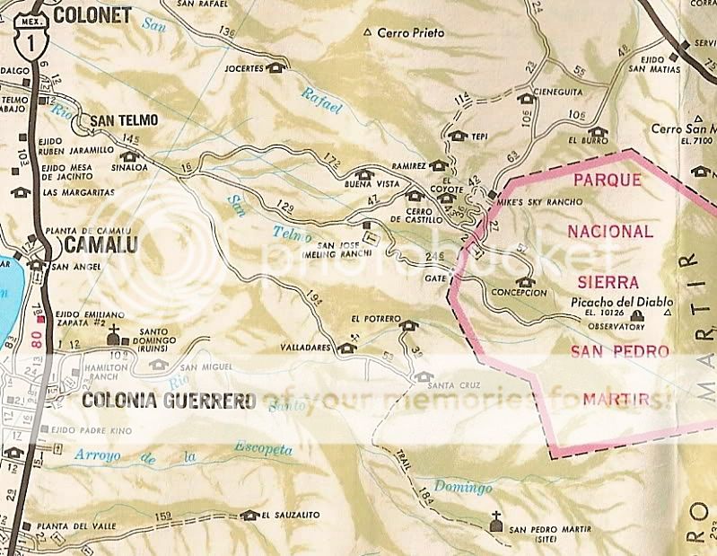
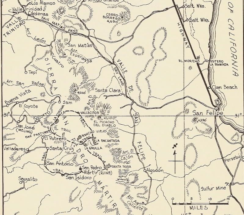
I have also heard of hot springs up in the sierra, south of Meling Ranch, at Valladares.

Maybe a Baja map with the hot springs pointed out to give an idea of the areas they are located in?
David I have none of your great map skills,nor use GPS.Please visit me,off we go:) To get to SV spring,yes its up wash.You need go in back of SV high school to get to it.Bike 35min.4x4 45min/hour.To get to other spring,45min past Rancho proteros.Valladares is down canyon from there. About 35/45 mins away. Show us your great map,I will point it out. Even better lets do 4x4 trip with the boys.I know every road trail up there,also have keys to locked gates.
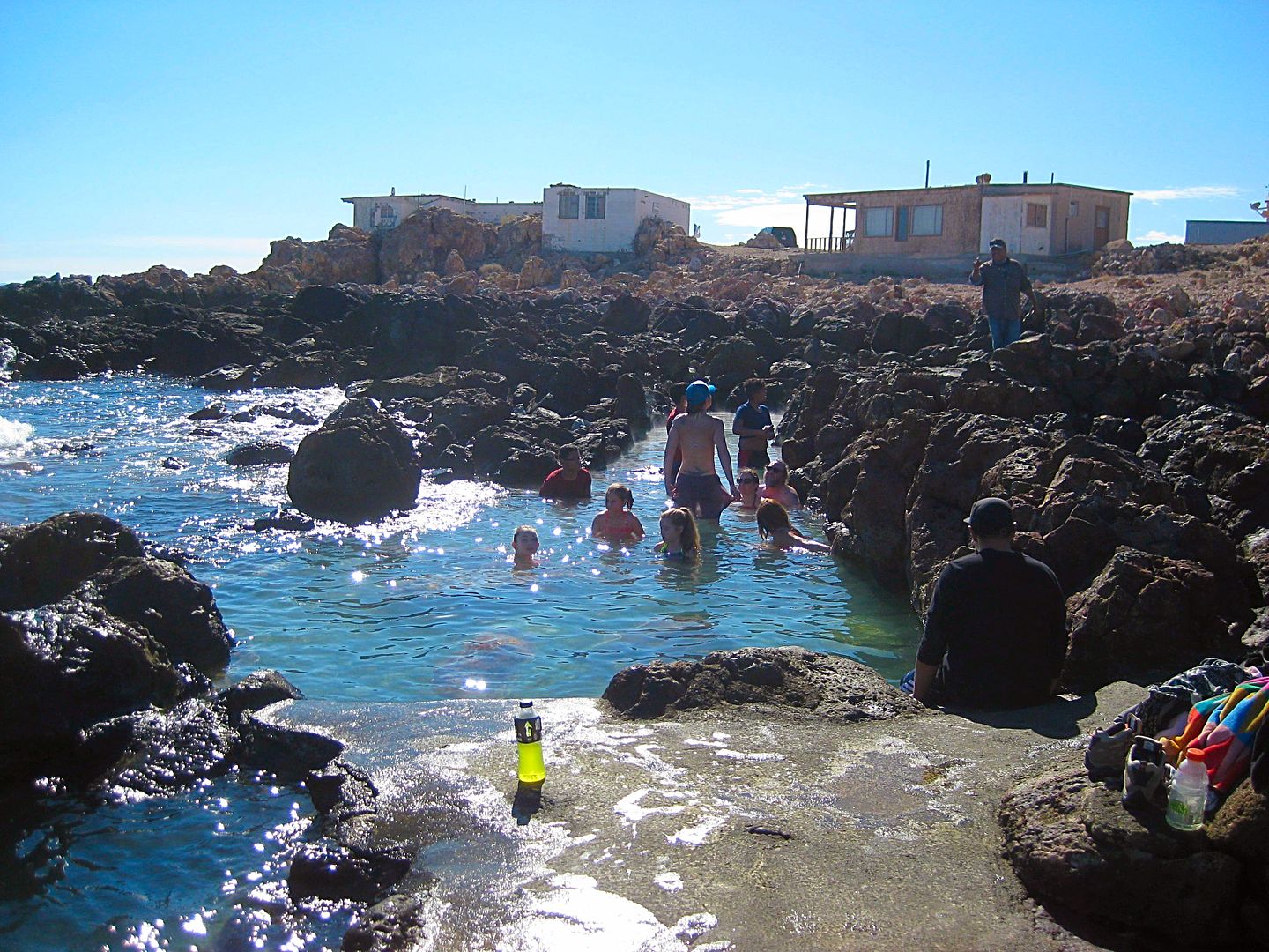
micah202 - 2-10-2018 at 08:59 AM


[img]https://www.flickr.com/photos/59103003@N05/40106697071/in/dateposted-public/[/img]

....had a great stay at the hots prints at Golf Club road, just Norte of Manneandro.
The big archway sign's not there anymore, but the springs are thriving, lots of improvements in the past 5 years., very well kept.
I think it was 150ps, per person, but well worth it.
There was the usual partiers and music blasting, but the camping area is well extended, we took a spot along the river upcreek, the water's sound covered the ghetto blasters nicely! <;~}

[Edited on 2-10-2018 by micah202]

[Edited on 2-10-2018 by micah202]

caj13 - 2-11-2018 at 01:58 PM

can anyone give me more specific directions to the Puertocito hot springs? i know its about 55 miles outh of San Felipe, but is there a mile marker, store, gas station etc, that will guide me in (I do have the GPS location given in this thread, but the guy I'm walking onto that site - no bueno on GPS

David K - 2-11-2018 at 02:08 PM

Quote: Originally posted by caj13  
can anyone give me more specific directions to the Puertocito hot springs? i know its about 55 miles outh of San Felipe, but is there a mile marker, store, gas station etc, that will guide me in (I do have the GPS location given in this thread, but the guy I'm walking onto that site - no bueno on GPS


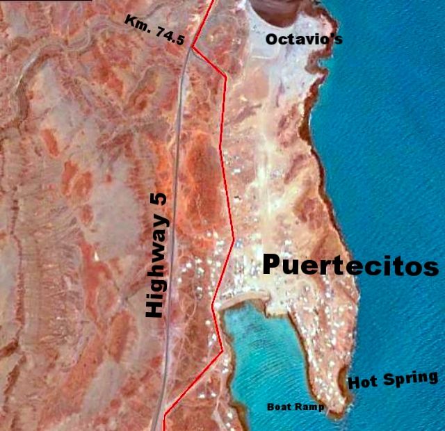
Highway 5 south from San Felipe to Km. 74.5 (it is a paved road forking to the left and signed "Puertecitos".

From my road guide:

Km. 74.5 Puertecitos paved entrance road.
0.2 mile to Octavio’s Playa Escondida driveway (additional 0.3 mile to the camp).
0.7-mile Puertecitos Pemex gas station.
Go left just ahead by the restaurant. A charge of 200 pesos/vehicle is collected to enter Puertecitos property beyond here.
0.9 mile to the beach palapas. Palapa camping only, no cabins or rooms.
1.2 miles to the hot springs. The natural lava-rock bathing pools mix sea water with hot sulfur springs to determine bathing temperature. The pools can be too hot at low tide and completely underwater at high tide.
1.3 miles to a boat-launching ramp at the end of the road at the point.


From my Trip #1 report:


The hot springs of Puertecitos in the tidal zone. It is 200 pesos ($10) even to take photos here.


The water temperature changes with the amount of sea water mixing with the hot sulfur water. Low tide= too hot, high tide= too cold!


[Edited on 2-11-2018 by David K]

David K - 2-11-2018 at 02:35 PM

Quote: Originally posted by bajatrailrider  
There is also Hot spring In San Vicente wash.Last bridge going South San Vicente.4x4 needed Its east of SV about 30/45min. Sorry no GPS tracks.


Nearly two years after this post by bajatrailrider, I was able to take him up on the invite he gave me:

From my TRIP #7 report in 2017:

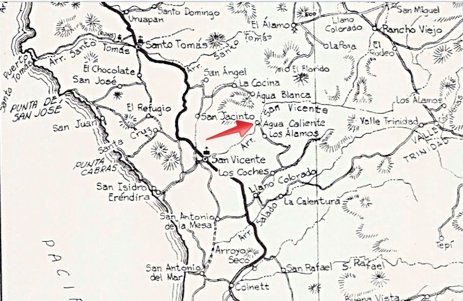
Rancho Agua Caliente and at least three source hot springs are 12 miles by 4WD road from San Vicente. The hot springs have been published as far back as the 1958 edition of the Lower California Guidebook. The ranch there is not occupied but is owned by a friend of Larry's in San Vicente.

Here it is, pointed out, on a 55-year-old map:

1962 Lower California Guidebook map, by Howard Gulick. Notice the pavement south ending before Colonet! There is a now more direct road to Agua Caliente than this 1958 & 1962 edition map shows.

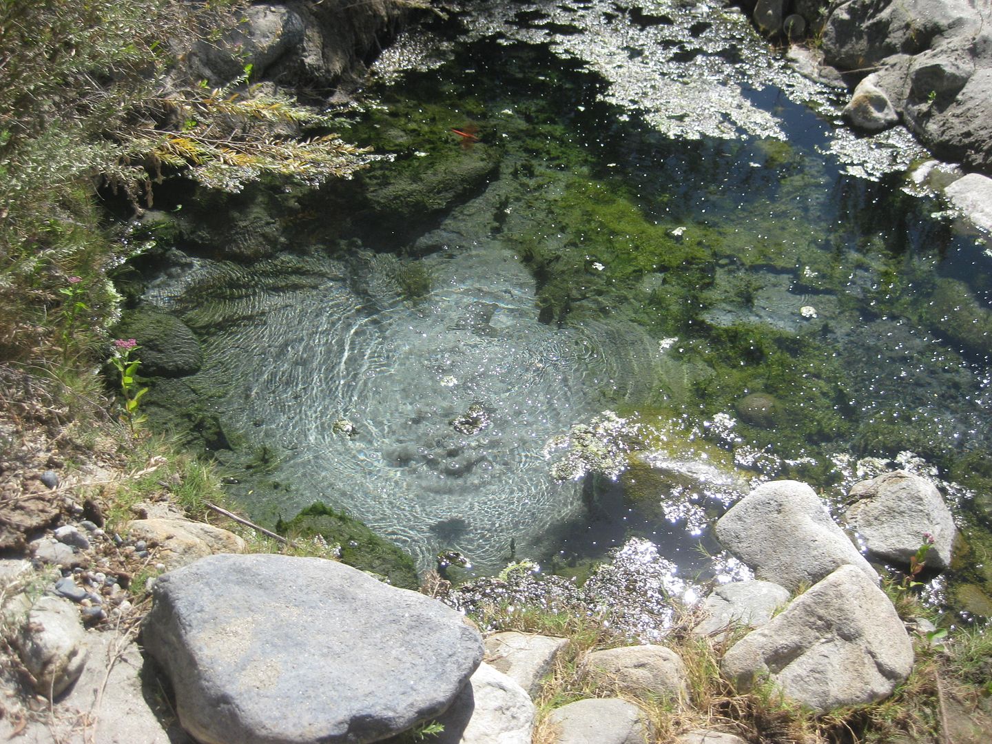
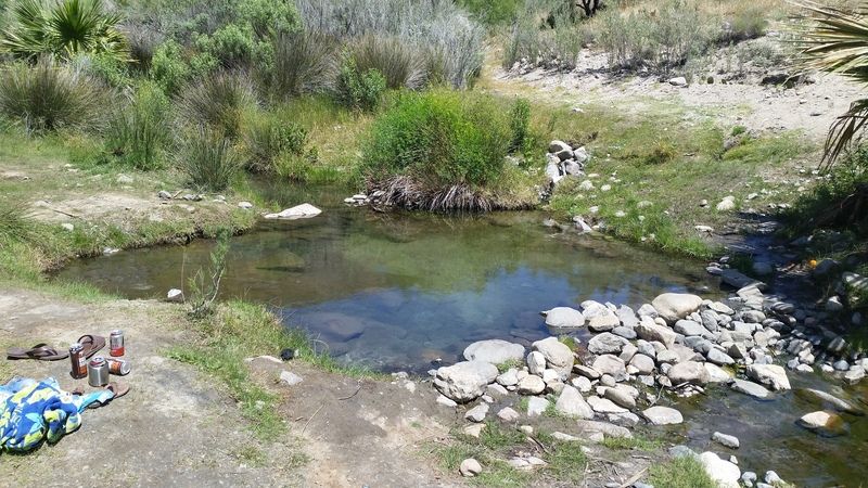
The hot springs are not developed at all. So, bring picks and shovels if you want to bathe here! They are along the south bank of Arroyo San Vicente and another, not as hot spring is by the ranch on the north side of the arroyo. The south springs felt to me to be about 90°-100° and the water rises in the pool with enough force to cause the sand to spin. There are some gas bubbles as well. No sulfur odor was detected, which is a nice surprise.


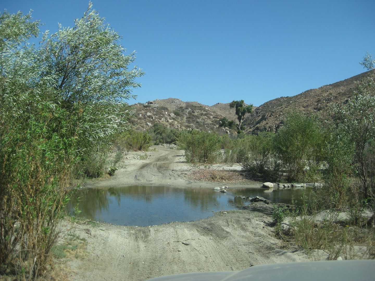
A pool is crossed driving up the arroyo road from San Vicente.


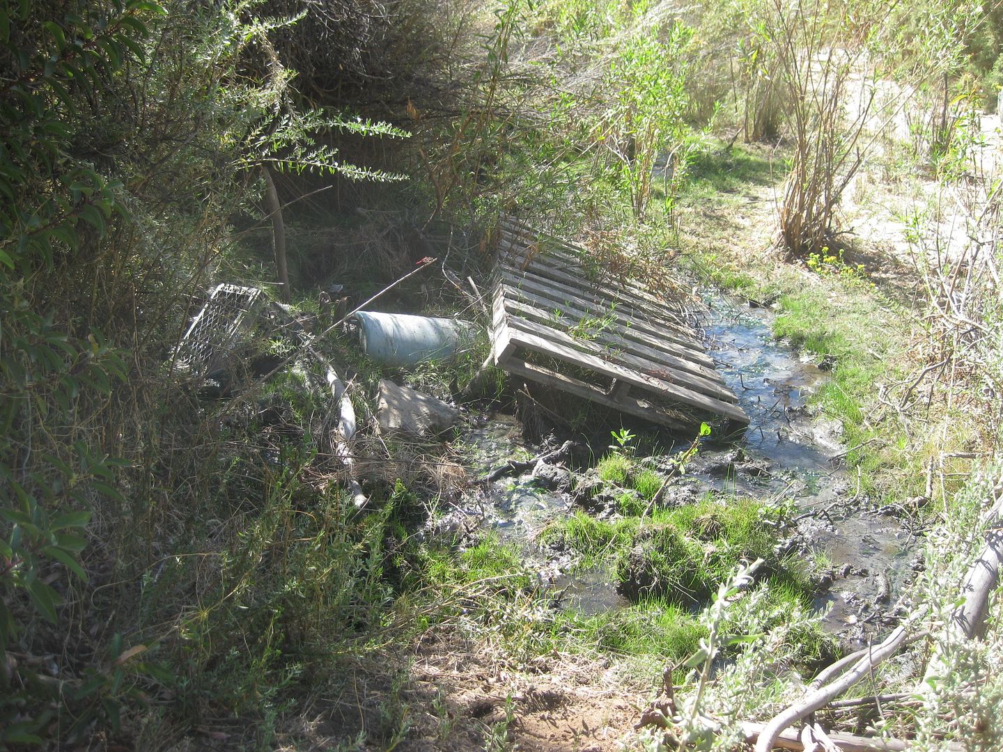
The first source spring is not very attractive!

About 1000 feet downstream (west) one comes to...


A hot stream drops down to a cool mountain stream... Natural hot and cold running water!:


Looking upstream where the hot water meets the cold water.


This is the warm spring by the ranch.


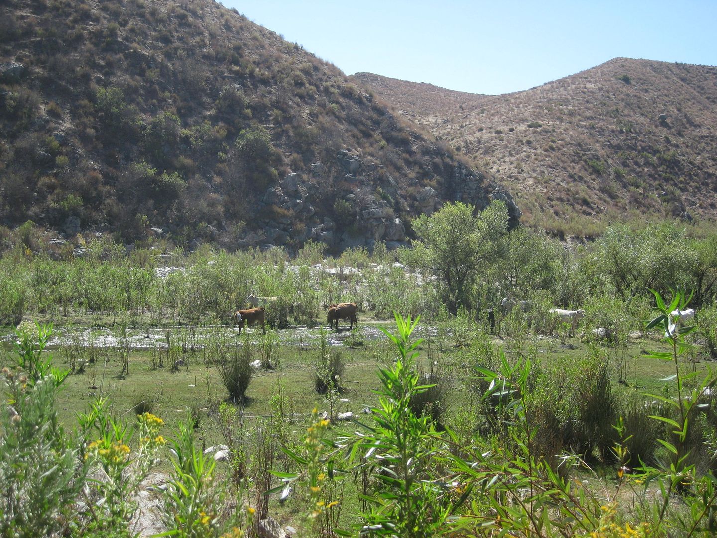
Cows grazing in Arroyo San Vicente/Cañon Agua Caliente.

bajatrailrider - 2-11-2018 at 09:02 PM

Great pictures David few days ago the second hot spring dug out and clean. Still best like you said bring a few shovels as it can change over night. In walking distance nice orange tree yummy.

daveB - 2-11-2018 at 09:44 PM

I can see now the long legs this Hot springs thread has had. Wanted to make sure I could revisit the best of what we had experienced and my oh my someone had beat me to it, the hot springs of Santa Rita. But wait! that was my own post from three years ago! I have a pretty vivid recollection of that day,which was likely 2001, with six of us enjoying it. The warm water, up to our chests in places. Oh, and the Farmer who had led us to waters edge, and watched over us for a time. No we weren't skinny dipping. That trip was my last to BCS. Loved the hiking that was so easy there, compared to the jungles near where we spent the next seven winters, 200km south of Peurto Vallarta.

kingdktgrv - 2-13-2018 at 04:41 PM

Not sure what the official name of this Spring is but it is the one off HWY 3 by LA CETTO back in April of 2016


PaulW - 2-17-2018 at 03:19 PM

Just got back from Rancho Agua Caliente. Exit Highway 3 @ Km27. No time now, but will make a thread after the big NASCAR Races.
www.ranchoauguacaliente.com

David K - 2-17-2018 at 06:43 PM

Paul, test that link. I think there is an extra u in your link?
Try www.ranchoaguacaliente.com

[Edited on 2-18-2018 by David K]

JZ - 7-13-2019 at 02:53 PM

What happened to mcfez.

daveB - 7-13-2019 at 09:10 PM

Traveled out of Santiago years ago, maybe 2001, remember using the Zoo's location as one of the waypoints, after that a lot of climbing (I wasn't the driver) we got on an even steeper tract that eventually led into a yard of a resident. We paid a small amount for each of the two cars, and a fellow led us down to the Santa Rita hot springs. Nice! Lush vegetation surrounded the fairly expansive waters that we could tell were about 90 degrees ( it was January). A very nice hot springs experience! Some of us climbed up into the valley created by the stream, good exercise too.

There is another, much smaller hot spring in the area as well, some call it, yes, Agua Caliente. It forms in a tiny area (when we were there) not far from the holding pond for flooding the culvert at certain times during the day - a man drives up and opens/ closes an under water valve manually for the water to run into the valley below. Hiking up the creek is a fine trip. Back near the holding pond, there is a ritual that will amaze most people: at about 4 PM on a winters day, just before the sun sets, bats emerge from the piping and begin to fly excitedly in a circle to then grasp onto a large boulder. I sat for a time right in the path they moved through, with a video camera taking it in. The bats would always miss me although i felt a wing against my shoulder a time or two. An owl flew into the throng once a took its dinner; one of our group was busy extracating bats trapped in foliage. Eventually hundreds of bats hung on the rock waiting for darkness to fall, to begin their own mealtime. For us, this was all simply amazing!

David K - 7-15-2019 at 09:05 AM

Keep up the hot spring posts!

New ones or updating old ones, would be great to read.

Has anyone been to the Valladares hot spring, south of Meling Ranch?


bajatrailrider - 7-16-2019 at 10:47 AM

Yes David it is mud pit I don't think. They let people there anymore but I will check

4x4abc - 7-16-2019 at 11:35 AM

here are the hot springs I have recorded over the last 30 years


Attachment: all hotsprings.kmz (7kB)
This file has been downloaded 302 times

micah202 - 1-16-2020 at 09:58 AM

Wowww, thanks dear Nomads,,, been keeping the thread going nicely!

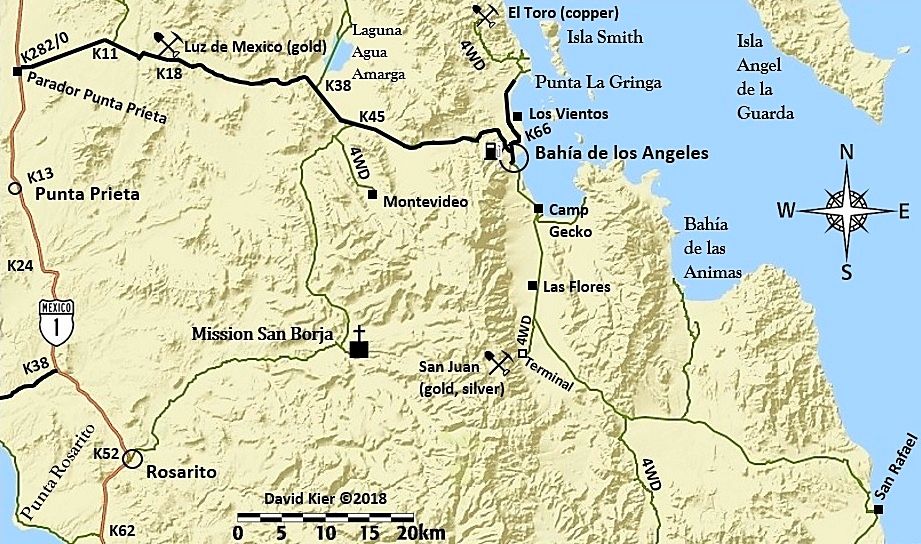
I'm not sure if it's already in here, but here's some deets on one South(?) of Bahia de los Angeles... though I'm not finding the Borja Mission on my map.... any clues, km's etc?

......Take the back road to San Borja mission - ask the caretaker family as a guide. Ask if they will allow you to use the warm springs (it's private property). Interesting hiking around there.

David K - 1-16-2020 at 10:38 AM

Quote: Originally posted by micah202  
Wowww, thanks dear Nomads,,, been keeping the thread going nicely!

I'm not sure if it's already in here, but here's some deets on one South(?) of Bahia de los Angeles... though I'm not finding the Borja Mission on my map.... any clues, km's etc?

......Take the back road to San Borja mission - ask the caretaker family as a guide. Ask if they will allow you to use the warm springs (it's private property). Interesting hiking around there.


Not a good map if it doesn't have San Borja!

Here is mine, with the kilometer markers at turnoffs:


micah202 - 1-16-2020 at 11:10 AM

ahh, DavidK, right on cue with your map!
I hadn't yet seen the road through there.

Quote: Originally posted by David K  
Quote: Originally posted by micah202  
Wowww, thanks dear Nomads,,, been keeping the thread going nicely!

I'm not sure if it's already in here, but here's some deets on one South(?) of Bahia de los Angeles... though I'm not finding the Borja Mission on my map.... any clues, km's etc?

......Take the back road to San Borja mission - ask the caretaker family as a guide. Ask if they will allow you to use the warm springs (it's private property). Interesting hiking around there.


Not a good map if it doesn't have San Borja!

Here is mine, with the kilometer markers at turnoffs:


David K - 1-16-2020 at 11:18 AM

Just fyi, the side road to the Montevideo pictographs is now closed with a locked gate... So so sad.

micah202 - 1-16-2020 at 11:27 AM

Quote: Originally posted by David K  
Just fyi, the side road to the Montevideo pictographs is now closed with a locked gate... So so sad.


Is that where there's the particularly spectacular picto's are?

Guide required?

David K - 1-16-2020 at 11:29 AM

Yes... No guide, no ranch in there. You just drove right up to the site... It was great.

micah202 - 1-16-2020 at 11:33 AM

Quote: Originally posted by David K  
Yes... No guide, no ranch in there. You just drove right up to the site... It was great.


Now there's no access, even with a guide?


Dang, realized we've crossed threads,, Hotsprings and Picto's/BOLA,,, ahh well.

David K - 1-16-2020 at 12:24 PM

Quote: Originally posted by lencho  
Quote: Originally posted by David K  
Just fyi, the side road to the Montevideo pictographs is now closed with a locked gate... So so sad.

You by chance talked to the owner to ask why? :?:


I have not been there since the gate was installed. I was last there in 2017. The gate was reported to me by a Nomad, who took photos.
There is no ranch on that side road.

Photo from Nomad 'Mothership'


[Edited on 1-16-2020 by David K]

David K - 1-16-2020 at 05:06 PM

Montevideo has been published, with driving directions, since the 1967 edition of the Lower California Guidebook. There has never been any graffiti (the modern kind) added. For a few years (2000s) INAH had even erected a sign pointing the way at the junction.
A flash flood made the road pretty sandy so 4WD was best after it (2016 or before?).
I was there in 2016 and 2017, and saw no reason to fence it off. Well, at least we have photographed it well, so the art is preserved. It is just extra special to see it in person.

bajaric - 1-17-2020 at 09:15 AM

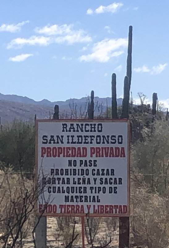
From the sign, they are concerned about hunting and wood gathering. It is interesting to note that most of Baja is private property. In the US the first thing an owner of private property does is put up a fence and post it no trespassing. In the past, land owners in Baja did not seem to care much about people going on their land, kind of a Mexican thing. I think this might be simply because it is expensive to put up fencing on thousands of miles of dirt roads, or perhaps in Mexico there a more fundamental view of the land as belonging to the people, from the revolution that redistributed land from the aristocracy to the masses, an event that has no parallel in the US.

wilderone - 1-17-2020 at 10:04 AM

I found a reference in a Mexican document called: AGRICULTURAL DEVELOPMENT FUND OF THE STATE OF BAJA CALIFORNIA
FOFAEBC Support Program for Investment in Equipment and Infrastructure 2013 - Traditional Productive Assets Component

There is a listing for the applicant name of Ruben Roman Daggett, apparently the owner of Rcho San Idelfonso, in Ejido Tierra & Libertad, for a project for [as translated from Spanish] "acquisition of 5000 ltrs R-20 nurse tank with 2 connection"
So maybe if there is a well with water lines or something, and a gate to protect that infrastructure asset.
???

David K - 1-17-2020 at 10:39 AM

Good investigative work, Cindi!
There would be no need for a well up in that valley unless a new ranch was going in, so maybe there is? I guess we can ask Reuben at Daggett's Camp?
Thank you!

billklaser - 1-17-2020 at 02:24 PM

There is supposed to be some hot springs between Puerto Al Meja and Punta Pulpito north of Loreto. Never been there, but my Mexican fishing guide has told me about it.

wilderone - 1-17-2020 at 07:06 PM

Interesting. Probably have to get there by boat.
"Punta Púlpito volcano is a lava dome which formed about 500,000 years ago on a small peninsula at the Gulf of California east of the southern tip of Bahía Concepción. It is included in the catalogue of potentially active volcanoes because it still has an active geothermal system with hot springs and steaming ground. One active geothermal field is known as the Saquicismunde geothermal area, and the larger Los Volcanes geothermal area, located along the coast about 5 km south of Punta el Púlpito, contains 18 fumaroles along a NW-SE alignment. The Saquicismunde geothermal area with hydrothermal springs and steaming ground lies close to the dome."

4x4abc - 1-17-2020 at 08:08 PM

Saquicismunde Cove is exactly 5 km from Punta Pulpito

sailors frequent the cove
haven't seen any reports of fumaroles yet