We are in Dagget's again for a few more days --the weather here has been great. We went to Las Flores on the ATV today and road to the south end of
the road & hiked around. There is some old debris from the tram system i guess.
We plan on crossing back to the US 2-20 or so.
We are signed up for the Crosby slide show is any one else going?wilderone - 2-15-2011 at 08:35 AM
Yes, I'm going to the side show - going to have Crosby sign my book.David K - 2-15-2011 at 08:54 AM
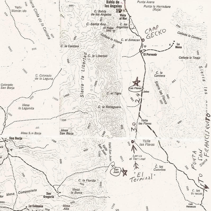
George, the tram line is at the end of the railroad line... the terminal platform is 5.5 miles south of Las Flores at 28º44.745', -113º32.582'
(WGS84).
This is where the ore came down the mountain from San Juan in ore buckets suspended from a cable, and then were dumped into railroad cars for the trip
down to Las Flores where the ore was turned into ingots. Officially a silver mine, but gold was the primary metal I have heard.ArvadaGeorge - 2-15-2011 at 01:02 PM
Thanks DavidMarc - 2-21-2011 at 02:03 PM
I thought that you (DK) had located the mission a short while ago??mcfez - 2-25-2011 at 08:03 AM
south end of the road & hiked around
Past Doc's place?
DavidK...ore/ what sort of ore? Gold? Havent heard about this tram line.David K - 2-25-2011 at 08:19 AM
Quote:
Originally posted by Marc
I thought that you (DK) had located the mission a short while ago??
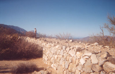
Hi Marc, we went to the site that Choral Pepper (and others) believed was a lost 'mission started' called Santa Maria Magdalena, as shown on the
Jesuit map of 1757... that was found in 1966 by the Erle Stanley Gardner expedition, which opened the road between Bahia de los Angeles and Punta San
Francisquito. They found rock walls, a dam, sleeping circles, and more.
It had been lost again, and I have searched for years and interviewed members of the Gardner expedition for the location, reported to be 40 miles
south of Bahia de los Angeles... A Baja Nomad spotted what looked like the wall in the photo of the site from 1966. We made the trip south ASAP to
confirm! See http://vivabaja.com/109
The site overlooks Bahia las Animas...David K - 2-25-2011 at 08:56 AM
Quote:
Originally posted by mcfez
south end of the road & hiked around
Past Doc's place?
DavidK...ore/ what sort of ore? Gold? Havent heard about this tram line.
This was first posted in 2005... now condensed and with additions:
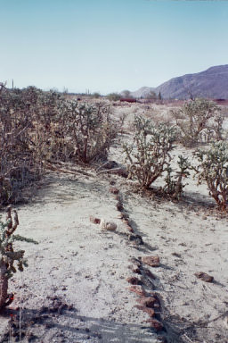
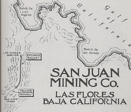
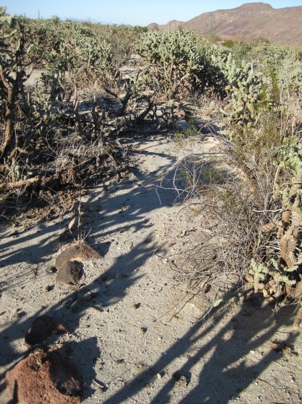
The railroad line runs 5.4 miles from the ruins of Las Flores (south of Bahia de los Angeles) to the bottom of El Terminal canyon where a cable bucket
tram line brought the ore down from the San Juan mines high atop the sierra.
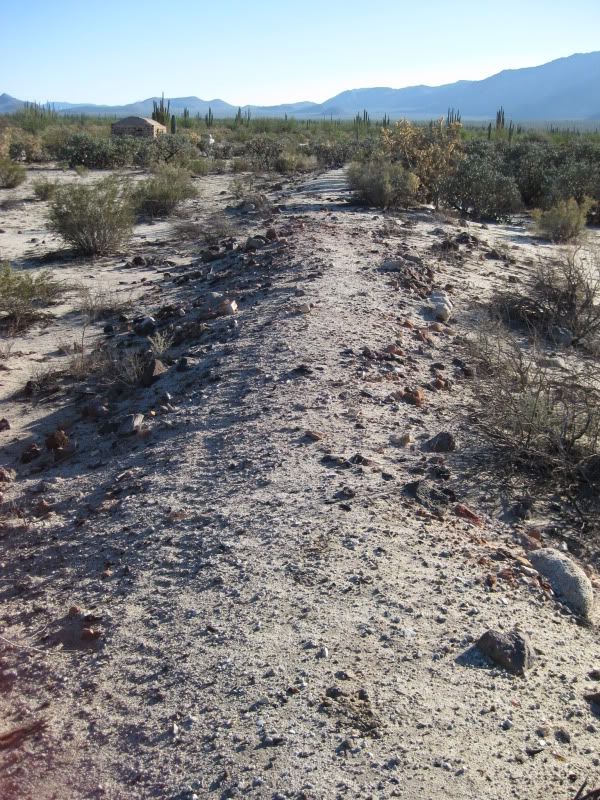
Here is the railroad bed at Las Flores heading south...
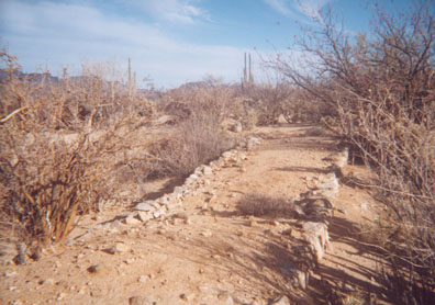
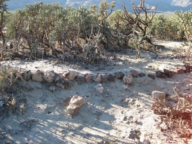
Here is the terminal platform where Dr. Abraham Vasquez ('Doc' of Camp Gecko) shows me where giant wheels were once mounted at the bottom of the cable
tram line. Here the ore was dumped into train cars for the trip north to Las Flores where the ore was processed...
One of the ore buckets that litter the canyon bottom (the good stuff has already been removed and some is on display at the museum in Bahia de los
Angeles...
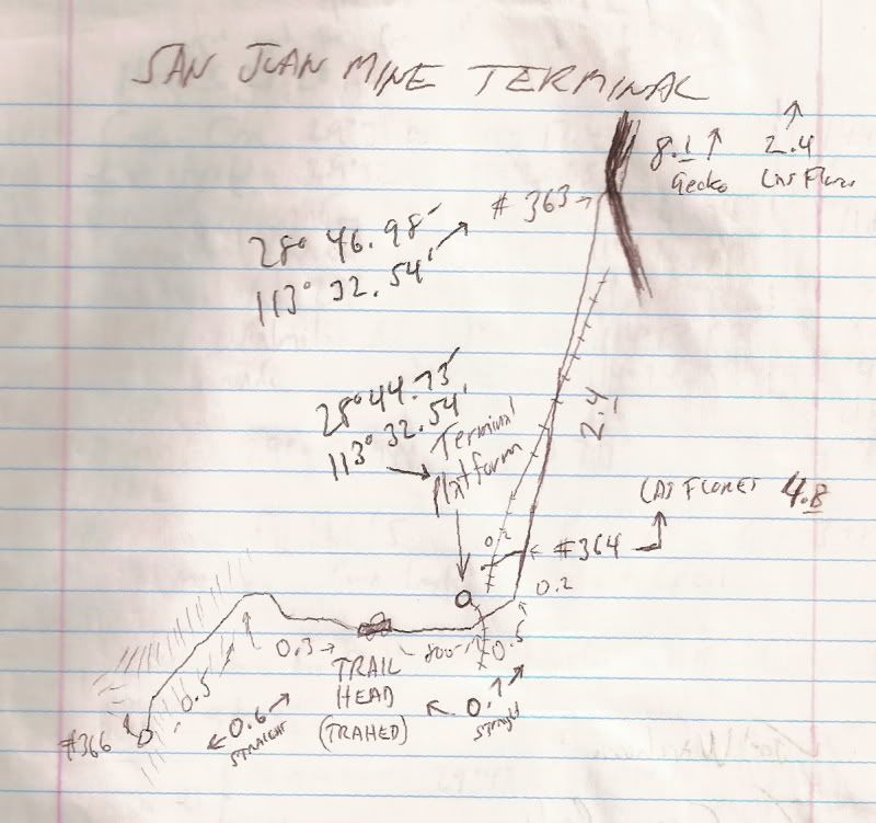
8.1 Top of long grade, a poor road continues ahead (28º46.98', 113º32.00'). Main road to Punta San Francisquito bends left.
11.1 Park where railroad crosses, now going from south to north, uphill. Platform at 28?44.73', 113?32.54' a short walk north from the road.
The auto road continues a short distance ahead to the trail going up Terminal Canyon to the San Juan mines. Before the cable tramline, pack animals
brought the ore down the mountain.
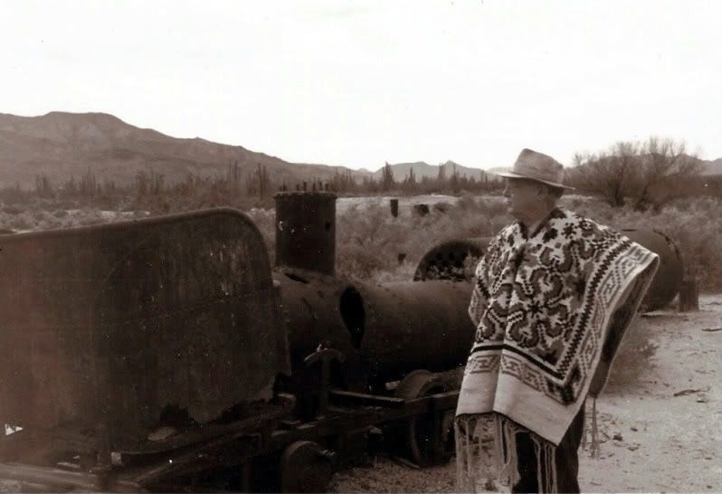
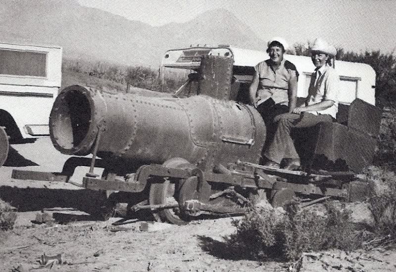
The museum of Bahia de los Angeles... on the outside, to the right, is a display of the railroad and ore tram bucket system... In front of the town
plaza is the locomotive that was left at Las Flores and an ore car that came from the smaller gauge train line up at San Juan...
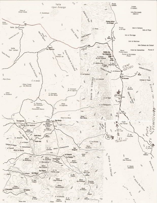
Map for reference.... stars placed by Las Flores and San Juan mines, terminal platform noted with arrow. Mileages from Las Flores (east of jail house
on graded road) to the junction with the road that continues uphill to the terminal (2.4)... and then 3.0 on to the terminal on the minor road
(overgrown brush will scratch vehicle).
It should be noted that the original topo map is incorrect with the placement of the graded road south of Las Flores (I doctored the map to correct
its location), and in naming Arroyo el Terminal: It is labled at the next arroyo south of where it really is! Too faint to see in this reproduction...
Google Earth allows you to see the railroad line route as it circles at the terminal, otherwise hidden by vegetation on the ground...