BajaNomad

Update: Very clear shot of the Islands

BajaWarrior - 4-15-2011 at 04:31 AM

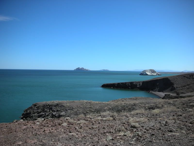
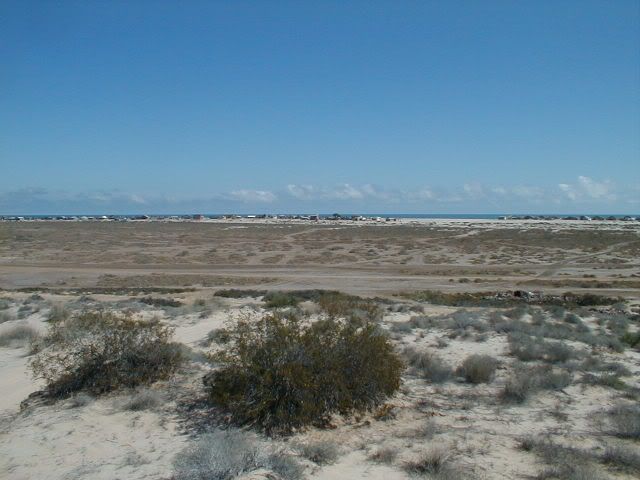
My wife took this with her new whiz bang Canon from the high dune behind our house this past week (South Campos KM 31 Bahia Santa Maria/Playa Hermosa) while on vacation at our home below San Felipe.

We had an exceptionally clear day and she captured the Islands perfectly to the south which are at least 45 miles away.


[Edited on 4-15-2011 by BajaWarrior]

[Edited on 5-15-2011 by BajaWarrior]

bajabass - 4-15-2011 at 05:22 AM

Must have been VERY clear! No way they look that far away. Nice shot, looks peaceful.

David K - 4-15-2011 at 07:20 AM

:?: :biggrin:

Bajafun777 - 4-15-2011 at 07:21 AM

It is really kind of nice being with the wife and selecting photo shots and then enjoying the walk back from your trek to take them, huh?? Some of our best conversations and quite moments have happen during the photo shot walks, as I am sure yours are too!! Enjoy these times as it seems life speeds up for us more than we think, Have FUN & ENJOY YOURSELVES! Take Care & Travel Safe------- "No Hurry, No Worry, Just FUN" bajafun777

coronamike - 4-17-2011 at 10:05 AM

Which island would that be? Angel de la Guarda?

David K - 4-17-2011 at 10:36 AM

I think it is either Tom Sawyer's Island or Fantasy Island?? Come on Chuck, give!:biggrin:

jeans - 4-17-2011 at 10:39 AM

looks like the Coronados, 10 miles off Tijuana

bajamigo - 4-18-2011 at 08:55 AM

It's a cloud bank...or something the tsunami brought in.
:bounce:

Borregoman - 4-27-2011 at 10:43 AM

Excellent shot! I have a Canon as well, they have excellent glass in them, even their point and shoots.

I'll have to keep and eye out for those islands. Looks like it was taken near sunset?

CortezBlue - 4-27-2011 at 10:53 AM

Must Be Shell Island

aka Isla Kavid D

Hook - 4-27-2011 at 12:38 PM

I'm also having a hard time figuring out what islands those are. Certainly doesnt look like the Encantadas from the south campos.

In fact, are the Encantadas even VISIBLE from the south campos? I never noticed them.

I think it's a shot from north of BOLA at Angel de la Guardia.

BajaWarrior - 4-27-2011 at 04:17 PM

Quote:
Originally posted by Borregoman
Excellent shot! I have a Canon as well, they have excellent glass in them, even their point and shoots.

I'll have to keep and eye out for those islands. Looks like it was taken near sunset?


Hey E, yes it was taken near sunset from the dune near our homes.

BajaWarrior - 4-27-2011 at 04:18 PM

Quote:
Originally posted by Hook
I'm also having a hard time figuring out what islands those are. Certainly doesnt look like the Encantadas from the south campos.

In fact, are the Encantadas even VISIBLE from the south campos? I never noticed them.

I think it's a shot from north of BOLA at Angel de la Guardia.


They are indeed the Encantadas. We see them nearly each morning from the deck upstairs. Buy this was especially clear in the afternoon.

David K - 4-27-2011 at 05:54 PM

I am still waiting for the secret of that photo... :rolleyes: which looks like a giant land mass maybe 20 miles off shore (not a couple of small island 80 miles away, south along the coast).

I have only seen as far south as Punta San Fermin along the coast and the mountains near Puertecitos... never any Enchanted islands from Shell Island or Nuevo Mazatlan... But, the direction of view and the elevation above sea level near Playa Hermosa, plus a telephoto may create that image... Let me play with Google Earth and see what a cloudless view south shows... :cool::light:

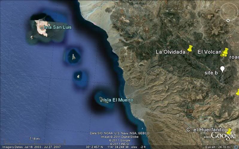
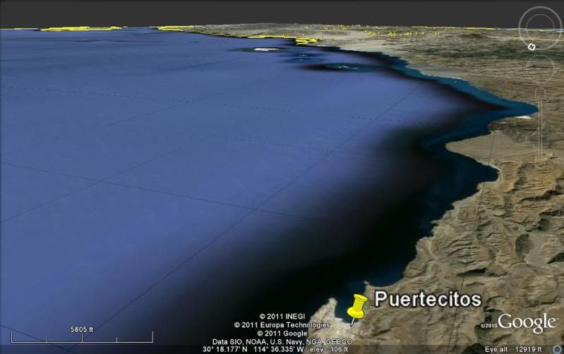
Here is how big (or how small) the Enchanted Islands look from about 17 miles south of Puertecitos... and Playa Hermosa is nearly 50 miles north of this spot! :O


They are called Enchanted Islands, for a good reason!

David K - 4-27-2011 at 07:05 PM

The secret of that photo may never be known! ;) Thanks Chuck for the fun!


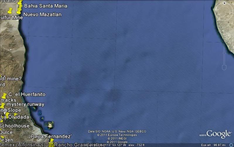
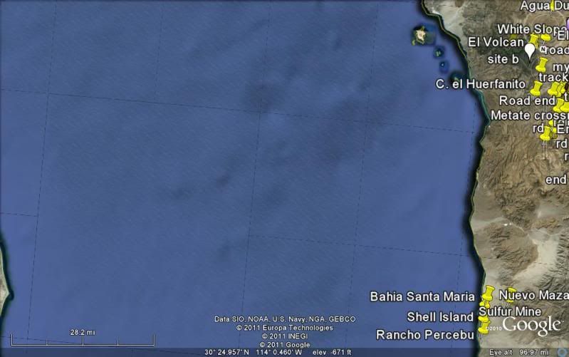
North at top (no giant islands in upper gulf)


South at top

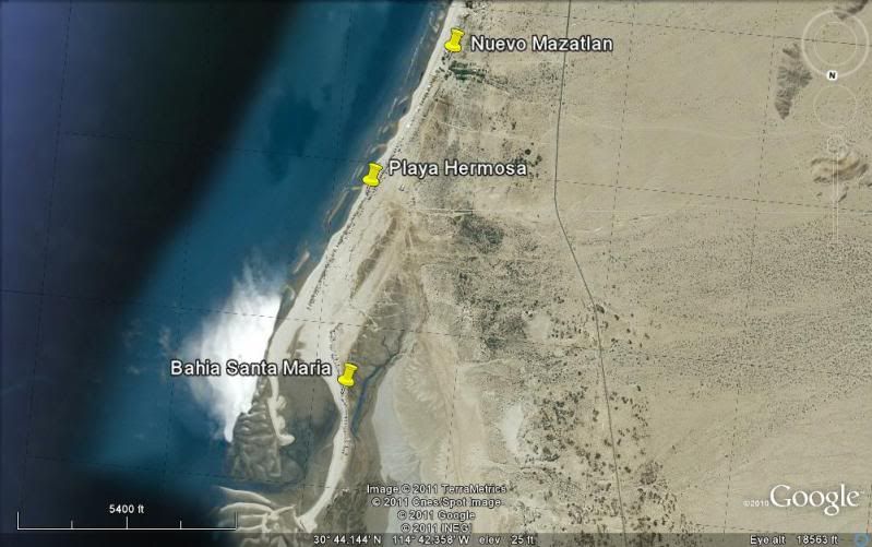
All remaining images, south at top:


Over Bahia Santa Maria


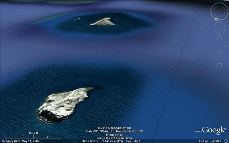
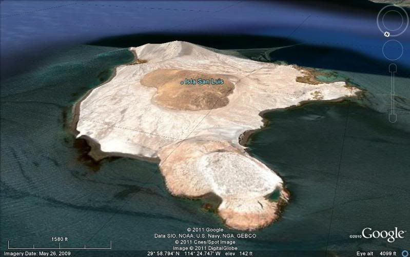
Over Islands


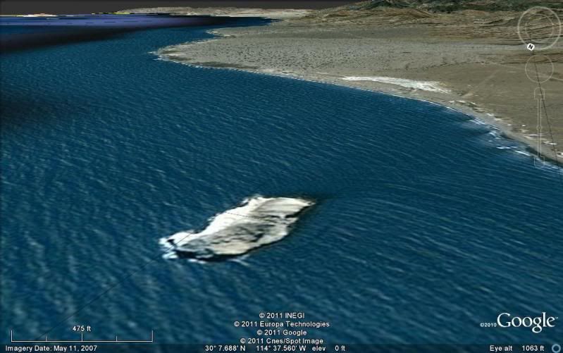
Huerfanito


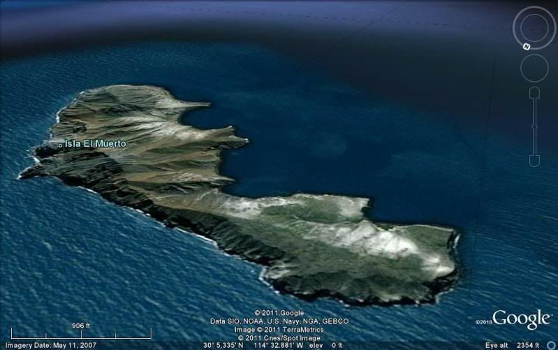
El Muerto


Lobos


San Luis (the biggest)


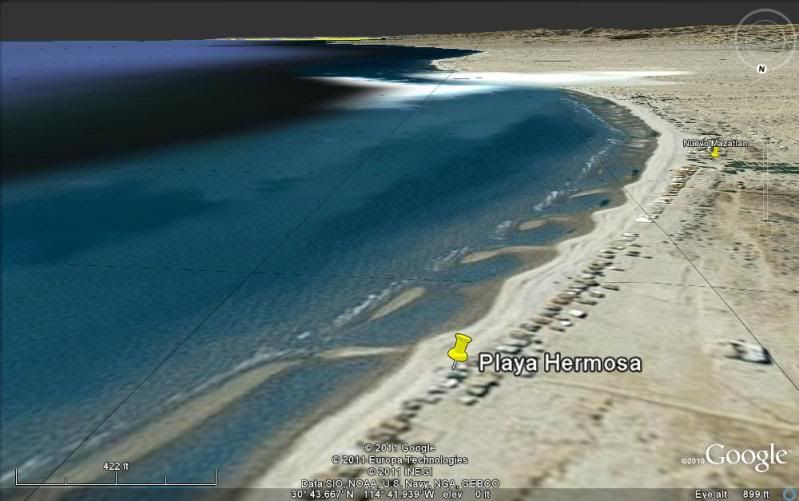
Towards the islands from 900' above Playa Hermosa


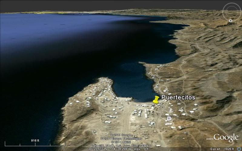
Towards the islands from 900' above Puertecitos


Even higher above Puertecitos...

BajaWarrior - 4-27-2011 at 07:41 PM

Ok, you got me...You wish!

Look, from beach level you cannot see these Islands or not very well. From our patio on the front house which is closer to sea level they hardly visible and usually only in the mornings on a clear day.

From the new back house with a second floor deck they are very visible in the morning on a clear day.

From the dune that is more directly behind (West) BajaRob's casa 30 homes North of me the Island(s) on a VERY CLEAR DAY are very visible given the elevation.

Keep in mind the curvature of the earth which is 17 (?) miles.

DavidK, the closest Island is not 80 miles away but only 18 miles south of Puertecitos and we are only 25 miles North of Puertecitos and that is road miles. So, as the Osprey flies, the first Island is only 35 miles away at best.

If you don't believe me come on by, bring cold Pacificos please.

Marc - 4-27-2011 at 07:46 PM

Nice shot. Looks closer than 45 miles.

bajalou - 4-27-2011 at 08:29 PM

I'm going by there tomorrow and will look around, although it won't be early and seeing things at a distance is much more difficult as the day progresses.

(I've finally got glasses, so I see a lot of things clearly that were just blurs in the past - so maybe!)

[Edited on 4-28-2011 by bajalou]

David K - 4-27-2011 at 09:04 PM

Okay Chuck... there is some trick photography going on to make any of those little islands look so huge, straight out in the gulf... Look at the photo I took of them from just 3 miles away from Huerfanito... tiny... no telephoto.

Yes, 50-60 miles is closer to correct than the 80 I first said... thanks.

San Clemente Island is 50 miles off San Diego, it is many time bigger than San Luis, and you rarely see it... only on a Santa Ana from a hill near the beach.

Please show more photos that include the coastline... those islands hug the coast, so don't know how you got one without the coast in it too?

So, going to join us on the search for Santa Isabel??? We could use some of that trick photography to capture the fountains and arches of gold elbeau sees!!:light::smug:

lizard lips - 4-27-2011 at 09:38 PM

Nice photos and it does look like Coronado Island.

BajaWarrior - 4-27-2011 at 09:40 PM

We are actually going to be at our Beach House this weekend so we'll get some shots from our house and from the Dune, which I think it's elevation is the key.

David K - 4-28-2011 at 07:04 AM

Cool! :bounce:

BajaWarrior - 5-14-2011 at 06:43 PM

Hi all,

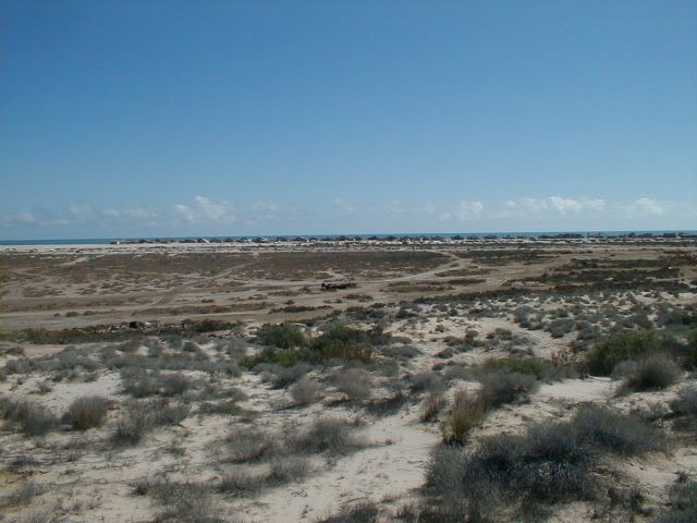
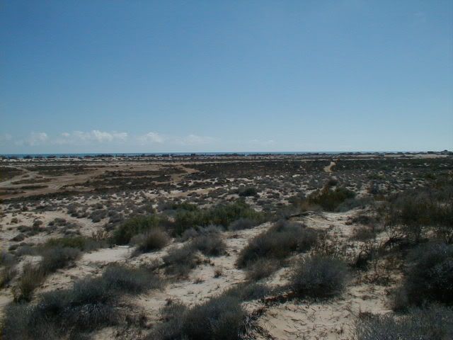
We went to our Beach House last weekend for a very windy trip. Here, from the same spot, looking through the same homes 1/2 mile away on top of the dune only a 1/4 mile behind our home we took this not so clear photo of the Islands (bottom photo when windy/dusty, top photo when super clear for days in a row). We see these Islands almost every day provided it is clear and not windy/dusty. The higher you are the more visible they are to the naked eye.

From out Beach front patio we see only small bumps and from our upstairs deck we see a little more of them. But from the dune we get this view.


[Edited on 5-15-2011 by BajaWarrior]

scouter - 5-15-2011 at 09:21 AM

David K how do you get the google earth shots into posts????

David K - 5-15-2011 at 10:41 AM

Chuck, that is scary looking photography... I have never seen across the gulf from the beach... but those must be mountains on mainland Mexico! The Enchanted islands are along the coast, south of you... They are lower than the mountains along the coast south of Puertecitos... Did you only take that one photo, and none showing the Baja coast to the right, for perspective?

Thanks for the fun look!

Scouter, I save the Google Earth image to my PC files, then upload them to Photobucket (800 pixels wide) to display here. Let me know if you need more details!

BajaWarrior - 5-15-2011 at 02:19 PM

Quote:
Originally posted by David K
Chuck, that is scary looking photography... I have never seen across the gulf from the beach... but those must be mountains on mainland Mexico! The Enchanted islands are along the coast, south of you... They are lower than the mountains along the coast south of Puertecitos... Did you only take that one photo, and none showing the Baja coast to the right, for perspective?

Thanks for the fun look!

Scouter, I save the Google Earth image to my PC files, then upload them to Photobucket (800 pixels wide) to display here. Let me know if you need more details!


They are indeed the Enchanted Islands. You have not seen what we see on a near daily basis. They look different with each elevation. Mainland? No. When we're down next (Memorial Day Weekend) if it's clear I'll get some shots from our Beach patio, upstairs deck, and the dune again. The shots from our patios will include Punta Colorado in the distance. Again, we had two days of strong winds dusting up the views.

Stop on by when your down next even if we're not there and climb the stairs to our upstairs deck and have a look for yourself. Check it from the dune due west by a 1/4 mile from BajaRob's casa too.

David K - 5-15-2011 at 03:45 PM

Yes, I will! We will be on Shell Island for the weekend... and are coming by Rob and Connie's for a visit on our way out, Monday.

Please show photos to the right (south) of the ones you have posted... I would like to see the 'islands' in relation to the Baja coast.

This is indeed very interesting... The size of the one mass (mountain) you say are the few tiny islands south of Puertecitos is baffling indeed.

I took a panorama photo from the dune west of your house, but no telephoto:


Bahia Santa Maria


San Carlos


Playa Hermosa

See you guys maybe in a couple weeks?


[Edited on 5-15-2011 by David K]

BajaLori - 5-15-2011 at 06:35 PM

What kind of camera is your wife using and what kind of lens. We will be down for the party memorial also. We will try to come by and you can show us too. We are in the same camp with you. We take the quads up in those dunes all the time and have never seen them. I recognize the houses in the shot so I know the angle. That's pretty cool. Can't wait.

BajaWarrior - 5-15-2011 at 09:27 PM

Quote:
Originally posted by BajaLori
What kind of camera is your wife using and what kind of lens. We will be down for the party memorial also. We will try to come by and you can show us too. We are in the same camp with you. We take the quads up in those dunes all the time and have never seen them. I recognize the houses in the shot so I know the angle. That's pretty cool. Can't wait.


Hi Lori,

The camera is a Canon Power Shot XS 30 IS with only the attached lens. Sure it is a zoom but we see these islands all the time in the morning hours from our sea level patio and raised deck. Come on by during Memorial Day Weekend (early) for coffee and we'll show you.

Chuck and Chris

Casa #24