BajaNomad

Calamajue

nuvag1976 - 6-22-2011 at 12:36 PM

Hi, everyone,
some one knows, how is the road from coco's corner to calamajue?
thanks guys and sorry for my bad english

Road to Calamajue

John M - 6-22-2011 at 02:43 PM

Welcome nuvag1976

Are you intending to drive through Calamajue Wash from Coco's to Highway 1, or just take a look at the route?

To Calamajue Wash from Coco's you do not need 4x4, just a bit of ground clearance is sufficient. If you drop into the wash, it could be a challenge to come back up the hill in 2wd, depending on the ruts and gullies you'll have to maneuver through.


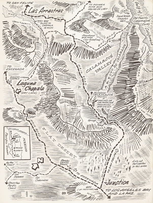
The road from Coco's to Calamajue is fairly wide and graded for about 6.5 miles in a kind of northeast and then east direction. Then at that point (GPS 29 31.121N & 114 13.507W) you head directly south and the road narrows and crosses many washes, for the next 7 miles. These 7 miles are a lot slower, not a bad road but just in and out of small cross washes for most of the 7 miles.

At a point roughly 14 miles from Coco's you drop down a fairly short and steep hill and into Calamajue Wash. (GPS 29 25.334N & 114 11.896W) Head to the right in the wash. As soon as you enter the wash the ruins of a short lived mission, Calamajue Mission, is on a low rise to the left, up and out of the wash. Your route continues up the wash. Within a half mile you'll begin to encounter water, perservere through it, following the obvious tire tracks. You will be going through water, sometimes looks deep but it's always been passable for us, for the next 2.5 miles or so. Once you leave the water behind you kinda get into some softer sand for awhile and slightly up hill.

It is 15 miles from when you first enter Calamajue Wash until you reach Highway 1 at Crucero.

We last drove it in October, but it's always been pretty much the same each time through.

John M

[Edited on 6-22-2011 by John M]

David K - 6-22-2011 at 05:38 PM

There is a chance that when the OP (nuvag1976) mentions 'Calamajue', he could have meant the former fishing village on the cove 'Puerto Calamajue'??

nuvag1976, WELCOME to Nomad! Your English is just fine!!

Three Calamajue's to choose from:

1) Mission/ Visita de Calamajue
2) Arroyo Calamajue
3) Puerto Calamajue

gnukid - 6-22-2011 at 09:34 PM

Ask Dr. Tecate he lives in Calamajue, just get there early, cause he sharpest before noon.

Calamajue

John M - 6-23-2011 at 05:49 AM

Yep you're right David, I may have jumped the gun assuming the arroyo and not the place on the gulf. Never been out to the gulf fish camp so I cannot comment on that route.

John

'got maps?'

David K - 6-23-2011 at 09:36 AM

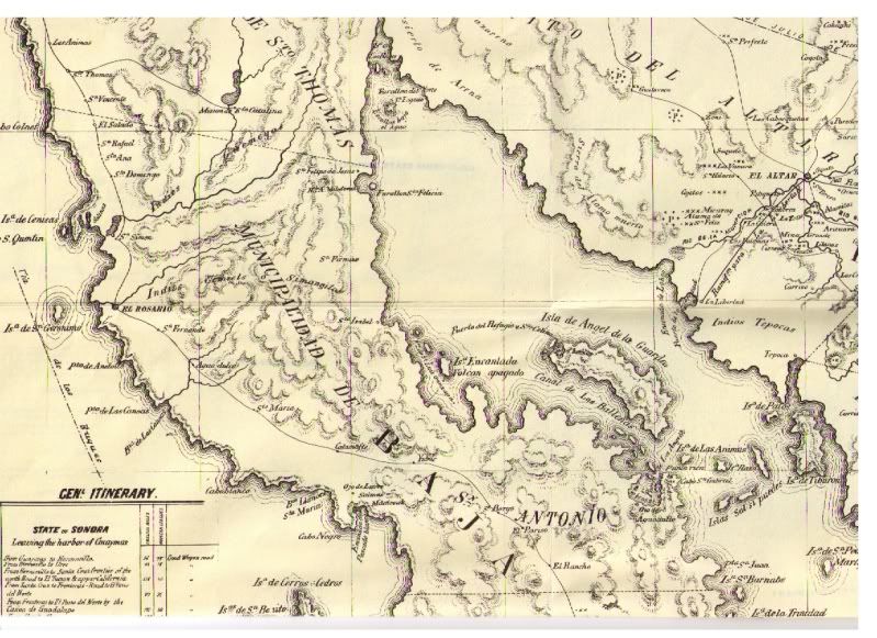
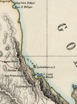
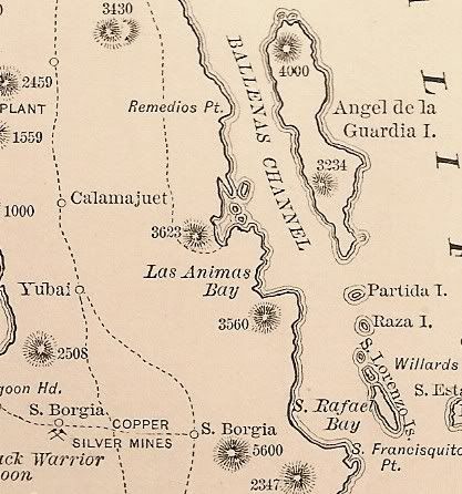
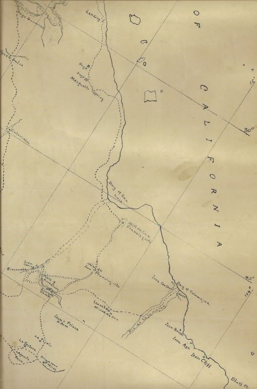
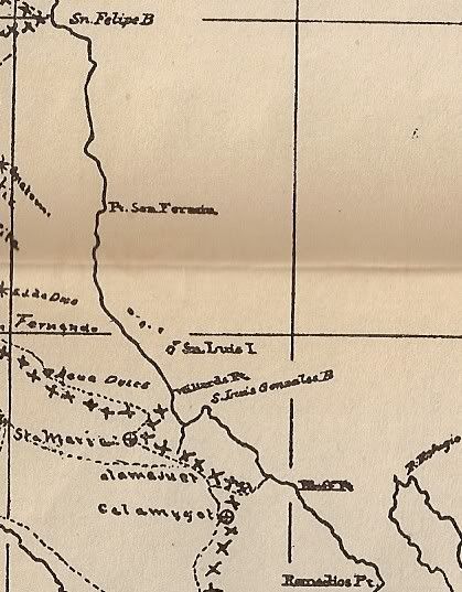
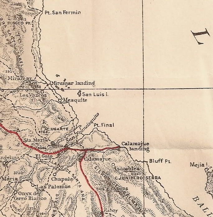
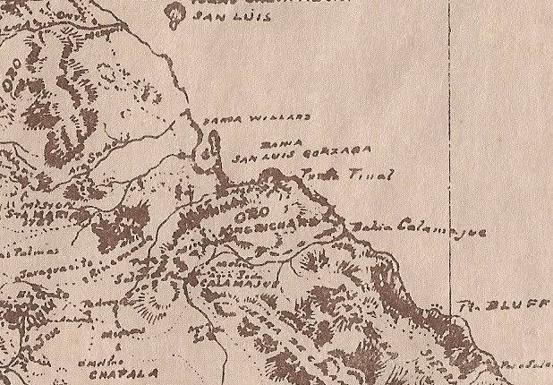
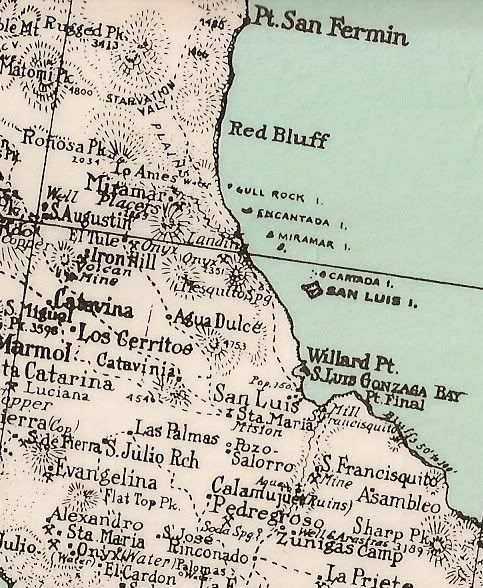
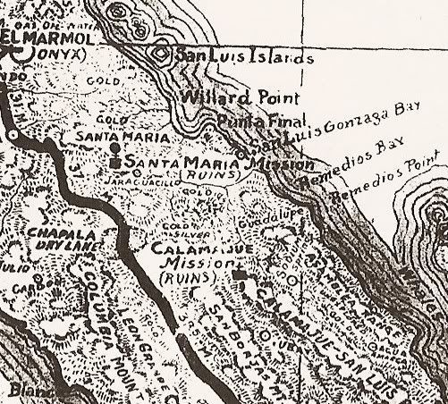
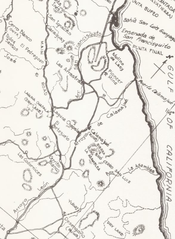
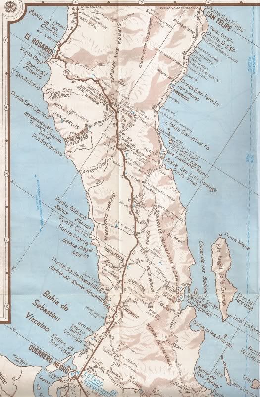
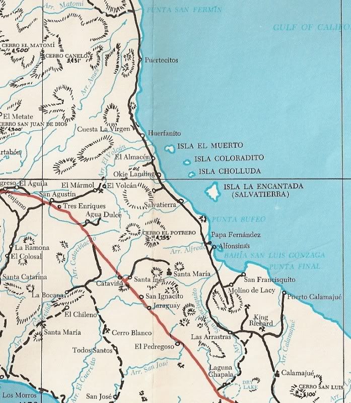
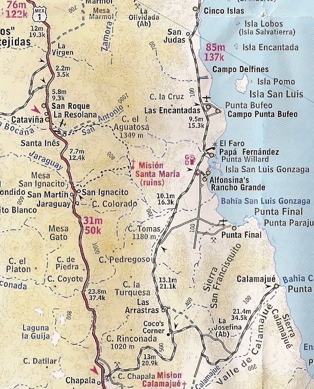
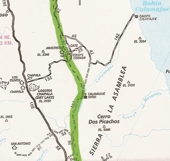
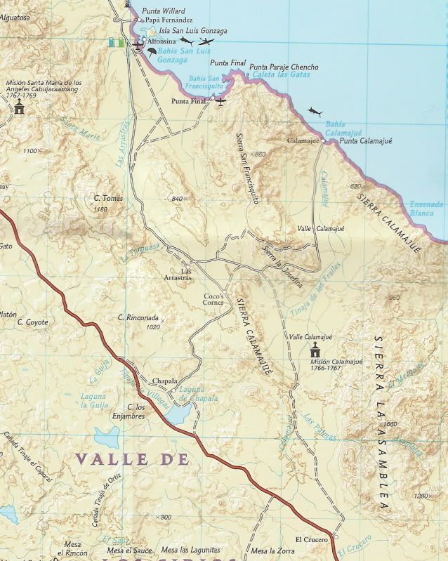
'Calamajue' as it is shown on maps (both the bay/port and the mission) over the years...


1864:


1868:


1888:


1905:


1907:


1911:


1919 (1905):


1919:


1930:


1941:


1962:


1970:


(mission site shown incorrectly, it is across the arroyo from the mill ruins)


1974:


1975:


2003:


2007:


(El Camino Real route shown)


2008:


Maps

John M - 6-23-2011 at 10:35 AM

After seeing all the maps I feel my answer was quite inadequate.

David K - 6-23-2011 at 04:32 PM

Quote:
Originally posted by John M
After seeing all the maps I feel my answer was quite inadequate.


Not in the least John! The more input on Calamajue, the better!!

As always, if I have the time or if requested, I will share all the maps I have of ANY area of Baja. If you see something you want a zoom-in of (because it isn't clear enough or otherwise), just let me know! I will do the best I can to show whatever is of interest to anyone!

Baja California is one of the most fascinating places on earth. It never ceases to amaze or interest us... and some of us have been going there for over 40 years!

BornFisher - 6-24-2011 at 07:37 AM

Great maps, I like the one from 1970.

David K - 6-24-2011 at 08:15 AM

Thanks... I have posted most of the Cliff Cross maps on Nomad. Let me know if you need a link to them!

dtbushpilot - 6-24-2011 at 08:34 AM

Quote:
Originally posted by John M
After seeing all the maps I feel my answer was quite inadequate.


After seeing all the maps I'm guessing DK isn't working on sprinklers today :lol::lol:

just kidding DK, you da "mapman"......dt

David K - 6-24-2011 at 09:15 AM

Quote:
Originally posted by dtbushpilot
Quote:
Originally posted by John M
After seeing all the maps I feel my answer was quite inadequate.


After seeing all the maps I'm guessing DK isn't working on sprinklers today :lol::lol:

just kidding DK, you da "mapman"......dt


Very perceptive! I have a job on Monday, but nothing yesterday or today... yet! esterday I had lunch with Bob H... Look to the Non-Baja trip reports forum soon...:light:

nuvag1976 - 6-27-2011 at 07:09 PM

Thanks guys
but I will not going to calamajue, :( maybe in other time, but thnaks for all.

David K - 6-28-2011 at 08:06 AM

Quote:
Originally posted by nuvag1976
Thanks guys
but I will not going to calamajue, :( maybe in other time, but thnaks for all.


De nada... just happy to help fellow Nomads. So, where you going to el Puerto de Calamajue or la Mision de Calamajue?

good reading about this area for you.....

mcfez - 6-28-2011 at 04:26 PM

http://www.ericrench.com/MEXICO/GONZAD/ROAD/COCO/index.htm

David K - 6-28-2011 at 06:12 PM

Quote:
Originally posted by mcfez
http://www.ericrench.com/MEXICO/GONZAD/ROAD/COCO/index.htm


It is such a beautiful web page...
a note, that he spells Chapala, Puertecitos, cirio trees and other places several different ways, in the same site. :?::(

mcfez - 6-28-2011 at 06:17 PM

Quote:
Originally posted by David K
Quote:
Originally posted by mcfez
http://www.ericrench.com/MEXICO/GONZAD/ROAD/COCO/index.htm


It is such a beautiful web page...
a note, that he spells Chapala, Puertecitos, cirio trees and other places several different ways, in the same site. :?::(


David...did you explore his
http://www.ericrench.com/MEXICO/baja.htm
by any chance?

Just excellent stuff.

David K - 6-28-2011 at 08:44 PM

I will check it out later, thanks Deno!

Bob H - 6-28-2011 at 10:57 PM

What is there once you get there?

mcfez - 6-29-2011 at 07:10 AM

http://forums.bajanomad.com/viewthread.php?tid=47613

calamajua.jpg - 22kB

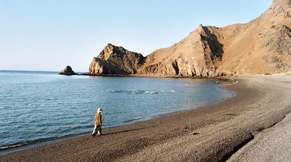
baitcast - 6-29-2011 at 07:34 AM

The question was asked whats there once you get there?:)

Igor,s boy chasing down some roosters!!


David K - 6-29-2011 at 07:51 AM

Quote:
Originally posted by Bob H
What is there once you get there?


Which Calamajue, Bob?

I see mcfez and baitcast posted photos of Puerto Calamajue...

From my Baja Missions web site (link below), here is a photo from Jack Swords of the original Calamajue (the mission site of 1766):


Across the arroyo from the mission and next to the road are the gold ore mill ruins. Here is a photo of 9 year old me (July, 1967) at the mill ruin on the edge of the cliff over-looking Arroyo Calamajue:


Whoops

mcfez - 6-29-2011 at 09:25 AM

Sorry folks ....if I got the wrong Calamajue here......

baitcast - 6-29-2011 at 10:25 AM

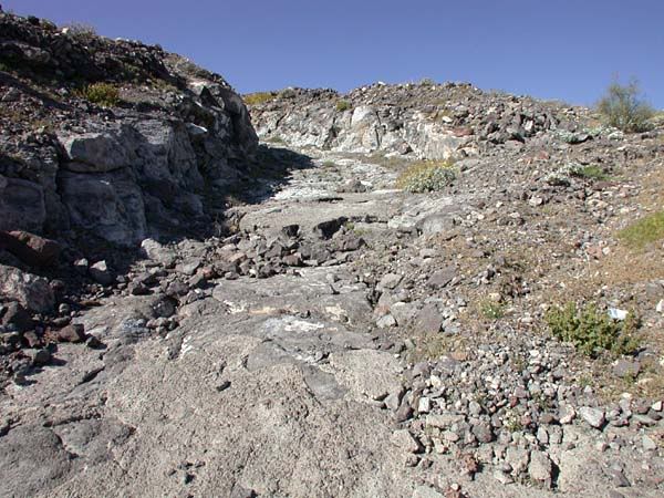
David as have told you more than once you can all the ols missions and catus I,ll take the water and fishing,I think its to funny when people write about the rough roads and how they manged to overcome it all,Qct 207:lol:this is how the same road looked in 64:lol:

and this was after it had been worked on!!
Rob

You can see the concrete they used to fill in the steps bottom center:)

[Edited on 6-29-2011 by baitcast]

David K - 6-29-2011 at 04:30 PM

Yes, the Gonzaga Grades pre-1986 were something we will remember for a lifetime! My folks and I drove over them multiple times starting in 1965. After Highway 1 was completed (the end of 1973), traffic and supplies for Gonzaga Bay started coming in from the south, via Calamajue Canyon* and the road south of Puertecitos ceased to get any maintenance and slowly deteriorated to near impassable condition. My final time over it was in November, 1979... just before the Baja 1000... I was pre-running the section I was to drive the race car over... we broke before getting there.

*In 1983, the new road from Laguna Chapala to Puerto Calamajue was built, and Gonzaga Bay traffic used it as a great short cut over Calamajue Canyon. The new Puertecitos road reached this new Chapala road in 1987, and that junction would become Coco's Corner in a few more years!

David K - 6-29-2011 at 04:33 PM

Quote:
Originally posted by mcfez
Sorry folks ....if I got the wrong Calamajue here......


Nope... the OP never said which Calamajue he wanted road info for... So we just covered all of them (Mision de Calamjue, Arroyo de Calamajue, Molina de Calamajue and Puerto de Calamajue!

Von - 6-29-2011 at 04:54 PM

MAN! wish i was in Baja right now~:rolleyes:

David K - 6-29-2011 at 07:47 PM

Quote:
Originally posted by Von
MAN! wish i was in Baja right now~:rolleyes:


Ready, set... GO!!!

Marc - 7-9-2011 at 01:48 PM

Quote:
Originally posted by mcfez
http://www.ericrench.com/MEXICO/GONZAD/ROAD/COCO/index.htm


Cool! Brings back memories.

David K - 8-20-2011 at 10:28 AM

Yup! Oct. 2007 and pavement had reached 5 miles south of Puertecitos...

In Nov. 2006, new pavement still was a mile north of Puertecitos.

4 years from 2007... and 20 miles have been added... 5 miles a year!

sancho - 8-20-2011 at 02:09 PM

Quote:
Originally posted by baitcast


Igor,s boy chasing down some roosters!!


My first glance at the photo I didn't see the commotion in
the Cortez, that's one of my favorite pastimes, walking the
Playa with spinning gear with a Krocadile. I imagine
that may be the first area going so. on the Cortez
that there is such beach fishing?