BajaNomad

smoking 3 virgenes volcano=today !!

BajaBlanca - 7-29-2011 at 10:48 AM


Bajalover - 7-29-2011 at 10:50 AM

Wow, is that for real? It looks as if Baja is about to have it's land mass increased.

GREAT PHOTO !

BajaNomad - 7-29-2011 at 10:51 AM

There was a lightning strike and a fire there a day or two ago....

Bajalover - 7-29-2011 at 10:54 AM

Now that makes sense. If the volcano would have errupted it would be all over the news. :?::lol:

BajaNomad - 7-29-2011 at 10:56 AM

Reported as a lightning strike on Sunday, with winds fanning the flames Monday.

http://www.oem.com.mx/elsudcaliforniano/notas/n2162531.htm

David K - 7-29-2011 at 02:02 PM

Quote:
Originally posted by BajaNomad
Reported as a lightning strike on Sunday, with winds fanning the flames Monday.

http://www.oem.com.mx/elsudcaliforniano/notas/n2162531.htm


Thanks Doug... Here's a translation:

Santa Rosalía, B.C.S. - A lightning bolt which fell during the rain of the last Sunday in the Sierra de San Francisco, just near the crater of the popular volcano Tres Virgines, caused a large fire in the Bush, to such an extent that its smoke confused many motorists who came to think it was a black smoker caused by volcanic activity.


They told us it was a thunderbolt that struck during the rain on Sunday and stoked during the Monday with strong currents of the wind on the heights of more than 2 thousand meters above sea level are the peaks of the majestic natural formation of the municipality of Mulegé.


The truth is that it was a great spectacle that enjoyed some motorists who were in the area during this holiday period, and of course that also played you observe all the Entourage that accompanied on his tour of this municipality to the State Governor, Marcos Alberto Covarrubias, where he was accompanied by Mayor William Santillán Meza, and the ladies María Helena Hernández de Covarrubias and Arely Santillán Camarena.

==========================================

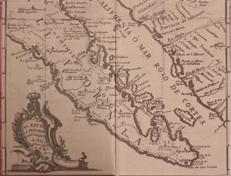
The last eruption was recorded by the Jesuits in 1746, and it was even mentioned on their 1757 map:


[Edited on 7-29-2011 by David K]

baitcast - 7-29-2011 at 02:30 PM

1964 on the way home from our first trip to Gonzaga Bay found I and the family abreast Isla Encantada or Lobos when my daughter let out a yell " Dad look at that Island smoking" sure enough white steamy looking smoke pouring out of the top,I really don,t know which one it was but I do remember floor boarding it:o

No brush to burn,no lighting that day,the road thru there is flat and fast to Huerfanito,we were flying:lol:

Never did hear anything about it,on my next trip I asked everyone about it but nothing:?:

Just another fun day on the gulf.
Rob

David K - 7-29-2011 at 03:06 PM

National Geographic did a blip on Isla San Luis (the largest of the Enchanted Islands... with a crater half in the gulf)... said it could erupt any time (not dead)!

Off Internet, note last sentence:

David K - 7-29-2011 at 03:12 PM

ISLA SAN LUIS VOLCANO, BAJA CALIFORNIA, MEXICO - LATE HOLOCENE ERUPTIONS

HAUSBACK, Brian P., Geology, CSUS, Sacramento, CA 95819, hausback@csus.edu, COOK, Andrea, Global Change Research Group, San Diego State Univ, San Diego, CA 92182, FARRAR, Chris D., USGS, Carnelian Bay, CA 96140, GIAMBASTIANI, Mark, Univ of California, Davis, CA, MARTIN, Arturo, CICESE, PO Box 434843, San Diego, CA 92143-4843, PAZ MORENO, Francisco, Universidad de Sonora, Hermosillo, Mexico, STOCK, Joann M., Seismological Laboratory, California Institute of Technology, M/C 252-21, 1200 East California Blvd, Pasadena, CA 91125, and DMOCHOWSKI, Jane Ellen, Geological and Planetary Sciences, California Institute of Technology, Mail Code 252-21, Pasadena, CA 90025

The Holocene island volcano of Isla San Luis (ISL) lies in the northern Gulf of California, only 5 km from the Baja California coast. Volcanism there is highly differentiated for a small eruptive center (3.5 by 2.5 km) and the compositional variation has been surprisingly regular, ranging from early basaltic andesite to the latest eruptions of rhyolite. Eruptions have varied from mildly effusive to powerfully explosive hydrovolcanic events.

Seven marine mollusk shells were analyzed by 14C acceleration methods to date beach deposits at three stratigraphic levels interbedded with the volcanic layers on ISL. Three shells were dated in beach sands directly below the youngest of the pyroclastic deposits on the island: coarse, rhyolitic breadcrust-bomb-containing tephras associated with the early eruptive stages of the growth of the central rhyolite domes. These shells yield a maximum age of 2888 to 3289 years before present for the latest rhyolite eruptions. Additionally, three mollusks were dated in beach deposits below the intermediate lavas exposed along the NW beach cliffs. These give a maximum age of 3036 to 3289 ybp for the intermediate lavas. One shell was dated at 4469-4725 ybp from the oldest palagonitic pyroclastic deposits exposed near sea level.

We attempted to use obsidian hydration analysis to date the youngest, coarse, rhyolitic breadcrust-bomb-containing tephras associated with the early eruptive stages of the growth of the central rhyolite domes. Hydration rinds of 3.6 and 3.7 microns thickness were measured for two separate bombs (averages of 5 measurements each). The hydration rate for this obsidian has not been established, however, a typical hydration rate of 82.74 (microns)2.06 yields an age of 1225 years for this tephra.

The beach sands dated at 2888 to 3289 ybp lie approximately 21m above sea level. The elevated deposits indicate an average uplift rate of 6.38 to 7.27 mm/yr, if sea level remained unchanged since deposition. This is the highest uplift rate along the Gulf of California and appears to be localized at ISL, probably the result of inflation due to upper crustal magmatic intrusion.

These dates indicate that volcanism on ISL began at least 4725 ybp and continued to perhaps 1200 ybp. These recent deposits and mildly active fumarolic activity suggest that this volcano remains potentially active.

baitcast - 7-29-2011 at 03:14 PM

Right next door that figures,we were the only rig on the road but then the traffic in those days was a little lighter:lol:
Rob

Isla San Luis

David K - 7-29-2011 at 03:17 PM


Maybe it was one of the others?

baitcast - 7-29-2011 at 03:33 PM

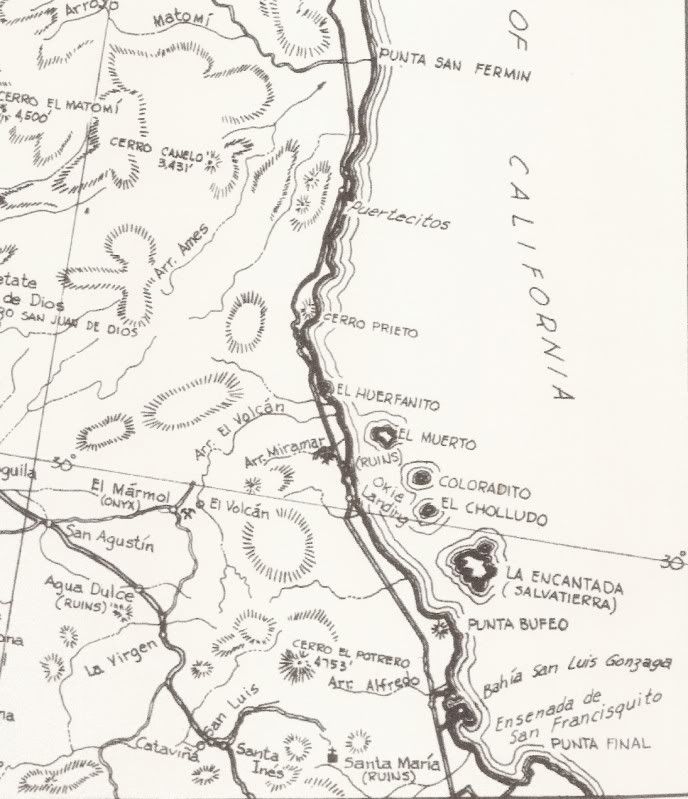
After looking at your pic and my map it had to be Encantada,check it David

baitcast - 7-29-2011 at 03:43 PM

Uplift rate of 6 to 7mm/year and the highest uplift rate along the Gulf of Calif:o..........Luv that picture,good job.
Rob

rts551 - 7-29-2011 at 04:11 PM

Quote:
Originally posted by David K
National Geographic did a blip on Isla San Luis (the largest of the Enchanted Islands... with a crater half in the gulf)... said it could erupt any time (not dead)!


I think the article says "this volcano remains potentially active."

David K - 7-29-2011 at 04:18 PM

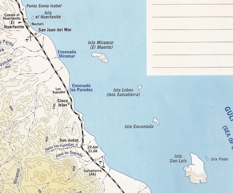
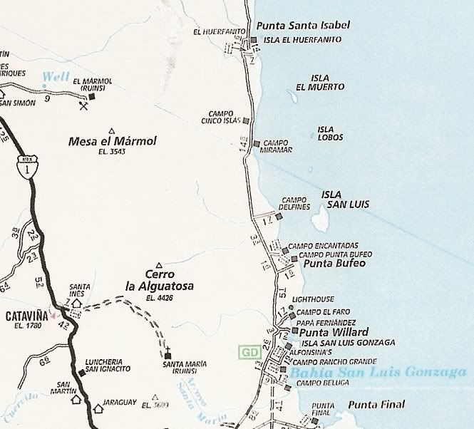
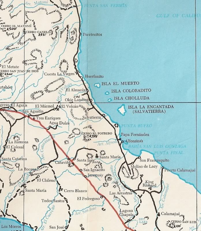
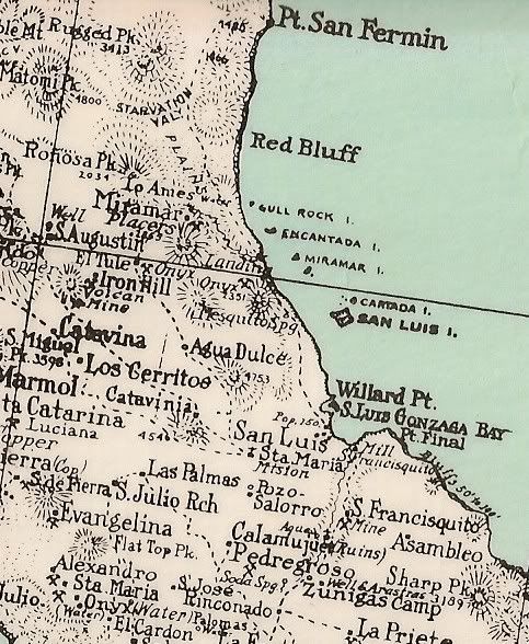
You know, these islands all have interchangable names, right? Except for El Huerfanito... the others are called by different names on different maps!

Here is a photo of San Luis, but the San Diego Natural History Museum says it is Isla Encantada:
Link to their photo: http://www.sdnhm.org/exhibits/desertandsea/images/encantada....


David K - 7-29-2011 at 04:20 PM

Quote:
Originally posted by rts551
Quote:
Originally posted by David K
National Geographic did a blip on Isla San Luis (the largest of the Enchanted Islands... with a crater half in the gulf)... said it could erupt any time (not dead)!


I think the article says "this volcano remains potentially active."


Right! "Potentially active" means it could erupt at any time and is not dead, so thanks for verifying my recollection!

baitcast - 7-29-2011 at 04:27 PM

OK OK lets just say the first island north of San Luis I think:lol: All those maps thats crazy.:?:

But keep in mind it was nearly 50 years,one thing for sure it looked angry and we didn,t wait for a second look.

[Edited on 7-29-2011 by baitcast]

David K - 7-29-2011 at 05:11 PM

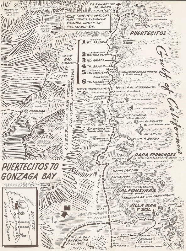
I was just thinking if you are calling the smoking island 'Encantada' beacause that is what Howard Gulick's map calls the big one (San Luis)... and all of us in the 1960's traveled Baja with Gerhard & Gulick's LOWER CALIFORNIA GUIDEBOOK ???

nomad 018.jpg - 48kB

BajaBlanca - 7-29-2011 at 06:59 PM

it IS a cool picture but I cannot take credit

1. I am in la bocana and haven't left town

2. a friend posted the pic on facebook

it does look like it is actively spewing smoke but we are very lucky it is NOT

:o