BajaNomad

South of San Felipe roads

Phil S - 11-1-2011 at 06:33 AM

Years ago when we drove this hwy 5, I remember one section that was pretty steep & the rocks were like razor sharp. Has this section been paved yet, or it is still pretty hazardous to the tires. Where is this section? I can't remember what part of the trip it was located.

David K - 11-1-2011 at 02:11 PM

Quote:
Originally posted by Phil S
Years ago when we drove this hwy 5, I remember one section that was pretty steep & the rocks were like razor sharp. Has this section been paved yet, or it is still pretty hazardous to the tires. Where is this section? I can't remember what part of the trip it was located.


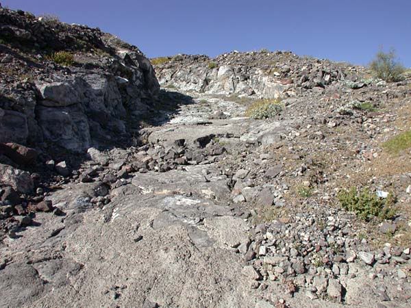
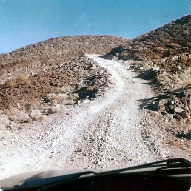
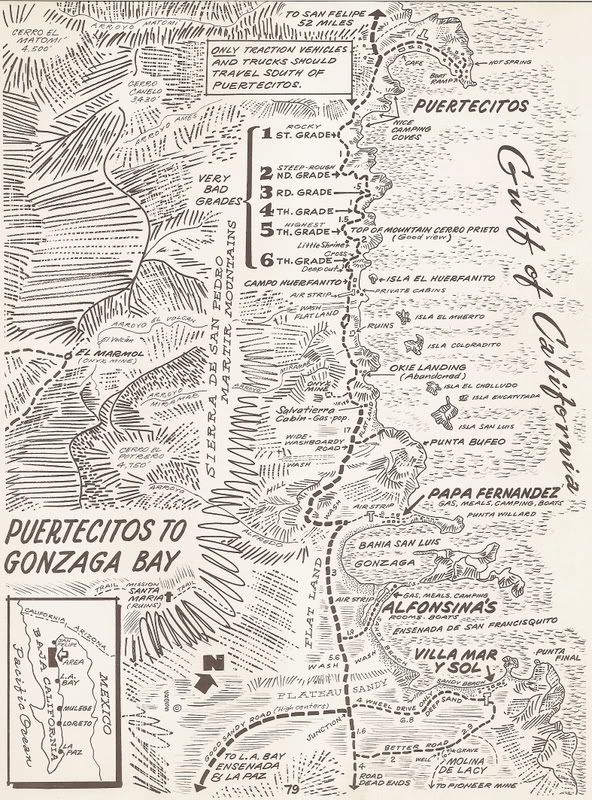
YES, a thing of the past (sadly to some of us)... This was the 20 miles between Puertecitos and El Huerfanito... and really the entire run to Gonzaga Bay (45 miles) was no joy ride.

We called it 'The Gonzaga Grades'... others called it the 'Sisters' named for each of the steep low range grades.


Baitcast's photo of one of the grades, near the top:


The original road built in the late 1950's had become nearly impassable after 1973 when the new Baja Highway allowed a shorter to pavement route for Gonzaga supplies to use (coming up from Calamajue Canyon way until the new road to Puerto Calamajue from Laguna Chapala was finished about 1983, and traffic used it to (today's) Coco's Corner, to get to Gonzaga.

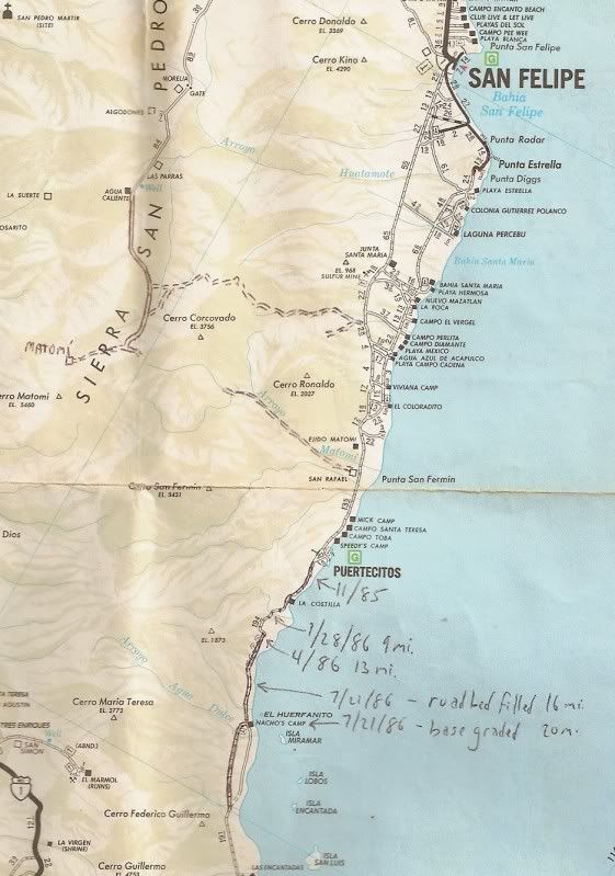
The newer graded road was built in 1986 between Puertecitos and (today's) Coco's Corner... making passenger cars finally able to safely drive south from Puertecitos. But, 2005 was the last year it was graded and it too became too rough for a lot of traffic soon after.

Here is my last trip over it (July, 2011): http://forums.bajanomad.com/viewthread.php?tid=53987

David K - 11-1-2011 at 02:20 PM

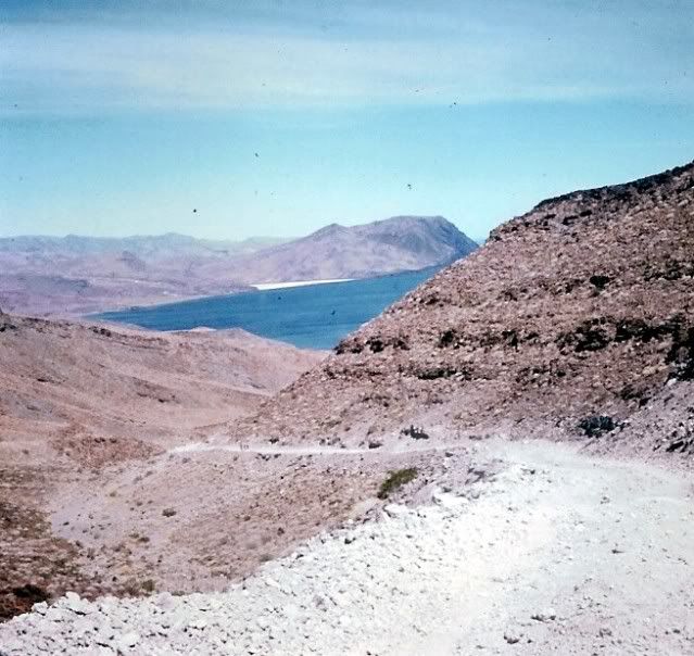
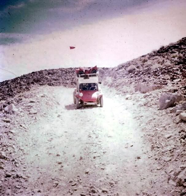
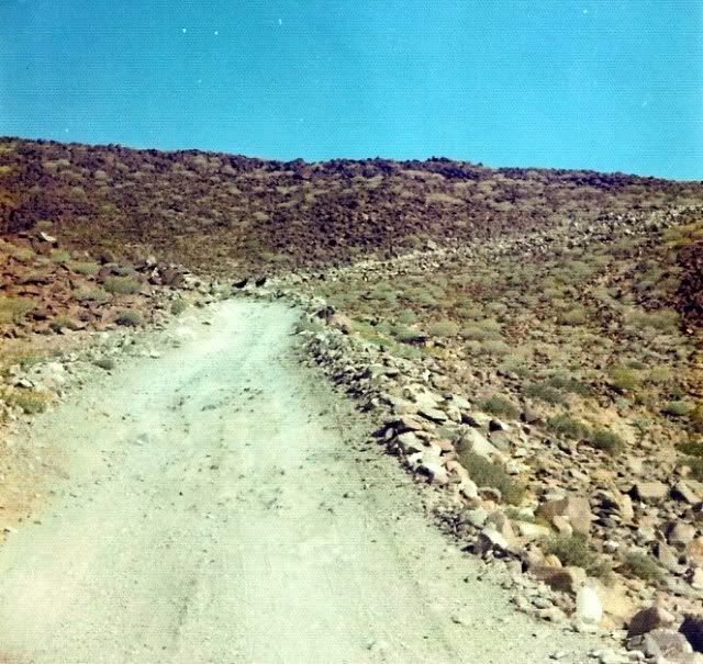
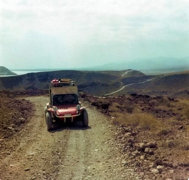
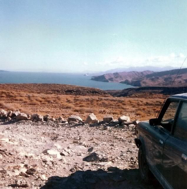
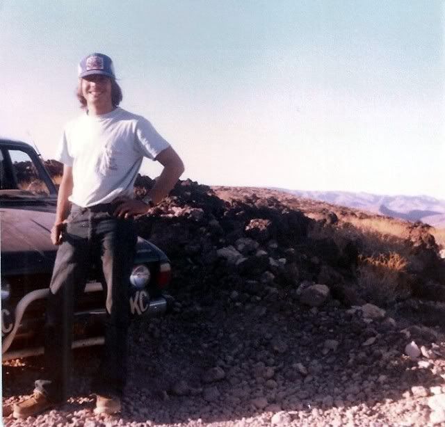
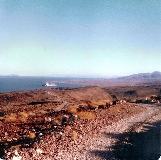
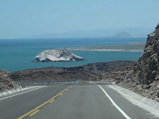
Here are my photos of the original road south of Puertecitos I took between 1974 and 1979:


Me, 22 years old, pushing my 4WD Subaru to the limits!


This is all 110 kph paved super highway now, past El Huerfanito Island!


[Edited on 11-1-2011 by David K]

David K - 11-1-2011 at 02:24 PM

Nice post by BryanMcKenzie on the new paved vs. 1993 older road: http://forums.bajanomad.com/viewthread.php?tid=49421

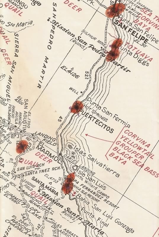
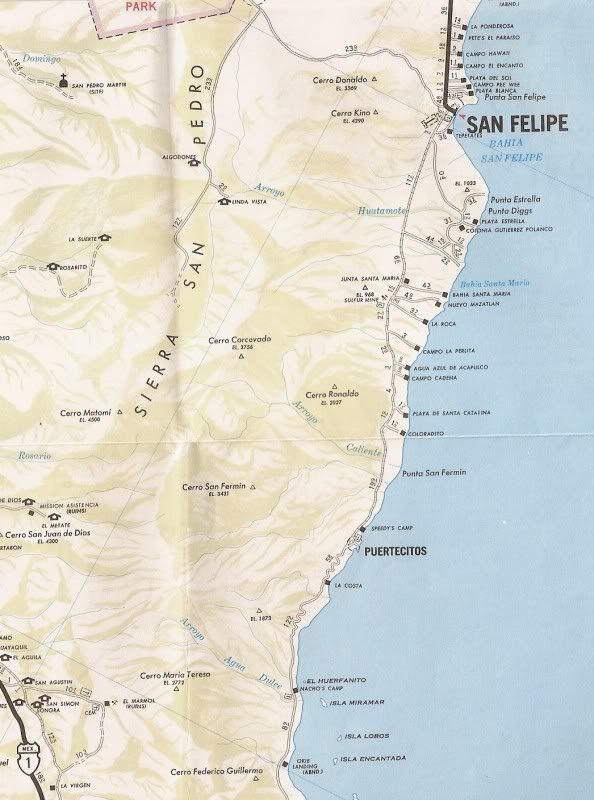
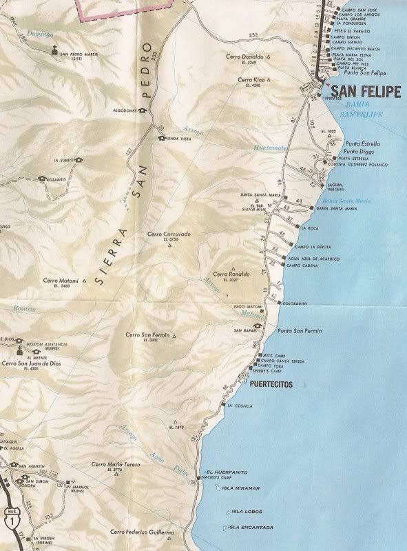
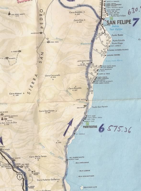
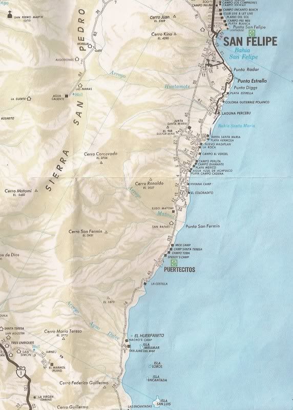
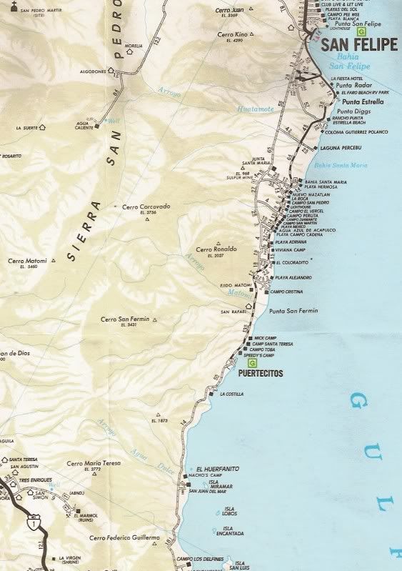
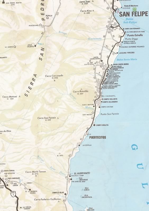
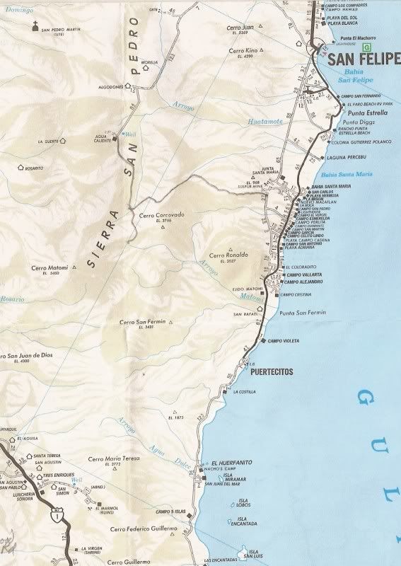
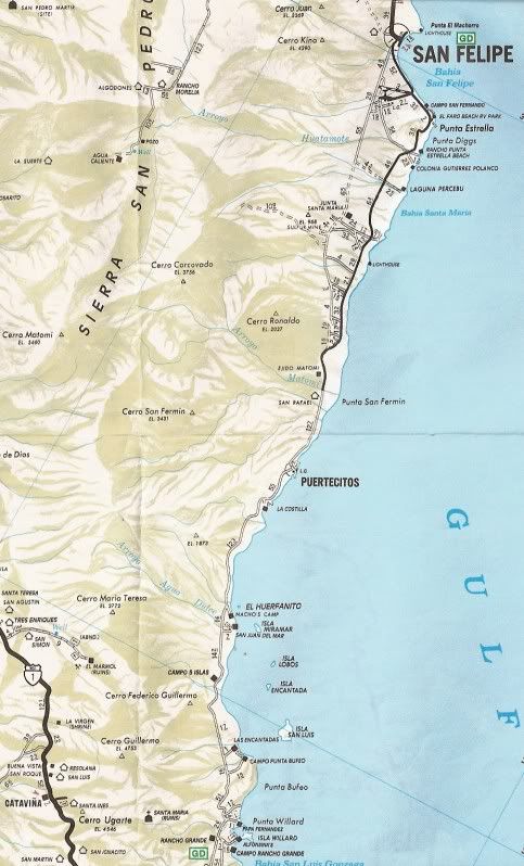
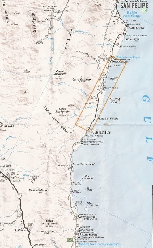
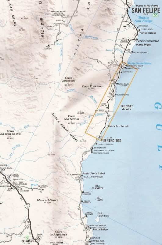
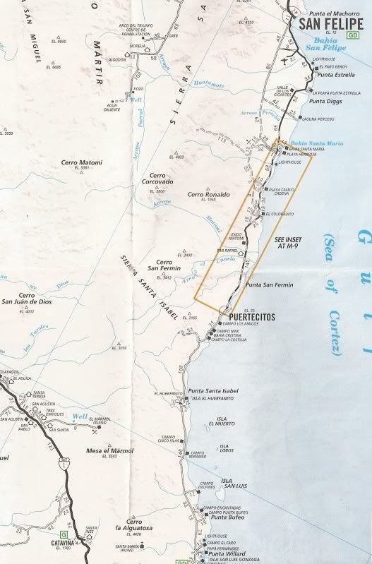
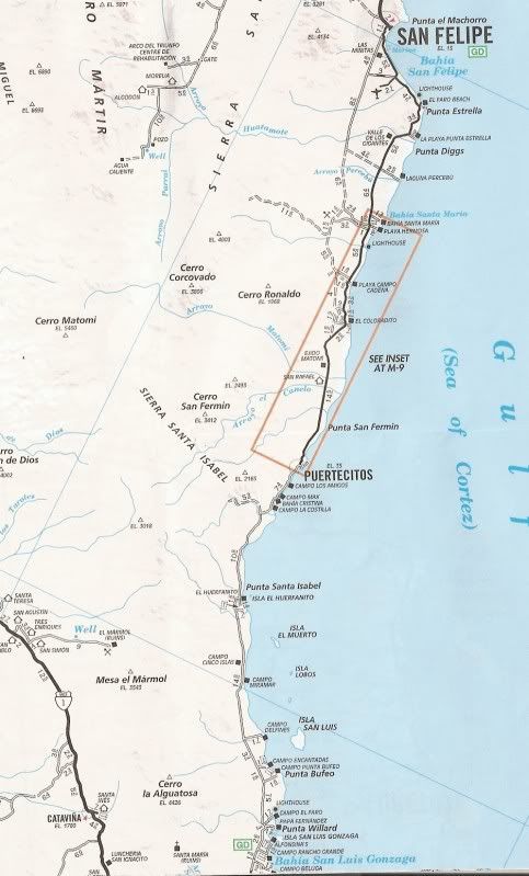
1963-2007 AAA Maps San Felipe South:

David K - 11-1-2011 at 02:27 PM

1963 (the marks added are places we spent the night, in the 1960's):


-------------------------------------------------------------------------------------
1975:


-----------------------------------------------------------------------------------------
1978:


------------------------------------------------------------------------------------------
1980 (markings show the 1981 Baja 1000 and pit stops):


-----------------------------------------------------------------------------------------
1987 (markings show the progress of the new graded road from Puertecitos south) Pavement now heading south from San Felipe on new roadbed reaching Punta Estrella/ Punta Diggs area. (Also, roads to Valle Chico/ Matomi added in by me):


--------------------------------------------------------------------------------------
1989 Pavement reaches Laguna Percebu, but wrong road paved on map:


------------------------------------------------------------------------------------------
1990 Pavement to Laguna Percebu road corrected:


------------------------------------------------------------------------------------
1996 Pavement reaches Puertecitos:


--------------------------------------------------------------------------------------
1997 (I lined in roads to Valle Chico/ Matomi):


---------------------------------------------------------------------------------------
2000 Pavement vanished last 10 miles to Puertecitos:


--------------------------------------------------------------------------------------
2001 Pavement mostly gone 30 miles north of Puertecitos:


---------------------------------------------------------------------------------------
2003:


----------------------------------------------------------------------------------------
2004:


---------------------------------------------------------------------------------------
2007 New Pavement again to Puertecitos:


Barry A. - 11-1-2011 at 02:35 PM

The first time we "tried" that route was in 1958, I believe. My buddies and I were in a WWII Army ambulance 4x4 powered by a 6 cyl engine and 4 speed tranny. I was driving, and certainly glad I was as the other 5 guys were banged around inside that Ambulance really good-------:lol:

We could not make it over the Grade 3 (or maybe 2---not sure) as it was just too steep and was scaring the hell out of our passengers, and they were too stewed to walk, tho they tried, to everybodies amusement---------we ended up backing down a long, long way and camping on a tiny cove for a week at the bottom of grade 2 (or 3 ?). One of the otherguys in our group (NOMAD "Vince") was driving his jeep, and he made it over the grades and back to our camp just fine. Another jeep that was sorta associated with our group attempted grade 3 and rolled his jeep over, bashing it up good, and injuring himself pretty badly. We all got the jeep righted, and they limped back to San Felipe, as I remember----we stayed at the cove and dove and played. Those were wild and wooley days!!! I was about 20.

Barry

David K - 11-1-2011 at 02:38 PM

Awesome... remember all the crosses along the edge marking where motorists had died? Brake failure perhaps or taking a run to climb the grade in a 2WD and bouncing off the edge?

Barry A. - 11-1-2011 at 02:44 PM

OMG yes------------and it was more fun than I can ever describe!!! We went all the way to Gonzaga in the early '60's, just 2 of us in a VW bus loaded to the gills with our "stuff"------I NEVER thought we would make it up some of these really bad places, but it just kept chugging like the old busses did, and we made it all the way down for a weeks stay. There were no real roads over to the bay at Gonzaga south of Alfonsina's back then, but we tried to get over anyway, ending up being stuck in the sand dunes for 2 days until we dug our way out. Went back to an unnamed bay along the coast near the "sisters grades" and camped out for the rest of the trip--------the old VW buses were incredible!!!

Barry

bonanza bucko - 11-1-2011 at 02:48 PM

We need to re erect the cross made of old boards with the hat on it and inscribed "RIP Ray Grove" that was at the edge of the cliff on the last of the Tres Marias...right above where he went over the side one bad night in 1973 (I'm told..before my time) The cliff is still there and it's an identifiable place despite the new road. I'm sure Ray would like it. Somebody maintained that memorial from 1973 until 2010...wonder who.

BB

Barry A. - 11-1-2011 at 03:29 PM

I think I remember that sign, Bucko--------there were a lot of crosses and shrines, like David K says, and a big shrine at the top of, I think grade #2 of the 3 main grades that we knew of then (cliff cross has id'ed more, I see).

Another story---------in the mid-70's we had made it all the way down to Gonzaga in my old '69 Ford pickup, 2-wheel drive with 4 speed tranny with huge tires, and a very small camper on the back. No problems, and we were jubilant and a little c-cky. On the way back north just north of Huerfanita Island on the very first grade going north, I broke all motor mounts (2) on a particularly steep rough rocky patch, the tranny shift-column suddenly came over and hammered my right thigh, almost breaking it. We opened up the hood and the engine was at a crazy angle. Took us about 3 hours to straighten up the engine, and then to chain the engine to the frame so that it would not fully tip over, and then we inched our way up the rest of the grades and limped back to El Centro in the USA. After that experience, I put in after-market semi-SOLID motor mounts and no more problems. My son still owns that truck, it is running strong in Owens Valley, and still uses the same motor mounts, and all. Ford built them tough back then, but we did have a few problems. That pickup has a 4-speed tranny out of a ton and a half dump truck I bought in a junkyard in Sacramento, and had it shipped home via YELLOW FREIGHT trucking, and installed in my truck. :lol:

Barry

OK, that's it for stories of that grade from me------all the rest of the "crossings" were relatively incident free.

Barry

David K - 11-1-2011 at 05:13 PM

Quote:
Originally posted by Barry A.
I think I remember that sign, Bucko--------there were a lot of crosses and shrines, like David K says, and a big shrine at the top of, I think grade #2 of the 3 main grades that we knew of then (cliff cross has id'ed more, I see).

Another story---------in the mid-70's we had made it all the way down to Gonzaga in my old '69 Ford pickup, 2-wheel drive with 4 speed tranny with huge tires, and a very small camper on the back. No problems, and we were jubilant and a little c-cky. On the way back north just north of Huerfanita Island on the very first grade going north, I broke all motor mounts (2) on a particularly steep rough rocky patch, the tranny shift-column suddenly came over and hammered my right thigh, almost breaking it. We opened up the hood and the engine was at a crazy angle. Took us about 3 hours to straighten up the engine, and then to chain the engine to the frame so that it would not fully tip over, and then we inched our way up the rest of the grades and limped back to El Centro in the USA. After that experience, I put in after-market semi-SOLID motor mounts and no more problems. My son still owns that truck, it is running strong in Owens Valley, and still uses the same motor mounts, and all. Ford built them tough back then, but we did have a few problems. That pickup has a 4-speed tranny out of a ton and a half dump truck I bought in a junkyard in Sacramento, and had it shipped home via YELLOW FREIGHT trucking, and installed in my truck. :lol:

Barry

OK, that's it for stories of that grade from me------all the rest of the "crossings" were relatively incident free.

Barry

EPIC!

Baja made off roading pioneers of us all!

Ateo - 11-1-2011 at 05:49 PM

David K:,epic photos. Great maps, great history and crazy road. Thanks.

Phil S - 11-1-2011 at 07:39 PM

David. Great pic's. Thanks. Brings back scary memories going up & coming down those hills.

David K - 11-2-2011 at 09:20 AM

De nada amigos!

The memories and old maps are my treasures and I am happy to share my wealth with all of you! Viva Baja!

Bob H - 11-2-2011 at 09:46 AM

Quote:
Originally posted by bonanza bucko
We need to re erect the cross made of old boards with the hat on it and inscribed "RIP Ray Grove" that was at the edge of the cliff on the last of the Tres Marias...right above where he went over the side one bad night in 1973 (I'm told..before my time) The cliff is still there and it's an identifiable place despite the new road. I'm sure Ray would like it. Somebody maintained that memorial from 1973 until 2010...wonder who.

BB


Bucko, you posted a story years ago about this grade. You mentioned in that story that a Jack Daniels bottle was found at the bottom, over the edge. Is this the same incident you referred to?

Bob H - 11-2-2011 at 09:48 AM

David, outstanding historical photos of this area of Baja. Loved it.
Bob H

David K - 11-2-2011 at 05:53 PM

Glad you liked it Bob... Why I often post photos again, is because they were missed the previous times, or for new Nomads!

Bob H - 11-2-2011 at 08:47 PM

Quote:
Originally posted by David K
Glad you liked it Bob... Why I often post photos again, is because they were missed the previous times, or for new Nomads!


You never need excuses David... just keep'm coming. Great stuff, all different every time! Love it.

I owe you Lunch! Bob H

David K - 11-3-2011 at 08:05 AM

Quote:
Originally posted by Bob H
Quote:
Originally posted by David K
Glad you liked it Bob... Why I often post photos again, is because they were missed the previous times, or for new Nomads!


You never need excuses David... just keep'm coming. Great stuff, all different every time! Love it.

I owe you Lunch! Bob H


Great, I will try and be hungry!:light::lol:

April 1974

David K - 11-3-2011 at 08:12 AM

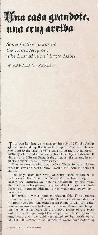
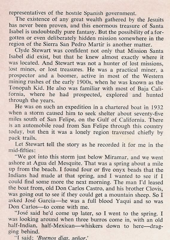
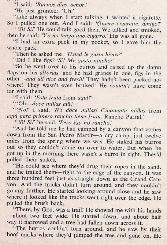
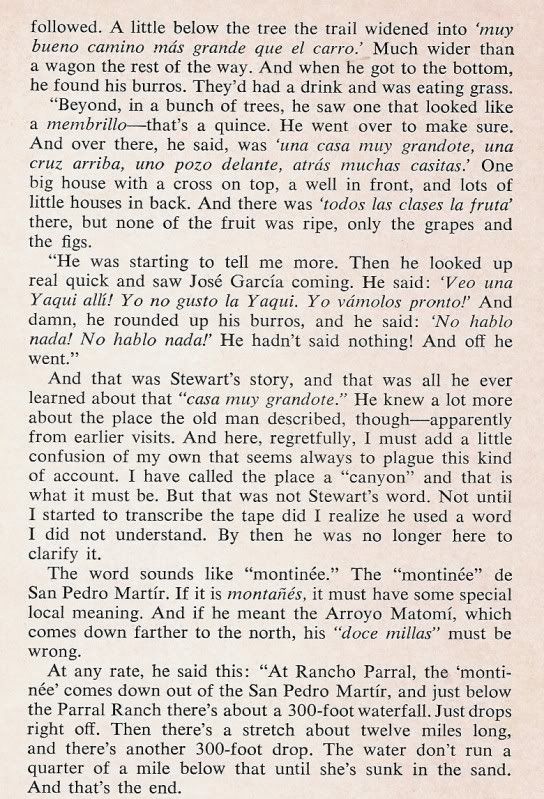
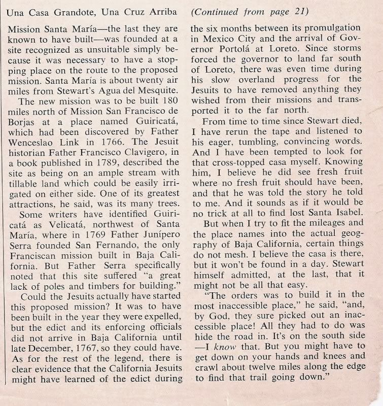
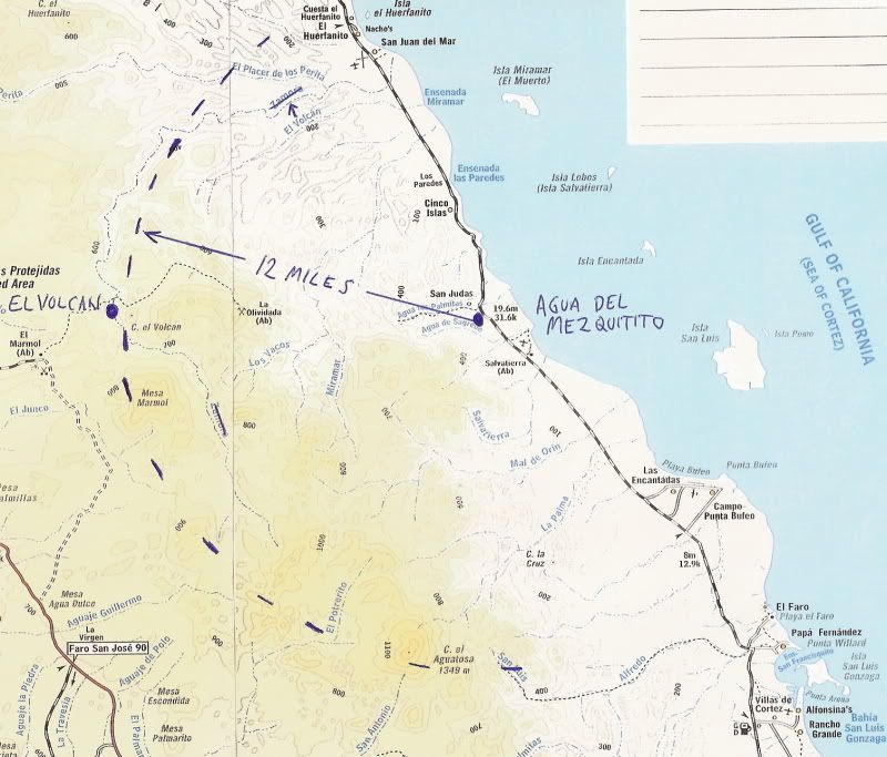
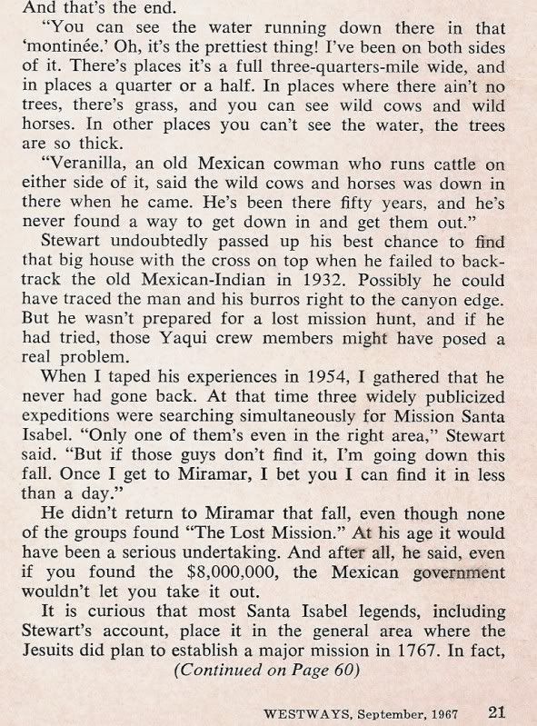
Here is a photo my friend took of me at Agua de Mezquitito spring on my first Mexico trip without parents, we were both 16 and traveled in my dune buggy (seen in the photos above). This spring is just a half mile off the road, between El Huerfanito and Gonzaga Bay. A lost Mission Santa Isabel story is based on an encounter at this spring.


I revisted this spring in 2002, and someone used a lot of tires to build a corral around it.

HERE is that story:


[Edited on 11-3-2011 by David K]

Barry A. - 11-3-2011 at 09:09 AM

Excellent!!!

David, you say referring to the pic of you as a boy,

"This spring is just a half mile off the road, between El Huerfanito and Gonzaga Bay."

Could you be a little more specific?? I don't see that spring on any of the maps above.

barry

David K - 11-3-2011 at 09:15 AM

Quote:
Originally posted by Barry A.
Excellent!!!

David, you say referring to the pic of you as a boy,

"This spring is just a half mile off the road, between El Huerfanito and Gonzaga Bay."

Could you be a little more specific?? I don't see that spring on any of the maps above.

barry


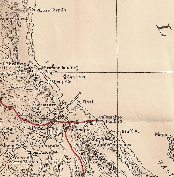
I read about it first in the Lower California Guidebook, then first saw it on our 1967 trip driving north from L.A. Bay. Lots of quail in there! The next time was in 1974 (photo of me at 16), and the last time was in 2002.

Here is its location on the Almanac map, with the 12 mile radius drawn in from the lost mission story, above:


GPS (NAD27 Mexico): Agua del Mezquitito water hole: 29º59.16'/ 114º34.12'


[Edited on 11-3-2011 by David K]

Barry A. - 11-3-2011 at 09:34 AM

Thanks, David. I have marked my maps and my "Almanac". Barry
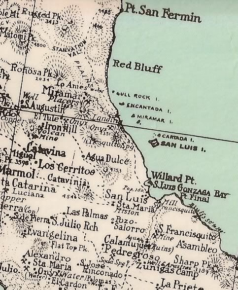
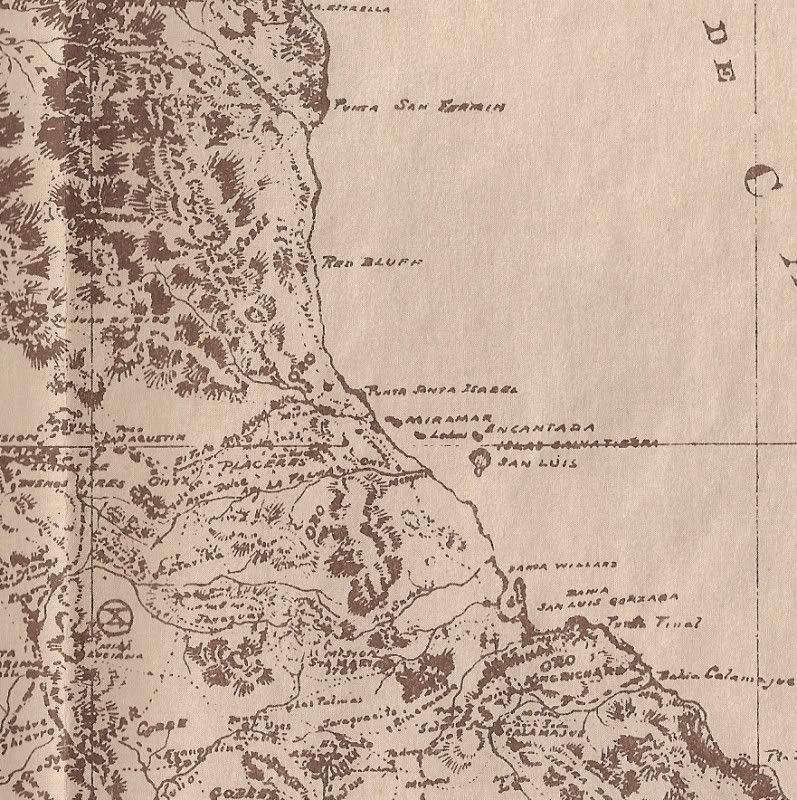
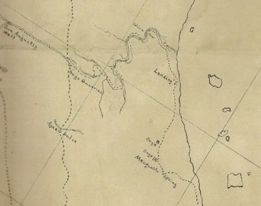
Mezquitito shown on maps:

David K - 11-3-2011 at 09:40 AM

1930 Map with spring shown:


1919 Map (hard to see, but it's there):


1905 expedition map (pub. 1919):


1905 Mine Map:

TMW - 11-3-2011 at 10:28 AM

I thought Elbeau was coming out this fall to explore the arroyos from the Sea of Cortez toward El Marmol looking for the Lost Mission. The spring would be a good starting point.

David K - 11-3-2011 at 12:26 PM

Quote:
Originally posted by TW
I thought Elbeau was coming out this fall to explore the arroyos from the Sea of Cortez toward El Marmol looking for the Lost Mission. The spring would be a good starting point.


We already did that... last April/May... wait, you were there! :light:

I have had a couple of emails with elbeau recently... He is going to come up with new stuff to further his research into looking for ancient sites in Baja. The Lost Santa Isabel story happened to fit when he saw those weird rocks we hiked to.
David K - 12-24-2011 at 05:29 PM

Bump (for fun)

edm1 - 12-26-2011 at 08:18 PM

"22 year old David Kier . . ."

That's one handsome son of a gun :-)


Anyway, i feel so lucky that i was able to traverse, in my 4x4 motorhome, the "old" grades in 2007 before they're paved.

[Edited on 12-27-2011 by edm1]

[Edited on 12-27-2011 by edm1]

bryanmckenzie - 12-29-2011 at 12:57 PM

Thanks, Dave.

Quote:
Originally posted by David K
Nice post by BryanMcKenzie on the new paved vs. 1993 older road: http://forums.bajanomad.com/viewthread.php?tid=49421

Latest Google Earth Aerial Photos = August 2009

bryanmckenzie - 12-29-2011 at 01:06 PM

GoogleEarth has posted new aerial/satellite imagery of this section of Baja. It is dated August 2009. Clearly visible is road construction (equipment, pavement, rough grading) of the new super-duper highway south of Puertecitos through the rough mountainous section.

[Edited on 2011-12-29 by bryanmckenzie]