BajaNomad

BOLA to San Franciscito

Sweetwater - 12-14-2011 at 03:41 PM

Are there any reports on the "road" south out of Bay of LA thru San Rafael to San Franciscito?

And then out to El Arco and Highway 1.

I rode this last February on a 650cc moto but we did not take the road to San Rafael. Instead, we stayed inland and encountered quite a bit of sand. I would love to hear if the alternative is a better route....has anyone been there in the last few months?

And how are the non-paved roads doing with the last set of storms.

Thanks in advance..............

David K - 12-14-2011 at 04:01 PM

See posts from 'bajaboy' who recently went to San Rafael and on out to Hwy. 1.

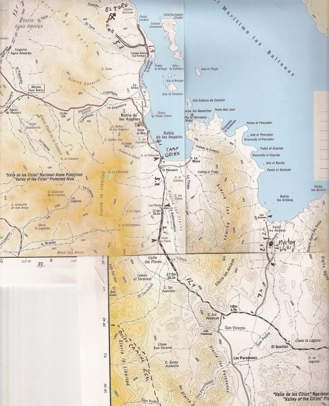
By the sandy inland route, you are speaking of the old road via Valle la Bocana through the giant cardon forests? Well, the newer road is a graded super highway in comparrison...

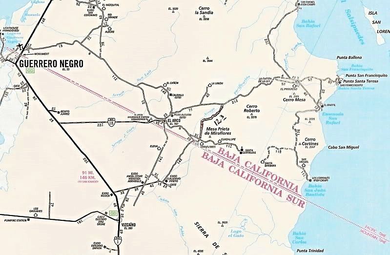
The 1989 AAA map actually shows both roads:


Topo with notes:


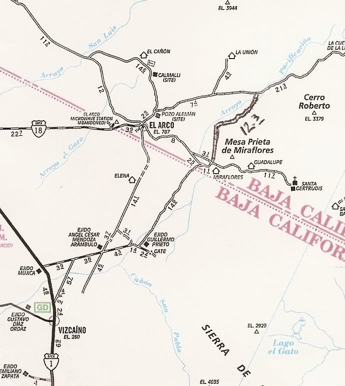
If you are heading on to Hwy. 1:


[Edited on 12-14-2011 by David K]

Sweetwater - 12-14-2011 at 05:51 PM

Thanks. Nice set of maps....wish I had my gpx trax that would confirm our moto route. I went through my photos and just can not find evidence that we made it to the coast prior to arriving at San Franciscito.

The road out through El Arco seemed to be in much better condition....I think I read that next year's Baja Mil will run Ensinada to La Paz again....really rough on those roads...

Bajaboy - 12-14-2011 at 06:33 PM

Drove the road three weeks ago. Road to PSR is rough....probably the worst I've seen it in many years. The road south to El Arco is in decent shape. From El Arco to the highway, the road is in great shape....we cruised it. Have fun.

zac

David K - 12-14-2011 at 07:00 PM

Quote:
Originally posted by Sweetwater
Thanks. Nice set of maps....wish I had my gpx trax that would confirm our moto route. I went through my photos and just can not find evidence that we made it to the coast prior to arriving at San Franciscito.

The road out through El Arco seemed to be in much better condition....I think I read that next year's Baja Mil will run Ensinada to La Paz again....really rough on those roads...


The graded road doesn't actually touch the coast at San Rafael, you need to take the short side road to the dunes on the north end or to Pancho's camp on the south end of the beach. The old road is a VERY ROUGH and seldom used track... mostly motorcycles use it beyond La Bocana ranch road (San Pedro on the maps). Lots of big cardon cactus... The graded road is totally different... You are on one or the other, no other choice.

David K - 12-14-2011 at 07:06 PM

Quote:
Originally posted by Bajaboy
Drove the road three weeks ago. Road to PSR is rough....probably the worst I've seen it in many years. The road south to El Arco is in decent shape. From El Arco to the highway, the road is in great shape....we cruised it. Have fun.

zac


Zac, are they using the old highway roadbed (Mex. 18) or the parallel sandy lanes alongside the deteriorated highway (1974+)?

In the 1980's it was pretty torn up from never having been repaved after the first thin asphalt broke apart. By 2000, the new road to Guillermo Prieto that passes closer to Santa Gertrudis was a much better road to Highway One.

[Edited on 5-5-2012 by David K]

Bajaboy - 12-14-2011 at 07:20 PM

They are using the old road. I drove that road once in 97 and swore I would never drive it again. We missed the turn south before El Arco and thus proceeded ahead. We averaged 40+ on the smooth road....very nice surprise for sure.

Quote:
Originally posted by David K
Quote:
Originally posted by Bajaboy
Drove the road three weeks ago. Road to PSR is rough....probably the worst I've seen it in many years. The road south to El Arco is in decent shape. From El Arco to the highway, the road is in great shape....we cruised it. Have fun.

zac


Zac, are they using the old highway roadbed (Mex. 19) or the parallel sandy lanes alongside the deteriorated highway (1974+)?

In the 1980's it was pretty torn up from never having been repaved after the first thin asphalt broke apart. By 2000, the new road to Guillermo Prieto that passes closer to Santa Gertrudis was a much better road to Highway One.

Skipjack Joe - 12-14-2011 at 07:58 PM

It's my understanding that an international consortium has bought out the mining rights to El Arco. The good road is likely the start of things to come. It's been like that for 2 years now.

Sweetwater - 12-14-2011 at 08:31 PM

Quote:
Originally posted by Bajaboy
Drove the road three weeks ago. Road to PSR is rough....probably the worst I've seen it in many years. The road south to El Arco is in decent shape. From El Arco to the highway, the road is in great shape....we cruised it. Have fun.

zac


Thanks zac. I did find your Tgiving trip post....enjoy those kids...mine have grown up and gone out into the world. I do have some Wind River Range packpacking memories...but those are pre-digital pics.

motoged - 12-15-2011 at 01:27 AM

Quote:
Originally posted by Sweetwater
..... we stayed inland and encountered quite a bit of sand.....


That sounds like we motoheads called the Green Door Trail....not a lot of fun on a 650, huh?!

I hate deep sand :biggrin:

http://www.advrider.com/forums/showthread.php?t=666961


Skipjack Joe - 12-15-2011 at 03:21 AM

Owww!

I had to read the story and see the stitches to figure out where the break had occured. Now it seems obvious.

It's a good thing that you broke it towards the end of your journey.

P.S. The important thing is you got lots of ubication.

[Edited on 12-15-2011 by Skipjack Joe]

Sweetwater - 12-15-2011 at 09:34 AM

After further review..........I don't think it's a great idea to take the bigger bikes into this terrain......deep sand sux fore shore.......

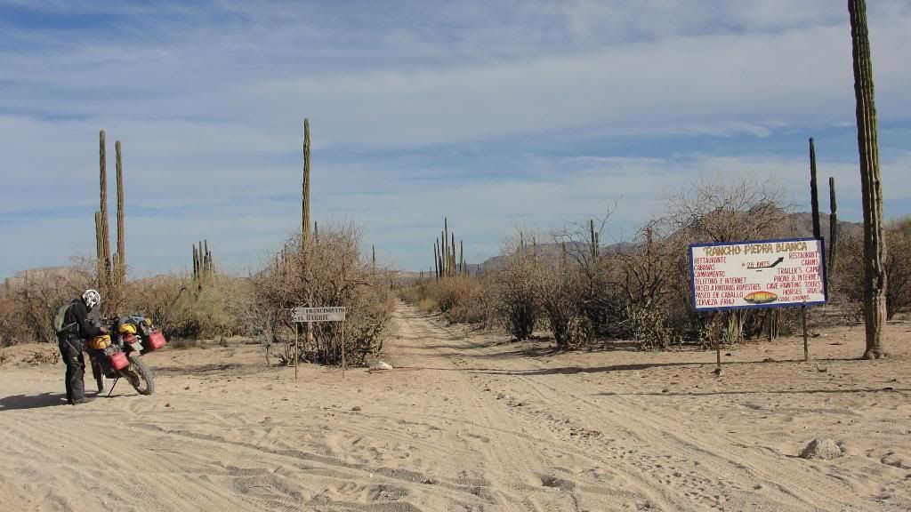
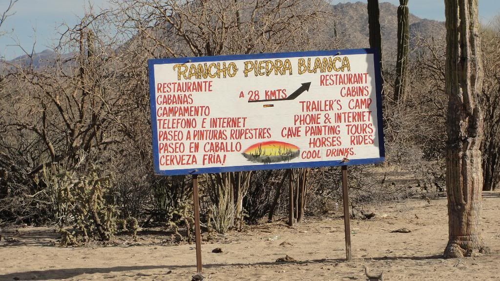
Can I get an ID on this intersection on the above maps please?

And thank you..........


David K - 12-15-2011 at 10:13 AM

Rancho Piedra Blanca is on the new Baja Almanac, located about 2 miles east of the Santa Gertrudis/ Guillermo Prieto shortcut, on the road to El Arco. On the AAA map above, near the '2' in mile 21.3 printed along the road.

San Francisquito and El Barril being at the east end of the road from El Arco, putting that photo between the two places... I can't quite make out the distance figure on the sign, but that would help... my guess is the junction of the road from L.A. Bay with the El Arco/San Francisquito road...?

Bajaboy would know, as I haven't been on that road since 2002 and there was no Rancho Piedra Blanca serving food then!

Sweetwater - 12-15-2011 at 10:19 AM


I really did enjoy that sign..........in the middle of nowhere.....

Skipjack Joe - 12-15-2011 at 10:57 AM

That fork, I believe, is very close to the El Barril turnoff.

David K - 12-15-2011 at 11:05 AM

Thanks for the close up of that great sign! 28 kms. = 17.3 miles and that would put it right at the junction of the Bahia de los Angeles road with the El Arco/San Francisquito road. ;)

Sweetwater - 12-15-2011 at 11:08 AM


So......as I continue to review my photos and maps........this might actually represent the San Rafael area, although we did not seem to skirt the coast as closely as the map would indicate.....?

David K - 12-15-2011 at 11:18 AM

You get to 1/4 mile from the beach, but you can't see it from the road (sand dunes/ hill). Pancho's has a tire and sign (fix flats) at his driveway. A super nice guy...

David K - 12-15-2011 at 11:43 AM

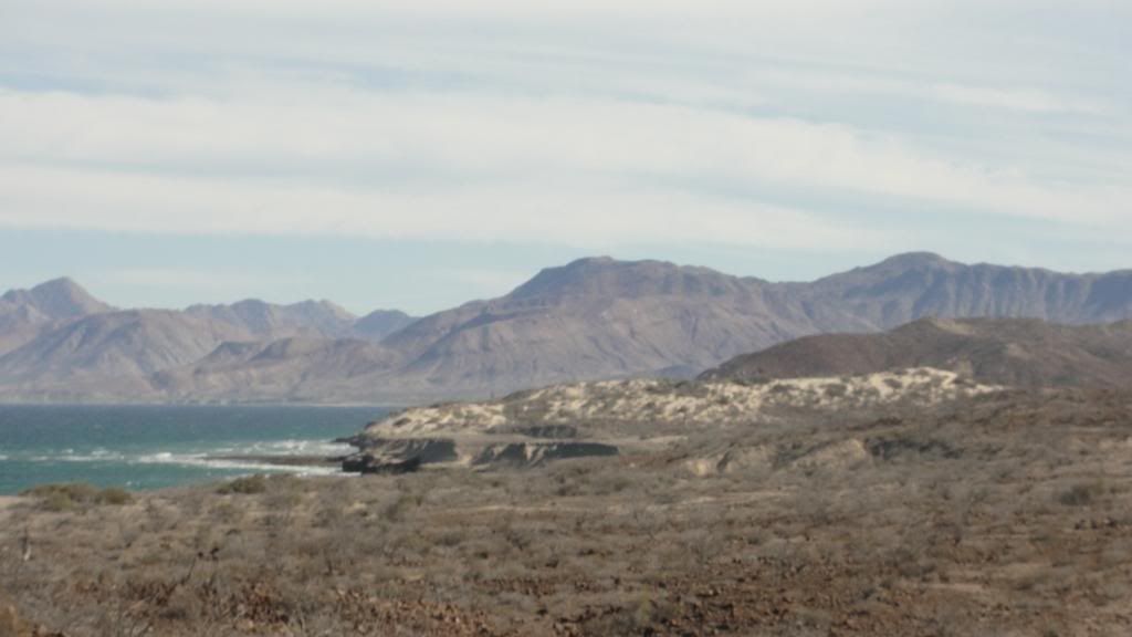
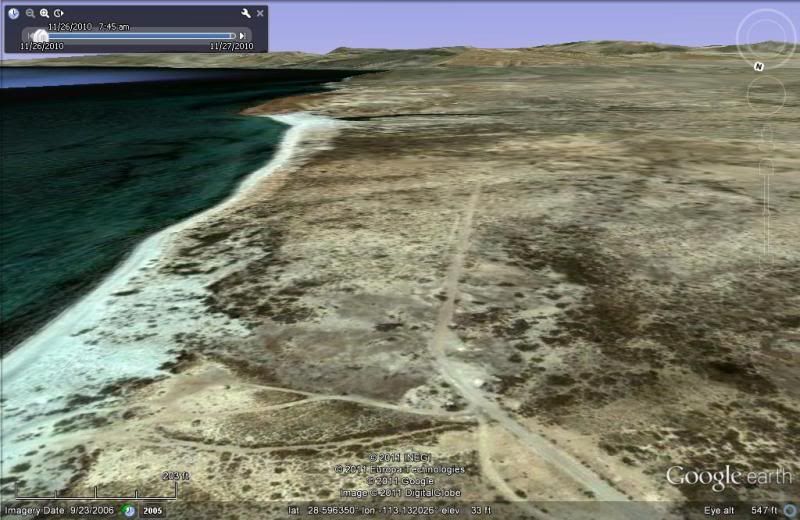
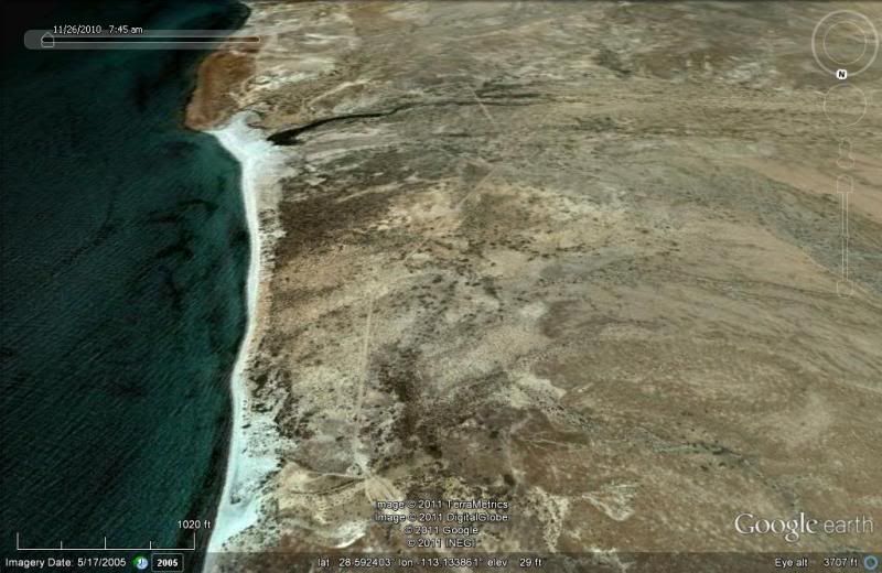
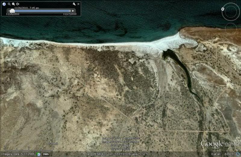
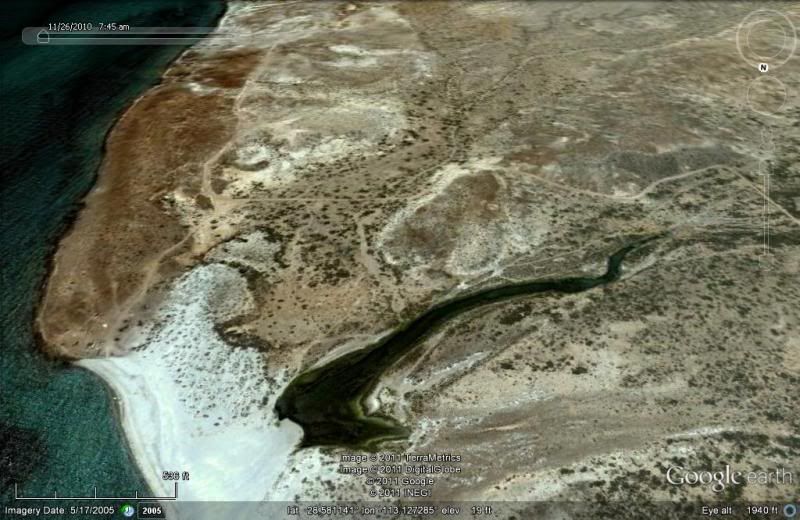
The graded road gets close at the north end of Pancho's beach... a road goes over the dune to the beach... looking south:


The graded road goes around a lagoon then gets close to the coast one more time at the turnoff to Pancho's:


View East:


Pancho's is on a bluff looking down onto the big beach:


motoged - 12-15-2011 at 12:02 PM

If you were on the "main road" between BoLA and San Francisquito as David is suggesting, you were NOT on the Green Door Trail (which is soft sand and rocks double track).
At any rate, I STILL hate deep soft sand when on a bike :barf:

The better riders say, "Just go fast enough to the point where you are scared....and wick it up a bit and sit back on the bike....you will have no problems....!!!"

That just defies common sense :lol:


So many trails and roads to explore in Baja...

Just south of the intersection posted earlier...


Skipjack Joe - 12-15-2011 at 12:03 PM

Rancho Piedra Blanco is that place with the cows next to and on the road. We always stop there for a coke and stories. They have a facebook page.

I suspect David is right. The intersection is where the BOLA road meets the SF-ElArco road.


http://es-es.facebook.com/pages/Rancho-Piedra-Blanca/117528994938225?v=info#!/pages/Rancho-Piedra-Blanca/117528994938225?sk=notes

Sweetwater - 12-15-2011 at 12:40 PM

I continue to say thanks.......and scheme of where and how to get back.....to so many of those spots.....

When you ride 2300 miles through Baja with a dirt bike fiend, it's difficult to get a stop and the photos to document the ride.....this is one reason I've never raced......and the next ride will be more leisurely.......fore shore......:yes: