BajaNomad

Do you know the way to San Juanico

Sweetwater - 1-8-2012 at 09:45 PM

And more specifically, has anyone driven from San Ignacio to the Laguna on the Pacific coast and then south to San Juanico, down which one of the roads.

I would like to run some bigger motos down that direction. Last year, we ended up in the silt sections and I'm not quite sure how to avoid them on the bigger bikes. We were told there was a "coastal" road that was more packed down. The other routes that Google maps show are inland. Is that a better way to avoid the deep sand and silt?

Islandbuilder - 1-8-2012 at 11:31 PM

Somebody here just made that run, perhaps they'll pick this up tomorrow. If now, I'll look for it and give you the link. I remember something about the road from San Ignacio to San Juanico was pretty bad, and not recommended for anything other than a 4x4.

But, don't trust my memory,,,,,

BajaNomad - 1-8-2012 at 11:45 PM

While not recently, I've chosen a number of times on the way south to go through San Ignacio Lagoon, and continue on to San Juanico.

Typically, the road closer to the coast is the smooth road the locals use - which goes across the salt flats. It's only a problem getting across these when the tides have been extra-high.

There's a road through the mountains... which I have not taken, but been told is pretty rough. Some of the folks that work down at the lagoon, or along the fish camps of the coast have ranchos up in the mountains along there...

woody with a view - 1-9-2012 at 06:25 AM

head for Datil on the map, then SJ.

Ateo - 1-9-2012 at 09:06 AM

Take the salt flats and head south. Once you come to the main road (north road), hang a right. This will take you all the way to sbay. Took me just under 3 hours last August.

Curt63 - 1-9-2012 at 09:16 AM

Ive got some video of big motos on salt flats in that area. Barely made it. Depends on recent high tides. Ask questions at the laguna and be careful.Salt Flat video

Islandbuilder - 1-9-2012 at 10:16 AM

Will this wet winter make the flats goopy as well? Not just the tides?

Sweetwater - 1-9-2012 at 11:54 AM

Option #1: This is the shorter route that seems to wander through some mountain ranges....

http://g.co/maps/xm86h

You can zoom in to specific areas to make comments and please pass them along.......I know that conditions can change with every storm.....

Gracias

Sweetwater - 1-9-2012 at 11:56 AM


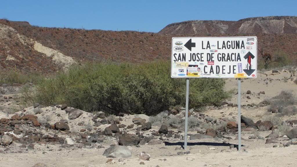
This is a photo I took last year where Option #1 joins up with the coastal road which seems to have all the silt beds......?


[Edited on 8-6-2021 by BajaNomad]

Sweetwater - 1-9-2012 at 12:00 PM

Option #2: This is another road to the west, I think we were more to the west in loose sand and not sure which road the Baja Mil follows....it will contrast with the next Option....

http://g.co/maps/aqws9

Sweetwater - 1-9-2012 at 12:03 PM

Option #3: I believe this is the Baja Mil route that has the most sand and silt...you turn up the canyon with a ranchito....there was nobody taking a toll but I've heard that often happens....then you have another long sand/silt stretch to get to the firmer road where I took that photo above.......I truly appreciate anyone who has experience on the three options....:yes:

http://g.co/maps/ggpfs

David K - 1-9-2012 at 12:14 PM

The last Baja 1000 that went to La Paz used the high/ inland road... your option 1 map.

[Edited on 1-9-2012 by David K]

Sweetwater - 1-9-2012 at 12:17 PM

Quote:
Originally posted by David K
The last Baja 1000 that went to La Paz used the inland road...


Would that be #1 or #2...I think #2...and I'm now convinced that's what we rode....thx

Sweetwater - 1-9-2012 at 12:20 PM


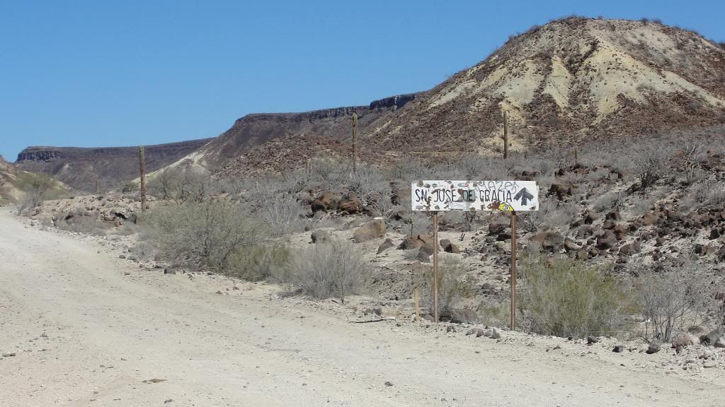
Here's another photo of that intersection where the coastal roads come from the west and the mountain road drops more from the north....

From here to San Jaunico is an easy ride.....what's the northern section like.....?

[Edited on 1-9-2012 by Sweetwater]

[Edited on 8-6-2021 by BajaNomad]

David K - 1-9-2012 at 12:23 PM

Quote:
Originally posted by Sweetwater
Quote:
Originally posted by David K
The last Baja 1000 that went to La Paz used the inland road...


Would that be #1 or #2...I think #2...and I'm now convinced that's what we rode....thx


I edited my answer... Option 1 was the Baja 1000... (also is the south half of Option 2 map).

Sweetwater - 1-9-2012 at 12:33 PM

Quote:
Originally posted by David K
Quote:
Originally posted by Sweetwater
Quote:
Originally posted by David K
The last Baja 1000 that went to La Paz used the inland road...


Would that be #1 or #2...I think #2...and I'm now convinced that's what we rode....thx


I edited my answer... Option 1 was the Baja 1000... (also is the south half of Option 2 map).


Thanks, I really thought the Baja Mil used those routes to the west, they're rutted sand and silt. They were a beeotch on 650 motos and I will not attempt them on larger, liter plus bikes.....

Still waiting to hear if anyone has been on the inland road....those big motos will be just fine if there isn't a lot of loose stuff on it....and I really like pulling in to SJ from the north....more smiles per miles.....:bounce:

David K - 1-9-2012 at 12:42 PM

I looked up and found it still online, the 2010 Baja 1000 tracking map, for Baja Sur: http://irctracking.com/2010/Baja1000/South/

merlin - 1-9-2012 at 01:07 PM

It's really pretty easy. Split the trip into three parts.

Part one: San Ignacio to La Laguna. This one is easy, just take the graded road. Approximately one hour.

Part two: La Laguna across salt flats. Make the left turn on the graded road just before you get to La Laguna. Go a couple of miles until you see the salt flat road down below you on the right - you can see it right on the edge of the dry salt flat. Stay on the most traveled road (black from tires and hard pack). If it looks wet check it first. Take this road to Datil (beautiful mangrove) then cut through the back side of the pueblo to get back on the salt flat road. Keep going until the road swings up an arroyo - you'll pass a small rancho and cross a dry river then you go up the hill and ultimately connect back to the graded road. Approximately one hour.

Better yet, wait for just a little while until you see someone crossing and follow them. Or, go to La Laguna and ask to see if anyone is heading south.

Part three: When you get to the graded road hang a right. Stay on this road all the way to San Juanico.

If you have more questions or need a place to stay when you get here drop a pm. Have a safe trip!

BajaNomad - 1-9-2012 at 01:45 PM

Quote:
Originally posted by Sweetwater

I really thought the Baja Mil used those routes to the west, they're rutted sand and silt. They were a beeotch on 650 motos and I will not attempt them on larger, liter plus bikes.....


The route Woody and Merlin allude to is this western-most route (your "option #3") - through the Datil fish camp. Staying on the main road is pretty much all hard pack unless the ultra-high tide's been in recently.

Sweetwater - 1-9-2012 at 02:08 PM

Quote:
Originally posted by BajaNomad
Quote:
Originally posted by Sweetwater

I really thought the Baja Mil used those routes to the west, they're rutted sand and silt. They were a beeotch on 650 motos and I will not attempt them on larger, liter plus bikes.....


The route Woody and Merlin allude to is this western-most route (your "option #3") - through the Datil fish camp. Staying on the main road is pretty much all hard pack unless the ultra-high tide's been in recently.


Gracias.......I have now realized how disoriented and tired I was when we hit that intersection I photo'd....that road really doesn't lead anywhere past San Jose de Gracia.....it looks like it dead ends up the valley into the hills......somehow I pictured it as a through road....

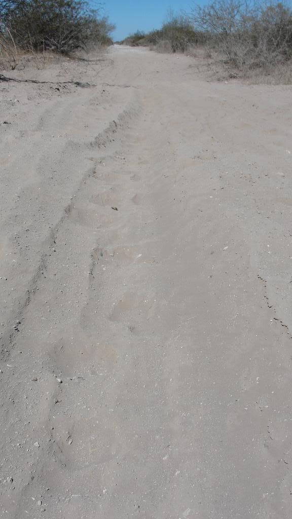
And I know we did not stay close enough to the beach to travel through the fish camp at Datil...but I've got a few pics of the silt.......Carumba!


merlin - 1-9-2012 at 04:12 PM

That silt is on the high road. The route I detailed is the western most route and you will bypass the silt. If you take the salt flat road just stick to the hard pack - never veer off or you will pay the price.

BajaBlanca - 1-9-2012 at 05:02 PM

oh merlin, it is soooooooooo easy to get sidetracked

we did and I thought our geo tracker and us were history

there were huge boulder filled arroyos filled with silt and once you cross one and don't know what is ahead ... well, we just forged on ! God was smiling down on us that day ....

I will hunt for the pics and post some.

Sweetwater - 1-9-2012 at 05:25 PM

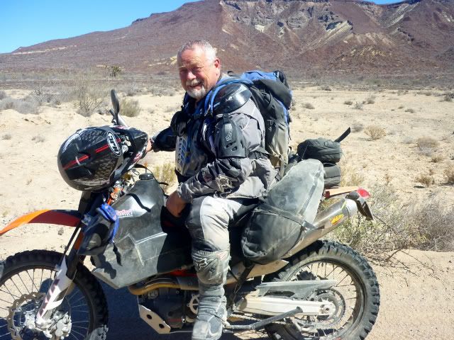
I was working so hard through that area that I did not take many photos.....but here is one of mi amigo.....resting......


woody with a view - 1-9-2012 at 06:49 PM

when you find yourself approaching the silt HIT THE GAS! if you fall it is mostly soft, for the first 6" or so!:light:

Ateo - 1-9-2012 at 07:27 PM

I would use Merlin's directions. After driving almost every road into San Juanico the North Road via the Salt Flats is the way to go. No silt. Some sand but nothing a smart driver can navigate. Never needed 4X4. Salt flats are smooth riding. I don't have it on GPS but if you have questions u2u me.

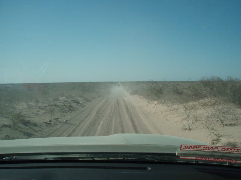
Here's the worst of the sand on the way to Datil:


Notice the interim registration sticker on dashboard. My truck was 1 week old. When I got it home it was 2 years old. Air down your tires to 20 PSI.

motoged - 1-10-2012 at 12:11 PM

Quote:
Originally posted by Sweetwater
Option #3: I believe this is the Baja Mil route that has the most sand and silt...you turn up the canyon with a ranchito....there was nobody taking a toll but I've heard that often happens....


Yep, that ranchito was CERTAINLY taking a toll last February :o:o:o

DT Bushpilot and I rode 690's through there coming north from SJ....the silt was what really took the toll:


Read all about it:


http://www.advrider.com/forums/showthread.php?t=666961&page=7


Next time I will take the western route on the flats and skip the silt.


Have I ever told you how much I hate riding deep sand and silt????:?:


[Edited on 1-10-2012 by motoged]

woody with a view - 1-10-2012 at 12:45 PM

don't be a girlie man, Ged! chicks dig scars!! "hey baby, did i ever tell you about this one?"

motoged - 1-10-2012 at 01:32 PM

Woody,
You and DT must have taken the same sensitivity seminar....he told me to just shake the silt out of my skirt and keep riding :lol:

May the curl pile-drive you head-first into some coral :biggrin:

I have kept those U2U notes you sent last year re: the coastal routes west of Catavina going south....hope to use them in a year or two.....

woody with a view - 1-10-2012 at 03:31 PM

let me know if you need any updates.

tanstaafltwentysix - 1-31-2012 at 04:12 PM

New member here-just seconding or thirding the salt flat option. I've taken sort of the inland road when some high tides and but mostly a bad directional decision led us up near the mountains. High-centered here and my friends actively helping...deplete the beer supply. After jacking and rock placement, we continued on and the track ended at a big washout. We ran/bounced down a dry stream bed and found another track that lead towards the ocean with really deep silt but didn't have the raised center. Needless to say I hammered that little 4wd Tercel. We made it into San Juanico at dusk after giving some gas to the local fish/game inspector. Surf was good and we continued on for another few months finally running out of money in Guatemala...The car never broke down although I think this high-center (There were a few) was responsible for ripped CV boots.


[Edited on 2-2-2012 by tanstaafltwentysix]

David K - 1-31-2012 at 06:58 PM

Quote:
Originally posted by tanstaafltwentysix
New member here-just seconding or thirding the salt flat option. I've taken sort of the inland road when some high tides and but mostly a bad directional decision led us up near the mountains. High-centered here and my friends actively helping...deplete the beer supply. After jacking and rock placement, we continued on and the track ended at a big washout. We ran/bounced down a dry stream bed and found another track that lead towards the ocean with really deep silt but didn't have the raised center. Needless to say I hammered that little 4wd Tercel. We made it into San Juanico at dusk after giving some gas to the local fish/game inspector. Surf was good and we continued on for another few months finally running out of money in Guatemala...The car never broke down although I think this high-center (There were a few) was responsible for ripped CV boots.

Ah, not able to post-I need to get a remote hosting.


[Edited on 1-31-2012 by tanstaafltwentysix]


WELCOME TO NOMAD!!:bounce:

vgabndo - 1-31-2012 at 08:46 PM

Too cool 26, We crossed the Belizian border in '92 just ahead of 4 Kiwis who had bought a beater Toyota in Houston. They had collected a horse near Candalaria and the bonnet was a mess and cooling variable. They were planning on walking away from it somewhere in Central America when it was though. Don't call it an adventure if there's no uncertainty! :lol::lol::lol:

We brought our '78 Ford HOME after 8400 miles and 42 days!

Welcome to the forum.

BajaBlanca - 1-31-2012 at 09:07 PM

welcome to BajaNomads !

tanstaafltwentysix - 2-1-2012 at 11:11 PM

Quote:


We brought our '78 Ford HOME after 8400 miles and 42 days!

Welcome to the forum.


Thanks for the greetings all! Big miles are easy to do down there! We did ~13,000 miles in about 3 months. Began in Baja, up, down, across, here and there through Mainland, surfing and wandering around doing the more 'normal' tourist stuff when it was flat, then down through Belize into Guatemala. Coming home, we went from Quetzaltenango to Phoenix via Brownsville in 78 hours after finding out there was a suprise birthday party for my Aunt.

David K - 2-2-2012 at 09:07 AM

Quote:
Originally posted by tanstaafltwentysix
Quote:


We brought our '78 Ford HOME after 8400 miles and 42 days!

Welcome to the forum.


Thanks for the greetings all! Big miles are easy to do down there! We did ~13,000 miles in about 3 months. Began in Baja, up, down, across, here and there through Mainland, surfing and wandering around doing the more 'normal' tourist stuff when it was flat, then down through Belize into Guatemala. Coming home, we went from Quetzaltenango to Phoenix via Brownsville in 78 hours after finding out there was a suprise birthday party for my Aunt.


Here on Nomad, there is a Baja Trip Reports and a Non-Baja Trip Reports forum... Sounds like you could post a great story of your travels in those!?:light:

roads

captkw - 2-2-2012 at 09:11 AM

HOLa,nomads we are a cool bunch of ---------------:lol:

tanstaafltwentysix - 2-3-2012 at 01:27 PM

Quote:
[Here on Nomad, there is a Baja Trip Reports and a Non-Baja Trip Reports forum... Sounds like you could post a great story of your travels in those!?:light:


I'll try to start a new thread this weekend during my son's nap time. Que Gilligan's island music in a now-defunct Santa Barbara bar during happy hour: One friend says to me: I'm going to ride my bicycle to Guatemala. Wanna come along? I reply: I don't have a bike, but I have a car, I'll drive. 6 days later we crossed the border. Alas, it was in '95 which was pre-digital camera for most. We didn't have a flat until Belize 2 months later, we were chased by Zapatista's, surfed our brains out and met some fantastic people. We couldn't sell the car in Guatemala (For enough $ to finance a trip to Europe via Cancun) so when we ran out of money we came home.