Originally posted by Barry A.
| Quote: | Originally posted by Vince
David- I just looked thru your maps and read the entries on this subject. I love those old maps and charts, they stimulate some great memories as do
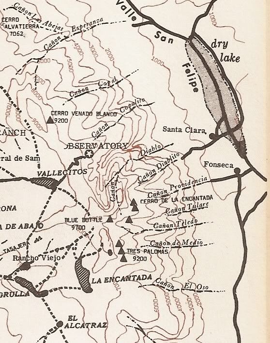
the stories. Barry was right, I was one of the many, like him, to climb around those canyons in the '50's. I have a vivid memory of hiking up Diablo
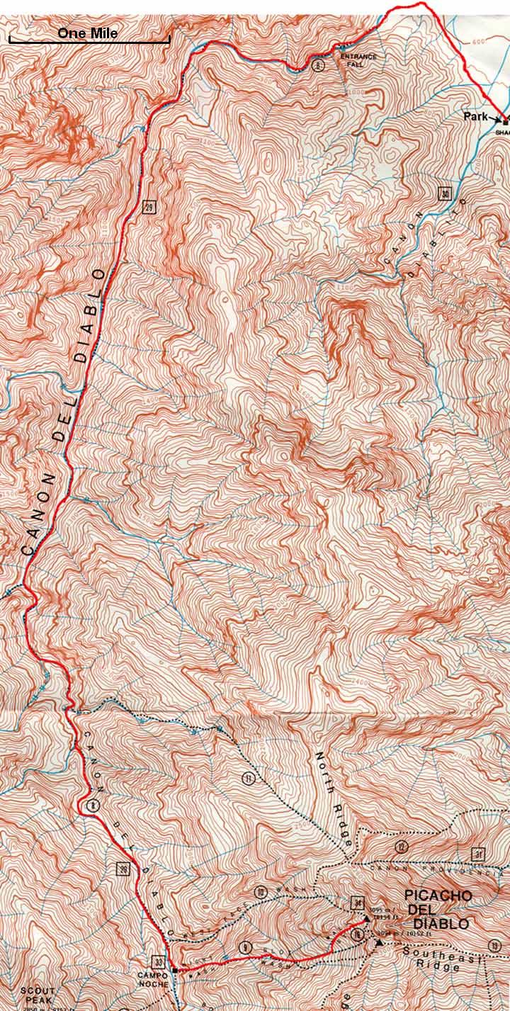
Canyon with Bud Bernhard, Becky McShea (sp?) and others . When we encountered the waterfall and the big pool of water, it was necessary to swim across
and hike up along the waterfall to proceed. We had to belay our packs up and over the pool and waterfall. Fortunatly we had some good mountaineering
people along with us. We continued up the canyon, made a base camp and climed the mountain the next day. These days I fly over that area on approach
to San Felipe, but don't get close enough to see that waterfall, but we do see many of those Blue Palms you wrote about in other canyons. Also took
some great trips with the Sierra Club people on the west side, hiking around the forest and meadows. All great stuff! |
Those were great times for sure, Vince.
The "Becky McShea" you refer to is my Mom's sister, Becky McSheehy, and she was EVERYWHERE in the SPM's back in those days and over the years
(deceased in 1995).
I love all those canyons, all different, and each has stuff to see and explore, and I think I have been in all of them over the years. Sorry to hear
that "Burro Bob" apparently is no longer at Cajon Canyon!?!?!?
Barry |