Originally posted by TW
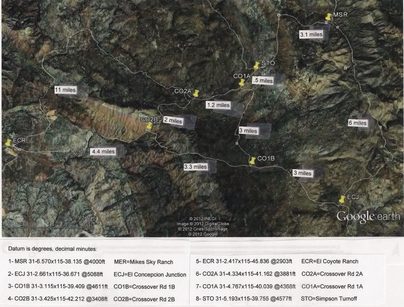
We need to get Ken and his Jeep compadres to do a road repair trip. We need to check out all the roads shown and fix them as needed so people can move
and explore the great unknown. My next trip to Mikes Sky Ranch will be to make a circle around the outer ring and crossover road CO1A to CO1B.
|