BajaNomad

Sea of Cortez camping trip... near Bahia de los Angeles

BajaNomad - 4-14-2012 at 03:02 PM

A pic or two for now.... maybe more later...

apr12-2012.jpg - 50kB

Bajaboy - 4-14-2012 at 03:07 PM

looks nice

woody with a view - 4-14-2012 at 03:14 PM

what was the water temp? similar to SD in the summertime yet? or was it still one toe at a time?

Skipjack Joe - 4-14-2012 at 03:21 PM

It looks very familiar. I found your spot and never divulged it to anyone because of my respect to you. Would not have done so anyway.

P.s. I expected clams and found none. What an enigma.

[Edited on 4-14-2012 by Skipjack Joe]

MMc - 4-14-2012 at 03:30 PM

Maps and GPS points will follow. I love that spot.
MMc

woody with a view - 4-14-2012 at 07:05 PM

Quote:
Originally posted by MMc
Maps and GPS points will follow. I love that spot.
MMc


please, no. even if you know where why broadcast it?

oh wait, i'm falling..... on deaf ears.:light:

Hook - 4-14-2012 at 08:29 PM

Quote:
Originally posted by woody with a view
what was the water temp? similar to SD in the summertime yet? or was it still one toe at a time?


Still nothing much over 60 and even 58 degree water at the north end of Isla Coronado.

http://www.tempbreak.com/index.php?&cwregion=la

And that was before today's rather cold wind on the Sea.

woody with a view - 4-14-2012 at 08:33 PM

great site, Bud! Terrafin shows nothing close to this detail.....

BajaNomad - 4-14-2012 at 08:36 PM

Quote:
Originally posted by Hook
Quote:
Originally posted by woody with a view
what was the water temp? similar to SD in the summertime yet? or was it still one toe at a time?


Still nothing much over 60 and even 58 degree water at the north end of Isla Coronado.


Definitely one toe at a time. I waded in above my knees for quite some time, but it was VERY cold.

:o

Hook - 4-14-2012 at 09:54 PM

Quote:
Originally posted by woody with a view
great site, Bud! Terrafin shows nothing close to this detail.....


If you've experimented with this, you probably know that you can:

-zoom in and out with the + and - keys

-click on any named port to change that as your port of departure, then you can drag the "fishy" around to get range and bearing from said port. Click on the NAME, not the icon representing the port.

-use the pull down menu to change locations, change time interval of the SST composites or change time interval of the chlorophyll composites.

woody with a view - 4-14-2012 at 09:57 PM

no

sorta

yes

MANY GARCIAS = MUCHAS GRACIAS!

BajaNomad - 4-14-2012 at 10:51 PM

.

clearwater.jpg - 49kB

BajaNomad - 4-14-2012 at 10:54 PM

.

shootbird.jpg - 49kB

woody with a view - 4-14-2012 at 11:19 PM

SWEET! i love a deserted beach....

BajaNomad - 4-14-2012 at 11:36 PM

My son and I ran across thousands and thousands of these Fiddler crabs (in many different colors) in a back bay area. We called it "crab hollow" (and he also called it "crab heaven").

fiddler-crab-gulf-of-california.jpg - 49kB

BajaNomad - 4-14-2012 at 11:41 PM

The Fiddler's were actually in this bay/inlet.... many towards the back off to the right (out of the image).

nextdoor-inlet.jpg - 49kB

BajaNomad - 4-14-2012 at 11:45 PM

.

rdmii-niice.jpg - 49kB

BajaNomad - 4-14-2012 at 11:49 PM

.

flat.jpg - 31kB

BajaNomad - 4-14-2012 at 11:51 PM

.

arroyo.jpg - 30kB

Cypress - 4-15-2012 at 04:23 AM

BajaNomad, Thanks for the pics.:spingrin:

Taco de Baja - 4-15-2012 at 07:11 AM

Quote:
Originally posted by Hook
Quote:
Originally posted by woody with a view
great site, Bud! Terrafin shows nothing close to this detail.....


If you've experimented with this, you probably know that you can:

-zoom in and out with the + and - keys

-click on any named port to change that as your port of departure, then you can drag the "fishy" around to get range and bearing from said port. Click on the NAME, not the icon representing the port.

-use the pull down menu to change locations, change time interval of the SST composites or change time interval of the chlorophyll composites.


Two thumbs up for sharing this site! As Woody said, MUCH better than Terrafin. :yes:

It'll be my new go-to for SST.

Back on topic...Nice beach, but water's too cold for me; although it's in line with some temps I've seen at my favorite secret Pacific spot in August. :lol: October's probably really nice. Not to hot outside, and warm water

BajaNomad - 4-15-2012 at 08:56 AM

Quote:
Originally posted by Taco de Baja
Nice beach, but water's too cold for me; although it's in line with some temps I've seen at my favorite secret Pacific spot in August. :lol: October's probably really nice. Not to hot outside, and warm water


This was our first Spring visit here.... and one of our conversations was that probably our own fav time to visit the area here (heat to water temp -wise) is at the very tail end of the Summer.

:biggrin:

Hook - 4-15-2012 at 09:19 AM

Is there ANYWHERE in North American that October ISN'T the best month? It sure seems like it. BOLA for sure.

Being on a school calendar for about 52 straight years, I never could vacation in October...........until I retired. Now, I take full advantage of it when I can.

After more than a few years hitting BOLA in the 70s and 80s, I concluded that the EARLIEST time to get there to enjoy the water is often June. Even mid May, it can still be in the mid 60s (or lower) in the water.

[Edited on 4-15-2012 by Hook]

David K - 4-15-2012 at 10:41 AM

Nice pics Doug... Last time the kids and I went there, the dry lake wasn't dry, lol!

redhilltown - 4-19-2012 at 11:31 PM

I know the spot well and what a shame there isn't a road that goes there... ;D

How were the wildflowers? About 8 years ago it was the most amazing display I have ever seen anywhere in 40 years of adventuring in the deserts.

(and please no gps cords!!!!)

David K - 4-20-2012 at 10:45 AM

Quote:
Originally posted by redhilltown
I know the spot well and what a shame there isn't a road that goes there... ;D

How were the wildflowers? About 8 years ago it was the most amazing display I have ever seen anywhere in 40 years of adventuring in the deserts.

(and please no gps cords!!!!)


Have you been beyond the next dry lake and seen how colorful that canyon to the next beach is? Puts the Painted Gorge to shame!

Skipjack Joe - 4-20-2012 at 11:11 AM

Quote:
Originally posted by David K
Quote:
Originally posted by redhilltown
I know the spot well and what a shame there isn't a road that goes there... ;D

How were the wildflowers? About 8 years ago it was the most amazing display I have ever seen anywhere in 40 years of adventuring in the deserts.

(and please no gps cords!!!!)


Have you been beyond the next dry lake and seen how colorful that canyon to the next beach is? Puts the Painted Gorge to shame!


When we were there a rock had been placed to bar the way north. I wondered why. Anyway there seemed few good launch beaches further north so there was little interest. Probably better fishing though.

David K - 4-20-2012 at 02:19 PM

Could have become a drug off-loading 'port'? Coco likes to scare folks into not going to places along that coast, I have read here on Nomad!

bacquito - 4-20-2012 at 05:12 PM

Great photos, looks "muy pacificio"

redhilltown - 4-20-2012 at 11:29 PM

Quote:
Originally posted by David K
Could have become a drug off-loading 'port'? Coco likes to scare folks into not going to places along that coast, I have read here on Nomad!


We have heard those stories too and "supposedly" (whatever that means!) there is a spot nearby where the water is deep right up to the shore so a good size boat call quickly pull up and off load...who knows? But it IS really desolate and you are on your own for good or for ill.

Though the good includes numerous leopard grouper!

YES!

El Vergel - 4-21-2012 at 05:33 PM

Wow, Doug! Thanks for a great post!

BajaNomad - 4-22-2012 at 08:58 PM

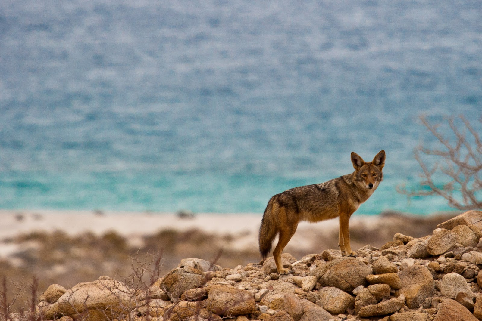
While no surprise in this area, the coyotes were visibly close - mostly in the evening and early morning. Many new footprints noted in the morning in our campsite, along the sand of the various beaches, as well as along coyote trails spread throughout the area.

Saw the glowing eyes of one individual across the beach at one point in the evening... and then a pair of glowing eyeballs a little later checking us out up close at our campsite.

Here is one of the nearby coyotes in pictures taken earlier this year by Taylor Cotten:


DianaT - 4-22-2012 at 09:16 PM

Quote:
Originally posted by BajaNomad
While no surprise in this area, the coyotes were visibly close - mostly in the evening and early morning. Many new footprints noted in the morning in our campsite, along the sand of the various beaches, as well as along coyote trails spread throughout the area.

Saw the glowing eyes of one individual across the beach at one point in the evening... and then a pair of glowing eyeballs a little later checking us out up close at our campsite.

Here is one of the nearby coyotes in pictures taken earlier this year by Taylor Cotten:


Coyotes? Nah--- it looks like Paulina's dog---the ears are the same! :biggrin:

I love that first photo---the intensity in those eyes is great


[Edited on 4-23-2012 by DianaT]

redhilltown - 4-22-2012 at 11:59 PM

Quote:
Originally posted by DianaT
Quote:
Originally posted by BajaNomad
While no surprise in this area, the coyotes were visibly close - mostly in the evening and early morning. Many new footprints noted in the morning in our campsite, along the sand of the various beaches, as well as along coyote trails spread throughout the area.

Saw the glowing eyes of one individual across the beach at one point in the evening... and then a pair of glowing eyeballs a little later checking us out up close at our campsite.

Here is one of the nearby coyotes in pictures taken earlier this year by Taylor Cotten:


Coyotes? Nah--- it looks like Paulina's dog---the ears are the same! :biggrin:

I love that first photo---the intensity in those eyes is great


[Edited on 4-23-2012 by DianaT]


Great photos!!!! A good lookin mutt... They can be so scrawny and desperate. Not long ago near these camps we had ours attacked by crows and other birds while we were shore fishing... another Baja lesson to be learned in that if you leave food or water out when remote camping (for any amount of time), you are rolling the dice! I think when we finally came back there were three crows, two buzzards, and one coyote milling about. The next day while hiking nearby we found little bits of red bed pepper cached into a tree......kind of cute...maybe.

edm1 - 6-26-2013 at 08:52 PM

Quote:
Originally posted by BajaNomad
A pic or two for now.... maybe more later...


Where is this and how to get there?

Paulina - 6-26-2013 at 09:16 PM


She does have a couple of big ones...her coyote side comes out quite often.

Quote:
Originally posted by DianaT
Quote:
Originally posted by BajaNomad
While no surprise in this area, the coyotes were visibly close - mostly in the evening and early morning. Many new footprints noted in the morning in our campsite, along the sand of the various beaches, as well as along coyote trails spread throughout the area.

Saw the glowing eyes of one individual across the beach at one point in the evening... and then a pair of glowing eyeballs a little later checking us out up close at our campsite.

Here is one of the nearby coyotes in pictures taken earlier this year by Taylor Cotten:


Coyotes? Nah--- it looks like Paulina's dog---the ears are the same! :biggrin:

I love that first photo---the intensity in those eyes is great


[Edited on 4-23-2012 by DianaT]

David K - 6-27-2013 at 08:45 AM

Quote:
Originally posted by edm1
Quote:
Originally posted by BajaNomad
A pic or two for now.... maybe more later...


Where is this and how to get there?


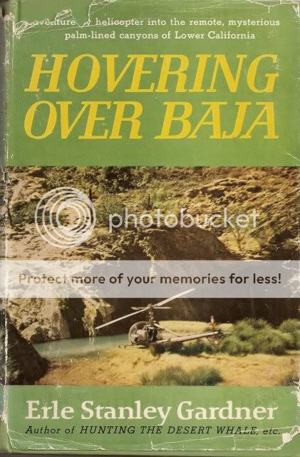
Erle Stanley Gardner in his 1961 book 'Hovering Over Baja' established a base camp on the northern dry lake bed for his expedition into SalSiPuedes canyon.


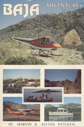
Marv Patchen in his book describes the road in to Bahia Guadalupe/ Punta Remdedios...


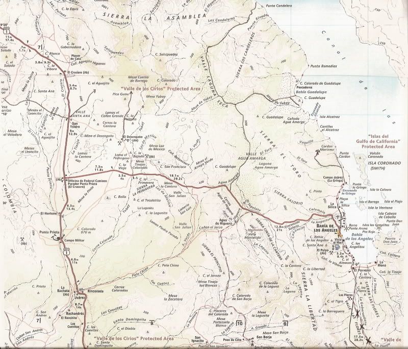
Roads penciled in, north of L.A. Bay highway:


On my Baja GPS waypoints web site: http://www.vivabaja.com/GPS/

Map Datum is set to NAD27 Mexico:

Side trip to Bahia Guadalupe and Punta Candelero

Road north to Bahia Guadalupe and Pta. Candelero (see log below): 29°01.27'/ 113°47.76'

Leave the L.A. Bay highway and head northwest then northeast across the Laguna Amarga dry lake.

Come to Arroyo Mesa de Yubay and 'T' junction of roads: 29°11.27'/ 113°47.15', right turn next two waypoints.

Road Fork, go left for next waypoint: 29°11.84'/ 113°40.20'

Bahia Guadalupe (Remedios): 29°12.37'/ 113°39.27'
--------------------------------------------------------------------------------------

Continuing north from 'T' junction, above....

Come to dry lake bed of 'Laguna Seca': 29°13.87'/ 113°50.67'

Road turns sharp from north to east: 29°17.50'/ 113°50.51'

Junction with Arroyo Los Candeleros: 29°20.16'/ 113°46.81'

Gulf Coast near Punta Candelero: 29°22.60'/ 113°44.50'

[Edited on 6-27-2013 by David K]

edm1 - 6-27-2013 at 10:23 AM

Thank you David.

This past trip to Tinaja de Yubay, where I hiked alone over the tinajas, I left Neal and the Rott behind for more than an hour looking for rock arts, etc. I must have hiked for more than an hour a mile east into the arroyo until Neal got worried. This isn't mentined in the trip report. Anyway, if I continued on my hike over the rock hills for a couple more hpurs I should have seen this wonderful place, right?

Anyway, when Neal couldn't wait for me he thought I fell or something wrong happened and he climbed the rock hills over the tinajas and started to shout his lungs out, his voice echoing over the canyons.

David K - 6-27-2013 at 12:13 PM

I drew a circle in Arroyo Yubay where the tinaja is. Look below the M in Mesa Yubay. It is still a long ways east to the beach! The road to Guadalupe Bay was easy as long as the lake bed is dry.

edm1 - 6-27-2013 at 12:50 PM

Quote:
Originally posted by David K
I drew a circle in Arroyo Yubay where the tinaja is. Look below the M in Mesa Yubay. It is still a long ways east to the beach! The road to Guadalupe Bay was easy as long as the lake bed is dry.


30 miles it looks like, and the mountain range blocks the view to the sea.

David K - 6-27-2013 at 04:12 PM

Quote:
Originally posted by edm1
Quote:
Originally posted by David K
I drew a circle in Arroyo Yubay where the tinaja is. Look below the M in Mesa Yubay. It is still a long ways east to the beach! The road to Guadalupe Bay was easy as long as the lake bed is dry.


30 miles it looks like, and the mountain range blocks the view to the sea.


Yup... you can drive your home right to the beach, no problem! Baja Angel and I would sure enjoy going there along with you too, as you guys are great sports! The place is remote and beautiful!

redhilltown - 6-27-2013 at 11:22 PM

Luckily there are a few problems...