BajaNomad

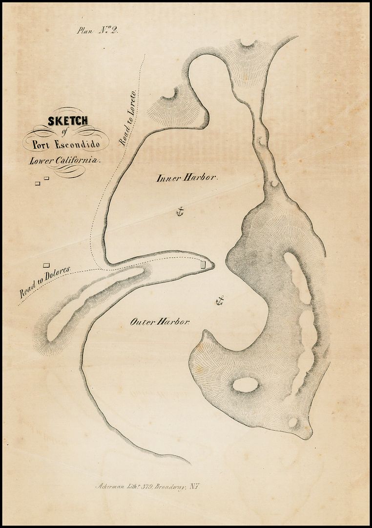
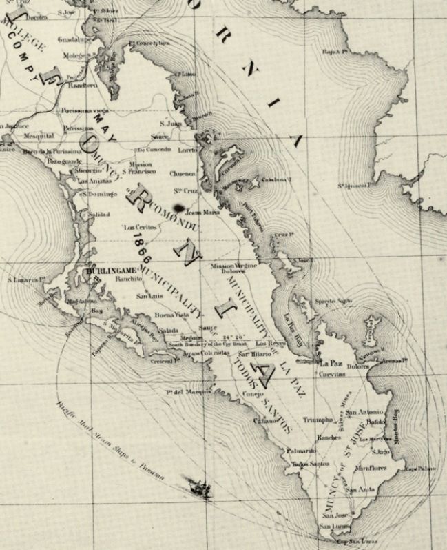
Puerto Escondido in an 1849 map !

David K - 3-4-2013 at 11:11 AM

Like the trails north and south labeled to the next missions along the coast...


Islandbuilder - 3-4-2013 at 12:30 PM

Really cool David, thank you!

ligui - 3-4-2013 at 12:59 PM

Wonder if they ever had a village here ? David , what is Dolores ?

David K - 3-4-2013 at 01:00 PM

Old Sea of Cortez nautical charts like this one would make cool decorations, wall art, or even place-mats in the galley?

David K - 3-4-2013 at 01:05 PM

Quote:
Originally posted by ligui
Wonder if they ever had a village here ? David , what is Dolores ?


Ahh.. you don't have the missions book yet!


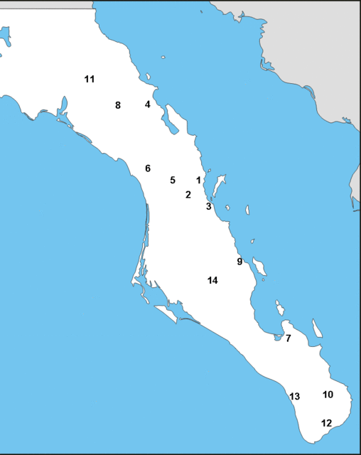
Dolores is #9 of the 48 California missions. Ligui is #3. Loreto is #1. San Luis Gonzaga mission is #14...

Dolores moved from the coastal location to La Pasion in 1741 (closer to San Luis Gonzaga mission).

[Edited on 3-4-2013 by David K]

Mission Dolores (aka Dolores del Sur) from my missions web site...

David K - 3-4-2013 at 01:11 PM

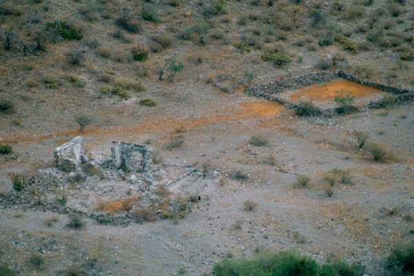
In an isolated location, 3 miles from the gulf coast N 25°03.30' W110°53.00'.


Dolores del Sur photo by Kevin Clough, taken in January, 1998.


Photo taken with a telephoto lens from a ridge,
reached after a 2 hour hike from the nearest road! c Jack Swords


Dolores-La Pasion (1741-1768)

Historians note La Pasion as the second location for Mision Dolores (del Sur).
N 24°53.24' W111°01.83' c Jack Swords


[Edited on 12-21-2013 by David K]

ligui - 3-4-2013 at 01:13 PM

Thanks David , just checked it out . Nice job , we be ordering one . Love maps and the old history of baja .

Keep it coming . :yes:

David K - 3-4-2013 at 01:15 PM

Quote:
Originally posted by ligui
Love maps and the old history of Baja :yes:


ME TOO! :yes::cool::light:

RnR - 3-4-2013 at 01:44 PM

Cool map.

Interesting that it is in English.

Jack Swords - 3-4-2013 at 02:22 PM

There is some information in the old literature that the entrance was in the northern "window". Both Ed Vernon and I have walked the area, scoured Google Earth, and yet found no valid evidence of that entrance being open. However, if you walk on the narrow closure of the "window" it somehow doesn't seem natural. There is an old wall at the very north end that climbs up the hill and over to the adjacent bay at the north that is next to Juncalito (Bahia Chenque). Also there are some very old walls behind (W of) Bahia Chenque next to the streambed, behind the palms, covered with brush. Bahia Chenque behind Isla Mestiza next to the wall is a deep large anchorage. Some sort of activity took place in the area long ago.

(edited to change E to W of)

[Edited on 4-3-2013 by Jack Swords]

David K - 3-4-2013 at 03:13 PM

Quote:
Originally posted by Jack Swords
There is some information in the old literature that the entrance was in the northern "window". Both Ed Vernon and I have walked the area, scoured Google Earth, and yet found no valid evidence of that entrance being open. However, if you walk on the narrow closure of the "window" it somehow doesn't seem natural. There is an old wall at the very north end that climbs up the hill and over to the adjacent bay at the north that is next to Juncalito (Bahia Chenque). Also there are some very old walls behind (W of) Bahia Chenque next to the streambed, behind the palms, covered with brush. Bahia Chenque behind Isla Mestiza next to the wall is a deep large anchorage. Some sort of activity took place in the area long ago.

(edited to change E to W of)

[Edited on 4-3-2013 by Jack Swords]


I remember reading about how the padres had the other entrance closed... I will do some checking.

Your photo of the mission-era wall near Puerto Escondido (some authors say was an early site for the Ligui mission):

Mystery Wall of Juncalito

The well built, mortarless wall is 4 feet tall by 3 feet wide and quite long. It resembles other walls found at mission sites in Baja. Photo c Jack Swords

See more of Jack Swords' history photography here: http://vivabaja.com/swords/

ligui - 3-4-2013 at 03:33 PM

I've seen the wall also and wondered what its for . Camped there for awhile . Is it part of the old road ?

David K - 3-4-2013 at 03:57 PM

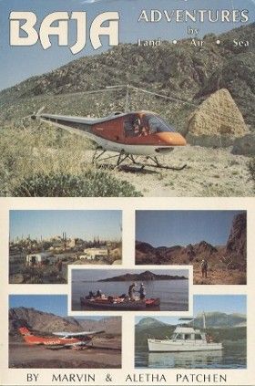
The 'road' on that map would be (and parts still are) a foot or burro/ mule trail... connecting the missions, thus 'El Camino Real' (The Royal Road/ King's Highway)... not even a 'wagon road'. Marv Patchen and others hiked it to Dolores... and made it a chapter in his great book "We Walk a Mission Trail" and that story was published in magazines, too.


David K - 3-4-2013 at 04:01 PM

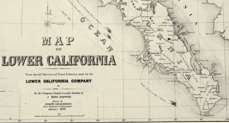
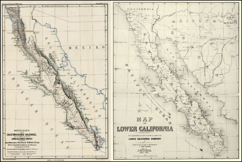
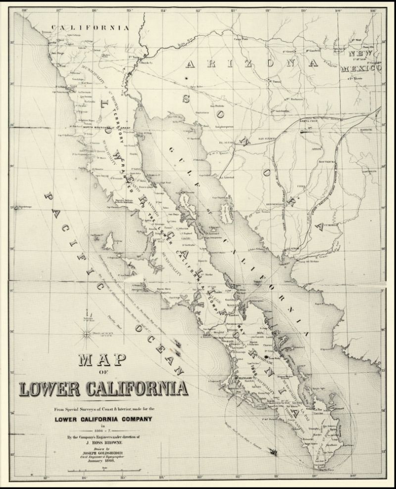
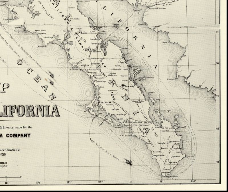
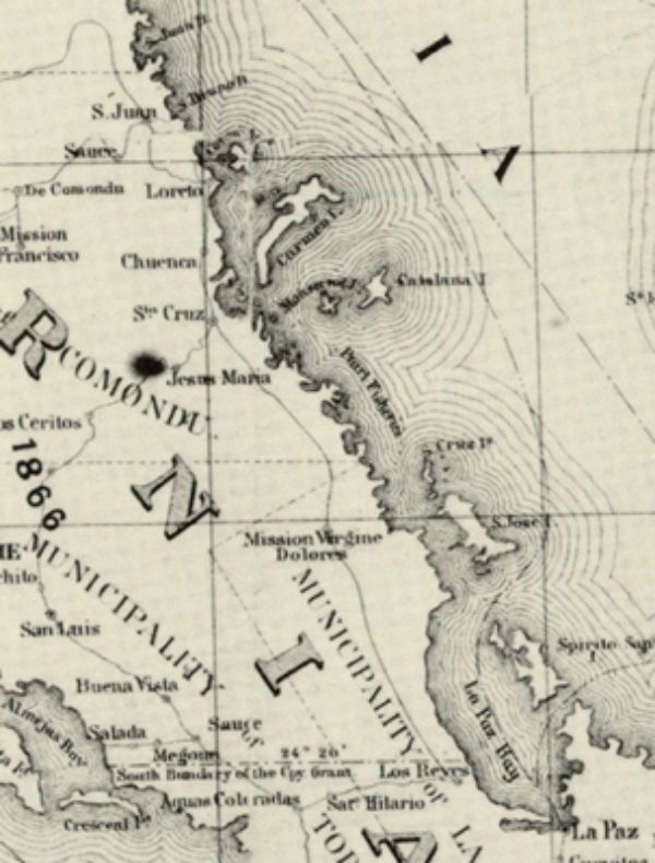
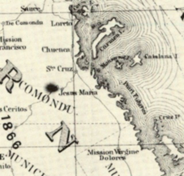
Here is an 1868 map, where 'roads' are shown as dashed line... The El Camino Real between Loreto and Dolores, included...


1868 Map... zoom-in

David K - 3-4-2013 at 04:24 PM

Okay, I reloaded that map, and I will show you all the zomm levels with it centered on Dolores:

Originally part of a 2 map set: