The 2013 Baja Pole Line Road 4WD event was one to not have missed. MICK (and his family) treated the Baja Pole Line Group to some of the most stellar
accommodations a desert Baja traveler could envision.
- Accomodations on the Rio Hardy River (sandwiched between Mexicali and the Laguna Salada)
- Dinner on the Rio Hardy River (while watching the local children enjoying an Easter Egg Hunt)
- A great, new jumping off point into the Laguna Salada (including an action-packed water crossing from a Sea of Cortez-fed tributary!)
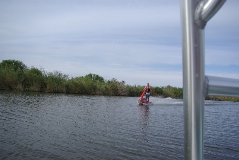
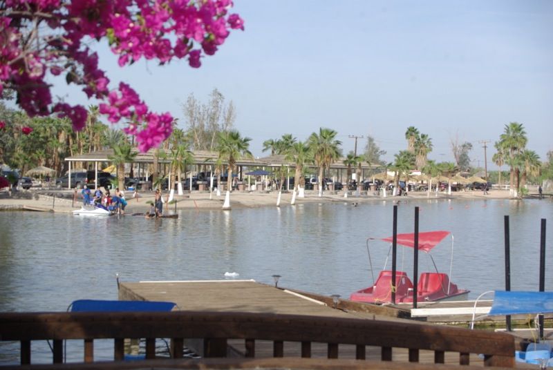
- And more "Off-Road Fun" in a speedy River Boat on the Rio Hardy! This rig had enough 'GET UP AND GO' to even knock over Nomad CG!
The 2013 Baja Pole Line Run began with a visit (among Nomads) to the home of MICK (and wife Penny, Brother-in-law Scott, and Sister-in-law Gaila).
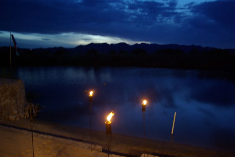
Our early arrival allowed for a late afternoon river cruise along the Rio Hardy.
The next morning, our group of six vehicles left for the Baja Pole Line Road. On this run, we kept the number of days on the trail to two. This
faster pace felt 'busier' than three-day runs, but the calendar dictated our schedule, and it worked well, regardless.
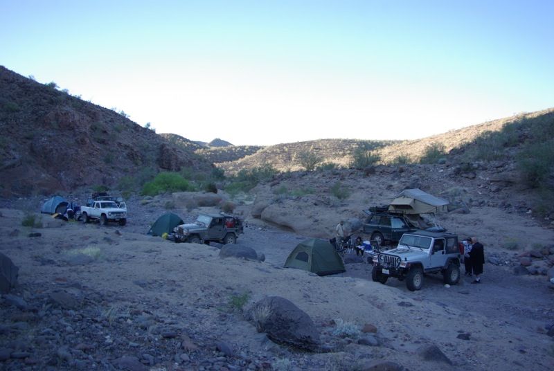
Our group camped in Cañon Enmedio - preferring a desert wash to the camp spots used previously. Nighttime temperatures were in the mid 50s with clear
nighttime skies. Vehicle breakdowns were nonexistent with MICK's pickup heating up along a sandy alluvial fan wash leading up to THE SUMMIT. My Jeep
Rubicon suffered a sheared shock absorber bolt, a LOOSE TIE ROD (Yikes!), and a
BROKEN LIGHT BAR.
On this run, no tires were punctured nor failed.
Follow along with the Pole Line photos (to be posted tomorrow after I get some sleep).David K - 4-2-2013 at 07:58 AM
Looking forward to the photos Ken... glad you got back okay!Mexitron - 4-2-2013 at 01:01 PM
Looking forward to pics. No wonder we were so tired after our Pole Line trip last March---we drove it all in one day! Camping along the way would be
much funner.russchung - 4-2-2013 at 03:10 PM
Great hospitality, perfect weather, wonderful friends and beautiful scenery describe the 2013 Pole Line Road trip.
I met up with Ken and Leidys in El Centro, CA on Friday morning for brunch. Unfortunately, the Dennys was packed with holiday travelers and instead
of waiting for a table we decided to cross the border and look for a place to eat. Our first stop in Mexicali was at a bank ATM to get some pesos. I
discovered that the bank ATM would only accept debit cards that have an embedded chip, so my current Bank of America debit card would not work. The
banks were closed for the holiday, so I could not go inside to get help. After trying four different bank ATMs, I gave up and hoped that my credit
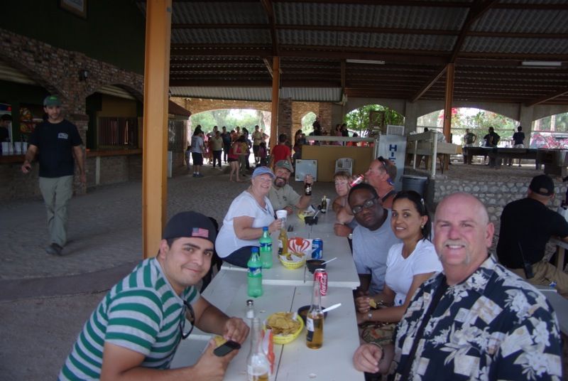
cards would work (they did). We ate lunch at the Mariscos Sonorense Restaurant on Avenida Castellon and went to the Wal-Mart to get some food and
supplies for the Rio Hardy BBQ.
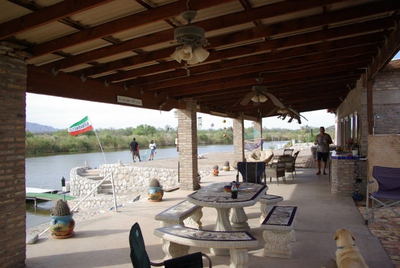
We followed Micks directions and arrived at the Rio Hardy casa about mid-afternoon.
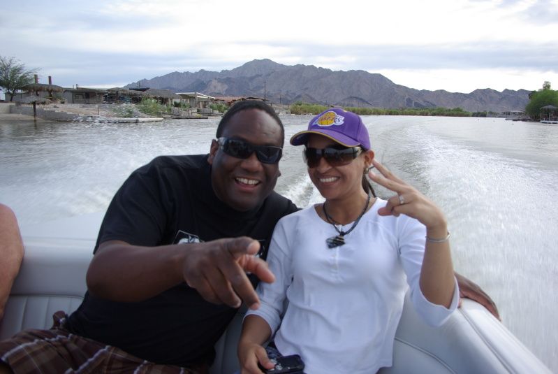
Mick gave us a tour of the neighborhood as we headed to the Pemex station in Durango to top off our tanks and gas cans, then he gave us a boat tour of
the Rio Hardy. On the boat tour we were joined by Micks wife, Pen, and his brother-in-law and sister-in-law, Scott and Gayla:
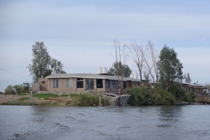
On the boat tour, Mick pointed out the damage from the 2010 earthquake. Because of the high water table, the soil liquefied so damage was
widespread. The quake damage to this home has yet to be repaired. Mick said that his own home shifted twelve inches and his deck shifted eighteen
inches during the quake:
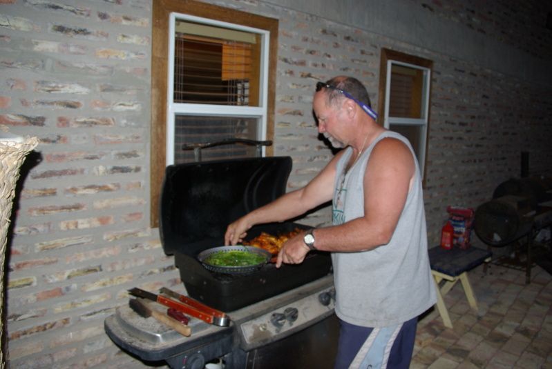
We watched the sunset from the deck as Mick prepared our dinner:
After dinner, we sat around a campfire and waited for Chris (CG) and Marco (TJMarco) to arrive from Tijuana. They arrived shortly before midnight,
and everyone retired for the night.
(continued)
[Edited on 4-3-2013 by russchung]russchung - 4-2-2013 at 03:13 PM
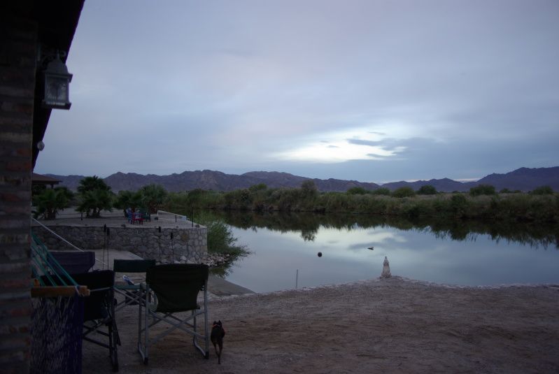
At sunrise on Saturday morning the sky was overcast but it cleared by mid-morning and remained sunny the rest of the weekend.
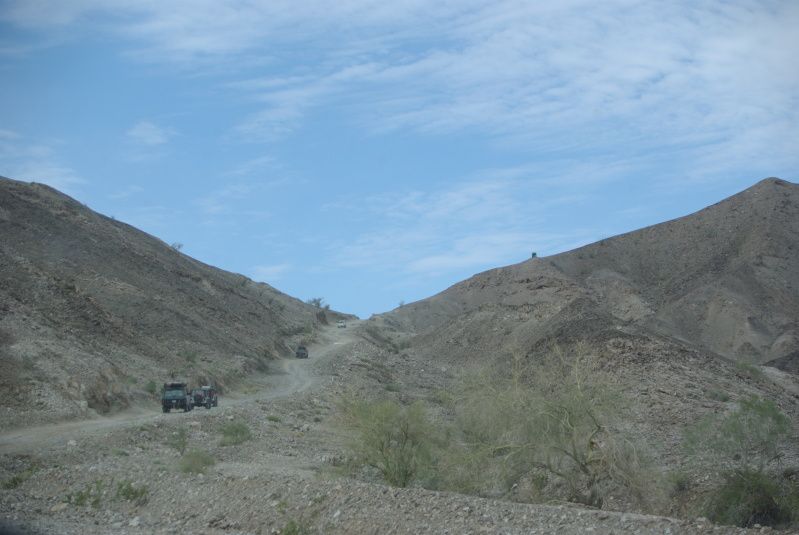
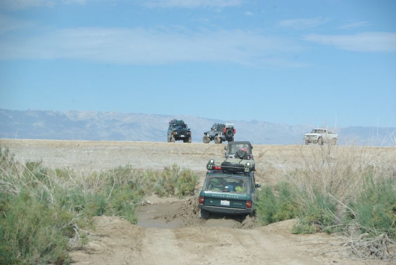
The plan was to head west from Rio Hardy, cross the Sierra El Mayor and Laguna Salada, stop for lunch near Cohabuzo Junction, head south along Arroyo
Enmedio to intercept the Baja Pole Line Road, then follow the Pole Line Road eastward to MEX-5. This was the route pioneered by Neal Johns on the
2004 Pole Line Road run. Mick led the group through the Sierra El Mayor to Cohabuzo Junction. Micks Ford Ranger is in the lead, followed by
Scotts Range Rover, Kens Jeep Wrangler, Chris Jeep Wrangler, and Marcos Range Rover:
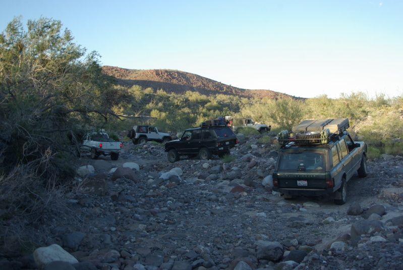
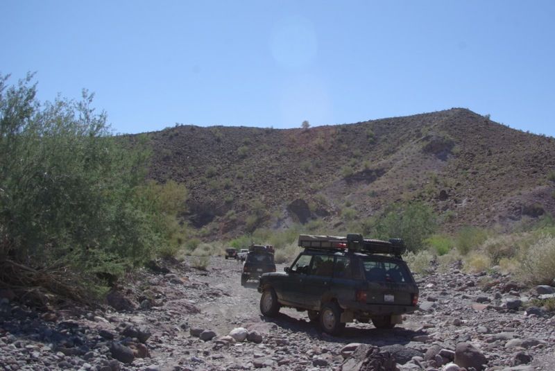
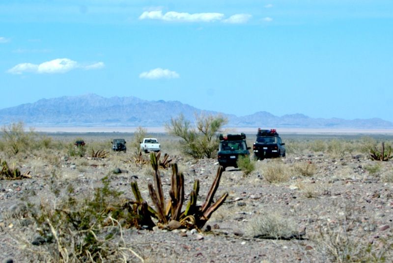
After lunch at Cohabuzo Junction, Ken took the lead and we headed south along Arroyo Enmedio to intercept the Pole Line Road. Ken is in the lead,
followed by Chris Jeep Wrangler, Micks Ford Ranger, Scotts Range Rover and Marcos Range Rover:
We encountered some minor mechanical problems. Ken complained that his steering wheel was no longer centered, and we found that his alignment shop
had not properly tightened the clamp on the drag link adjustment sleeve. Micks engine stalled twice. We determined that the problem was fuel system
related, but we never found a definitive cause. His fuel pump was working, but there seemed to be a vapor lock on the suction side of the pump.
After cooling down for a few minutes, his engine resumed running and it ran all day Sunday with no further problem.
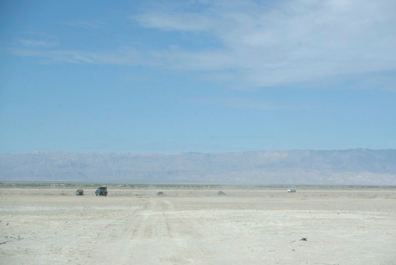
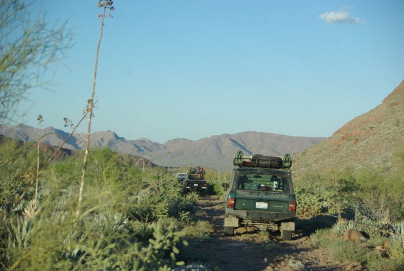
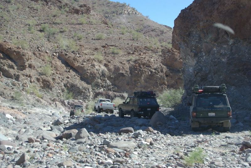
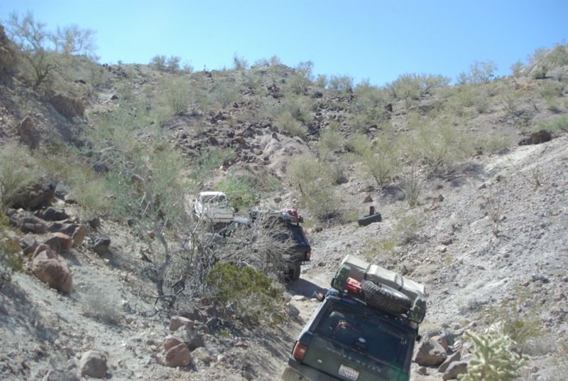
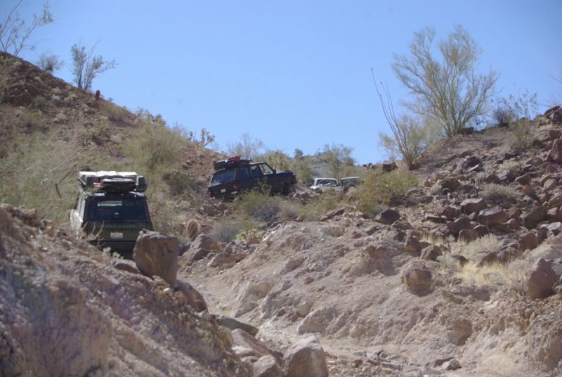
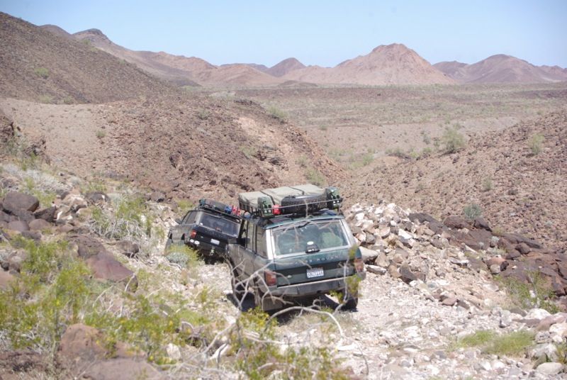
We reached the Pole Line Road. In this picture, Chris Jeep Wrangler is followed by Micks Ford Ranger, Scotts Range Rover and Marcos Range Rover:
A beautiful view of Arroyo Enmedio from the Baja Pole Line Road:
More Pole Line Road pictures:
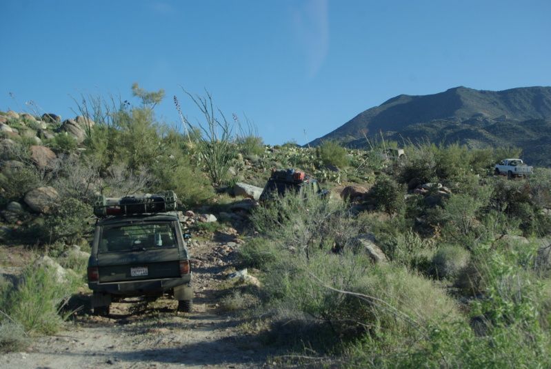
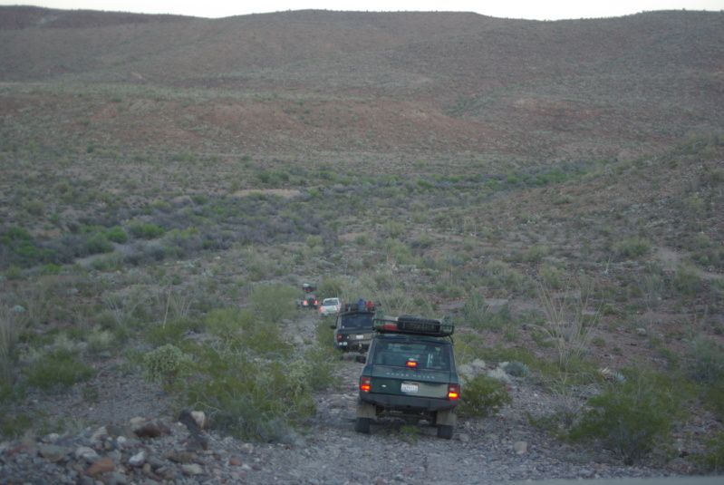
We set up camp on a dry wash in Cañon Enmedio. The canyon provided us shelter from the strong westerly wind that blew across the exposed ridgelines.
(continued)russchung - 4-2-2013 at 03:15 PM
Easter Sunday dawned sunny and clear.
Our departure from camp was delayed briefly while Ken investigated the source of a knocking noise from his suspension. He discovered a broken bolt on
a rear upper shock mount. He was unable to replace the broken bolt so he removed the shock absorber and we were on our way:
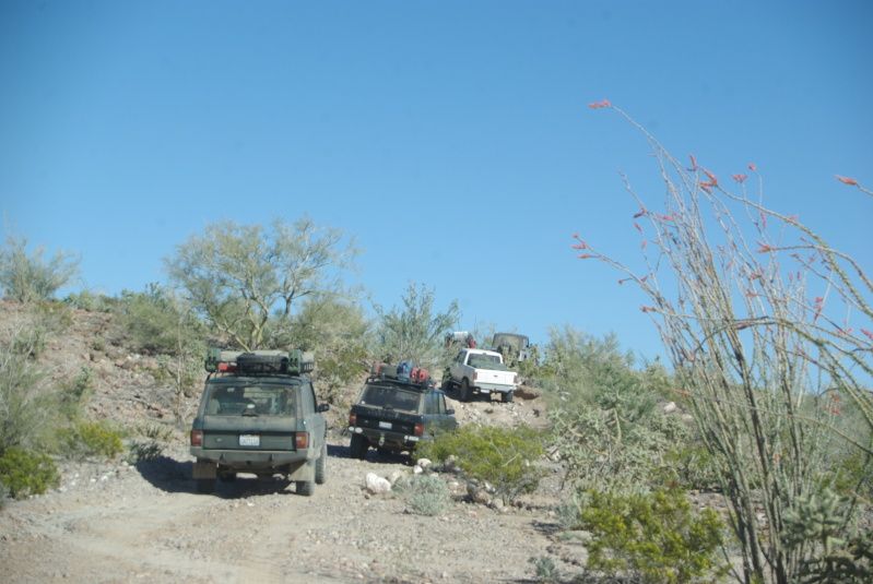
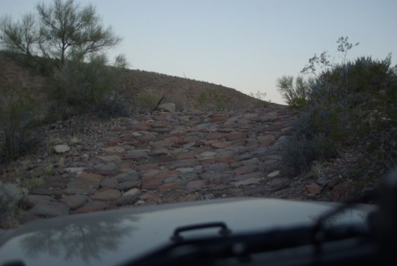
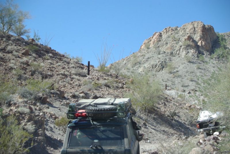
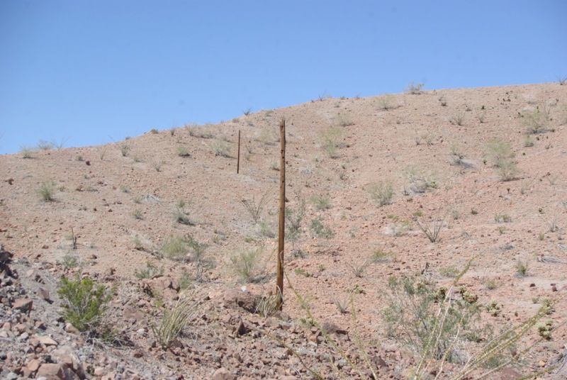
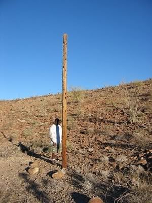
I remarked that I had not yet seen a single telegraph pole since we reached the Pole Line Road. When we arrived at the base of Basketball Hill, Ken
made sure that I saw the remnants of some poles:
I had expected to find a lot of basketball size rocks on Basketball Hill, but there were not many rocks on the trail:
Ken pointed out two more poles in Cowboy Canyon:
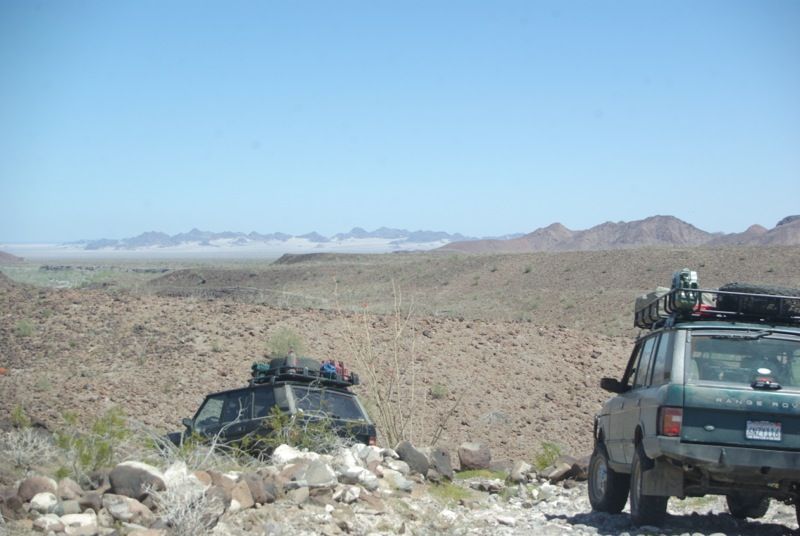
Sierra Las Pintas and MEX-5 in the distance:
After a stop for lunch near the mouth of Arroyo Grande, we left the Pole Line Road and followed a trail that led north to Ejedo José Saldaña and then
to MEX-5:
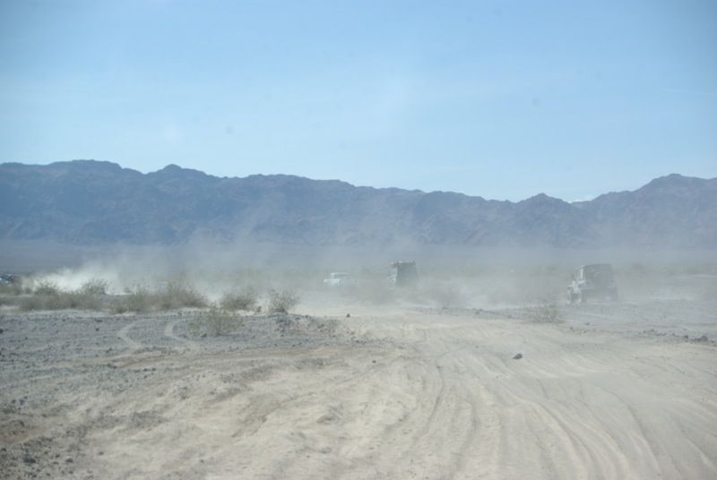
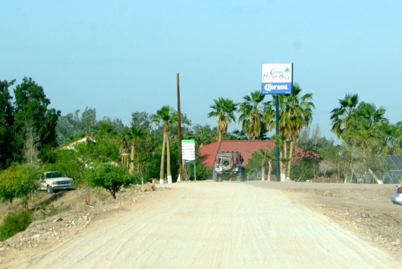
Just before reaching the highway we aired up our tires and headed to Campo Mosqueda on the Rio Hardy for dinner:
After dinner at Campo Mosqueda, we returned to Mick and Pennys casa on the Rio Hardy. While Mick took the others on a boat ride on the Rio Hardy, I
stayed behind and washed the mud off my Jeep, then took a dip in the river to wash the dust and dirt off my body. Mick started a campfire, but
everyone retired early. The next morning, we reluctantly said our goodbyes and headed home. Chris and Marco returned to Tijuana. Ken, Leidys and I
crossed the border at Mexicali West. It took us just under an hour to cross the border. We traveled together to Cabazon, then Ken headed home to
Riverside while I continued to Los Angeles. I had a wonderful time and thank Ken for organizing the trip and thank Mick and Penny for their
hospitality.
[Edited on 4-2-2013 by russchung]
[Edited on 4-3-2013 by russchung]David K - 4-2-2013 at 04:33 PM
Wow... stellar trip report Russ... and A+ on uploading the photos at no wider than 800 pixels!
It is wild the effort we (The U.S.) put into homeland security back in 1942!
Ken and one of the poles in an earlier trip:
[Edited on 4-2-2013 by David K]MICK - 4-2-2013 at 07:06 PM
Great trip, could not have asked for better company. Thanks to all that went Penny and I had a great time. Look forward to doing it again sometime
MickKen Cooke - 4-2-2013 at 10:29 PM
Today, I spent some time with a local fabricator removing my light bar (w/4 Hella F55 lights). The light bar completely split open, leaving me no
option but to remove it. My Fabricator applied some anti-seize to the broken shock bolt (also bent) which will be removed on Thursday afternoon. My
steering is still steering me straight, but no more visits to that tire shop that nearly had me killed.
Thanks again, Mick and Penny - Leidys is telling everyone she knows about Rio Hardy and the great place you and your family have there.TMW - 4-3-2013 at 09:13 AM
Great trip report. Looks and sounds like fun all all. Love the pictures, thanks.edm1 - 4-3-2013 at 10:30 AM
Great report, great photos.
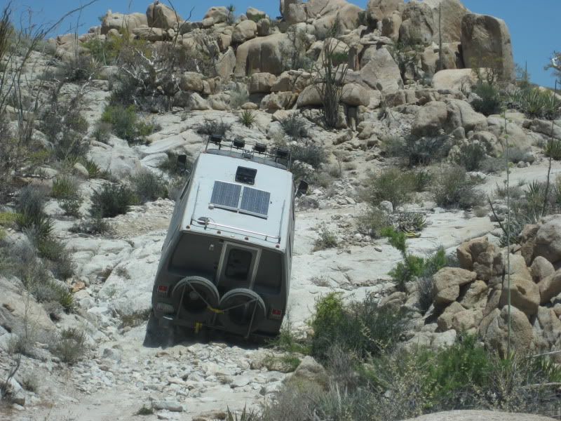
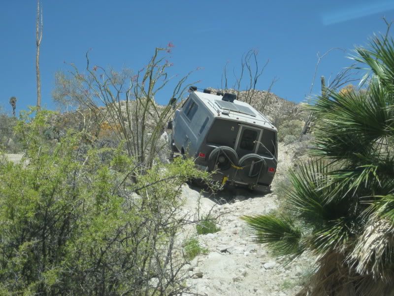
How does one get past this section?
David K - 4-3-2013 at 10:43 AM
In a motorhome, how else?
[Edited on 4-3-2013 by David K]edm1 - 4-3-2013 at 02:54 PM
Quote:
Originally posted by David K
In a motorhome, how else?
[Edited on 4-3-2013 by David K]
Absolutely not this one!
[Edited on 4-3-2013 by edm1]
Our MoreFM moment
Ken Cooke - 4-3-2013 at 07:15 PM
Ateo - 4-3-2013 at 07:26 PM
Wow. I'm very jealous. What a great report and epic trip you guys did. I recognized the last mountain range from the San Felipe 250 trip I did
recently. The More FM video was the bomb Ken. Tell Leidys nice work.Steve&Debby - 4-3-2013 at 09:06 PM
Are there any trails that actually require 4 wheel drive around San Felipe???Bajaboy - 4-3-2013 at 09:34 PM
Nice....I've always wondered about Rio Hardy area. Looks like a great area.Ken Cooke - 4-3-2013 at 09:40 PM
Quote:
Originally posted by Steve&ebby
Are there any trails that actually require 4 wheel drive around San Felipe???
If any of us did not have 4WD while crossing the Laguna Salada river, we might still be walking home across the El Mayor Mountains.David K - 4-4-2013 at 09:31 AM
Looking forward to your photos Ken... CG, if you have any as well!
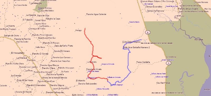
GPS Track
russchung - 4-4-2013 at 10:51 PM
This is the GPS track from the Pole Line Road run. The Red Line is Saturday's track starting from Cohabuzo Junction
to Saturday night's campsite. The Blue Line is Sunday's track.
The 2013 Baja Pole Line Run
Ken Cooke - 4-7-2013 at 08:39 AM
Drivers Meeting outside of the MICK compound - Rio Hardy, Baja California
from left - MICK's brother-in-law SCOTT, MICK, Russ, Marco, Chris, and KenKen Cooke - 4-7-2013 at 08:54 AM
Crossing the muddy Laguna Salada River - Scott leading with MICK
Russell crossing the Laguna Salada River - the El Mayor Mountains in the background.
Ken Cooke - 4-7-2013 at 08:57 AM
Posing with all of our vehicles across the deep, muddy crossing of the Laguna Salada River
Traveling along the route to Cohabuzo Junction near the vineyard.
Russell standing outside of his 230,000 mi. Jeep Wrangler! Bajafun777 - 4-7-2013 at 09:00 AM
Some great photos and good information about your trip. Ken, I am surprised during your moment while crossing the border you did not have several
venders at both windows trying to sell you something getting into your video!LOL Well, at least the break in the waiting helps and you always have
the large photos on the fence put up by Mexico to share some history moments too! Take care and keep finding and having FUN in Baja! Take Care
& Travel Safe---"No Hurry, No Worry, Just FUN" bajafun777
Driving along the Baja Pole Line Road
Ken Cooke - 4-7-2013 at 09:02 AM
'CG' and MICK
The sun setting against the Sierra Juarez mountains
Our group traveling the trail against a setting sun
Setting up camp in the Cañon Enmedio
Tackling the Baja Pole Line Road
Ken Cooke - 4-7-2013 at 09:08 AM
Ascending the challenging Basketball Hill.
SCOTT and Gaila
Marco and daughter Jessica
Russell and 'Ziggy'
Driving along an off-camber section - NOT FOR THE FAINT OF HEART
Driving down the 'Bad Hill' as Neal Johns described it in his writings for Discover Baja - Chris Glass and son Noe make it look easy in their Tijuana
Jeep (TJ Wrangler) Ken Cooke - 4-7-2013 at 09:14 AM
Traveling down another washed out section of the Baja Pole Line Road
Russell dropping into the massive Arroyo Grande
END OF THE RUN!!
Our group met for dinner at Campo Mosqueda along the Rio Hardy River in Baja California. Here is Gaila, Jessica, Leidys, and Penny.
MICK took our group up the Rio Hardy in his Mastercraft boat
MICK, Ken, 'CG', Marco, and Noe enjoying the ride.
Nomad 'CG' at the controls
Noe at the controls!
The 2013 Baja Pole Line Group - SCOTT, Gaila, MICK, Penny, Russ, Ken, Leidys, Marco, Jessica, Chris, Noe David K - 4-7-2013 at 09:41 AM
Thanks Ken!TMW - 4-7-2013 at 11:04 AM
The Too Much Fun Club.
We had a great time!
Ken Cooke - 4-7-2013 at 11:31 AM
Russ after filling his tank for only $3.49/gallon!
Waiting to cross the border at the Calexico Point-of-Entry
Just in...from MICK's Sister-in-Law Gayla
Ken Cooke - 4-7-2013 at 08:26 PM
The desert was in FULL BLOOM as seen by these photos!
...more from Gayla and Scott
Ken Cooke - 4-7-2013 at 08:29 PM
MICK making it look easy in his Ford Ranger
Wildflowers surround a Baja pin cushion
The Ocotillo had blooming red flowers atop!
Colorful! Ateo - 4-7-2013 at 08:29 PM
Nice photos as I previously stated. How did the BFG AT TA's hold up? Someday I shall get a vehicle able to do the pole line.
Back on the trail...with Gayla, Scott, Marco, Jessica, and Russ
Ken Cooke - 4-7-2013 at 08:32 PM
Jessica and Marco + Russell
Jessica and Marco traveling down the steep and rocky trail
Scott had a wonderful time on the trail in his 'Rover! Ken Cooke - 4-7-2013 at 08:34 PM
Quote:
Originally posted by Ateo
Nice photos as I previously stated. How did the BFG AT TA's hold up? Someday I shall get a vehicle able to do the pole line.
I was amazed, but my BFG's held up much better than I had expected them to. There was a little bit of chunking of the tread, but the chunking was
minimal. My traction in the 35" size was incredible - as good as, or better than a 33" Mud-Terrain tire (if you can believe that).
From the lens of Nomad 'CG'
Ken Cooke - 4-8-2013 at 08:46 PM
The El Mayor Mountains
Approaching the Laguna Salada and Laguna Salada River
Our 2013 Pole Line Group - parked at the Laguna Salada River
Parked on the Laguna Salada playa
Boating with MICK Ken Cooke - 4-12-2013 at 08:31 PM
Quote:
Originally posted by edm1
Great report, great photos.
How does one get past this section?
This area contains a go-around where you have to scale the side of the hill to the right. I am not sure a vehicle of your size would get hung up or
not.durrelllrobert - 4-13-2013 at 10:28 AM
Quote:
Originally posted by TW
The Too Much Fun Club.
Why is it called Pole Line"? I saw no poles in any of the photos.
Technically the pole of a line L in a circle C is a point P that is the inversion in C of the point Q on L that is closest to the center of the
circle. Conversely, the polar line (or polar) of a point P in a circle C is the line L such that its closest point Q to the circle is the inversion of
P in C.
[Edited on 4-13-2013 by durrelllrobert]David K - 4-14-2013 at 10:02 AM
Quote:
Originally posted by durrelllrobert
Quote:
Originally posted by TW
The Too Much Fun Club.
Why is it called Pole Line"? I saw no poles in any of the photos.
Ken posted this a couple years ago:
In 1942, President Eisenhower asked the Mexican Government if a road could be built that would connect the border region to the tip of Baja
California. This was to surpress any German and/or Japanese submarine activity which could have presented a problem in our nations Southwest. This
idea was balked at, due to the enormity of the task, manpower, and the amount of money this would have cost. So instead, a telephone line road linking
Ensenada to San Felipe was constructed. Mexican and American soldiers would man a small outpost in San Felipe, Mexico notifying American soldiers of
any Axis powers attempting to invade the United States via the Colorado River. The Baja Pole Line Road was built within one year - at the same exact
time as the Alaskan Highway.
[I think he intended to say 'General' Eisenhower?]
Here is more on the American radar station near San Felipe, from the Internet:
=======================================================
Mexico and the Defense of California
American concern for the security of Mexico was intimately related to the extent and proximity of any threat to United States territory. After the
attack on Pearl Harbor, the security of Baja California became a matter of acute interest to the United States. Just as lend-lease was a manifestation
of American interest in the security of Mexico, so the measures taken by General DeWitt and General Card##as, singly and jointly for the defense of
the United States' southwest and Mexico's northwest were concrete expressions of Mexican cooperation in the defense of the United States.
There were three fields of activity in which the defense of California involved joint action with Mexico: first, the placing of aircraft detector
stations in Baja California; second, the building of airfields and highways there; and third, the formulation of joint plans by General DeWitt and
General Card##as.
The proposal to establish radar stations in Baja California grew out of a study made by the GHQ Air Force early in 1941, disclosing that vital areas
in the southwest, near the Mexican boundary, could not be adequately covered either by a ground observation system or by radar detectors in American
territory. "An enemy desiring to attack Southern California," a later Air Forces report stated, "may be expected to be aware of the limitations of our
Aircraft Warning Service, and will make his approach over or from Mexican territory. " 74 The Air Forces therefore recommended taking steps to obtain
Mexico's permission to establish at least two detector stations in Baja California. These views were brought to the attention of the War Plans
Division sometime in April. Without denying the merits of the proposal, the War Plans Division informed the Army Air Forces that the moment was not
propitious for discussing the subject with the Mexican staff representatives, then in Wash-
ington. The Air Forces continued to agitate the matter during the next three months, only to receive the same reply: "The War Department considers it
inadvisable to submit to the Mexican representatives a request to station detachments of U.S. Army armed and uniformed forces in Mexican territory, as
it is convinced that the Mexican Government would reject such a request at this time." 75 In framing the War Plans Division reply, Colonel Ridgway,
then serving as one of the American staff representatives, noted, "there is no probability of securing Mexican consent . . . at least until an Axis
attack is delivered or imminent." 76
No action was taken until 3 December 1941, four days before the attack on Pearl Harbor, when the American staff representatives presented their
Mexican colleagues with a proposal for an immediate reconnaissance of Sonora and Baja California for the purpose of locating sites for radar stations.
Although it was agreed that the necessity of using the installations might never arise, the American representatives nevertheless proposed that the
preliminary steps be taken at once and that small mixed groups of United States officers and Mexicans, in civilian clothes, should survey the area
within two hundred miles of the border for access roads and radar sites.77 An appeal on 8 December brought a reply from President Avila Camacho the
same day giving full permission to make the reconnaissance and install the radar stations. To the original purpose the Air Staff had, however, added
that of investigating rumors of Japanese airfields and fuel caches. A separate party under Maj. A. P. Ebright conducted the Air Staff survey, entering
Mexico on 16 December. An attempt by the War Department to identify the Ebright mission with the radar station reconnaissance no doubt contributed to
the initial confusion and suspicion that attended it.78 Although no signs of enemy activity were uncovered, the Ebright party remained in Mexico until
the end of January to investigate suitable sites for landing fields, to report on the availability of water and other supplies along the route of
communications from the border south, and in general to add to the Army's store of information about the area.79 As the immediate post-Pearl Harbor
frenzy subsided and as the scope and positions of the Ebright mission became clarified,
General DeWitt's Western Defense Command headquarters gave it firmer support against the continued skepticism at the headquarters of the Southern
California Sector.80 Meanwhile, other groups had crossed the border, and had tentatively chosen sites for radar detector stations at Punta
Salispuedes, 20 miles northwest of Ensenada; Punta San Jacinto, 125 miles south of Ensenada; and Punta Diggs on the northeast coast of the peninsula.
With all this activity going on, the issue that had threatened the negotiations over staging fields the previous summer-whether Mexico would permit
the entry and stationing of armed and uniformed American soldiers promised to become a hardy perennial. On the earlier occasion, it had been solved by
accepting the Mexican position, and when the proposal for the reconnaissance of Baja California was presented to the staff representatives on 3
December the wearing of civilian clothes by the soldiers making the survey was accepted by the American representatives as inescapable. The first
draft of the instructions for `the reconnaissance, drawn up on 9 December for the Chief of the Army Air Forces, stated, "United States personnel will
be limited to officers and they will wear civilian clothing," but at the suggestion of G-2, and with the concurrence of Colonel Ridgway, this
particular restriction was deleted.81 Because of the United States' belligerent status, it was no longer appropriate. General DeWitt was especially
insistent that no soldiers cross into Mexico unless in uniform and armed, but the point was not raised with Mexican representatives in Washington.
Consequently, the Ebright group was turned back at the border and not permitted to cross until the men changed into civilian clothing and left their
weapons behind. Sometimes, depending on the attitude of the local Mexican commanders, American parties were permitted to enter the country in uniform,
but never under arms, and not even the excellent personal relations that existed between General DeWitt and General Card##as could bring about a
definite acceptance of the American view. The War Department as well as the Department of State took the position that, unsatisfactory though it might
be to send American soldiers into Mexico in civilian clothes and without arms, to arrive at an impasse with Mexico and risk having permission to
install the radar sets refused would be even more undesirable. Accordingly, on 20 December General DeWitt was authorized to accede to Mexican wishes
in the matter. His efforts to obtain a less dangerous and more face-saving solution
continued but met with slight success.82 After the summer of 1942 this particular issue ceased to be a matter of record. The establishment of the
radar stations, a diminution of American activity in Baja California, and the withdrawal of American personnel were probably responsible.
Two of the radar stations were set up and began operations during the first week in June 1942 and the third a month later. At each, one officer and
twenty-five enlisted men were stationed to operate the set and train Mexican military personnel in its use. The equipment itself was turned over to
the Mexican Army under lend-lease. By the end of August the Mexican troops had taken over the operation of the sets, and the Americans had withdrawn
except for a small detachment of five men and one officer at each station.83 The coverage provided by the three sets was far from complete, but even
as early as October 1942 the War Department was breathing more easily and saw no need to install additional equipment. 84 By the summer of 1943
retrenchment had become the order of the day in Baja California. All Americans were withdrawn from the radar stations except for one officer and three
enlisted men, who were left in Ensenada primarily for liaison purposes. All requests for additional equipment had to be refused. By mid-May 1944 the
Commanding General, Fourth Air Force, reported that he no longer considered the three radar stations necessary for the defense of California and, much
to the dismay of both Navies, who wished to have the sets in operation for air-sea rescue work, operations ceased about the first of June. When, at a
meeting of the defense commission, Admiral Johnson protested against a Mexican Army proposal to move the equipment to Mexico City, General Henry was
obliged to state that the War Department's policy of retrenchment remained unchanged but that there would be no objection to the Navy's supplying and
maintaining the operation of the sets. For the remainder of the war, the Army had no further responsibility in the matter. One station resumed
operation with gasoline and oil supplied by the Navy. The
other two were moved away.85 During the two years they had been in operation, the stations performed a useful function. They had closed all but a
small gap in the network around the San Diego-Los Angeles area. Anticipated language difficulties failed to materialize to any great extent, and
valuable training in the use of highly technical equipment was given our Mexican ally.
As part of the general scheme of filling in the gaps in the defenses of California after the attack on Pearl Harbor, the Fourth Air Force had strongly
urged the building of three landing fields for pursuit planes in Baja California and two staging fields, one near Rosario and the other near La Paz.
Time, and authority to use the fields for operations, were the important considerations. Both the War Department and the joint defense commission,
when formally constituted, were agreed upon the desirability of the proposal, which the commission adopted as its Fourth Recommendation on 10 April
1942.86 After some backing and filling a joint survey got well under way and recommended three sites as primary airdromes-El Cipres, six miles south
of Ensenada; Camalu, just south of San Jacinto; and Trinidad, about eighteen miles south of La Ventura. 87 Later, four other fields were surveyed. For
three weeks at the end of June and in early July the War Department, on the advice of the joint defense commission, called a halt to all activity in
connection with the airfields in order to give Mexican opinion time to crystallize and to give General Card##as an opportunity to make a decision.
After authority was given to proceed with the plans and estimates for the original five airfields, General Card##as and especially General Juan Felipe
Rico, the local Mexican commander, took hold of the project with enthusiasm and pushed not only the airfields but also a connecting highway down the
peninsula. General DeWitt promised any help in materials and equipment that General Rico might need. The United States, General DeWitt thought, was
committed to assist both projects, the roads as well as the airfields.88
By the beginning of 1943, the War Department had begun to cool, although the Fourth Air Force still urged that the three northern fields, at El
Cipres, Camalu, and Trinidad, be constructed and tied to San Diego by connecting roads. In March the War Department rejected General Rico's request
for materials and equipment for the construction of the airfields. The Mexican section of the joint commission thus found itself in the position, in
August, of arguing in favor of the United States Army undertaking a defense construction project on Mexican soil, while the American section was
opposed. With the War Department unwilling to provide the construction materials because of the urgent needs of more active theaters of operations,
the discussion became academic.89
In the field of joint planning, the Mexican experience took a contrary course to that of Canadian-United States planning. In the case of the latter a
basic plan was drawn up by the Permanent Joint Board, and local joint plans, more detailed and specific, were subsequently completed in accordance
with its general principles. With Mexico, on the other hand, the only joint plan completed during the war was the DeWitt-Card##as plan of
February-March 1942 for the defense of the Pacific coastal region. When later the joint defense commission undertook to draw up a plan, two of the
members-Admiral Johnson and General Castillo Najera-understood that the commission was supposed to base its plan on the DeWitt-Card##as agreements. A
casual observer would perhaps have seen little in the local situation to indicate much success for the Western Defense Command planners. The local
Mexican commanders either were uncertain of their authority to commit the federal government or were reluctant to accept instructions from Mexico
City; the difficulties and delays in obtaining full permission for a reconnaissance in Baja California were inauspicious. But such an observer would
have been wrong. Actually, the Mexican commanders made clear their willingness and desire to cooperate, and if they were reluctant to place their
names to a document committing them to joint action, they made it plain by word of mouth that in an emergency they would call on General DeWitt to
send American troops into Mexico.
In its final shape the plan represented a compromise between an earlier draft drawn up by General DeWitt's headquarters and one presented by General
Card##as.90 It provided for the patrol and defense of the two coastal areas-Mexican and American-by the forces of the respective countries, for an
exchange of information between the two forces, and for the passage of troops of either country through the territory of the other; and it permitted
the forces of either country to operate in the other, in uniform and under arms. There were several provisions that failed to meet with the approval
of General Card##as. The Mexican commander could not agree to the control and operation of airfields and radar stations in Mexico by American
personnel, and insisted that the forces of one country operating in the territory of the other be under the commander in whose area they were
operating.91 Both generals agreed that the plan was sound from a "military standpoint" and that "the question from a nationalistic standpoint is one
for the decision of the two governments." 92 The points on which the two commanders could not agree were accordingly turned over to the joint defense
commission.
The American section thought it best to defer consideration of a general, basic plan until such specific matters as the radar stations and airfields
were agreed upon, and when the draft of a basic plan was presented by Col. Lemuel Mathewson at the meeting of 21 April 1942, it was patterned after
the Canada-United States Basic Defense Plan of 1940.93 Little progress had been made when Admiral Johnson, becoming chairman of the American section,
suggested a fresh start and a new approach. This was in December 1942. The new scheme-to draw up a plan of collaboration, in ratification of the
agreements reached by the commission, instead of a defense plan-was no more easily agreed upon than the old. General Henry, recently appointed senior
Army member, took over the job of drafting a new plan in collaboration with General Alamillo of the Mexican section. Discussion during the meetings
the following summer and fall reveal what seem to be a measure of impatience and perhaps satiation. The question of command proved to be the stumbling
block, and by April 1944 General Henry was ready to abandon the attempt to write an acceptable plan. Finally, after more than two years of effort, the
commission decided upon a "statement of general principles . . . which might serve as a basis for other plans of collaboration between any two
nations." 94
In a broader sense, the wartime collaboration between the United States and Mexico cannot be measured adequately by the activity in Baja California,
by the joint planning of General DeWitt and General Card##as, by the deliberations of the defense commission, or by the airfields provided from
Tampico to Tapachula. All of these might well have created dissension. But
from the early wartime experience came a closer bond between the two countries. The commendable combat record of the Mexican 201st Fighter Squadron on
Luzon, the Mexican airmen who gave their lives in the same cause for which American fliers died, these were the true measure of the cooperation that
began in 1941. There were indications that ties so strongly forged would not be lightly dropped. Although the joint defense commission had not been
formally designated as a permanent body, plans were made at a staff conference in March 1945, at which the American members of the commission
represented the United States, to continue the defense commission in the postwar years. The mutual confidence and respect between the two countries
that developed out of their wartime association are proof that the New World can still serve as a beacon for the Old.
====================================================
Ken Cooke and a Pole, 2004:
How many BajaNomads knew this?
durrelllrobert - 4-14-2013 at 11:56 AM
"The commendable combat record of the Mexican 201st Fighter Squadron on Luzon, the Mexican airmen who gave their lives in the same cause for which
American fliers died, these were the true measure of the cooperation that began in 1941. "
I certainly didn't know that the Mexican Airforce participated in WWII as an ally to the US.David K - 4-14-2013 at 03:28 PM
History is cool Bob! willardguy - 4-14-2013 at 03:45 PM
there's a long story about the "aztec eagles" on the bajagay site. yes there is a bajagay site and the search for mexican air force landed me there.
not that there's anything wrong with that.
I forgot to mention that the quote above and this one came from an article originally posted by Ken
durrelllrobert - 4-14-2013 at 06:21 PM
Although I'm sure that it's been updated many times since WWII the Fuerza Aerea in Cipres, just south of Ensenada, is a Mexican Air Force relic from
that era.
"..which the commission adopted as its Fourth Recommendation on 10 April 1942. After some backing and filling a joint survey got well under way and
recommended three sites as primary airdromes-El Cipres, six miles south of Ensenada; Camalu, just south of San Jacinto; and Trinidad,
about eighteen miles south of La Ventura."
[Edited on 4-15-2013 by durrelllrobert]durrelllrobert - 4-14-2013 at 06:29 PM
Quote:
Originally posted by willardguy
there's a long story about the "aztec eagles" on the bajagay site. yes there is a bajagay site and the search for mexican air force landed me there.
not that there's anything wrong with that.
And although that web site shows "no registered members" it is apparently geared towards ex-pats since
the article is written in perfect English.chuckie - 4-14-2013 at 07:08 PM
There was a small contingent of tough lil Mexican Special Forces types in Nam....I met em...Prolly off the books....Good fighters
Thanks to Marco (and his daughter Jessica) for filming!
Ken Cooke - 4-14-2013 at 08:57 PM
Basketball Hill 2013
David K - 4-15-2013 at 08:31 AM
Thanks Ken... nice slow pace... do you have any film of the bad sections?Mexitron - 4-15-2013 at 11:32 AM
David---don't know that any one section is all that bad, there's just so many of them, gets tiring after awhile.David K - 4-15-2013 at 02:17 PM
Thanks Steve... I am just having some fun with Ken... (you know, it's a
'Jeep thing')
Rough section (waiting for breakfast)
Ken Cooke - 4-17-2013 at 08:38 PM
Quote:
Originally posted by David K
Thanks Ken... nice slow pace... do you have any film of the bad sections?
Russ was not able to withdraw any money from his Bank of America ATM while in Mexicali. Leidys filmed me enjoying my Latin music while we
waited...for breakfast, and Russ.
David K - 4-18-2013 at 05:58 PM
That sucks... I hope he had enough DOLLARS for the trip! Dollars are accepted gladly everywhere in Baja and a recent Nomad reported the exchange rate
at the Pemex stations was better than what the Casa de Cambio was offering.Ken Cooke - 4-18-2013 at 09:06 PM
I was able to loan Russ cash, and we continued on without it being a problem. The ATM Machines in Mexicali required a 'chip' that our ATM/Debit cards
don't have. Good thing I brought dollars to spend, or our trip would have been just like Baja Grande 2011. No food, no gas, no cash...Ateo - 4-18-2013 at 09:10 PM
Diggin it. Thanks for the vids.russchung - 4-20-2013 at 12:32 AM
I'm not sure my ATM card was rejected because it lacked a chip. When I got home, I had a new BofA debit card in my mailbox. The bank said that they
cancelled my old debit card and issued me a new one because a merchant reported a possible compromise of card and PIN numbers. The letter was
postmarked the day before I left home so it probably arrived the day after I left. I wish they would have notified me by phone or email instead of
just cancelling the card and sending me a new one by snail mail.Ken Cooke - 7-19-2013 at 11:56 AM
Quote:
Originally posted by David K
Thanks Ken... nice slow pace... do you have any film of the bad sections?
I can happily report that, "Yes, I do!" I have on video a Full Size Chevy on 35s w/6" of lift attempting 'Basketball Hill' and lower Enmedio Canyon.
I will post that video here in the next week. Here is a short preview.
David K - 7-19-2013 at 11:12 PM
Quote:
Originally posted by Ken Cooke
Quote:
Originally posted by David K
Thanks Ken... nice slow pace... do you have any film of the bad sections?
I can happily report that, "Yes, I do!" I have on video a Full Size Chevy on 35s w/6" of lift attempting 'Basketball Hill' and lower Enmedio Canyon.
I will post that video here in the next week. Here is a short preview.


 (Yikes!), and a
BROKEN LIGHT BAR.
(Yikes!), and a
BROKEN LIGHT BAR.


 (you know, it's a
'Jeep thing')
(you know, it's a
'Jeep thing')

 ebby
ebby