
DavidE - 5-30-2013 at 10:55 AM
http://www.redorbit.com/images/pic/76188/earth-california-coast-cloud-formation-modis-042313/
???
durrelllrobert - 5-30-2013 at 11:08 AM
The ISS photo shows Bolivia not Baja
DavidE - 5-30-2013 at 11:23 AM
SCROLL, SON. SCROLL. No way to capture the precise link. Note the arrows on the right or left side of the images. All the images are fascinating
satellite shots but the one showing extreme southern California and B.C. is IMHO a "keeper"!
Griffin - 5-30-2013 at 12:24 PM
i think this is the correct link:
http://www.redorbit.com/images/pic/76222/earth-southern-mexi...
http://www.redorbit.com/media/gallery/earth/iod-earth-042513...
DavidE - 5-30-2013 at 01:35 PM
Thanks Griffin!
David K - 5-30-2013 at 04:26 PM
Here it is... sized to fit Nomad...
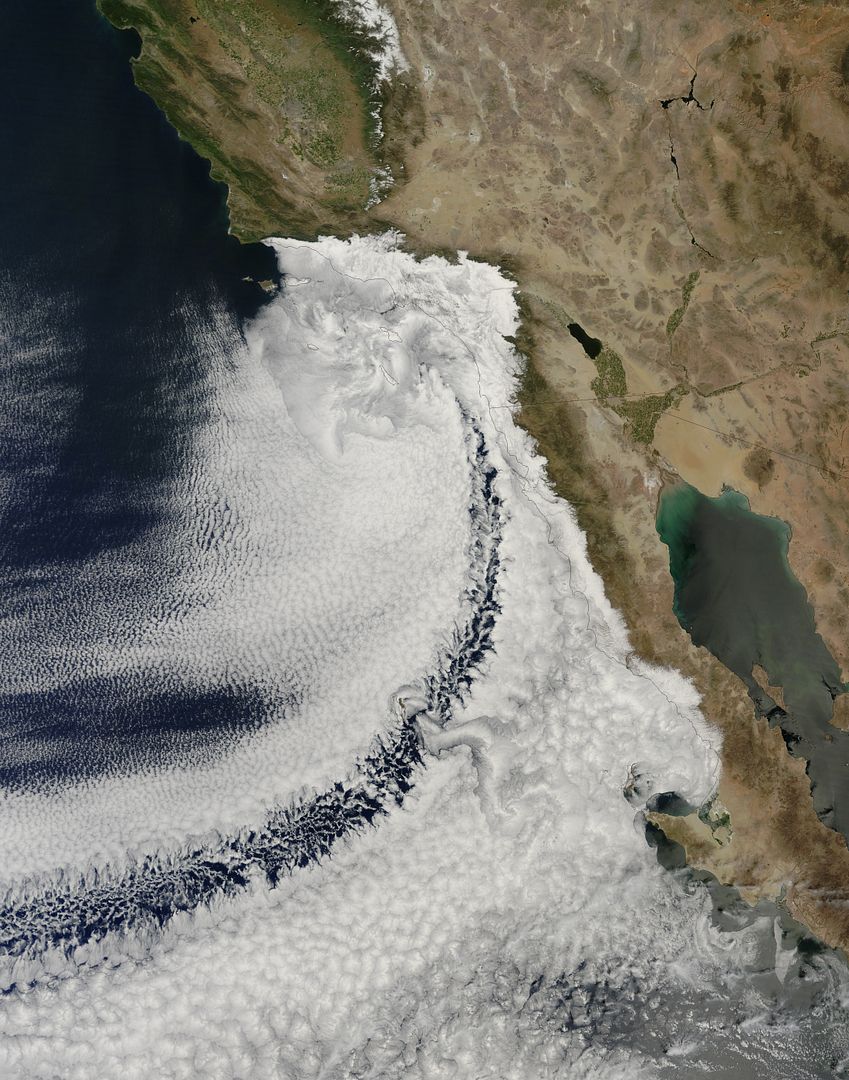
Wow. That's an impressive on shore flow
Whale-ista - 5-30-2013 at 08:54 PM
Thanks for sharing the image. What a great example of the upwelling that occurs offshore this time of year. Lots of productivity off shore, no wonder
the fish are biting.
It's becoming that time of year when they turn on the air conditioning on the West Coast, and the heater on the sea of Cortez side.
One year, in early June, We started out camping in bahia de Los Angeles. The temperature climbed steadily in a very short time, And it was such a
relief to drive west into the cool Pacific fog.
So in answer to the question "what is West?", This time of year I would say "foggy".
BajaNomad - 5-30-2013 at 09:40 PM

http://www.redorbit.com/images/pic/45447/island-swirls/

http://www.redorbit.com/images/pic/71486/baja-a2002315-2040-...
shari - 5-31-2013 at 08:40 AM
Very cool images and fascinating how the gloom just sit offshore of Asuncion/ San Roque enough for us to have sunshine on our parade!
