BajaNomad

Crooked Meadows and Bald Mountain

DianaT - 7-20-2013 at 07:48 PM

Earlier this year we started on the Crooked Meadow Road south of Mono Lake in the mountains and we were stopped by the snow. We are not sure which range this is, but it is fantastic. We started this loop on Forest Service Road 1S17 closer to Benton. Here it is major
tourist season, and there are some beautiful campgrounds where there are no or few people; beautiful places to escape. Even the campground at Big Springs near 395 on the Owens River road is not crowded. On our drive around this loop and then connecting with the Bald Mountain look-out road, we only saw one other moving vehicle and it is BEAUTIFUL high country that is easy to access. There are a few spur roads in the lower parts that are really soft pumice, so be selective.

It was our first real outing since the loss of our Maggie and we kept seeing her everywhere, and she is everywhere we are. She will never completely leave us. Just a few images of our day..

A tough job on the highway, especially when it is hot.


A friend along the way


View of the Sierras


Mono Lake from the back side


Soul searching in Wet Meadows


Even in a dry year there are many wild flowers to enjoy


Tommy Dog is always so curious as to what is what


A Road Less Traveled


Bald Mountain from a little ways down the mountains --- it is obvious how it got its name


The Ranger Station at Bald Mountain. It is such a perfect place for the look-out as the 360 degree views go on and on forever. It is such an important job, and I just can't imagine having such a job. I love top of the world places, and I love experiencing the soul renewing solitude in paradise, but not for such long periods of time. It is a special person who can occupy this job


And the views from up there just can't be captured in one photo, but the love between man and best friend is always there


[Edited on 7-22-2013 by DianaT]

fandango - 7-20-2013 at 08:15 PM

Wow, what a beautiful place.
I hope the 3 of you are coping well without your Maggie girl.

"Love between man and best friend is always there" added love when a snack is involved!

DianaT - 7-20-2013 at 08:18 PM

Quote:
Originally posted by fandango
Wow, what a beautiful place.
I hope the 3 of you are coping well without your Maggie girl.

"Love between man and best friend is always there" added love when a snack is involved!


Dogs will be dogs with a part of sandwich to be had :biggrin:

But seriously, while Tommy has always been a velcro dog, he is even more so since we lost Maggie, snack or no snack. :biggrin:

We all miss Maggie everyday. It sounds crazy, but today two feathers blew in our back door and it is something that has not happened before. Just as in Forrest Gump, I believe they are loving messages from our little Maggie Mae.


[Edited on 7-21-2013 by DianaT]

KaceyJ - 7-20-2013 at 08:46 PM

Diana

All those pics are great but the first one has some serious pespective to it.

monoloco - 7-21-2013 at 12:03 AM

Beautiful!

Mexitron - 7-21-2013 at 01:27 PM

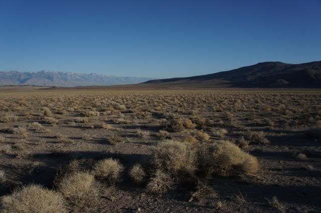
What a cool place to explore...I'm trying to get to the White Mountains in September---might just go further up to see this area too. The Sierras are, of course, beautiful, but the Panamints/Inyos/Whites have much less crowds and have their own stark beauty.

schwlind - 7-21-2013 at 01:40 PM

Quote:
Originally posted by DianaT
Quote:
Originally posted by fandango
Wow, what a beautiful place.
I hope the 3 of you are coping well without your Maggie girl.

"Love between man and best friend is always there" added love when a snack is involved!


Dogs will be dogs with a part of sandwich to be had :biggrin:

But seriously, while Tommy has always been a velcro dog, he is even more so since we lost Maggie, snack or no snack. :biggrin:

We all miss Maggie everyday. It sounds crazy, but today two feathers blew in our back door and it is something that has not happened before. Just as in Forrest Gump, I believe they are loving messages from our little Maggie Mae.


[Edited on 7-21-2013 by DianaT]


Diana... now you've done it... I read your post.. and tears just welled up in my eyes and spilled over... I am still so sad from your loss of Maggie, but Tommy I am sure wants to comfort you as you do him...

Incredibly beautiful area and photos... Thank you!

DENNIS - 7-21-2013 at 01:54 PM

WOW....Cinemascope. Remember that? The birth of the BIG, wide screen.

DianaT - 7-21-2013 at 05:43 PM

Thanks for the nice comments. It is such a beautiful area to explore and it is ignored by so many. While there are beautiful Jeffery Pine and Lodgepole forests, one big difference it the amount streams and lakes in the Sierra Nevada.

KaceyJ, I love taking photos of working people as I so admire what they do. Directing traffic may look like an easy job, but at that low elevation it was hot, windy and dry --- a very long day for him, I am sure.

Linda,
Thank you. Maggie will never be completely gone; we just miss her physical presence so much everyday.

woody with a view - 7-21-2013 at 05:58 PM

i've always wondered how two animals who grow up together cope with the loss of the other. is it like our mechanisms? did they see it coming in their own ways or are they always looking for the other to reappear, any moment now?

DianaT - 7-21-2013 at 06:35 PM

Quote:
Originally posted by woody with a view
i've always wondered how two animals who grow up together cope with the loss of the other. is it like our mechanisms? did they see it coming in their own ways or are they always looking for the other to reappear, any moment now?


Yes, I very much believe they see it coming. As she started to fail, Tommy spent a lot of time sniffing her and being close to her. I know of other dogs for which this is true. Tommy's behavior reminded us of what we knew was happening even as we tried to so hard to believe she would rally.

I have always heard that it is important for the survivor to sniff and have time with the deceased. We did just that so that Tommy would know Maggie was gone.

In some ways Tommy seems to enjoy being top dog right now as Maggie was the alpha. Then again, he is glued to us more than ever. We think he did not want to see her buried as he kept pawing at her grave as we buried her, but that was only for a short time. Like people, they seem to react differently. I know that when my sister had to bury her one dog at her home in Baja, her other dog spent a lot of time sitting on the grave. Animals do grieve.

I do wonder if Tom expects to see her; I know that everyday I still expect to see her. They do have their own relationships that I think we can never fully understand

Ms. Lizard Tongue. Her tongue was too long for her mouth and her under bite, and it was ready to hand out kisses at all times. The memories keep us going and make us smile through the tears.


[Edited on 7-22-2013 by DianaT]

TMW - 7-22-2013 at 08:10 AM

Beautiful, thanks.

Bwana_John - 7-23-2013 at 12:35 PM

For a nice drive try starting at the Crooked Meadows road from 120, do Bald Mountain, then continue south just east of the Glass Mountains divide thru Sawmill Meadows and The Clover Patch and come out at the Watterston Troughs turnoff on the Benton Crossing Road.

Barry A. - 7-23-2013 at 01:13 PM

Quote:
Originally posted by Bwana_John
For a nice drive try starting at the Crooked Meadows road from 120, do Bald Mountain, then continue south just east of the Glass Mountains divide thru Sawmill Meadows and The Clover Patch and come out at the Watterston Troughs turnoff on the Benton Crossing Road.


?? Sounds great, but how do you get from "Sawmill Meadows" to the "Clover Patch"? No road shows up on the USFS map of Inyo Natl. Forest between those two points!?!?!?!?

Barry

Bwana_John - 7-24-2013 at 09:54 AM

Quote:

No road shows up on the USFS map of Inyo Natl. Forest between those two points!?!?!?!?


The Inyo National Forest map is about the worst resource you can use for road information, it is out of date, and not very detailed.

Try a USGS 7.5 min topo map of the area, it will show much more information, the route goes through Kelty Meadows.
Online Topo Maps

Bwana_John - 7-24-2013 at 10:24 AM

PS: I would also recommend camping at Sawmill Meadows and hiking to the top of Glass Mountain from there when you do this route, MUCH easier than trying to hike to the top from the west, with lots of mahogany or fire obsidian.

RE: Losing canine members of the family - While it has always devastated the human members of our family, all the canine members have seemed to be happiest as an only child, pre or post canine "buddy".

[Edited on 7-24-2013 by Bwana_John]

Barry A. - 7-24-2013 at 11:48 AM

Quote:
Originally posted by Bwana_John
Quote:

No road shows up on the USFS map of Inyo Natl. Forest between those two points!?!?!?!?


The Inyo National Forest map is about the worst resource you can use for road information, it is out of date, and not very detailed.

Try a USGS 7.5 min topo map of the area, it will show much more information, the route goes through Kelty Meadows.
Online Topo Maps


Thanks, John. There is a new addition of the USFS Inyo map, made out of flexible and durable plastic and rediculously huge and hard to handle within a vehicle due to it's rediculous size--------but it is actually a very good map. Unfortunately I don't have one here, so cannot check it.

Barry

Barry A. - 7-24-2013 at 12:27 PM

Buana John---------that link you provided takes me to a private map site but I can't get any topos to come up, seemingly no matter what I plug into their search window. Very strange. I tried everything I could think of, but it simply says "not available", or something like that.

Bummer!!!

Barry

wessongroup - 7-24-2013 at 02:17 PM

Barry ......

http://store.usgs.gov/b2c_usgs/usgs/maplocator/%28ctype=area...

http://preview.tinyurl.com/y8z2k89

[Edited on 7-24-2013 by wessongroup]

Barry A. - 7-24-2013 at 02:39 PM

Wiley & Bhana John----------I guess I am just computer-stupid--------the first link says that the info does not exist--------?????

The second link leads to the USGS Map source, but when I try to look at any one map the detail is much worse than even the Forest Service map, and it is hard to read unlike a "real" paper topo map no matter how far I zoom in.....or out. I am partially blind, but this is rediculous!!!!

I am about to just give up.

I did pull one of my 35 year old BLM maps of the area, and sure enough that map shows lots of roads or trails which is better than any other map I have been able to access. I have always believed that BLM maps, at least in the CA desert, are the best maps ever produced, and I was involved in making them so yes, I am prejudiced. (-:

Barry

Bwana_John - 7-24-2013 at 06:13 PM

Interesting... the URL I put into the link is NOT the one currently shown, it should have went to a page with a 1:250,000 map of the area, and double clicking on that map would lead you through a series of maps, 15 min, 7.5 min, ect

The Forest Service Maps have always great for land ownership, and very poor for everything else.

Unfortunately when the USFS has put out a new map it usually means that many roads have been closed in that Forest.

Hopefully this route (Glass Mountain Traverse) is still open.

DianaT - 7-24-2013 at 06:17 PM

John, as always, thanks for the tips--- So Much to do!

I will spend some time checking out those map sites, including the BLM maps to see if Barry is correct, or just biased. :biggrin::biggrin:

BTW Barry, you should have stayed in this area a bit longer this last trip. A couple of nights ago, we had thundershowers that were HUGE; according to our neighbors, more rain than they have seen around here at one time. Highway 395 had a mud slide and was closed for a while, and boulders closed 168. The Badwater area of Death Valley received 2 inches of rain in one hour! http://www.inyoregister.com/node/4897 The lightening show was wild and beautiful.

The good thing is we really needed the rain! The bad thing is it started fires on the West side and the smoke is crossing the mountains. And it is not easy having a 70 lb dog jump in your lap with the thunder.

Quote:
Originally posted by Mexitron
..... The Sierras are, of course, beautiful, but the Panamints/Inyos/Whites have much less crowds and have their own stark beauty.


Stark beauty for sure with afternoon dancing shadows. --- just a quick pix I took yesterday on a side road on the way to Bishop.


Barry A. - 7-24-2013 at 06:37 PM

Your right, Diana---------I just heard from my son that the Manzanar Natl. Hisktoric Site (just south of Independence) got flooded from both the creek to the north and the one to the south, but no really serious damage. Also, "8-mile Ranch" was flooded from a small flash flood out of Sawmill Canyon just north of Oak Creek (8 miles north of Independence.). I am so bummed that we missed it------I love weather like that, but not the floods. Lots of remote places in Death Valley that have not reported yet.

I am sure there are many reports of flooding to come.

Barry

Barry A. - 7-24-2013 at 06:46 PM

Just heard again from my son---------Sawmill Canyon did not flood, it was Division Creek, and it went all over the place including to highway 395 and points south.

Also big flood covered Highway 395 at Coso Junction in the southern Owens Valley.

Barry

Mexitron - 7-24-2013 at 07:55 PM

Yep Diane!


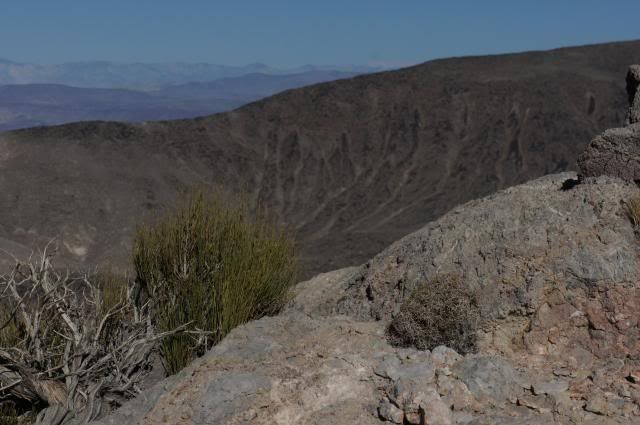
Up in the Panamints (Whitney is the white peak waaaay off in the center):


Bubba - 7-25-2013 at 01:33 PM

More great pictures, thank you!

DianaT - 7-25-2013 at 02:33 PM

Nice pictures Mexitron, very nice. So much life in what looks barren.

John, they are closing down more and more roads in the Sierras and in the Whites. It is not just that they are not maintaining them in any way, they have them blocked off, especially the ones that were not really roads but were simply created by off-roaders driving just anywhere. Hopefully, we can check on the road and route you mentioned.

Barry, people had to wait 3 1/2 hours for 395 to be cleared. It was a real mess. It didn't just go across the road, but the mud traveled on the highway before it spilled over to the other side. They also closed 168 for a while. We drive a little ways up there today just to see what going on and it is open, but they are still working on it so there are delays. Lots of dirt on the road where the water ran.

Also, we wanted to drive a little ways out the road to Saline Valley and the Eureka dunes, and all those roads are closed at the turn off from 168, and the green sign that lists all the different options are all closed. We imagine there were a lot of washouts.

Barry A. - 7-25-2013 at 03:12 PM

Quote:
Originally posted by DianaT
Nice pictures Mexitron, very nice. So much life in what looks barren.

John, they are closing down more and more roads in the Sierras and in the Whites. It is not just that they are not maintaining them in any way, they have them blocked off, especially the ones that were not really roads but were simply created by off-roaders driving just anywhere. Hopefully, we can check on the road and route you mentioned.

Barry, people had to wait 3 1/2 hours for 395 to be cleared. It was a real mess. It didn't just go across the road, but the mud traveled on the highway before it spilled over to the other side. They also closed 168 for a while. We drive a little ways up there today just to see what going on and it is open, but they are still working on it so there are delays. Lots of dirt on the road where the water ran.

Also, we wanted to drive a little ways out the road to Saline Valley and the Eureka dunes, and all those roads are closed at the turn off from 168, and the green sign that lists all the different options are all closed. We imagine there were a lot of washouts.


Diana-------this report of yours is disturbing---------many of the roads are County roads, and Inyo County does not have a lot of money for clearing them. I remember the southern main road into Saline Valley was closed for well over a year because of flash floods, and may still be for all I know.

In my travels about the area in the near past, I am always encouraged that less and less abuse is evident, so people are learning to behave, even the extreme 4-wheelers, I believe. That is my impression, anyway. I hope I am right. However, it REALLY annoys the Local when roads they have used for years (most of their lives?) are closed because of a decision by the Feds, and they tend to ignor such closures much of the time. It's complicated, and a tough sell.

The good news is that the desert will look great for several weeks with all this rain.

Barry

Mexitron - 7-25-2013 at 04:10 PM

The road to Saline Valley from Hwy 190 was closed (at least the sign said it was closed) last month when I went by there.

Barry A. - 7-25-2013 at 06:28 PM

Quote:
Originally posted by Mexitron
The road to Saline Valley from Hwy 190 was closed (at least the sign said it was closed) last month when I went by there.


Ok, thanks-------it's been SEVERAL years now. My son and I went in on that "closed" road a couple of years ago just after the floods, and it was tricky but doable in my X-terra. We went on into Saline and then over Steel Pass into the Eureka Dunes Valley via Warm Springs (many nudies there, closed road or no)--------interesting trip. I was thinking that Inyo Country closed that road for liability purposes, as you could get thru with a proper vehicle, but it was certainly not "safe". I suspect it is even easier now, but the liability still exists until it is brought back up to "standard". Just my speculation tho.

It may be a different story after this latest series of storms.

On edit-------Oooops, I just looked at a map and I am talking about the road into Saline from 190 (the south approach), not 168 (the north approach).

Barry

[Edited on 7-26-2013 by Barry A.]

DianaT - 7-25-2013 at 07:53 PM

We just hope all the roads going south from 168 are repaired as it is just one of our favorite way to go to several places.

DianaT - 7-25-2013 at 08:17 PM

Today we also drove up the mountain and took a short walk up to the first bridge on the Big Pine Creek. A few months ago with the two years of little rain and LA taking most of the water, it was calm and the downfalls were not a lot to talk about. After our major thunder showers, things have changed and it is beautiful. OK, not so good for the fishermen who need some calmer water. :biggrin:

A trickle down the LADWP pipe


The gentle creek rages on


And just the sheer power of the water--- we had to keep Tommy on a leash as the water was just too powerful.


It takes up 15 minutes to ride up the hill and it is 20 degrees cooler! What a great area.

The bad thing is that tonight, we both finally admitted that we are seeing our Tom beginning to fail in some ways at almost 13. We have to keep him on the leash as the water was so swift, but we let him soak his old joints in the cold water. We so need him to be with us for a few more years at least!

wessongroup - 7-25-2013 at 09:11 PM

:biggrin::biggrin:

Fishing the LA Aqueduct

bajaguy - 7-26-2013 at 09:06 AM

Quote:
Originally posted by Barry A.
Your right, Diana---------I just heard from my son that the Manzanar Natl. Hisktoric Site (just south of Independence) got flooded from both the creek to the north and the one to the south, Barry


Many years ago there was great fishing for rainbows and browns in the aqueduct just south of the north creek.

Turn off 395 to the right (east) just north of the orchard at Manzanar, drive past the old WWII runway to the aqueduct and turn right on the dirt road along the aqueduct. Cross the first stream and park.....using worms, seems like every cast brought in a good sized trout.

Barry A. - 7-26-2013 at 11:41 AM

Quote:
Originally posted by bajaguy
Quote:
Originally posted by Barry A.
Your right, Diana---------I just heard from my son that the Manzanar Natl. Hisktoric Site (just south of Independence) got flooded from both the creek to the north and the one to the south, Barry


Many years ago there was great fishing for rainbows and browns in the aqueduct just south of the north creek.

Turn off 395 to the right (east) just north of the orchard at Manzanar, drive past the old WWII runway to the aqueduct and turn right on the dirt road along the aqueduct. Cross the first stream and park.....using worms, seems like every cast brought in a good sized trout.


Nawwwwww, that creek is hopeless---------NO fish in there!!!! Nobody should even bother to check that creek-----go on up to Rock Creek and points north to find ANY fish!!!! There are NO Fish in the Owens Valley-------NONE!!!!

Barry

DianaT - 7-26-2013 at 12:06 PM

Quote:
Quote:
Originally posted by Barry A.

Many years ago there was great fishing for rainbows and browns in the aqueduct just south of the north creek.

Turn off 395 to the right (east) just north of the orchard at Manzanar, drive past the old WWII runway to the aqueduct and turn right on the dirt road along the aqueduct. Cross the first stream and park.....using worms, seems like every cast brought in a good sized trout.


Nawwwwww, that creek is hopeless---------NO fish in there!!!! Nobody should even bother to check that creek-----go on up to Rock Creek and points north to find ANY fish!!!! There are NO Fish in the Owens Valley-------NONE!!!!

Barry


:lol::lol::lol: Be careful of a growing nose! :lol::lol:

Right now it sounds like bad news for the Saline Valley road going south from 168. Th Inyo Register says that the road was damaged with a hole 40 feet deep and 50 feet wide. I wish I knew more details as to exactly where, etc. :( And who knows, maybe there will be an easy fix?

wessongroup - 7-26-2013 at 01:01 PM

Does sound like your getting a little "water" ....... what barry said .. fish the west side ... much better :biggrin::biggrin:

Barry A. - 7-26-2013 at 01:15 PM

Quote:
Originally posted by wessongroup
Does sound like your getting a little "water" ....... what barry said .. fish the west side ... much better :biggrin::biggrin:


The "west side" is even worse than the east side of 395---------NO FISH AT ALL!!!!!! --------------especially within 20 miles either side of Independence!!!

I certainly hope that both normal roads to Saline Valley are not now "closed", but sounds like they may be. There is always the "Steel Pass" trail south from Eureka Dunes Area for the truly adventurous?!?!?!?!?! (or maybe the trail west from the 'RaceTrack' for the fool-hardy).

Barry

wessongroup - 7-26-2013 at 03:52 PM

"west side" ......... of the "Sierra's" ........ your side ....... :biggrin::biggrin:

was meant to keep the "dust" down .... in the area

[Edited on 7-26-2013 by wessongroup]

bajaguy - 7-26-2013 at 05:16 PM

Quote:
Originally posted by Barry A.
Quote:
Originally posted by bajaguy
Quote:
Originally posted by Barry A.
Your right, Diana---------I just heard from my son that the Manzanar Natl. Hisktoric Site (just south of Independence) got flooded from both the creek to the north and the one to the south, Barry


Many years ago there was great fishing for rainbows and browns in the aqueduct just south of the north creek.

Turn off 395 to the right (east) just north of the orchard at Manzanar, drive past the old WWII runway to the aqueduct and turn right on the dirt road along the aqueduct. Cross the first stream and park.....using worms, seems like every cast brought in a good sized trout.


Nawwwwww, that creek is hopeless---------NO fish in there!!!! Nobody should even bother to check that creek-----go on up to Rock Creek and points north to find ANY fish!!!! There are NO Fish in the Owens Valley-------NONE!!!!

Barry


Yup, you are right......don't fish the creek, fish the aqueduct!