BajaNomad

Sierra el Mayor - Site of the 7.2 Mexicali-area "Easter" quake

Ken Cooke - 8-27-2013 at 10:17 PM

source: http://en.wikipedia.org/wiki/2010_Baja_California_earthquake
The 2010 Baja California earthquake (also known as 2010 Easter earthquake, 2010 Sierra El Mayor earthquake, or 2010 El Mayor – Cucapah earthquake) was an earthquake of 7.2 magnitude on the moment magnitude scale. It started 26 kilometers (16 mi) south of Guadalupe Victoria, Baja California, Mexico, at a depth of 10 km (6.2 mi).


Maderita - 8-28-2013 at 01:15 AM

Interesting photos. Thanks for posting.
Note to self: Must remember to clean the camera lens before the next trip.

Barry A. - 8-28-2013 at 09:28 AM

Quote:
Originally posted by Maderita
Interesting photos. Thanks for posting.
Note to self: Must remember to clean the camera lens before the next trip.


That was a BIG earthquake-----------perhaps the photos indicate the beginning of a new BLACK HOLE?!?!?!?!? or an oil seep!?!?!?!?

:lol:

Barry

Ken Cooke - 8-28-2013 at 08:27 PM

Quote:
Originally posted by Maderita
Interesting photos. Thanks for posting.
Note to self: Must remember to clean the camera lens before the next trip.


The camera has issues. The lens was clean - the dark spot went away after the camera was dropped a few times.

Mexitron - 8-29-2013 at 06:08 AM

How far in does that road go? Where did you start from?

MICK - 8-29-2013 at 06:45 AM

Looks like the beginning of a great trip
Oh ya that's my white truck. By the way Ken found the problem with it dieing when hot.
Bad fuel pump in the tank. Changed it out and now it startis better and runs great even in this heat
Mick

mcfez - 8-29-2013 at 07:30 AM

Yes....good question!

Ken...............have you been in the Rio Hardy area to see the damage? It's a real wow factor.

Also......that river actually raised from the earthquake......

Quote:
Originally posted by Mexitron
How far in does that road go? Where did you start from?

Barry A. - 8-29-2013 at 08:28 AM

Quote:
Originally posted by mcfez
Yes....good question!

Ken...............have you been in the Rio Hardy area to see the damage? It's a real wow factor.

Also......that river actually raised from the earthquake......

Quote:
Originally posted by Mexitron
How far in does that road go? Where did you start from?


The valley floor in the Rio Hardy area actually tilted to the west which makes it appear that the river came up permanently, the way I understand it. What actually happened is the ground in that area went down (sunk) in the earthquake causing the river level to rise relative to it.

Barry

David K - 8-29-2013 at 09:07 AM

Quote:
Originally posted by Mexitron
How far in does that road go? Where did you start from?


I believe that's the road to the sulfur mine and to Laguna Salada side of the mountain...

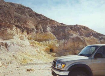
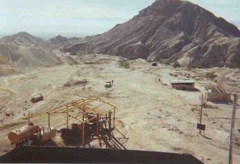
Went over it to the sulfur mine in 2001 http://www.vivabaja.com/baja_2001 :

El Promontorio Sulfur Mine


Located 7 miles west of Hwy. 5 at Km.49.


Laguna Salada is in the background. A bulldozer,
boiler tanks and a caretaker's house indicate recent activity.

Ken Cooke - 8-29-2013 at 08:57 PM

Atop the Sierra el Mayor range


Just beyond the mountain range


Laguna Salada Creek


Looking back at the Sierra el Mayor Range


David K - 8-29-2013 at 11:27 PM

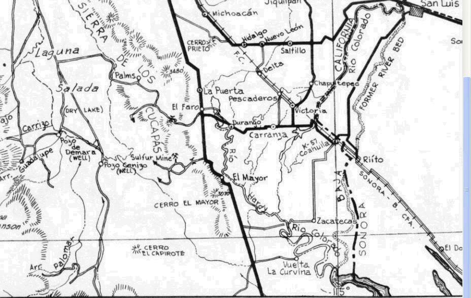
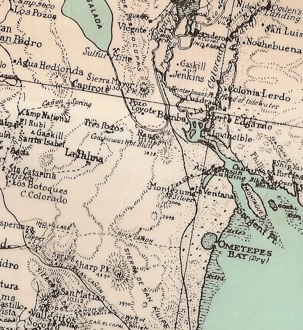
The road from Hwy. 5 over to Laguna Salada on the 1962 Gulick map... Note the sulfur Mine just north of the cross-over road that Ken drove.


David K - 8-30-2013 at 05:47 PM

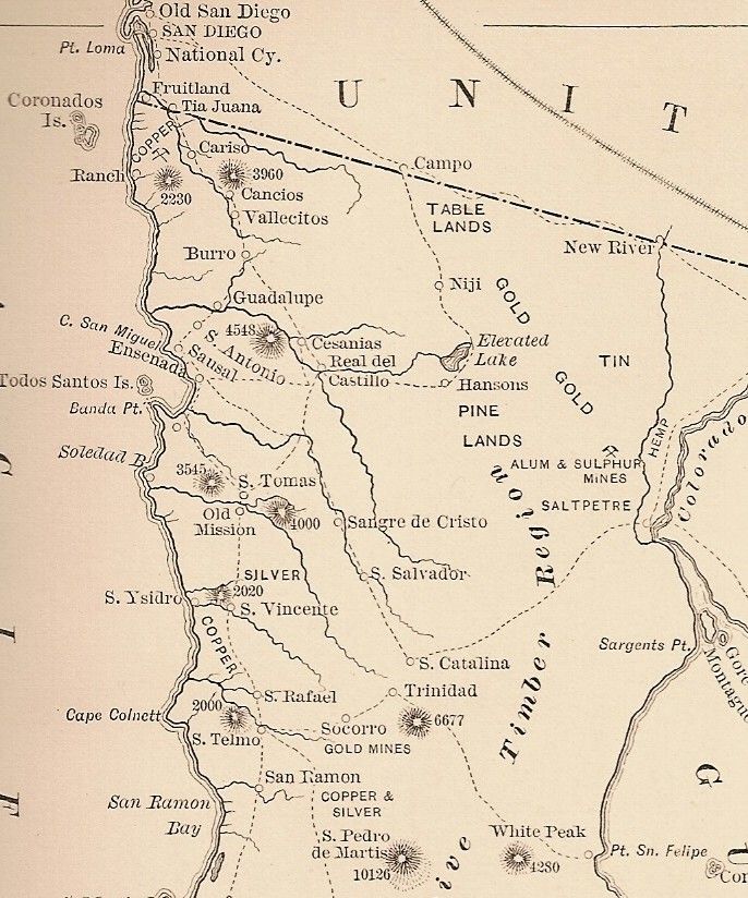
Note Sulfur (Sulphur) mine on an 1888 map:


See the Sulfur Mine next to a wet Laguna Salada on the 1930 map:


MICK - 8-30-2013 at 09:38 PM

nothing left at that mine now They took all the old equipment for scrap. All thats left is the two old shacks
Mick